Showing posts with label Imbrium. Show all posts

Thursday, July 11, 2013

Lunar Kipuka

A ghost crater, breached and filled with the lavas of Mare Imbrium (31.364°N, 334.217°E), the 3.2 km field of view from LROC Narrow Angle Camera (NAC) observation M193132768L, LRO orbit 13487, May 31, 2012; 74.94° angle of incidence, resolution 1.46 meters from 147.07 km [NASA/GSFC/Arizona State University].
Brett Denevi
LROC News System

The lunar maria were once "seas" of highly fluid lava, and within their margins small islands and shorelines can be found. Today's featured image highlights a classic example of a partially flooded impact crater within Mare Imbrium. The western wall of the crater, a low point in the rim, was breached by the flowing lava, and the crater was filled nearly to its rim. What remains of the rim is known as a kipuka, the Hawaiian word describing an island of older land surrounded by younger lava flows.

The shoreline can be seen within the crater as a terrace-like ring just inside the crater rim, particularly on the eastern side. This terrace is akin to the high-water mark of a flood, and marks the high-lava point along the crater wall. As the lava cooled, it contracted and subsided to a somewhat lower level. Similar features are seen in areas like Bowditch, within Lacus Solitudinis.

The kipuka of interest, out on the vast plains of Mare Imbrium, in the 48 km-wide field of view of LROC Wide Angle Camera (WAC) monochrome (643 nm) observation M177798520C, spacecraft orbit 11338, December 6, 2011; 76.25° angle of incidence, resolution 60.03 meters from 43.97 km [NASA/GSFC/Arizona State University].
The flooded crater in today's image is approximately 2.7 km in diameter, and was likely originally around 500 m deep. That gives a maximum lava thickness of a little less than 500 meters in this spot, though that does not require a single 500-meter thick flow. Lava likely pooled in the low of the crater floor from multiple individual flows, rather than one massive influx of lava. Layering exposed within sinuous rillesmare pits, and impact craters suggests individual lava flows were much thinner (on the order of 10 meters).

LROC WAC context mosaic showing the location of the flooded crater (arrow) within an outline of the footprint of NAC M193132768L [NASA/GSFC/Arizona State University
Note the small (250 meters in diameter) high reflectance crater nearly in the center of this flooded crater. An astronaut could descend its interior and inspect a cross-section of about the top 25 meters of the basalts and determine the thickness and frequency of the lava flows that filled the host crater. The rim of this impact crater is the only kipuka preserved in the area, and is the last local remnant of the surface before it was drowned in the lavas of Mare Imbrium several billion years ago.

Browse the full-resolution NAC image HERE.

Related LROC Featured Images:
The Swirls of Mare Ingenii
Remnants of the Imbrium Impact

Thursday, May 23, 2013

Layers of Imbrium excavated by Caroline Herschel Crater

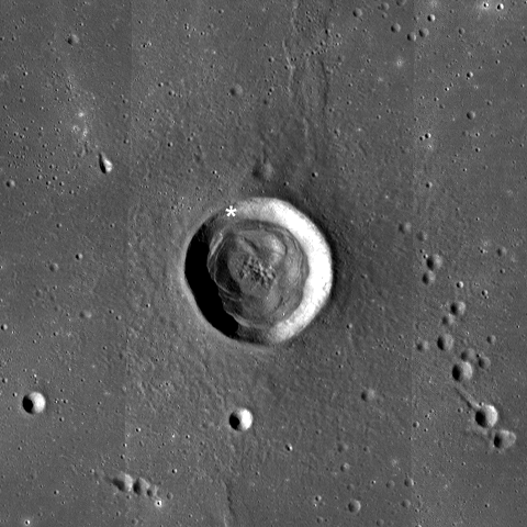
Exposed mare basalt layering in the wall of Caroline Herschel crater (34.48°N, 328.71°E). LROC Narrow Angle Camera (NAC) observation M175475137R, spacecraft orbit 10994, November 9, 2011; field of view 350 meters at 45 cm per pixel resolution; angle of incidence 55.93° from 30.15 km [NASA/GSFC/Arizona State University].
Sarah Braden
LROC News System

Outcrops of layered mare basalt are visible in the interior wall of Caroline Herschel crater (located at 34.48°N, 328.71°E, in western Mare Imbrium).

The mare basalt layers were exposed during the excavation phase of the impact which created this 13.7 km diameter crater. Some debris from the crater rim and the wall have fallen over the layers but the structure of the outcrop is still preserved.

The crater is superposed on a north-south trending wrinkle ridge which is visible in the LROC WAC context image below. This crater is named after Caroline Herschel, an astronomer and half of the sister/brother science team with astronomer Sir William Herschel.

Wider angle view of the northwestern rim, wall and interior of C. Herschel. LROC NAC M1106123678L, orbit 15305, October 29,  2012; resolution 1.5 meters per pixel, angle of incidence 53.18° from 150.4 km [NASA/GSFC/Arizona State University].
Caroline discovered several comets, and in 1828 the Royal Astronomical Society awarded her their Gold Medal for her work. She made observations, kept detailed records, performed complex mathematical calculations, and polished her own telescope mirrors. Caroline has multiple comets named after her as well as the lovely lunar crater in today's Featured Image.

LROC Wide Angle Camera (WAC) context for Caroline Hershel. The white asterisk marks the area of basalt layering in the Featured Image. Field of view is 48 kilometers [NASA/GSFC/Arizona State University].
Explore the entire NAC frame to see the beauty of the Moon, HERE.

Related Images:
Galilaei's Layered Wall
Pytheas
Dawes
Lava Flows Exposed in Bessel Crater

Wednesday, August 22, 2012

LROC: Looking over a four-leaf clover..

Several shallow depressions, secondary craters, dot the surface of Mare Imbrium, in this case near a rocky ext Mons la Hire (near Euler and Lambert), and giving the impression of a four leaf clover. LROC Narrow Angle Camera (NAC) M190780929RE, spacecraft orbit 13158, May 4, 2012; resolution 1.5 meters and field of view 1500 meter across. View a larger cropped image HERE.  [NASA/GSFC/Arizona State University].
Drew Enns
LROC News System

These large, ~500 m diameter, depressions are characteristic of secondary impacts on the Moon. When a bolide (asteroid or comet) hits the surface of the Moon a crater forms at the impact site. To create a secondary crater material is ejected from the impact site at about a 45° angle. If the ejecta travels less than the escape velocity, it falls back down to the Moon. Since the escape velocity on the Moon (~2.4 km/s) is much lower than that at which bolides typically impact the Moon (10-20 km/s) secondary craters often have a distinctive appearance. These lower velocity impacts result in irregularly shaped craters. Sometimes secondaries land in clumps and create distinctive patterns, such as the "four leaf clover" whimsically identified in today's Featured Image.


Smaller scale context image shows the relationship of the out-cropping above with the larger Mons La Hires 30 km to the southeast.  Image width is 650 km, LROC WAC mosaic [NASA/GSFC/Arizona State University].
If the secondaries featured today were formed in another impact, which impact created them? The number of craters in our secondary group is fairly large, so the parent crater cannot be small. In the context image covering a slightly broader field of view below, other secondary chains (red arrows) appear to point to the southeast. Maybe zooming out further will reveal the mystery parent crater!

A quick look over the 605 kilometers from the southwestern tip of  the northwest Mons La Hire outcrop and the center of Copernicus, courtesy of the ILIADS application released by NASA/LMMP. The immediate and long-range legacy of the Copernicus event was lasting.
It looks like Copernicus is the parent crater! That makes sense. Copernicus fits our criteria. These secondary chains have been previously identified, but the fact that they were sourced from Copernicus crater hundreds of kilometers away is remarkable. The impact cratering process really is amazing.

Can you identify other secondary craters in the full LROC NAC frame, HERE?

Related Posts:

Tuesday, February 14, 2012

Spudis: Cataclysmic Conundrum

Impact melt samples from the Moon tend to have the same age, around 3.9 billion years old. What does this mean?
Paul D. Spudis
The Once and Future Moon
Smithsonian Air & Space


One of the hottest topics in planetary science is the nature of the Moon’s early impact history.  So it was not unexpected that the Early Impact Bombardment of the Solar System Workshop, recently held at the Lunar and Planetary Institute in Houston, generated some interesting discussion.  More than 30 years ago, when researchers at Caltech and elsewhere noted that many lunar highland impact generated rocks had very similar ages, they advanced the idea that the early Moon underwent an extremely large increase (peak) in the rate of asteroid and comet bombardment 3.9 billion years ago (600 million years after the Moon had formed).  They called this late bombardment the lunar “cataclysm.” Work on lunar samples continued after this proposal, and while that apparent peak in impact ages around 3.9 billion years was considered remarkable, many investigators resisted the idea of a cataclysm.  Part of their resistance was because such a late barrage of impacts is difficult to explain dynamically.

All the planets form by the accretion (addition by impact) of smaller particles.  Much work with meteorites (samples from the early Solar System, including lunar and other planetary materials) has shown that Earth and Moon had mostly finished assembling (i.e., grown to their present mass) by 4.5 billion years ago.  This means that the debris clouds orbiting the Sun had been largely swept clean by that time.  How could the Moon then experience another intense bombardment 600 million years later, at 3.9 billion years?  Many complex ideas were examined, including the break up of other, previously existing planets or the incursion of a large number of objects from the shadowy Oort cloud of comets orbiting the Sun in the deep cold and darkness far beyond the orbit of Pluto.

What if there was no cataclysm?  Perhaps the plethora of ages at 3.9 billion years is more apparent than real (a possibility that has been studied in detail).  Part of the problem is that most of our lunar samples come from the “Apollo zone,” a small polygon centered on the lunar near side.   Most of whose landing sites seem to be somehow related to the enormous Imbrium basin, one of the youngest of the many large, multi-ring impact craters that cover the entire Moon.  Perhaps the reason this age turns up so often is that it is really just reflecting one age – that of the Imbrium basin.  Indeed, our best estimate for the age of that feature is 3.85 billion years, very close to the age of the supposed “cataclysm.”  Moreover, some argue that because early cratering rates were so high, they would have destroyed the very evidence we seek – the older impact rocks would have been ground up into an unrecognizable powder, the so-called “stonewall effect.”

Lest you think that this is merely some esoteric debate among lunar scientists and only of interest to them, comparable to arguments between medieval theologians about the number of angels on the head of a pin, you should know that much of our current alleged understanding of the early history of the Earth and other planets comes from our interpretation of the well preserved geological record of the Moon.  Mass accretion followed by global melting and then an impact bombardment is the received wisdom for the early story of all the planets.  We did not make up this narrative; it was dictated by the lunar record.  If we have the story of the Moon wrong, perhaps we are wrong about all the other planets as well.  This era of time is important to Earth history in a special way – it is the time when we suspect that life may have arisen.  The bombardment rate is a crucial variable in that story, as too high a rate will produce too many sterilizing impacts, thereby stopping life in its yet-to-be-made-because-there-are-not-yet-feet tracks.

So which model for early lunar history is correct and how might we decide that?  One possibility is to study samples derived far from the Apollo sites, ones that may not have been as heavily influenced by the dynamics of the Imbrium basin.  We have additional samples of the Moon in the form of meteorites (blasted off the Moon by impact); over 100 are presently known.  Assuming that they come from random places on the Moon (and there is no reason to assume otherwise), many of them could come from areas of the Moon not affected by Imbrium, such as the lunar far side. There is ongoing study of these objects but at first glance, although they contain impact melts from post-heavy bombardment times, they do not appear to have impact melts much older than what is found in the Apollo collections.  This relation suggests that the absence of impact melts older than 3.9 billion years is a global phenomena and not a sampling bias reflecting the effects of the single Imbrium impact event. Such a relation could be produced via a cataclysm or the stonewall effect.

So this result leaves the question of the early bombardment unresolved.  The discussion at the workshop tried to imagine new ways to solve this problem.  Most agreed that the best way to document or refute the cataclysm was to absolutely date some older basin whose relative age is well known and see if it is close in time to Imbrium or not.  We can absolutely date rocks through isotopic methods, but getting the right rocks is the challenge.  Humans can intelligently select samples, but no humans are going to the Moon in the near future.  Robotic spacecraft can collect rocks and soil, so perhaps a robotic sample return mission could provide the samples to resolve this problem.  But where would we send such a robot?

For the last decade, attention has been focused on the extremely large (2500 k diameter) South Pole-Aitken basin, the oldest visible impact feature on the Moon, centered on the southern far side.  The problem is that this feature is so old, much has occurred since its formation and although “grab samples” could be obtained by a robot probe, what might these rocks represent – basin impact melt or some other, post-basin deposit?  Moreover, even if we could somehow convince ourselves that SPA melt had been obtained, the only way these samples resolve the issue is if they are the same age as Imbrium, in which case there was a cataclysm of epic proportions.  If the age of SPA is much older, it could have formed early, leaving the Moon with little subsequent activity, and then a cataclysm at 3.9 billion years ago.  An old age would provide no information on that possibility.

The slightly oblong 4 billion year old South Pole-Aitken impact basin, some of which spills over the South Pole onto the nearside, as represented in preliminary LRO LOLA laser altimetry-based topography from April 2009 [NASA/GSFC/LOLA].
At the workshop, the man who first discovered the multi-ring nature of lunar impact basins over 50 years ago, Bill Hartmann, suggested a different approach.  Bill advanced the notion that we should not sample the oldest basin, but one in the middle of the sequence – the Nectaris basin.  First, because it is much younger than SPA and we are more likely to find a basin melt sheet.  Second, it is on the near side of the Moon, which simplifies the mission requirements and allows direct communication with Earth.  Finally and most importantly, determining the age of Nectaris resolves the cataclysm because it is old enough to be distinct from Imbrium, yet young enough to let us resolve the intermediate cratering history of the Moon.  If Nectaris is 3.9 billion years old, there was a cataclysm.  If it is significantly older (say 4.1 billion years old) there was not one.  It’s not often we get the possibility of such a clear-cut answer in science.

Originally published February 13, 2012 at his Smithsonian Air & Space blog The Once and Future Moon, Dr. Spudis is a senior staff scientist at the Lunar and Planetary Institute. The opinions expressed are those of the author and are better informed than average.

Saturday, July 16, 2011

Relative age relationships


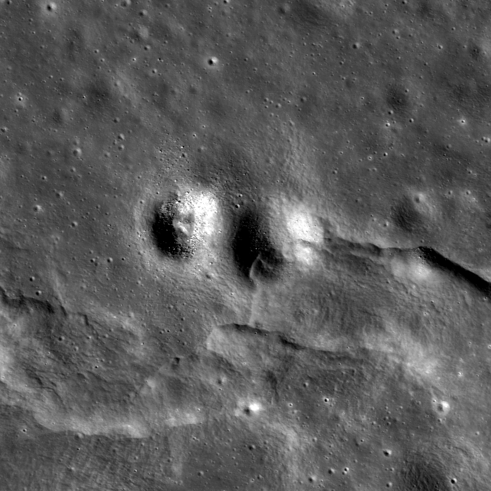
A wrinkle ridge cross-cuts and deforms an impact crater in northeast Mare Imbrium. The deformed impact crater is about 330 meters in diameter, LROC Narrow Angle Camera (NAC) observation M104540211RE, LRO orbit 565, August 10, 2009; image field of view is 1.7 kilometers. See the full-sized LROC Featured Image, HERE [NASA/GSFC/Arizona State University].

Lillian Ostrach
LROC News System

Relative age relationships are key to unraveling the geologic history of the Moon. Relative ages reveal the order of geologic events without knowledge of their absolute age. Usually relative ages are determined by the stratigraphic relationships of geologic features - what is on top and what is below.

Stratigraphy is not simply the study of rock layers and layering, it provides geologists with the tool to determine age relations locally, and in some cases globally. Gene Shoemaker and Robert Hackman used some ingenious thinking to describe key stratigraphic markers throughout the Moon's geologic history. But you don't have to be a lunar geologist to understand the significance of stratigraphic relationships. The most obvious stratigraphic relationships on the Moon are the mare basalts embaying (or covering) the older highland terrain.

Sometimes it takes a bit of searching to find clear stratigraphic relationships at the high resolution of the LROC NAC images. Today's Featured Image provides an example of a clear age relation, where an impact crater is cross-cut and deformed by a wrinkle ridge. The deformation of this crater took place in the north-south direction, and distorts the crater from a circular shape to ellipse. Its diameter is ~330 m measured east to west, and in the north-south direction, the crater is only ~300 m wide.


LROC Wide Angle Camera (WAC) monochrome mosaic showing the wrinkle ridge in Mare Imbrium. Although the landscape looks smooth and uniform from Earth, and even at this scale, the LROC Featured Image released July 12 demonstrates otherwise! The asterisk denotes the location of that NAC close-up and the deformed impact crater. See the full-sized LROC context image HERE [NASA/GSFC/Arizona State University].

These observations help us construct a plausible geologic story for this small area. First, the mare basalts erupted and cooled, then the impact crater formed. At some point after the impact event, the wrinkle ridge deformed the crater. However, much time has passed since the impact event, because the crater has no high-reflectance ejecta rays, its walls are smooth, and there are only a few boulders. Alternatively, very little to no time may have passed between crater formation and wrinkle ridge formation because the wrinkle ridge is smooth and also has only a few boulders. So, while parts of the relative age story can be clearly inferred, some details are tricky to fully unravel.

Furthermore, how does the bouldery crater adjacent to the deformed crater fit into this story? There are several options based on the appearance of both craters, but the easiest explanation is that these craters formed at slightly different geologic times because although their rims are rounded and smooth and the craters do not not have ejecta rays, they do have different concentrations of exposed boulders. But why does this adjacent crater have so many more boulders? Boulders are usually formed by impact into a coherent rock layer (e.g., the impact exposes and fractures bedrock). Since the mare regolith is probably only a few meters deep at most, these ~300 m diameter craters would have punched through the regolith layer to expose bedrock. If the two craters are the same age, they should have similar boulder concentrations, but if they are not the same age, we can devise a different geologic story. If we assume that the deformed crater is older than its neighbor, we would expect that the deformed crater would be more eroded. If the neighboring, bouldery crater is younger, then perhaps the boulders surrounding this crater have not had enough time to be worn away by continuous micrometeorite bombardment.

What do you think? Observe the full LROC NAC image and decide whether you can come up with a better geologic story!

Related posts:
Fault scarp with impact melt in King crater
Rupes Recta
Wrinkled Planet
Forked wrinkle ridge

Thursday, March 3, 2011

LROC: Mare Flooded Archimedes


Contact between Archimedes' southwestern interior crater wall (lower left) and floor (upper right). The floor is smooth and relatively flat, compared to the sloped and rough elephant skin-textured crater wall. LROC Narrow Angle Camera (NAC) observation M119883761, LRO orbit 2801 (alt. 39.33 km, res. 0.62 meters per pixel) field of view 800 meters. View the full-sized Featured Image HERE [NASA/GSFC/Arizona State University].

Drew Enns
LROC News System

Archimedes is an 83 km diameter crater located in east Imbrium basin (29.7°N, 356.0°E). Archimedes is notable for its smooth floor, but unlike other craters (e.g., Necho & Copernicus) with smooth floors, Archimedes is flooded with mare basalt. Craters with flooded floors are geologically important as they can establish relative ages of features thanks to the geologic law of superposition.


LROC Wide Angle Camera monochrome mosaic, context image showing Archimedes. The 85 km-wide crater floor appears as smooth as Mare Imbrium to the northwest. Arrow shows location of the LROC NAC Featured Image. Field of view is 130 kilometers, view the full-sized context mosaic HERE [NASA/GSFC/Arizona State University].


A second LROC WAC monochrome (689nm) mosaic swept up over several orbital opportunities on January 7, 2010, at local afternoon. View a 800 pixel-wide version of the above mosaic HERE [NASA/GSFC/Arizona State University].

Because both Archimedes and Imbrium basin are flooded by mare basalt, their formations must be older than the volcanic activity. Furthermore, because Archimedes is located within Imbrium basin, Archimedes must be younger than Imbrium. Just by studying relationships between features, scientists can piece together their history!

Explore more of Archimedes' floor in the NAC frame!


Archimedes from the northwest, high over Mare Imbrium and in HDTV from Japan's SELENE-1 (Kaguya). Further south are, appropriately enough, the Montes Archimedes and further left, at the foot of the Appenines marching beyond the horizon, is Palus Putredinus site of Hadley Rille and the 1971 Apollo 15 expedition. View a larger image HERE [JAXA/NHK/SELENE].

Related Posts:
Central Peak/Mare Boundary
Aitken Crater Constellation Region of Interest

Thursday, February 24, 2011

Dark streaks in Diophantus crater


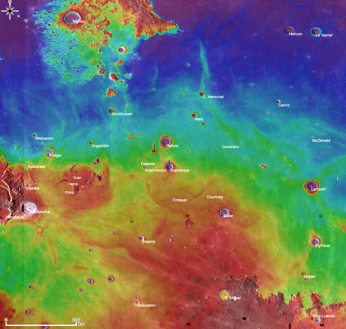
Dark streaks down the steep inside northern rim of 19km Eratosthenian crater Diophantus (27.6°N 325.6°E) in southwest Mare Imbrium. LROC Narrow Angle Camera (NAC) frame M124797072L; 0.56 m/pixel, field of view about 678 meters, with Illumination from the south; downslope is from top to bottom. View the full-sized Featured Image HERE [NASA/GSFC/Arizona State University].

Hiroyuki Sato
LROC News System

Today's Featured Image reveals the upper slopes of Diophantus crater, located on the western edge of Mare Imbrium. The upper dark area of this image corresponds to the flat mare surface, outside of the crater. The most striking feature here is the dark material that flowed down the crater wall. The reflectance of surface materials is controlled by various factors such as sunlight direction, grain sizes and surface textures, and composition. In this picture, the dark materials are most likely a different composition (relatively bright materials also flowed down-slope next to the dark flows).

These dark features originate from several layers exposed in the crater walls. The horizontal extent of these layers is rather discontinuous and they appear at various elevations; their thickness ranges from five to ten meters. What material composes these dark slides? We know from samples returned from the Apollo 17 mission that very dark pyroclastic materials (explosive volcanics) exist on the Moon. Perhaps these slides are a layers of pyroclastics that were buried by younger lava flows. When Diophantus was formed these layers were exposed! There is much to be learned about the distribution and chemistry of pyroclastics and in turn about the deep interior of the Moon. Imagine future astronauts rappelling down to sample these exposures!


Digital Terrain Model (DTM) context map of a large area surrounding Diophantus with a rectangular strip, located at 326.34E, 27.63N. Product is from a LROC Wide Angle Camera (WAC) 100 meter-per-pixel monochrome global mosaic overlayed by WAC color DTM 500 meter-pixel survey by DLR of Germany. The rectangle corresponds to the footprint of the LROC NAC frame from which came the LROC Featured Image, February 23, 2011. View the full-sized context map HERE [NASA/GSFC/Arizona State University].

Explorer lunar landslides by viewing the full NAC frame!

The topographic color was produced as a by-product of stereo analysis of the WAC global dataset. Producing the global Digital Elevation Model (DEM) is a big job being led by LROC team members at the German Aerospace Center (DLR; English version) in Berlin.

Related Featured Images:
Color of the Moon
Volcanoes in Lacus Mortis
A Dark Cascade at Sulpicius Gallus


Foreshortened view of the LROC Featured Image (February 23, 2010) supported by the full left and right NAC frames M124797072 and the digital elevation model available to users of Google Earth (versions 5 and above) [NASA/GSFC/Arizona State University].


From the southern rim, a simulated view of the interior of Diophantus overlaid with the left and right frames of LROC NAC M124797072 and the "free air" elevation range from the dark streaked terrain just inside the crater's northern rim and the deep interior [NASA/GSFC/Arizona State University].


Diophantus, supporting Diophantus C on its southwestern rim, swept up in LROC Wide Angle Camera observation M117718865M before local sunset, from 38.8 km up during LRO orbit 2482, January 9, 2010 [NASA/GSFC/Arizona State University].

Thursday, November 18, 2010

Avalanche in Robinson crater


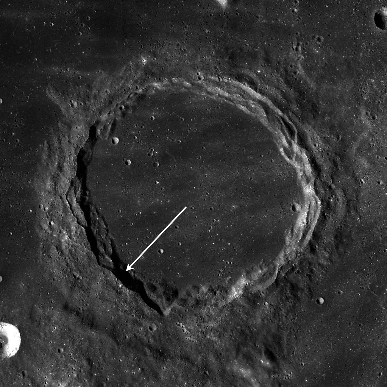
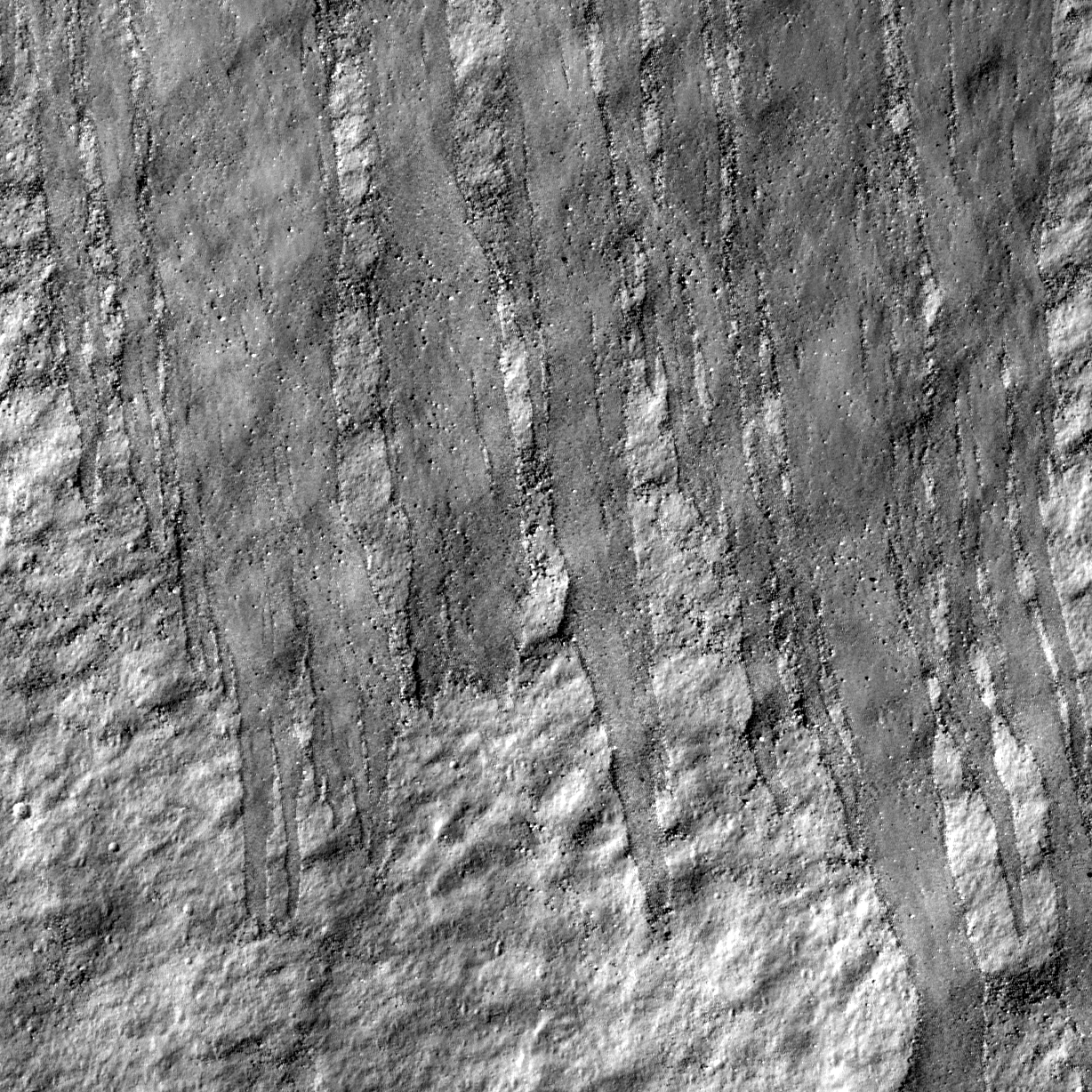
Northern slope inside Robinson crater, far to the northeast on the face of a Full Moon as seen from Earth (59.1°N, 314.1°E). Close-up from LROC Narrow Angle Camera observation M114259768R, LRO orbit 1972, November 30, 2009 Image resolution is 0.52 m/pixel, field og view 620 meters, sun light is from right, and the slope runs from top to bottom. View the full-width Featured Image, HERE [NASA/GSFC/Arizona State University].

Hiroyuki Sato
LROC News System

An impact crater changes its shape with time by various degradation processes, such as wall slumping, infilling with ejecta deposits from nearby impacts, and volcanic activities. Rock avalanches as shown in today's featured image also contribute to modifying crater shape little by little.


Pulling back from the NAC observation and this view inside Robinson north rim show wispy fine debris trails [NASA/GSFC/Arizona State University].

Multiple tongue shaped flow fronts in this image evoke liquid (Newtonian) flow features, especially mudflows. Similar features have been found on Mars, and are interpreted to represent recent mudflows. Water is not stable on the Moon's surface (except perhaps as ice in permanently shadowed craters), so these flows are dry (granular) rock slides. Perhaps some of the flow features on Mars thought to indicate wet mudflows are really dry granular flows?


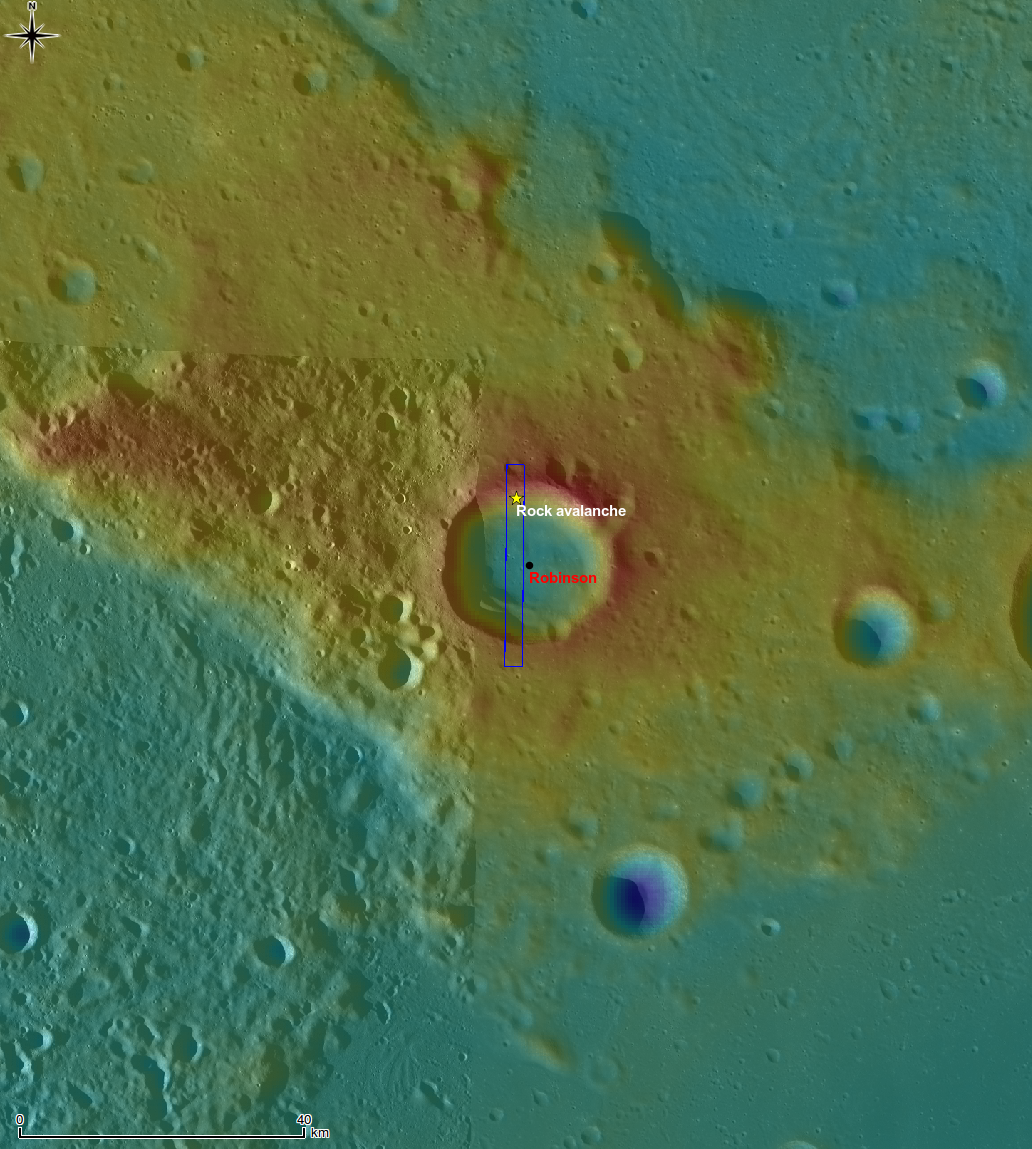
Context map of Robinson crater, centered near 59.1°N, 314.0°E. LROC Wide Angle Camera 100 m/px monochrome global mosaic overlayed by the WAC color Digital Terrain Model (DTM) at a resolution of 500 meters/px. The blue rectangle outlines the full footprint of the LROC team's Featured NAC Image November 18, 2010. View the full field of view in the original release, HERE [NASA/GSFC/Arizona State University].


A wider view showing the location of the rockslide just inside the northern rim of Robinson, in the context of the landmark Imbrium impact event. The vicinity of Robinson, near the long and winding Mare Frigoris, appears to be on a battered outer ring of Imbrium [NASA/LROC PDS Interface].

Explore lunar landslides by viewing the full NAC frame!

Similar slides can be seen in a small crater in the center of crater Henry Frères.

Tuesday, October 12, 2010

LROC WAC: Archimedes


From LROC Wide Angle Camera monochrome (689nm) mosaic of tell-tale Archimedes region, hugging the southeastern edge of the Imbrium impact basin. Even evidence for "emplacement" set forth in studies of 85 km-wide Archimedes (29.7°N, 356°E) was not enough for some early Space Age investigators to accept. Nevertheless, evidence mounted and the sequence generally went something like this: Imbrium impact, Archimedes impact affecting areas in the immediate vicinity, and then the Mare Imbrium mare basalt melt seen today, and embayment of lower elevations [NASA/GSFC/Arizona State University].

LROC: Alphonsus


Among the fifty Constellation program Regions of Interest, none ranked higher than 117 km-wide Alphonsus (13.4°S, 357.2°E), specifically a landing zone chosen in the northeast, not-coincidentally less than 20 km from the impact of Ranger 9 (12.83°S, 357.53°E), March 24, 1965 - though the LZ was closer-still to the inter-mixture of floor and pyroclastic fracture-zone material located there. Alphonsus is older than the Imbrium basin-forming-impact event and the apparent affect of that catastrophe (note the harsh grooving cut into the low and worn outer rim, almost certainly radiating from the center of Imbrium) remains a matter of high interest. As highly surveyed and well-photographed as Alphonsus is, some questions can only be addressed through direct assaying and sampling [NASA/GSFC/Arizona State University].

Review the Lunar Reconnaissance Orbiter Camera Featured Image, HERE.


LROC Narrow Angle Camera closeup (M111606491LE LRO orbit 1581, October 31, 2009) of a fracture in the northeast floor of Alphonsus. Dark pyroclastic materials are intermixed with rocks and boulders from the fracture walls and all appear to have moved in streamers toward the fracture floor at upper right. A NASA Constellation region of interest is centered to the southeast (lower right) of this view. Full frame field of view is 2.7 km [NASA/GSFC/Arizona State University].

Monday, October 4, 2010

Dispatch from Chang'E-2: Sinus Iridum


Clementine (1994) Near-Infrared Multi-Spectral Mosaic (USGS Map-A-Planet] view of Sinus Iridum (44.4°N, 330.0°E), the 414 km-wide "Bay of Rainbows" on the northwestern tier of Mare Imbrium (with the lofty Jura Mountains on its west). Xinhua news agency reports the relatively high-latitude feature is the intended target of a low a planned low-perigee, high-resolution survey by Chang'E-2 as the intended target for a planned landing by Chang'E-3 in 2013.

Dr. Yong-Chun Zheng, associate professor at the National Astronomical Observatories, Chinese Academy of Sciences (NAOC) reports from Beijing, "the high energy particle detector (HPD) on board Chang'E-2 was switched a day after Trans-Lunar Injection, "suggesting the scientific instrument has begun working"

"Data transmitted from Chang'E-2, such as the temperature, voltage and power of the HDP, are all within range, indicating the instrument works well."

Chang'E-2 carries seven scientific instruments. "The HPD is responsible for surveying the space environment in the journey from the earth to the moon and space environment near the moon," Zheng said. HPD is one of two instrument stages of the Chang'E'2 Space Environment Monitor System, designed to measure heavy ions, proton spectra and the composition and spatial distribution of low-energy solar wind.

Second of Three Course Corrections Unnecessary

Beijing Aerospace Command and Control Center completed an initial adjustment of Chang'E-2's course at 12:25, October 2 (Beijing time). Further adjustments are expected, but Xinhua has reported that the second of three planned TLC maneuvers had been deemed "unnecessary."

Chang'E-2 was launched at 18:59:57 pm, October 1 (Beijing time) and was directly inserted into an earth-moon transfer orbit. Direct Earth-Moon transfers generally require an initial critical course correction.

"Chang'E-2 needed to slightly change its orbit at the appropriate time," Zheng reports. "If the orbit correction is not on time, the satellite could depart from its correct orbit to the moon and might not be captured by the moon's gravity," which is overwhelmed first by Earth and then, about half the distance to the Moon, by the Sun. "So, for Chang'E-2," Zheng said, "the orbit correction was very important."

Telemetry indicates the Long March 3C booster successfully sent Chang'E-2 into its target course and, "everything is going well," Zheng said. "We give the mission perfect evaluation marks."

"Chang'E-2 needed to slightly change its orbit at the appropriate time," Zheng said. "If the orbit correction is not on time, the satellite could depart from its correct orbit to the moon and might not be captured by the moon's gravity," which is overwhelmed first by Earth and then, about half the distance to the Moon, by the Sun.

China's state news agency Xinhua reported Monday Chang'E-2 is expected to travel a total of 112 hours before lunar orbit insertion.

Xinhua also disclosed the relatively high-latitude Sinus Iridum, the familiar 411 km "half-moon" embayment "Bay of Rainbows," on the northwestern edge of Mare Imbrium is one intended target of the Chang'E-2 survey. "To acquire more detailed moon data, Chang'E-2 will enter a lower lunar orbit about 100 km above the surface (compared with the 200-km altitude of Chang'E-1) according to the control center.

"The satellite will eventually be maneuvered into an orbit just 15 kilometers above the moon. At that point, Chang'E-2 will take pictures of moon's Bay of Rainbows area, the proposed landing site for Chang'E-3, with a resolution of 1.5 meters. The spatial resolution of Chang'E-1's CCD stereo camera was 120 meters, said Wu Weiren, chief designer of China's lunar orbiter project.

Friday, October 1, 2010

The Far Shore of Palus Putredinis

Rima Bradley, surface manifestation of an apparently deep fault under the Apenninus piedmont (It's concentric with the Montes Apenninus front), and disappearing under Palus Putredinis. "Almost too much to take in," is the description frequently given to certain of the LROC Wide Angle Camera assemblies. This one is a 80 km-wide early morning look at a scene familiar to telescope observers on Earth, southwest of the Hadley Rille Valley and the Apollo 15 LZ. It is a mosaic of four monochrome (659nm) LROC WAC observations swept up in successive lunar orbits December 24, 2009.

Can you spot Putredinis 1, a 2 km wide pyroclastic vent, just off the southwest shore of Palus Putredinis? Is it yet another surface manifestation, the same stratigraphic source as Rima Bradley? [NASA/GSFC/Arizona State University].

Take a closer look at the WAC mosaic and find these two (of four) oblong "sinks" (Ann, left, near 25.1°N, 0.07°W, and Patricia, right; 800 to 1200 meters in length, respectively) tied into ancient Rima Vladimir, etched on a blasted plain pasted over a filled-in valley that radiates from Mare Imbrium's center. This image also is from a mosaic, left and right frames of LROC Narrow Angle Camera (NAC) observation M104519138; LRO orbit 562, August 10, 2009; alt. 145.98 km, res. 1.46 m, phase angle 55.94° [NASA/GSFC/Arizona State University].

Wednesday, August 4, 2010

Remnants of the Imbrium impact event


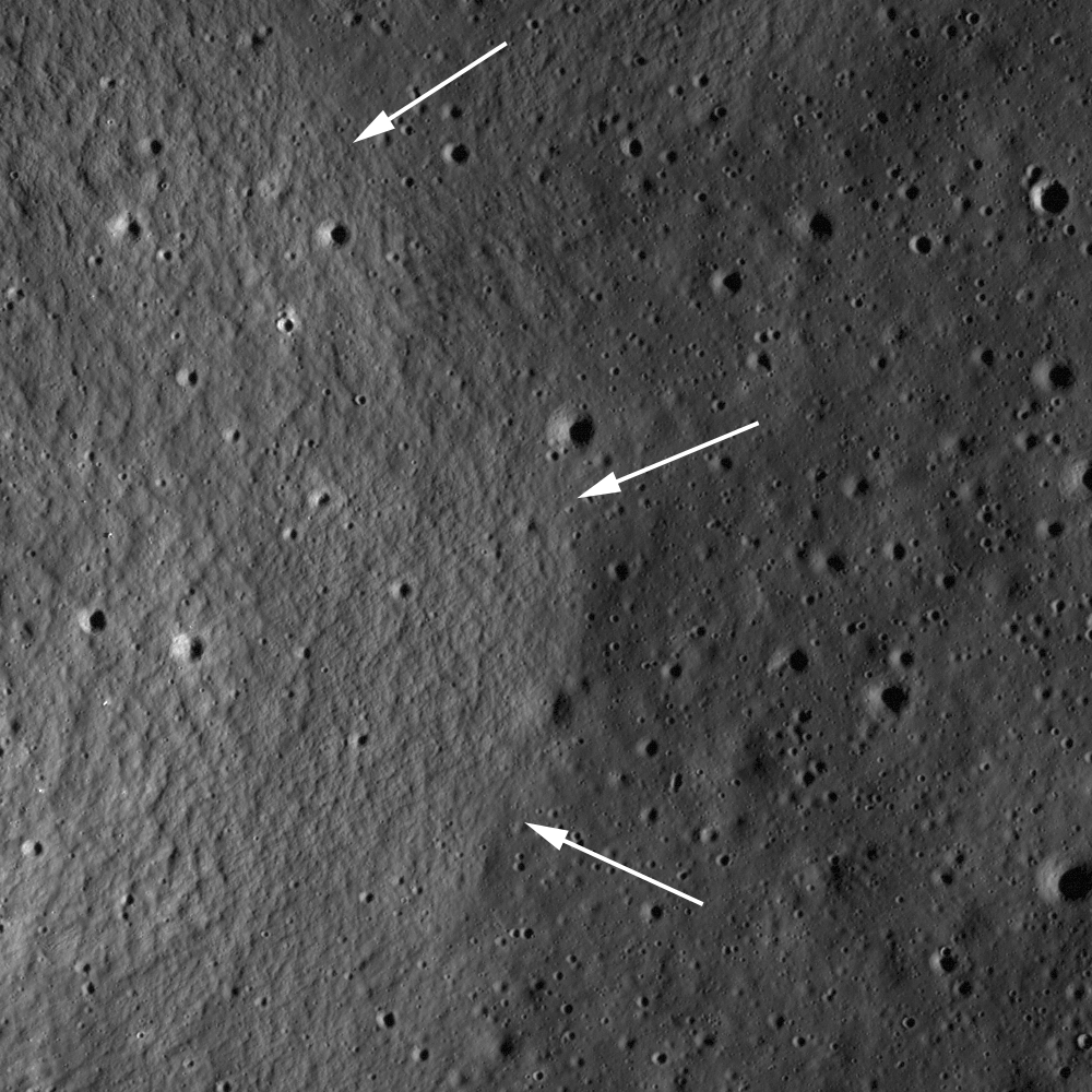
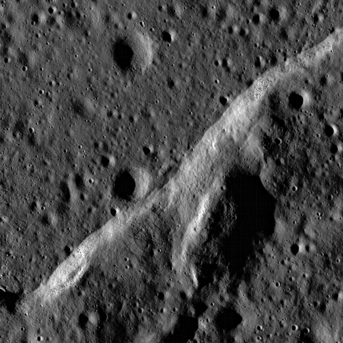
Mare basalts embayed ejecta structures formed by the massive Imbrium impact in this sub-scene of LROC Narrow Angle Camera (NAC) observation M131501983RE (2.2 km higher above, 902 meters in the LROC Featured Image field of view [full image HERE], immediately above). Arrows denote the contact between younger mare basalts and older Imbrium ejecta, image [NASA/GSFC/Arizona State University].

Lillian Ostrach
LROC News System

Mare basalts fill most of the large impact basins on the Moon, and in many cases the pre-existing topography was buried by the huge outpourings of lava. However, sometimes pre-existing topography is not completely buried by the mare basalts. When lava flows around a topographic high and does not bury it completely, the resulting landform is called a kipuka, and may be used to tell scientists about the region before the lavas flowed across the landscape. In the case of today's Featured Image, this kipuka in southwestern Lacus Somniorum is probably ejecta from the impact that formed the Imbrium basin. When looking at a regional view, this knob and others form relatively linear chains which can be traced back to the Imbrium basin.


Preliminary Lunar Reconnaissance Orbiter (LRO) laser altimetry (LOLA) data showing Imbrium as seen from Earth, the most predominant, clearly identifiable feature on the near side seen with the naked eye from Earth. Imbrium is central to most of the Moon's mare phenomena and it's highest diversity of compounds. [NASA/GSFC].

Since the mare basalts are embaying this feature, the basalts postdate the formation of the Imbrium basin. Using remotely-sensed data to establish this kind of geologic relationship on the lunar surface helps to clarify the geologic history of the Moon, an important consideration for planning future lunar exploration.

LROC Wide Angle Camera view of southwestern Lacus Somniorum; arrow points to location of today's Featured Image. Subset of LROC WAC monochrome M117339055M [NASA/GSFC/Arizona State University].

Explore the landscape of Lacus Somniorum
for yourself, HERE.

Wednesday, December 30, 2009

Wrinkle Ridge Near Montes Teneriffe


Boulders perched atop a wrinkle ridge in Mare Imbrium west of the Montes Teneriffe. Image width is 2 km, NAC frame M102264014RE [NASA/GSFC/Arizona State University].

Samuel Lawrence
LROC News System

Mare wrinkle ridge outlined by dramatic low Sun shadowing. Common in the lunar mare, wrinkle ridges are found in nearly all of the lunar maria, lunar scientists think that there is a genetic relationship between the basalts they deform and the ridges themselves. Basalt is much denser than the anorthositic crust on which the mare basalts are deposited. As the basalt fills in low areas in the crust, the increased weight causes sagging and the mare deposit is compressed, resulting in tectonic deformation in the form of wrinkle ridges.

Many LROC images show that boulders are often found on the top of ridges and other topographic highs. How did they get there? Were they tossed up and out by nearby impacts? To test this hypothesis look closely for small indents where the boulder hit and for possible source craters nearby. Alternatively they might be fragments of the ridge material broken off during deformation. Or were they on the surface before the ridge was formed? This unnamed ridge is found in the central northern Imbrium basin between Montes Recti and Montes Teneriffe Lat: 47.1°N, Long: 348.2°E.

Explore the whole NAC frame and see if you can determine the origin of the boulders!


Powers of thousands. The yellow square roughs out the 1200 by 1200 px image reduced above, down to one-third its full-size. The full-size strip of the LRO Narrow Angle Camera image on the right is the right-hand twin of two images swept up at the same time, the 8.5 km-wide size as seen when first accessing the image through the LROC website, here. From there, the whole field of view can be examined in detail unseen since Cernan & Schmitt departed the surface in December 1972.

Friday, December 18, 2009

Really, Really Close-Up on the Alpine Valley


Just how old is the incredible Vallis Alpes, the "Alpine Valley" bisecting the Montes Alps on the northeast "rim" of Mare Imbrium? Through a telescope the valley appears to be a crack radiant from the Imbrium impact (~3.8 billion years). Among other clues the arc of mountains it transects seems out of "sync" with where the eye traces out an apparent circumference for Mare Imbrium. Lunar Orbiter IV obtained excellent shots of the area, and in 2008, Japan's space agency JAXA released a 3D Grand Tour "fly-over" of the valley from data obtained by Kaguya. And last summer, soon after LRO arrived in lunar orbit, its narrow-angle camera (NAC) under the direction of Mark Robinson's LROC team at Arizona State University, LRO flew over the "mouth" of the valley, crossing where its inner channel seems almost to briefly run uphill, over the highest hills along its 134 km length [JAXA/SELENE].


LRO is in a polar orbit, of course, but Vallis Alpes runs southwest to northeast (or vice versa). LRO crossed the valley very much as diagrammed in the Kaguya Terrain Camera image up above. It was necessary to back away a bit to get the entire 8.5 kilometer strip from orbit 562 inside the constraints of this blog's template. Along the whole of the valley's length a sinuous rille meanders through its middle plain. At this location, however, the wider valley has narrowed to a "bottleneck," and the channel continues through the higher mountains not far from the edge of Mare Imbrium [NASA/GSFC/ASU].


Closing in on the bottle neck, using Arizona State University's "Zoomify" Image Browser (which also hosts Apollo's orbital metric and panorama photography), and what is easily the best image ever of Vallis Alpes inner channel comes into view. An island can be seen where the channel of molten material changed course long ago, and strong hints are seen of the channel's true age. "Elephant Skin" mottling, typical of highland hills throughout the Moon, traces down along a hillside that long ago collapsed or weathered down into the channel, burying its north rim [NASA/GSFC/ASU].


As close as it gets thus far in LRO's mission and the east side of the "island" seems to sit in a gently flowing river on Earth, complete with "river gravel." The image is perhaps a kilometer wide at this scale, however, and its depth is ~1.6 meters per pixel, so those stones are really boulders. The landscape presents another mystery, too. Where are the intermediate-sized and secondary craters? The Moon's surface, it is thought, is superficially "gardened" every two million years or so. Is this terrain telling us of Moonquakes and relatively recent landslides?

"A bottleneck at the start of the lunar sinuous rille within Vallis Alpes formed several morphologic features including (from left to right) a lava pond, a breached dam, and an island in the rille." [NASA/GSFC/Arizona State University].

Brent Garry
LROC News System

"Vallis Alpes (Alpine Valley) is a spectacular linear valley along the northeastern edge of the Imbrium impact basin. It is easily visible in amateur telescopes. The floor of the valley was flooded by mare basalts that host a sinuous rille which stretches for more than 150 km. High-resolution NAC images reveal small features that not previously resolved in the existing Lunar Orbiter frames; including an "island" within the rille, a breached dam, and a remnant lava pond. Based on the available data, there are some outstanding geologic questions about this rille that will be addressed by future human exploration. For instance, where is the source for the lavas in the middle of the ejecta blanket? Are these lavas older, younger, or related to lavas in Mare Imbrium and Mare Frigoris? Did a fault or graben create the long valley now occupied by frozen lava? Was the valley formed as a result of the Imbrium impact event or is it younger? For now NAC images, combined with previous maps and data sets allow scientists to make observations of the rille's morphology and stratigraphic relationships between the different units to piece together the geologic history of this rille and the surrounding region."

View the full discussion, the images and diagrams,
at LROC's website
HERE.