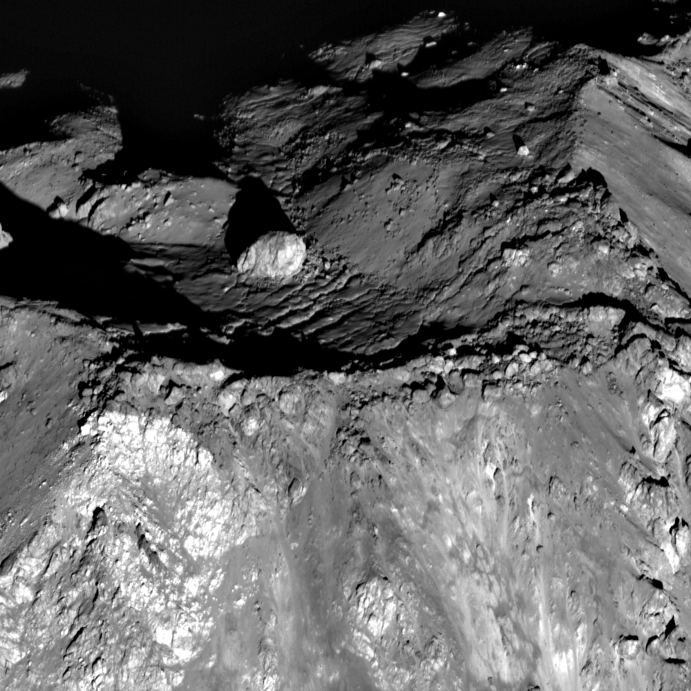
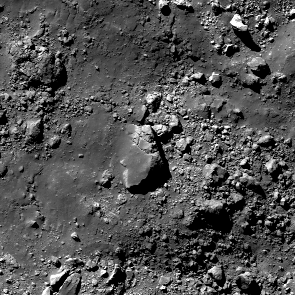
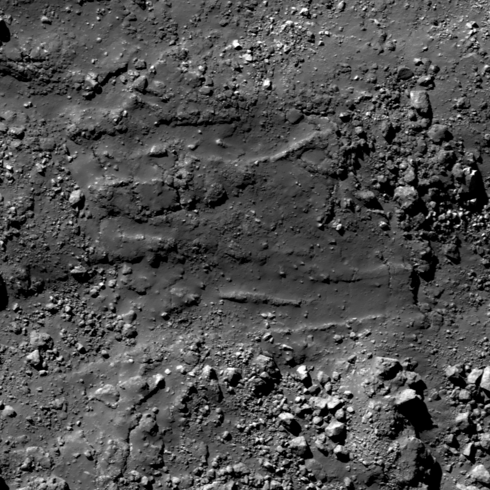
Showing posts with label LPOD. Show all posts

Monday, March 4, 2013

New oblique views of Gruithuisen Domes

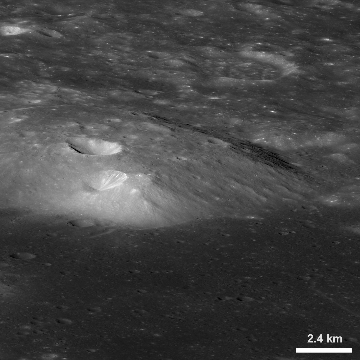
An oblique view of the northern portion of the Gruithuisen Gamma volcanic dome, from the northwest. From a new LROC Narrow Angle Camera (NAC) mosaic M1106087898LR, LRO orbit 15300, October 28, 2012; overall resolution 4.9 meters per pixel [NASA/GSFC/Arizona State University].
Sarah Braden
LROC News System

The last LROC Featured Image post on the Gruithuisen Domes featured some of the earliest Narrow Angle Camera (NAC) coverage of this amazing region.

Now LROC brings you an even more dramatic view of these volcanic domes from an oblique angle (viewing from East to West), from an altitude of 154 km (96 miles) above the lunar surface.

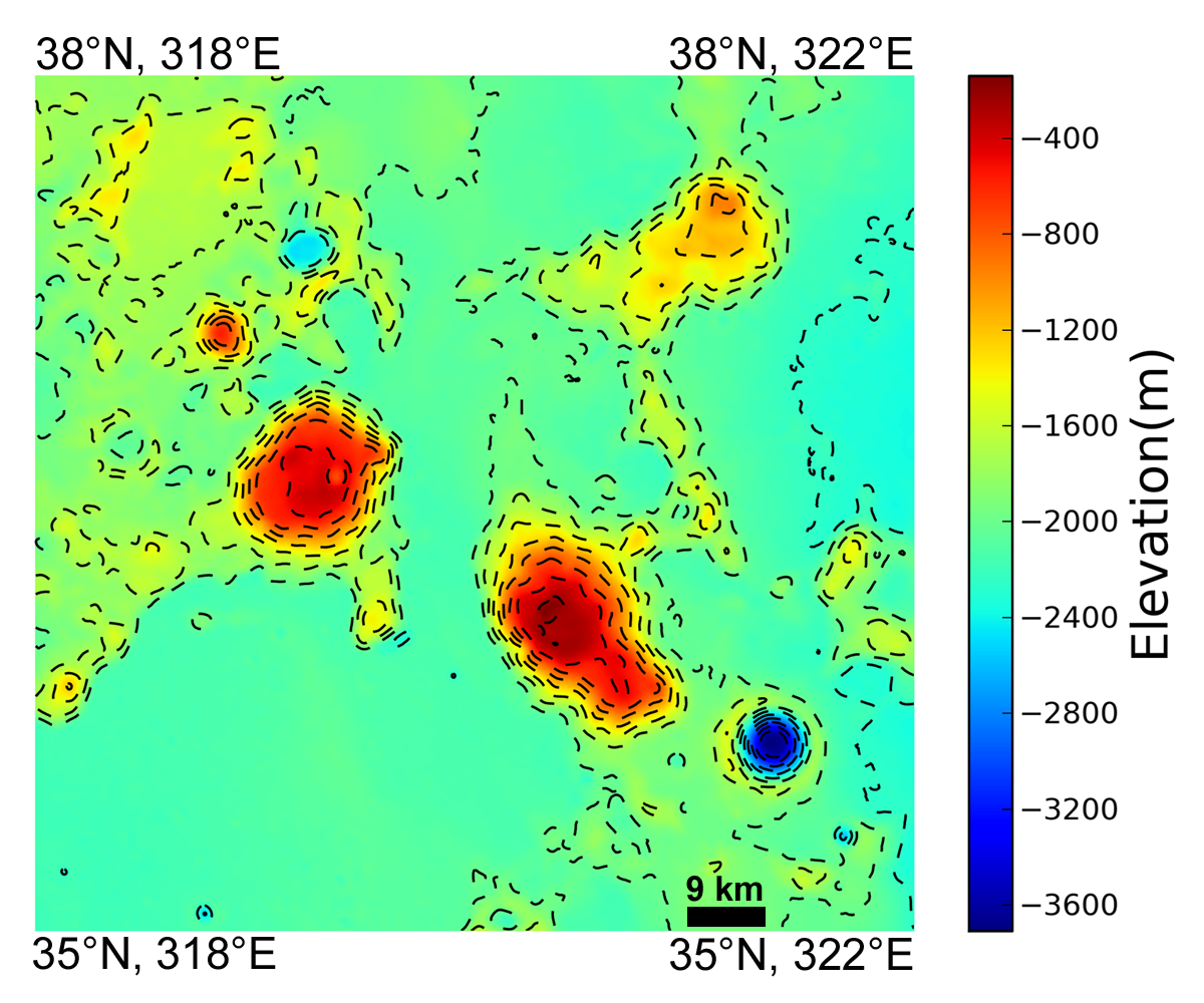
Located along the mare/highlands boundary, on the northeast border of Oceanus Procellarum (36.6°N, 319.9°E), the three Gruithuisen domes Gamma, Delta, and Northwest (NW) are primary examples of lunar silicic volcanism.

A thumbnail image of the 20376 x 6728 oblique NAC montage users can zoom into HERE. The crater Gruithuisen B is 9 km in diameter (north is to the right) [NASA/GSFC/Arizona State University].
Field of view seen at an oblique angle sketched out (arrows) on a photometric work-up of an LROC monochrome Wide Angle Camera (WAC) overview by Maurice Collins, originally presented as a Lunar Picture of the Day (LPOD), September 27, 2010 [NASA/GSFC/Arizona State University].
Silicic volcanism is relatively rare on the Moon. The Gruithuisen Domes pre-date the lunar mare in this region, so some portion of these domes has been covered by mare basalt, although there are also contacts with the older highlands material. Silicic volcanism might have been more widespread during the Moon's early history, however, any evidence for that may be buried beneath the maria. We know that the composition of the Gruithuisen Domes are different from that of the mare and the highlands from Earth-based telescopes, Lunar Prospector gamma-ray spectroscopy data, and Clementine multispectral data. The Gruithuisen Domes are characterized by relatively high reflectance and strong absorptions in the visible and ultraviolet. The Domes are also low in iron and titanium abundance compared to the lunar maria. New data from the Diviner instrument on the LRO spacecraft confirmed that the Gruithuisen Domes are silicic.

Colorized topography of the Gruithuisen Domes region derived from the 100 m/pixel LROC WAC DTM. Contour line interval is 220 meters [NASA/GSFC/Arizona State University].
Experience the full resolution oblique image HERE.

Related LROC Featured Images:

Gruithuisen Domes - Constellation Region of Interest
Morphology of lunar volcanic domes
LROC NAC DTM Viewer Gruithuisen Domes (ROI) 1 - 2 - 3 - 4 - 5
Hansteen alpha yields some of its secrets
Silicic volcanism on the Moon
Compton Belkovich - Constellation ROI
Hortensius Domes - Constellation ROI

Monday, January 21, 2013

Why the Moon looms large on the horizon: Binocular disparity as an explanation for the moon illusion

Is the Moon really larger at the horizon than overhead, or is this an illusion, created in our heads? [Photograph by Robert Arn, AstroArn Photography].
Joseph Antonides, Toshiro Kubota

We present another explanation for the moon illusion, in which the moon looks larger near the horizon than near the zenith. In our model, the sky is considered a spatially contiguous and geometrically smooth surface. When an object (like the moon) breaks the contiguity of the surface, humans perceive an occlusion of the surface rather than an object appearing through a hole. Binocular vision dictates that the moon is distant, but this perception model dictates that the moon is closer than the sky. To solve the dilemma, the brain distorts the projections of the moon to increase the binocular disparity, which results in increase of the angular size of the moon. The degree of the distortion depends upon the apparent distance to the sky, which is influenced by the surrounding objects and the condition of the sky. The closer the sky appears, the stronger the illusion. At the zenith, few distance cues are present, causing difficulty with distance estimation and weakening the illusion.

Read the research paper, HERE.

News story with commentary from MIT: "Moon illusion: New theory reignites debate over why Moon appears larger near the horizon," The Physics arXiv Blog, January 17, 2013

Full Moon rises over the ruins of the Temple of Poseidon, Cape Sounion, 69 km south-southeast of Athens, southernmost tip of the Attica peninsula in Greece. Seventeen sequential images by John Doukoumopoulos, June 18, 2008 [Lunar Picture of the Day (LPOD), June 20, 2008].

Tuesday, June 19, 2012

Welcome new medium resolution views from LRO

Rich detail and context is seen in this "medium resolution" image of a familiar part of the complex Aristarchus Plateau from the Lunar Reconnaissance Orbiter (LRO). Prior to a recent mission-conserving transfer to higher orbit, capturing the entire width of the 165 kilometer-long Vallis Schroteri in a single Narrow Angle Camera (NAC) frame was not possible. The maneuver should add some years to the record-smashing mission following three years in an energy-taxing low lunar orbit, and welcome perspectives like this one in a 'middle range' between the best of the orbiter's narrow and wide angle camera catalogs.  LROC NAC frame M183861408R, LRO orbit 12190, February 14, 2012; angle of incidence 41.03° at 1.39 meters resolution from 140 kilometers [NASA/GSFC/Arizona State University].
Other nations can rightly boast of recent accomplishments in low Earth and lunar orbit, and its easy to lament the embarrassing length of time since America sent six manned expeditions to the lunar surface. It might seem a small thing in comparison, and easy to forget, but the United States presently has five vehicles in lunar orbit. Queen among them is the under-rated Lunar Reconnaissance Orbiter.

The LRO will soon celebrate three years in lunar orbit, far longer than any spacecraft in history, and by all accounts the vehicle is healthy and still shy of middle age. It's no small accomplishment maintaining close-lunar orbit precisely for the very reason the twin GRAIL gravity probes, "Ebb" and "Flo," were designed and subsequently dispatched to spy out. The Moon is "lumpy," with mass concentrations putting uneven drag on objects in orbit, and it also dances through a realm of space overwhelmed by the influences of Earth and Sun. To remain in lunar orbit requires skill and fuel, even over robust design.

After more than two years surveying the lunar surface from within 40 kilometers, close enough to photograph the forty year-old footprints of the Apollo astronauts and allowing more than half the Moon to be imaged at high resolution, in 2011 flight directors included two periods when LRO was swept through the 20 kilometer range. It was a last slow dance before the spacecraft was brought up above 100 kilometers. 

Eventually, planning requires LRO to be wound down tightly for more unprecedented close-ups before what is hoped will be a controlled impact, good to the last thruster fire. In the meantime, since late last year scientists have been enjoying a "medium range" perspective using the LROC Narrow Angle Camera from a higher altitude.

It difficult to disparage the quality of this LROC NAC frame of Rima Galilaei and the exposed layering of the surrounding floor of Oceanus Procellarum. This image is a full-resolution crop from LROC NAC M181552312R, orbit 11867, January 18, 2012; angle of incidence 62.51° at 1.25 meters resolution, from 125.4 kilometers altitude. For comparison, from 24.16 kilometers in orbit 9978 the previous August 21, two insets from LROC NAC frame M168584181R show half-meters resolution fields of view of the same region [NASA/GSFC/Arizona State University].
Soon after LRO arrived in lunar orbit and the first of Arizona State University's LROC Narrow Angle Camera images began arriving back on Earth, Charles Wood, who is the steadfast lunar observer and architect of the Lunar Picture of the Day (LPOD) website, was quick to point out the level of detail and small fields of view seen in those images seemed almost overwhelming. He looked forward to the time, still several months off, when LROC's Wide Angle Camera (WAC) catalog premiered on the Planetary Data System (PDS). He wasn't disappointed. That wider context showed familiar landmarks Wood had long witnessed under every available illumination and focus in ways that were truly new.

These are still high-resolution images, even at less than half their previous detail. A new range of medium resolution photography from the LROC NAC offers a welcome opportunity to continue the long process of digesting the incredible volume of data that's been returned to Earth from what may already be the most cost-effective deep space mission in history.

Wednesday, June 13, 2012

LROC: Rock silde in Rima Hyginus

A rock slide along a section of the northern wall of Rima Hyginus. LROC Narrow Angle Camera (NAC) observation M111545012R, LRO orbit 1572, October 30, 2009; angle of incidence 27.62° at a native resolution of 0.48 meters from 47.28 kilometers. See the 576 meter-wide field of view of the area in the LROC Featured Image HERE [NASA/GSFC/Arizona State University].
Sarah Braden
LROC News System

Rima Hyginus is a linear rille which branches to the northwest and east of Hyginus crater.

The rock slide shown in the Featured Image is located on the northern wall of the eastern branch of Rima Hyginus at 7.393°N, 7.954°E. Bright boulder-rich material from the edge of the rille slid down the wall, possibly during a period of tectonic shaking due to a moonquake or forces associated with a nearby impact.

A trio of large boulders also left trails as they tumbled down the rille's wall.

LROC NAC and WAC mosaic overlay showing a cross-section of Rima Hyginus at the point of the rock slide of interest, LROC QuickMap at 4 meters per pixel resolution [NASA/GSFC/Arizona State University].
Rima Hyginus formed through faulting, and is actually a graben. A graben is a section of the crust that sunk as two parallel faults pulled apart. Remember, the term linear rille is just a fancy way of saying a graben. After the graben formed Rima Hyginus, the landscape changed again due to volcanic activity, specifically the collapse craters easily seen in the the WAC context image here. The craters follow the slight curve of the rille, which indicates that they are not simply a chain of secondary craters that happened to land on top of the existing graben. These craters also do not have raised rims, and they probably formed when the volcanic structures underlying the graben collapsed.

Branch of Rima Hyginus trailing away east from the Hyginus crater, with the subject rock slide designated with the yellow arrow. Cropped at its full 52.5 meter resolution from LROC Wide Angle Camera monochrome (604nm) observation M177582468C, LRO orbit 11306, December 3, 2011, from 38.58 kilometers [NASA/GSFC/Arizona State University].
Examine more of Rima Hyginus in the full LROC NAC frame HERE.

Related Images:

Read more about the Hyginus region in the Icarus paper, "An igneous origin for Rima Hyginus and Hyginus crater on the Moon."

Tuesday, June 12, 2012

LROC: Inside Rima Hyginus

Collapse features within Hyginus Crater. 1240 meter-wide field of view from LROC Narrow Angle Camera (NAC) observation M104476560L, LRO orbit 556, August 9, 2009; resolution 1.24 meters from 122.77 kilometers. View the LROC Featured Image, released June 12, 2012 HERE [NASA/GSFC/Arizona State Univeristy].
Sarah Braden
LROC News System

Most craters posted to the LROC Featured Image page are impact craters, however, Hyginus Crater (located at 7.75°N, 6.27°E, in Sinus Medii) is a volcanic crater known as a caldera. Two main pieces of evidence suggest that Hyginus Crater formed through volcanic processes. First, Hyginus lacks a raised rim typical of impact craters. Second, the rim of Hyginus is irregular (not circular), which is typical for volcanic craters caused by collapse. Also, if you look closely with the LROC NAC, the interior of Hyginus has a number of small irregular depressions which are most likely collapse features, indicating a volcanic origin for Hyginus. These irregular depressions are in the Featured Image, distinguished by rough, high reflectance material around their edges.

Eight meter per pixel resolution view from LROC QuickMap shows the "meniscus hollows" features in context with the eastern interior of Hyginus [NASA/GSFC/Arizona State University].
The entire Hyginus region, shown in the LROC context image below, is a complex piece of lunar real estate. Not only do you have the volcanic crater Hyginus, but also Rima Hyginus, a linear rille, more volcanic collapse craters aligned with the linear rille, and a pyroclastic deposit around the crater Hyginus. How do all the geologic features relate to one another? The Hyginus region is so amazing that it was a candidate landing site for the canceled Apollo 19 mission. Had events turned out differently, we might know much more about the pyroclastic materials and the Hyginus caldera. Continue reading below for a summary of the scientific theory of how the Hyginus region formed.
An almost oblique view (spacecraft and camera slewed 19.57° east from nadir), LROC WAC view from 42.29 kilometers over an area west of Rima Hyginus. The caldera, particularly its east walls, can be seen here in some relief, without the high angle of incidence seen in the next image. LROC WAC observation M165814883C (604nm), LRO orbit 9570, July 20, 2011; native resolution 62.94 meters [NASA/GSFC/Arizona State University].
In a recent paper, scientists proposed a model of formation for Hyginus crater and Rima Hyginus. First, a body of magma from the mantle rose vertically through the lunar crust. The magma stopped rising near the surface and spread out laterally. This introduction of new material beneath the surface caused stress on the crust, which resulted in faulting. Eventually, gasses from the magmatic material still underneath the surface built up and increased the gas pressure, further increasing the stress on the crust.

LROC Wide Angle Camera (WAC) monochrome (689nm) observation of the Hyginus region. The yellow arrow marks the location of the collapse feature, the meniscus hollow, within Hyginus caldera seen at high resolution in the LROC Featured Image and the white arrow designates a small dome feature brought to attention by Maurice Collins. LROC WAC M117447052ME, orbit 2442, January 6, 2010; incidence angle 81.75° and a 62.6 meter resolution from 41.63 kilometers [NASA/GSFC/Arizona State University].
This stress eventually caused graben to open along the faults, and the same release of stress initiated an eruption, including pyroclastic materials. After the eruption of magmatic material an empty cavity beneath the surface was left behind. This cavity collapsed, creating Hyginus crater. The collapse craters along the linear rille also formed in a similar way.
LROC NAC image M126887222L gives another look at the largest collapse feature in the main image. This image field of view is 487 meters wide (588 meters in the LROC Featured Image release), and has a lower illumination incidence angle, which emphasizes albedo differences over the kind of relief visible in the LROC WAC image immediately above. LRO orbit 3833, April 26, 2010; incidence angle 28.28° with a resolution of 0.48 meters from 40.55 kilometers [NASA/GSFC/Arizona State University].
Explore more of the Hyginus caldera in the full LROC NAC, HERE.

Related Posts:
LPOD: Another Ina?
It's a gas, man
Brayley G
Sinuous Chain of Depressions
It's the Moon's Fault

You can read more about the Hyginus region in the Icarus paper, "An igneous origin for Rima Hyginus and Hyginus crater on the Moon."

The central and western Hyginus and Rima Hyginus region and points immediately north and beyond under mid-morning illumination, as seen from around 100 kilometers over the south , a forward-looking HDTV still captured by Japan's lunar orbiter SELENE-1 (Kaguya) in 2008 [JAXA/NHK/SELENE].

Sunday, April 15, 2012

Scientists at PRL suggest evidence of continued volcanism long after Tycho's formation

From "Tycho's flash-frozen inferno" (Lunar Pioneer/Lunar Networks), November 2, 2011: As impact melt briefly ran down the exterior side of the southeast brim of Tycho it pooled, cooled, and came to a halt in the cold vacuum of space long before 'finding its level.' PRL director Dr. Goswami and team suggest these and other melt pools are superimposed at positions suggesting extrusive volcanism at Tycho continued well after the impact event, 109 million years ago. LROC NAC observation M150578086R, LRO Orbit 7324, January 25, 2011; resolution 71 centimeters per pixel, incidence angle 69.84° from 44.74 kilometers [NASA/GSFC/Arizona State University].
EDITOR'S NOTES: RE: "Claim supported by discovery of two-km high peak with boulders." Obviously the central peak of Tycho is not a recent discovery, though the nature of the large boulder situated near it's apex, discussed here last July, was a recently resolved feature, and before either Chandrayaan-1 or the on-going Lunar Reconnaissance Orbiter missions. That feature is plainly visible in Terrain Camera images returned by Japan's SELENE-1 (Kaguya) in 2009. Now without reading the full paper by Dr. Goswami, whose credibility is well established along with that of the PRL, we are left a bit confused by the report that follows which suggests 100 million year-old features related to a 100 million year-old impact should be thought of as unusual. Nevertheless, a hint that impact melt and other features superimposed upon Tycho might be evidence of volcanism continuing for an unusually long time after Tycho's formation is intriguing.
Addendum 1 - 201204141459 ut: Charles Wood discussed and linked to the abstract discussed below at his definitive website LUNAR PICTURE of the DAY (LPOD), April 14, 2012.
Addendum 2 - 201204152359 ut: Dr. J. N. Goswami, director of India's noted Physical Research Laboratory (PRL), who is quoted in the Deccan Herald news article below, was gracious enough to forward to our group a complete copy of the newsworthy research regarding the interesting possibility of an extended and dynamic period of volcanism near the central peak of Tycho. We will follow up on this shortly. - JR.

"Indian scientists find volcanic activity on moon"

Kalyan Ray
Deccan Herald

Breaking through a popular perception of moon being a geologically inert place for the last three billion years, Indian scientists have found new evidence of the recent volcanic activities inside a lunar crater, opening up a new window for research.

The discovery of a 2-km high peak with large boulders comfortably sitting atop inside a crater and signatures of strong volcanic activities all around the peak may eventually aid scientists to solve one of the long-standing lunar mysteries – what is the moon made of?

Analyzing data collected by Chandrayaan-I and USA’s Lunar Reconnaissance Orbiter, a team at the Physical Research Laboratory (PRL) in Ahmedabad, found evidences of volcanic vent, lava pond and lava channels as recent as 100 million years old inside the ‘impact crater’, thus implying that the moon was not a geologically quiet, rather, it was an active place.

From "LROC Featured Image, 'Tycho Central Peak Spectacular,'" July 5, 2011: Oblique view of summit area of the central peak of Tycho. The boulder resting inside a summit notch is 120 meters wide, and the image area is about 1200 meters across. LROC Narrow Angle Camera (NAC) observation M162350671L & R, LRO orbit 9059, June 10, 2011. Zoom in on the fill-sized NAC mosaic HERE [NASA/GSFC/Arizona State University].
The lunar volcano was different from the volcanoes seen on earth. Possibly, there was no explosive eruption. The magma may have oozed out silently through the vents. The discovery – if supported by further studies in future – has the potential to change the commonly held belief on geological history of moon, the team claimed.

Constantly bombarded by asteroids and meteors, moon has many scars on its face – the impact craters. The high-velocity collisions with lunar surface creates “impact-induced” mounds. The 2-km high peak in Tycho – a 110 million year old crater, is one such peak.

The fresh evidence of volcanic activity suggests magma may have been released from the interior as a consequence of the impact that led to the formation of the crater in the first place. This suggests that the moon was geologically active from inside when the carter was formed.

Additional illustration for Dr. Mark Robinson's "Tycho Central Peak Spectacular," From almost an entirely different angle and illumination, Japan's lunar orbiter Kaguya (SELENE-1) released a Terrain Camera image of Tycho's interior in 2009. Once again, the boulder, situated on a tiny melt plain near the very highest point of Tycho's central peak, is seen. Another large "melt plain" can also be seen at a lower elevation, above left center, a high valley between summits 600 meters above the jumbled, relatively fresh impact melt-based and chaotic Tycho interior floor [JAXA/SELENE].
“Either the signatures were made post formation of the crater or sub-surface solidified magma which was released due to the impact. We can’t be sure at this point, therefore, require more studies from other craters.

“But unlike on earth, we cannot have a deep drilling project on moon to understand its deeper crust,” Prof. J. N. Goswami, PRL director and lead scientist of Chandrayaan told Deccan Herald.

“We found the inner crustal material exposed on the central peak of Tycho,” said Prakash Chauhan, a PRL scientist. The study, he claimed, changed views about geological history of the moon and brought out details of more recent modifications of the lunar surface.

“A surprise findings revealed the  presence of large boulders–about 100 meter in size –on top of the peak. Nobody knew how did they reach the top,” Chauhan said. The findings were reported in the April 10 issue of ‘Current Science’.

Composition of lunar core and the nature of materials present on the surface remains one of the unsolved scientific problems. The evidence so far, has come mainly from the analysis of lunar rocks collected by Apollo missions, and analysis of images collected by a handful of spacecraft within the last six years including Chandrayaan-I.

Friday, March 30, 2012

LROC: Splish Splash

An impact melt veneer coating a large boulder, roughly 80 meters by 120 meters in size, larger than a football field! Downslope to the right, LROC Narrow Angle Camera (NAC) observation M169630027R, orbit 10132, September 2, 2011; image field of view is 530 meters across, inclination 47.19° at 0.56 meters resolution from 54.5 kilometers overhead. View the larger LROC Featured Image HERE [NASA/GSFC/Arizona State University].
Lillian Ostrach
LROC News System

Ryder crater (43.877°S, 143.246°E, ~15 km diameter) is a Copernican-aged crater located within the South-Pole Aitken basin. A pond of impact melt is present on the crater floor, and boulders and melt streamers pepper the crater rim. Taking a look at the crater wall just interior to the rim (opening image), the wall is littered with boulders of varying sizes and shapes as well as areas smoothed by impact melt flows and veneers. Even though substantial ejecta and impact melt were deposited exterior to the crater, the rim and immediate surroundings were also littered with vast quantities of ejected material and impact melt. Today's Featured Image displays the complicated relationship between impact melt and ejecta emplacement, specifically around the crater rim.

Interspersed with melt-covered boulders are sections of impact melt channels (43.878°S, 143.021°E). Erosion over time has fractured and fragmented the channels and not many areas like the one pictured above are visible in this image. Downslope to the right, NAC M1696330027R, field of view 530 meters; view the full sized image HERE [NASA/GSFC/Arizona State University].
In some places, the crater wall is very smooth, indicating that the impact melt deposited was thick enough to bury the fractured wall material. However, as observed in the opening and above images, jumbles of boulders and fragmented ejecta are interspersed among impact melt-smoothed surfaces. Many of these boulders are veneered with impact melt where a thin layer of impact melt splashed onto the surface of the rock and solidified, and some boulders are partially buried within the smoother regions of impact melt. Some boulders do not appear to have impact melt veneers at all - why might that be? Furthermore, channels formed in some places that allowed impact melt to flow from the crater rim back toward the crater floor.

HDTV still looking north over Ryder crater from Japan's lunar orbiter Kaguya (SELENE-1, 2009). By way of Charles Wood's Lunar Picture of the Day (LPOD), December 26, 2009 [JAXA/NHK/SELENE].
Unlike other channels, those observed in the above image are not as well-formed, suggesting that less melt utilized these pathways and perhaps the impact melt had cooled substantially as it flowed back into the crater so that it was not able to flow quickly nor hot enough to maintain thermal erosion in the channels. However, as seen in the above image, the channel halts abruptly in the downslope direction (right side of the image). What could be the cause?

LROC WAC monochrome mosaic of Ryder crater. Note the massive slump originating from the eastern wall and the pond of impact melt on the crater floor. Asterisk notes location of opening image (43.895°S, 142.988°E). View the LROC context image HERE [NASA/GSFC/Arizona State University].
The answer to both the halted channel and presence of boulders without melt veneer is that erosion has taken place since Ryder crater formed. Simply put, things (rocks) like to move downhill. Over time, boulders from the crater rim and higher up on the crater walls dislodged and traveled toward the crater center. While some of these blocks do not have impact melt veneers now, they may have in the past, but their downhill travels may have fractured those blocks even further so that any melt veneer present cracked off or was left behind on another fragment. Take a look at the central boulder in the opening image; although the majority of the boulder face visible has an impact melt veneer, there are fractured areas of the block that do not. Additionally, crater wall erosion may be invoked as an explanation for the apparent halt in the impact melt channel. Observations of the cracks perpendicular to the channel flow direction suggest that the jagged edge of the channel (middle-right) probably cracked off and fragmented to fall toward the crater floor. Or perhaps the ejecta blocks entrained within the melt that formed the channel dislodged and carried the lower portion of the channel downhill.

How many different impact melt features and morphologies do you observe when you traverse the entire LROC NAC frame, HERE? In case you missed it, and be sure to check out the LROC NAC oblique view of Ryder crater, released this past week, HERE.

Related Posts:

Farside impact!
On the Floor of Thales
Lichtenberg B Flow
Impact melt channel

Tuesday, February 14, 2012

Spudis: Cataclysmic Conundrum

Impact melt samples from the Moon tend to have the same age, around 3.9 billion years old. What does this mean?
Paul D. Spudis
The Once and Future Moon
Smithsonian Air & Space


One of the hottest topics in planetary science is the nature of the Moon’s early impact history.  So it was not unexpected that the Early Impact Bombardment of the Solar System Workshop, recently held at the Lunar and Planetary Institute in Houston, generated some interesting discussion.  More than 30 years ago, when researchers at Caltech and elsewhere noted that many lunar highland impact generated rocks had very similar ages, they advanced the idea that the early Moon underwent an extremely large increase (peak) in the rate of asteroid and comet bombardment 3.9 billion years ago (600 million years after the Moon had formed).  They called this late bombardment the lunar “cataclysm.” Work on lunar samples continued after this proposal, and while that apparent peak in impact ages around 3.9 billion years was considered remarkable, many investigators resisted the idea of a cataclysm.  Part of their resistance was because such a late barrage of impacts is difficult to explain dynamically.

All the planets form by the accretion (addition by impact) of smaller particles.  Much work with meteorites (samples from the early Solar System, including lunar and other planetary materials) has shown that Earth and Moon had mostly finished assembling (i.e., grown to their present mass) by 4.5 billion years ago.  This means that the debris clouds orbiting the Sun had been largely swept clean by that time.  How could the Moon then experience another intense bombardment 600 million years later, at 3.9 billion years?  Many complex ideas were examined, including the break up of other, previously existing planets or the incursion of a large number of objects from the shadowy Oort cloud of comets orbiting the Sun in the deep cold and darkness far beyond the orbit of Pluto.

What if there was no cataclysm?  Perhaps the plethora of ages at 3.9 billion years is more apparent than real (a possibility that has been studied in detail).  Part of the problem is that most of our lunar samples come from the “Apollo zone,” a small polygon centered on the lunar near side.   Most of whose landing sites seem to be somehow related to the enormous Imbrium basin, one of the youngest of the many large, multi-ring impact craters that cover the entire Moon.  Perhaps the reason this age turns up so often is that it is really just reflecting one age – that of the Imbrium basin.  Indeed, our best estimate for the age of that feature is 3.85 billion years, very close to the age of the supposed “cataclysm.”  Moreover, some argue that because early cratering rates were so high, they would have destroyed the very evidence we seek – the older impact rocks would have been ground up into an unrecognizable powder, the so-called “stonewall effect.”

Lest you think that this is merely some esoteric debate among lunar scientists and only of interest to them, comparable to arguments between medieval theologians about the number of angels on the head of a pin, you should know that much of our current alleged understanding of the early history of the Earth and other planets comes from our interpretation of the well preserved geological record of the Moon.  Mass accretion followed by global melting and then an impact bombardment is the received wisdom for the early story of all the planets.  We did not make up this narrative; it was dictated by the lunar record.  If we have the story of the Moon wrong, perhaps we are wrong about all the other planets as well.  This era of time is important to Earth history in a special way – it is the time when we suspect that life may have arisen.  The bombardment rate is a crucial variable in that story, as too high a rate will produce too many sterilizing impacts, thereby stopping life in its yet-to-be-made-because-there-are-not-yet-feet tracks.

So which model for early lunar history is correct and how might we decide that?  One possibility is to study samples derived far from the Apollo sites, ones that may not have been as heavily influenced by the dynamics of the Imbrium basin.  We have additional samples of the Moon in the form of meteorites (blasted off the Moon by impact); over 100 are presently known.  Assuming that they come from random places on the Moon (and there is no reason to assume otherwise), many of them could come from areas of the Moon not affected by Imbrium, such as the lunar far side. There is ongoing study of these objects but at first glance, although they contain impact melts from post-heavy bombardment times, they do not appear to have impact melts much older than what is found in the Apollo collections.  This relation suggests that the absence of impact melts older than 3.9 billion years is a global phenomena and not a sampling bias reflecting the effects of the single Imbrium impact event. Such a relation could be produced via a cataclysm or the stonewall effect.

So this result leaves the question of the early bombardment unresolved.  The discussion at the workshop tried to imagine new ways to solve this problem.  Most agreed that the best way to document or refute the cataclysm was to absolutely date some older basin whose relative age is well known and see if it is close in time to Imbrium or not.  We can absolutely date rocks through isotopic methods, but getting the right rocks is the challenge.  Humans can intelligently select samples, but no humans are going to the Moon in the near future.  Robotic spacecraft can collect rocks and soil, so perhaps a robotic sample return mission could provide the samples to resolve this problem.  But where would we send such a robot?

For the last decade, attention has been focused on the extremely large (2500 k diameter) South Pole-Aitken basin, the oldest visible impact feature on the Moon, centered on the southern far side.  The problem is that this feature is so old, much has occurred since its formation and although “grab samples” could be obtained by a robot probe, what might these rocks represent – basin impact melt or some other, post-basin deposit?  Moreover, even if we could somehow convince ourselves that SPA melt had been obtained, the only way these samples resolve the issue is if they are the same age as Imbrium, in which case there was a cataclysm of epic proportions.  If the age of SPA is much older, it could have formed early, leaving the Moon with little subsequent activity, and then a cataclysm at 3.9 billion years ago.  An old age would provide no information on that possibility.

The slightly oblong 4 billion year old South Pole-Aitken impact basin, some of which spills over the South Pole onto the nearside, as represented in preliminary LRO LOLA laser altimetry-based topography from April 2009 [NASA/GSFC/LOLA].
At the workshop, the man who first discovered the multi-ring nature of lunar impact basins over 50 years ago, Bill Hartmann, suggested a different approach.  Bill advanced the notion that we should not sample the oldest basin, but one in the middle of the sequence – the Nectaris basin.  First, because it is much younger than SPA and we are more likely to find a basin melt sheet.  Second, it is on the near side of the Moon, which simplifies the mission requirements and allows direct communication with Earth.  Finally and most importantly, determining the age of Nectaris resolves the cataclysm because it is old enough to be distinct from Imbrium, yet young enough to let us resolve the intermediate cratering history of the Moon.  If Nectaris is 3.9 billion years old, there was a cataclysm.  If it is significantly older (say 4.1 billion years old) there was not one.  It’s not often we get the possibility of such a clear-cut answer in science.

Originally published February 13, 2012 at his Smithsonian Air & Space blog The Once and Future Moon, Dr. Spudis is a senior staff scientist at the Lunar and Planetary Institute. The opinions expressed are those of the author and are better informed than average.

Saturday, February 11, 2012

Support a startling and new 3D Moon map

Help "Kickstart" the wide distribution and availability of this excellent piece of work, a 3D map of the Moon that represents a substantial improvement over the famous (and incomplete) National Geographic lunar map first sent to Society members in March 1970.
Lunar observers who devote much time online are already aware of the existence of a new anaglyph 3D Moon map because of the efforts of Dave Mosher for Wired via Charles A. Wood's essential "Lunar Picture of the Day."

As Chuck wrote very early February 11, "The Wired Science website just featured this stereo image of the Tycho ... region of the Moon.

"Jeffrey Ambroziak created the 3-D image from LRO digital terrain data by constructing red and blue anaglyph images from two slightly different perspectives. He and his father patented a new technique to create stereo images that work when viewed from nearly any angle or distance.

"As I have mentioned before, I can't see stereo so get out your red-blue glasses and send me your comments on how it works. Is it better than LRO anaglyph images by Maurice Collins and others?"

Echoing Dave Mosher's comments for Wired, this is a remarkable and very useful piece of work set up in such a way that everyone can both contribute and benefit.

View Dave Mosher's report on the Ambroziak 3D map HERE.

Saturday, August 27, 2011

LROC: Atlas


The interior of a crater-floor fracture within landmark nearside crater Atlas. LROC Narrow Angle Camera (NAC) observation M157303976L, LRO orbit 8316, April 13, 2011; incidence angle 47°, resolution 0.5 meters per pixel. View the full size LROC Featured Image HERE [NASA/GSFC/Arizona State University].

Sarah Braden
LROC News System

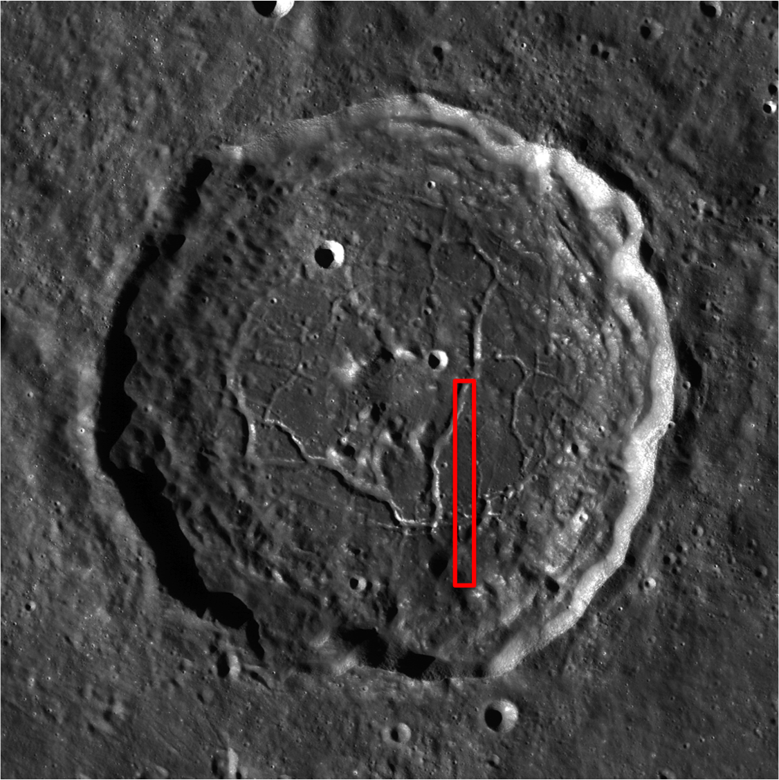
Floor-fractured Atlas crater (46.7°N, 44.4°E) is 87 km in diameter. The cause of the fractures that cut the crater's floor is not well understood. It is thought that the fractures have wide, flat floors, like a trough (or graben) and that they record a period of uplift of the crater floor. The question is, what caused the uplift? Floor-fractured craters have been a known lunar feature since the days of the Lunar Orbiters, but with LROC images, geologists are working to better understand how they formed. LROC NAC frames allow for a look at the interiors of the fractures, and with stereo images we can measure their shapes.


A roughly 2 by 4 kilometer section of LROC NAC frame M157303976L, from which the field of view (red box) within the LROC Featured Image released August 26, 2011 can be found [NASA/GSFC/Arizona State University].


And, in turn, the field of view within the image above is seen in this small section of a much larger LROC Wide Angle Camera (WAC) 643 nm band mosaic gathered during LRO orbits 2750 through 2757, January 31, 2010. The field of view is roughly 50 x 100 kilometers [NASA/GSFC/Arizona State University].

After the impact that created Atlas, the floor of the crater was molten. As it cooled, the solid floor formed. In the case of Atlas, eventually uplift caused the floor to break and pull apart, forming the graben, or fractures. There are two theories for the cause of the uplift. One possibility is the slow readjustment of the crust after the crater-forming impact. During an impact, the energy released compresses the crust. However, over time the crust can rebound to its original, pre-impact position. This rebound would supply the uplift that forms the fractures on the floor of Atlas crater. A second possibility is that the fractures may be due to an intrusion of magma into the crust below the crater, which uplifted and disrupted the crater floor as it rose. When investigating floor-fractured craters, geologists often look for signs of volcanic activity related to an intrusion of magma. Unraveling the origin of lunar features like this one is a primary focus of LROC science.


One hundred meter per pixel WAC context view of Atlas, showing the field of view of the entire LROC NAC frame M157303976L View the full size LROC WAC context image HERE[NASA/GSFC/Arizona State University].

Explore the entire NAC frame!

Related Images:
Mapping the Moon with Wide Angle Camera
The fractured floor of Compton
Gassendi's Fractures
Alphonsus crater mantled floor fracture


From an Earth-bound perspective Atlas (upper right) is the constant companion of it's neighbor to its west, 71 km-wide Hercules, seen in this oblique view captured when the Moon was Full, January 10, 2009, by Mario Weigand [LPOD/SkyTrip.de/VMA].

Wednesday, February 9, 2011

LROC: Rupes Recta


Artful Lunar Picture of the Day (LPOD) contributor Maurice Collins of New Zealand created this mosaic of LROC Wide Angle Camera images, swept up at local sunrise, and demonstrates why Rupes Recta is easier to spot when the Moon is just past First Quarter as seen from Earth. The change in elevation is not unusually high, for the Moon, but the rift is consistent (even if segmented) throughout its more than 100 kilometer length. The Straight Wall is consistent with a change in topography, if not age and stratigraphy, dividing an eastern zone from a western slope, both within an inundated crater broken in half by the weight of later melt pressing down on the interior of Mare Nubium. This gentle rift casts a long shadow at sunrise, however, one that gradually thins until the Moon waxes Full, and afterward it stays visible in modest telescopes [NASA/GSFC/Arizona State University/MoonScience].

EDITOR'S NOTE: Every 90 days, each time Dr. Mark Robinson's Lunar Reconnaissance Orbiter Camera (LROC) team at Arizona State University releases its latest voluminous batch of low-orbit lunar photography, one of several bench mark locations we immediately search for updates has been the familiar "Straight Wall," Rupes Recta. LROC Featured Image February 9, 2011 examines and better explains a feature discussed here in a post originally uploaded July 8, 2010.

For a review of our many posts (and images) featuring Rupes Recta, we recommend the reader take a side trip HERE, or simply examine the list of relevant Lunar Pioneer links below the list of LROC "Related Posts" below.

In July, when after we first began manipulating the same frame LROC released below, we described the image above as, a "closer look at the crater straddling the Straight Wall near 21.6°S, 352.2°E, The character of each half of the plain divided by the rift appears similar. Also, at this point in this montage, consisting of both the right and left frames of LROC Narrow Able Camera observation M122264663. For a Wallpaper-sized view of the above image, click HERE [NASA/GSFC/Arizona State University].


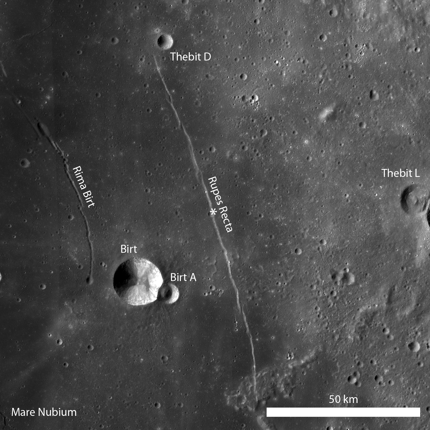
Rupes Recta is a well-known linear rille over 100 kilometers long, familiar in amateur telescopes, west of the central meridian in the Nearside southern hemisphere, seen here in an annotated portion of LROC Wide Angle Camera (WAC) monochrome mosaic; illumination from the west (left), the asterisk denotes the location where LROC Narrow Angle Camera (NAC) observation M122264663 intersected the fault, in the LROC Featured Image below [NASA/GSFC/Arizona State University].

Lillian Ostrach
LROC News System

Several weeks ago LROC featured a series of WAC monochrome mosaics of some of the most spectacular sinuous rilles on the Moon (Rimae Posidonius, Vallis Schröteri, and Rimae Prinz). Unlike sinuous rilles, linear rilles (or graben) are not believed to primarily result from lunar volcanism. Linear rilles are surface manifestations of structural faulting that formed when the lunar crust was pulled apart. The widths of these linear rilles range from as little as a few meters to kilometers across; Rupes Recta is between 1 - 3 km wide across its length. In addition, Rupes Recta is composed of several en echelon segments - the linear rille is not a single, uninterrupted 100 km length fault! There are at least 5 large fault segments visible at the LROC Wide Angle Camera scale (100 meters/pixel) ranging from around 8 to 50 kilometers in length.


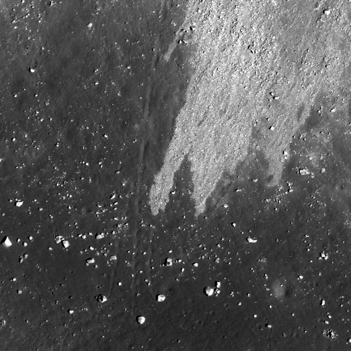
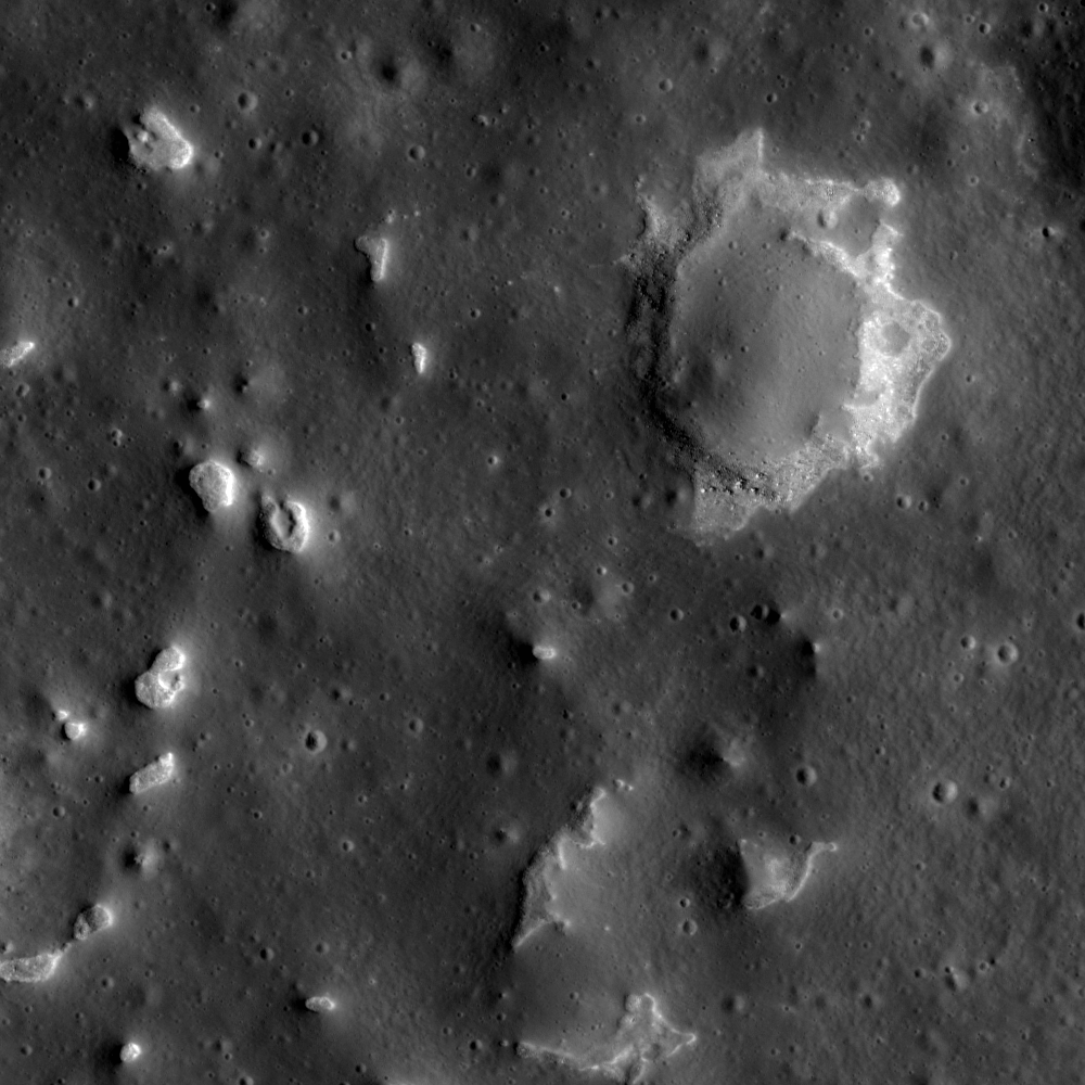
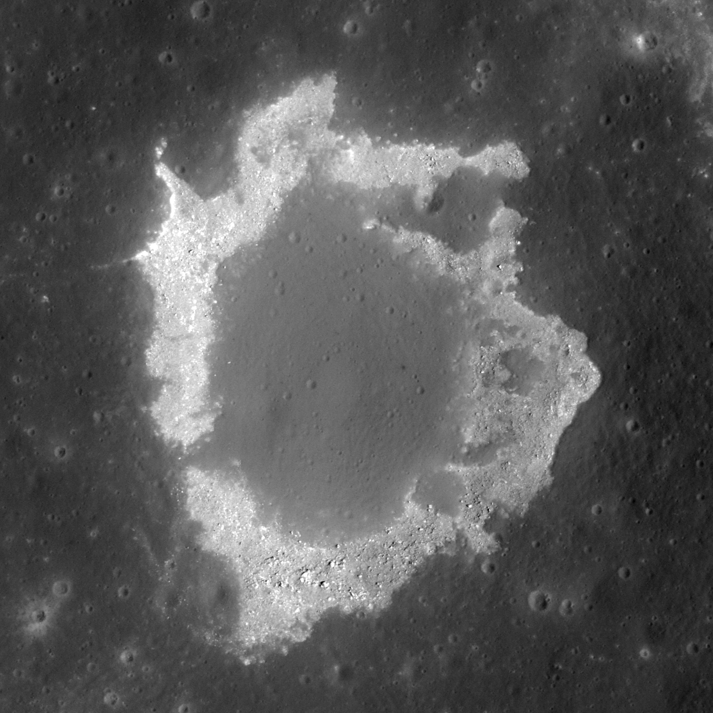
Cross-cutting relations between Rupes Recta and an impact crater are evident in this subset of LROC NAC observation M12264663R (LRO orbit 3151, March 3, 2010). The cliff-face of Rupes Recta is noted by the arrows on the right side of the image. At some point after the formation of Rupes Recta an impact occurred and excavated material from the fault wall. The arrows on the left side (forming a somewhat-curvilinear path) denote the crater wall. Subsequent down-slope movement of eroded debris and blocks is visible. Image field of view is 840 meters, illumination from the left, and a low-incidence angle highlights albedo variations [NASA/GSFC/Arizona State University].

What cross-cutting relationships can you determine in the LROC WAC monochrome mosaic? How does the full LROC NAC image change your view of Rupes Recta?

Related posts:
Linear Graben

Lunar Pioneer Posts:
A second NAC cross-section of Rupes Recta
More on that second Rupes Recta close-up
Rima Birt and Rupes Recta
LOLA/LROC: Hunting for ancient impact basins (LROC)
More Kaguya Terrain Camera images
Paul Spudis: Caves on the Moon
Google Moon, Limited (Part One)
A New Era of Lunar Exploration


Segment from the really outstanding LROC WAC monochrome mosaic of the >100 km-long segmented fault east of Mare Nubium in the Nearside southern hemisphere. The northern half of the feature is set apart here to note a cross-fault (upper arrow) first brought to our attention by Charles A. Wood in a discussion posted to his essential Lunar Picture of the Day (LPOD) website. The nearly perpendicular rille is often difficult to pick out in Earth-side photography but unmistakable in the LROC image. The lower arrow, again identifies the location of the impact crater in extreme close-ups above. The image field of view is approximately 40 kilometers [NASA/GSFC/Arizona State University].