Wednesday, October 12, 2011

Moon in UV sheds light on maturation and materials

One of four "enigmatic" domes singled out in a segment of an LROC Wide Angle Camera (WAC) color mosaic released at the European Planetary Science Congress and the American Astronomical Society's Division for Planetary Sciences on October 7. Long suspected of being a separate species from more common volcanic features, like those of the Marius Hills, the Darney C 3 domes ("D" on the second image following) on the border of Mare Cognitum with Oceanus Procellarum (11.22°S, 333.5°E) may, instead, be fragments of a long obliterated lunar crust or islands, once high places now nearly buried  by the flows that created the nearside's basins. LRO orbits 4559 and 4560, June 22, 2010; from 44.9 km altitude, resolution ~ 62.5 meters per pixel [NASA/GSFC/Arizona State University].

Editors Note: Fairly reliable elemental maps of the Moon have been around since the Apollo era, becoming more detailed as planetary scientists continue to comb through data obtained by Clementine (1994) and Lunar Prospector (1998-1999) (along with those of the flotilla of probes dispatched by ESA, Japan, India and China). The highest-resolution direct observations of the Moon are still being swept up by the record-shattering Lunar Reconnaissance Orbiter, now well into a third year in low lunar orbit and only beginning to show a degree of age after the loss of Mini-RF operations and a redundant gyro this past year.

In December LRO will be raised to a more stable 100 km-high orbit to save fuel after orbiting the Moon 11,000 times since arriving in lunar orbit in June 2009, and long after becoming the longest lasting lunar mission as well, returning more data than all previous Deep Space missions put together.

LRO teams continue to use earlier abaselines to map confirm the abundance of a variety of strategic elements on the lunar surface, and in unprecedented detail.A promise made for delivering such comprehensive high-resolution color maps and elemental surveys of the Moon is being fulfilled.

What follows is "value-added" detail from a widely-circulated press release about presentations made by the Lunar Reconnaissance Orbiter Camera (LROC) investigators to a joint meeting of the European Planetary Science Congress and the American Astronomical Society's Division for Planetary Sciences on October 7. Along with the elusive original demonstration images we've added a number of mosaics of images already released to the Planetary Data System.

From a partial map of the nearside lunar surface centered on the colorful contact zone bordering Mare Serenitatis and Mare Tranquillitatis, combining observations in visible and ultraviolet wavelengths and showing a 'treasure trove' of areas rich in titanium oxide. Titanium is a valuable element, key to helping scientists unravel mysteries of the Moon's interior. LROC investigators Mark Robinson and Brett Denevi presented the results at the European Planetary Science Congress and the American Astronomical Society's Division for Planetary Sciences on October 7. The relative blue color of the Tranquillitatis mare is due to a higher abundances of the titanium-bearing mineral ilmenite. Direct study of samples gathered by Cernan and Schmitt (Taurus Littrow, Apollo 17, December 1972) aided in establishing baselines for comparable elemental signatures. Enhanced color formed as 689 nm filter image in red, 415 nm in green, and 321 nm in blue. See the full size demonstration image HERE [NASA/GSFC/Arizona State University].
Titanium relative abundance mapped
by Clementine (1994).
From: EPSC/ASA Joint Meeting 2011 Press Notice - October 7
 
Subtly Shaded Map of Moon Reveals Titanium Treasure Troves

"Looking up at the Moon, its surface appears painted with shades of grey -- at least to the human eye. But with the right instruments, the Moon can appear colorful," said Mark Robinson, of Arizona State University. "The maria appear reddish in some places and blue in others. Although subtle, these color variations tell us important things about the chemistry and evolution of the lunar surface. They indicate the titanium and iron abundance, as well as the maturity of a lunar soil."

The Lunar Reconnaissance Orbiter Camera (LROC) Wide Angle Camera (WAC) is imaging the surface in seven different wavelengths at a resolution of between 100 and 400 metres per pixel. Specific minerals reflect or absorb strongly certain parts of the electromagnetic spectrum, so the wavelengths detected by LROC WAC help scientists better understand the chemical composition of the lunar surface.

Robinson and his team previously developed a technique using Hubble Space Telescope images to map titanium abundances around a small area centred on the Apollo 17 landing site. Samples around the site spanned a broad range of titanium levels.  By comparing the Apollo data from the ground with the Hubble images, the team found that the titanium levels corresponded to the ratio of ultraviolet to visible light reflected by the lunar soils.

“Our challenge was to find out whether the technique would work across broad areas, or whether there was something special about the Apollo 17 area,” said Robinson.

Robinson’s team constructed a mosaic from around 4000 LRO WAC images collected over one month. Using the technique they had developed with the Hubble imagery, they used the WAC ratio of the brightness in the ultraviolet to visible light to deduce titanium abundance, backed up by surface samples gathered by Apollo and Luna missions.

The new map shows that in the mare titanium abundances range from about one percent to a little more than ten percent. In the highlands, everywhere TiO2 is less than one percent. The new titanium values match those measured in the ground samples to about one percent.

From a full-resolution LROC Wide Angle Camera three-color composite (566 nm filter image in red, 360 nm in green, and 321 nm in blue), "Figure 2" accompanying the October 7 press release, highlighting regions with varying mare compositions and certain of the more "enigmatic" small volcanic domes. The area shown is a familiar nearside territory, west longitude from around 340° to 320° and from the equatorial landing sites of Apollo 12 and 14 down to 21° south. View the full size image accompanying the October 7 press release HERE  [NASA/GSFC/Arizona State University].
Designated by the letter "H" in 'Figure 2' immediately above is 'the Helmet," apparently the official designation for the enigmatic dome previously known as Agatharchides 1 (and "the Fireman's Hat) for the associated crater group, may be an island of ancient crust 60 km wide floating northeast of Mare Humorum (18.2°S, 328.9°E). Mosaic of three LROC WAC observations in the 643 nm band, January 27, 2011 [NASA/GSFC/Arizona State University].

“We still don’t really understand why we find much higher abundances of titanium on the Moon compared to similar types of rocks on Earth.  What the lunar titanium-richness does tell us is that the interior of the Moon had less oxygen when it was formed, knowledge that geochemists value for understanding the evolution of the Moon,” said Robinson.

Lunar titanium is mostly found in the mineral ilmenite, a compound containing iron, titanium and oxygen. Future miners living and working on the Moon could break down ilmenite to liberate these elements.  In addition, Apollo data shows that titanium-rich minerals are more efficient at retaining particles from the solar wind, such as helium and hydrogen. These gases would also provide a vital resource for future human inhabitants of lunar colonies.

“The new map is a valuable tool for lunar exploration planning. Astronauts will want to visit places with both high scientific value and a high potential for resources that can be used to support exploration activities. Areas with high titanium provide both – a pathway to understanding the interior of the Moon and potential mining resources,” said Denevi, from John Hopkins University.

Based on it's spectacular rays and highly reflective deeper anatomy Giordano Bruno (35.9°N, 102.8°E) had once been believed the result of a very recent event, perhaps even a famous 12th century phenomena witnessed and recorded by European monks. Though that theory fell by the wayside some time ago, LROC Wide Angle Camera UV imagery has shown optical maturity by solar UV radiation occurs more rapidly than previously understood. In the LROC WAC UV mosaic below, more or less matching the area shown above of global lunar albedo mosaic from the 1994 Clementine mission, the wider area affected by the G. Bruno event is far less dramatic [NASA/DOD/VMA6].
On the other hand, in the LROC global UV mosaic (Figure 3 from the Oct. 7 press release: Color Ratio 321 nm / 415 nm), the full extent of the Goddard/Mare Marginis albedo swirl, contrasts with it's background quite well. The coincident crustal magnetic anomaly is antipodal to Mare Orientale, which, though the youngest of the classic impact basins is still estimated at over 3 billion years old. This image adds evidence to the theory that lunar swirls associated with fossil magnetic fields must result from a more dynamic phenomena than merely deflection of solar radiation by magnetic fields. Shedding and retaining charged sub-micron regolith must, in no small part, be linked with the Moon's "daily" dusty atmospheric cycles [NASA/GSFC/Arizona State University].

The new maps also shed light on how space weather changes the lunar surface. Over time, the lunar surface materials are altered by the impact of charged particles from the solar wind and high-velocity micrometeorite impacts. Together these processes work to pulverize rock into a fine powder and alter the surface’s chemical composition and hence its colour.  Recently exposed rocks, such as the rays that are thrown out around impact craters, appear bluer and have higher reflectance than more mature soil. Over time this ‘young’ material darkens and reddens, disappearing into the background after about 500 million years.

“One of the exciting discoveries we’ve made is that the effects of weathering show up much more quickly in ultraviolet than in visible or infrared wavelengths.  In the LROC ultraviolet mosaics, even craters that we thought were very young appear relatively mature. Only small, very recently formed craters show up as fresh regolith exposed on the surface,” said Robinson.

SCIENCE CONTACTS:
Mark Robinson 
Arizona State University
School of Earth and Space Exploration
E-mail: robinson@ser.asu.edu
http://ser.sese.asu.edu/
Brett Denevi

The Johns Hopkins University
Applied Physics Laboratory
Brett.Denevi@jhuapl.edu 

Figure 4 from the October 7 press release compares the familiar Reiner Gamma swirl in the visual with the UV (right), as seen in LROC WAC mosaics. Nearside swirls differ from those on the farside. They are fewer and none are linked with basin-forming impacts on the opposite side of the Moon. The beauty of the swirl at Reiner Gamma and the much more vague bright albedo of the Descartes Formation are associated with the strongest crustal magnetic anomalies yet mapped. Reiner Gamma is almost certainly linked geologically with the Marius Hills. Regardless, in ultra-violet, Reiner y seems too fresh and too superficial for an airless body whose surface is gardened every 2 million years. The Moon's dusty surface may be migrating very slowly, but it is surely on the move [NASA/GSFC/Arizona State University].
A seventy kilometer-wide field of view LROC WAC mosaic swept up during two orbital passes last May. The yellow box show the roughly 2.5 km-wide Narrow Angle Camera field of view shown in the last image, below. Something is allowing the radiation-linked maturation of lunar regolith in the dark lanes of Reiner Gamma and continually keeping the dust at the surface of its bright albedo fresh and optically (and UV) "immature." The intense crustal magnetism closely incidental with this very long but very superficial swirl anomaly may be linked to sub-surface flows of melt and remelted materials originating in the Marius Hills, where the swirl has a clear terminus, 200 kilometers to the northeast. Though the local magnetic field may be intense enough to refract solar radiation it is insufficient at repelling more energetic (or, admittedly less frequent) cosmic rays. Though less frequent, the latter would have had sufficient time to mature the brighter regions over the last 900 million years. Instead, it was proposed in 2008 by one of us (and more recently by Carle Pieters, et.al.) that a far more dynamic, seasonal and daily cycle of lunar dust formation, charging, discharging and relentless migration is being disrupted at these locations [NASA/GSFC/Arizona State University].
LROC Narrow Angle Camera (NAC) observation M114342150L, LRO orbit 1984, December 1, 2009 [NASA/GSFC/Arizona State University].
how to make gif
Juxtaposed LROC WAC mosaics of the Lassell dome formation designated with the letter "L" in the third image from the top in this posting, Figure 2 from the October 7 press release. From LRO orbital observations under different angles of incidence.  M129350040CE, orbit 4195, May 24, 2010 (phase angle 55.94°) and M147041474CE, orbit 6803, December 15, 2010 (phase angle 76.89°) [NASA/GSFC/Arizona State University].

Saturday, October 8, 2011

It's a gas, man

"Ina," (18.65°N, 5.3°E) an extremely young and unusual 3 by 2 km depression that may represent a gas eruption site on the Moon. LROC Narrow Angle Camera (NAC) observation M119815703, LRO orbit 2791, February 3, 2010 [NASA/GSFC/Arizona State University]

Paul D. Spudis
The Once and Future Moon
Smithsonian Air & Space

There are times when seemingly unrelated discoveries about other planets come forward to enlighten us about the history and processes of the Moon. A recent paper, using data from the orbiting MESSENGER mission mapping Mercury, describes a number of newly discovered rimless pits and depressions.  These pits (called hollows by the mission team) are difficult to explain by impact processes and are hypothesized to be the products of outgassing from the planet’s interior.  They are often associated with color anomalies (which implies compositional differences from the surrounding terrain) and frequently found on the floors of impact craters and basins.

Impact craters come in a wide variety of sizes, but within selected size ranges, they all appear more or less similar.  Small craters are nearly perfectly round and bowl-shaped with smooth rims that are raised above the surrounding terrain.  Craters with irregular shapes and no raised rims suggest that processes other than impact might be at work.  It has been suggested that on Mercury, these “hollows” were created by the violent release of volatile substances.  Such a release of gas under pressure accompanies volcanic eruptions called pyroclastic, meaning “fire-broken” (fine liquid rock (magma) fragments spewed into space and cooled during flight).

We’ve known about pyroclastic eruptions on the Moon for many years, evidenced by the green glass of the Apollo 15 site and the orange-black glass from Apollo 17.  Careful search of the images taken from lunar orbit reveal the rimless pits that served as vents for the pyroclastic eruptions that produced these Apollo glasses.  They are distinct from impact craters and often are found on the floors of craters and basins along fractures, the conduit by which volcanic magma travels to the lunar surface.

Sometimes pit craters or “hollows,” found across the surface of the Moon, take unusual form.  The kidney-shaped feature shown above is named Ina; after its discovery in one of the Apollo orbital images, it was informally named the “D-caldera” after its shape and the interpretation that it represented a volcanic collapse feature.  Ina is about 3 km across and consists of a series of small platforms, mounds and holes within a larger irregular depression.  Other similar pits and hollows occur elsewhere on the Moon (e.g., on the floor of Rima Hyginis).  And while not major features, they have been found often enough to bother many lunar scientists, who had no good explanation for their origin.

About five years ago, we got a clue as to the possible origins of these features.  Pete Schultz and associates from Brown University published a paper showing Ina displayed unusual spectral reflectance characteristics.  The slow micrometeorite bombardment of the Moon adds craters to the surface and also makes small iron-rich glass particles that darken and redden the surface.  As these glass particles build up in the soil, a soil is said to “mature.”  Fresh surfaces are more “blue” in color (actually, less red) and become redder with time as the soil matures.  Most lunar features show age or “become mature” on timescales of millions of years.  Ina shows very few impact craters on top of it, meaning that geologically, it is very young.  Moreover, the soils associated with Ina are much bluer than surrounding areas.  Both of these observations suggest that Ina is young with immature surfaces.

Perspective view of Ina looking NW based on coaligned M3,
Kayuga and LOLA topographic data. Bright optically immature
deposits on the floor of Ina appear green in this M3
(Chandrayaan-1) color-ratio composite due to a strong 1 m ferrous
band relative to surrounding deposits (B=460/750, G=750/990,
R=750/460) [Fig. 3 from LPSC XLII, #2499].
How are these features created?  Significant volcanism on the Moon largely stopped at least a couple of billion years ago.  The Brown team thought that the combination of young age, low maturity and unusual morphology suggested a relatively uncommon pit-forming process.  They proposed that the explosive release of volatile substances from the lunar interior would have disrupted the surface, created a chaotic mixture of rock and soil, exposed fresh surfaces (creating the immature spectral signature), and formed a collapse depression caused by the instantaneous removal of mass from below.

Now we can see that the new Mercurian hollows have morphologies displaying spectral anomalies similar to the lunar collapse pits such as Ina.  The new data suggest that Mercury contains significant volatile substances.  These volatiles must be present at some depth, accumulated under high pressure until crustal failure ensues and a massive gas release results in an “eruption.”  This explosive event leaves behind a chaotic, disrupted surface (“immature,” with fresh bedrock and deep regolith “newly” exposed to space).

In the case of Ina on the Moon, its extreme youth is suggested both by the lack of overlying impact craters of almost any size, as well as the sharp preservation of topography in its cliff and pit interior morphology.  This extreme youth may be on the order of thousands to hundreds of thousands of years, not the millions and billions of years that typify most lunar landforms.  Such youth and the widespread distribution of Ina-like collapse pits across the lunar surface implies that outgassing events are occurring on the Moon now; it is highly unlikely that we were just lucky enough to find a singular or unique occurrence.

For context and depth of field, Ina is shown prior to local sunset north of Mare Vaporum, in this roughly 46 kilometer wide LROC Wide Angle Camera (WAC) color (689 nm) mosaic stitched from two sequential observation opportunities, from LRO orbits 2443 and 2444, January 6, 2010. Down slope from the feature, to the east by southeast, younger surface material may be a hint of pyroclastic flow [NASA/GSFC/Arizona State University].
What might these volatile substances be?  Before the recent lunar missions flew, it was common to declare that water was not a possibility.  However, we recently discovered from study of the lunar samples that water was present in the deep interior of the Moon during the epoch of mare volcanism three billion years ago; water could still be present in the subsurface.  There are many other volatile substances that could be responsible as well, including carbon monoxide, hydrogen sulfide, gaseous sulfur, as well as other more exotic gases.  Because the compositions on Mercury are poorly known, the possibilities for exotic materials there are even more extensive.

The explosive release of gas from the deep interior (without the eruption of magma) appears to be an ongoing lunar process.  This gas release could provide at least a partial answer to two vexing lunar problems: the accumulation of volatiles at the poles of the Moon (discussed in my blogging many times, most recently HERE) and the infamous phenomena of Lunar Transient Phenomena (LTP), described as glowing reddish “clouds” hovering over the lunar surface that mysteriously appear and disappear.  Telescopic observers have reported seeing LTP for many years.

Unfortunately, we have not been able to verify and document these events, largely because they are transient.  Now we have direct morphological evidence for the venting of gas from both planets, making it possible that at least some LTP might be related to gas release from inside the Moon.  Stay tuned – the book of the Moon continues to be rewritten and expanded with new and interesting discoveries.

NOTE: The latest version of the paper Tony Lavoie and I wrote on using lunar resources to create a cislunar space faring system has been published in the Proceedings of the AIAA Space 2011 Conference.  A copy is available for download HERE.

Originally published October 8, 2011 at his Smithsonian Air & Space blog The Once and Future Moon, Dr. Spudis is a Senior Staff Scientist at the Lunar and Planetary Institute in Houston. The opinions expressed are those of the author and are better informed than average.

Friday, October 7, 2011

New map of lunar titanium and Iron presented

The above image accompanying many reports of the LROC titanium and iron survey is everywhere being misidentified as showing the boundary area between Mare Serenitatis and Tranquillitatis. It's not clear why Figures 1 - 4 listed along with the official conference news posting were apparently not released at the news conference reported below. The image above may be a part of a larger global mosaic and looks suspiciously like early WAC color test articles released by LROC more than a year ago. Regardless, the area shown in the image above is interesting enough but shows an area mostly south of the equator and southwest of Copernicus on the Moon's nearside.

Map showing concentration of iron and titanium in Nearside maria. Iron and titanium are part of the mineral ilmenite (FeTiO3 ), which has the ability to capture and retain gases, such as hydrogen and helium, from the solar wind. An isotope of helium, helium-3, can be found in ilmenite and is especially valuable for nuclear power production [NASA/USGS/Community College of Baltimore County].
Paris (AFP) — A new map of the Moon has revealed an abundance of titanium ore that is up to 10 times richer than on Earth, a finding that could one day lead to a lunar mining colony, astronomers said on Friday.

The discovery was made thanks to a camera aboard the US Lunar Reconnaissance Orbiter, which swept the surface of the Moon, scrutinizing it in seven different light wavelengths.

Mark Robinson of Arizona State University, who presented the research at a conference in Nantes, western France with Brett Denevi of Johns Hopkins University in Baltimore, sifted through the data for telltale jumps in the ratio of ultra-violet to visible light.


NASA/USGS/Community College of Baltimore County
They established this signature thanks to rock samples brought back to Earth by Apollo 17 astronauts in 1972 and images of the area around the mission's landing site by the Hubble space telescope.

"Looking up at the Moon, its surface appears painted with shades of grey, at least to the human eye," explained Robinson.

"But with the right instruments, the Moon can appear colorful.

"The maria [lunar plains] appear reddish in some places and blue in others.

"Although subtle, these color variations tell us important things about the chemistry and evolution of the lunar surface. They indicate the titanium and iron abundance, as well as the maturity of a lunar soil."

Titanium is as strong as steel but nearly half as light, which makes it a highly desired -- and also very expensive -- metal.

On Earth, titanium is found, at the very most, in around one percent of similar types of ore. But the new map found abundances in the lunar maria that range from about one percent to 10 percent, the conference organizers said in a press release. In the lunar highlands, abundance was around one percent.

The meeting gathers, for the first time, members of the European Planetary Science Congress and the American Astronomical Society's Division for Planetary Sciences.

The find offers a double potential bounty, they said.

"Lunar titanium is mostly found in the mineral ilmenite, a compound containing iron, titanium and oxygen," they said.

"Future miners living and working on the Moon could break down ilmenite to liberate these elements.

"In addition, Apollo data shows that titanium-rich minerals are more efficient at retaining particles from the solar wind, such as helium and hydrogen. These gases would also provide a vital resource for future human inhabitants of lunar colonies."

The exposed upper 3 centimeters surface of the Moon is turned over, or "gardened" at least once every 2 million years. The visible surface has been estimated to reach "optical maturity," or "OMAT," over the course of 900 million years. Direct and remote examination has confirmed that the Moon's deeper topography retains a high-fidelity record of it's stormy 4.74 billion year history, recording the history of the Solar System and Earth while a continuous make over by solar radiation and heavier elements implanted by cosmic ray bombardment. The abundance of Helium-3 and Helium 4 is thought to be related to the abundance of iron and titanium. From: "Global inventory of Helium-3 in lunar regoliths estimated by a multi-channel microwave radiometer on Chang'E-1," WenZhe Fa and Yaqiu Jin (2010), Chinese Science Bulletin, Vol. 55, No. 35 [Maurice Collins].

USRA EPOD: "Paper Moon"

From Lunar Pioneer 7
A Gibbous 'Paper Moon,' Earth Science Picture of the Day, October 7, 2011, projected through the lens of an 80 cm (31.5 in), f/8 telescope onto a piece of tissue paper, instead of using an eyepiece. This interesting projection allows many observers, rather than just a single viewer, to see the image coming out of the telescope. It also nicely demonstrates the real field of view of a telescope, which is larger than what an eyepiece can cover. Photo taken on August 18, 2011 from Casa del Romano, Italy [Martin Dietzel & Mario Sämisch/EPOD/USRA].

GRAIL twins 'going their own way'

Using a precision formation-flying technique, the twin GRAIL spacecraft will map the moon's gravity field, as depicted in this artist's rendering [NASA/JPL].
NASA/JPL (Pasadena, CA) - NASA's Gravity Recovery And Interior Laboratory (GRAIL)-B spacecraft successfully executed its first flight path correction maneuver Wednesday, Oct. 5. The rocket burn helped refine the spacecraft's trajectory as it travels from Earth to the moon and provides separation between itself and its mirror twin, GRAIL-A. The first burn for GRAIL-A occurred on Sept. 30.

"Both spacecraft are alive and with these burns, prove that they're kicking too, as expected," said David Lehman, GRAIL project manager at NASA's Jet Propulsion Laboratory in Pasadena, Calif. "There is a lot of time and space between now and lunar orbit insertion, but everything is looking good."

GRAIL-B's rocket burn took place on Oct. 5 at 11 a.m. PDT (2 p.m. EDT). The spacecraft's main engine burned for 234 seconds and imparted a velocity change of 56.1 mph (25.1 meters per second) while expending 8.2 pounds (3.7 kilograms) of propellant. GRAIL-A's burn on Sept. 30 also took place at 11 a.m. PDT. It lasted 127 seconds and imparted a 31.3 mph (14 meters per second) velocity change on the spacecraft while expending 4 pounds (1.87 kilograms) of propellant.

These burns are designed to begin distancing GRAIL-A and GRAIL-B's arrival times at the moon by approximately one day and to insert them onto the desired lunar approach paths.

The straight-line distance from Earth to the moon is about 250,000 miles (402,336 kilometers). It took NASA's Apollo moon crews about three days to cover that distance. Each of the GRAIL twins is taking about 30 times that long and covering more than 2.5 million miles (4 million kilometers) to get there. This low-energy, high-cruise time trajectory is beneficial for mission planners and controllers, as it allows more time for spacecraft checkout. The path also provides a vital component of the spacecraft's single science instrument, the Ultra Stable Oscillator, to be continuously powered for several months, allowing it to reach a stable operating temperature long before beginning the collection of science measurements in lunar orbit.

GRAIL-A will enter lunar orbit on New Year's Eve, and GRAIL-B will follow the next day. When science collection begins, the spacecraft will transmit radio signals precisely defining the distance between them as they orbit the moon. Regional gravitational differences on the moon are expected to expand and contract that distance. GRAIL scientists will use these accurate measurements to define the moon's gravity field. The data will allow mission scientists to understand what goes on below the surface of our natural satellite.

NASA's Jet Propulsion Laboratory, Pasadena, Calif., manages the GRAIL mission. The Massachusetts Institute of Technology, Cambridge, is home to the mission's principal investigator, Maria Zuber. The GRAIL mission is part of the Discovery Program managed at NASA's Marshall Space Flight Center in Huntsville, Ala. Lockheed Martin Space Systems, Denver, built the spacecraft. Launch management for the mission is the responsibility of NASA's Launch Services Program at the Kennedy Space Center in Florida. JPL is a division of the California Institute of Technology in Pasadena.

More information about GRAIL is online at: http://www.nasa.gov/grail and http://grail.nasa.gov.

LROC: At the top of an avalanche in Langrenus

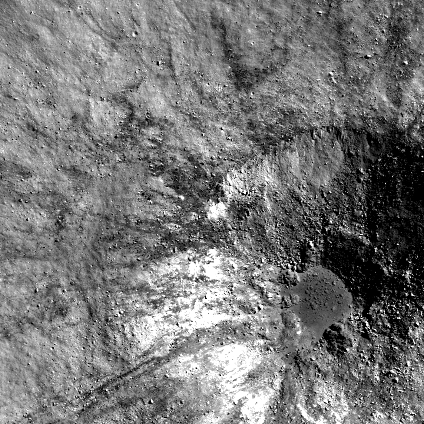
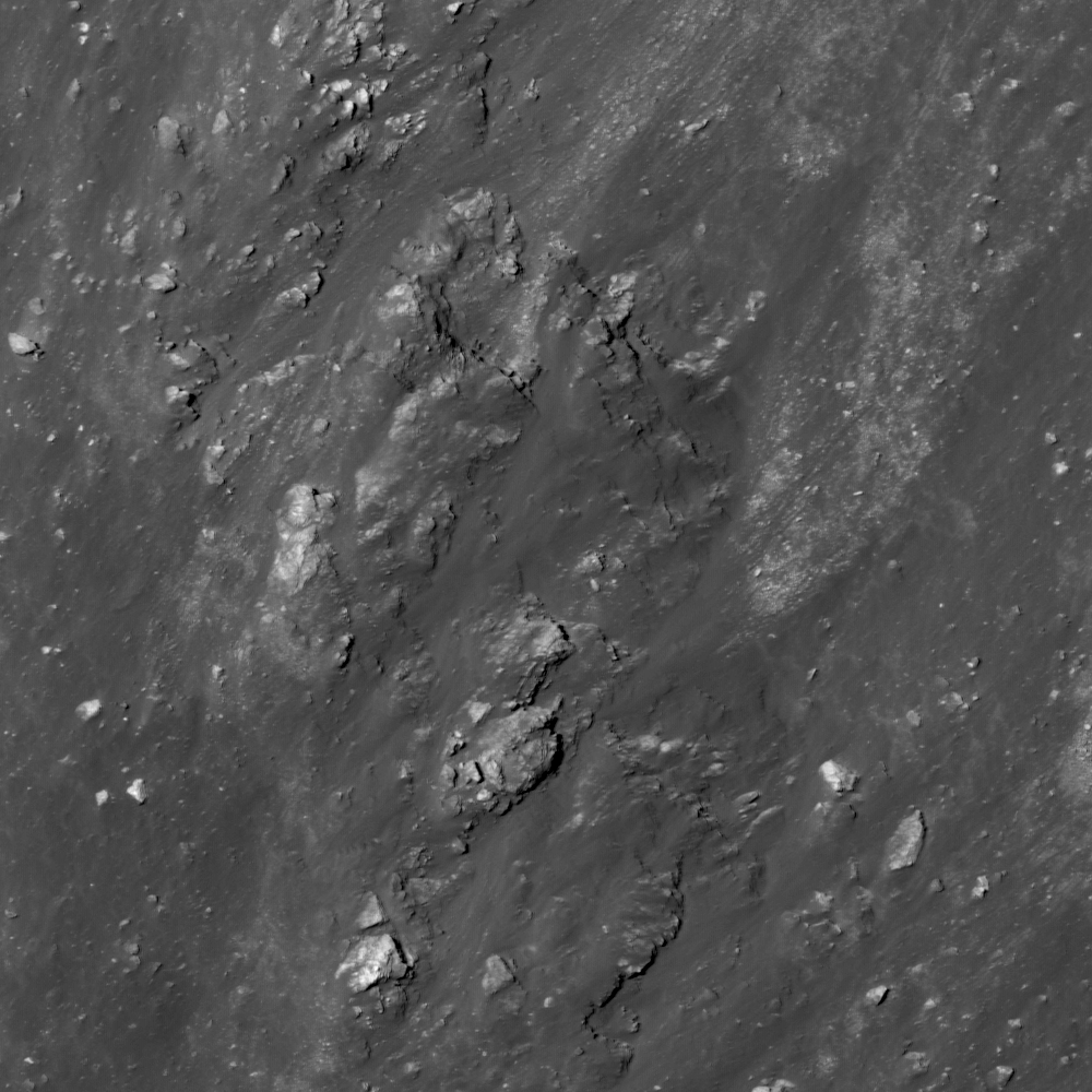
Bedrock benches near the top of an avalanche on the central peak of Langrenus (8.79°S, 61.22°E). LROC Narrow Angle Camera (NAC) observation M139504224L, LRO orbit 5692, September 19, 2010; downslope is to lower left, image field of view is ~302 meter. From the full size LROC Featured Image HERE [NASA/GSFC/Arizona State University].

James Ashley
LROC News System

Do these "stair steps" represent true rock layers that somehow survived the compression and uplift which accompanied the formation of this central peak, or are they expressions of jointing in the fractured bedrock? Many examples of lava flow layering have been identified within mare deposits across the Moon (see related Featured Image post links below), but these have been as exposures in crater walls or the sides of vertical pits within the mare. Rock layering in a central peak may be more difficult to see.

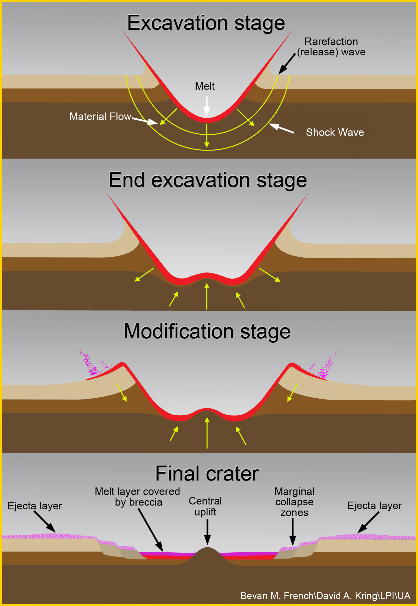
The physics of impact cratering describes the way a rock may respond to high-energy shockwave formation and decay. The central peak of a complex crater represents material that had once been deep beneath the lunar surface, but was later exposed by the rebound that followed compression during the impact event. The phenomenon of central peak formation in rock targets is often likened to the way a droplet of liquid creates a splash in a saucer. It represents a kind of snapshot of the splash phenomenon that results from impact into a target with an appreciable gravity field.

While considerable deformation of target layers is expected, vestiges of that layering can survive impact and become preserved in the central peak. The features in today's image are exposed by erosion caused by landslide activity, and reveal the bedrock that once lay underneath (see context image below).

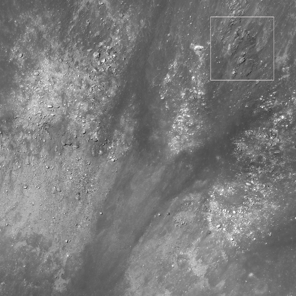
The wider view of the NAC frame shows granular material which flowed down (toward the lower left) the steep central peak wall and away from the featured bedrock in Langrenus. From the full width of LROC NAC M139504224L, image field of view is ~2.0 kilometers wide. View the full size LROC context image HERE [NASA/GSFC/Arizona State University].
The central peak of Langrenus and surrounding crater floor shows the location of the ridge and slope highlighted in the LROC Featured Image. From LROC Wide Angle Camera (WAC) observation M131249971CE (566 nm Band), LRO orbit 4475, June 15, 2010; from an altitude of 38 km, resolution 55 meters per pixel, illumination from the east with an incidence angle of 76.63° [NASA/GSFC/Arizona State University].
From an early local morning illumination to late afternoon brings the highlighted slope out of shadows though unfortunately from an orbital pass at higher altitude. LROC WAC observation M134788704CE (566 nm Band), LRO orbit 4996, July 26, 2010; from an altitude of 50 kms with a resolution of 70 meters per pixel, illumination from the west with an incidence angle of 64.48° [NASA/GSFC/Arizona State University].
On the Moon, rock jointing can be caused by tidal stresses working over time to weaken the rocks. Once jointed, the fragments are more easily eroded, and tend to break away in blocks - which may or may not give the appearance of true stratigraphic layering. Because the energy of impact is expected to at least partially destroy whatever fine structure might have been in pristine layers, it may be difficult to differentiate the two types of stair step benches in an outcrop. The WAC mosaic shows the central peak and Langrenus crater, with the Featured Image location indicated as the red square.

From the LROC Quickmap WAC mosaic shows Langrenus crater with its greater anatomy, field of view is roughly 180 km [NASA/GSFC/Arizona State University].
Langrenus at its best when seen through an earth-bound telescope, in this case a Celestron C14 XLT under the steady guidance of Mario Wegand (www.SkyTrip.de), who swept up this view January 12, 2009 (Central European Time) from Offenbach am Main, Germany.
Take a look at the full NAC image.

There are many details visible in the Langrenus crater floor deposits that warrant further scrutiny. What other clues might aid in determining whether this apparent laying is the result of lava flows or of rock jointing? Related Featured Image posts include Layering in Euler Crater, Layering in Messier A, and Rock Avalanche in Robinson Crater.

Langrenus stands out at the center of the bow, half way between limb and terminator, in this three-and-a-half-day-old Crescent Moon. From a 5000 pixel deep mosaic assembled by Mario Weigand, captured the early evening of January 29, 2009.

Thursday, October 6, 2011

An ill-defined portion of an otherwise circular rim

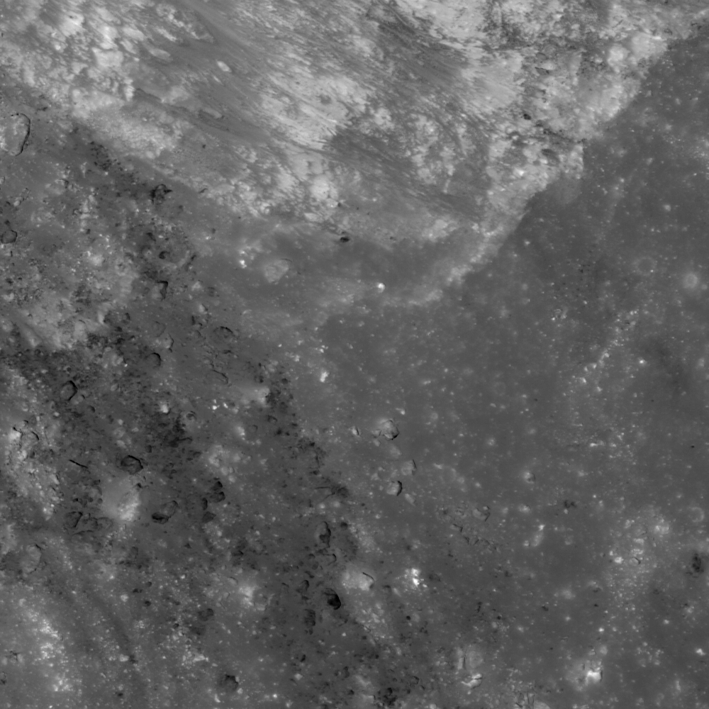
The bright craterlet rim of Nearside landmark Censorinus (upper right) is abruptly truncated by a pile of debris (lower left). LROC Narrow Angle Camera (NAC) observation M139694087R, LRO orbit 5720. September 21, 2010 (north is up), incidence angle is 9.32° and the field of view is 296 meter. See the full size LROC Featured Image HERE [NASA/GSFC/Arizona State University].
James Ashley
LROC News System

Censorinus is a fresh impact crater along the southeastern shore of Mare Tranquillitatis (0.47°S, 32.73°E). The amount of detail in the NAC frame is staggering, and worthy of a baker's dozen Featured Images. Noteworthy, however, is how well-formed and highly circular the rim is with the exception of this small portion along the southeast perimeter. Are there good geologic reasons for something like this, or is it simply the luck of the draw which portion of a crater rim will get a little sloppy? Such things are not much more than curiosities, but they are great for initiating geologic discussion!


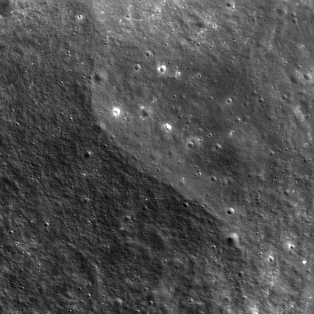
The full-width of the featured NAC frame shows context of the Featured Image above (white rectangle) and the circularity that persists along most of the eastern Censorinus rim. LROC NAC M169398317R, field of view ~2.4 km (north is up). View the higher-resolution original LROC context image accompanying the Featured Image release HERE [NASA/GSFC/Arizona State University].
A neat, circular crater is usually a sign of sufficiently high energy from a hypervelocity projectile to create an explosive outcome. Censorinus is clearly the result of just such a high-energy, explosive event. In the case of the featured area of the rim, however, we see that energies were not high enough to excavate the target material radially all the way to meet the rest of the rim, but stopped short, as though making a smaller-diameter feature. This action resulted in littering the surface adjacent outside the wall with loose ejecta blocks, giving the impression that the rim stops suddenly in the Featured Image.

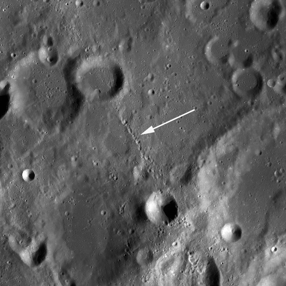
Censorinus (left) and Censorinus A (right) in a single band (566 nm) color LROC Wide Angle Camera (WAC) mosaic swept up during two orbital passes over this area, on the south frontier of Mare Tranquillitatis June 7, 2011, about 40 hours after local sunrise, when the Moon was barely more than 6 days old. At this scale the discontinuity of the south-southeastern rim of Censorinus is easy to see, perhaps the result of slumping of material from adjacent high ground in that direction [NASA/GSFC/Arizona State University]/
Why was material in this portion not accelerated to create a neat rim? Since the 'ground zero' target rock was destroyed in the impact, it is difficult to tell what kind of influence the local geology may have had on the energy distribution. The final answer therefore remains a bit of a mystery, but it is probably safe to speculate that target lithologies played a role here. The terrain along this portion of Mare Tranquillitatis shoreline is fairly rugged, and may contain a variety of rock types, some of which may be more resistant to excavation than others, thus creating a heterogeneous target for an incoming bolide!. A partially buried block of hard rock or even greater-than-average compaction in the regolith might be all that is needed to explain today's Featured Image.

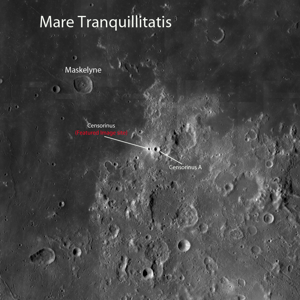
This WAC mosaic context image shows the location of Censorinus and Censorinus A in relation to Mare Tranquillitatis, two relatively fresh craters. Though Censorinus A is larger than Censorinus, the latter is probably younger and thus more reflective and less "gardened" by impacts into darker "optical maturity." Censorinus was identified in early telescopes and Moon maps much sooner.Image field of view is roughly 360 km in height. See the higher-resolution LROC context image HERE [NASA/GSFC/Arizona State University].
A highly reduced "thumbnail" version of a much larger black and white mosaic assembled from several digital stills by Yuri Goriachko of Astronominsk in Belarus. Because the landmark Nearside equatorial crater stands out so well from the background, despite its small size, it almost seems unnecessary to mark bright Censorinus with a yellow arrow [Astronominsk].
The high-reflectance spot that marks the location of the Censorinus - Censorinus A crater pair may just be visible through a small telescope at the southwest edge of Mare Tranquillitatis beginning about the First Quarter phase of the lunar cycle, but albedo differences will become more accentuated as the Moon waxes to full and the shadows shorten.

What additional clues can you find in the full NAC frame

Other examples of asymmetry in impact features can be found in the distribution of rubble on the floor of this crater, and the distribution of impact melt around this crater.

Wednesday, October 5, 2011

LROC: Scar in the Farside Highlands

A curvilinear valley calls attention to itself by virtue of its apparent isolation from the surrounding terrain. LROC Narrow Angle Camera (NAC) observation M153632648L, LRO orbit 7775, March 3, 2011; north is up, Sun is from the southwest, incidence angle 33° and the image field of view is roughly 302 meters. View the full size LROC Featured Image HERE [NASA/GSFC/Arizona State University].
James Ashley
LROC News System

With such an abrupt beginning and end, and no obvious connection to typical geologic flow, fault or scour processes, what could have caused this curious arcuate, negative-relief landform in the lunar highland regolith (24.3°N, 245.0°E)? 

Sometimes it helps to step back for a wider look.


The featured scar is to the lower right (white box) in this wider field, which shows it as only one of several similar features. LROC NAC M153632648L, image width is ~2.3 km, see the LROC 1.5 km context image HERE [NASA/GSFC/Arizona State University].
Compare the NAC frame above with the segment taken from a LROC Wide Angle Camera (WAC) mosaic below.

In our slow zoom out, we see that several similar features, appearing as blind valleys with abrupt endings, are aligned in a north-northwest to south-southeast direction, but are still somewhat isolated from anything that might have caused them in the nearby vicinity.

The WAC mosaic shows the full length of the scar (white arrow); View the full size LROC 97 km-wide field of view HERE [NASA/GSFC/Arizona State University].
Sometimes, however ... it helps to step WAY back!

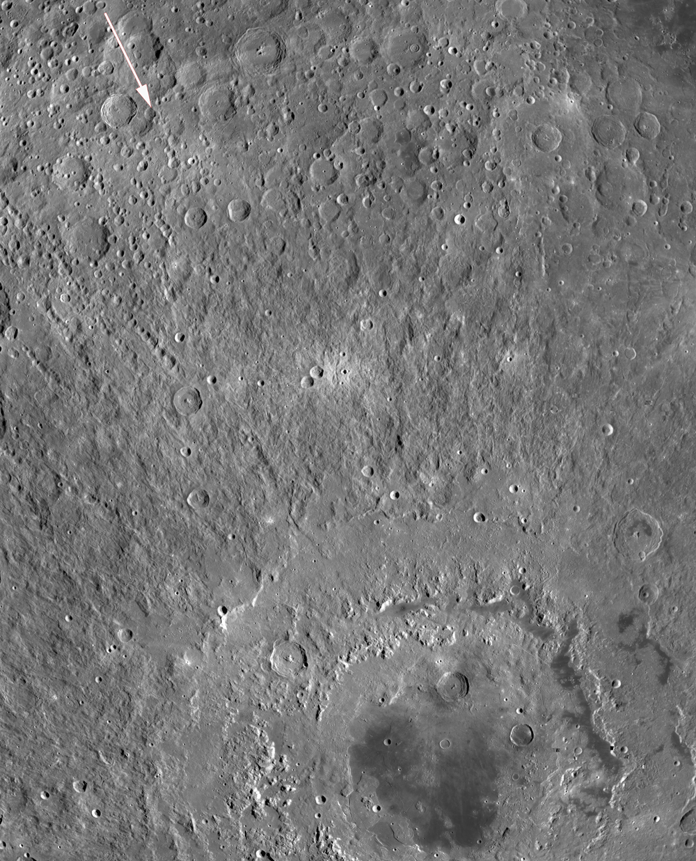
WAC mosaic showing Mare Orientale and portions of its spectacular rayed ejecta pattern. Arrow in upper left quadrant overlays scar feature in the Comrie crater group; image field of view is 1,500 km from top to bottom. See the full resolution LROC WAC context image HERE and compare the mosaic with the hemisphere-wide LOLA topography in the image below [NASA/GSFC/Arizona State University].
Notice the arrow in the northwest corner of this WAC mosaic, which overlays and parallels the linear trend of the featured scar. It points toward the center of Mare Orientale, a 900 km-diameter impact feature. Several crater chains are visible to the southwest of the arrow at this scale that similarly radiate from the Orientale basin. The violence of the basin-forming event was so great that it hurled prodigious volumes of target rock hundreds of kilometers across the lunar surface. The orientation and location of the featured scar pattern makes the Orientale impact a plausible cause for what we see there. In addition to rocky projectiles, ground-hugging and/or ballistically emplaced ejecta deposits are a common accompaniment to large impact features on the Moon. From their morphology and occurrence, they seem to have behaved in a very fluid-like way, and can morph and merge as they flow across the surface until losing energy and coming to rest as dunes or lobes. Today's Featured Image appears to be a place where advancing dunes merged and "healed over."

In addition to the orientation of this linear form, what other clues would help determine if this feature is indeed associated with the Orientale impact, or part of some other debris source? What other clues are visible in the full NAC frame?

Additional examples of fluidized ejecta can be found in the Lavish Lobes of Necho R, and in King Crater Ejecta Deposits. The Orientale Basin is featured in the LROC PDS Release 5 post, and the Farside! and All the Way Around post.

LOLA Altimetry adds global context to the LROC WAC image, third following from the top of the post, and shows the stark dichotomy between lunar Nearside (right) and Farside. The technical meridian need hardly be designated but begins at the lunar north through the equator (270° East). The Moon's highest regions (orange) are 13 kilometers higher than the deep and wide impact basins familiar to it's Earth-facing hemisphere. The area within the LROC Featured Image released October 4, 2011 lies roughly 1400 kms away from the center of the Mare Orientale basin at lower center [NASA/GSFC/LOLA/LMMP].

Friday, September 30, 2011

LROC: Farside Impact!

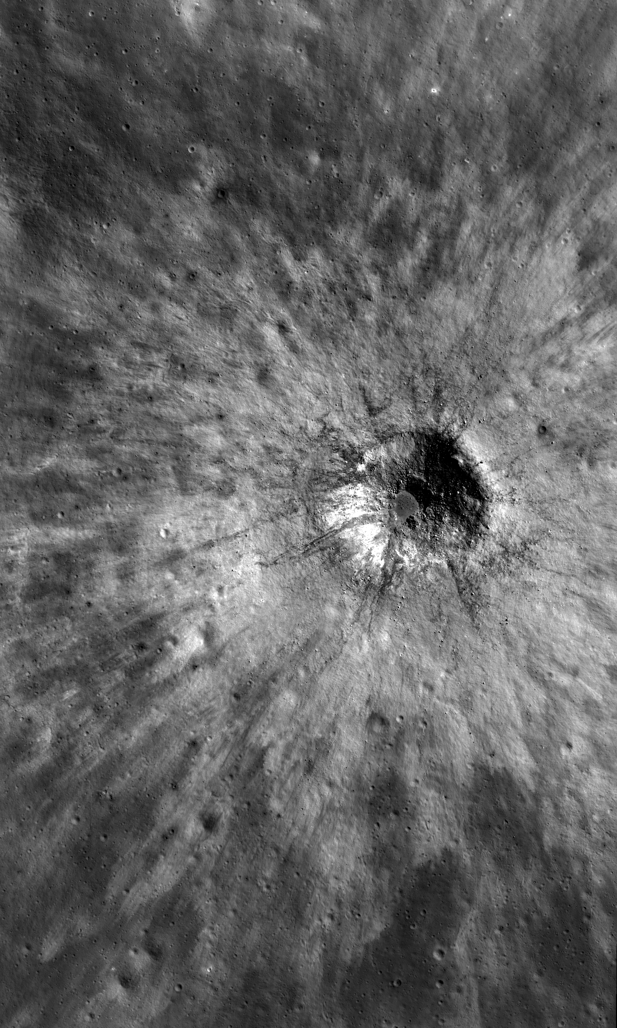
A young, fresh impact into the farside highlands, south of Tsiolkovskiy crater. LROC Narrow Angle Camera (NAC) observation M159073200L, LRO orbit 8576, May 3, 2011; image field of view is roughly 325 meters wide. See the full size LROC Featured Image HERE [NASA/GSFC/Arizona State University].
Lillian Ostrach
LROC News System

Young impacts abound on the Moon, and the LROC NAC images of beautiful crater morphologies, spectacular ejecta blankets, and stunning impact melt deposits are enough to make any lunar geologist jump for joy. Many times, fresh impacts into mare material are featured because these craters punch through the thin layer of regolith and produce boulders. However, impacts into the lunar highlands can be just as spectacular.

Today's Featured Image of an unnamed Copernican-aged crater (~630 m diameter, 29.73°S, 134.07°E) is one such example on the farside. Close-up, the crater is bowl-shaped with a well-defined circular rim. At the crater floor center is a small, bouldery pond of solidified impact melt. Debris from the crater walls have slumped toward the floor center, but whether these slumps happened immediately after crater formation or yesterday is difficult to determine. 

The first in a brief series of reduced views of a relatively small fresh impact crater near the southwestern rim of the far more ancient 61 km-wide crater Subbotin, in the Farside lunar Highlands [NASA/GSFC/Arizona State University].
Take a look at some of the material nearest to the crater floor; in the crater center, some slumps are veneered with impact melt but other debris piles superpose (overlie) these veneered materials. These stratigraphic relationships can be used to interpret the relative ages of the slumps - the impact melt-covered piles formed soon after impact because they are splashed with impact melt, and the overlying debris piles happened after the impact melt solidified (maybe even yesterday!). Furthermore, the ejecta blanket closest to the crater rim is mostly uniform in reflectance but there are scatterings of boulders and lower-reflectance impact melt streamers that were thrown out of the crater during ejecta emplacement. 

What a beauty! 

A further reduced-resolution view from M159073200L, showing a 2.7 km field of view. See the full-size LROC context image HERE [NASA/GSFC/Arizona State University].
LROC WAC monochrome (566nm) mosaic of the Farside west of Subbotin crater swept up over the course of LRO orbits 4924 through 4926, July 20, 2010. The fresh impact crater in the opening image the small "bulls eye" just left of center in the image above. At this illumination incidence angle, ~72.7° from the west north west, the deeper central circular floor of the crater is already deeply shadowed in the coming sunset.  [NASA/GSFC/Arizona State University].
What other exciting geologic features do you observe when you explore the full LROC NAC image?

Related Posts:
Small crater at the southern rim of Menelaus
Smooth floor in Copernicus crater

Thursday, September 29, 2011

Descent of Apollo 11, DAC film compared with LROC NAC using Google Earth lunar digital elevation model

HT to Phil Platt and Scott Hall, Uploaded to YouTube by May 26, 2011.
 
"You can download my Google Moon KMZ file for import into Google Moon HERE," GTP writes. And "here is the link to my Apollo web site: http://apollo.mem-tek.com."

"Footage from the Eagle's movie camera has been matched to deconvolved and/or enhanced versions of Lunar Reconnaissance Orbiter image M116161085 (left and right NAC image pairs) which were taken by the LRO on December 22, 2009. Google Moon does not have a roll angle feature which would be useful for rolling the point of view. Additionally, Google Moon's digital elevation model is not of a fine enough resolution in order to precisely model the terrain. Thus some of the Google Moon screen captures of the overlaid LRO image may not precisely match the view from the Eagle's video camera."