Showing posts with label Pyroclastic. Show all posts

Monday, August 25, 2014

Striped pyroclastic vent in Sinus Aestuum

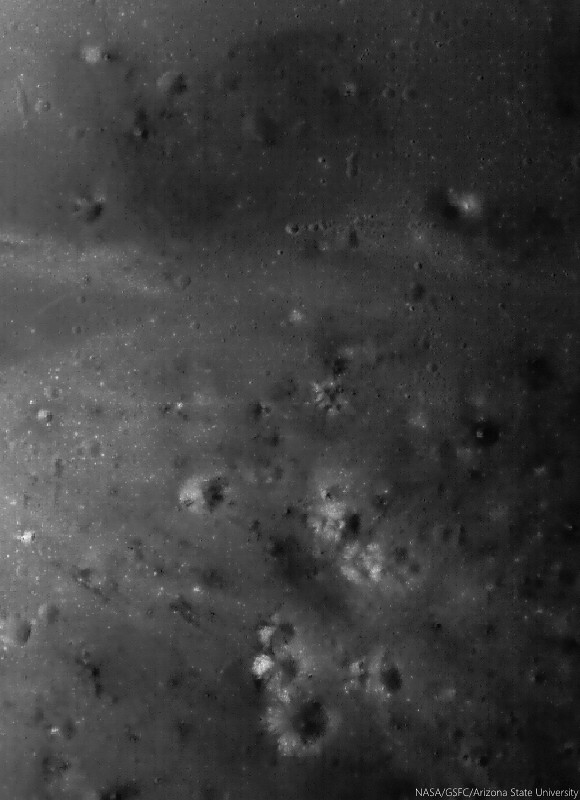
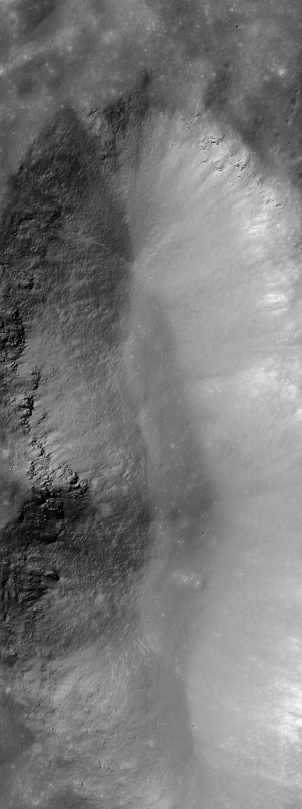
Dark mantle deposits decorate a crater wall. Slowly pulled downhill by gravity, the volcanic glasses that compose these stripes where formed during explosive volcanic eruptions on the Moon. 1130 meter-wide field of view from LROC NAC observation M1101259688L, LRO orbit 14524, September 2, 2012; low incidence 17.83° angle, 97 cm resolution from 117.17 km over 8.26°N 352.18°E [NASA/GSFC/Arizona State University].
Aaron Boyd
LROC News System

Today's Featured Image location is in southern Sinus Aestuum.

Low reflectance pyroclastic material flowed downslope (NE) due to mass wasting in this crater, and high reflectance fresh ray material from small young craters dot the streaks.

The high reflectance material from small craters on top of the pyroclastics indicate that the pyroclastic deposit is relatively thin, because the excavated material is from a maximum of about 0.2 crater radii below the surface.
Striped slides of pyroclastic-sourced granular flow, darker material eroding back into its likely source, a "striped crater," a vent north of Schroter T in Sinus Aestuum, east of Copernicus. A 4675 meter-wide-wide field of view from LROC NAC observation M1101259688L, LRO orbit 14524, September 2, 2012; low incidence 17.83° angle, 97 cm resolution from 117.17 km over 8.26°N 352.18°E [NASA/GSFC/Arizona State University].
In addition to the thickness of the deposit, scientists can also tell that this deposit is most likely discontinuous by observing the streaks in the larger crater. If there was a continuous blanket of material on the surface, the dark mantle material would not form streaks, but a sheet of dark material as it is eroded away.

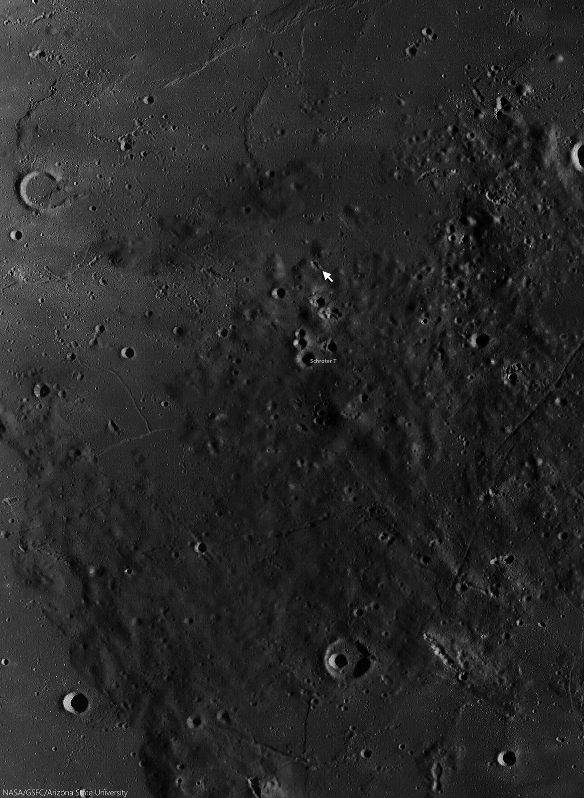
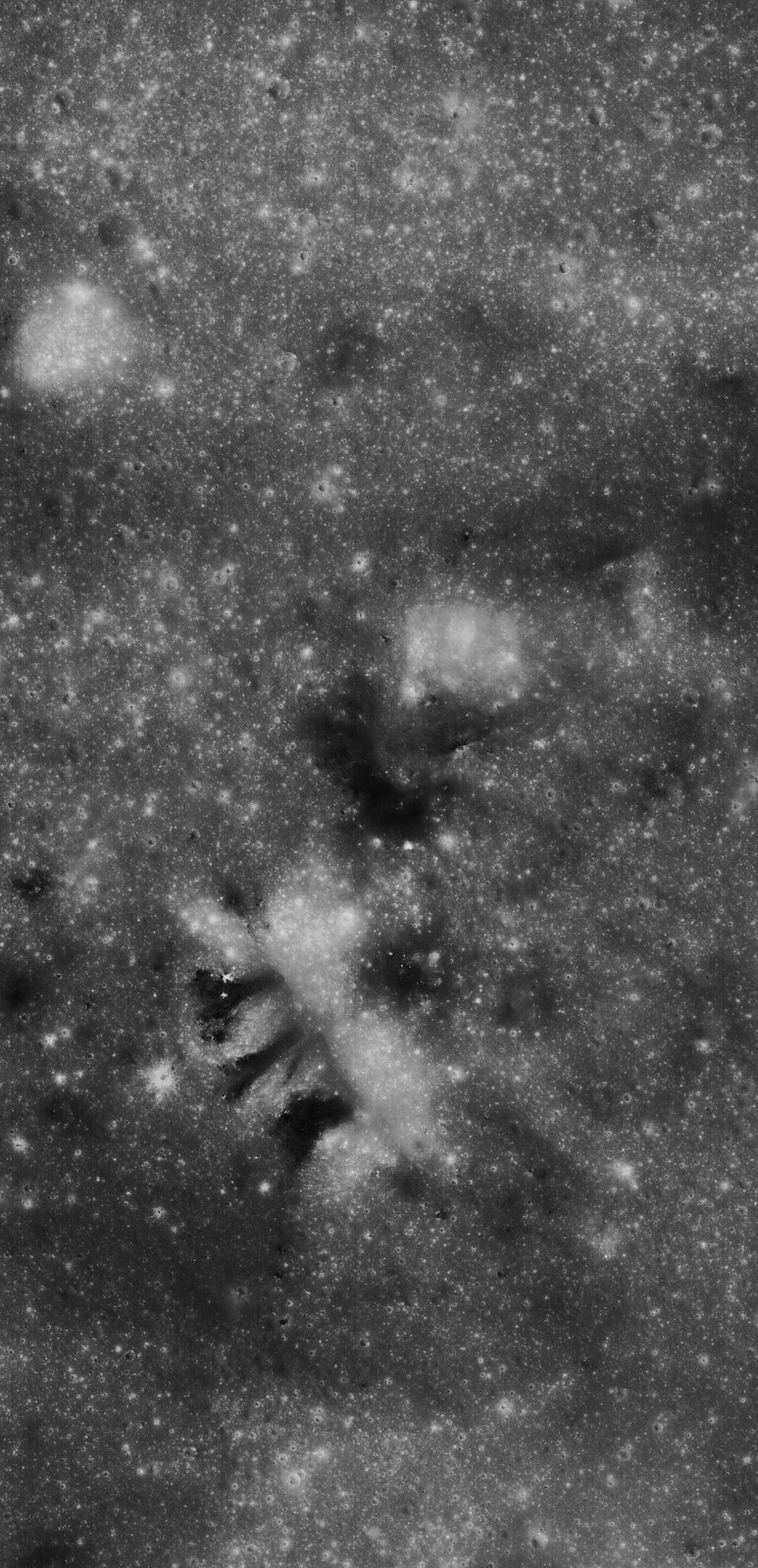
Schroter T (3.96 km; 7.03°N, 352°E) is the largest of the triplet craters in a "snowman" formation at lower center in this 37 km field of view centered near 7.72°N, 352°E. The energetic creation of Copernicus nearby left its mark on the pyroclastic material, Some high places seem to have been sheered off, leaving dark chevrons pointing away from that direction.  LROC Wide Angle Camera (WAC) monochrome (604 nm) observation M160003304CE, LRO orbit 9713, May 14, 2011; 48.97° incidence, 54.53 meters resolution from 38.89 km [NASA/GSFC/Arizona State University].
Dark mantle deposits (DMDs) on the Moon are composed of red, green, orange, and black glasses and crystals that were formed during strombolian or vulcanian eruptions. Sinus Aestuum is littered with dark mantle deposits, showing there were many different vents that were sending magma aloft.

The striped walls of the pyroclastic vent (arrow, 7.716°N, 352.062°E), in the dark terrains east-southeast of Copernicus, disappear into the long shadows of a complex topography, in the light of sunrise. A roughly 120 km-wide field of view from a distilled LROC WAC mosaic of sequential monochrome  (643 nm) observations swept up December 15, 2010; 77° incidence, resolution 63.3 meters from 45 km [NASA/GSFC/Arizona State University]. 
The crater in which we see the dark streaks in the Featured Image could have been the source for the streaks; a piece of evidence for the crater being a vent is its irregular shape, but without further surface investigation (perhaps by humans one day) that question can not be answered for certain.

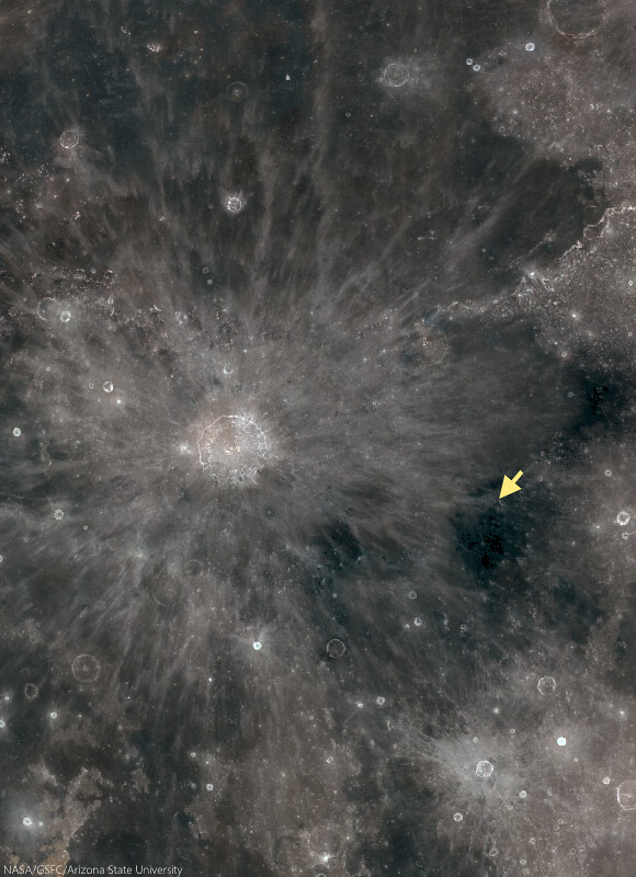
The small vent in Sinus Aestuum (arrow), 370 km east-southeast of the central peaks of Copernicus, is part of the pyroclastic fields highly visible even in modest binoculars, because of their relative low reflectivity. The area more to the southeast bear Gambart is the site of the Moon's highest concentration of radioactive isotopes, of thorium and less common uranium for example. A roughly 900 km-wide view from the LROC Lunaserv web-mapping program, Test RGB overlay (See "Resolved Hapke Parameter Maps") LROC WAC global mosaic [NASA/GSFC/Arizona State University].
See how many dark mantle deposits you can find in the full NAC frame HERE.

Related Posts:

Tuesday, July 15, 2014

Birt E and the fiery rift valleys of Nubium

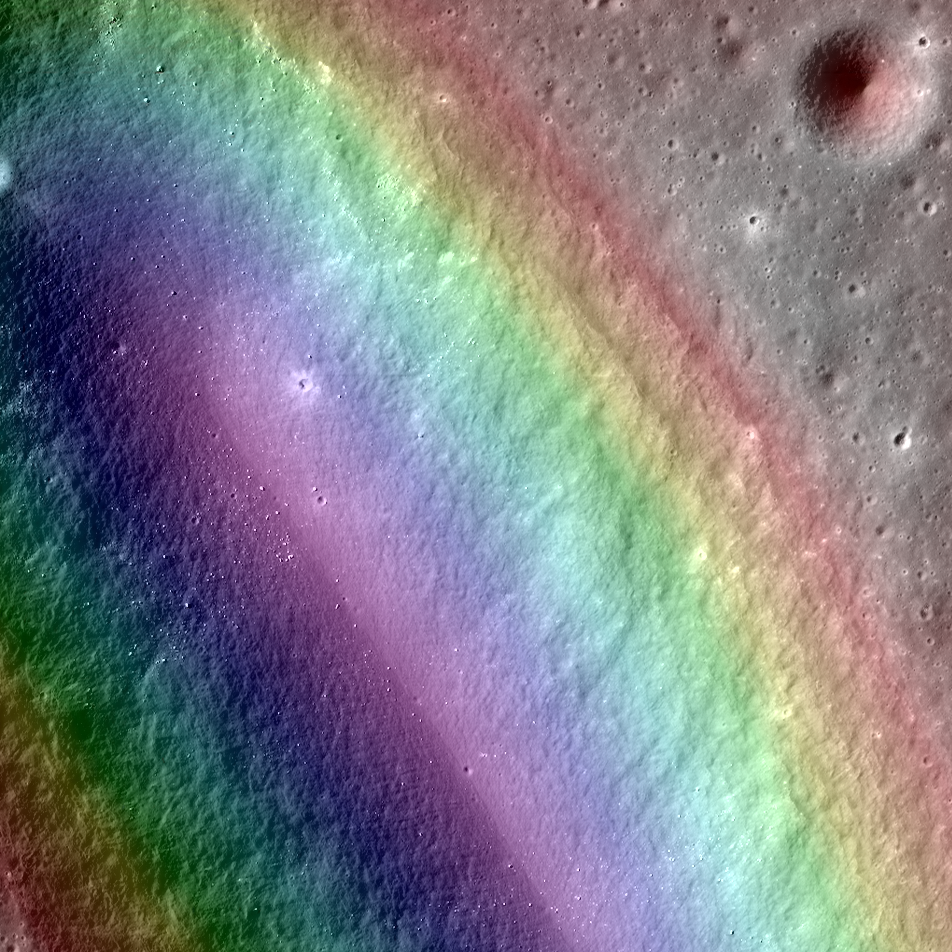
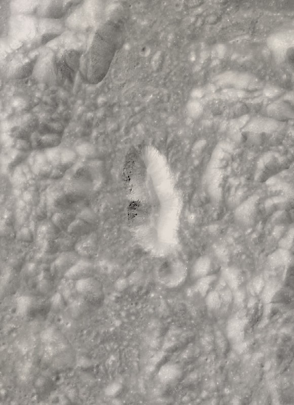
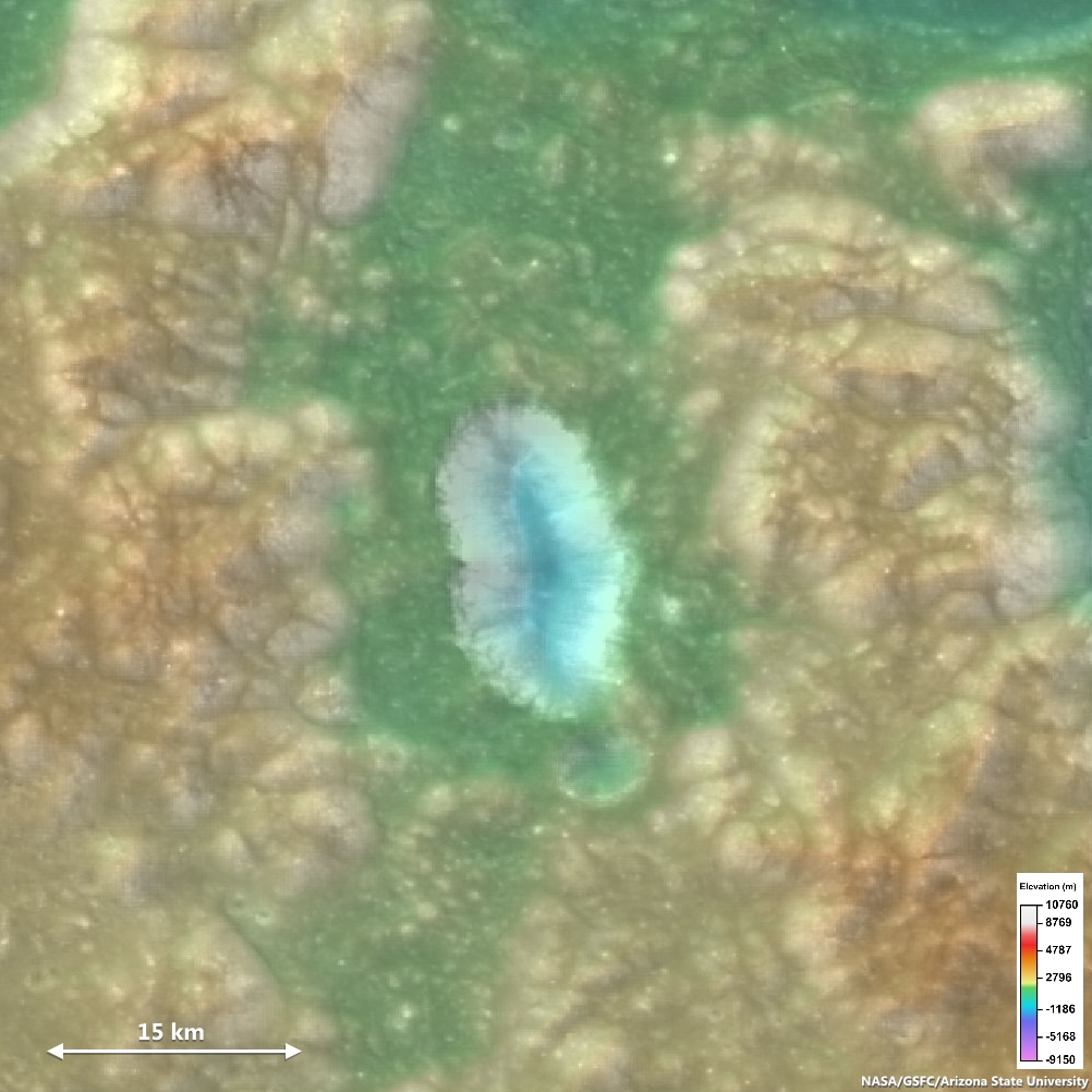
LROC Narrow Angle Camera-derived Digital Terrain Model (DTM, color gradations superimposed) on a close-up view along the northeastern long axis of Birt E (5.34 km; 20.72°S, 350.337°E), the vent structure of Rima Birt, a sinuous rille in east Mare Nubium immediately west Rupes Recta. The vent is thought to be a source region for pyroclastic flows that traced out Rima Birt. The mare basalt, visible as slightly darker material in a fan spreading north from the vent, is older than 3.4 billion years. A roughly 3 km-wide field of view from LROC NAC mosaic M1144849711LR, LRO orbit 20750, January 20, 2014; 46.21° incidence angle, 84 cm resolution from 78.77 km over 20.69°S, 351.11°E [NASA/GSFC/Arizona State University].
Aaron Boyd
LROC News System

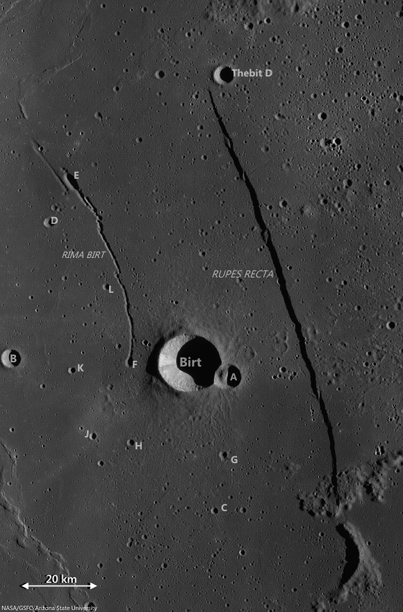
Birt E (20.72°S, 350.337°E) was not created like most craters on the Moon; there was no meteorite impact. Lava sputtered out of this pyroclastic vent in Mare Nubium over 3.4 billion years ago, dispersing lava onto the surface and leaving the crater we see today.

How can we tell it is a volcanic vent and not an impact crater?

Impact craters and volcanic vents can be differentiated because vents often have an irregular or elongated shape (as with Birt E). Impact craters are usually circular in shape, created by the shockwave during an impact event.

Pyroclastic vent structure at Rima Birt, officially "Birt E," though it is not a crater; west of Rupes Recta in east Mare Nubium. 4.66 km-wide field of view from LROC NAC mosaic M1144849711LR [NASA/GSFC/Arizona State University].
Also, the vee-shape of this crater is likely a product of the formation mechanism. Vee-shaped vents are thought to be formed from a pyroclastic eruption. Gasses fractionating out of the liquid rock create violent events during eruptions. Explosive eruptions created the shape that we see today, but Birt E could have had a complex history with effusive eruptions forming Rima Birt, the short sinuous rille flowing from Birt E to the south-southeast.

Birt crater group and Rupes Recta, the eye-drawing structure in telescopic views of Mare Nubium. (See a larger, unnoted reproduction HERE.) LROC Wide Angle Camera (WAC) monochrome (604 nm) mosaic stitched from observations swept up over three sequential orbital passes June 10, 2011; incidence roughly 78° and 58 meters per pixel resolution, from 43 km [NASA/GSFC/Arizona State University].
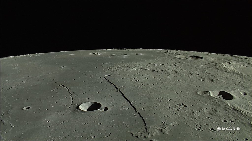
East Mare Nubium, an orbital view north from 100 km altitude, an HDTV still from Japan's lunar orbiter Kaguya (SELENE-1) in 2008. (See the wallpaper-sized release HERE.) [JAXA/NHK/SELENE].
Over long enough time scales Birt E will be filled in with ejecta from newly formed craters around Mare Nubium or by mass wasting of the walls into the crater. Let’s enjoy this ancient crater today while we still can!

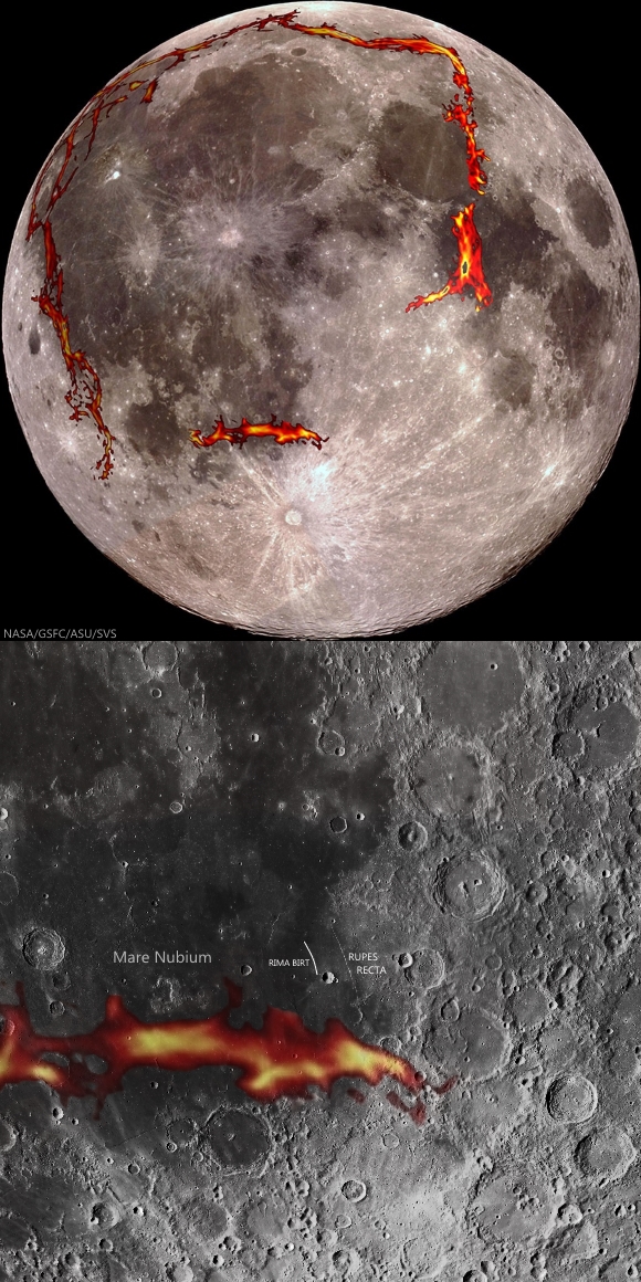
As the GRAIL gravity probes mapped the Moon's basic anisotropy in 2012 detecting the densities of "deep fiery rift valleys," a probable source of a half billion year period of pyroclastic volcanism surrounding the Moon's Procellarum terrain, added important pieces to the tossed puzzle of the Moon's morphology. In the newest maps of the Moon's own squarish "ring of fire," there is still a missing link under the Southern Highlands, but a source for the multiple inundations of the nearside's lowlands, weight that may have created the Straight Wall fault in east Mare Nubium, may have been found [NASA/GSFC/SVS].
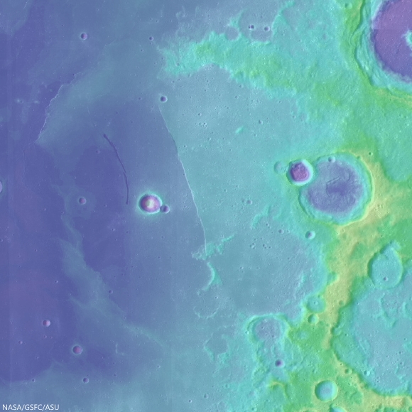
LOLA laser altimetry color-coded over LROC WAC 100 meter global mosaic demonstrates where Rupes Recta marks a neat break in the continuity of the floor of an otherwise almost entirely erased 190 km crater. The weight of repeated inundations gradually sloped that crater's floor 1500 meters in elevation deeper on the west side, gradually, aside from the 100 to 300 meter "snap" represented by Rupes Recta [NASA/GSFC/Arizona State University].
Check out the topography in the full NAC DTM HERE.

Related Posts:
Friday, May 23, 2014

Punching through Abel C

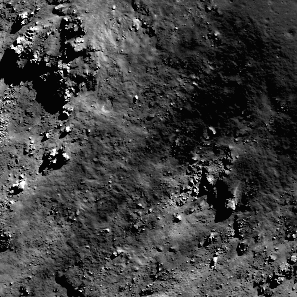
Excavation on the floor of Abel C. A bench crater in the pyroclastic deposit mantling the floor of Abel C. The impactor appears to have punched through multiple layers, giving the 100 meter crater an irregular, stepped appearance. LROC NAC observation M1153673248R, LRO orbit 21990, May 2, 2014; 68.8° incidence angle, resolution 75 cm from 72.53 km [NASA/GSFC/Arizona State University].
H. Meyer
LROC News System

Lunar craters less than between approximately 15-20 km in size are usually bowl-shaped, so the crater above, excavating the floor of Abel C (41.5 km; 36.72°S, 82.5°E) has a somewhat irregular morphology relative to most craters of its size (about 100 meters).

This crater is characterized by its block-strewn, hummocky floor and low-relief rim. The step-like or benched appearance most evident in the northeastern portion of the wall is due to a strength discontinuity. Such discontinuity indicates that the impact penetrated through two materials of different strengths. Lab experiments have shown that the bench crater morphology forms when the surface layer is composed of thin and poorly consolidated regolith and the subsurface is composed of harder, more coherent material.

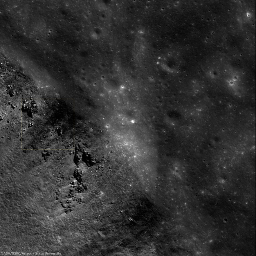
Small relatively fresh excavation, the 100 meter crater right of center shown in context of the full, 3.6 km-wide field of view swept up in LROC NAC observation M1153673248R, May 2, 2014 [NASA/GSFC/Arizona State University].
In some cases, the underlying material is bedrock, evidenced by an abundance of boulders. So, what did the impactor punch through at the surface? Usually regolith is the culprit, but further investigation of the floor of Abel C suggests that it may not be regolith alone.

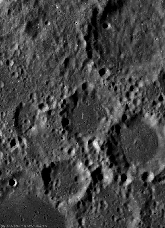
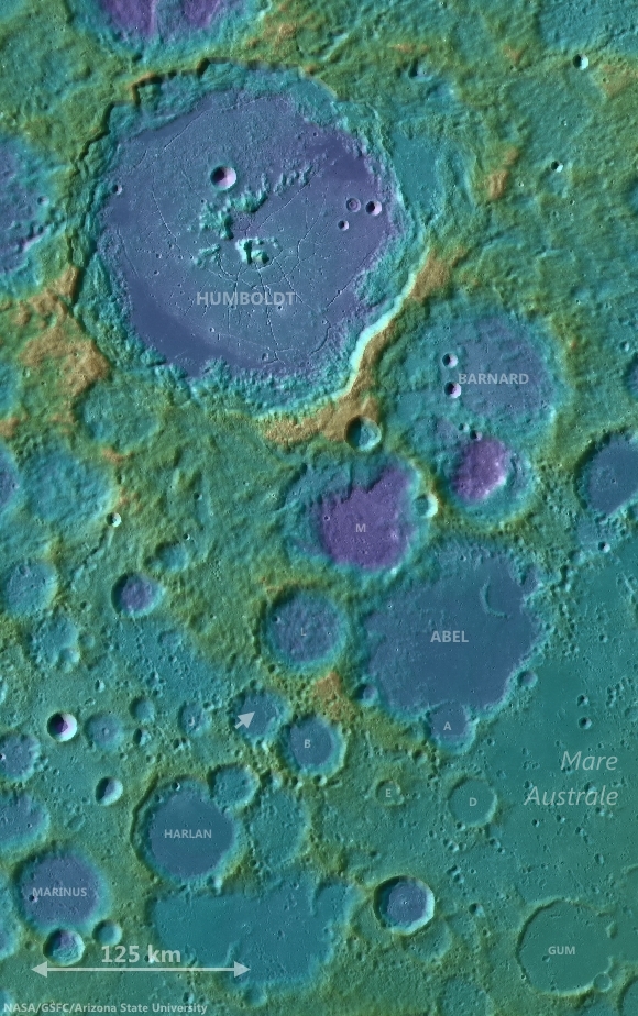
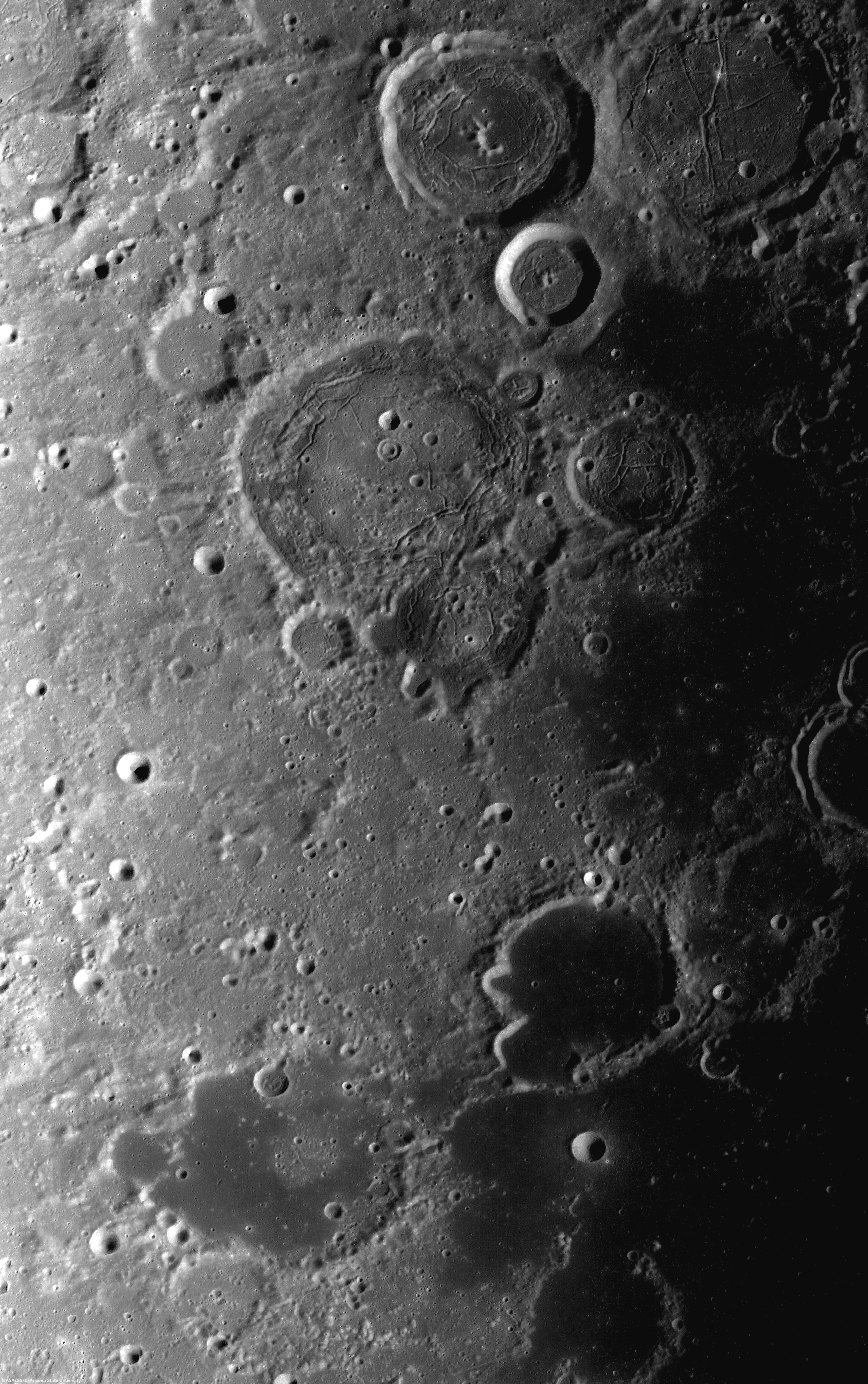
Ancient Abel C (41.5 km; 36.72°S, 82.5°E), on the northwest frontier of Mare Australe, has a smooth floor of relatively low reflectance, compared with it's equally eroded neighbors. Arrow marks the location of the 100 meter crater presented at high resolution above. LROC 100 meter Wide Angle Camera (WAC) global mosaic [NASA/GSFC/Arizona State University].
Abel C is a 36 km diameter crater on the southeastern limb of the Moon, just off the northwest edge of Mare Australe, a large region dominated by volcanic activity. Clementine (1994) color ratio images are extremely useful in identifying nonmare deposits since non basaltic compositions tend to stick out when Clementine images are placed in the proper color space. Three bands (415 nm, 750 nm, and 1000 nm) from the Clementine UVVIS camera were used to create the false-color image below.

Clementine (1994) false color image of the Mare Australe region with Abel C off the western edge. The floor of Abel C appears more red than the surrounding highlands, along with a clear indication of similar pyroclastic exposure like the multiple indications within Mare Australe   [NASA/GSFC/Arizona State University].
The three bands were ratioed to control the colors of the false-color image. The 750/415 ratio controls the red component, which is an indication of low titanium or high glass content as found in mature lunar regolith and to a greater degree pyroclastic deposits. The 750/1000 ratio controls the green component and is an indicator of the amount of iron on the surface. The 415/750 ratio controls the blue component and indicates high titanium or bright slopes and albedos. In the Clementine false-color image, Abel C stands out  from the highlands and more closely resembles the nearby mare. The strong red component, combined with the low-reflectance, mantled floor seen in Abel C is indicative of a pyroclastic deposit.

Abel C is shown in relation to the terrain of the Moon's southeastern limb, between Humboldt crater and Mare Australe. LROC WAC-derived digital elevation model and 100 meter global mosaic data [NASA/GSFC/Arizona State University].
This pyroclastic deposit encompasses approximately 190 km2 and has been identified in studies of pyroclastic deposits across the Moon (Compositional analyses of lunar pyroclastic deposits by Gaddis et al. 2003). Because pyroclastic deposits have a mantled appearance,  they must be relatively thin. It's possible that the thin upper layer the impactor penetrated was partially composed of pyroclastics.

Related Posts:
Tuesday, April 15, 2014

Sometimes you just need to 'vent'

Low reflectance material cascaded down the wall of what is likely a volcanic vent in the southwestern portion of the Orientale basin. Image field of view approximately 750 meters, from LROC NAC observation M1150135366,  LROC orbit 21493, March 22, 2014; incidence 37.45° resolution 77 cm from 75.55 km over 30.12°S, 262.19° [NASA/GSFC/Arizona State University].
H. Meyer
LROC News System

Pyroclastic deposits on the Moon are often identified by a mantled appearance and low reflectance. These deposits are the result of an explosive eruption (or many) that involved a volatile component, likely carbon monoxide. The resulting fine-grained debris, including glass beads like those sampled by Apollo 17, gives the surface a dark, mantled appearance (See WAC image below).

So, where did the low reflectance material come from? The low reflectance material here flowed down the wall of a kidney-shaped (reniform) depression located at the center of the annulus.

Expanded 3.8 km-wide context for LROC Featured Image released April 15, 2014 - outlined box - northwestern rim of pyroclastic vent, southern frontier Mare Orientale impact basin. Mosaic of left and right frames of LROC NAC observation M1150135366  [NASA/GSFC/Arizona State University].
The lack of a discernible crater rim and irregular shape make this depression a suspect (See WAC image below). The walls of the depression are steep-sloped, yet the floor is fairly flat, which is best observed in a color-shaded digital terrain model (DTM). Such reniform depressions are observed in other locations across the Moon, such as Sulpicius Gallus, interpreted to be a pyroclastic source vent.

A higher angle of incidence, in this 2.8 x 7.5 km-wide field of view, washes out much of the finer grain albedo, though a look at the larger 40 percent -3760 x 9920- reproduction does reveal much of the detail of the rim, walls, boulder trails and debris-filled floor of the two-kilometer deep "smoke ring vent."  The area of interest on the upper right, also in the LROC Featured Image can be compared. LROC NAC mosaic of the left and right frames of observation M1099502843, LRO orbit 14378, August 13, 2012; illumination incidence angle 45° at 76 cm per pixel resolution, from 72.13 km over 30.11°S, 261.81°E [NASA/GSFC/Arizona State University].
If the kidney-shaped depression is the source of the low reflectance material, it is likely that material was ejected from the source vent at high velocity, creating an umbrella-shaped plume and depositing the dark, fine-grained material in a ring around the vent.

The larger than lunar average - 12.5 x 19.75 km pyroclastic "smoke ring vent," on the southwestern frontier of the Mare Orientale impact basin, is also hub to a regionally distinct 190 km-in diameter ring of darker material that, while not apparent in topographic studies, stands out in all native reflectance photography. Medium resolution Chang'e-2 Global albedo Mosaic [CNSA/CLEP].
Pyroclastic deposits are currently of interest to lunar scientists as a possible resource for future missions to the Moon. Such deposits are rich in hydrogen and helium-3, two potential resources for energy production, and iron and titanium, which have engineering applications.

Elevation study, LROC WAC-derived GLD100 topography in color-coded overlay onto LROC global normalized reflectance data. The high mountains of the concentric Orientale impact basin ring, where the vent is nested, offers a high vantage. Elevations range over 4000 meters in 10 km [NASA/GSFC/Arizona State University].
LROC WAC normalized reflectance 643 nm, of the low-reflectance pyroclastic annulus on the southwest Orientale impact basin. The annulus is approximately 180 km in diameter [NASA/GSFC/Arizona State University].
The necessary capabilities for utilizing resources such as these in-situ, or on site, are currently under development. In-situ resource utilization (ISRU) is critical to the future of exploration of areas that would otherwise be beyond our reach, both physically and financially.

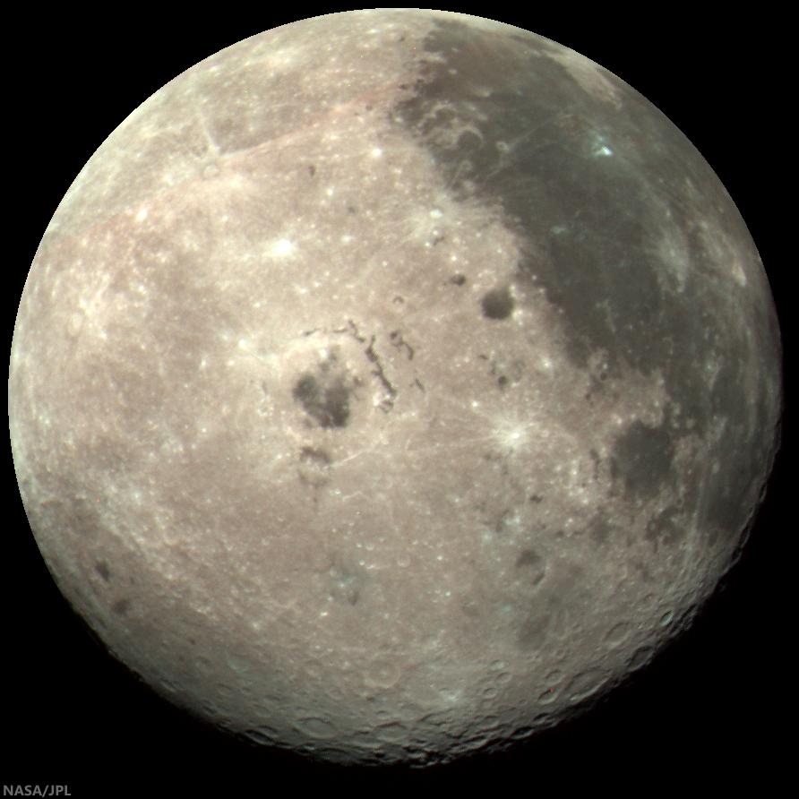
Another opportunity to display this stacked three-color image of the Moon's western hemisphere, which features Mare Orientale so prominently and demonstrates that the pyroclastic annulus south-southwest of its central plain, is large and prominent enough to be photographed from more than half a million kilometers away. In this case, captured by the Jovian probe Galileo at 1735 UT, December 9, 1990 [NASA/JPL].
Do some investigating of your own with the full NAC, HERE.

Related Posts:
Pyroclastics and an unnamed Procellarum vent
Source vent for Rima Prinz I
Craters on the Schrödinger pyroclastic cone
Morphology and distribution of volcanic vents in the Orientale basin from Chandrayaan-1
Unassuming volcanic vent north of Aristarchus Plateau
New pyroclastic structures identified using LROC data
A dark cascade at Sulpicius Gallus
Hyginus and pyroclastics
Layer of pyroclastics in Sinus Aestuum
Lavoisier Pyroclastics
Pyroclastic Excavation
Pyroclastic Trails
Pyroclastic Vent at Orientale DTM

Tuesday, April 1, 2014

Lavoisier pyroclastics

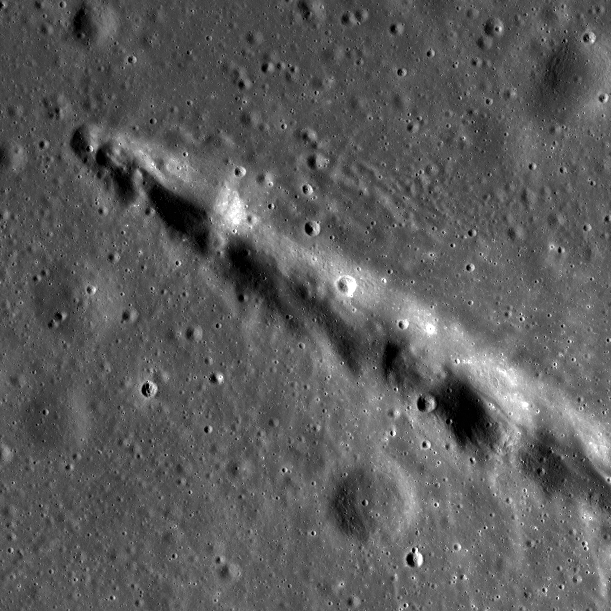
Irregular "peanut-shaped" depression, perhaps a former fire-fountain vent, at the head of a floor fracture skirting the western floor of Lavoisier crater, on the west-northwest frontier of Oceanus Procellarum. Low reflectance material, thought to be pyroclastics, appears to have flowed and pooled, eastward and throughout the ancient crater floor. 15 km-wide field of view from a mosaic of LROC NAC observations M105055584L & R, from early in the LRO mission, spacecraft orbit 637, August 16, 2009; resolution 1.6 meters per pixel, incidence angle 57.3° from 162.45 km above 38.32°N, 231.59°E  [NASA/GSFC/Arizona State University].
Raquel Nuno
LROC News System

Lavoisier crater has many geologic forms that give insight into its history. On the floor are concentric craters, which exhibit an inner and outer rim; these strange craters are thought to have formed as a subsurface discontinuity, such as a strong rock layer below loose regolith, which interfered with the passage of the impact shock wave.

Fractures, which are caused by uplift of brittle material, are also abundant and point to subsurface magmatic intrusions or viscous relaxation as possible formation mechanisms.

The peanut-shaped irregular formation, just within the west wall of Lavoisier crater (71 km, 38.17°N, 278.75°E), in an image of the entire crater. Pyroclastic deposits encircle the crater floor, visible as areas of slightly darker appearance in this LROC WAC mosaic stacked from seven sequential monochrome (643 nm) observations by LROC Wide Angle Camera captured after local sunrise November 23, 2010; average resolution 65 meters from 49.5 km [NASA/GSFC/Arizona State University].
Today's Featured Image, found on the western edge of the floor of Lavoisier crater, shows low reflectance material that appears to have flowed from the head of one of these fractures. These flow fronts have been identified by lunar scientists as being the remnants of pyroclastic deposits. The irregular depression is not just another fracture, but a source vent for the eruption that created these deposits!

Context for the context. The west by northwest extremes of Oceanus Procellarum hosts several deposit remnants of fire-fountain pyroclastic volcanism. On the edge of the vast plains to the east and farside highlands to the west, dykes of volcanic faulting offer clues to the long-sought definitive origin for the Procellarum basin that, like Mare Tranquillitatis, does not seem to have formed from a single basin-forming impact. Breakthrough data was collected by the sensitive GRAIL A and B probes. Image stacked from from seven sequential orbital monochrome (643 nm) observations by LRO LROC Wide Angle Cameras of the region, soon after local sunrise, November 23, 2010; average resolution 65 meters, from 49.5 km [NASA/GSFC/Arizona State University].
The eruption (or eruptions) that threw these pyroclastic deposits out onto the surface are thought to be an energetic style of volcanic eruption called fire fountains. Eruptions like this are more chaotic due to the presence of volatile elements in the magma. Since magma source regions are hundreds of kilometers below the surface, pyroclastics are of interest to scientists because they provide information about the deep interior at the time of eruption. Understanding the distribution and composition of these deposits provide a path to deciphering the evolution of the interior conditions of the Moon through time. The Lavoisier pyroclastics and many other similar deposits are key sites for future robotic and human exploration.

Investigate the mantling of pyroclastics over the crater floor up close with the full resolution NAC mosaic, HERE.

Related Posts:
Lavoisier Crater
Pyroclastic Excavation
Layer of Pyroclastics
Pyroclastics and Vent
Hyginus Crater and Pyroclastics

Thursday, June 13, 2013

Revealed Surface, eastern Mare Insularum

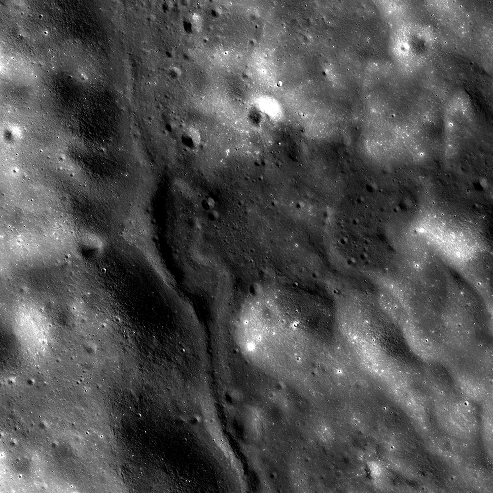
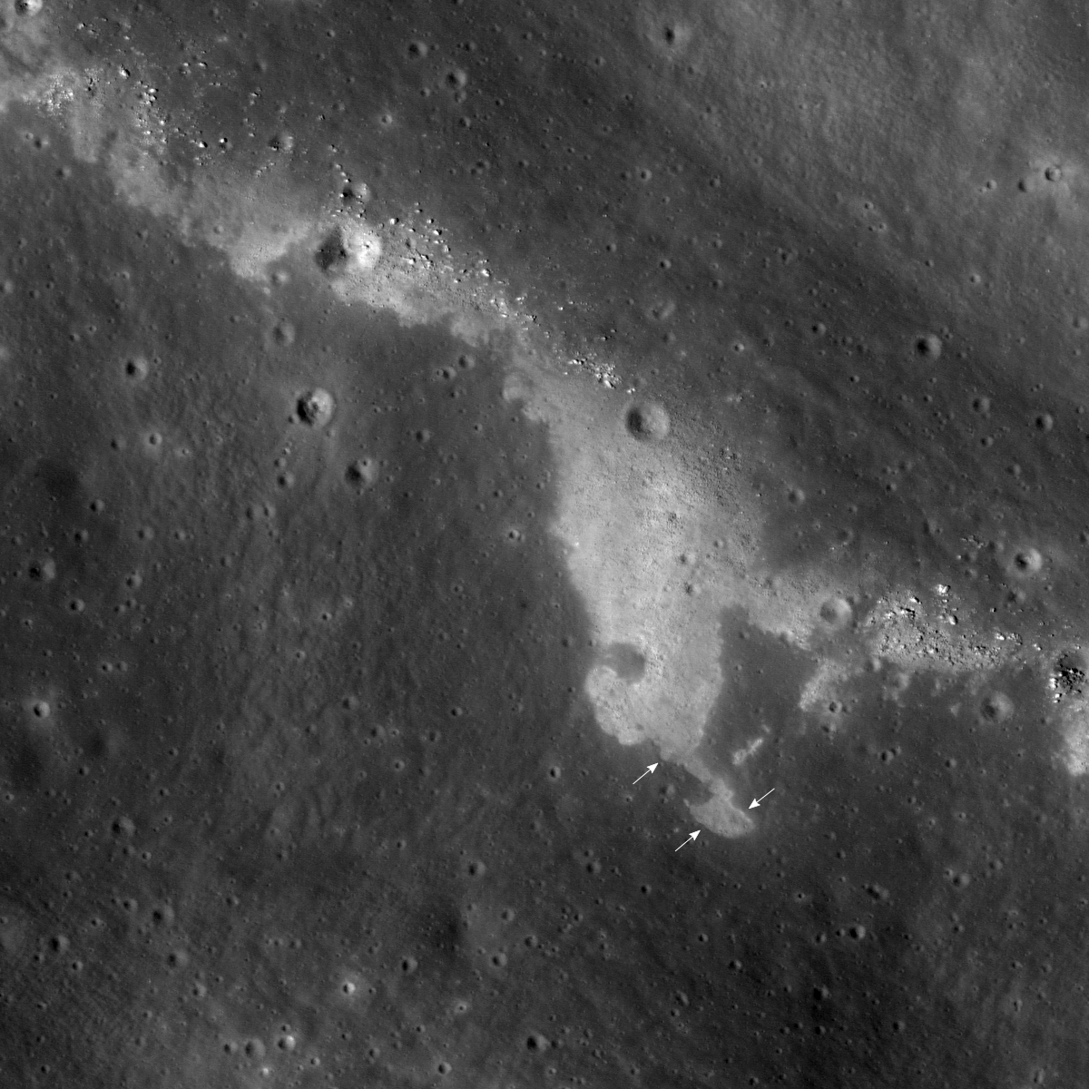
Southern slope of unnamed fracture along the eastern mare/highland boundary of Mare Insularum. LROC Narrow Angle Camera (NAC) frame M1114199297R, LRO orbit 16439, January 30, 2013; 1147.2 meter field of view centered on 13.135°N, 355.638°E, 42.94° angle of incidence, resolution 0.96 meters per pixel from 114.18 km. (Downslope toward upper-right, north at top) [NASA/GSFC/Arizona State University].
Hiroyuki Sato
LROC News System

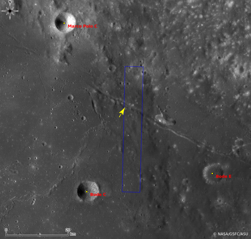
Today's Featured Image highlights a portion of an unnamed linear fissure located along the eastern edge of Mare Insularum, near the mare/highland boundary.

The width of this fissure varies from about 1.5 to 2 km, its  length is about 90 km, and it extends in the northwest-southeast direction.

The upper-right portion of the opening image, showing a shallow groove extending from up to middle right of the image, corresponds to the bottom of the fissure. Thus most of the image reveals the southern wall of the fissure.

The LROC Featured Image field of view rendered approximately in elevation data from the LROC WAC DTM. Local slopes in the vicinity of the fracture of interest can be difficult to otherwise see. LROC QuickMap [NASA/GSFC/DLR/Arizona State University].
On this slope, there is a high reflectance area with sinuous boundaries. This unit is hard to interpret in terms of what is on top and what is below, stratigraphically. The sunlight is from left side, highlighting what appears as a slightly raised boundary between the two units (arrows). Elsewhere it looks as if the high reflectance material overlies the lower reflectance material. Which unit is younger? Try counting craters between the two, but be careful, if the units have different hardnesses, then the more coherent unit may preserve craters better. 

Unnamed fracture running northwest to southeast on the eastern side of Mare Insularum and surrounding vicinity in LROC WAC monochrome mosaic (100 meters per pixel), centered is 13.12°N, 355.66°E. The LROC NAC footprint (blue box) and location of the field of view in the Featured Image (yellow arrow) are marked [NASA/GSFC/Arizona State University].
Since this whole area is on a slope, slope failure may have revealed an underlying immature surface. Indeed multiple higher reflectance boulders are sitting at the downslope side of this high reflectance unit. But the upper complicated shapes are difficult to explain by this simple story. Or perhaps low reflectance materials could have slumped and covered portions of the high reflectance material? A high resolution NAC DTM would help scientist unravel this complicated morphology.

Explore this enigmatic patterned surface in full NAC frame yourself, HERE.

Related Posts:
Inside Hyginus Crater
Bright ridge near Mons Hansteen
Wrinkle Ridge vs. Impact Crater
Really Wrinkled
Boulders In The Sea Of Serenity
Ghost crater in Mare Imbrium
Zebra Stripes
Aitken Central Peak, Seen Obliquely
Constellation Region of Interest at Mare Tranquillitatis

Tuesday, April 16, 2013

Crater chain near Rima T Mayer

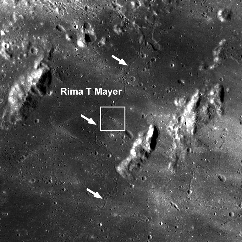
A small, rather unique crater chain, or catena, near Rima T Mayer, a geologically and observationally interesting region northwest of the central near side, between Copernicus and Kepler. LROC Narrow Angle Camera (NAC) M181373663R, a 2.6 km field of view captured at 1.29 meters per pixel resolution from 128.61 kilometers in spacecraft orbit 11842, January 16, 2012; angle of incidence 64.29° [NASA/GSFC/Arizona State University].
Sarah Braden
LROC News System

What sound do impacts make when they hit the lunar surface? If you were an astronaut standing on the lunar surface, you probably would not hear anything even if you were nearby since the lunar surface is a near-vacuum! However, you might feel the rumble of the impact through your boots perhaps giving you enough time to duck behind a nearby boulder. Today's Featured Image shows part of a ~3 km long crater chain, located at 13.360°N, 328.807°E.

The irregular shape of the crater rims and tapered appearance suggests that these are not primary but rather secondary craters, formed from material ejected from a larger primary impact.

LROC Wide Angle Camera (WAC) context image of the area surrounding the crater chain (located inside the white box). The sinuous rille Rima T Mayer winds its way through the region (denoted by white arrows). Image field of view 58 km across [NASA/GSFC/Arizona State University].
Secondary craters form many of the crater chains on the Moon, but not all. The term crater chain, or catena, describes any set of craters in a linear array. Crater chains can be formed not only by secondary craters but also by volcanic collapse (associated with graben) or primary impacts from a string of smaller objects which was observed during the Comet Shoemaker-Levy 9 impact with Jupiter.

A slightly closer look at the same region in "pushed" LROC WAC photography shows the catena bisects a contact zone between an effusive dome structure and the mare material of the surrounding area. Illustration from "New Pyroclasts identified using LROC data," February 18, 2011. LROC WAC observation M117691527ME (689 nm), orbit 2478, January 9, 2010 [NASA/GSFC/Arizona State University].
Can you find other areas with evidence of secondary crater ejecta in the full LROC NAC, HERE?

Related Images:
Tres Amicis
Four of a Kind in Catena Davy
Stream of Secondary Craters
Chain of Secondary Craters in Mare Orientale
New Pyroclasts identified using LROC data

Thursday, April 4, 2013

Downhill creep or flow on the floor of Vitello?

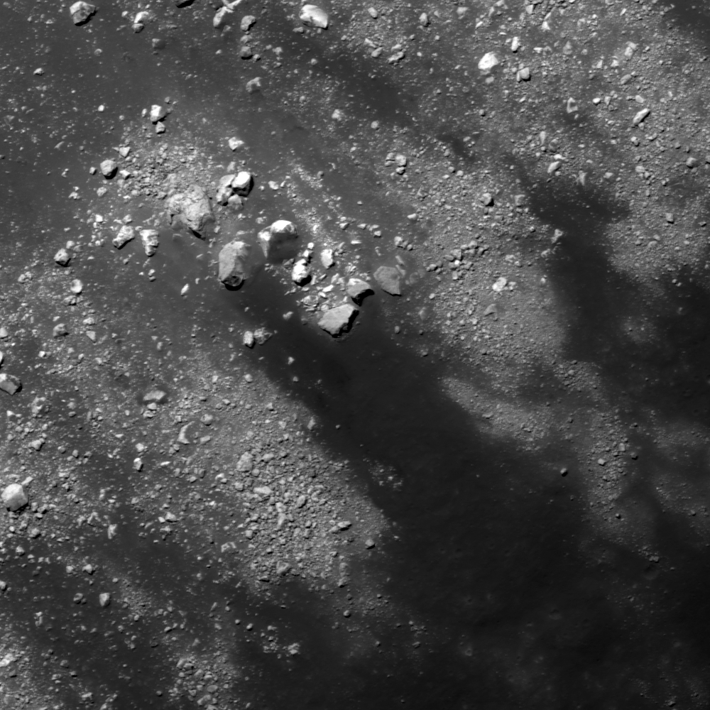
Southern slope of a fracture developed in the floor of Vitello crater, on the south side of Mare Humorum. Downward slope is toward upper left in a 640 meter wide field of view centered on 30.214°S, 322.352°E, LROC NAC M1101460425L, LRO orbit 14652, September 5, 2012; angle of incidence 31.65° over 0.64 meters resolution, from 61.86 km  [NASA/GSFC/Arizona State University].
Hiroyuki Sato
LROC News System

Vitello crater is a floor-fractured crater (42.5 km in diameter), located at the south edge of Mare Humorum.

As seen in the LROC Wide Angle Camera (WAC) context view further down, there is a circular network of fractures, with numerous branches, throughout the crater floor.

The opening images (above and immediately below) highlights a portion of north facing slopes inside one of these fractures (yellow box and arrow).

Full with of LROC NAC M1101460425L, from the corrected exploration link at the bottom of this post. The yellow square encompasses the area within the LROC Featured Image, released April 4, 2013 [NASA/GSFC/Arizona State University].
The dark materials on the floor of the crater partially cover the upper part of this fracture. The dark materials extend from the bottom right to upper left and are detoured around of a large boulder (30 by 20 meters) at the center of opening image, indicating that these materials flowed down the slope. With occasional events of slope failures or meteorite impacts, they might have flowed at once or little by little over a long period of time. But of what is this dark material composed?

The origin of floor-fractured craters on the Moon is still under discussion, but volcanic intrusions are suspected, and some of the fractures are associated with Dark Mantle Deposits (DMD), that are likely pyroclastic in origin. In Vitello crater, no clear DMD have been documented. But since the circular cracks are well developed in this crater, pyroclastics or any low reflectance materials of volcanic origin might have covered the fractured floor surface, supplying the dark materials flowing into the open cracks as seen in the opening image. 

Vitello crater and surrounding areas in LROC WAC monochrome (604nm) mosaic (70 meters per pixel) centered on 30.393°S, 322.43°E, stitched from three LROC WAC observations, from three sequential orbital passes, February 6, 2010, from just above 50 km altitude. The locations of area  in the LROC Featured Image (yellow arrow) is indicated once again [NASA/GSFC/Arizona State University].
Explore the slopes of the floor-fractured crater on the Moon in full NAC frame yourself, HERE.

Related Posts:
Rimae Posidonius
DMD Excavations
Pyroclastics and Vent
Pyroclastic Excavation
Pattern of dark deposits
Alphonsus crater mantled floor fracture
Low Reflectance Deposits on the Lassell Massif

Tuesday, March 12, 2013

Not your average crater

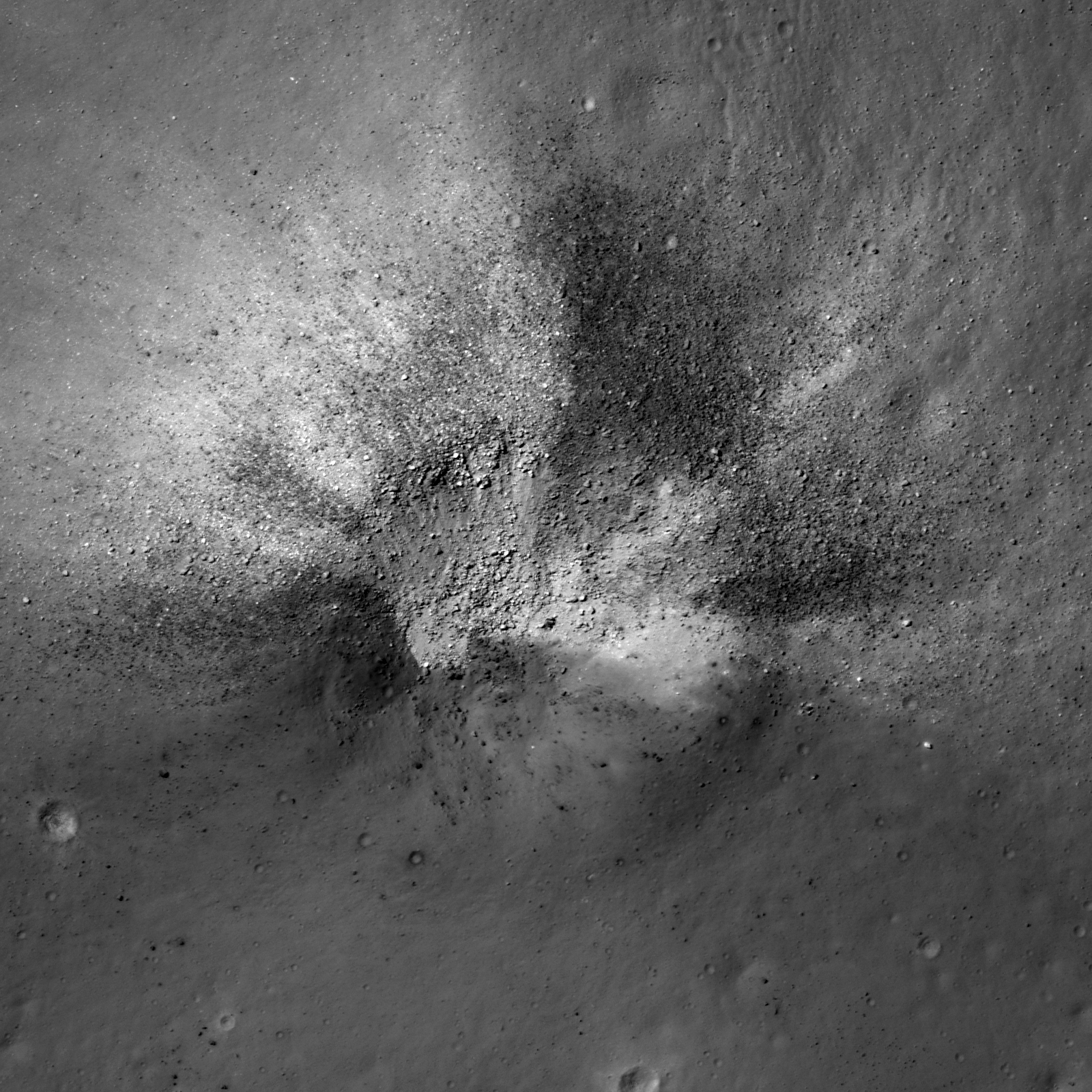
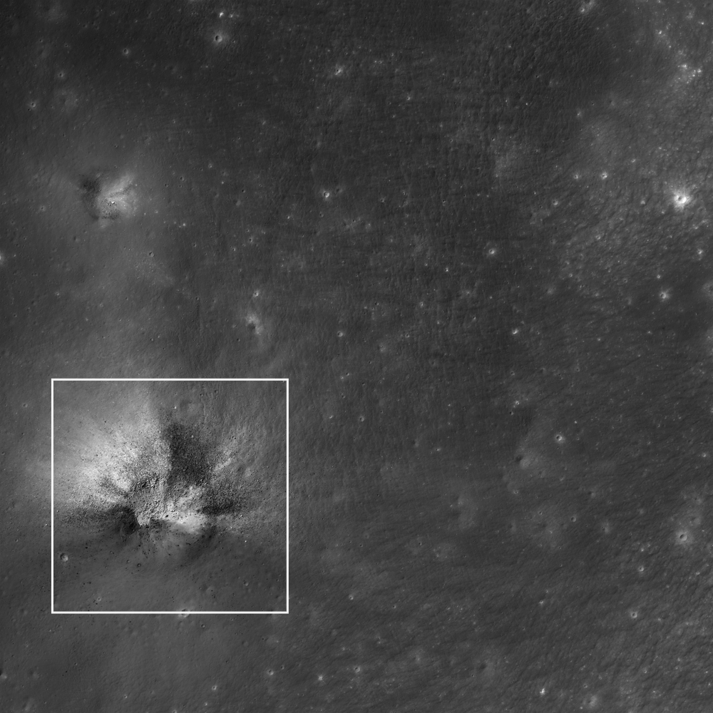
An asymmetric impact crater (14.349°S, 350.977°E) on the Lassell Massif revealing low reflectance material. NAC frame M152939732L, LRO orbit 7672, February 21, 2011; incidence angle 17.58° from the northwest, resolution 0.49 meters per pixel over a field of view approximately 820 meters across, from 39.65 km [NASA/GSFC/Arizona State University].
James Ashley
LROC News System

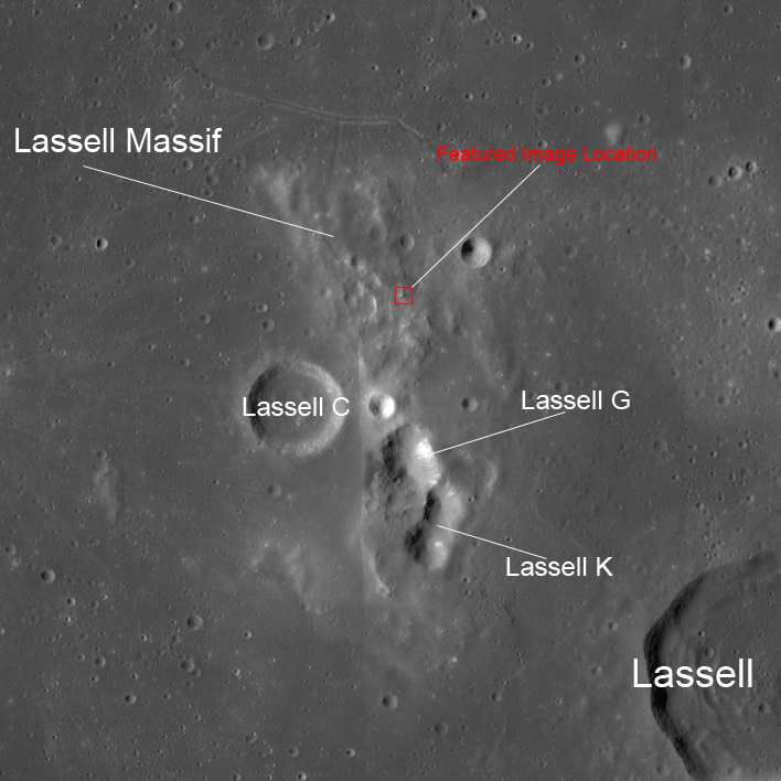
This week's Featured Images focus collectively on a region of the Moon known to present a ruddy discoloration through the eyepiece of ground-based telescopes (and also directly to the eyes of Apollo Command Module pilots). Known colloquially as "lunar red spots," such areas include the Gruithuisen Domes, Mons Hansteen, and the Helmet region. The red spot under observation this week is the Lassell Massif. This fascinating feature is a highstanding region of the Lassell Complex, located within the Alphonsus A basin in northeastern Mare Nubium, and consists of a rugged (though somewhat muted), hilly terrain, and several large, steep-walled depressions.

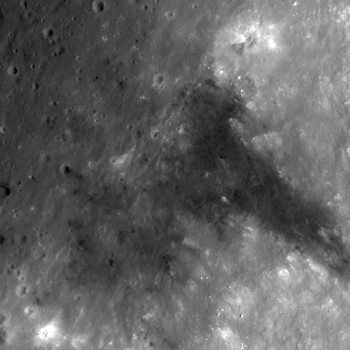
Today's Featured Image shows a striking impact crater in the northern hills of the massif. The crater exhibits an asymmetrical ejecta pattern, suggesting it to be the result of an oblique impact. The crater outline and ejecta distribution may also have been influenced by the uneven local topography. More geologically intriguing than this crater's shape, however, are the intermixed high and low reflectance materials excavated by the impact.

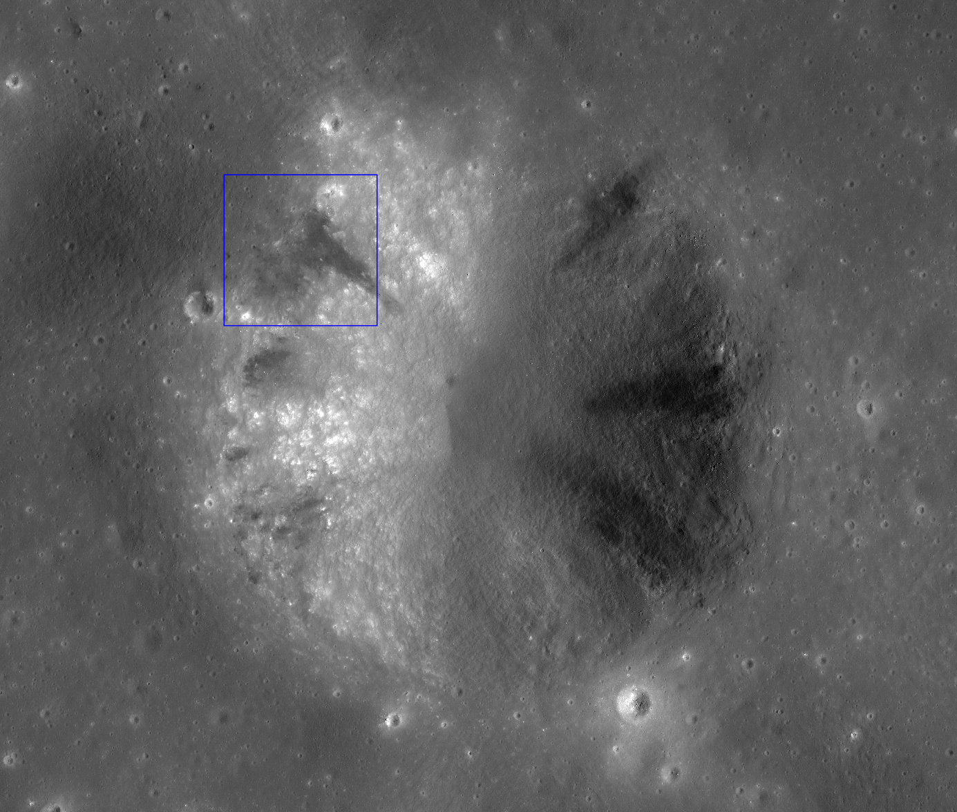
This wider field image from the same NAC frame shows an adjacent impact (northwest quadrant) to have excavated similar dark materials in the region; white square is the Featured Image location. Image is ~2.2 km wide [NASA/GSFC/Arizona State University].
The low reflectance materials (here seen as blocky) are suspected to be pyroclastic in origin, which speaks to the volcanic history of the Moon. Lassell crater itself (lower right in context image above) was described as being a source of pyroclastic materials since telescopic mapping efforts of the 1960s and '70s. The Lassell Massif is arguably close enough to this (and potentially other mare sources) to have received a share of these materials on the summits of its hills. Alternatively the central depressions on the massif may themselves be volcanic vents.

WAC mosaic context image. The white box outlines the area shown in the second image following above, field of view roughly 67 kilometers across [NASA/GSFC/Arizona State University].
While most lunar volcanism produced basaltic rocks, recent evidence is suggesting that Lassell Massif and other red spot areas are silica-rich, iron-poor volcanic deposits -- perhaps similar to the kind of volcanism we see with the Long Valley Caldera on Earth. While darker deposits tend to indicate an iron-rich material, their presence among silica-rich materials (which might seem like a geologic contradiction) may actually be suggestive of complex volcanism, where a variety of volcanic deposits are possible, and for which the Long Valley volcanics remain a good example.

What are the high reflectance materials seen distributed outward from the crater? Likely we are seeing ancient highland anorthositic material excavated from beneath an overlying volcanic deposit(s). What a fascinating spot for a future explorer!

From a 2010 demonstration, animation of separate LROC WAC observations of the geologically interesting Lassell Massif and crater group east of Lassell D, showing the latter's fresh ray system intruding from the west. This is more easily discerned under a high Sun while topography is easier to view under a mid-morning Sun in the east-northeast. The bright, widespread ejecta streamers from Lassell D alternates with a visible chevron affect by the Lassell D pressure front [NASA/GSFC/Arizona State University].
The next two Featured Image posts will include a brief discussion of this type of volcanism on the Moon, and explore some of the clues scientists are using to probe the Lassell Massif area. See the full NAC frame HERE. Other examples of pyroclastic deposits include DMD Excavations, Pyroclastic Trails, and Pyroclastic Excavation.

Thursday, September 6, 2012

LROC: Pyroclastic Trails

Northeastern rim of unnamed crater 340 km southeast of Copernicus, among the Schröter and Gambart crater groups in Southern Sinus Aestuum (5.65°N, 8.71°W). A 612 meter-wide field of view from LROC Narrow Angle Camera (NAC) observation M144680787R, spacecraft orbit 6455, November 18, 2010; angle of incidence 49.39° at an original 50 cm per pixel resolution from 46.42 km. Downslope is to the bottom-right, view the original 1200 x 1200 LROC Featured Image HERE [NASA/GSFC/Arizona State University]
Hiroyuki Sato
LROC News System

The pyroclastic Southern Sinus Aestuum (5.42°N, 351.36°E) is famous for extensive dark mantle deposits (DMD), materials which have the lowest albedo (or highest optical maturity, or 'OMAT') on the Moon.

The DMD were likely formed as explosive eruptions threw out a blanket of small particles (pyroclasts).

Today's Featured Image shows a portion of unnamed crater rim located inside this DMD unit, about 2.4 km in diameter, with 4 or 5 dark streaks on its slope (see the crater's full profile in the NAC mosaic below).

The opening image highlights one of the sources for a dark streak. The right half of the image is the crater wall, and the left half is the surrounding flat area. The streak originates at nearly the top portion of the crater wall and extends down the slope. Notice that the streak is darker than the surrounding flat area some buried low reflectance materials were exposed on the middle of the slope and slid downhill.

Zoom out view of a mosaic of both the right and left frames of LROC NAC observation M144680787 (M144680787R and M144680787L). About a 3.93 km-wide field of view, sunlight from the east. Blue box indicates the location of the area shown in the LROC Featured Image released September 6, 2012. View the full size context image HERE [NASA/GSFC/Arizona State University].
Actually, the albedo around this unnamed crater is not as low as the main DMD area. The contrast is very, small but you can see a slightly higher albedo halo around the crater in the WAC context image. The dark streaks inside this crater all originate from almost the same level of the crater wall. Probably this unnamed crater excavated higher reflectance bedrock under the DMD, and spread it around the crater. Then the pyroclastic materials exposed in the wall (sandwiched between the bedrock and the ejecta) slumped down the crater wall leaving the dark streaks.

Careful investigations of the craters in the DMD by NAC images are quite useful to understand the thickness, the volume, and formation process of DMD. More and more NAC observations of DMD are expected. 

Southern Sinus Aestuum in context with Copernicus, 340 km away. Note dark streaks from rim to floor are also a feature of nearby Schröter D crater. LROC WAC monochrome mosaic (100 m/pix) centered on the subject unnamed crater (arrow), draped over LOLA altimetry data using the NASA LMMP ILIADS application  [NASA/LMMP/GSFC/Arizona State University].

Explore this pyroclastic slides by full NAC frame yourself, HERE.

Related Posts:
Dark streaks in Diophantus crater
Dark Craters on a Bright Ejecta Blanket
Alphonsus crater mantled floor fracture
Dark-haloed crater in Mare Humorum
Pyroclastic Excavation

Pyroclastic Southern Sinus Aestuum, including the unnamed crater of interest at center, as seen from Earth. 4100 x 5000 pixel Mosaic of the Moon captured by Astronominsk, August 8, 2012.