Showing posts with label granular flow. Show all posts

Tuesday, June 24, 2014

Breaking Down Walls

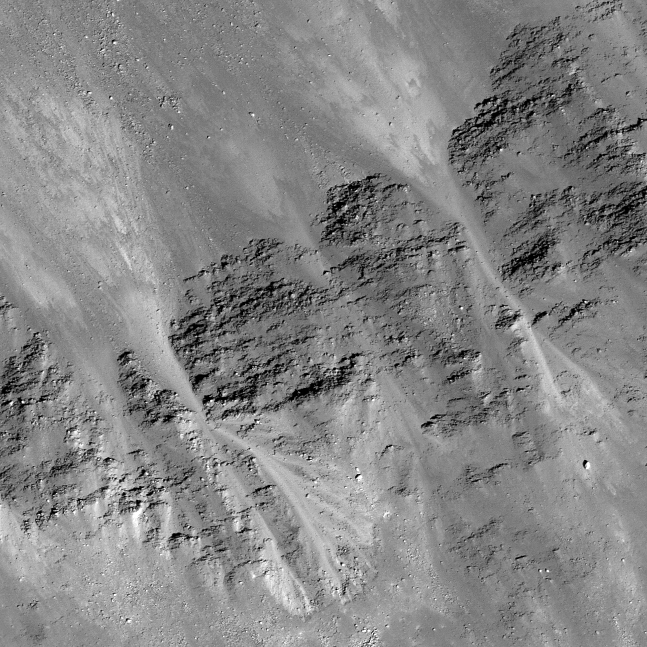
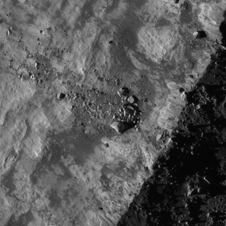
Gravity is winning as boulders erode and ultimately tumble down from the rim of Moore F (23.8 km; 37.29°N, 185.03°E), in the north farside highlands. 862 meter-wide field of view from LROC NAC mosaic M1156517189LR, LRO orbit 22390, May 18, 2013, spacecraft and camera slew 11.24° from nadir, 84.67° sunset incidence angle, resolution 1.49 meters from 146 km over 37.45°N, 186.59°E [NASA/GSFC/Arizona State University].
H. Meyer
LROC News System

Moore F is located in the highlands of the lunar farside. Its well-defined rim, steep walls, and the predominance of boulders suggest that it is quite young.

Over time, micrometeorite bombardment, the shock from more recent impacts, and other erosional processes break down the rock that composes the crater rim, walls, and floor.

The result will eventually be a smoother, more subdued appearance.  The many large blocks suggest that Moore F has only just begun to break down.

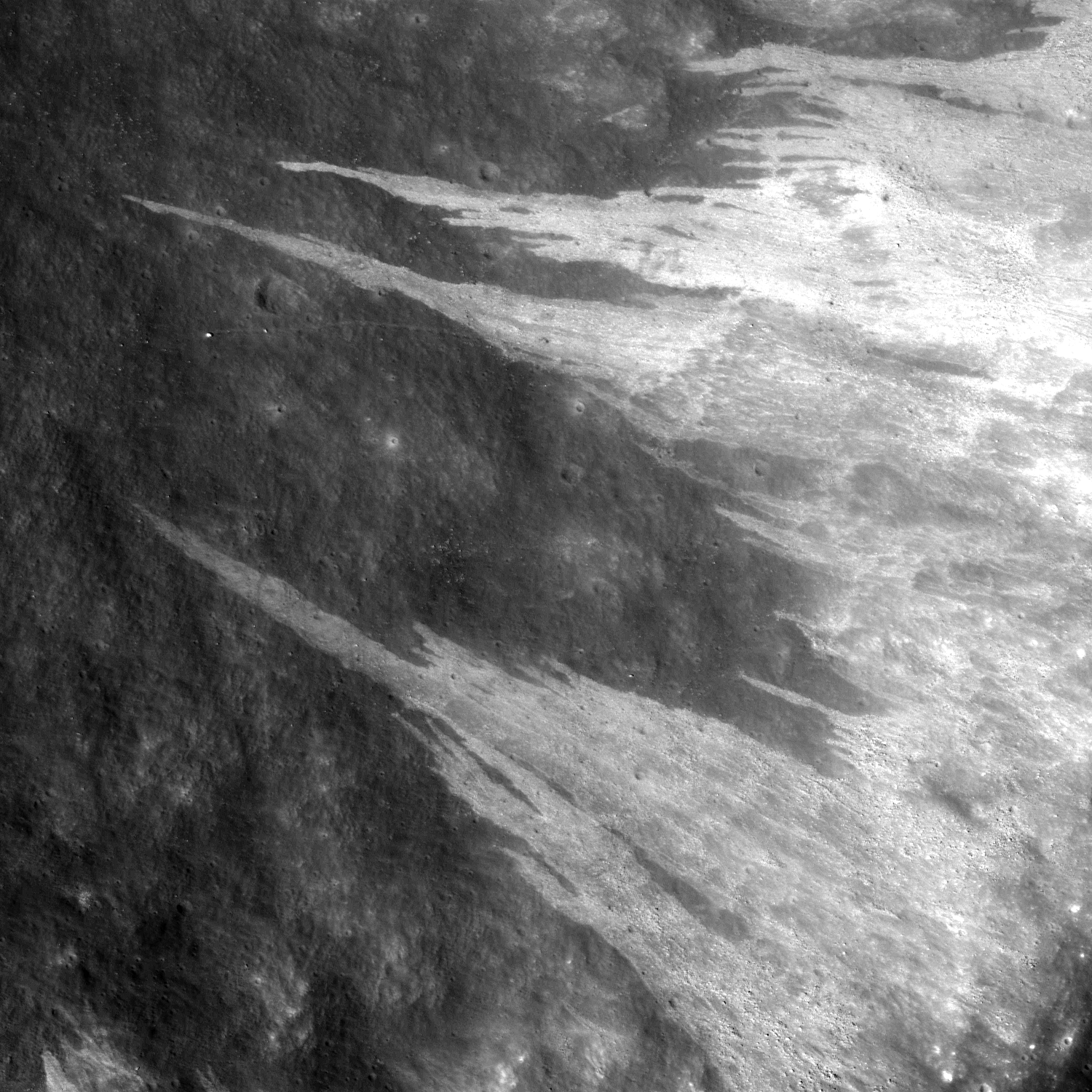
The impact process left Moore F with exquisite impact melt, abundant terracing, and a stunning central uplift, but a closer look reveals subsequent modification courtesy of gravity that has yielded even more entrancing beauty in the flows streaming down its walls, as in the NAC image below. 
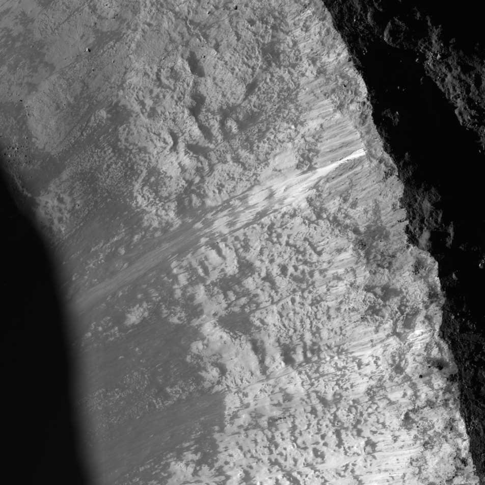
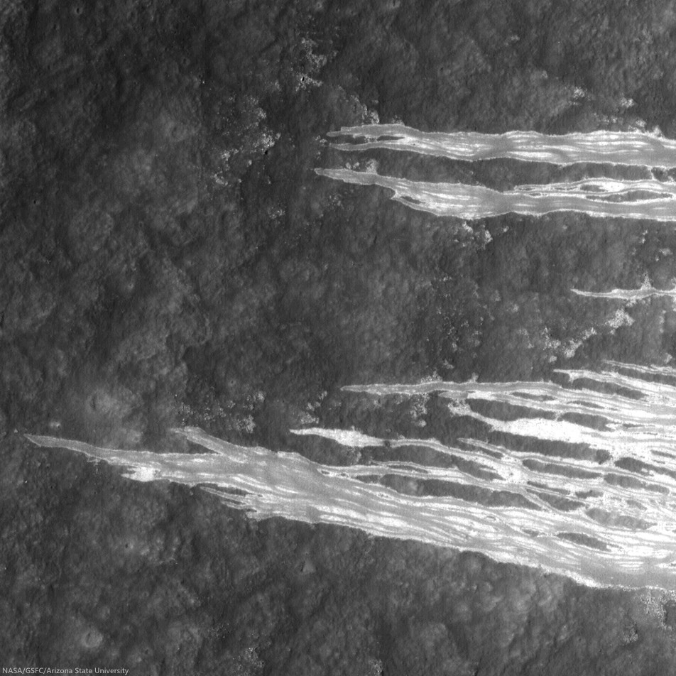
LROC NAC image displaying granular flows in the wall of Moore F highlighted by the dramatic lighting of a low sun. Downhill is to the southeast (bottom left). Image width is approximately 8 km [NASA/GSFC/Arizona State University].
The streaks we see on the walls of Moore F in the image above are likely made of granular material that acted like a fluid as it slid downslope. But how do we know if the flows formed by the downslope movement of dry, fine-grained material?

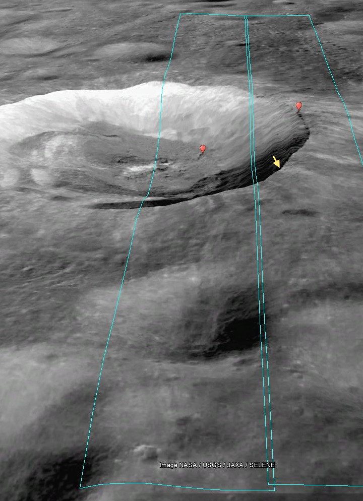
Footprint of LROC NAC observation M1156517189L & R, LRO orbit 22390, May 18, 2013 [PDS/Google Earth].
The sources of the flows can be traced to specific locations and outcrops along the rim of the crater, suggesting that this is material from the rim that was disturbed and flowed downslope. The slightly braided appearance suggests multiple depositional episodes. These episodes could have been triggered by collapsing material from the rim or wall, boulders (like those in the opening image) knocking material loose as they hurtle downhill, or by shockwaves from nearby impacts.

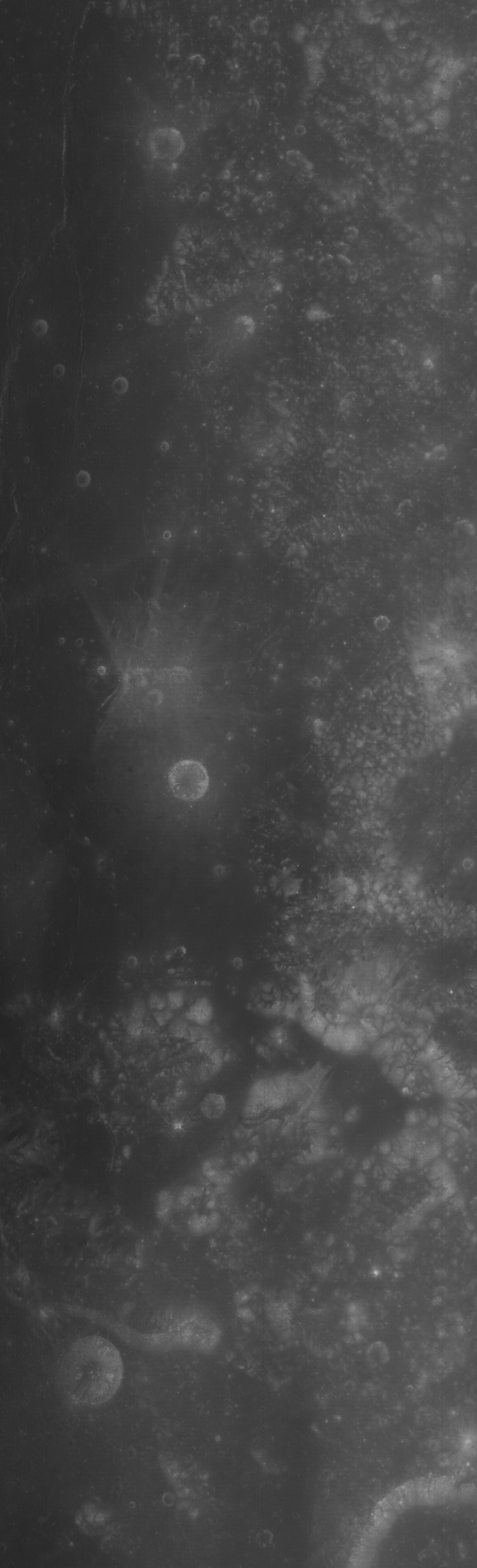
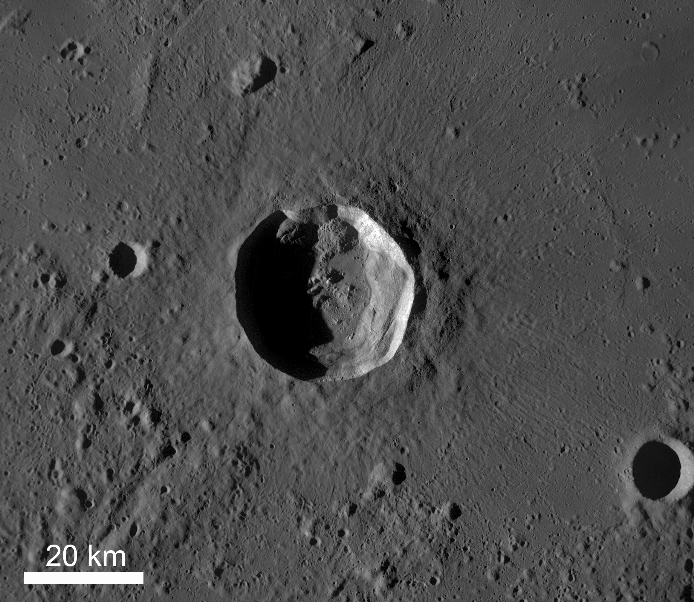
This "real color" false color LROC WAC-derived 155 km field of view, combining Normalized Reflectance with a touch of RGB beta natural coloring, shows the wide dispersal of bright ejecta from Moore F, overwhelming the topography of older, nearby larger craters in the farside highland terrain [NASA/GSFC/Arizona State University].
Investigate this incredible NAC mosaic HERE.

Related Posts:

Wednesday, June 4, 2014

The tender tendrils of Hipparchus G

Beautiful granular flows on the steep eastern wall of Hipparchus G crater (13.68 km; 5.03°S, 7.4°E) brought fresh debris from the rim down downslope to the left. Field of view about 1 km from LROC NAC observation M183474839L, LRO orbit 12135, February 10, 2010; 38.77° incidence angle, resolution 1.02 meters from 100.52 km [NASA/GSFC/Arizona State University].
Raquel Nuno
LROC News System

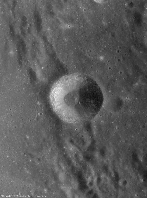
Hipparchus G (13.68 km; 5.03°S, 7.4°Eis a high reflectance crater formed on the rim of the much older and degraded Hipparchus crater, in the nearside Southern Highlands.

While these streamers may look like mudslides, they are actually dry solids that underwent fluidized flow; these features are called debris flows and are seen in many craters on the Moon.

Why do these flows look like tendrils? As the debris was flowing downhill, in some places it encountered obstacles, such as a rougher surface or large boulders. If the flow had enough energy it found its way around the obstacle, as seen by the curved path taken by these streams, if the obstacle was too large and the debris was too thin, it came to a halt.

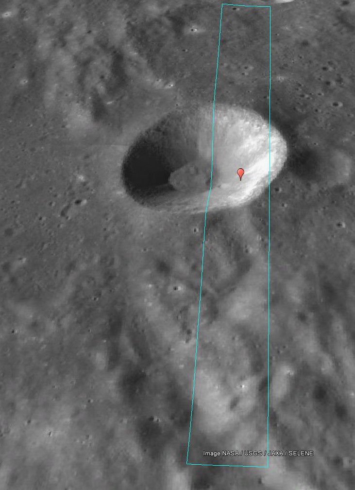
Footprint of LROC NAC observation M183474839L, from 100 km, LRO orbit 12135, February 10, 2010, This PDS projection, even on the outdated lunar DEM available in Google Earth, show the true profile of Hipparchus G, not readily discerned from directly overhead. The higher east rim, nested in the rim of ancient Hipparchus, rises 3.2 km in elevation above the smaller crater floor, may have originally brought up a variety of materials of contrasting reflectance [NASA/JAXA/GSFC/USGS/Arizona State University].
Among the highest resolution LROC Wide Angle Camera observations of Hipparchus G yet available from LRO, actually a mosaic of two sequential passes on November 16, 2010; 47.35° incidence angle, resolution 61 meters from 44 km [NASA/GSFC/Arizona State University].
These flows really stand out from the rest of the crater wall material because they have a higher reflectance. Higher reflectance indicates that this material has been exposed to less space weathering than the crater wall, so this flow happened long after the formation of this crater.

Related Posts:

Thursday, September 5, 2013

Clerke

Granular fine falls on the wall of Clerke crater
Granular debris flows along the interior wall of Clerke crater, marking a stark contrast in surface reflectance. The crater floor is upper left of this approximately 2 km-wide field of view from LROC Narrow Angle Camera (NAC) observation M183332397R, LRO orbit 12116, February 8, 2012, incidence angle 43.96° full resolution 1.32 meters per pixel from 132.84 km over 20.63°N, 29.76°E [NASA/GSFC/Arizona State University].
Sarah Braden
LROC News System

The interior wall of the Clerke crater has many distinct flows of granular material which narrow as they reach towards the floor of the crater. The source material originates from the crater rim. The debris appear higher in reflectance compared to the rest of the crater wall, likely due to differences in maturity and perhaps grain size of the material.

The debris flows may be younger than the crater floor and walls if the flow was instigated by seismic shaking or a nearby impact crater. The flow may contain more boulders, which may cause the higher reflectance.

The crater is 7 km in diameter, located at 21.7°N, 29.8°E near the Taurus Littrow Valley where Apollo 17 landed on December 11, 1972 and is named after Agnes Mary Clerke.

M170361778-8558CE_566nm-Clerke
Clerke under a high Sun, a low illumination angle of incidence (25°), resulting in an image emphasizing surface reflectance over topographic variation. From an LROC Wide Angle Camera (WAC) monochrome (566 nm) mosaic of two sequential orbital observations captured September 11, 2011; average resolution 60 meters per pixel from 41 km [NASA/GSFC/Arizona State University].
Agnes Mary Clerke was key in increasing public interest in astronomy and astrophysics. She wrote the book A Popular History of Astronomy During the Nineteenth Century (published in 1885), which was written for the non-astronomer. This publication brought her recognition from the astronomy community. Later she wrote Problems in Astrophysics which described her ideas on the direction for future research involving the Sun, stars, and nebulae. Ms. Clerke possessed a great ability to synthesize research results, look at the "big picture" of science, and communicate those ideas to the public as well as scientists. She was elected an honorary member of the Royal Astronomical Society, and an award given (at the time) to only three other women: Caroline Herschel, Mary Somerville, and Margaret Lindsay Huggins.

Sunrise topography of Clerke
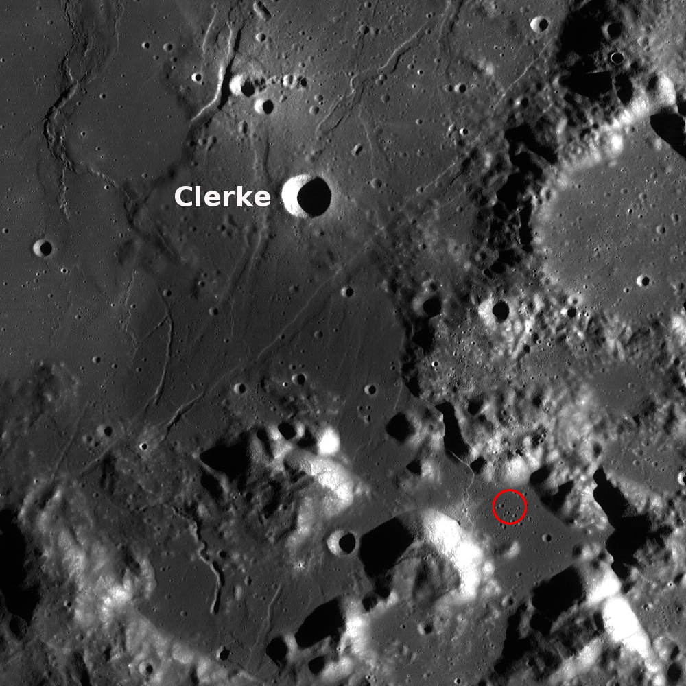
Alternately, Clerke under a low Sun, and thus a high illumination angle of incidence, resulted in this view of the crater and vicinity in an image greatly emphasizing topographic variation over surface reflectance. LROC GLD100 meter per pixel mosaic, an LROC WAC context showing the proximity of Clerke to the Apollo 17 landing site (red circle) in the Taurus Littrow valley [NASA/GSFC/Arizona State University].
Explore the rest of Clerke crater and the surrounding area in the full NAC, HERE.

Related Images:
Caroline Herschel Crater
How Recent?
Dawes
Dichotomy
Diversity

Wednesday, February 6, 2013

Debris Flows in Kepler Crater

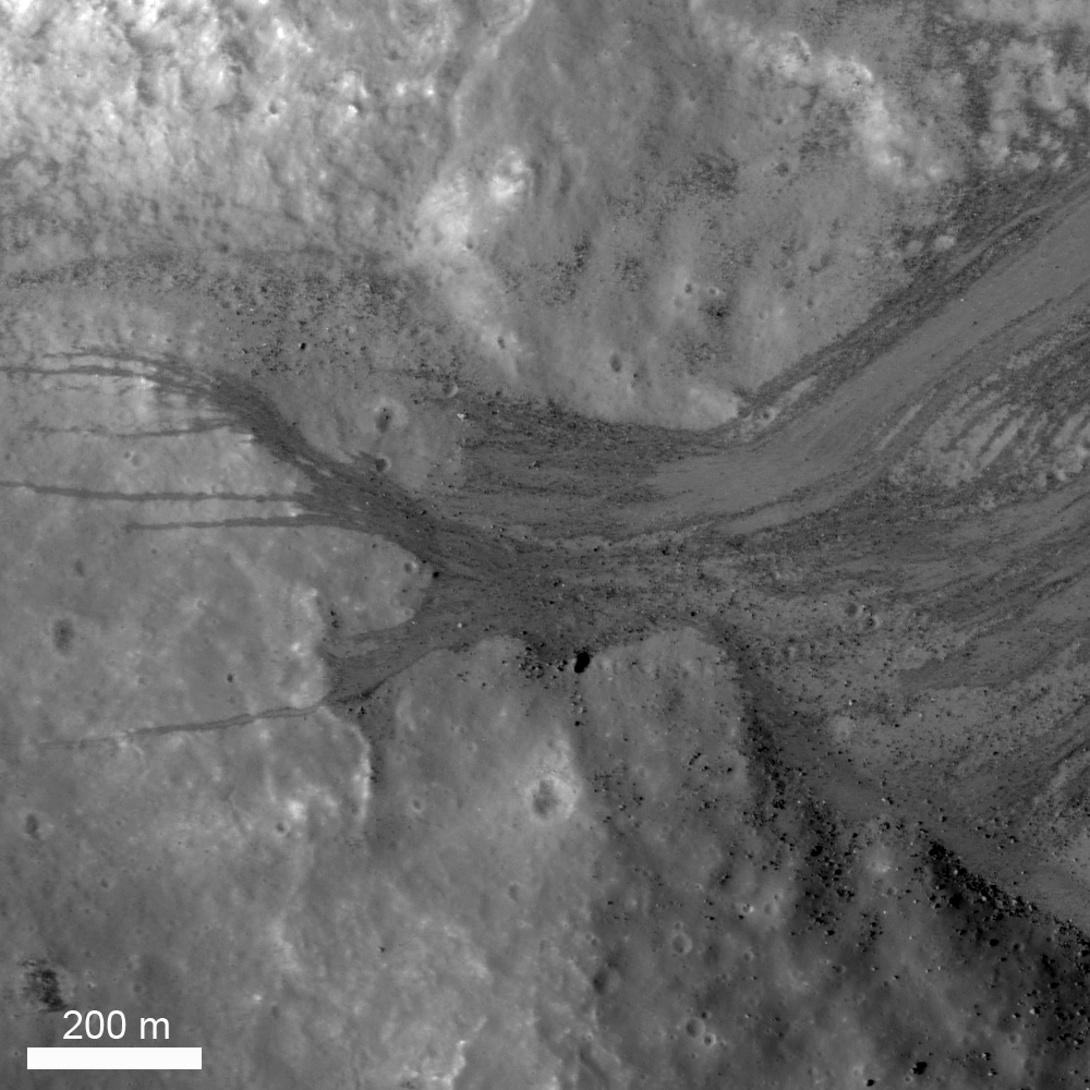
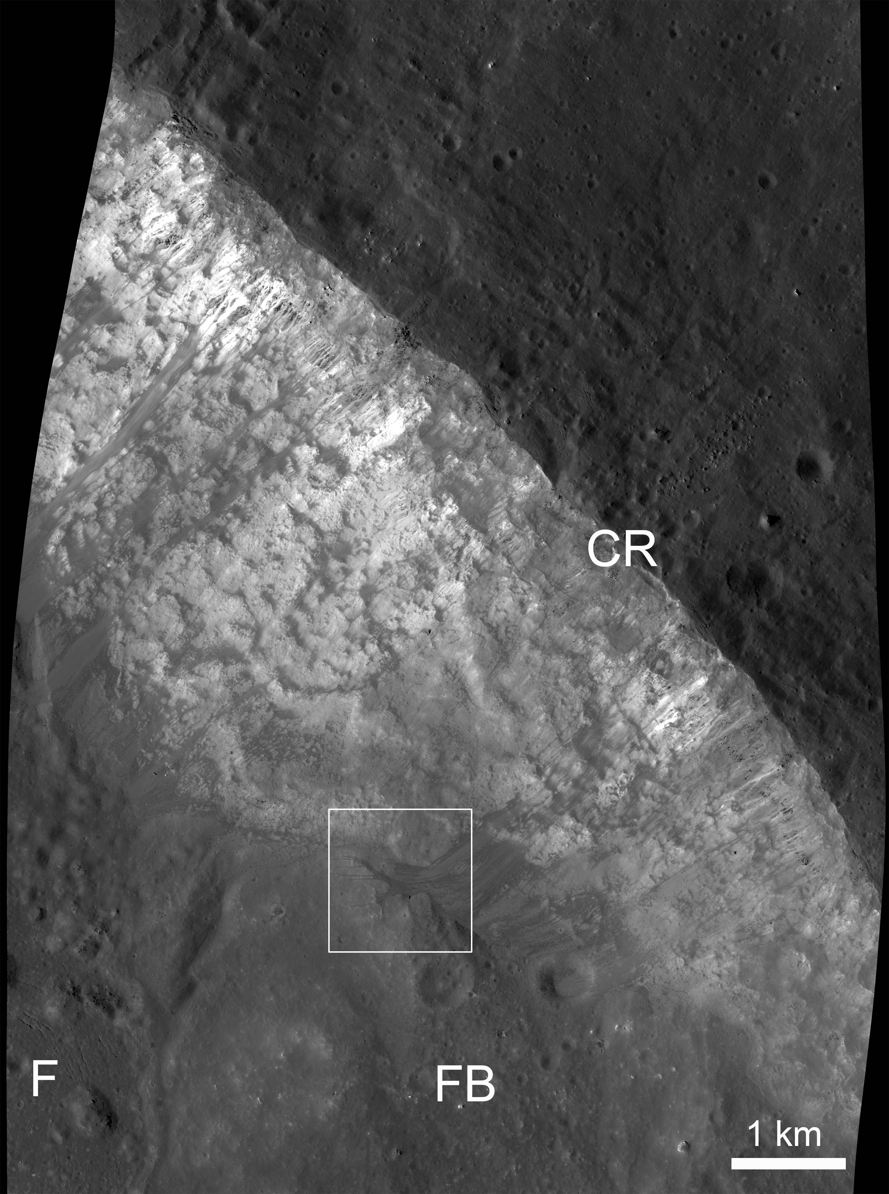
The lower part of the northeast wall of nearside landmark crater Kepler. Loose material is sliding down from near the rim crest (upper right) and ponding on a part of the crater floor. LROC Narrow Angle Camera (NAC) M104755664L, LRO orbit 595, August 12, 2009; resolution 1.27 meters from 119.86 km [NASA/GSFC/Arizona State University].
Jeffrey Plescia
LROC News System

The Featured Image shows the lower slopes of the northeast inner wall of the Kepler impact crater (8.1°N, 322.0°E, diameter 32 km). Loose material often moves down the steep slopes of impact craters, and there are many examples of lunar landslides. The observation that such landslides exist on the Moon were first made during the Apollo program using the images taken from the Command Module while it was in lunar orbit.

This landslide is composed of a range of particle sizes from well below the pixel scale (1.25 m/pixel) to boulders as large as 20 m. Debris slid down the walls and spread out across the crater floor being locally deflected by obstacles on the crater floor. The crater wall has a slope of about 33°.

Another similar pond at the bottom of a long granular debris flow, this one on the southeast wall and floor of Kepler but captured two years later, and at a high resolution opportunity afforded by spacecraft maneuvers in late summer 2011.  LROC NAC M168455361R, LRO orbit 9959, August 20, 2011; 29 cm per pixel, at 36.67° angle of incidence from 22.92 km [NASA/GSFC/Arizona State University].
In the center left of the (top) image, a coarse debris flow was diverted around local topography into several narrow (up to 12 meters wide) flows that extend an additional 400-500 m across the slope and crater floor. Boulders accumulated at the base of the debris flows after rolling all the way down the slope. Debris flows occurred numerous times in this location, as well as many other locations around the crater wall. The material acted as a fluid as it moved downslope flowing around and over obstacles and ponding behind obstructions despite the fact that there was no water present.

View of the northeast crater wall of Kepler, the field of view in the LROC Featured Image outlined by the white box. Legend: F: crater floor, FB: fault block which has slide down the crater wall, CR: crater rim. LROC NAC M104755664L [NASA/GSFC/Arizona State University].
Above is a reduced resolution version of a larger area around the image shown above (outlined by the white box). Several bright debris flows are observed along the inner crater wall. The area around Kepler crater is illustrated in the wide angle image below.

Kepler Crater (32 km diameter) and surrounding plains, afternoon lighting. LRO Wide Angle Camera (WAC) M117738837M. [NASA/GSFC/Arizona State University].
View the entire LROC NAC frame, HERE.

Oblique view of Kepler from on-board Apollo 12, November 1969; 70mm B/W, AS12-52-5547 [NASA/JSC/LPI].
In the shadow of Copernicus, Kepler's bright, widely distributed ejecta and rays would more easily stand out to the naked eye if the similarly youthful and larger crater to its east did not exist. From one of the incredible telescopic mosaics, this one of a Full Moon, by Yuri Goryachko and ASTRONOMINSK team, March 29, 2010.
 Related Posts:

How Recent?
Granular Flow
Dawes
Debris Channels
Kepler's Rim

Thursday, October 18, 2012

Debris flow at Clavius E: How Recent?

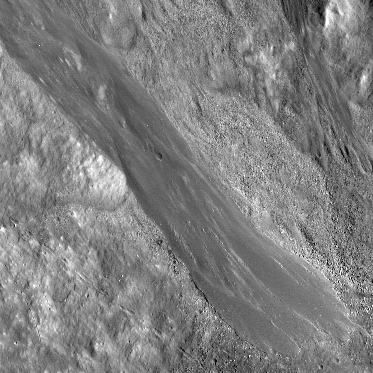
Granular debris flows cascade down the wall of a young crater. Geologically these are young features - but how young? Approximately a 696 meter-wide field of view from LROC Narrow Angle Camera (NAC) frame M185961505L (downslope to lower right, north is down), spacecraft orbit 12483, March 9, 2012; resolution 60 centimeters per pixel from 57.29 kilometers, angle of incidence 53.52° [NASA/GSFC/Arizona State University].
Lillian Ostrach
LROC News System

Granular debris flows are found in many young impact craters and are the products of mass-wasting. Over time, material from the crater rim and walls erodes into successively finer particles, and when the influence of gravity becomes too much this material moves downhill. Observations of mass-wasted material are prevalent in the LROC NAC images, and the detailed morphology of the flows are striking. Examples are composed of low-reflectance material when compared to the crater walls, fine-grained fingers superposing coarser-grained flows, as well as meandering flows interweaved with one another. Although debris flows on the Moon exhibit many spectacular morphologies and features, the presence of the flows represents relatively recent activity of a geologic process that is still active today.

Two kilometer-wide field of view, resampled to 12 percent of original NAC frame, with north at top, shows the granular flow in context with the southeastern rim, wall and floor of Clavius E. Boulder trails, shown at much greater visibility through the LROC Image Browser, abound [NASA/GSFC/Arizona State University].

Some debris flows show evidence of multiple formation events in the form of superposed lobes of material or braided channels, and today's Featured Image is no exception. The debris flow descending across the center of the image (51.725°S, 347.058°E) has braided, meandering channels at the upper left (uphill) that gradually disappear downslope into larger lobes of material. The lobes are most easily distinguished at the lower right corner of the image (downhill) where the flow terminates, and there are at least three individual flow units (and thus separate depositional events) that can be distinguished by a faint outline of higher-reflectance material. However, what makes today's flow special is the ~13 m diameter impact crater superposed on the flow because both of these features are geologically young. The presence of an impact crater on a debris flow suggests that the flow may not be geologically active at present and may not have been geologically active for some time (although constraining that time period is difficult).

Simulated view north over Clavius E (51.509°S, 347.278°E, ~15 km diameter), from a perspective originating 130 km over Clavius proper, south of Tycho. LOLA elevation model under LROC 100 meter Global WAC mosaic, ILIADS application from NASA Lunar Mapping and Modeling Project (LMMP).
Because the debris flows form in the young, least-degraded craters and do not often exhibit degradational features (such as superposed impact craters), determining the absolute age of the flow is impossible because the flow may have formed 100 million years ago or yesterday. However, the presence of a superposed impact crater on a debris flows constrains the relative age of the flow because the crater must have formed after the flow was deposited. Crater counting techniques are frequently used by lunar scientists to estimate an absolute age-date for a surface, but there have to be craters to count! For the moment, we must be satisfied knowing that enough geologic time has passed for the flow pictured above to accumulate one crater. Alternatively, LROC could target this debris flow (or others like it) and acquire additional observations over time in an attempt to understand the geologic history of these spectacular features. Because who knows - maybe a seismic event (moonquake, impact) will dislodge material upslope to flow downhill that erases the crater!

Can you find additional impact craters superposed on the debris flows in the full LROC NAC, HERE?

Hint: there is at least one other crater superposed on a debris flow in the opening image.

Related Posts:
Debris Channels
Lunar landslides!
Dawes
Granular Flow

Thursday, May 17, 2012

LROC: Multiple Flow Lobes

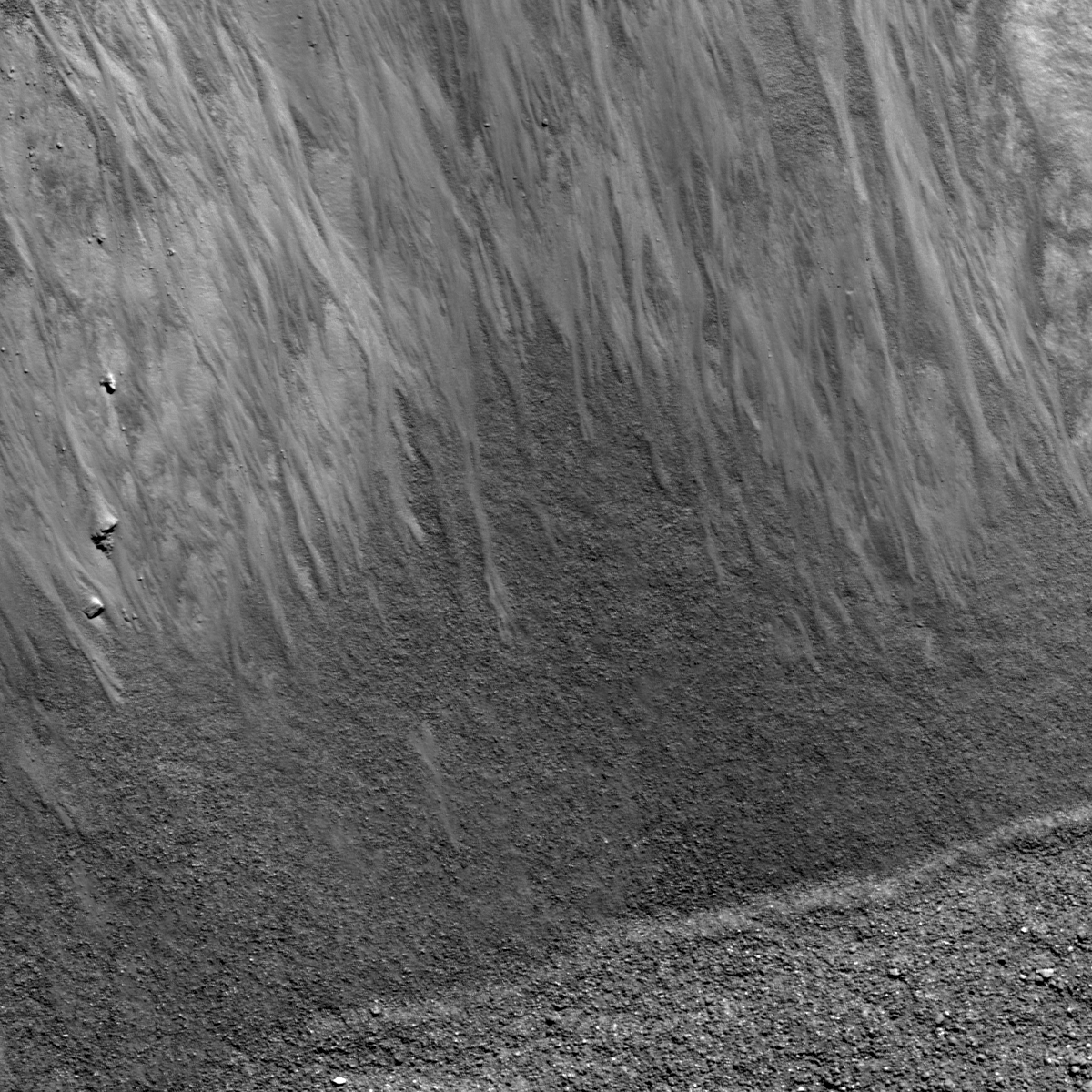
Multiple flow lobes on the northern interior slope of Furnerius A. Field of view 756 meters, LROC Narrow Angle Camera (NAC) observation M187848982R, LRO orbit 12747, March 31, 2012. Sunlight is from northeast, resolution 0.63 meters. View the 1200 x 1200 pixel LROC Featured Image, released May 17, 2012, HERE [NASA/GSFC/Arizona State University].

Hiroyuki Sato
LROC News System

Today's Featured Image highlights granular flows on the northern wall of Furnerius A crater (11.21 km in diameter), located between Mare Fecunditatis and the South Pole-Aitken basin. At the bottom of the image, a diagonal boundary delineates between the coarse blocky crater floor (relatively bright) and the still coarsely textured, but relatively darker surface, which is part of the sloping crater wall. From the top of the image extend a number of relatively bright granular flows. At the end of each flow, the flow lobe is visible against the darker, coarsely textured crater wall. Notice that the sunlight is from the right side, thus each flow unit is positive relief (not negative relief) on the top of preexisted slope.

Foreshortened contextual view of the Featured Image detailed within the 4.1 kilometer-across field of view swept up in LROC NAC frame M187848932R, March 31, 2012 [NASA/GSFC/Arizona State University].
These granular flow features are commonly observed inside the fresh crater walls on the Moon. Little by little slope failures degrade the steep walls, which enlarge the apparent diameters of the craters, as well as create shallower crater floors. Over long periods of time, small impacts also destroy any sharp relief features, and someday Furnerius A will be transformed into a crater like Furnerius C (left side crater in the image below). Since the Moon's surface has no water or wind weathering (erosion), the Moon is the best natural museum to learn about the long term evolution of crater forms.

Surrounding area of Furnerius A crater in WAC monochrome mosaic (100 m/pix). Image center is 33.49°S, 59.03°E. The locations of full NAC frame (blue box) and the area highlighted in the LROC Featured Image released May 17, 2012 (yellow arrow) are indicated [NASA/GSFC/Arizona State University].
Nearly the same field of view at a higher angle of incidence, perhaps a day after local sunrise (inclination angle 69.65°), reveals more relief, and with the addition of data derived from the LROC WAC Digital Terrain Model, Furnerius A is seen as being on the edge of Furnerius proper to the southeast. LROC Wide Angle Camera (WAC) observation M177251343 (604nm), LRO orbit 11257, November 30, 2011; resolution 69.7 meters from 51 kilometers [NASA/GSFC/Arizona State University].
Explore the beautiful flow lobes in the full NAC frame yourself! 

Related Posts:
Detour!
Lunar landslides!
Dark streaks in Diophantus crater
Rock avalanche in Robinson crater

Wednesday, May 16, 2012

LROC: Meandering

Western slope of Fabbroni crater cavity; field of view width 1200 meters (view the original 1200 px LROC Featured Image released May 16, 2012 HERE), downslope is to the east. Unreleased LROC Narrow Angle Camera (NAC) observation M188050156R, orbit 12776, April 2, 2012; 1 meter resolution [NASA/GSFC/Arizona State University].
Hiroyuki Sato
LROC News System

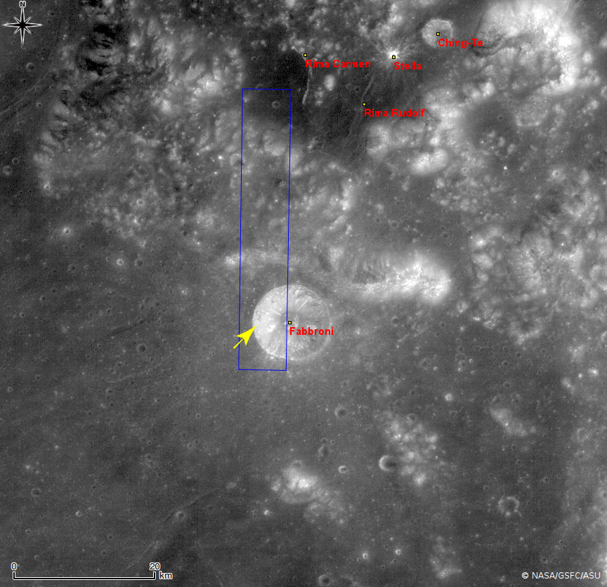
Young fresh lunar craters always present sharp and spectacular features. Today's Featured Image highlights the western slope of the Fabbroni crater located at the north edge of Mare Tranquillitatis, near the Apollo 17 landing site. Slope failures have created many narrow channels of granular material flowing down toward the center of the crater.

The reflectance of a material changes depending on various factors, such as the composition, grain size, and maturity. The crater cavity slope is composed of multiple layers and their debris. The mixtures of these materials exhibit various reflectances, which bring the flow features into sharp contrast.

Fabbroni crater and immediate vicinity, near the confluence of Mare Serenitatis and Tranquillitatis. Image cropped from LROC Wide Angle Camera (WAC) monochrome (604nm) mosaic swept up during three sequential orbital passes December 2, 2011; resolution 51 meters from 36.2 kilometers, centered on 18.65°N, 29.27°E, southwest of the landing site of Apollo 17 in 1972. The area highly resolved in the LROC Featured Image released May 16, 2012 is designated by the yellow arrow. The original context image accompanying the Featured Image release, showing a labeled, larger area can be viewed HERE [NASA/GSFC/Arizona State University].

Open up the full NAC frame and explore these spectacular meandering flows by yourself, HERE

Related Posts:
Rock avalanche in Robinson crater
Granular Flow
Dichotomy
Lunar landslides!
Marius A
Pytheas


HDTV still image from above 100 kilometers captured by Japan's lunar orbiter SELENE-1 (Kaguya), released in 2008 shows Fabbroni (left of center bottom) in relation to Mare Serenitatis on the east and Taurus Littrow valley (cul de sac surrounded on three sides by mountains) explored by Cernan and Schmitt of Apollo 17 in December 1972. View the larger image HERE [JAXA/NHK/SELENE].

Tuesday, May 15, 2012

LROC: Dark Material Flows

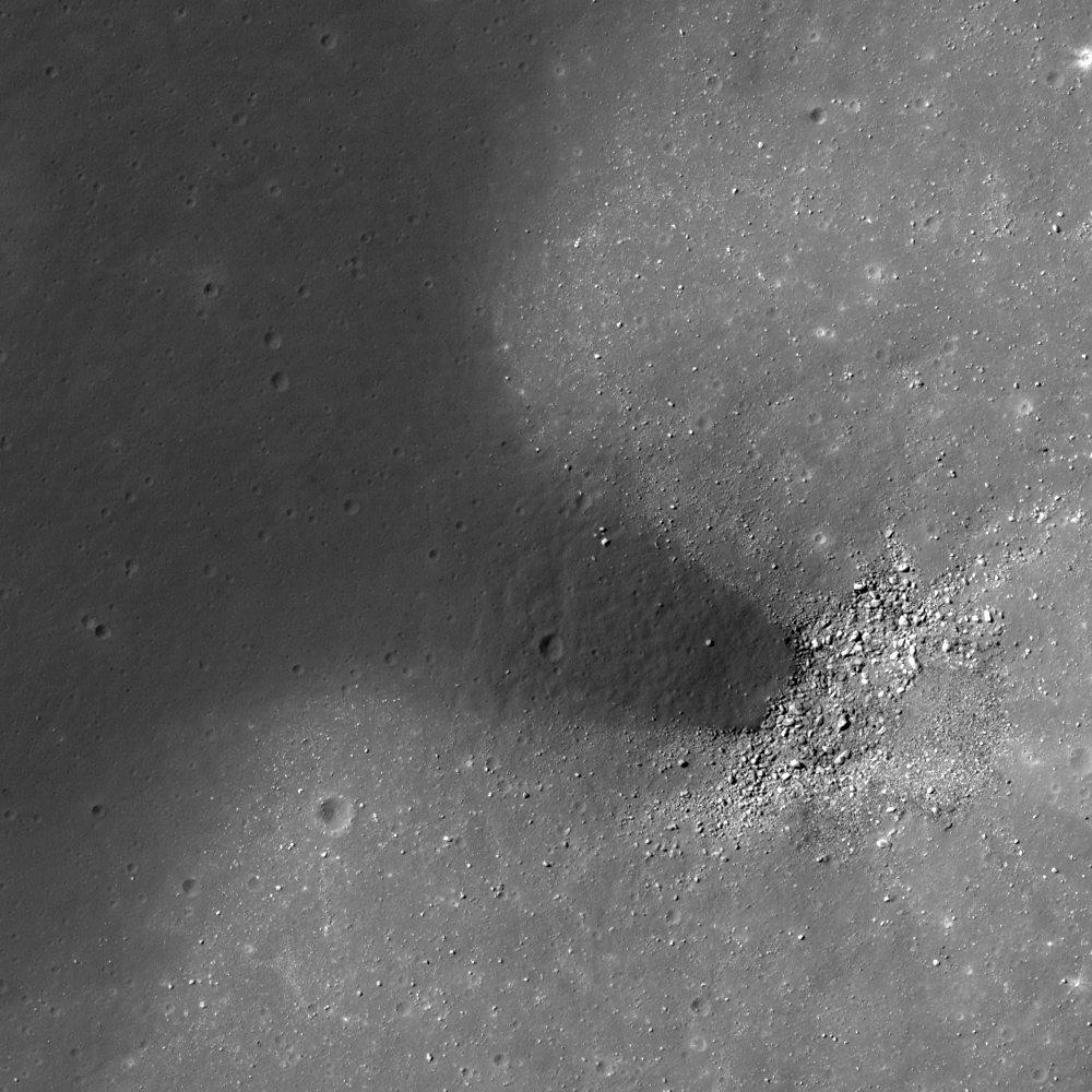
Low reflectance material inside a degraded small crater south of Dopplemayer J near the center of Mare Humorum. Field of view is 290 meters. LROC Narrow Angle Camera (NAC) observation M168476297L, orbit 9962, August 20, 2011; angle of incidence 41.54° at 40 centimeters per pixel resolution from 23.77 kilometers. View the 500 meters wide field of view in the LROC Featured Image released May 15, 2012 HERE [NASA/GSFC/Arizona State University]
Hiroyuki Sato
LROC News System

Today's Featured Image shows off a degraded small crater (400 m in diameter) that appears to have been partly flooded by a low reflectance material. This crater is found 1.5 km south of the southern rim of Doppelmayer J crater (5.68 km in diameter), in Mare Humorum. The boulder-rich portion in the image corresponds to the bottom of an unnamed small crater. Following the slope of this small crater cavity, the low reflectance material appears to have flowed in a southeast direction. The distal edge of this dark deposit is on the top of several boulders, indicating that the small crater preexisted before the emplacement of the dark material. What is this material? Where did it came from?

One likely answer is that an impact melt flow from Doppelmayer J invaded this crater. However, the deposit does not have any cracks nor stream lines which are typical melt flow features. Perhaps a long period of micro-meteorite bombardment degraded the original surface textures disguising the true origin of this deposit.

Area surrounding Doppelmayer J and satellite craters in Mare Humorum, LROC Wide Angle Camera (WAC) monochrome mosaic (100 m/pix), centered near 24.53°S, 318.81°E. The locations of full NAC frame (blue box) and the area highlighted in the Featured Image released May 15, 2012 designated by the yellow arrow [NASA/GSFC/Arizona State University].
Explorer this dark feature and surrounding geology in the full NAC frame yourself, HERE.

Related Posts:
Herigonius K Impact Melt Flow
Impact melt tongue
Rootless impact melt flows
Splash and flow
Impact Melt Lobes

Friday, January 27, 2012

LROC: Pytheas

A lovely combination of layered mare basalt, granular flow, and talus. The top of the image is down-slope. LROC Narrow Angle Camera (NAC) observation M170694505L, orbit 10289, September 15, 2011; image field of view is 735 meters, pixel scale of 0.49 meters per pixel from 45.53 kilometers. See the much larger full sized LROC Featured Image HERE [NASA/GSFC/Arizona State University].
Sarah Braden
LROC News System

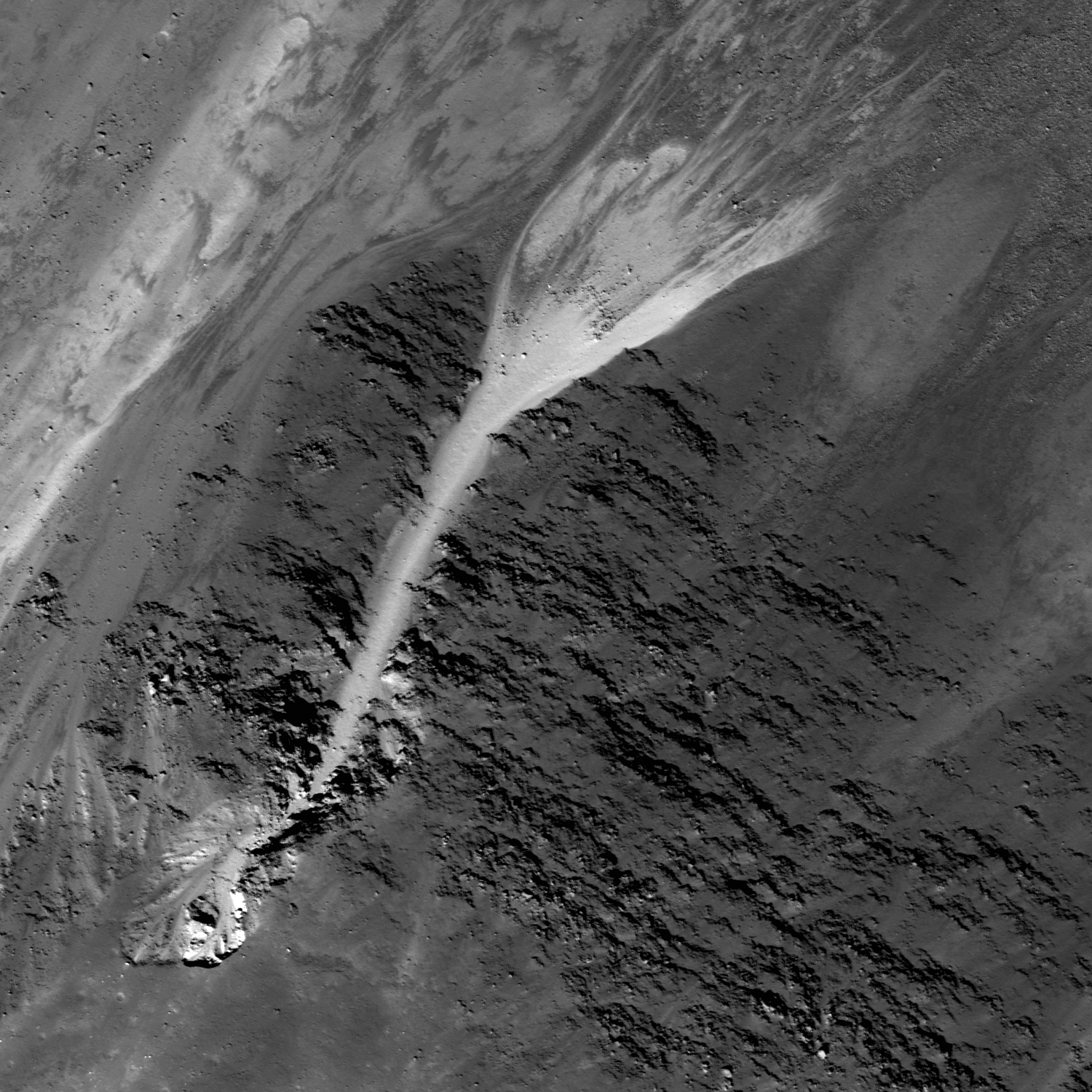
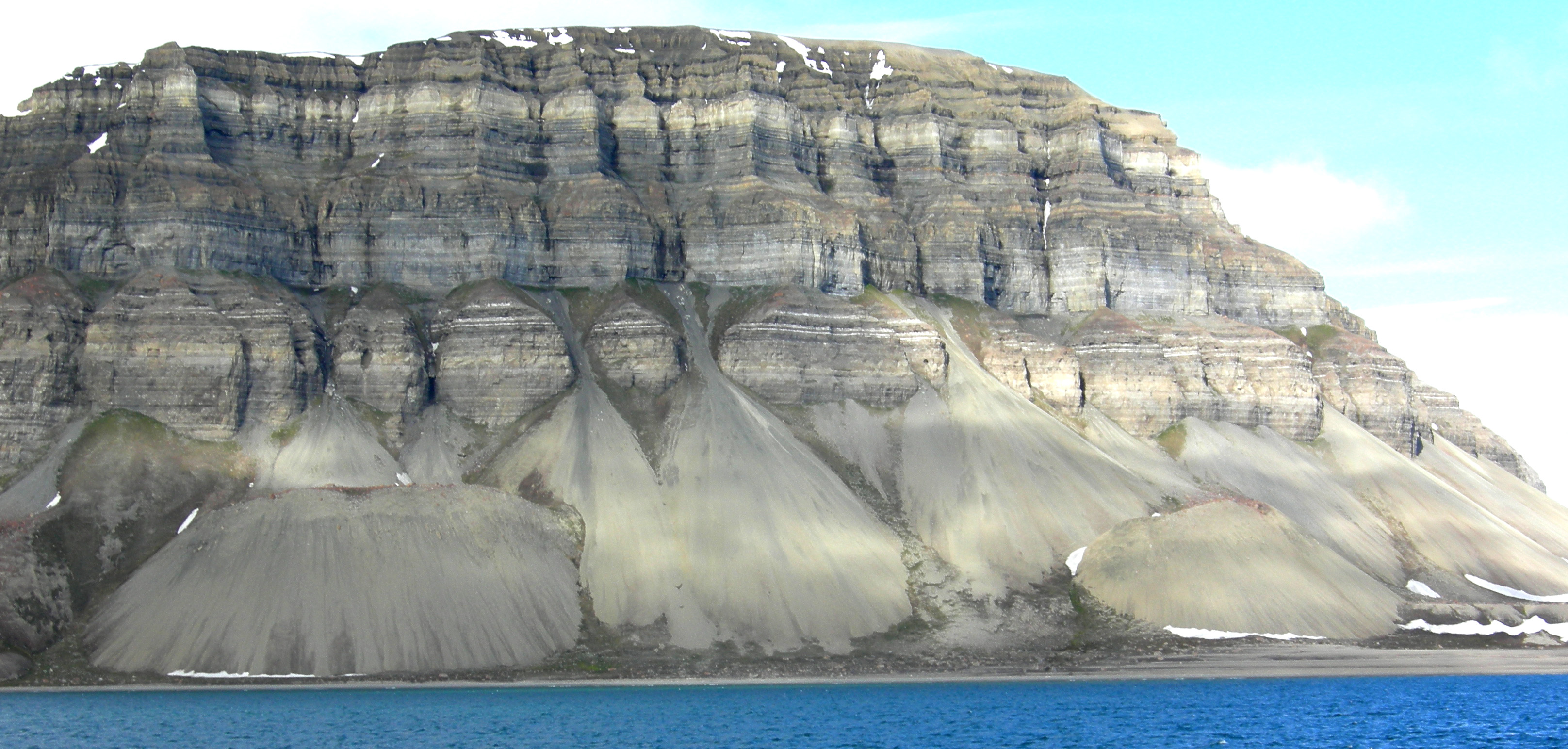
Inside the southern rim of the crater Pytheas (20.55°N, 20.6°W) is a great combination of layered mare basalt, granular flow, and talus. In the bottom left hand corner of the Featured Image you can see the details of erosion where granular material fell away from the rest of the surface near the rim. The high reflectance (bright) tendril of material flowed in a narrow band over the layers of lower reflectance (darker) mare basalt, then, after clearing the basalt layers, finally spread into a wide cone of talus. Talus cones are common on the Earth, with some stunning examples that may rival the Moon's beauty. On the Moon, talus deposits are created entirely by gravity, but on the Earth wind and water play a role in their formation.

A somewhat 'twisted' view of the larger slope context of the granular flows in the Featured Image from the LROC NAC frame. The apparent floor contact is, in fact, far from the crater's lowest elevations, on the opposite side of Pytheas [NASA/GSFC/Arizona State University].
A particularly detailed LROC Wide Angle Camera (WAC) monochrome (604 nm) 66 meter per pixel resolution image of Pytheas and Pytheas D directly to its north, the topography of its interior, and exterior ejecta blanket as well as albedo chevron, stitched from three sequential orbital viewing observations under an average 54.7° incidence angle from 46.8 kilometers, November 18 and 19, 2010 [NASA/GSFC/Arizona State University].
The same LROC WAC 604 nm mosaic at 50 percent (132 meter) of its original resolution offers a fuller view of the Pytheas chevron and other rays, apparently "downwind" from the Copernicus impact. The small crater to the west of Pytheas is Pytheas A. The inset shows elevation range of the Pytheas environs from LROC's versatile QuickMap [NASA/GSFC/Arizona State University].
Pytheas and the south-central Imbrium basin clearly had their topography and appearance affected by the relatively recent arrival of the Copernicus progenitor, 800 million years ago. LROC WAC 100m Global Mosaic overlaid upon LOLA digital elevation model (v.2) in the NASA ILIADS application [NASA/GSFC/Arizona State University].
Pytheas was a Greek geographer and explorer (circa 325 BC) from a Greek colony in what is now Marseilles, France. He is especially important to lunar geology since his report on Earth's ocean tides was probably the first to associate the tides with the phases of the Moon.

Explore the entire NAC frame, HERE.

Related Posts:
Dawes
Marius A
Lava Flows Exposed in Bessel Crater

Thursday, January 26, 2012

LROC: Dawes

Layers of mare basalt affected the paths of granular material that flowed down the crater wall. The top of the image is down-slope. LROC Narrow Angle Camera (NAC) observation M157418698RE, orbit 8333, April 14, 2011; field of view 546 meters and the pixel scale is 0.4 meters/px from an altitude of 38.6 kilometers. View the full size LROC Featured Image HERE [NASA/GSFC/Arizona State University].
Sarah Braden
LROC News System

The wall of Dawes crater (17.21°N, 26.32°E) contains sections of spectacular mare basalt layering. However, mass wasting, a geologic process where material moves downhill due to gravity, has started to partially cover these beautiful outcrops.

Granular flows started above the outcrop and then flowed down the interior crater wall. As seen in the Featured Image, the topography of basalt outcrop caused the flow to deviate into narrow paths, away from a simple path flowing straight down the crater wall. As the crater Dawes ages over billions of years, the mare basalt outcrop will eventually be completely covered with granular material due to slumping of the crater's walls and more mass wasting.

The full width of LROC NAC M157418698R with the high resolution field of view in the January 25, 2012 LROC Featured Image set off by the yellow box. The slope of the south-southeastern wall of Dawes, from floor (upper left) to rim (bottom) rises nearly 2 kilometers in elevation [NASA/GSFC/Arizona State University].
Through the last release of LROC Narrow Angle imagery, all but the center swath of Dawes has been photographed at mission-optimal high resolution. The yellow arrow marks the location of the field of view in the LROC Featured Image released January 25, 2012 and the yellow rectangle the area swept up in the full LROC NAC observation [NASA/GSFC/Arizona State University].
Dawes has an asymmetrical ejecta to match the asymmetry of its rim elevation and floor. The fan of its ejecta blanket, still visible on the crater's western flank, sweeps north and crosses 'under' the color contact separating the mare of Tranquillitatis from the Serenitatis basin. Because that change is superimposed over the Dawes ejecta the crater is older, at least, than the last time (the last of many times) the ancient Serenity basin was flooded with impact melt [NASA/GSFC/Arizona State University].
WAC/topographic context image of 17.8 km diameter Dawes [NASA/GSFC/Arizona State University].
Explore the entire NAC frame, HERE.

Related Posts:
Marius A
Detour!
Dry debris or liquid flow?
Boulder Mound