 |
| Close-up of Silver Spur (bottom) shows linear “bedding” coincident with topography, suggesting it is real. Its stratigraphic significance is still unknown. From panorama of photographs taken during the initial "Stand-Up" EVA, a 360° survey of the Hadley Rille Delta Apollo 15 landing site from the top hatch of the lunar module Falcon just after midnight (UT), July 31, 1971. Dave Scott's panorama included the layered component atop Mons Hadley Delta, whose slopes 5 km east he and Jim Irwin would later sample and explore [NASA/JSC]. |
Paul D. Spudis
The Daily Planet
Smithsonian Air & Space
In northern Arizona, a spectacular region of exposed, layered rocks over 6,000 feet thick was carved by the Colorado River. Aptly called the Grand Canyon, it represents over a billion years of Earth’s history. Geologists are able to study the history of past ages in exquisite detail by reading the historical record found in that well-known natural landform. No matter the planet, geologists are always searching for layered rocks. The study of rock layers (stratigraphy, from strata, meaning rock layers) allows scientists to reconstruct the geological history of a region and over time, an entire planet.
The nature of the Moon does not lend itself well to the display of rock layers, yet considerable effort has been expended searching for outcrops. Most layered rocks on the Earth are created from water-laid or wind-blown sediments, and neither of those processes occurs on the Moon. Still, the lunar surface has been built up piecemeal by the sequential deposition of blankets of ejecta—the ground-up rock thrown out radially from the center of impact craters and basins during formation. The overlap relationship of these ejecta deposits allows scientists to reconstruct the history of the Moon, i.e., younger impact craters overlie older ones. This simple methodology has allowed us to decipher the stratigraphy of the Moon.
 |
| Exposed layering in an outcrop from the rim of the west wall of Rima Hadley (Hadley Rille). A newly inter-laced Apollo 15 image from a panorama of 500 mm black and white photographs at a range of 1400 meters away, on the opposite rim, at Science Station 9a. Dave Scott, August 2, 1971. Features in this view were successfully compared with LROC NAC observations of the area from low lunar orbit [NASA/JSC]. |
 |
| Parallel bedrock outcrops 50 km southwest of the Apollo 15 landing site, from LRO in orbit 38 years later. (From "Layers near Apollo 15 landing site,") The orbital view shows distinct outcrops occurring at different topographic levels within the rille, strongly suggesting the presence of rock layers. The image of the western rille wall by Dave Scott (above) clearly shows a layered outcrop, about 15 meters thick. Several lines of evidence suggest these lavas are the oldest in the region, about 3.84 billion years old. LROC NAC observation M113941548LE, LRO orbit 1925, November 27, 2009; incidence 59.35° at 50 cm resolution, from 46.04 km over 24.65°N, 2.42°E [NASA/GSFC/Arizona State University]. |
When the crew returned to Earth, images taken on the surface dramatically showed this layering (above, below). But this presented scientists with a puzzle. Because large impacts are highly energetic, chaotic events, how could they generate evenly spaced, regular layering? Some team members began to suspect that something else was going on. Ed Wolfe and Red Bailey of the U.S. Geological Survey made scale models of the mountain and dusted it with cement powder. They then photographed it under low, oblique illumination, similar to the lighting conditions of the landing site during the mission. Surprisingly, fine-scale linear features were evident in the laboratory “mountain” (above, right), suggesting that the “layering” seen by the astronauts on the Moon may have been an illusion, caused by the low-angle illumination of a particulate, granular surface.
 |
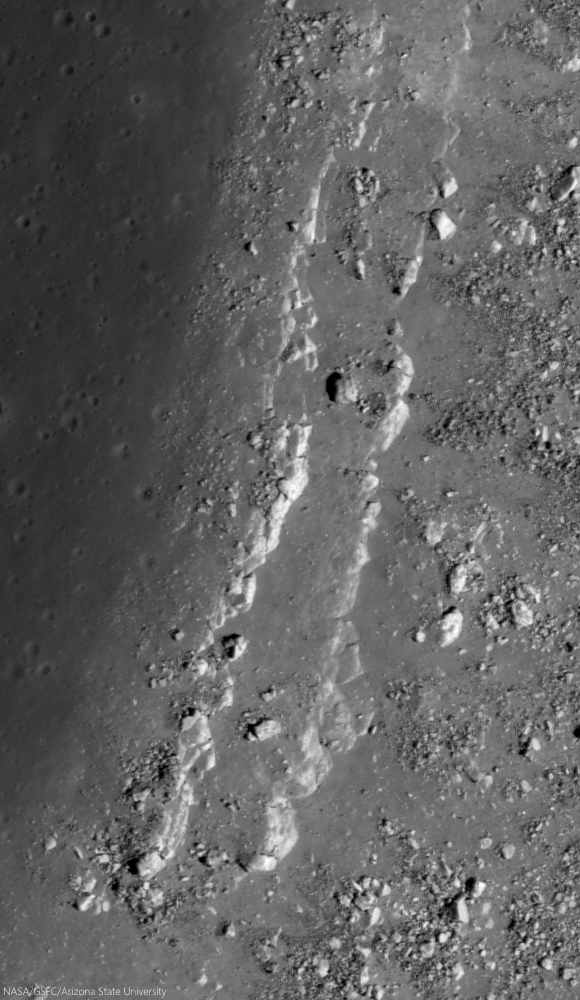
| Stratified outcrops steadily shed house-sized boulders from the central peak of Hausen crater (163.24km; 65.111°S, 271.509°E) the formation of which may have excavated among the Moon deeper vertical columns (29 km), in part because of its location on the rim of South Pole-Aitken impact basin. The deepest materials brought to the surface here might include examples of the Moon's mantle, the original material between the Moon's crust and core; time capsules of the Moon's history before the formation of Hadley and the nearside basins. LROC NAC Commissioning observation M105100555LR, orbit 643, August 16, 2009; incidence 72.47° at 48 cm resolution, from 41.38 km over 64.94°S, 271.84°E [NASA/GSFC/Arizona State University]. |
Clear and unequivocal layering was observed in the walls of Hadley Rille, a lava channel located near the landing site. In this case, it is easier to accept that we are looking at real layering—the rille cuts into a series of lava flows that cover the landing site (below). Lava flows make up layered deposits on Earth and there is no reason to assume that they wouldn’t do likewise on the Moon. In fact, the layering observed in the walls of Hadley Rille could be significant for another reason, one that may hold great scientific promise for future explorers.
 |
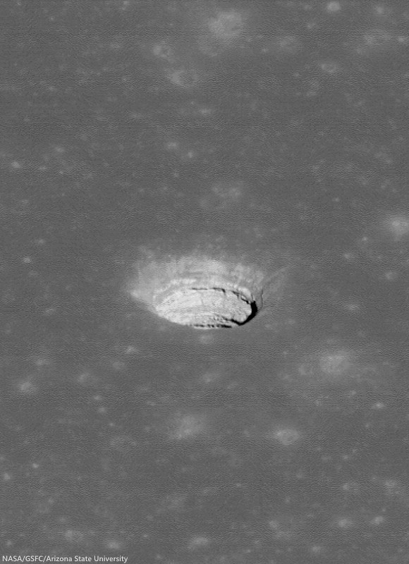
| The morphology of the "Aratus CA" collapse pit (24.55°N, 11.78°E) in Mare Serenitatis is unclear, but portions of its southwest rim include layered outcrop, perhaps including a long history of an early intermediate pre-Imbrium period and successive clues to the nature and timing of the catastrophes in our star system's early history called "the Grand Bombardment. 1.74 meter-wide field of view from LROC NAC Commissioning phase observations M104447576LR, LRO orbit 552, August 9, 2009; incidence 57.87° at 1.45 meters resolution, from 145.46 km over 25.15°N, 11.17°E [NASA/GSFC/Arizona State University]. |
It appears that such an ancient, buried regolith exists in the walls of Hadley Rille. The lowest layers consist of ancient, relatively aluminous lavas called KREEP basalts. From the dating of Apollo 15 samples, we know that these rocks formed 3.84 billion years ago. Over this layered unit is a covered interval about 10-20 meters thick (a friable, slope-forming unit, like regolith). Above this slope-former are two massive rock layers, a thick massive unit and a thin, finely layered unit. These upper two units probably consist of mare basalt lavas of the two types found at the Apollo 15 site, both of which date to around 3.3 billion years. Thus, the regolith lying between these lava flows may hold the record of more than 500 million years of solar and galactic history, an interval from the distant early portion of Solar System evolution.
 |
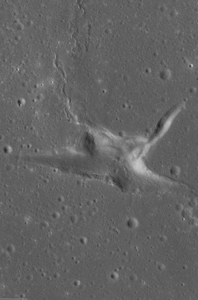
| The now-notable original oblique view of the Tranquillitatis pit crater (8.34°N, 33.22°E), revealing, layer by layer the invaluable history of an area in the universe occupied by Earth. LROC NAC observation M144395745LE, LRO orbit 6413, November 14, 2010; spacecraft and camera slewed 50.46° from orbital nadir, incidence 47.91° at 81 cm resolution, from 44.23 km over 8.75°N, 35.02°E [NASA/GSFC/Arizona State University]. |
New high-resolution images of the Moon from NASA’s Lunar Reconnaissance Orbiter show that layered deposits, such as those seen in Hadley Rille, are common in the walls of rilles and impact craters occurring in the maria, where layered lava flows are expected. Finding layering in the highlands is more problematic, although some large ejecta blocks appear to consist of layered rocks, quarried out of the crust during impact. We seek such rock layering on the Moon for the same reasons that geologists look for them on the Earth—as time capsules to be carefully opened and read, giving us new insights into the complex history of the Moon.
Originally published as his Smithsonian Air & Space Daily Planet column, Dr. Spudis is a senior staff scientist at the Lunar and Planetary Institute. The opinions expressed are those of the author but are better informed than average.
Originally published as his Smithsonian Air & Space Daily Planet column, Dr. Spudis is a senior staff scientist at the Lunar and Planetary Institute. The opinions expressed are those of the author but are better informed than average.
Related Posts:
The eroding walls of Maskelyne B (May 30, 2014)
Jagged rim on the southwest limb (April 29, 2014)
Swept slopes of Herigonius (April 8, 2014)
Stratification in a tranquil sea (March 13, 2014)
Down the Montes Carpatus (March 1, 2014)
Layering waves at Darwin C (February 7, 2014)
Rima Marius layering (June 27, 2013)
Layers near Apollo 15 landing site (August 30, 2011)
Retracing the steps of Apollo 15 (April 17, 2010)


No comments:
Post a Comment