
 |
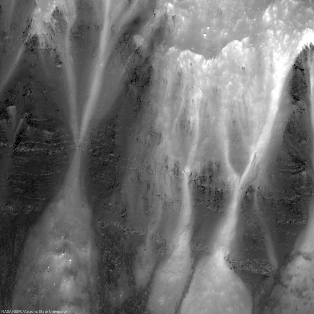
| Bright talus winds downslope through crags and crannies in the banded scarps exposed in the east wall of Dionysius crater. Horizontal lineations result from differential mass wasting of stratified rock in Mare Tranquillitatis; High (35.12°) incidence Narrow Angle Camera (NAC) mosaic, from both left and right frames, from LROC observation M137434784, orbit 5387, August 26, 2010; east is up in this 450 meter field of view, 49 cm per pixel resolution [NASA/GSFC/Arizona State University]. |
J. Stopar
LROC News System
 Dionysius crater (2.766°N, 17.297°E) is situated on the western edge of Mare Tranquillitatis (the Sea of Tranquility) and excavates both highlands (bright, high reflectance) and mare (dark, low reflectance) materials. Dark banded layers of mare peek out of the eastern wall, where mare material was disturbed by the impact that formed Dionysius crater. Bright talus trails wind downslope through crags and crannies in the dark mare scarps.
Looking closely, the mare appears banded or striated, indicating a non-uniform material. In general, mare are thought to form from large volumes of fluid lavas, much like the Columbia River Basalts in the Pacific Northwest of North America. The stratifications in the lunar mare may represent a series of lava flows in the region.
Blocky overhangs indicate areas more resistant to mass wasting and are interpreted as more coherent basaltic (mare) materials. The thinner, more finely grained layers might represent boundaries between individual lava flows or they may indicate changes in physical properties within a single flow unit. Some of the fine grained layers may even consist of paleoregoliths, ancient regolith surfaces exposed to the vacuum of space in between volcanic eruptions.
In any case, craters such as Dionysius provide windows into the subsurface structure of the lunar mare. With further study, the total thickness of the mare, as well as the structure and flow mechanics of individual mare flows may be intuited from this and other mare exposures in the walls of impact craters.
Explore the full NAC image, HERE.
Visit these other craters with layered mare exposures:
Lava Flows Exposed in Bessel Crater
Layering in Messier A
Layering in Euler Crater
Layers in Lucian Crater
Marius A
Galilaei's Layered Wall
Dawes
Dionysius Detour
LROC News System
Looking closely, the mare appears banded or striated, indicating a non-uniform material. In general, mare are thought to form from large volumes of fluid lavas, much like the Columbia River Basalts in the Pacific Northwest of North America. The stratifications in the lunar mare may represent a series of lava flows in the region.
Blocky overhangs indicate areas more resistant to mass wasting and are interpreted as more coherent basaltic (mare) materials. The thinner, more finely grained layers might represent boundaries between individual lava flows or they may indicate changes in physical properties within a single flow unit. Some of the fine grained layers may even consist of paleoregoliths, ancient regolith surfaces exposed to the vacuum of space in between volcanic eruptions.
 |
| LRO Wide Angle Camera (WAC) mosaic of Dionysius and vicinity at local sunrise (featured area, on east wall, remains in deep shadow). Embedded on the southeast 'shore' of Mare Tranquillitatis, the high angle illumination on the surface during this observation opportunity revealed local topography over material brightness, though dark rays, beyond the bright ejecta blanket, can already be seen superpositioned on higher elevations to the west and much lower elevations to the east. 604 nm wavelength view stitched from observations during three sequential orbital passes December 13, 2010; resolution ~60 meters per pixel from 44 km [NASA/GSFC/Arizona State University]. |
Explore the full NAC image, HERE.
Visit these other craters with layered mare exposures:
Lava Flows Exposed in Bessel Crater
Layering in Messier A
Layering in Euler Crater
Layers in Lucian Crater
Marius A
Galilaei's Layered Wall
Dawes
Dionysius Detour
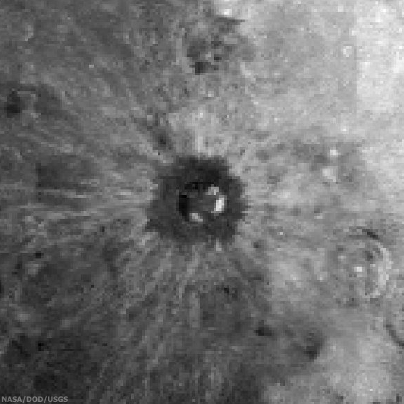 |
| Roughly 150 x 150 km sample of the lunar surface captured from the 1994 Clementine mission. Centered on Dionysius, the data is filtered for Iron Oxide (FeO), a bright constituent of the Mare Tranquillitatis southwest and considered an indication of titanium and a reliable proxy for helium-3, shows how the relatively recent impact that created Dionysius excavated and mixed the sea boundary highlands to the west and ancient basalt plain to the east. Both bright and dark materials radiate more than 100 km from the crater center and beyond the dark ejecta blanket, darker here (though bright in radar and optical data), that dark doughnut is likely a 'false negative' resulting from the spacecraft's low resolution, at this wavelength, of small and fine blocky materials. The bright talus of exposed and very ancient mare basalt layers sifting down the craters walls (particularly on the east) is prominent however, matching the the spectral data of the basin on the east. (Note how older craters, gardened by longer exposure to space weathering, are far more faded into the background [NASA/DOD/USGS]. |
No comments:
Post a Comment