Showing posts with label Mare Nubium. Show all posts

Monday, September 15, 2014

Watching craters "as they happen"

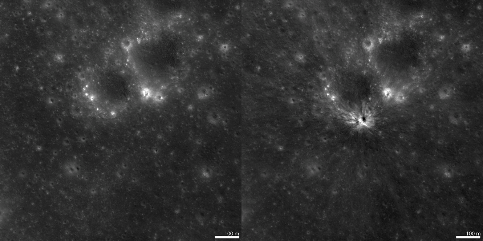
A new crater on the Moon, "found among so many." The bright flash of formation for this approximately 34 meter diameter crater was captured simultaneously by two Earthbound telescopes in Spain on September 11, 2013. From LRO, before-image LROC NAC observation M1119014742L, orbit 17116, March 27, 2013; incidence 23.66° resolution 82 cm from 84.41 km, After-image LROC NAC M1149637354L, LRO orbit 21423, March 16, 2014; incidence 23.18° resolution 91 cm from 89.12 km  [NASA/GSFC/Arizona State University].
Mark Robinson
Principal Investigator
Lunar Reconnaissance Orbiter Camera (LROC)
Arizona State University

On 11 September 2013 the "Moon Impacts Detection and Analysis System" (MIDAS) camera captured a bright 8-second long flash on the central nearside of the Moon.

This was the brightest event captured so far by the MIDAS team, and they estimated that the crater should be between 46 and 56 meters in diameter.

The LROC team targeted the reported coordinates (17.2°S, 339.5°E) of the flash and acquired several images over a few months until the crater was found in images acquired on 16 March 2014 and 13 April 2014.
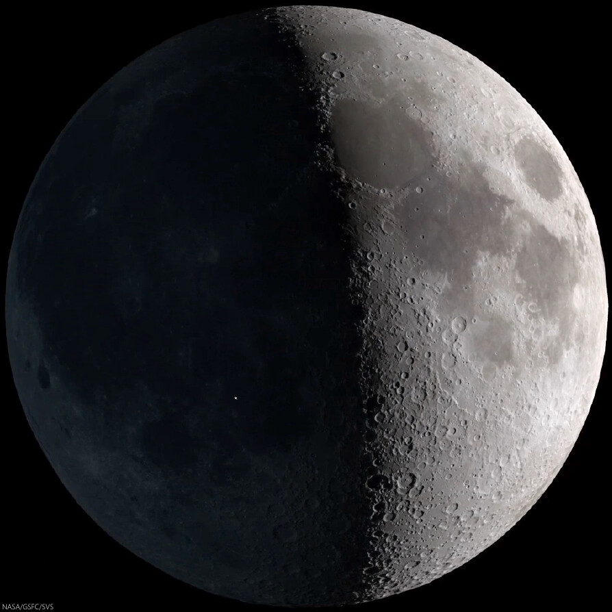
Strictly speaking, the 11 Sept. 2013 event was visible to the naked eye, though at nearly First Quarter the idealized reproduction above fails to account for the discriminating human eye. The illuminated east hemisphere would tend to have washed out Earthshine for all but those with the steadiest eyes. Fortunately, for at least ten years the unlit portion of the Nearside "visible" at night has been carefully monitored systematically, improving our understanding of hazards in the Near-Earth environment [NASA/GSFC/SVS].
Video sequence recording impact on the Moon's nearside in Mare Nubium. The magnitude of the explosion is estimated to have been roughly equal to that of Polaris, the North Star, and the recorded light curve following after lasted a remarkable eight seconds. Madiedo, et al. (2014) [IAA-CSIC/Universidad de Huelva].

Fortunately there was a NAC image of the target area acquired before the impact, so finding the new crater was relatively easy once an "after" image with comparable lighting to the "before" image was acquired.

As it turns out the new crater is ~34 meters (112 feet) in diameter and is located at 17.167°S, 339.599°E, only 2 kilometers (1.2 miles) from the original telescope-based prediction. In the before-after animation you can see ejecta effects from the crater extend out more than 500 meters in all directions!

See also LROC NAC image M1149637354L (16 March 2014).


Impact flash recorded on the unlit Nearside by Prof. Jose M. Madiedo, 11 Sept. 2013. North is to the right (note the visibility of Grimaldi, top center - the 173 km-wide walled plain is often the last recognizable feature on portion of the Nearside lit by Earthshine as the Moon waxes Full). The Moon was shy of First Quarter. This video was produced on the occasion of the publication (in Feb. 2014) in Monthly Notices of the Royal Astronomical Society (MNRAS) of the paper entitled "A large lunar impact blast on 2013 September 11," by J.M. Madiedo, J.L. Ortiz, N. Morales and J. Cabrera-Caño.

A longer, more instructive version was uploaded by the authors HERE

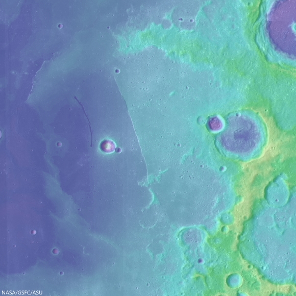
Wide Angle Camera morphology basemap overlaid with color-coded LROC GLD100 topography centered on the 11 September 2013 impact crater. The large crater just visible in the lower left is 60 kilometer diameter crater Bullialdus [NASA/GSFC/Arizona State University].
Revisit the LROC NAC image of new crater formed on 17 March 2013, HERE.

Read the paper describing the 11 September 2013 observation (Madiedo et al., 2014)

Thursday, August 14, 2014

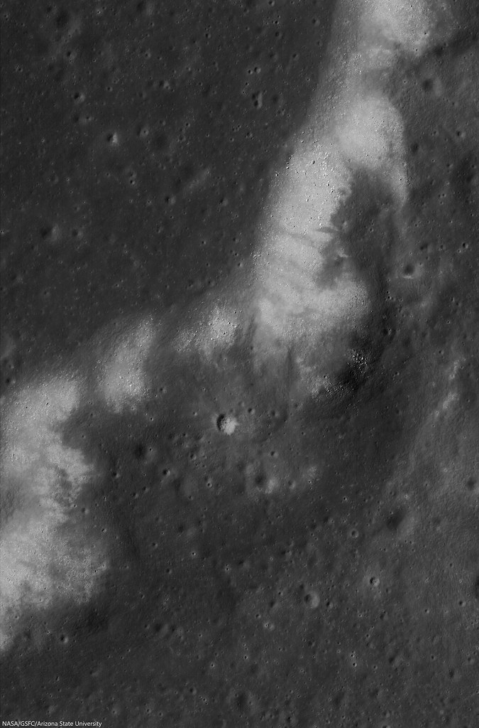
Littered wrinkle ridge in west Mare Nubium

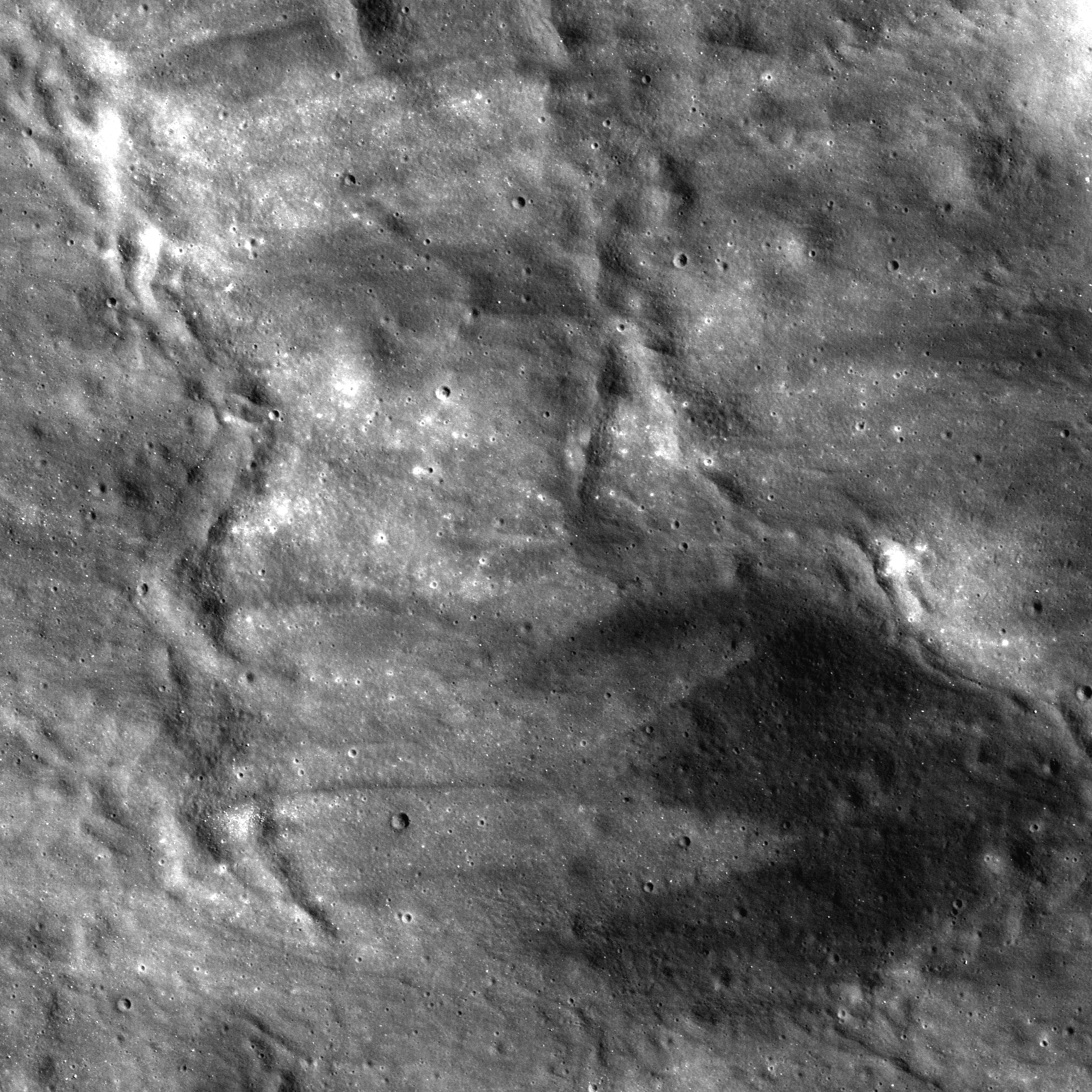
Portion of a wrinkle ridge found in Mare Nubium.  The crest and side of the ridge is lined with high reflectance boulders, likely eroded from the fractured basalts that make up the ridge. 2.4 km wide field of view from LROC NAC mosaic M1144863959LR, LRO orbit 20752, January 20, 2014; 46.33° incidence, resolution 83 cm, from 80.7 km over 19.5°S, 349.04°E [NASA/GSFC/Arizona State University].
Raquel Nuno
LROC News System

Wrinkle ridges on the Moon are positive-relief tectonic features found predominately in mare, although some even occur inside craters.

Tectonic forces that created the wrinkle ridges were caused by the sinking of high density basalts that poured over the crust (lower density) during the formation of the maria.

In general this sinking stretched the crust on the margins of the maria, forming graben, and compressed the rock in the center of the maria, forming wrinkle ridges. 

The opening image shows a portion of a wrinkle ridge located in Mare Nubium. The slope of this ridge is littered with boulders, which have higher reflectance than the surrounding material. Where do these boulders come from?

Corrected mosaic of 20000 lines by 10000 samples (of 52224 by 5000 x 2), both the left and right camera frames from LROC NAC observation M1144863959LR, January 20, 2014; from 80.7 km over 19.5°S, 349.04°E [NASA/GSFC/Arizona State University].
They were likely eroded from the fragmented basalt by seismic events from nearby impacts. The bedrock (mare) was pre-fractured during the formation of the wrinkle ridge, thus the boulders' size and shape likely represents these small scale internal fracture patterns. The ridge is still eroding today! New boulders will erode out of the edge of the ridge until there is no more ridge to erode, while the boulders will be turned to dust by micrometeorite bombardment.

Accepted nomenclature of features of the western portion of Mare Nubium. The arrow designates the location on a prominent wrinkle ridge shown at high-resolution in LROC NAC mosaic M1144863959LR. The field of view is, in turn, a mosaic of LROC Wide Angle Camera (WAC)  monochrome (604 nm) observations (see the full-size WAC mosaic, with inset, HERE) swept up over three sequential orbital passes June 11, 2011, incidence 78.4° at 61.8 meters resolution, from 45.3 km [NASA/GSFC/Arizona State University].
Explore the fill-resolution LROC Narrow Angle Camera mosaic HERE.

Related Posts:

Tuesday, July 15, 2014

Birt E and the fiery rift valleys of Nubium

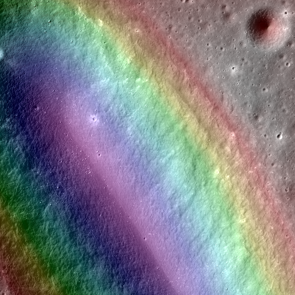
LROC Narrow Angle Camera-derived Digital Terrain Model (DTM, color gradations superimposed) on a close-up view along the northeastern long axis of Birt E (5.34 km; 20.72°S, 350.337°E), the vent structure of Rima Birt, a sinuous rille in east Mare Nubium immediately west Rupes Recta. The vent is thought to be a source region for pyroclastic flows that traced out Rima Birt. The mare basalt, visible as slightly darker material in a fan spreading north from the vent, is older than 3.4 billion years. A roughly 3 km-wide field of view from LROC NAC mosaic M1144849711LR, LRO orbit 20750, January 20, 2014; 46.21° incidence angle, 84 cm resolution from 78.77 km over 20.69°S, 351.11°E [NASA/GSFC/Arizona State University].
Aaron Boyd
LROC News System

Birt E (20.72°S, 350.337°E) was not created like most craters on the Moon; there was no meteorite impact. Lava sputtered out of this pyroclastic vent in Mare Nubium over 3.4 billion years ago, dispersing lava onto the surface and leaving the crater we see today.

How can we tell it is a volcanic vent and not an impact crater?

Impact craters and volcanic vents can be differentiated because vents often have an irregular or elongated shape (as with Birt E). Impact craters are usually circular in shape, created by the shockwave during an impact event.

Pyroclastic vent structure at Rima Birt, officially "Birt E," though it is not a crater; west of Rupes Recta in east Mare Nubium. 4.66 km-wide field of view from LROC NAC mosaic M1144849711LR [NASA/GSFC/Arizona State University].
Also, the vee-shape of this crater is likely a product of the formation mechanism. Vee-shaped vents are thought to be formed from a pyroclastic eruption. Gasses fractionating out of the liquid rock create violent events during eruptions. Explosive eruptions created the shape that we see today, but Birt E could have had a complex history with effusive eruptions forming Rima Birt, the short sinuous rille flowing from Birt E to the south-southeast.

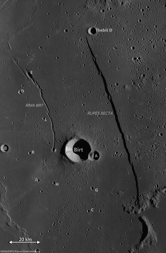
Birt crater group and Rupes Recta, the eye-drawing structure in telescopic views of Mare Nubium. (See a larger, unnoted reproduction HERE.) LROC Wide Angle Camera (WAC) monochrome (604 nm) mosaic stitched from observations swept up over three sequential orbital passes June 10, 2011; incidence roughly 78° and 58 meters per pixel resolution, from 43 km [NASA/GSFC/Arizona State University].
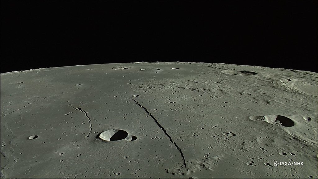
East Mare Nubium, an orbital view north from 100 km altitude, an HDTV still from Japan's lunar orbiter Kaguya (SELENE-1) in 2008. (See the wallpaper-sized release HERE.) [JAXA/NHK/SELENE].
Over long enough time scales Birt E will be filled in with ejecta from newly formed craters around Mare Nubium or by mass wasting of the walls into the crater. Let’s enjoy this ancient crater today while we still can!

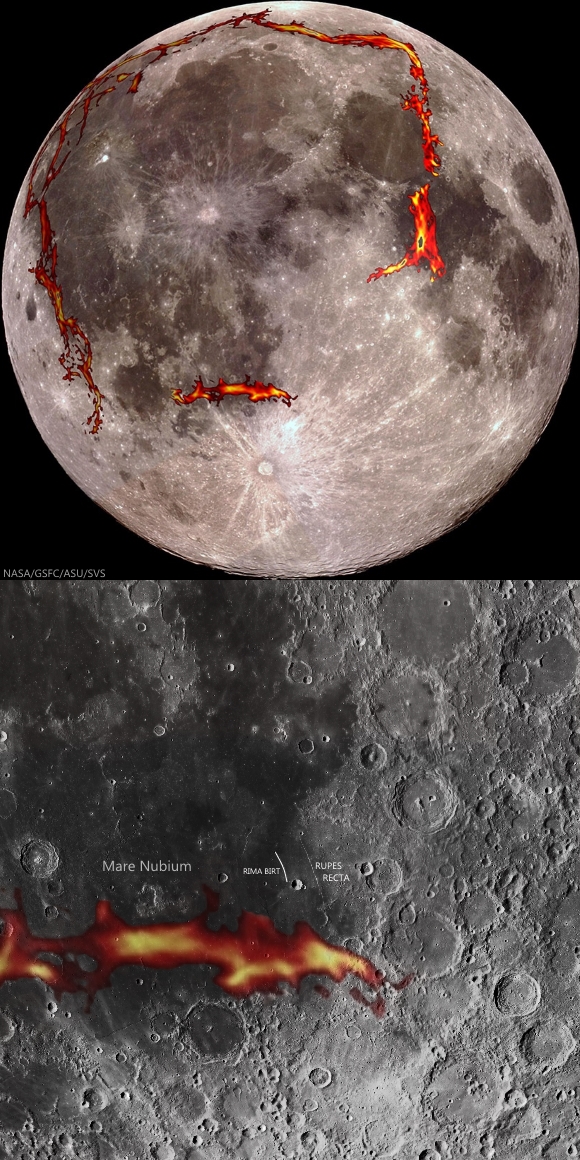
As the GRAIL gravity probes mapped the Moon's basic anisotropy in 2012 detecting the densities of "deep fiery rift valleys," a probable source of a half billion year period of pyroclastic volcanism surrounding the Moon's Procellarum terrain, added important pieces to the tossed puzzle of the Moon's morphology. In the newest maps of the Moon's own squarish "ring of fire," there is still a missing link under the Southern Highlands, but a source for the multiple inundations of the nearside's lowlands, weight that may have created the Straight Wall fault in east Mare Nubium, may have been found [NASA/GSFC/SVS].
LOLA laser altimetry color-coded over LROC WAC 100 meter global mosaic demonstrates where Rupes Recta marks a neat break in the continuity of the floor of an otherwise almost entirely erased 190 km crater. The weight of repeated inundations gradually sloped that crater's floor 1500 meters in elevation deeper on the west side, gradually, aside from the 100 to 300 meter "snap" represented by Rupes Recta [NASA/GSFC/Arizona State University].
Check out the topography in the full NAC DTM HERE.

Related Posts:

Friday, May 16, 2014

The complex case at Lassell K

An early morning view looking east-to-west from an altitude of 86 km across the southern portion of the Lassell Massif, an irregularly shaped series of hills and steep-walled depressions. North is to the right in this LROC NAC oblique mosaic M1108311369LR, LRO orbit 15611, November 23, 2012; 71.73° incidence angle, spacecraft and camera slew 56.64° from orbital nadir, resolution above 2 meters from 85.65 km over 14.63°S, 355.69°E [NASA/GSFC/Arizona State University].
J. Stopar
LROC News System

The Lassell Massif is a complex area of rugged terrain located in northeastern Mare Nubium (14.7°S, 351.0°E). This undulating terrain of hills and steep-walled depressions is 45 km across from north to south and 25 km across from east to west.

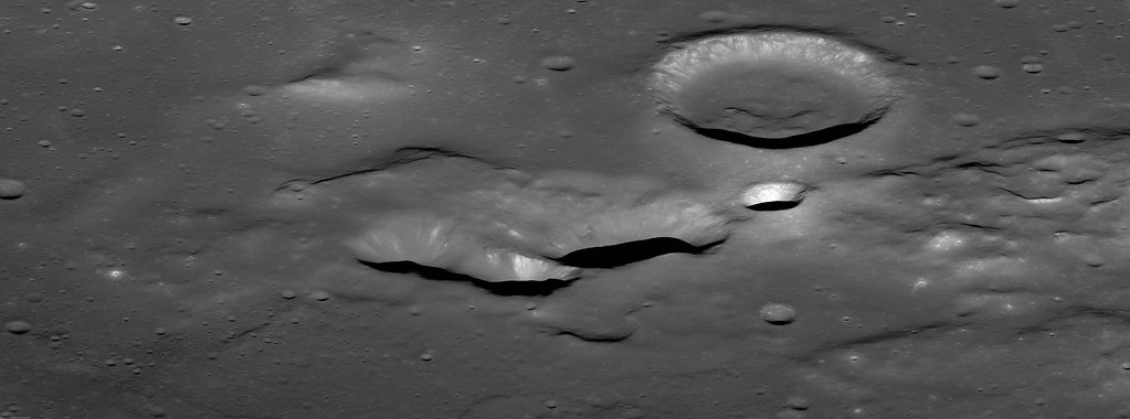
The southern portion of the massif comprises several prominent elongate depressions (like Lassell K and Lassell G, seen below) that are clustered together.

The Lassell Massif in Mare Nubium; north is to the right. Prominent features of the Lassell Massif region include Lassell C, K, and G [NASA/GSFC/Arizona State University].
The clustering and irregular shape of these negative-relief features is reminiscent of volcanic calderas on Earth and other terrestrial planets, including Mars. Calderas generally form through collapse as magma retreats from the vent area. Overlapping collapse features suggest multiple episodes of magma advance and retreat over time. Lassell K and G may be part of a volcanic caldera!

Lassell K and G could, however, instead represent a series of clustered impact craters, which are relatively common on the Moon.

Remote sensing data displayed in eight diverse views of the 1000 meter-high profile of Lassell massif, collected by four spacecraft (all of them post-Apollo) presented in an overlapping 40.2 km-wide field of view, visible throughout both day and night. The largest crater at center-left is Lassell C (8.74 km; 14.67°S, 350.64°E) [Clementine, LRO, Chandrayaan-1 and Chang'e-2].
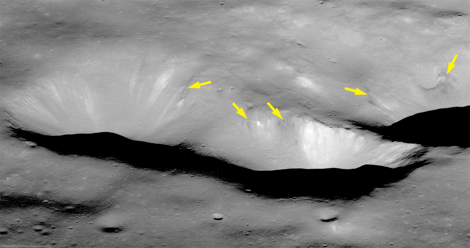
Lassell K (left) and portion of Lassell G (right). The upper walls of these steep-walled depressions have dark, low-reflectance, boulders and downslope streamers (arrows), where a thin layer of dark material, possibly pyroclastic, has eroded out of the wall [NASA/GSFC/Arizona State University].
Looking closely at this region, we see other features that are typical of volcanic eruptions including: dark mantling layers interpreted as possible pyroclastics, a subdued or mantled terrain, and even a possible volcanic cone.

Taken together, these features suggest a complex volcanic history for this region. If the Lassell Massif is constructed from a series of volcanic extrusions, it may represent an unusual type of silicic volcanism on the Moon (perhaps similar in composition to rhyolite).

Read more about the Lassell massif and its unusual style of volcanism in a study presented by members of the Lunar Reconnaissance Orbiter Camera team and colleagues to the 44th Lunar and Planetary Science Conference (2013): "The Lassell Massif, Evidence for Complex Volcanism on the Moon," #2504.

The full oblique image (below) along with other images and compositional data sets may reveal more clues to the timing and nature of volcanism in the Lassell region. However, returning rock samples to Earth and exploring the slopes of this structure from the surface may be the only way to confirm its origins.

View assorted sizes of an unlabeled sample of a mosaic from the LROC observation above, HERE.
View oblique in full-window, HERE.

Related LROC Featured Images:

Wednesday, November 28, 2012

Lassell D Ejecta

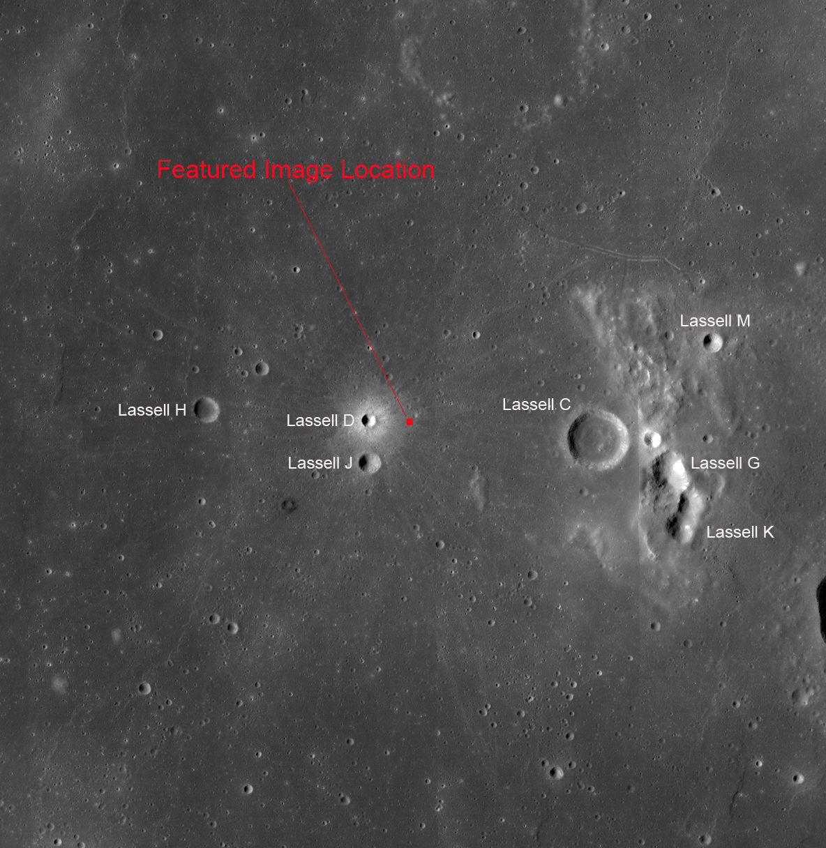
A variety of effects are still visible from this recent impact in Mare Nubium (14.60°S; 10.26°W). LROC Narrow Angle Camera (NAC) frame M111660844L, LRO orbit 1589, October 31, 2009; illumination from the east, north is up, from full field of view, approximately 1 kilometer wide, 51 cm per pixel resolution from 49.13 km altitude [NASA/GSFC/Arizona State University].
James Ashley
LROC News System

The complex geologic process of impact cratering often results in a diverse medley of landforms and other surface features. The more nuanced of these are best observed in fresh craters because the subtlest attributes of impacts are those most easily removed by space weathering. Lassell D crater (2 km diameter) has been described as "one of the freshest craters on the Moon" (Muller, et al., 1986). 

In the proximal (nearby) ejecta blanket we see a hummocky, streaked surface with dune-like forms, ribbon-shaped lobes, and an eye-catching admixture of low- and high-reflectance soils. Immediately following the high-energy of impact, advancing walls of ejecta hugged the ground and moved like a dry tsunami across this region.

The west interior and ejecta blanket of Lassell D. The area detailed in the LROC Featured Image is on the crater's eastern flank, outside the field of view above, capturing the rough, young crater's sharp features on an earlier pass. The 5 km field of view above is from a mosaic of the left and right frames of LROC NAC M135257059, spacecraft orbit 5066, July 31, 2010; incidence angle 59.64° at 50 cm resolution from 46.63 km [NASA/GSFC/Arizona State University].
The crenulations are the result of mechanical interactions of the moving debris with pre-existing topography. As the wave of rock and dust is arrested by this resistance, some portions of the debris continue flowing while others slow and stop moving. The result is a wavy landform, a cross-section of which might reveal how the lobes partially rode up and over each other, hence the descriptive term "imbricated deceleration lobes."

LROC Wide Angle Camera (WAC) mosaic as context, from original image 118 km-wide field of view, resampled with added contrast to, perhaps unnecessarily, bring out from the background the subtle fresh and widespread ray system of Lassell D [NASA/GSFC/Arizona State University].
As regolith redevelops and matures over the tens of millions of years to come, these features will gradually diminish. Which features would disappear first and why? Examine the full NAC frame HERE. Additional examples of fresh impact features can be found in Kamarov, Icarus, and The Lavish Lobes of Necho R.

Lassell D's affect on the Lassell Massif (above and below), to the east. The massif and crater group, a spectral "Red Spot," is speculated to be intrusions of silicate-rich lava characterized by a higher viscosity than the Moon's far more common pyroclastic domes. The feature shows a much lower iron-oxide concentration than the surrounding basalt plains and marks the southwest border of a high thorium signature. LROC WAC observation M129350040C (604nm) [NASA/GSFC/Arizona State University].
From a 2010 demonstration, animation of separate LROC WAC observations of the geologically interesting Lassell Massif and crater group east of Lassell D, showing the latter's fresh ray system intruding from the west. This is more easily discerned under a high Sun while topography is easier to view under a mid-morning Sun in the east-northeast. The bright, widespread ejecta streamers from Lassell D alternates with a visible chevron affect by the Lassell D pressure front [NASA/GSFC/Arizona State University].

Tuesday, February 2, 2010

LRO Mini-RF: Asymmetric crater in Mare Nubium


Mini-RF has imaged this unusual crater in Mare Nubium that shows a bright pattern of ejecta around the crater, but with and excluded zone in one sector. We know from laboratory experiments that this is caused by a very low-angle, oblique impact, coming from the direction of the excluded zone (south). The large crater at bottom is Kies C (26° S 26.1° W; 5 km diameter). Area shown is about 12 km wide by 25 km long [View large version of the Nubium Crater (1.3 MB) NASA/GSFC/LRO-Mini-RF].

Friday, July 3, 2009

LRO LROC returns first images


Near Mare Nubium, as photographed by the Lunar Reconnaissance Orbiter LROC. Craters feature prominently; older with weathered edges and younger crisp. Image shows ares 1,400 meters wide, at 3 meters resolution, a power of ten less than LROC is expected to eventually deliver. (bottoms is north).

NASA's Lunar Reconnaissance Orbiter, or LRO, has transmitted its first images since reaching lunar orbit June 23. The spacecraft has two cameras -- a low resolution Wide Angle Camera and a high resolution Narrow Angle Camera. Collectively known as the Lunar Reconnaissance Orbiter Camera, or LROC, they were activated June 30. The cameras are working well and have returned images of a region a few kilometers east of Hell E crater in the lunar highlands south of Mare Nubium.

"Our first images were taken along the moon's terminator -- the dividing line between day and night -- making us initially unsure of how they would turn out," said LROC Principal Investigator Mark Robinson of Arizona State University in Tempe. "Because of the deep shadowing, subtle topography is exaggerated, suggesting a craggy and inhospitable surface. In reality, the area is similar to the region where the Apollo 16 astronauts safely explored in 1972. While these are magnificent in their own right, the main message is that LROC is nearly ready to begin its mission."

The satellite also has started to activate its six other instruments. The Lunar Exploration Neutron Detector will look for regions with enriched hydrogen that potentially could have water ice deposits. The Cosmic Ray Telescope for the Effects of Radiation is designed to measure the moon's radiation environment. Both were activated on June 19 and are functioning normally.

Instruments expected to be activated during the next week and calibrated are the Lunar Orbiter Laser Altimeter, designed to build 3-D topographic maps of the moon's landscape; the Diviner Lunar Radiometer Experiment, which will make temperature maps of the lunar surface; and the Miniature Radio Frequency, or Mini-RF, an experimental radar and radio transmitter that will search for subsurface ice and create detailed images of permanently-shaded craters.

The final instrument, the Lyman Alpha Mapping Project, will be activated after the other instruments have completed their calibrations, allowing more time for residual contaminants from the manufacture and launch of LRO to escape into the vacuum of space. This instrument is an ultraviolet-light imager that will use starlight to search for surface ice. It will take pictures of the permanently-shaded areas in deep craters at the lunar poles.

"Accomplishing these significant milestones moves us closer to our goals of preparing for safe human return to the moon, mapping the moon in unprecedented detail, and searching for resources," said LRO Project Scientist Richard Vondrak of NASA's Goddard Space Flight Center in Greenbelt, Md.

While its instruments are being activated and tested, the spacecraft is in a special elliptical commissioning orbit around the moon. The orbit takes less fuel to maintain than the mission's primary orbit. The commissioning orbit's closest point to the lunar surface is about 19 miles over the moon's south pole, and its farthest point is approximately 124 miles over the lunar north pole.

After the spacecraft and instruments have completed their initial calibrations, the spacecraft will be directed into its primary mission orbit in August, a nearly-circular orbit about 31 miles above the lunar surface.

Goddard built and manages LRO, a NASA mission with international participation from the Institute for Space Research in Moscow. Russia provides the neutron detector aboard the spacecraft.


For more information about LRO's cameras and to view the first images, visit: LROC Here.