Friday, September 10, 2010

King Crater Natural Bridge


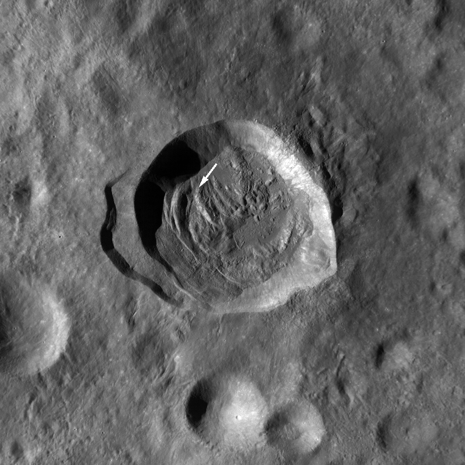
About ten kilometers north of the deep 73 km-wide crater King, a 20 meter-long natural bridge near 6.23°N, 119.70°E. has been discovered, surveyed in high-resolution from Lunar Reconnaissance Orbiter (LRO). Impact melt from King's energetic formation was flung up and over this area. Still semi-liquid, cooling unevenly, the flood then rushed back into King's interior, carving a wide notch on the crater rim. This brief chaos blistered and channeled this slope, under the surface. A void, perhaps briefly a subsurface channel, eventually degraded into a pit opening amazingly "bridged" by a uniquely stubborn ceiling. This intriguing lunar feature is well within the King Crater Region of Interest, a Tier One priority target for LRO. Further views and Discussion about this discovery [NASA/GSFC/Arizona State University].

Paul D. Spudis
The Once & Future Moon
Smithsonian Air & Space

The camera aboard NASA’s Lunar Reconnaissance Orbiter spacecraft, currently about to begin its second year of mapping the Moon, continues to reveal new and fascinating details of the geology of the Moon. A recent featured image at the LROC web site shows what appears to be a “natural bridge” on the lunar surface, i.e., an unsupported strip of terrain that connects two topographic prominences. What might this feature be telling us about the Moon’s processes and history?


Four Windows Cave, El Malpais National Monument, New Mexico [DesertMarmot].

Natural bridges are not common on Earth. They typically form by erosion of rock from beneath, in which material is slowly and gradually removed at such a rate that the uppermost surface remains intact. They are found most often on Earth in sedimentary deposits, in which running water erodes rock away from opposite sides of an area, causing the retreat of two scarps that eventually meet, leaving an intact arch or “bridge” that appears to connect two hills. Such a feature is ephemeral, of course; the same erosion that created the bridge will eventually destroy it, leaving at last only two disconnected hills, both of which will eventually be eroded flat themselves over time.

As there is no running water, how can such a feature be made on the Moon? A flowing liquid is involved, but it’s not water. I have discussed the flow of lava in the lunar maria and its production of caves in a previous column. Billions of years ago, lava erupted onto the surface of the Moon. This lava was of very low viscosity (about the consistency of motor oil at room temperature) and it spread out into thin sheets that flowed across the surface very rapidly. As the lava cooled, it solidified from the outside inward, leaving the hottest, most fluid material in the center of the flow. In some cases, this created a lava tube, which is a very efficient method of transporting erupted lava from a vent to a flow margin. Lava tubes can be active for most of the duration of an eruption and when the eruption stops, the lava inside them often drains out, leaving behind an empty, underground tunnel. Sometimes, the roofs of these tunnels collapse, exposing the tube interiors to space through cave “skylights.”


Natural bridge in a terrestrial lava tube, El Malpais National Monument, New Mexico. "Nearby, old lava tubes have collapsed to form narrow steep-walled box canyons (the largest called 'Catepillar Collapse' for its winding path). A small section of a cave roof survived to form this narrow bridge." [DesertMarmot].

It is difficult to understand how caves on the Moon may be preserved for very long periods of time. When drained, the tube roofs are exposed to space and over time, may be hit by impact debris, both meteoroid projectiles from space and secondary debris kicked up by other impacts nearby. This debris will erode and shake the surface and could destroy the tube roofs to the point where they might collapse, filling in the underlying void space. If such a process were incomplete, collapse could create a natural bridge on the Moon, where adjacent segments of a collapsed lava tube roof are still connected by a segment of the roof that has not yet been destroyed (see picture above).

One interesting aspect of the newly found natural bridge is that it does not occur in volcanic terrain, but in the middle of the far side highlands. How can such a feature form here, so far away from the volcanic maria that is found predominantly on the near side? The same processes are at work but the liquid rock here has a different origin. During very large impact events, some of the shock energy of the impacting projectile is dissipated as heat, both vaporizing and melting some of the rocky target. The LROC images have shown us a wealth of features around very young craters that appear to be solidified flows of liquid rock (shock melt from the impact event). In the case of this natural bridge, it is found in a smooth pool of impact melt that was formed when the 70 km diameter crater King was formed. King is a very young crater in lunar terms, probably having formed no more than a few hundred million years ago. This is extremely old by Earth standards, but on the Moon – with its extremely low rates of erosion – it is part of the Copernican time system, which encompasses events that occurred within the last one billion years of lunar history. King is probably slightly younger than the crater Copernicus and to look at its rim in the high resolution images from LROC, one sees a myriad of fresh, crisp features that look liked they formed only a few days ago.

The natural bridge found near King crater probably formed when a large pool of shock liquid rock cooled enough to roof over, creating a solid surface crust. Downhill draining of the melt pond removed the liquid from beneath this crust, weakening the surface and causing its collapse in some places. The natural bridge is actually just a zone of preserved surface crust that occurs between two adjacent collapse pits. As with natural bridges on the Earth, this bridge is transient; the constant bombardment of the lunar surface will grind away the bridge through erosion by impact, which is extremely slow (erosion rates on the order of one millimeter per 20 million years.) Eventually, both surface grinding and shaking during impacts will cause the collapse of this feature. However, this won’t happen anytime soon, so you have several tens of millions of years to see it.

Closer look at the King crater natural bridge


Stretched "3D" close-up of the 20 meter natural bridge over a far side lunar pit discovered by the Lunar Reconnaissance Orbiter Camera (LROC) team at Arizona State University. The bridge's shadow cast on the pit floor is visible in the west opening [NASA/GSFC/Arizona State University].


The view over "King Y," the 17 km-wide impact-melt flooded depression northwest of 72 km King (5°N, 120.5°E). The interior and western rim of the larger complex crater is on the horizon. 10 km north of King the natural bridge is seen huddled in the blistered melt sheet. Flow patterns from the King impact event hint at the forces briefly at work here, and quickly fossilized, hundreds of millions of years ago.

Discovering a Natural Bridge on the Moon


Credited as the first view of the natural bridge discovered in high-resolution surveys of the King Crater Constellation Region of interest (ROI). This 400 x 400 pixel segment, cropped from a 5064 x 52224 pixel Narrow Angle Camera (NAC) strip was swept up early in the Lunar Reconnaissance Orbiter (LRO) mission, August 1, 2009. The vehicle was slewed -6.09° to image the King ROI target, 118.57 kilometers over the Moon. The field of view is approximately 480 meters. LROC NAC observation M103725084L, orbit 451 (Res. 1.22 m, Sun-Moon-LRO phase angle 68.74°) [NASA/GSFC/Arizona State University].


The subsequent orbit (LRO orbit 452) over King brought cameras nearer to being directly over the natural bridge, and this slightly better view was captured, again on August 1, 2009, from 118.72 kilometers. The field of view is approximately 480 meters. LROC NAC observation M103732241L; Res. 1.2 meters, phase angle 53.57° [NASA/GSFC/Arizona State University].


The next opportunity to image the King ROI took place a lunar month later, August 28, 2009, still in the LRO Commissioning phase of its mission. The Natural Bridge was imaged in afternoon sunshine from 127.88 kilometers, and the 400 pixel field of view was approximately 517 meters. LROC NAC observation M106088433LE, LRO orbit 781, res. 1.29 m, phase angle 36.92° [NASA/GSFC/Arizona State University].


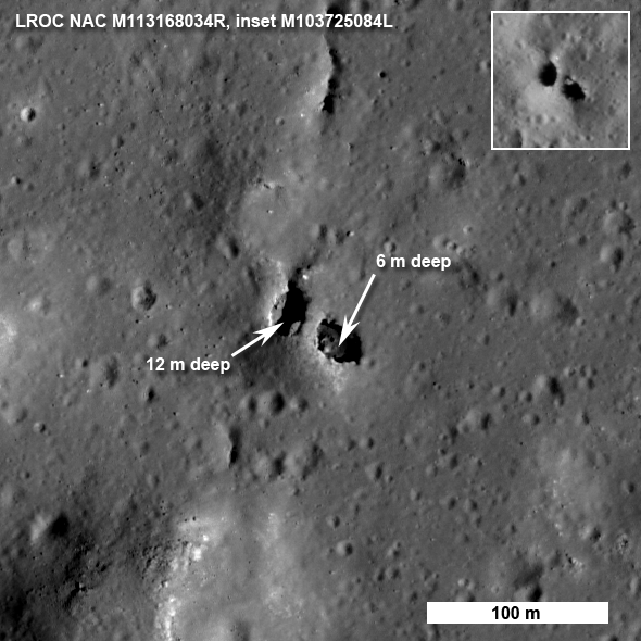
By November 18, 2009, LRO was several weeks into the year-long Nominal mission, circling the Moon at an average altitude of 54 kilometers. This "Shadow under a Walking Bridge" and Featured Image (Inset) view was released with its announced discovery, September 7, 2010. Below that is shown a greatly reduced "full-width" of the Right Frame image from the LROC NAC observation, to allow for context. LROC NAC M113168034R, from 60.49 km, LRO orbit 1811 (Res. 0.625 m, phase angle = 46.36°) [NASA/GSFC/Arizona State University].

Chandrayaan-1 M3 lunar data released to Planetary Data System

Updated September 14, 2010 1336 UT

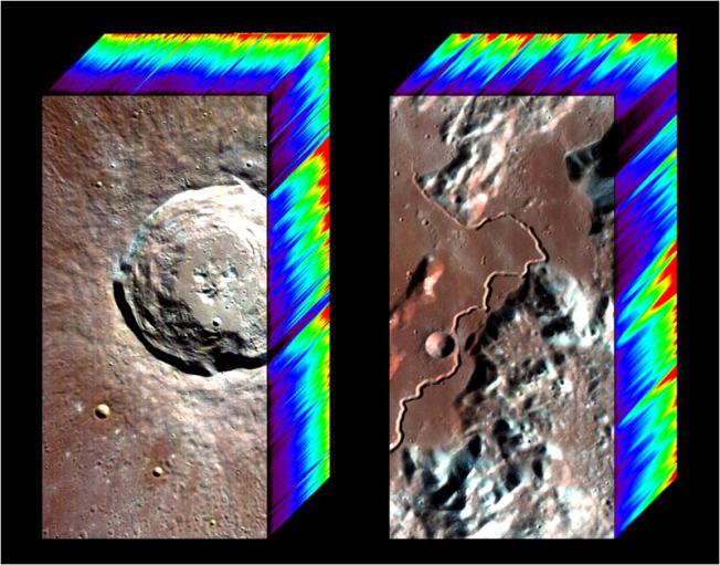
The M3 release of Optical Period 1, Level 1B data products, is now accessible via the online data volumes. Corresponding Level 0 data products are forthcoming as they are being updated by the team to ensure ease of use and compliance with PDS standards. More info can be found at the Chandrayaan-1 M3 mission page.

Note: The national treasure Charles A. Wood, curator of LUNAR PICTURE of the DAY (LPOD) posted what many will discover to be a more understandable summary of this important development HERE. - Ed.

Carle Pieters
Principal Investigator
Moon Mineralogy Mapper (M3)
Brown University

It is with great pleasure to announce that the first installment of Moon Mineralogy Mapper (M3) data has been released and is now available through PDS: http://img.pds.nasa.gov/ http://pds-imaging.jpl.nasa.gov/volumes/m3.html

M3 is an orbital imaging spectrometer that operated from 450 to 3000 nm. It was built at JPL and flown on India’s Chandrayaan-1 lunar spacecraft. Almost all data were taken in the lower resolution “Global” mode that includes 85 simultaneous co-registered spectral channels. More information about M3 can be found at the M3 website (being updated): https://m3.jpl.nasa.gov/NEWS/

This first release is Level 1B (L1B) spectral image cubes calibrated through radiance at sensor for Optical Period 1 (OP1) of Chandrayaan-1 operations, along with all their selenolocation and observation geometry back planes. No data re-sampling has been performed. L1B data for Optical Period 2 (OP2) are being processed and are expected to be released in December.

Higher-level calibrations continue, and Level 2 data (~reflectance) for both OP1 and OP2 are scheduled to be released in June 2011.

The M3 science team is planning a tutorial session to be held early in the week at Fall AGU for those who would like to learn more about how to work efficiently with M3 data. We will also schedule short presentations at the PDS exhibit during the week. The timing for both of these will be set after the AGU program is determined.

Best wishes from the M3 Team

ISRU: Microbe mining the Moon & Mars

From From Album LP1 -
Light weight passenger - Cyanobacterium Anabaena cylindrica used commercially as a nitrogen fixer and as a natural fertilizer in rice paddies. Scientists also found it could help mine oxygen, nutrients and minerals on the Moon. Field of view approximately 100 μm [Protist Information Server].

Charles Choi
Scientific American

Microbes currently are used in mining to help recover metals such as gold, copper and uranium. Now researchers suggest bacteria could be enlisted for "bio-mining" in space, to extract oxygen, nutrients and minerals from extraterrestrial bodies such as the moon and Mars for use by future colonists there.

Researchers experimented with a variety of cyanobacteria, often known as blue-green algae, on analogues of lunar and Martian regolith (loose surface rock). These photosynthetic bacteria have adapted to live in some of the most extreme environments on Earth, from the cold, hyper-arid Antarctic McMurdo Dry Valleys to the hot, dry Atacama Desert in Chile, suggesting they might be capable of surviving the rigors of outer space.

"We will not be able to colonize either the moon or Mars without development of cyanobacterial biotechnologies," says astrobiologist Igor Brown, who did not take part in this study. Previously, at NASA, Brown and his colleagues successfully grew cyanobacteria from hot springs in Yellowstone National Park on iron-rich rocks designed to simulate lunar material.

"There are processes one could use to dissolve lunar regolith with special chemicals, but the costs of delivering such compounds to the moon is enormous," Brown says. "That is why we propose using just vials of microbes instead. "Scientists could also genetically engineer new microbes that are even better at bio-mining, he adds.

Read the full article, HERE.

Abort trajectory for manned lunar landing missions

XiaoNing Xi, WenDe Huang & Wei Wang

SCIENCE CHINA
Technological Sciences
Volume 53, Number 10

The safety of astronauts is always of dominant importance, though the major objectives of the manned lunar landing mission are to land the astronauts to the moon, explore the surface, and return safely to the earth. This safety requirement demands an abort and a safe return when an emergency occurs. However, it is difficult to send another spacecraft to save the spacecraft in the emergency, because it is flying away from the earth either on the way to the moon or too far from the earth when arriving at the moon.

Consequently, the safe return can only rely on the spacecraft itself to transfer the trajectory onto an abort trajectory. Since the trajectory design is an upper work of the mission design [1], the abort capability should be considered in the design of manned landing mission trajectory. That is, abort trajectory should be designed before a manned landing mission is initialized.

Although the abort is usually not carried out, the design of abort trajectory is as important as the normal mission trajectory, especially in the sense of ensuring the safety of astronauts. American scholars have studied the abort for manned lunar mission as many as the normal mission, which will be described in detail below.

After the CE-1 was successfully implemented, China’s manned lunar landing program will also be accomplished consequentially in the near future. In this paper, we review the experience of the manned lunar landing mission, as well as summarize ourselves long-term research in this area, especially the studies on the mission trajectory design for manned lunar landing, abort trajectory design and launch window since the year of 2008.

In this review, the mission abort studies of America’s Apollo program are described in the next section. Then the essential elements of abort, which include the failures that result in an abort, the abort trajectory that returns the crew to the earth, thrust system that realizes the abort, navigation and guidance system, and life support system, are analyzed.

To that end, the requirements of an abort and the rational selection of the abort trajectory are mainly discussed during various flight phases of the mission. In addition, the two primary constraints of abort, the time of flight and energy requirement, are discussed. In order to make a trade-off between time of flight and energy requirement, an optimum method that uses multi-impulse abort is proposed. Lastly, suggestions of abort research are given for China’s future manned lunar landing mission.

Download and read the research (pdf), HERE.

Acropolis

From Album LP3 -

Wednesday, September 8, 2010

Moon's Eastern Hemisphere from LROC WAC

Updated September 16, 2010 2000 UT

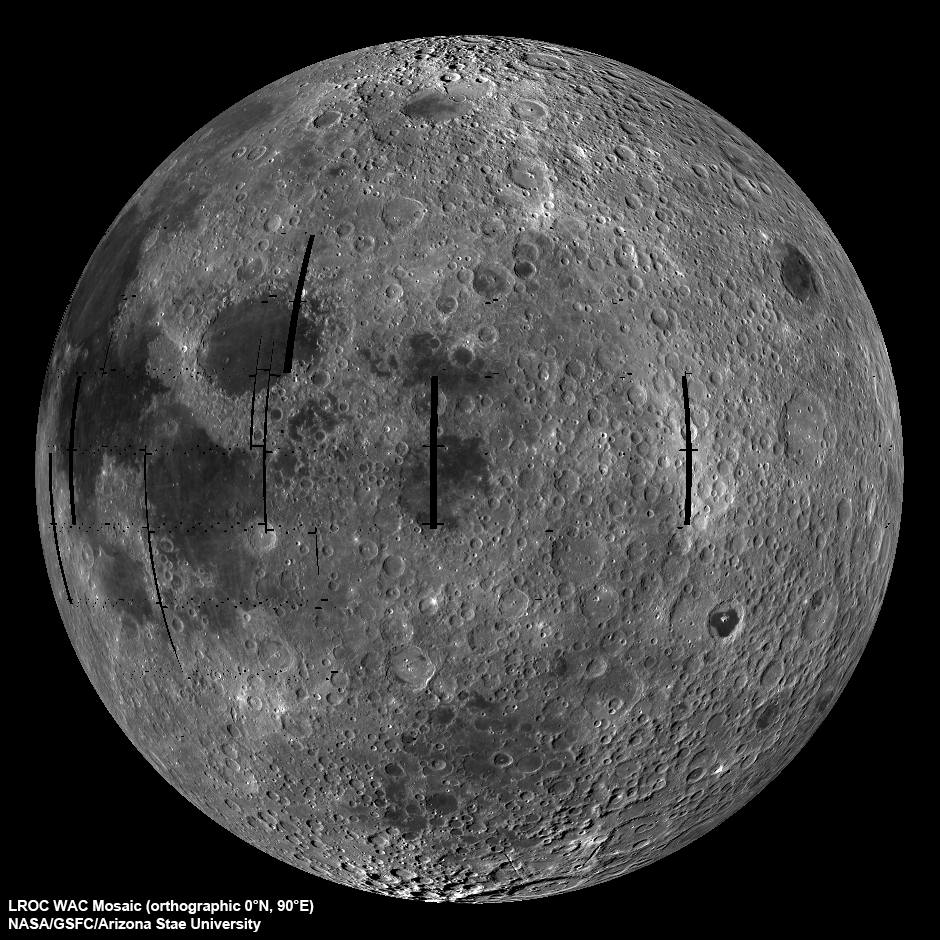
LROC Wide Angle Camera (WAC) view of the Moon seen from 90° east longitude. Half the nearside is visible to the left, and half the farside to the right [NASA/GSFC/Arizona State University].

Mark Robinson
Principal Investigator
Lunar Reconnaissance Orbiter Camera
Arizona State University


The LROC WAC is a real workhouse and gets little attention, at least so far. Since the WAC is a wide angle camera, it maps nearly the whole Moon over a course of about 4 weeks and the lighting and viewing geometries are complicated. In the first case, the Sun angle at the equator changes about 28°. This change in lighting over a mosaic cycle results in a very different surface brightness where the end of the mosaic meets the beginning. The viewing angle of the WAC changes from straight down at the center to 45° at the edge since the camera's field-of-view is 90°. The extreme angle at the edges results in geometric distortion and an apparent change in brightness of the surface. Both effects need to be removed to make mosaics and the LROC team has been working on corrections since this Spring. The global mosaic from which this view was produced contains over 3700 WAC images, which translates into a lot of processing! Note that the black "holes" (gores) are the result of LRO slewing off nadir to acquire NAC stereo images. Over the course of the mission these gores will be imaged and the mosaic completed.


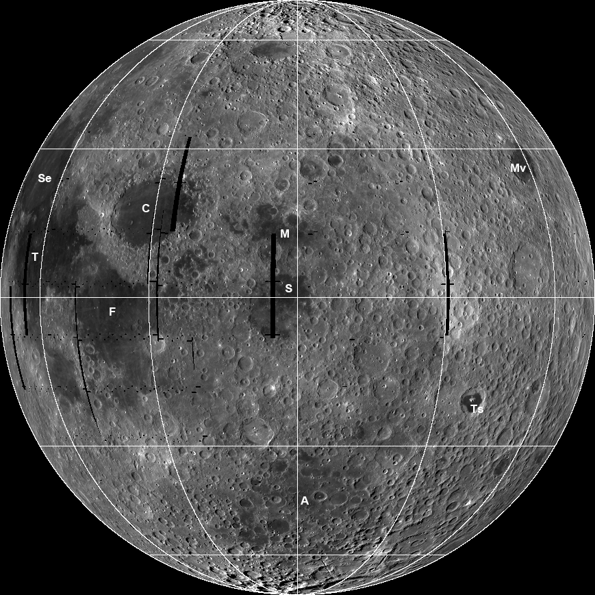
Annotated version of the WAC eastern hemisphere orthographic mosaic: Se=Mare Serenitatis,T=Mare Tranquillitatis, F=Mare Frigoris, C=Mare Crisium, M=Mare Marginis, S=Mare Smythii, A=Mare Australe, Ts=Mare Tsiolkovskiy, Mv=Mare Moscoviense. Lat/lon grid in increments of 30° with the center coordinate at 0°N and 90°E [NASA/GSFC/Arizona State University].

Great progress has been made and the preliminary products are now starting to flow. Keep checking back as more WAC products are released in the coming weeks.

Explore the 400 m/pixel WAC view of the eastern hemisphere of the Moon!

Visit the LROC Wide Angle Camera mosaic of South Pole Aitken basin and another of the Orientale basin.

Huntsville team joins run for GLXP


A cooperative venture of scientists and companies from Huntsville, Alabama - legendary home of the U.S. Army Redstone Arsenal &, NASA's Marshall Space Flight Center - have teamed up to compete for the Google Lunar X-Prize. The ROCKET CITY SPACE PIONEERS become the 22nd team working to land and operate a privately-funded lunar rover before the end of 2012.

Tuesday, September 7, 2010

Natural Bridge on the Moon

Updated September 16, 2010 2006 UT

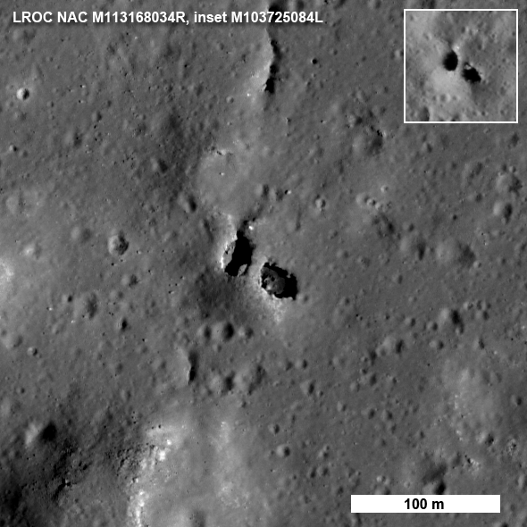
Another amazing bit of lunar geology revealed by LROC, northwest of Narrow Angle Camera (NAC) observation M113168034R (Near 6.41°N, 119.74°E, within an impact melt "pond," inundating the depression King Y, immediately northwest of far side landmark King crater. (North is up; LRO orbit 1811, November 18, 2009; alt. 60.49, res. 0.625 m, phase angle = 46.36°) [NASA/GSFC/Arizona State University].

Mark Robinson
Principal Investigator
Lunar Reconnaissance Orbiter Camera
Arizona State University

Just when you think you have seen everything, LROC reveals a natural bridge on the Moon!

Who would have thought? Natural bridges on Earth are typically the result of wind and water erosion - not a likely scenario on the Moon. So how did this natural bridge form? The most likely answer is a dual collapse into a lava tube. From the Apollo era, SELENE, and LROC images, we know that lava tubes did form in the Moon's ancient past. SELENE and LROC images have raised the tantalizing prospects that lava tubes remain intact to this day. However this bridge did not form in mare (basalt), but rather in (a splash of) impact melt from King crater! More astonishingly, the same NAC image revealed two natural bridges - not just one!


The bridge is approximately 7 meters wide on top and perhaps 9 meters on the bottom side, a 20 meter walk to cross from one side to the other (see full-size view of above, HERE [NASA/GSFC/Arizona State University].

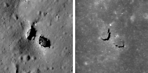
How do we know for sure that this feature is truly a bridge? Look closely at the west pit (left side) and you can see a little crescent of light on its floor. That patch of light came from the east, under the bridge. In another lower resolution image (see inset), you can see light passed under the bridge from the west. So there must be a passage. How did this oddity form? The impact melt deposit on the north rim of King crater is over 15 km across and was emplaced in a matter of minutes as the crater grew to its final configuration.


King Y: A large (17 km east to west), smooth impact melt "pond" on the northwest rim of King crater (5°N, 120.5°E - 72 kilometers in diameter). LROC WAC mosaic [NASA/GSFC/Arizona State University].

The impact melt that was thrown out of the crater pooled on the newly deposited ejecta and must be many tens of meters thick, allowing its interior to stay molten for a long time. As the local terrain readjusted after the shock of the impact, the substrate of this massive pool of melt was jostled to some degree. Local pressures built up and the melt moved around under a deforming crust. You can see that the south end of the bridge extends from a small local rise, shaped something like a blister. Perhaps some melt was locally pushed up forming the rise, then the magma found a path to flow away, leaving a void which the crusted roof partially collapsed? Right now we do not know for certain the details of how the bridge formed, however, the LROC team is processing stereo images into topographic maps to aid scientists in determining exactly what took place on this fascinating melt sheet. There are actually six NAC images in which you can find the bridge under varying lighting (M103725084L, M103732241L, M106088433L, M113168034R, M123785162L,* M123791947L*). Why so many images?

The melt sheet north of King crater is one of fifty Constellation Regions of Interest - high priority for LROC coverage. As the pair of images below vividly illustrate, having a set of images of the same area under varying lighting allows scientists to more confidently interpret the local geology and thus better prepare for future exploration.


Left shows the bridge when the Sun is 42° above the horizon and the right is the same area when the Sun is 80° above the horizon (near noon). M113168034R on the left, M123791947L* on the right, both are 128 meters across, north is up - full-sized inset, HERE [NASA/GSFC/Arizona State University].

Explore the entire LROC NAC image and investigate the variety of geologic features in the King crater melt sheet. Can you find the second natural bridge in the full NAC frame (hint - it's fairly close to the one shown above and about half its size)?

Learn more about the Constellation Regions of Interest:

Tier1 Regions
Tier2 Regions

*LROC Narrow Angle Camera observation M123785162L & M123791947L are not yet available through the Planetary Data System.

M113168034RE sampled at full resolution and pushed to 200%

Discovering the King Y Natural Bridge


Credited as the first view of the natural bridge discovered in high-resolution surveys of the King Crater Constellation Region of interest (ROI). This 400 x 400 pixel segment, cropped from a 5064 x 52224 pixel Narrow Angle Camera (NAC) strip was swept up early in the Lunar Reconnaissance Orbiter (LRO) mission, August 1, 2009. The vehicle was slewed -6.09° to image the King ROI target, 118.57 kilometers over the Moon. The field of view is approximately 480 meters. LROC NAC observation M103725084L, orbit 451 (Res. 1.22 m, Sun-Moon-LRO phase angle 68.74°) [NASA/GSFC/Arizona State University].


The subsequent orbit (LRO orbit 452) over King brought cameras nearer to being directly over the natural bridge, and this slightly better view was captured, again on August 1, 2009, from 118.72 kilometers. The field of view is approximately 480 meters. LROC NAC observation M103732241L; Res. 1.2 meters, phase angle 53.57° [NASA/GSFC/Arizona State University].


The next opportunity to image the King ROI took place a lunar month later, August 28, 2009, still in the LRO Commissioning phase of its mission. The Natural Bridge was imaged in afternoon sunshine from 127.88 kilometers, and the 400 pixel field of view was approximately 517 meters. LROC NAC observation M106088433LE, LRO orbit 781, res. 1.29 m, phase angle 36.92° [NASA/GSFC/Arizona State University].


By November 18, 2009, LRO was several weeks into the year-long Nominal mission, circling the Moon at an average altitude of 54 kilometers. This "Shadow under a Walking Bridge" and Featured Image (Inset) view was released with its announced discovery, September 7, 2010. Below that is shown a greatly reduced "full-width" of the Right Frame image from the LROC NAC observation, to allow for context. LROC NAC M113168034R, from 60.49 km, LRO orbit 1811 (Res. 0.625 m, phase angle = 46.36°) [NASA/GSFC/Arizona State University].

Monday, September 6, 2010

Christel, Krishna, Lorca, and Sung-Mei

If the Lunar Reconnaissance Orbiter were all that ultimately came of the Vision for Space Exploration, it would ultimately be hailed as a triumph.

There remain a lot of things on the Moon in need of a second, a third, and in many instances, a first look. And decades after its on-board consumables are, well, consumed, investigators will still be cracking its data and making new discoveries. Remarkably, this will be true even after humans make the Moon a permanent home.

After Japan turned up the Harayuma Cavern, punched into the floor of a sinuous rille winding among the Marius Domes, along with two others, in Mare Tranquillitatis and Mare Ingenii, LRO cameras may have identified others. Where such features fit into the complexities of lunar volcanism is far from understood. What may be a transitory feature, and also as much a ready-made excavation as any impact crater, is a 7 km long, 4 km wide and 400 meter deep cavern situated in western Serenitatis.


The Moon is a colorful place, though the eye and most cameras are normally quite overwhelmed by it. Tranquillitatis, and the greater part of the surrounding inside edge of Serenitatis, are relatively dark in comparison to the latter's interior. Both the basins were flooded with melt (more than once) long after the events that initially formed them, and not necessarily at the same time. Our feature of interest is virtually invisible at this resolution (arrow), yet a detail not immediately evident closer in can be seen. A meandering contact between colors, lava types and events, winds north and blends together a little before returning south again, back to the edge and the once-volcanically active vents of the Sulpicius Gallus region on the south-southwestern mountainous ring around Serenitatis basin. Inside that ring, and for reasons not yet clear, the elevation of the floor of Serenitatis slopes downward as it approaches the west-southwestern ring. Of course, the timeline landmark event affecting the face of the Moon here was the basin-forming impact that formed Mare Imbrium, further west. Just how those affects manifested is not always immediately clear.

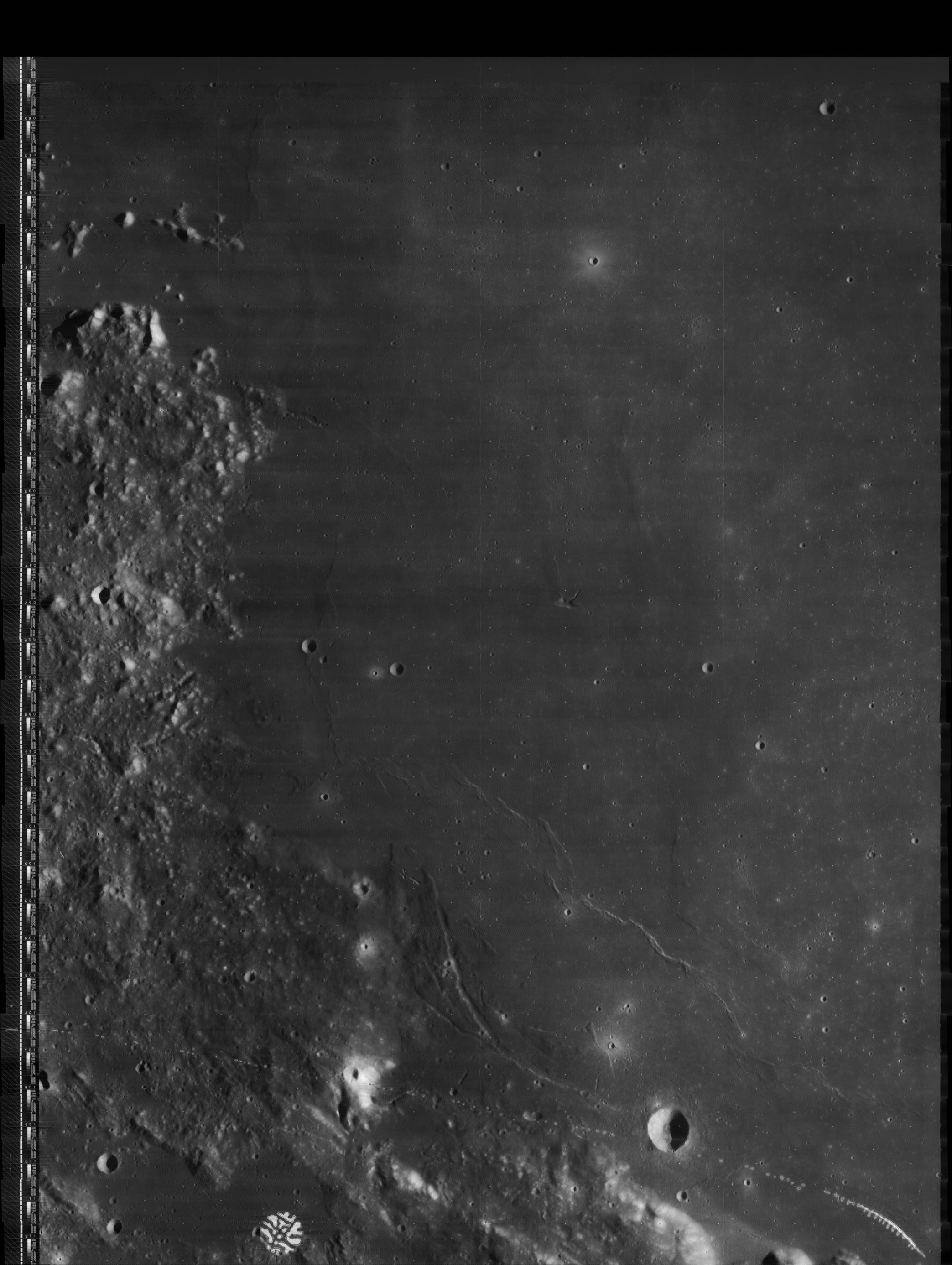
Here's a thumbnail of a photograph of another photograph from telemetry scanned from still another photograph imaged and originally chemically developed on-board Lunar Orbiter IV from 2700 kilometers over southwest Mare Serenitatis 44 years ago. Those subtle regional differences in landscape mentioned above are apparent at this scale, also. The near-miraculous remastering of these pictures, digitization from tapes of the original telemetry, is dramatically exaggerated. See a remastered view, an image unavailable when it was taken, allowing investigators to map the rate of changes to the lunar surface, HERE. Lunar Orbiter IV-097-H3 [NASA/JPL/USGS/LPI].


In the expanse of west central Mare Serenitatis (24.5°N, 11.2°E), the low profile wrinkle ridge Dorsum Owen comes to an abrupt terminus at the 7 km-long, highly unusual and multifaceted open pit feature called "Aratus CA," though it seems each groove and neighboring crater has its own peculiar label. Over the years it's become known as a "coalescing" of four depressions named Christel, Krishna, Lorca, and Sung-Mei. The only actually coalescing, however, has been how a single feature, once thought to be four, gradually coming into focus. It's a favorite target for amateur telescopes six days before a Full Moon, but amateur telescopes are not what they used to be, either. LROC WAC observation M116241995ME, LRO orbit 2264, December 23, 2009; alt. 44.86 km, res. 63.4 meters, phase angle = 83.15° [NASA/GSFC/Arizona State University].


Early in the Commissioning segment of LRO's mission, the Narrow Angle Camera demonstrated why it was sent. Even at three times the altitude of it's current Nominal orbital altitude, no telescope could catch this amount of detail from the Sea of Serenity. Mosaic of sampling from LROC NAC observation M104447576M, field of view approximately 7.2 km; LRO orbit 552, August 9, 2009; alt. 145.46 km, res. 1.45 m, phase angle 56.68° [NASA/GSFC/Arizona State University].


Our field of view is halved, confined to only the right frame of the high-altitude observation from early in the Commissioning phase of the LRO mission.


Closing in upon the detail available in only a 400 x 400 pixel segment of the LRO observation, the detail is sufficient for draping it like a skin over a digital elevation model. For example, what would it be like to stand, just inside the rim of Aratus CA at lower right, for example, and took in the view toward the northeast, over the interior of the canyon to the place where Dorsum Owen comes to its abrupt terminus?


Lunar superlatives from LROC WAC


The 'Rooftop of the Moon' appears to be on the wide, flat northwest rim of 43 km-wide Engel'gard, the largest crater in this monochrome sample from the LROC Wide Angle Camera. The actual spot (5.44°N, 201.36°E) is not immediately distinct, as are Everest or Denali, for example. A future traveler standing there, 10.75 km above the global mean elevation might notice little beyond a close horizon. A brief 'bunny hop' may be necessary to get to an overlook, to see breathtaking views of astounding depths and distances. LROC WAC observation M103209735ME, field of view roughly 100 km; LRO orbit 379, July 26, 2009; alt. 112.88 km, res. 178.3 meters, phase angle 66.22° [NASA/GSFC/Arizona State University].


Barely 2400 km from the Moon's highest point is it's lowest point, invisible above, inside the shadows of the 12 km crater at middle-left, within the wide interior of 143 km-wide Antoniadi, not far from the center of 4 billion year old South Pole-Aitken basin. From Kaguya the smaller crater's interior (70.43°S, 187.42°E) was measured to a depth of 9.06 km below global mean (19.85 kilometers below the high point at Engle'hardt and 2 km more than the range gauged as recently as 2005). This image was processed using LROC WAC Previewer (v.1.2) from LROC WAC observation M103254154ME; field of view approximately 150 km; LRO orbit 385, July 26, 2009; alt. 42.68 km, res. 66.03 meters, phase angle 82.5° [NASA/GSFC/Arizona State University].


The bright, highest of the Moon's highlands as seen from Kaguya as the orbiter sailed under a late morning Sun. [JAXA/NHK/SELENE].


Also from Kaguya, the Moon's lowest place (70.43°S, 187.42°E) is briefly seen at the bottom of the bowl-shaped crater in wider Antoniadi. All the scenery in this late mission Terrain Camera image averages a few kilometers lower in lunar elevation than anything we can see of the Moon's near side from Earth. [JAXA/SELENE].

Saturday, September 4, 2010

Boulder saturation


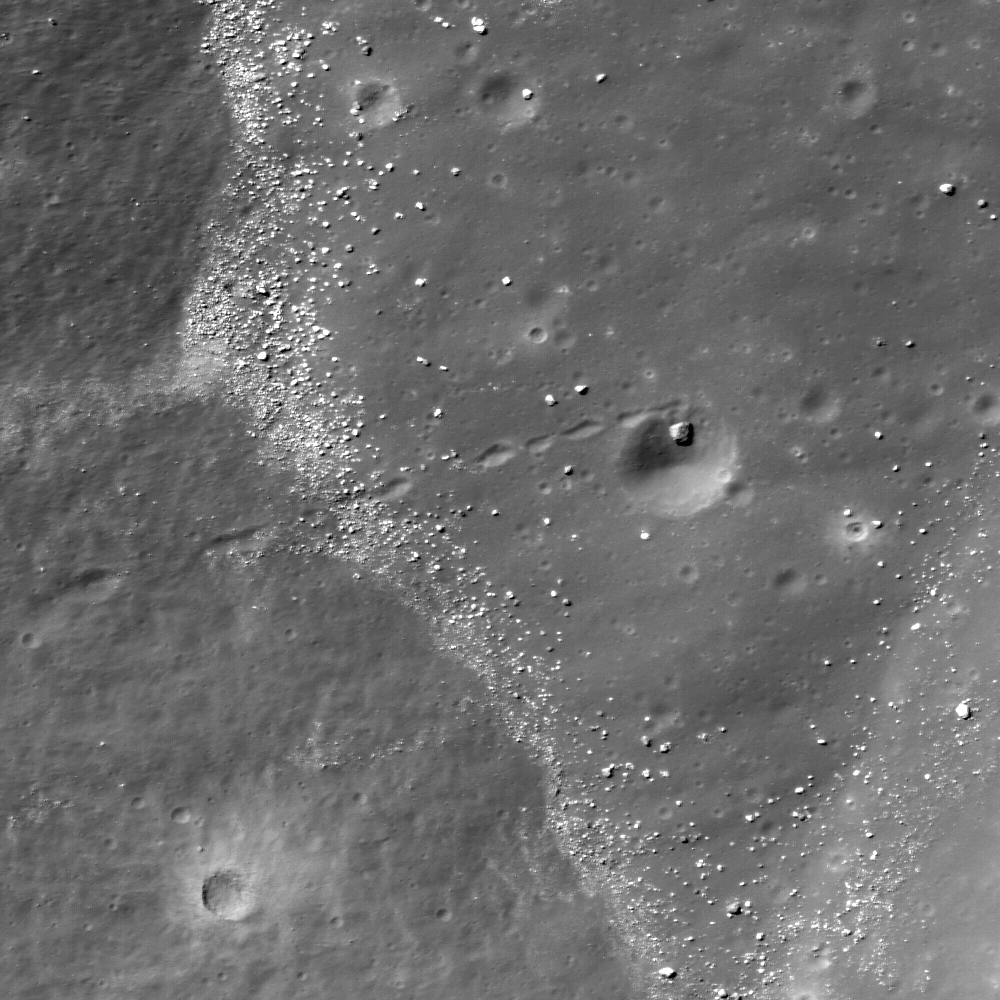
Second look at the LROC Featured Image, from LROC Operations Center, Arizona State University, May 20, 2010 - close up of a 'house-sized' bolder and the end of its bouncing trail, angling back into a worn crater - coming to a halt millennia ago. The 200 meter wide field of view from the interior a large crater situated in still larger 42 kilometer-wide Henry Frères (23.39°S, 301.06°E). ("Hole in one, in a hole in one," Lillian Ostrach, from LROC NAC M122597190L - LRO orbit 3200, March 7, 2010; alt. 46.24 km; res. = 0.50 meters) [NASA/GSFC/Arizona State University].

The history of the Moon is a history of bombardment. From the global to the micro-scale the history of the Solar System has been etched in detail with little erosion other than subsequent bombardment. Other than the splash, relatively brief flow and inundation of melted material, most of the resulting debris has been broken rock, in sizes ranging almost as wide in scope as those of the Moon's craters.

Fortunately, most of this debris has been shattered and shattered again, gardened into pieces small enough to become packed down by micrometeorites, and the Moon turned out to be perfectly safe to walk on. Like the craters, Moon rock is another language time used to write the history of our home star and its system of orbiting bodies, especially Earth, all preserved from the dynamic, relentless erosion supplied by Earth's lithosphere and watery atmosphere.

Everywhere on the Moon where sufficient grades meet up with "flat lands," boulders and their bouncing trails can be found. This has been established and confirmed, as many expected, since the Apollo era. Now, LRO is providing us with our first comprehensive large scale view of these processes.

In March, one boulder along with its meandering trail downward into the interior of 42 kilometer-wide Henry Frères (23.39°S, 301.06°E) caught the trained eye of the planetary geologists at Arizona State University, who operate the wide and narrow angle cameras on-board the Lunar Reconnaissance Orbiter.

The size of the thumbnail image from LROC observation M122597190L did the scene justice, but not when reduced down within the limitations of this blog template (400 x 800). Even though we downloaded the 253 megabyte original, it's taken since May to sort though the fire hose of data being returned by LRO, allowing a second look. We offer it above rotated 90 degrees and in such a way allowing closer examination.

How long ago this boulder was shaken loose from the rim to begin and end it's bouncing journey back into the host crater's interior is not easy to determine. The effects of optical maturity hint at more than 900 million years ago, but that's not narrowing it down very much.

The shape of the boulder is recorded in the pattern it carved, alternately bouncing and then rolling its way to the point where it was briefly caught by the much older crater near the bottom of the slope, where it obviously hesitated and then rolled backward to a stop.

The imagination can almost see the event as it happened, in less than a wink of an eye in comparison to its age. And our experience can also easily imagine just how long such a feature would last, even in the lightest perennial rainfall, here on Earth.

Friday, September 3, 2010

Chang'e-2 sets stage for future Moon missions


China's second lunar orbiter Chang'e-2 began as back up for Chang'e-1 (2007-2009). Scheduled for a possible October launch, Chang'e-2 should arrive sooner, orbit the Moon closer and gather better data. If all goes well the vehicle should allow rehearsal opportunities for China's first soft landing on the Moon in 2013, and a better camera on Chang'e-2 may gather 1 meter resolution photographs of preferred landing sites.

China's unmanned space program has only one deep space target: the Moon. The United States may be preparing to abandon manned exploration of the lunar surface but the new era of international lunar exploration, a 'second moon race,' continues. India, Russia and China may each have achieved soft landings there before the U.S. deploys the first, if any, of planned nodes for an International Lunar Network (ILN). After Chandrayaan-2 and Chang'e-3, Chang'e-4 may return the first lunar samples to Earth since the Soviet's Luna 24 in 1976.

From Xinhua -- China's second lunar probe, Chang'e-2, will transition much faster than its predecessor, reaching lunar orbit in a shorter period of time, a top Chinese space scientist told Xinhua Friday.

China launched Chang'e-1 from Sichuan October 24, 2007. The first of China's planned unmanned lunar missions ended a 16-month mission March 1, 2009 when it was intentionally de-orbited into Mare Fecunditatis.

"It is estimated Chang'e-2 can reach lunar orbit within five days, compared to 13 days, 14 hours and 19 minutes for Chang'e-1," Ouyang Ziyuan, chief scientist at the China Lunar Exploration Project, told Xinhua.

"China had not been to Moon before Chang'e-1 so we were very prudent and adjusted its transfer orbit in a very slow manner. It traveled 2.06 million kilometers before lunar orbit insertion," Ouyang said. "It's different now. We are more certain about the launch and can send Chang'e-2 directly to the moon, and we have also planned the transfer orbit to reach the Moon within five days."

Plans call for Chang'e 2 to orbit 100 km closer to the moon with a higher resolution camera, he said.

According to China's three-phase lunar exploration 'road map,' the country will first launch the Chang'e-2 and afterward soft-land Chang'e-3 on the moon in 2013 and, in 2017, Chang'e-4 will return a lunar sample to Earth.

Experts have speculated the Chang'e-2 mission will allow China to begin mastering soft-landing techniques for Chang'e-3 and 4, short of terminal descent. Careful lowering of its orbit to rehearse everything short of terminal descent that otherwise might begin after passing perilune could allow low passes over an intended target and an opportunity to take high-resolution photography.


Public mock-up of the China Lunar Exploration Program (CLEP) Chang'e-4, in development for a soft landing on the Moon in 2013. China's methodical dual-track developmental plans, its manned and unmanned (lunar), space programs seem devoted more to engineering design capability over science [Xinhua].

Thursday, September 2, 2010

The jumbled floor of Necho


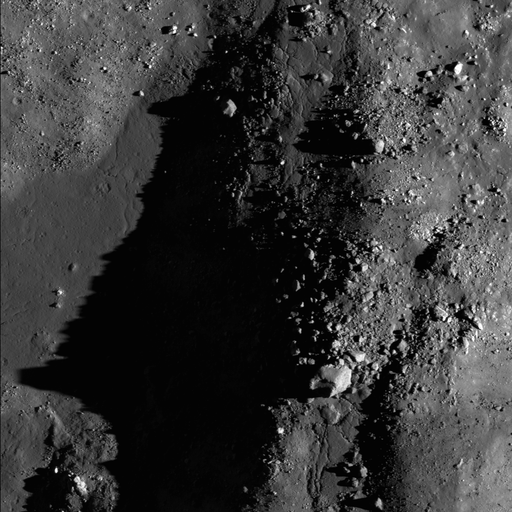
The chaotic floor of Necho crater attests to a dynamic environment immediately after the impact event. LROC Narrow Angle Camera (NAC) observation M115502787RE, LRO orbit 2155, December 15, 2009; alt. 59.85 km, resolution = 0.96, field of view width = 960 meters [NASA/GSFC/Arizona State University].

Brett Denevi
LROC News System


Wide Angle Camera monochrome full image of the 30 km far side crater Necho, 490 km northeast of Tsiolkovskiy (5°N, 123.1°E); arrow indicates approximate location of NAC detail above. LROC WAC observation M119048299ME; LRO orbit 2677, January 25, 2010; alt. 56.44 km [NASA/GSFC/Arizona State University].

Curious as to what's in the shadows? A more drastic stretch of the image can help.


A look into the shadows - close-up of the same NAC scene above, but "harshly stretched" to highlight shadowed terrain where boulders litter a dark slope in shadow, salvaging light scattered by the surrounding crater interior [NASA/GSFC/Arizona State University].

Browse the full-resolution image of Necho's interior here!


Stepping back to view the full width of the NAC frame, shows the interior of Necho exhibits a rich geologically-complex morphology, debris and melt deposits with substantial ponding. (NAC M115502787RE; field of view width = 2.4 km) [NASA/GSFC/Arizona State University].

Related posts:
Impact Melt at Necho Crater
September 1, 2010
Necho's terraces
August 31, 2010
A molten flood
July 29, 2010

Armadillo to Near-Space with NASA from NM


Armadillo Aerospace, Inc. SuperMOD reusable VTOL rocket during recent demonstration flight. Armadillo has committed to NASA-funded "near-space" suborbital missions from New Mexico's Spaceport America [William Pomerantz/GLXP].

LAS CRUCES, NM - The New Mexico Spaceport Authority (NMSA) has announced that Armadillo Aerospace of Rockwell, Texas, plans to launch three NASA-funded tests of their vertical takeoff and landing rocket technology from Spaceport America this winter. 


"These launches mark an important step in NASA's plan to empower the emerging commercial spaceflight industry to assume a greater role in the nation's space program," said Rick Homans, executive director of the New Mexico Spaceport Authority. "Spaceport America is the launch pad for this new industry, and Armadillo's decision to launch here affirms our important position."


Armadillo Aerospace is developing new vehicles that can launch small payloads to suborbital “near space”, which NASA defines as altitudes between about 19 and 106 km, and return them safely to earth.

"Armadillo is proud to pioneer reusable rocket technology for the commercial space industry and Spaceport America provides the perfect place for our launches," said Neil Milburn, Vice President of Program Management at Armadillo Aerospace. "We selected Spaceport America because of its geographic advantages, dedicated staff, technical experience, flexibility and its low cost. We need exactly this kind of support to be successful."


Read the Armadillo news release, HERE.

Wednesday, September 1, 2010

Impact Melt at Necho Crater


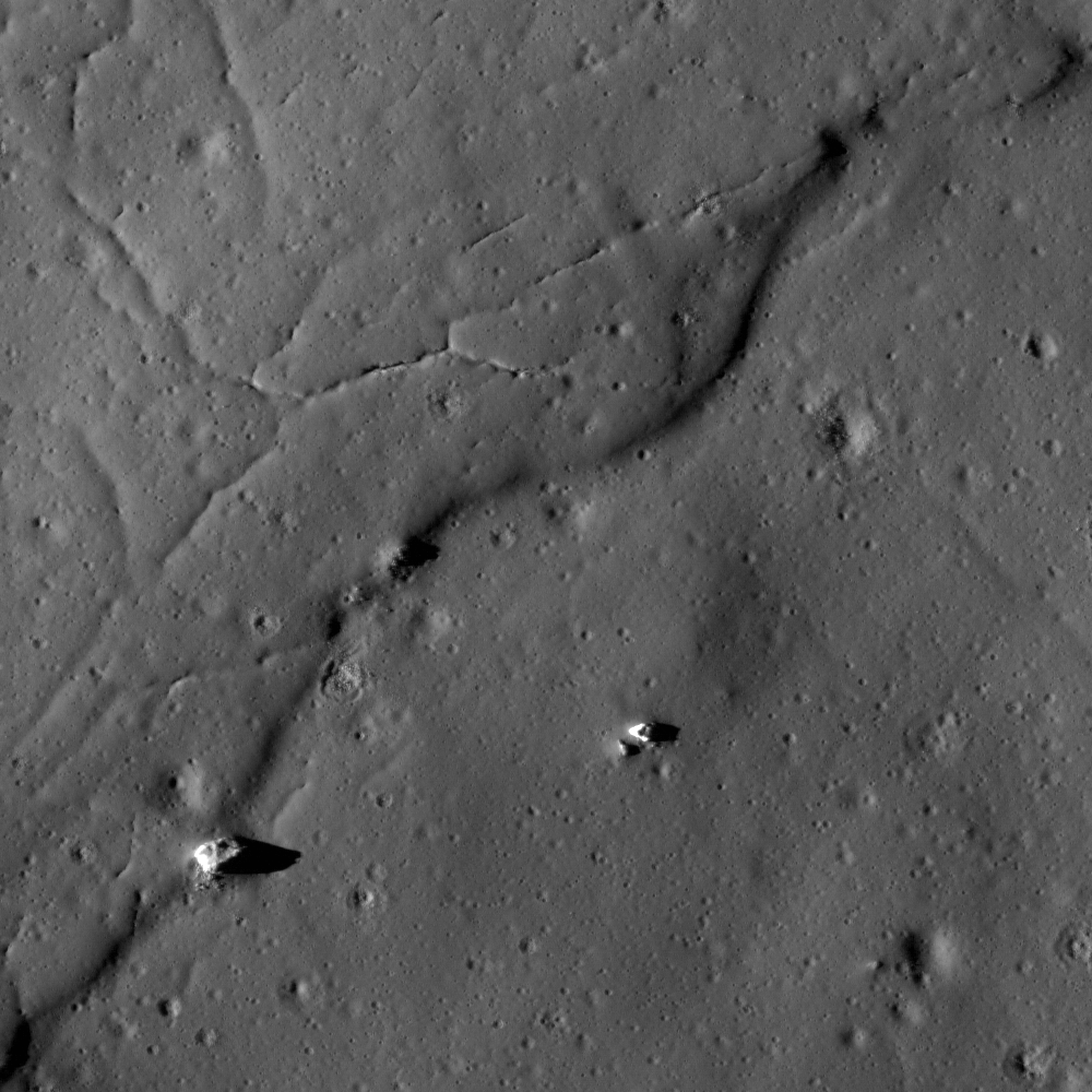
Impact melt, eastward of Necho (5°N, 123.1° E) that once flowed from the rim for a brief time after the crater's relatively recent Copernican Age formation. Lunar Reconnaissance Orbiter Camera (LROC) Narrow Angle Camera (NAC) observation M134374642R, LRO orbit 4936, July 21, 2010; Full Resolution 62 centimeters per pixel, field of view = 620 meters [NASA/GSFC/Arizona State University].

Brett Denevi
LROC News System

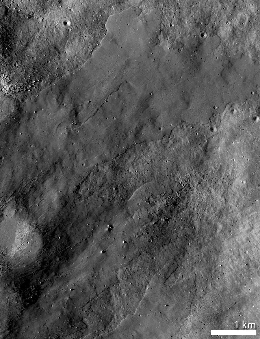
This region of impact melt was highlighted in a past featured image, but just a few weeks ago it was imaged again with the LROC NAC, revealing impact melt flows that extend further to the east than previously seen.


A wider view of the broad flows of impact melt east of Necho. From mosaic of both the left and right frames of LROC NAC observation M134374642; Full-sized field of view = 6.2 km. [NASA/GSFC/Arizona State University].

Explore Necho's impact melt flows in the full resolution LROC NAC image!


Closer, again, with west at top, for a look at the mix of shocked terrain, ejecta and the down-grade flow of impact melt [NASA/GSFC/Arizona State University].

Related posts:
Necho Crater
July 29, 2010
Necho's Terraces
August 31, 2010