
 If the Lunar Reconnaissance Orbiter were all that ultimately came of the Vision for Space Exploration, it would ultimately be hailed as a triumph.
There remain a lot of things on the Moon in need of a second, a third, and in many instances, a first look. And decades after its on-board consumables are, well, consumed, investigators will still be cracking its data and making new discoveries. Remarkably, this will be true even after humans make the Moon a permanent home.
After Japan turned up the Harayuma Cavern, punched into the floor of a sinuous rille winding among the Marius Domes, along with two others, in Mare Tranquillitatis and Mare Ingenii, LRO cameras may have identified others. Where such features fit into the complexities of lunar volcanism is far from understood. What may be a transitory feature, and also as much a ready-made excavation as any impact crater, is a 7 km long, 4 km wide and 400 meter deep cavern situated in western Serenitatis.

The Moon is a colorful place, though the eye and most cameras are normally quite overwhelmed by it. Tranquillitatis, and the greater part of the surrounding inside edge of Serenitatis, are relatively dark in comparison to the latter's interior. Both the basins were flooded with melt (more than once) long after the events that initially formed them, and not necessarily at the same time. Our feature of interest is virtually invisible at this resolution (arrow), yet a detail not immediately evident closer in can be seen. A meandering contact between colors, lava types and events, winds north and blends together a little before returning south again, back to the edge and the once-volcanically active vents of the Sulpicius Gallus region on the south-southwestern mountainous ring around Serenitatis basin. Inside that ring, and for reasons not yet clear, the elevation of the floor of Serenitatis slopes downward as it approaches the west-southwestern ring. Of course, the timeline landmark event affecting the face of the Moon here was the basin-forming impact that formed Mare Imbrium, further west. Just how those affects manifested is not always immediately clear.

Here's a thumbnail of a photograph of another photograph from telemetry scanned from still another photograph imaged and originally chemically developed on-board Lunar Orbiter IV from 2700 kilometers over southwest Mare Serenitatis 44 years ago. Those subtle regional differences in landscape mentioned above are apparent at this scale, also. The near-miraculous remastering of these pictures, digitization from tapes of the original telemetry, is dramatically exaggerated. See a remastered view, an image unavailable when it was taken, allowing investigators to map the rate of changes to the lunar surface, HERE. Lunar Orbiter IV-097-H3 [NASA/JPL/USGS/LPI].

In the expanse of west central Mare Serenitatis (24.5°N, 11.2°E), the low profile wrinkle ridge Dorsum Owen comes to an abrupt terminus at the 7 km-long, highly unusual and multifaceted open pit feature called "Aratus CA," though it seems each groove and neighboring crater has its own peculiar label. Over the years it's become known as a "coalescing" of four depressions named Christel, Krishna, Lorca, and Sung-Mei. The only actually coalescing, however, has been how a single feature, once thought to be four, gradually coming into focus. It's a favorite target for amateur telescopes six days before a Full Moon, but amateur telescopes are not what they used to be, either. LROC WAC observation M116241995ME, LRO orbit 2264, December 23, 2009; alt. 44.86 km, res. 63.4 meters, phase angle = 83.15° [NASA/GSFC/Arizona State University].

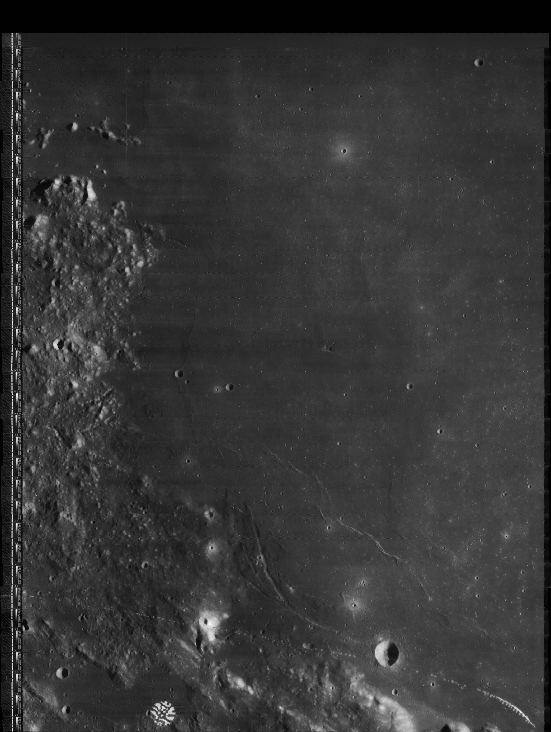
Early in the Commissioning segment of LRO's mission, the Narrow Angle Camera demonstrated why it was sent. Even at three times the altitude of it's current Nominal orbital altitude, no telescope could catch this amount of detail from the Sea of Serenity. Mosaic of sampling from LROC NAC observation M104447576M, field of view approximately 7.2 km; LRO orbit 552, August 9, 2009; alt. 145.46 km, res. 1.45 m, phase angle 56.68° [NASA/GSFC/Arizona State University].

Our field of view is halved, confined to only the right frame of the high-altitude observation from early in the Commissioning phase of the LRO mission.

Closing in upon the detail available in only a 400 x 400 pixel segment of the LRO observation, the detail is sufficient for draping it like a skin over a digital elevation model. For example, what would it be like to stand, just inside the rim of Aratus CA at lower right, for example, and took in the view toward the northeast, over the interior of the canyon to the place where Dorsum Owen comes to its abrupt terminus?

No comments:
Post a Comment