Showing posts with label Tsiolkovskiy. Show all posts

Wednesday, July 3, 2013

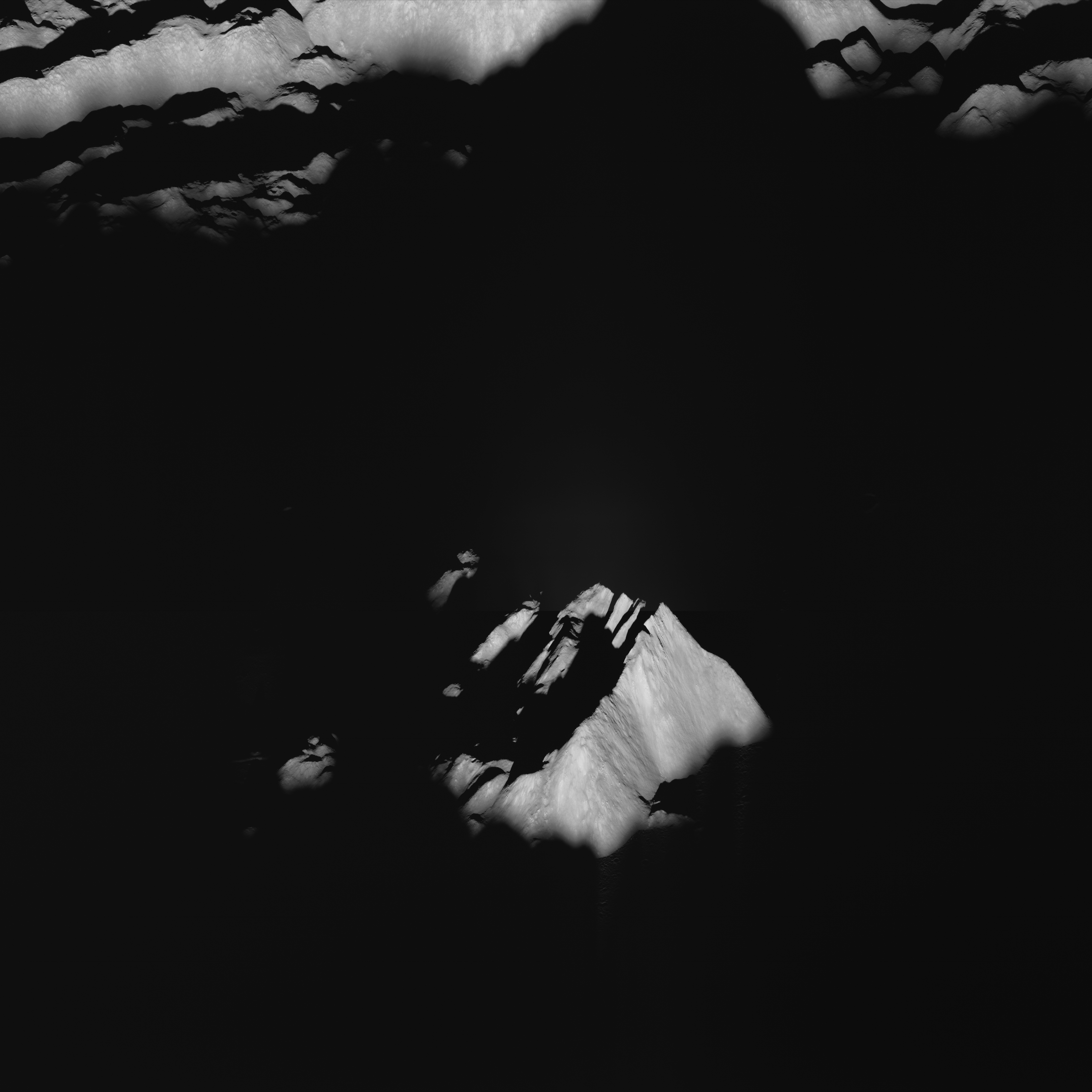
Tsiolkovskiy central peaks at sunset

LROC Narrow Angle Camera (NAC) oblique view of the central peaks of Tsiolkovskiy. (See the full-size mosaic assembled HERE.) LROC Narrow Angle Camera (NAC) mosaic M1111030948LR, from orbit 15992, December 24, 2012; 88.89° angle of incidence, long focus resolution roughly 8 to 10 meters per pixel from 89.44 km above 19.97°S, 119.15°E [NASA/GSFC/Arizona State University].
Tsiolkovskiy (184 km in diameter, 20.37°S, 128.97°E), the landmark mare-inundated crater in the lunar highlands south of the farside equator, was conspicuous in our first look at the Moon's farside in 1959.

Also compare this scene - rolling under the sunset terminator (as the Moon was Waxing Full from our standpoint on Earth with the fully-illuminated and closer oblique perspective of the same region from a similar angle six months earlier, HERE.)

This latest LROC Narrow Angle Camera observation is among the 141,630 NAC stills, 23,88 TB of data, released in mid June to the Planetary Data System by the LROC team at Arizona State University, according to Ernest Bowman-Cisneros.

"Additionally," Bowman-Cisneros announced, "the LROC team has been reprocessing data from early in the LRO mission. We have re-released Volume 1, 2 and 3 of the EDR and CDR data sets. Reprocessing will continue until Volumes 4 through 11 have been updated.

"To date, the LROC Team has delivered 1,041,298 LROC images - totaling 123 TB for EDR and 235 TB for CDR products, and over 8,743 derived (RDR) data products to the NASA Planetary Data System," Bowman-Cisneros said. "The complete LROC PDS archive can be accessed via the URL http://lroc.sese.asu.edu/data or one can search for specific images or mosaic products using the LROC WMS Browse interface.

"Also be sure and try out our Quickmap interface."

The full LROC NAC mosaic highly resampled down to the 580 pixel maximum width allowable with this blog format. Captured just before midnight (UT) on Christmas Eve in 2012, most of the interior of of Tsiolkovskiy had already entered the two-week long lunar night, and the high crater rim and central peaks, towering 3200 meters over the crater floor, were mere hours behind. See the mosaic at higher resolutions by right-clicking on the images HERE. [NASA/GSFC/Arizona State University].
The Lunar Reconnaissance Orbiter continues to re-shape the envelope of what was once believed to be possible for long-term lunar missions, having long ago doubled it's record of returning more data to Earth than all other deep space missions combined.It begins a fifth year in lunar orbit, no small achievement itself, having orbited the Moon 18,313 times, as of 3 July, 2013, 2100 UT.

This LROC QuickMap 3D WAC-derived topographical view of Tsiolkovskiy's central peaks has become, more or less, a regular feature, as this distinctive farside crater has been the subject of many interesting posts, some highlighted below [NASA/GSFC/Arizona State University].
Sample Posts regarding Tsiolkovskiy crater:

New oblique view of Tsiolkovskiy central peaks (December 26, 2012)
The Old and the Young at Tsiolkovskiy (October 31, 2012)
Weaving boulder trails on the Moon (July 11, 2012)
Bulging wrinkles at Tsiolkovskiy (January 11, 2010)
Regolith on Basalt (January 10, 2012)
Highland-Mare boundary of Tsiolkovskiy (September 29, 2011)
The Hummocks of Tsiolkovskiy (August 26, 2010)
More of Tsiolkovskiy's boulders and boundaries (August 26, 2010)
Small fractures in the mare floor of Tsiolkovskiy (August 25, 2010)
Tsiolkovskiy - Constellation Region of Interest (May 1, 2010)
Uplift, Boulders of Tsiolkovskiy (September 1, 2009)

Wednesday, May 29, 2013

Alien materials found in lunar crater! (Film at Eleven)

Central peaks of Copernicus - covered by fairy dust? -- From oblique LROC Narrow Angle Camera (NAC) mosaic M193025138LR, LRO orbit 13472, May 30, 2012; field of view is a 1350 pixel section from a spectacular LROC mosaic revealing the 90 km-wide interior of the landmark lunar crater, HERE [NASA/GSFC/Arizona State University].
Paul D. Spudis
The Once and Future Moon
Smithsonian Air & Space


Accuracy in scientific reporting (and thus the education of the public) is wholly dependent on a reporter’s understanding of the material they’re covering.  Making a reporter’s job even more challenging is the fact that some research results themselves can be misleading.  
A variant of my post title above appeared recently over a story reporting the results of a paper published in the journal Nature Geoscience.  That study used computer modeling to simulate the effects of a low velocity impact on the Moon.  Computer models of natural phenomena are made in an attempt to understand complex processes that we could otherwise not be able to address.

To briefly set the stage on this new work, we believe that the vast majority of craters on the Moon and planets are formed by the collision of solid objects with these bodies.  These impacts occur at very high speeds; on the Moon, the average velocity of impact is about 20,000 meters per second.  At such speeds, geological materials will vaporize and the mechanics of the formation of a crater are complex.  These results have been painstakingly described through laboratory and field studies of both natural and artificial impact craters of a wide range of sizes.

Because we needed to fully understand the mechanics of impact cratering to understand the record in the Apollo lunar samples, much work was conducted toward characterizing the physical and chemical effects of impact on typical rocks.  Because impact velocities are typically high, there is little preservation of the projectile in impact craters.  Most of the impactor is vaporized and this super-hot silicate vapor is partly lost to space and partly incorporated into the shock melted rocks of the crater interior.
"For every problem there is a solution that is simple, elegant and wrong." - Mencken

The soils returned from the Apollo missions contained a recognizable fraction of material that must have been added by the impacting objects that created its craters.  In most soils, this fraction is on the order of a few weight percent.  Interestingly, this “meteoritic component” tends to be defined chemically and actual fragments of meteorite in the lunar soil are extremely rare.  This observation would seem to support the notion that most of the impacting debris is vaporized at impact and does not occur as fragments on the surface.

However, the speed of impacting projectiles cited above is an average speed, meaning that while some impacts occur at higher velocities, others must occur at lower speeds.  As the encounter velocity decreases, there is an increasing likelihood that some portions of the impacting fragments might be preserved on the surface.  It is this last possibility that the new paper considers.  The authors modeled the effects of the impact of a relatively slow-moving body with the Moon and found that more fragments of the object are preserved than in high velocity impacts.  Moreover, by tracing the paths of impactor particles during cratering flow, they find that much of this preserved material ends up on or near the central peak of the resulting crater.

That last finding is interesting because in remote sensing studies of the lunar surface, it is in the central peaks where we find “unusual” compositions, in the sense that those compositions are different from the average upper lunar surface.  The traditional explanation for this relation is that because central peaks are derived from well below the impact target, they are exposing deep-seated compositions (lower levels of the crust of the Moon contain different rock types than occur on the surface).  The study’s new interpretation suggests instead that the central peaks are covered in debris from the impacting projectile.

One problem with this interpretation is that the “debris covering” of central peaks should occur in a distinct minority of craters (i.e., those created by low velocity impacts).  But the exposure of unusual compositions within central peaks of lunar craters is quite common and occurs globally.  Moreover, there are as many impacts at higher velocity as at lower velocity.  Yet slow impacts would produce less total volume of impact melt and most of the central peak craters on the Moon have abundant melt deposits.
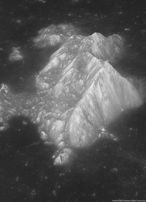
M1098059280LR-NSJ-58ax-33p-2450x3380
Central peaks of the farside landmark crater Tsiolkovskiy, from over 200 km to the west of the highest promontory. The large, mare-inundated impact crater was very unlikely to have been formed by a "low-velocity" collision.  A highly reduced in scale crop from a LROC NAC mosaic, M1098059280, orbit 14176, July 27, 2012; resolution between 4.6 and 5.3 (background) meters, from 87.66 km over 20.44°S, 121.42°E. Enlargement, HERE [NASA/GSFC/Arizona State University].

The most serious flaw in the new study is the assumption that the “unusual minerals,” olivine and spinel (found in many central peaks), are rare on the Moon. They are not rare; although spinel is somewhat sparse on the lunar surface (requiring high pressure for its formation), it has been described as present in lunar rocks from the first sample return and more recently has been found in remote sensing data of impact basin deposits. 

Olivine is a very abundant mineral on the Moon and typically makes up a significant fraction of the dark mare basalts (including some lavas that consist only of olivine and glass.)  Olivine is also not uncommon in highland rocks, usually occurring within the rock type troctolite, a 50-50 mixture of olivine and plagioclase.  The presence of olivine does not indicate either “deep” origins or “lunar mantle” provenance; virtually all olivine in lunar samples has high calcium content, indicating a relatively shallow origin (probably in magmas that crystallized within a few kilometers of the surface). 

In short, there is no compelling reason to believe that the central peaks of many lunar craters are dusted with exotic minerals from asteroids, although such a possibility is certainly not excluded.  The minerals that we see in central peaks are all indigenous to the Moon and in some cases, abundant in the lunar crust.

Computer modeling in science has both value and pitfalls.  An impact event is extremely messy and complicated.  Simultaneously, gigantic shock pressures and temperatures occur, putting billions of particles in motion.  Computers are good at keeping track of these particles and the codes developed to model complex, multi-variable phenomena have been shown to at least partly describe the behavior of crater formation on Earth.  However, the results of computer models must be interpreted cautiously; small changes in input variables or the conditions of the simulation sometimes result in drastic changes in the output of the model.  In addition, there is a tendency in science to believe in numbers, regardless of their provenance.  Because a model holds together does not mean that it describes reality.

In science, it is dangerous to embrace a model because it “works” (i.e., comes to closure).  Much of the current fracas over human-induced climate change comes from those who contend that the results of computer models constitute “settled science” (whatever that is).  Because the computer models say that it may happen, people assume (and some journalists report) that it is happening.  In actual fact, we have no direct observational evidence that human-caused emissions of carbon dioxide are causing the climate to change.  That conclusion comes from computer models that “show” (project) that humanity’s introduction of “excess” carbon dioxide into the atmosphere by industrialization will increase the magnitude of the greenhouse effect and raise the mean global temperature.  But climate (like impact) is a complex, chaotic phenomenon and we still do not fully understand how the Earth’s atmosphere interacts with itself and the cosmos.

In questions of complex natural processes, beware of accepting the results of computer modeling too easily.  Computer models are useful tools, but the old software adage of “garbage in, garbage out” still applies.  Be familiar with whom and from where the information comes, understand how it is processed and then carefully consider the likelihood of reported accounts.

Originally published May 29, 2013 at his Smithsonian Air & Space blog The Once and Future Moon, Dr. Spudis is a senior staff scientist at the Lunar and Planetary Institute. The opinions expressed are those of the author but are better informed than average.

Wednesday, December 26, 2012

New oblique view of Tsiolkovskiy central peak

The prominent, very distinctive central peaks of farside Tsiolkovskiy crater, from a new, scaled mosaic of the left and right frames of LROC Narrow Angle Camera (NAC) observation M1098059280, spacecraft orbit 14176, July 27, 2012; resolution between 4.6 and 5.3 (top) meters per pixel, captured 87.66 km over 20.44°S, 121.42°E, a point over 200 km west of the highest promontory. Larger versions available HERE  [NASA/GSFC/Arizona State University].
Joel Raupe
Lunar Pioneer

Each quarterly release of LROC data to the Planetary Data System (the twelfth, on December 15, covers the three months between mid-June and September), is not really complete until the KML index emerges, for viewing through Google Earth's lunar simulation.

Fortunately, the Lunar Reconnaissance Orbiter Camera (LROC) team made available to the public an incredibly useful set of improvements to their Web Map Server (WMS) Image Search tool, something that was already a real complimentary companion to the newer LROC QuickMap tool. Playing with the layers and search capabilities of the new tool, while studying the LUNAR landing site study, was enough to keep us busy.

The KML data are a fast and intuitive way yet to search directly for LROC NAC images, especially those with exceptionally high slew angles, the few oblique images. And the latest KML files appeared on the Massachusetts Institute of Technology servers December 21.

Since the very first grainy, misunderstood images of the Moon's far side were returned to Earth by the Soviet Union in 1959, Tsiolkovskiy immediately stood out, strongly underscoring the remarkable differences between the tidally locked hemispheres. LROC Wide Angle Camera (WAC) context view of the most conspicuous mare-flooded surface on the lunar farside, 185 km Tsiolkovskiy crater [NASA/GSFC/Arizona State University].
The oblique views are rare. Off nadir NAC observations are of a lower scientific value, perhaps, than the job of completing the high-resolution photography of the entire Moon, a goal the LROC team is closing in on. My favorite targets for these oblique views are never in the new batches, but there's always one or two that are breathtaking and unexpected.

Last September LROC's 11th release included an oblique look into the interior of Antoniadi, for example, that was then included in our post highlighting oblique views of Engel'gardt heights. Antoniadi, as it turns out, figures prominently in the aforementioned landing site study. Follow-up posts on that Eratosthenian crater, well inside the very ancient South Pole-Aitken basin, are in preparation.

Among the new, few oblique views that really stand out in the twelfth release is an off-nadir view of the central peaks of Tsiolkovskiy, shown up above. The complete field of view here is a highly re-sampled (less than 8 percent) version of what was originally a 6204 by 8955 mosaic (of LROC NAC M1098059280LR, swept up last July). It's reduced down to 580 x 800, or the maximum size allowable in a blogger post.

Because we derive vast amounts of valued-added imagery, in an image-intense subject of study, this last limitation has become a nagging problem we would like to solve.

Quarter resolution view of the LROC NAC mosaic shows some of the glory of the wider view, the eastern range and summit, as well as some of the considerable slumping of the degraded northern section of Tsiolkovskiy central peak [NASA/GSFC/Arizona State University].
We would welcome recommendations and/or reviews of image hosting sites, most especially those that do not presume to arbitrarily substitute photography with lossy resampling. Meanwhile, a planned migration to a new host for this website has been delayed yet again.

A virtually full resolution view of a high promontory of the Tsiolkovskiy central peak, suffering from a foreshortening affect, partly the result of simple distance and the high lateral motion of the LRO spacecraft, more 200 kilometers away. Like a more dramatic LROC NAC view of the high place on the central peaks of Tycho, this view seems to show a large boulder sitting near its top, likely a rock that emerged from the upthrust after considerable mass wasting [NASA/GSFC/Arizona State University].
Perhaps the best off-nadir view of the central peak of Tsiolkovskiy crater, prior to this latest oblique LROC NAC observation, from among the HDTV stills of the crater captured by Japan's SELENE-1 (Kaguya) orbiter in 2008. The view is from well to the north [JAXA/NHK].
Like the oblique LROC NAC mosaic of the Moon's highest elevation at Engel'gardt, discussed here in early October, this latest view of Tsiolkovskiy took place while the area of interest was under a high Sun, and from a great distance. Thus the raw result is of low contrast, the details of relief given over to raw albedo. That, and the apparent lateral motion through a field of view made small by distance, results in a less than perfect aesthetically pleasing result. We will take what we can get before continuing with the work of putting together raw illustrations needed to offer posts about the LUNAR landing site study.

Another 'full-resolution' first look at the new Tsiolkovskiy central peak NAC mosaic, this section near the southern base, a good illustration of the affects of foreshortening, and lateral speed through a narrow window, and over a bright Sun-Subject-Spacecraft phase angle. Though their trails are not individually seen, the subject and scene shown above are near to the area shown at much higher resolution (from overhead) discussed in the LROC Featured Image post "Weaving boulder trails on the Moon," last July 11 [NASA/GSFC/Arizona State University].
Sample Posts regarding Tsiolkovskiy crater:

The Old and the Young at Tsiolkovskiy (October 31, 2012)
Weaving boulder trails on the Moon (July 11, 2012)
Bulging wrinkles at Tsiolkovskiy (January 11, 2010)
Regolith on Basalt (January 10, 2012)
Highland-Mare boundary of Tsiolkovskiy (September 29, 2011)
The Hummocks of Tsiolkovskiy (August 26, 2010)
More of Tsiolkovskiy's boulders and boundaries (August 26, 2010)
Small fractures in the mare floor of Tsiolkovskiy (August 25, 2010)
Tsiolkovskiy - Constellation Region of Interest (May 1, 2010)
Uplift, Boulders of Tsiolkovskiy (September 1, 2009)

Wednesday, October 31, 2012

The Old and the Young in Tsiolkovskiy

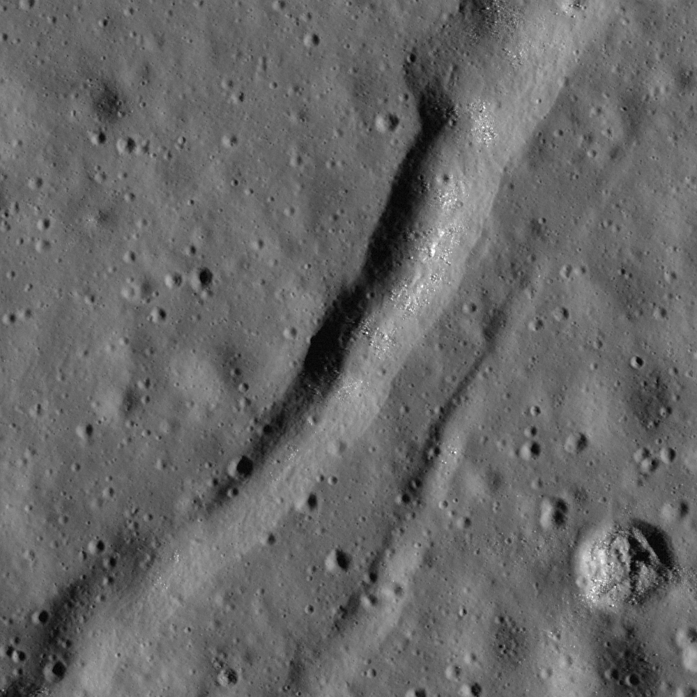
A recent impact narrowly missed an ancient extensional crack in the mare-filled floor, the northeast interior of Tsiolkovskiy crater (18.97°S, 130.34°E). That recent impact's crater is at lower left. An 800 meter-wide field of view from LROC Narrow Angle Camera (NAC) frame M161455429R, spacecraft orbit 8927, May 31, 2011; illumination from the east by northeast at 67.26° incidence at 61 cm per pixel resolution (in the original) from an altitude of 59 kilometers [NASA/GSFC/Arizona State University].
James Ashley
LROC News System

A common question from people examining the Moon through a small telescope for the first time is 'Why isn't the Earth covered with large craters like the Moon?' The first answer is that the Earth does have a number (more than 200) of known impact craters, but clearly nothing like the profusion of craters we see on the Moon. The more complete answer is that the Earth, during the first 600 million or so years of Solar System history, was indeed subject to the same relentless pounding that resulted in the Moon's population of large basins. However, early basins were subsequently obliterated by plate tectonics and surface weathering on the Earth. The Moon's features have been preserved because without wind, water, or plate tectonics, it takes a much, much longer time for the lunar surface to be reworked.

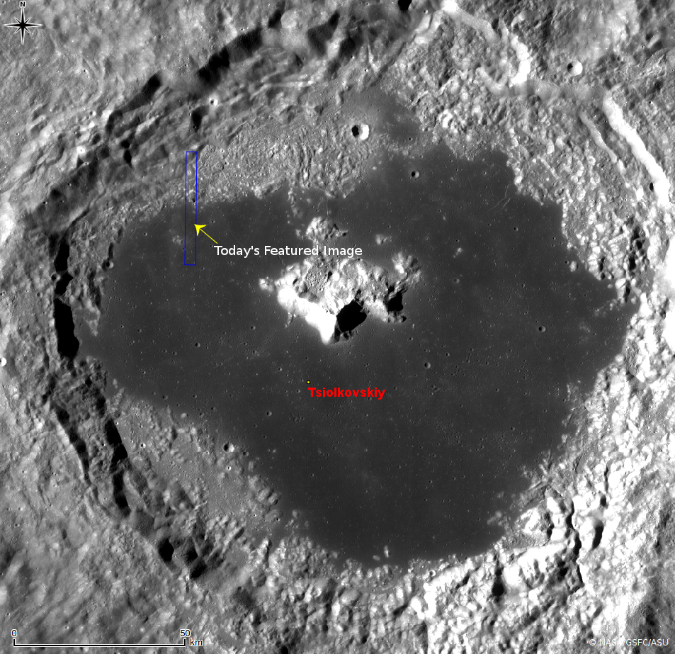
Today's Featured Image provides an example of this difference. We examine a length of shrinkage crack along the northern shore of Tsiolkovskiy's mare basalt volcanic deposits. Visible also in the WAC mosaic below, these features appear to result from contraction of the molten basaltic deposits during cooling. Also present (immediately adjacent to this portion of crack) is a relatively young impact crater. The two formation events are separated in time by several billion years, yet both present bouldery surfaces, and relatively sharp topographic expressions. Because of the slow rate of "space weathering," Lunar scientists must use more subtle indicators of freshness, or stratigraphic and other cross-cutting relationships, to determine the relative ages of landforms. The Apollo and Luna samples allow us to anchor portions of the lunar geologic time scale to radiometric age dates.

A12,922 line by 8,734 sample from a mosaic of both the left and right frames from LROC NAC observation M161455429, resampled to allow a medium resolution context for the field of view seen at higher resolution further above (white square). Again, that square represents approximately 800 meters and this re-sampling is about 4 kilometers across [NASA/GSFC/Arizona State University].
Compare the shadows within the linear feature to those of the recent impact in the southwest corner of the opening image. Because the crater is known to be an excavation, and the eastern walls of both features are in shadow, it is clear that the linear feature also shows negative relief. Contrast these shadows to those of this feature from within the same basin, which shows a similar outline, but represents a topographic high. Clearly several processes have been at work within these deposits. The crater is another example of a special type of impact feature called a bench crater (see October 17, 2012 LROC Featured Image).

LROC Wide Angle Camera (WAC) mosaic of the northeast quadrant of Tsiolkovskiy, field of view about 115 km across [NASA/GSFC/Arizona State University].
The full NAC image can be explored HERE. Other LROC Featured Images highlighting landforms related to mare tectonics include Tectonics in Mare Frigoris, and Not Your Average Scarp.

Since the very first grainy, misunderstood images of the Moon's far side were returned to Earth by the Soviet Union in 1959, Tsiolkovskiy immediately stood out, strongly underscoring the remarkable differences between the tidally locked hemispheres .
Weaving Boulder Trails on the Moon (July 12, 2012)
Bulging wrinkles at Tsiolkovskiy (January 11, 2012)

Friday, July 20, 2012

The Twentieth of July


"The Earth is the cradle of the mind,
but one cannot live forever in a cradle."

- Tsiolkovskiy

"Земля это колыбель разума, но нельзя вечно жить в колыбели. Для мечты вчера надежду сегодня и реальность завтрашнего дня."

- Циолковский

Wednesday, July 11, 2012

LROC: Weaving boulder trails on the Moon

Boulders have rolled downslope from the central peaks of Tsiolkovskiy crater, leaving a wide variety of trails in their wake.  Some boulders have come to a stop and several trails curve beyond the field of view further downslope. A 500 meter field of view taken from LROC Narrow Angle Camera (NAC) observation M176791784R, LRO orbit 11189, November 24, 2011; angle of incidence 62.6° at 0.5 meters resolution, form an altitude of 42.12 km. View the larger LROC Featured Image HERE [NASA/GSFC/Arizona State University].
Drew Enns
LROC News System
 

A variety of geologic processes form boulders on the Moon. Some boulders are thrown out as ejecta during the impact process. Other boulders are found at the top of wrinkle ridges; members of the LROC Science Team have identified boulder populations atop lava flows and other lunar volcanic landforms; still other boulder fields are found on the floors of craters after eroding out of outcrops on the walls or central peak. Of course, when we say “erosion” in the context of lunar geology, we don't mean erosion the way one would use it for terrestrial geology. The Moon has no atmosphere, no rain, and no weather, so the main processes that would cause this sort of erosion on the Moon are the constant flux of bolide impacts, and to a lesser extent, seismic activity. So which of these processes produced the boulders in today's Featured Image? Looking at a context image helps.

Interior of 184 km-wide Tsiolkovskiy crater, from the Global LROC Wide Angle Camera (WAC) 100 meter monochrome mosaic, context with the location of the field of view taken from LROC NAC frame M176791784R (designated by the yellow arrow) on the south terraces and slopes of the central peak complex highlighted in the LROC Featured Image released July 11, 2012 [NASA/GSFC/Arizona State University].
The Featured Image shows an area near base of Tsiolkovskiy crater's central peak. Tsiolkovskiy crater, located at 20.38°S, 128.97°E, is filled with mare basalts and has a prominent central peak. The boulders have rolled downhill from outcrops of rock at higher elevations, closer to the summit of the central peak. Central peaks are thought to be made up of the deepest materials exposed during an impact. So, these boulders present an excellent opportunity to enable future astronauts to sample materials from the deep lunar crust.

Under a higher sun (angle of incidence 46°) the area on the south central peak of Tsiolkovskiy comes out of the shadows, also at a slightly higher resolution (89.3 meters), from a monochrome (604nm) mosaic stitched from a series of sequential orbital passes averaging 60 km in altitude, August 17, 2010 [NASA/GSFC/Arizona State University].
But Tsiolkovskiy crater is not just interesting because of its large central peak. Tsiolkovskiy is also partially filled with mare basalt material, a relatively rare occurrence on the farside of the Moon. The combination of accessible deep crustal materials and mare basalts within traverse distance of each other make Tsiolkovskiy crater a high-priority target for future human and robotic lunar exploration.

Explore more of Tsiolkovskiy's central peak and find the source of the boulders in the full LROC NAC frame, HERE.

Some Related Posts:
Frozen in Time (June 9, 2011)
Rolling, Rolling, Rolling (May 1, 2012)
A Recent Journey (February 7, 2012)
Sampling Schrödinger (August 17, 2011)
Archimedes - Mare Flooded Crater! (March 2, 2011)

Wednesday, January 11, 2012

LROC: Bulging wrinkles at Tsiolkovskiy

From the complementary left-side frame of the north-northwest interior of Mare Tsiolkovskiy spotlighted January 10, "bulging" and interestingly entwined wrinkle ridges can be seen extending into the prominent farside crater's very flat and expansive floor. Sunlight is from northeast in this slightly "twisted" view of the original Featured Image (which shows a larger field of view 610 meters across) HERE. LROC Narrow Angle Camera (NAC) observation M161475783L, orbit 8930, May 31, 2011, resolution 0.61 meter per pixel from 58.99 kilometers  [NASA/GSFC/Arizona State University].
Hiroyuki Sato
LROC News System

The mare in the Tsiolkovskiy crater looks extremely flat and smooth at first glance. But if you stare carefully, you can find many tectonic features deforming this large plain; extension cracks, classic wrinkle ridges, and special wrinkle ridges that have a convex bulge shape.

Today's Featured Image shows a portion of a narrow "bulging" wrinkle ridge 60 to 100 meters in width, extending in a northeast direction to the edge of the mare. Wrinkle ridges are common in the lunar mare and are believed to be a type of thrust fault. These ridges typically have a steep slope on one side and a shallow slope on the other. In this case, the ridge seems to have a uniform curved shape. Local tectonic conditions such as the thickness of mare, stress direction, and the layer strength affect the final shape of a ridge. Since this ridge has a unique shape, it is now targeted for future NAC stereo imaging. From the new stereo pair, scientists will make a detailed topographic map that will allow tectonic experts to better understand the nature of this feature and add to our knowledge of tectonism on the Moon.

LROC WAC 100 m/pixel monochrome (643 nm) mosaic of the area around northwest Mare Tsiolkovskiy. The area shown at high resolution (white arrow) is near 19.41°S, 127.34°E. View the full-scale WAC context image, and the totality of Tsiolkovskiy's interior HERE   [NASA/GSFC/Arizona State University].

Explore the full length of the "bulging" wrinkle ridge and other nearby tectonic features, HERE.

Related Posts:
Tectonics in Mare Frigoris
Stress and pull
Relative age relationships
Zebra Stripes
Right Angle
Wrinkle ridge in Oceanus Procellarum
Sinuous Chain of Depressions

Tuesday, January 10, 2012

Regolith on Basalt

Clusters of possible secondary craters on the north edge of the mare deposits inside Tsiolkovskiy crater. LROC Narrow Angle Camera (NAC) observation M161475783R, LRO orbit 8930, May 31, 2011; incidence angle 67.51° with a resolution of 0.61 meters per pixel from 58.99 km. Image field of view is 610 meters. View the larger LROC Featured Image HERE [NASA/GSFC/Arizona State University].

Hiroyuki Sato
LROC News System

Tsiolkovskiy is a large and spectacular crater on the farside of the Moon (diameter is 180 km). Some time after the impact event that created Tsiolkovskiy, low viscosity lava erupted and flooded the bottom portion of the crater; forming the dark, flat, smooth plain that stands against the bright background of anorthositic highlands.

The age of this mare is estimated, through crater-counting techniques, to be about 3.5 billion years old. The initial solid surface of the solidified lava sheet has slowly been dug up and churned by small impact events. These small impacts build up a layer of loose, crushed rock, similar to a soil on the Earth. On the Moon this layer is called regolth. Today's Featured Image highlights a cluster of relatively young and small craters on the Tsiolkovsiky mare (formed in the regolith). These small craters are probably secondary craters formed as material was thrown out of a nearby primary impact. Did you notice that some of these craters have unusual shapes? Instead of the usual bowl shape of small craters, these examples have very flat floors. Why?

Context for the full LROC NAC frame (rectangle) under the polar orbit of LRO, superimposed on the USG/JAXA digital elevation model and the recently completed Apollo J mission orbital camera survey mosaic in Google Earth [NASA/USGS/JAXA/GSFC/ASU/Google].
Secondary impacts hit the Moon with much lower velocities than primary impacts, so there is less energy (for the same size impactor) available to excavate a crater. Also there is a strength difference between the regolith and the still solid bedrock that it covers. The upper layer is unconsolidated (loose), which is easily excavated and swept out. The lower layer is more solid, and requires more energy to excavate. The flat floor is thus thought to represent the boundary between the regolith and the still solid basalt. By measuring the depth of the flat floor craters, scientists can estimate the depth of the regolith.

LROC Wide Angle Camera (WAC) monochrome 100 meter per pixel mosaic with false-color DLR elevation data (LROC QuickMap) centered over Tsiolkovskiy. The crater's central peak (20.32°S, 128.68°E), at nearly a kilometer above the Moon's mean elevation, rises more than 2000 meters over the mare covered crater floor. [NASA/GSFC/Arizona State University].

Explore these odd craters in the full NAC frame!

Related Posts:
Terraced Craters in Aitken Crater
Fresh Bench Crater in Oceanus Procellarum
Just Another Crater?
Bench Crater in Plato

Thursday, August 26, 2010

The Hummocks of Tsiolkovskiy

Updated August 27, 2010 1655 UT

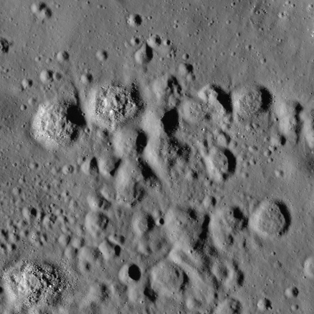
LROC Narrow Angle Camera observation M115475912R shows the hummocky terrain north of the Central Peak of Tsiolkovskiy, well within the crater rim - though not a remnant of the slumping of collapsing crater wall material that resulted in the crater's magnificent terraces, but also outside the region flooded by mare basalt. The hummocks formed as the crater rebounded after the shock of impact dissipated. The image field of view is 940 meters, with an solar illumination incidence angle of 75° [NASA/GSFC/Arizona State University] - Sarah Braden, LROC News System, August 26, 2010.


The Featured Image (arrow) in a montage within 6000 (of 52224) lines from LROC NAC frames M114575923R & L, from half-way across the hummock formation to its boundary with Tsiolkovskiy's mare basalt fill. Channels through the hummocks, and even a solidified "falls" at the boundary shelf are seen. Study of the formation may reveal mixing, channeling and cooling behaviors of super-heated materials elsewhere on the Moon. The LRO frames, from 60.25 km (LRO orbit 2151, December 15, 2009) are superimposed on a low-resolution digital elevation model [NASA/GSFC/ASU/JAXA].


The Hummock region of the north central interior of Tsiolkovskiy from the Apollo 15 Service Module mapping camera in 1971. The arrows indicate the general location of the LROC featured image and the mare-Central Peak boundary, below [NASA/ASU/LPI].

More of Tsiolkovskiy's boulders and boundaries


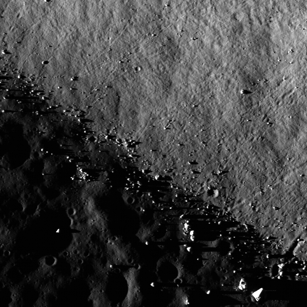
The central peak of Tsiolkovskiy crater is surrounded with mare basalt. This Narrow Angle Camera frame shows where boulders have rolled down the sides of the steep central peak onto the Sea floor (boulder trails abound). The central peaks of larger lunar craters like Tsiolkovskiy are of particular interest because they expose rock uplifted from great depth, rebounding during the impact event. This image is 890 meters wide, with a sunset solar incidence angle of 88° [NASA/GSFC/Arizona State University].


Pulling back, to the full 4.25 km-wide field of view of the LROC observation, boulders abound, shedding from the peak. The LROC Featured Image further up is indicated by the arrow. LROC NAC M101313293LE was gathered very early in LRO mission, on July 4, 2009. Orbit 114 was still relatively eccentric when compared to the nearly circular 50 km Nominal Mission orbit where LRO presently operates. It's altitude above was 84.95 km, and the image resolution is about 90 cm per pixel [NASA/GSFC/Arizona State University].

Browse the full NAC image, from top to bottom, HERE, and it's companion half, HERE.


Five LRO NAC observations, representing widely varying illumination angles and altitudes, are seen here superimposed on Clementine (1994) albedo studies [NASA/GSFC/Arizona State University].


Even though far more bright highland terrain exists on the Moon than mare-inundated basins, you wouldn't know by looking at the near side from Earth alone. In the hemisphere centered on Tsiolkovskiy, none of the spectacular basins and other features we now know exist in this field of view stands out as clearly as this most obvious feature of the far side.


Now ready for LROC close-ups, Tsiolkovskiy, with rest of the far side, is tidally locked beyond line of sight from Earth. The Soviet Union's probe Luna 3 caught humanity's first photographic look in 1959. The surprising differences between the Moon's near and far sides, with an origin still being debated, was obvious even in these first photographs. The relatively small, heart-shaped Sea of Tsiolkovskiy, with it's lofty central peak, stood out clearly from the bright highland that surround it [RAS/USSR].

Wednesday, August 25, 2010

Small fractures in the mare floor of Tsiolkovskiy

Updated August 25, 2009 1500 UT

Small fractures in the mare floor of Tsiolkovskiy Crater are a departure from the usual scene of smooth mare pitted with impact craters. As the mare cools, fractures like these can form, or these fractures might have formed due to changes in the morphology of the Tsiolkovskiy impact crater over time. Image width is 580 m; NAC Image M130822373R, incidence angle 73° and resolution is 0.58 meters per pixel [NASA/GSFC/Arizona State University].

"The Earth is the cradle of the mind.
But one cannot live forever in a cradle."
- Tsiolkovskiy

Sarah Braden
LROC News System

Located on the lunar far-side (20.4° S, 129.1° E), the interior of Tsiolkovskiy Crater is filled with Upper Imbrium aged mare basalt. The 185 km diameter impact crater is named after the Russian physicist and space pioneer Konstantin E. Tsiolkovskiy (1857 - 1935). The first image of this crater was acquired by the Soviet Luna III robotic spacecraft in 1959.

Read more about Tsiolkovskiy crater here, view the LROC NAC Youtube movie, and browse the full-resolution NAC image, HERE.


Only a kilometer away from the area featured by LROC, similar fractures impinge through a small space weather and micrometeor worn crater. One trail of fractures clearly runs through the crater structure, clearly younger than both the crater and the surrounding terrain. It also appears to have caused generous shedding. Sampling of differing ages in similarly impinged features help date the faults and trace their origin. LROC NAC M130822373R, LRO orbit 4412, June 10, 2010 [NASA/GSFC/Arizona State University].


A five kilometer long section, 2.6 km-wide, from the Narrow Angle Camera observation shows the featured area, the impinged crater above (arrows), and at bottom the a sharp steep boundary between basalt inundated crater interior and the steep rise of Tsiolkovskiy's slumping rim. (see Kaguya HDTV still, below) LROC NAC M130822373R [NASA/GSFC/Arizona State University].

Related posts:

Hummocks and blocks and craters

Uplift, Boulders of Tsiolkovskiy

Floor of Tsiolkovskiy -
Constellation Region of Interest


HDTV view of Tsiolkovskiy from Japan's SELENE-1 (Kaguya) lunar orbiter in 2008 (compare with a Kaguya HDTV still from the crater's opposite side, HERE - May 1, 2010). The view here is from the north and above, showing the rugged terrace structure of wide slumping walls and an interior dominated by central peak. NASA, MIT and the Naval Research Laboratory hope to eventually deploy a radio telescope here to probe the elusive cosmic Dark Age, taking full advantage of radio quiet available only on the Moon's far side shaded from the loud interference of earthbound radio on needed frequencies [JAXA/NHK/SELENE].

Saturday, May 1, 2010

Tsiolkovskiy - Constellation Region of Interest


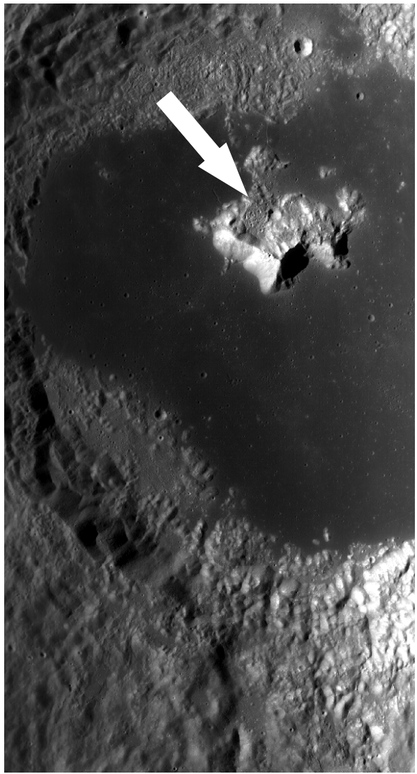
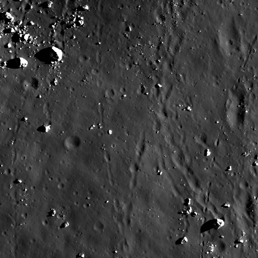
LROC Featured Image, April 30, 2010. Narrow-Angle Camera view of massive boulders on an outlying rampart of the complex central peak of Tsiolkovskiy, and within the Constellation Region of Interest. The full image is of and area roughly 700 meters wide (LROC NAC frame M113107391L) [NASA/GSFC/Arizona State University].

Maria Banks
LROC News System

Tsiolkovskiy Crater is 185 kilometers (115 miles) wide and located on the far side of the Moon. It's named after Russian scientist and visionary space pioneer Konstantin Tsiolkovskiy.

"The earth," Tsiolkovskiy wrote, "is the cradle of the mind. But one cannot live forever in a cradle."

The crater has a complex central peak, a smooth lava-flooded floor, a lunar lobate scarp located on the ejecta blanket near the crater rim and several other interesting geomorphological landforms and features that make Tsiolkovskiy an exciting destination for future human lunar exploration.


LROC Wide Angle Camera context image showing Tsiolkovskiy crater and the surrounding lunar highlands. The approximate position of LROC's Featured Image is shown by the white arrow [NASA/GSFC/Arizona State University].

Tsiolkovskiy's floor is covered with relatively smooth mare basalt that formed from pooling basalt that was erupted after the crater formed. The central peak, a large mountain near the center of the crater, is composed of material from beneath the crater floor that rebounded upward after being compressed during the impact event. Also visible are many boulders or pieces of the uplifted central peak that have broken off and accumulated on the crater floor. The relationship between some of the boulders and the mare basalt flows is complex. In some areas it appears that boulders are surrounded and partially covered by the basalt lava indicating that the lava formed more recently than the boulders. In others, the boulders look like they rest on top of the dark lava flows.

The biggest boulders in this view are up to ~25 m (over 80 feet) in length! This is roughly the length of a college basketball court or two school buses lined up lengthwise. In areas such as this, astronauts are able to easily collect and study rocks from the smooth mare crater floor as well as rocks that originated from beneath the lunar surface! You can also see on the floor of the crater multiple smaller craters that formed over time as small asteroids and comets impacted the Moon. Scientists can use counts and measurements of superposed craters to estimate when Tsiolkovskiy Crater formed - the more craters, the older the surface on which they lie.

For more information on LROC's observation campaign for the Constellation program Regions of Interest read this Lunar and Planetary Science Conference abstract, and visit the LRO Science Targeting Meeting website (look for the baseball card summary sheets for each site: part 1, part 2).

Read more about Tsiolkovskiy at Arizona State University's Apollo Digital Image of the Week.

Explore the Tsiolkovskiy Constellation region of interest for yourself!


HDTV still image of Tsiolkovskiy from Japan's lunar orbiter SELENE-1 (Kaguya, 2007-2009). The Naval Research Laboratory, Massachusetts Institute of Technology and NASA have teamed up to design and deploy a radio telescope array on the floor of the far side crater, hoping to use the radio quiet of the side of the Moon blocked from the interferences of Earth and her billions to probe the cosmological "Dark Ages," a poorly understood time between the primeval fireball of the Big Bang and the formation of earliest galaxies [JAXA/NHK/SELENE].

Tuesday, September 1, 2009

Uplift, Boulders of Tsiolkovskiy

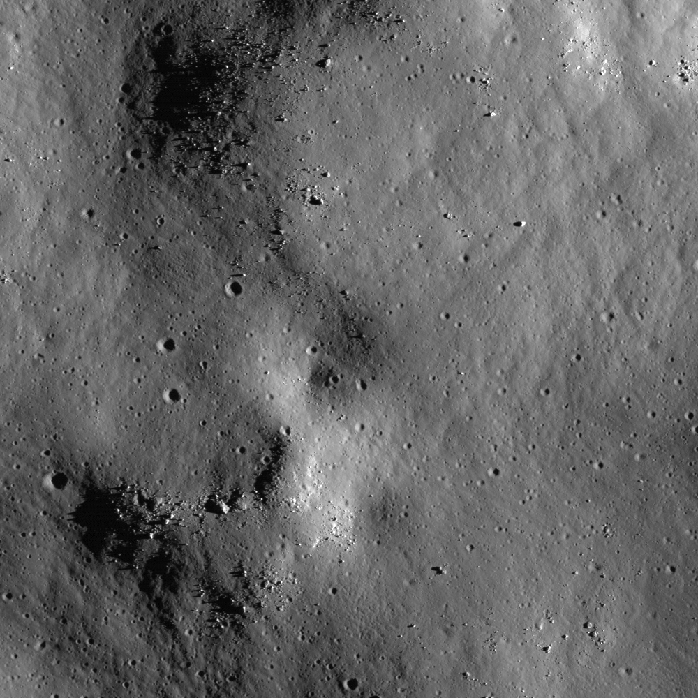
Boulders perched on the summit of the central peak of Tsiolkovskiy [NASA/GSFC/Arizona State University]

Jeff Plescia
LROC News System

Tsiolkovskiy (185 km diameter) is a spectacular example of complex impact crater. It has a terraced rim, a central peak, and a floor flooded with mare basalts. Impact events release tremendous amounts of energy and result in very dynamic changes in the local landscape. Just after the initial impact, the central peak was uplifted from lower crustal rock, forming a giant mountain in the middle of the crater. Later large and small pieces of that uplifted rock rolled down and accumulated at the base of the slope -- just waiting for future lunar explorers to examine. This strategy was used by the Apollo 17 astronauts as an easy way to sample nearby mountain tops without having to climb to the top. Frequently it is easy to see where a boulder came from by following its tracks, a great clue to geologists reconstructing the local geology. The largest boulder in this image is about 40 meters wide - half as big as a soccer field! The dark area in the lower right is the tip of enormous shadow cast by the central peak.
Read the latest from the LRO Camera
Operations Journal HERE.