Showing posts with label Lunar South Pole. Show all posts

Wednesday, November 21, 2012

ESA Lunar Lander mission axed

The EADS Astrium - European Space Agency (ESA) Lunar Lander, clinging to a 2018 landing, possibly on the rim of lunar South Pole crater Shackleton, is likely scrubbed [EAS/Astrium].
Germany's DLR has reportedly given up advocating the 2018 south polar Lunar Lander mission as ESA member nations struggle with dire discretionary budget constraints in the midst of an on-going sovereign debt crisis.

Germany dropped further efforts to secure joint European funding for Lunar Lander at an ESA budget meeting in Naples in favor of upgrades to the Ariane 5.

Meanwhile, following NASA's exit from the ExoMars orbiter-rover mission, in development since 2005, Russia's Federal Space Agency Roscosmos has become ESA's new launch partner, set to launch the orbiter half of that mission in 2016 and its tandem six-wheeled rover two years later.

Related Posts:
ESA input sought on multi-purpose lunar lander (March 2, 2009)
Astrium study of ESA NEXT lunar lander underway (June 10, 2009)
Remembering SMART-1 (September 17, 2009)
ESA: Fly us to the Moon's South Pole (March 31, 2010)
NEXT step for ESA's first lunar lander (September 16, 2010)
Astrium tests ESA Lunar Lander thrusters (March 5, 2012)
ESA's MoonNEXT boosted by ATV development (April 30, 2012)
ESA Lunar Lander still on target for 2018 (July 27, 2012)

Friday, July 27, 2012

ESA Lunar Lander still on target for 2018

Lunar Lander is a robotic explorer that will demonstrate key European technologies and conduct science experiments. The mission is a forerunner to future human and robotic exploration of the Moon and Mars. Like the SMART-1 program, the ESA Lunar Lander is intended to establish European expertise and encourage "strong international partnerships in exploration" [ESA].
HT: Jason Major, Universe Today

European Space Agency - After more than 30 years, the Moon is once again in the spotlight of space agencies worldwide, as a destination for both robotic missions and human explorers. Europe’s ambitions for lunar exploration begin with a lander on the Moon in 2018.

Plans call for launching the ESA Lunar Lander on board a newly designed Soyuz 2.1B, attached to a high-performance fregat upper stage, from the Russian launch facility adjacent to Europe's busy Guiana Space Centre at Kourou, French Guiana, near the equator on the Atlantic coast of South America. Utilizing a low energy transfer orbit, boosting the height of perigee in successive orbits, the Lunar Lander will rendezvous with the Moon and brake into a polar orbit.

Lunar Lander is a robotic explorer that will demonstrate key European technologies and conduct science experiments. The mission is a forerunner to future human and robotic exploration of the Moon and Mars. It will establish European expertise to allow strong international partnerships in exploration.

Lunar Lander’s primary goal is to demonstrate the advanced technologies needed to land precisely and safely. The spacecraft will find its landing site without human intervention, recognising and avoiding hazards such as craters and boulders autonomously. 

On the Moon, it will prove European technologies for surviving and working while exploring the environment around the landing site. The choice of the high rim of Shackleton crater, location of the Moon's south pole, should allow long periods of near-constant availability of solar energy.

Before operating more ambitious equipment and conducting human activities on the Moon, many questions need to be answered. How hazardous is lunar dust to equipment and astronauts? Does the Moon offer resources that could be used by future missions?


Lunar Lander will touch down near to the Moon’s south pole, an interesting location for future exploration missions, where no craft has landed before. The technologies developed to reach this site, together with a deeper understanding of this challenging environment, will equip Europe’s scientists and engineers for future cooperation on even more ambitious exploration missions.

Related Posts:
ESA: more about its Lunar Rover (March 16, 2008)
ESA input sought on multi-purpose lunar lander (March 2, 2009)
ESA demonstrates lunar life support system (June 6, 2009)
Astrium study of ESA NEXT lunar lander underway (June 10, 2009)
Russia comes to South America (June 18, 2009)
Remembering SMART-1 (September 17, 2009)
ESA: Fly us to the Moon's South Pole (March 31, 2010)
NEXT step for ESA's first lunar lander (September 16, 2010)
Scientific Preparations for Lunar Exploration Workshop (November 14, 2011)
Astrium tests ESA Lunar Lander thrusters (March 5, 2012)
ESA's MoonNEXT boosted by ATV development (April 30, 2012)

Monday, March 5, 2012

Astrium tests ESA lunar lander thrusters

The European Space Agency (ESA) is developing MoonNEXT,
a lunar lander mission to the Moon's south pole set for 2018 [ESA].
Europe’s ambition of touching down at the Moon’s south pole by 2018 has been boosted by recent test firings of the craft’s thrusters. The robot lander will prove new techniques for sending humans to the Moon and assess lunar hazards. One of these thrusters was recently put through its paces at Astrium’s specialized facility in Lampoldshausen, Germany.

The test chamber was configured to reproduce the vacuum and temperatures that Lunar Lander will face on its way down to the Moon’s surface. A complete descent and touchdown was simulated, with the thruster firing in a series of short bursts, reaching a white-hot 1100ºC.

According to ESA’s Bérengère Houdou, the results are positive: “The thruster operations were smooth and stable, with great performance, even under the stress of a lunar lander’s operating conditions.”

To save the cost of developing a new engine, ESA engineers looked to the tried-and-tested thrusters of Europe’s proven Automated Transfer Vehicle (ATV) space ferry.

Related video HERE. - ESA press release HERE.

Saturday, January 14, 2012

Shadowed fluffy lunar frost detected in starlight

LRO (in this case the LOLA imaging team) is slowly but certainly stripping away the shadows from the permanently shadowed regions of the Moon. The differences between the water-supporting natures of the rocks deep in the shadowed southern craters Haworth and Shoemaker has been better explained by data collected by LRO's LAMP instrument. From Earth, seen here from a Kaguya HDTV still shot from nearly the same angle in 2008, the shadowed region between the nearside rim of South Pole Aitken basin and 10 km-wide Shackleton (which supports the Moon's south pole on it's rim) can only be measured through "the notch" between Malapert massif on the left and the lofty "Leibnitz beta" massif on the right [NASA/JAXA/LMMP/ILIADS]
San Antonio  New maps produced by the Lyman Alpha Mapping Project (LAMP) aboard NASA's Lunar Reconnaissance Orbiter (LRO) reveal features at the Moon's north and south poles in regions that lie in perpetual darkness. Developed by the Southwest Research Institute (SwRI), the LAMP instrument is sensitive on dim "starlight," specifically the band of electro-magnetic frequencies emitted when hydrogen (which usually travels in pairs) is reduced to a single atom, usually when encountering other forms of radiation.

This Ly-α (Lyman-alpha) spectral line is peculiar to neutral hydrogen, the most basic and abundant element in the universe, is produced by light with a wavelength of 121.4 nm, a frequency below the narrow band of optical frequencies visible to the naked eye. By gathering data revealed by this all-pervasive indirect starlight LAMP can peer into so-called "permanently shadowed regions" (PSRs).

In repeated passes over the lunar poles using this method researchers have able to determine the presence of very fine structure, such as the likely porosity of lunar surface rock or the most likely textures of water frost in super-cold volatile traps, in permanent shadow from the Sun, and only in those places on the Moon not overwhelmed by direct or immediately indirect sunlight.


The LAMP maps show that many PSRs are darker at far-ultraviolet wavelengths and redder than nearby surface areas that receive sunlight. The darker regions are consistent with large surface porosities — indicating "fluffy" soils — while the reddening is consistent with the presence of water frost on the surface.

"Our results suggest there could be as much as 1 to 2 percent water frost in some permanently shadowed soils," says author Dr. Randy Gladstone, an Institute scientist in the SwRI Space Science and Engineering Division. "This is unexpected because naturally occurring interplanetary Lyman-alpha was thought to destroy any water frost before it could accumulate."

The LAMP team estimates that the loss of water frost is about 16 times slower than previously believed. In addition, the accumulation of water frost is also likely to be highly dependent on local conditions, such as temperature, thermal cycling and even geologically recent "impact gardening" in which micrometeoroid impacts redistribute the location and depth of volatile compounds.

Lyman-alpha albedo maps for greater south polar region from the first year of LAMP night-side observations. Initial studies were focused on those areas above 80°N. The white square is the area highlighted in a recent paper comparing what's been discovered about the big differences between the interiors of permanently shadowed neighbors Haworth and Shoemaker craters. "Calibrated photon events" accumulated month by month and divided by model-based illumination baselines show "generally, we find good agreement between UV-dark regions and the coldest shaded craters revealed by the LRO Diviner instrument." Identifying the cause of this albedo darkening required spectral analysis but the likeliest explanation included either the presence of "UV-absorbing volatiles at the surface" and/or "a change in surface properties (e.g., roughness or porosities) at these interesting locations." [Retherford et al., Lunar and Planetary Sciences Conference, (2011)].
Finding water frost at these new locations adds to a rapidly improving understanding of the Moon's water and related species, as discovered by three other space missions through near-infrared emissions observations and found buried within the Cabeus crater by the LCROSS impactor roughly two years ago. During LRO's nominal exploration mission, LAMP added to the LCROSS results by measuring hydrogen, mercury and other volatile gases ejected along with the water from the permanently shaded soils of the Moon's Cabeus crater.

"An even more unexpected finding is that LAMP's technique for measuring the lunar Lyman-alpha albedo indicates higher surface porosities within PSRs, and supports the long-postulated presence of tenuous 'fairy-castle' like arrangements of surface grains in the PSR soils," says co-author Dr. Kurt Retherford, a senior research scientist also in SwRI's Space Science and Engineering Division.

Comparisons with future LAMP maps created using data gathered from the Moon's day side will prove helpful for revealing more about the presence of water frost, as well as the surface porosities of the darker surface features observed. The LAMP team is also eager to apply the Lyman-alpha technique elsewhere on the Moon and on other solar system objects such as Mercury.

No longer terra incognitia, the permanently shadowed interiors and area surrounding the southern polar craters Haworth and Shoemaker have had their elevation unveiled in precise detail, seen here in laser altimetry collected over two years and several thousand polar orbits [NASA/GSFC/LOLA].
LRO's findings are expected to be valuable to the future consideration of a permanent Moon base. The permanently shadowed regions of the Moon are revealing themselves to be some of the most exotic places in the solar system, well worthy of future exploration, says Retherford. Any discovery of water frost and other resources in the area also could reduce the need to transport resources from Earth to a base at the pole.

The paper, "Far-Ultraviolet Reflectance Properties of the Moon's Permanently Shadowed Regions," by G.R. Gladstone, K.D. Retherford, A.F. Egan, D.E. Kaufmann, P.F. Miles, et al., was published in the Jan. 7 issue of the Journal of Geophysical Research. LAMP's principal investigator is Dr. Alan Stern, associate vice president of the SwRI Space Science and Engineering Division.

Wednesday, September 28, 2011

Scarps in Schrödinger


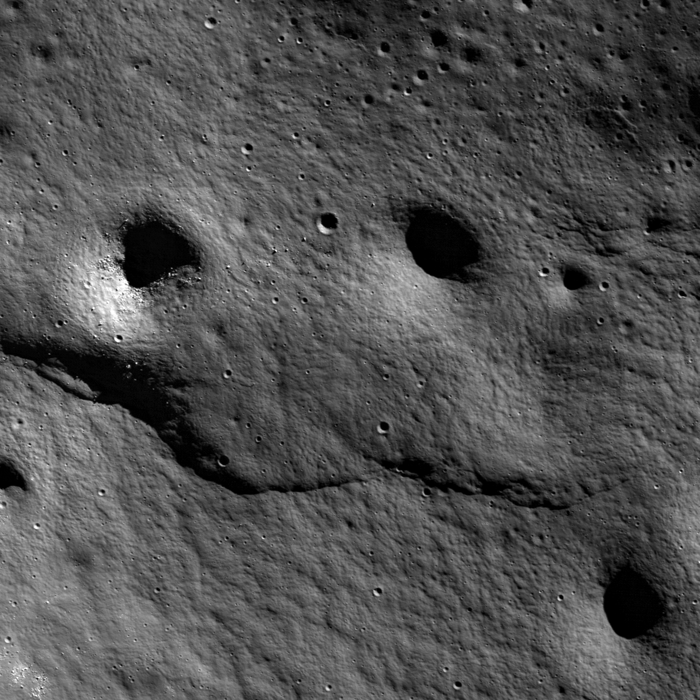
A lobate scarp formed in the wall material of Schrödinger basin. LROC Narrow Angle Camera (NAC) observation M159099396R, LRO orbit 8580, May 3, 2011, field of view 1.1 km, illumination from the extreme northeast, within 75° of the lunar south pole. View the full-sized LROC Featured Image HERE [NASA/GSFC/Arizona State University].

Lillian Ostrach
LROC News System

Surface manifestations of contractional stresses are observed frequently on the Moon. Oftentimes, wrinkle ridges (from several tens of meters to many hundreds of kilometers long) formed in maria are the most easily identified contractional tectonic features. Another geologic feature resulting from contraction, lobate scarps, are observed in the highlands. From LROC NAC images we now know that lobate scarps are prevalent in the highlands and thus are globally distributed. The Lee-Lincoln scarp and a lobate scarp in Slipher crater are excellent examples of highland scarps. Today's Featured Image reveals a lobate scarp in the Schrödinger basin (79.30°S, 126.50°E), an example smaller than the Lee-Lincoln and Slipher crater scarps.

Lobate scarps are the surface expression (visible part) of a fault that cuts through the lunar crust. In the opening image, the crust was probably under compression from approximately north to south (squeezed from top to bottom). The ground on the northern part of the image buckled, broke, and rode up over the ground on the southern part of the image, creating the obvious bulge. Also, just like faults on Earth, the scarp shallows out and disappears (near the right of the image). This shallowing of the scarp may be due to non-uniform contractional stresses in this area such that the stresses were not the same everywhere. Alternatively, the underlying rocks may have had different strengths, which caused the stresses to deform the rocks differently. The story is further complicated here because the scarp formed in the impact basin wall material, which was likely heavily fractured and fragmented during the violent, basin-forming impact. This scarp is ~1.3 km long and may extend for several hundred meters or more beyond the western edge of the NAC frame. While this scarp shallows and disappears, the full NAC image includes portions of at least two additional nearby lobate scarps. The scarp formation story is not a simple one, and additional observations are necessary to piece together the compressional history of this area.


From the LROC Wide Angle Camera (WAC) monochrome 100 meter per pixel resolution global mosaic, showing the southern frontier of the Schrödinger impact basin. A twenty kilometer stretch, running from southwest to northeast, is the location of a plethora of lobate scarps. The location of the lobate scarp highlighted in the LROC Featured Image released September 27, 2011 is noted with a yellow arrow [NASA/GSFC/Arizona State University].


Wider angle segment from the WAC 100 meter global mosaic, showing the full width of Schrödinger basin. The location of the lobate scarp highlighted in the LROC Featured Image released September 27, 2011 is noted with a yellow arrow [NASA/GSFC/Arizona State University].

How many lobate scarps can you find in the full LROC NAC image? Do these scarps intersect or are they separate from one another?

Related Posts:
LOLA: Schrödinger Basin
A Review of All Things Schrödinger
Wrinkled Planet
Aitken Crater Constellation Program ROI
Sampling Schrödinger


From LOLA data, Schrödinger basin in relation to the far lunar south and within the degraded mountainous rim of the vast South Pole Aitken basin. Once again, the location of the area highlighted in the LROC Featured Image released September 27, 2011 is indicated with a yellow arrow [NASA/LOLA/ILIADS].

Wednesday, December 22, 2010

New Light on the Lunar Poles

From - From Album LP4
Multi-temporal illumination map of the lunar south pole; Shackleton crater (19 km diameter) is in the center and the Moon's south pole is located at approximately "9 o'clock" on its rim. The mapped area extends from 88°S to 90°S - Mark Robinson, Principal Investigator, Lunar Reconnaissance Orbiter Camera [NASA/GSFC/Arizona State University].

A new image released this week by the Lunar Reconnaissance Orbiter Camera Team shows the lighting conditions of the south pole of the Moon. This new data supports the conclusions of many previous studies that areas exist on the Moon that are illuminated by the sun for more than one-half the lunar day (the time it takes the Moon to rotate once on its axis, a bit more than 29 Earth days or about 708 hours).

Why do such areas exist and why are they important? Most locations on the Moon experience a day/night cycle, albeit one of an Earth month duration. But unlike the Earth, the spin axis of the Moon is nearly perpendicular (off from the vertical by 1.5°) to the plane of its orbit around the Sun (the Moon orbits the Earth, but as the Earth orbits the Sun, the Moon can be said to do the same). This means that at the poles, the Sun is always close to the horizon. As the Moon slowly rotates during the course of a lunar day, the Sun tracks a 360° circle around the pole, sometimes just above the horizon, sometimes dipping just below it.

Or rather, it would do that if the Moon were a smooth sphere. But as we all know, the Moon is not smooth – deep craters and basin make rims, peaks and holes that complicate the picture. The deep interiors of craters may never see any sunlight at all. These areas are extremely cold; we’ve learned from new orbital data that some of these cold traps are only a couple of tens of degrees above absolute zero. It is for this reason that we find water ice and other volatiles near the poles – they are stable in the permanently dark, cold areas here.

On the other hand, if some bit of terrain near the pole is topographically high, it may stick up into the sunlight for a much longer time than other spots on the Moon. This concept was first postulated in 1837 by German astronomers Wilhelm Beer and Johann Mädler and popularized in 1879 by French astronomer Camille Flammarion, who dubbed these areas pics de lumière éternelle (peaks of eternal light). If such an area could be found near one of the lunar poles, the only time it would not be in sunlight would be during a lunar eclipse, which occur infrequently and last only a few hours.

We got our first good look at the lunar poles in 1994 with the global mapping obtained by the Clementine spacecraft. Although Clementine only orbited the Moon for 71 days, we were able to determine that no peaks of “eternal light” existed at the south pole. However, we did find small areas near the south pole that are lit more than 70% of the lunar day, and this was during the southern “winter” season (the 1.5° obliquity of the Moon provides some small seasonal variation). We also found locations that are lit 100% of the day at the north pole. These images were taken during mid-summer, when the north pole receives maximum solar illumination.

These areas are extremely cold; we’ve learned from new orbital data that some of these cold traps are only a couple of tens of degrees above absolute zero. It is for this reason that we find water ice and other volatiles near the poles – they are stable in the permanently dark, cold areas here.
Lighting at the poles is primarily dependent on local topographic relief. Because Clementine did not get laser topography for latitudes greater than 70°, we had a poor understanding of polar topography until the Japanese Kaguya mission flew in 2008. The Kaguya spacecraft made a detailed laser altimetry map of the entire Moon, including both poles. From this precision topographic data, we made a simulated relief model of the poles and illuminated it as the real Moon would be illuminated by the Sun over the course of a year. Our new results suggest at least four areas near the south pole are in sunlight for large fractions of the lunar day. One location (B) is illuminated more than 82% of the lunar day and is only 10 km from another point (A) that is lit 81% of the day. Moreover, these two points are complementary in that the dark times at one corresponds to sunlit times at the other. The four topographically high sunlight points are collectively illuminated 100% of the time during the lunar seasons.

The new composite image from LROC confirms the inferences from the illumination model we devised from the Kaguya altimetry. The four high points (A-D) correspond to bright zones on the illumination map (see image above), indicating that they are sunlit most of the time. These areas of “quasi-permanent” sunlight are the closest things we have found to correspond to Flammarion’s imagined pics de lumière éternelle. Although not “eternal” in the original sense, they are sunlit for extended periods, well beyond the typical lunar day-night cycle.

What is the significance of such features? Permanently lit areas of the Moon are important for future habitation and use of the Moon for two principal reasons. First, these sunlit areas are prime locations for the establishment of solar photovoltaic arrays. The constant sunlight here means continuous generation of electrical power using solar panels. This solves one of the most difficult problems of lunar habitation, survival during the 354-hour lunar night. Prior to the discovery of the quasi-permanently lit areas, we imagined that the only feasible power source to survive this long night was nuclear reactors. Such a power system does not exist and would require several tens of billions of dollars to develop. So sunlit zones allow us to go to the Moon and stay there without this expense and technology development.

The second advantage of a sunlit area is that it is thermally benign. The surface temperatures at the lunar equator and mid-latitudes depend almost entirely upon incident solar illumination and range from less than -150° to over 100° C, a 250° temperature-swing over the course of a day. In contrast, the surface temperature of these quasi-permanent lit areas is nearly constant – a nice, toasty -50° ± 10° C. This simplifies the thermal design of surface habitats and equipment and greatly relieves the energy required for thermal control at an outpost.

The sunlit areas of the poles occur in close proximity to high concentrations of water ice and other volatiles at the poles of the Moon. Their presence indicates the lunar poles are the best places we have found off-planet for human habitation. Constant sunlight, benign temperatures, near the water and a great view – that’s prime real estate.

Tuesday, October 26, 2010

LRO-Diviner Lunar Radiometer observations of cold traps in the Moon’s south polar region

David A. Paige,1* Matthew A. Siegler,1 Jo Ann Zhang,1 Paul O. Hayne,1 Emily J. Foote,1 Kristen A. Bennett,1 Ashwin R. Vasavada,2 Benjamin T. Greenhagen,2 John T. Schofield,2 Daniel J. McCleese,2 Marc C. Foote,2 Eric DeJong,2 Bruce G. Bills,2 Wayne Hartford,2 Bruce C. Murray,3 Carlton C. Allen,4 Kelly Snook,5 Laurence A. Soderblom,6 Simon Calcutt,7 Fredric W. Taylor,7 Neil E. Bowles,7 Joshua L. Bandfield,8 Richard Elphic,9 Rebecca Ghent,10 Timothy D. Glotch,11 Michael B. Wyatt,12 Paul G. Lucey13
22 OCTOBER 2010 VOL 330 SCIENCE

Diviner Lunar Radiometer Experiment surface-temperature maps reveal the existence of widespread surface and near-surface cryogenic regions that extend beyond the boundaries of persistent shadow. The Lunar Crater Observation and Sensing Satellite (LCROSS) struck one of the coldest of these regions, where subsurface temperatures are estimated to be 38 kelvin. Large areas of the lunar polar regions are currently cold enough to cold-trap water ice as well as a range of both more volatile and less volatile species. The diverse mixture of water and high-volatility compounds detected in the LCROSS ejecta plume is strong evidence for the impact delivery and cold-trapping of volatiles derived from primitive outer solar system bodies.

The Moon’s polar regions are notable because of their potential to cryogenically trap water ice and other volatile species (1). The Lunar Reconnaissance Orbiter (2) (LRO) Diviner Lunar Radiometer Experiment has been mapping the infrared emission from the Moon since July 2009 using seven spectral channels that span a wavelength range from7.55 to 400 mmat a spatial resolution of ~200 m (3).

Thermal maps of the south polar region (Fig. 1, A and B) were obtained during the LRO monthly mapping cycle just before the Lunar Crater Observation and Sensing Satellite (LCROSS) impact (4), as the Moon approached southern summer solstice (5). The mapped quantity is the bolometric brightness temperature, which is the wavelength-integrated radiance in all seven Diviner channels expressed as the temperature of an equivalent blackbody (6). For quantifying the overall heat balance of the surface and comparing with available models, the bolometric brightness temperature is the most fundamental and interpretable measurable quantity.

For the simplest case in which Diviner’s surface footprint is filled with a blackbody of uniform surface temperature, the bolometric brightness temperature will be equal to the temperature of the surface.


Figure 1. Maps of measured and model-calculated surface and subsurface temperatures in the lunar south polar region. The outer circle on all maps is 80° south latitude. Observations were acquired between 6 September and 3 October 2009 as the Moon approached southern summer solstice. (A) Diviner-measured daytime bolometric brightness temperatures acquired between 11.4 and 13.6 hours local time (5). (B) Diviner-measured nighttime bolometric brightness temperatures acquired between 21.41 and 1.66 hours local time (5). (C) Model-calculated annual average near-surface temperatures and the location of the LCROSS impact in Cabeus Crater. (D) Model-calculated depths at which water ice would be lost to sublimation at a rate of less than 1 kg/m−2 per billion years. - The white regions define the locations where water ice can currently be cold trapped on the surface, the colored regions define the upper surface of the lunar ice permafrost boundary and the gray regions define locations where subsurface temperatures are too warm to permit the cold-trapping of water ice within 1 m of the surface.

In the more general case, where Diviner’s surface footprint contains small-scale slopes, shadows, or rocks, the brightness temperatures in Diviner’s individual infrared channels may vary with wavelength depending on the distribution of sub–footprint-scale temperatures, spectral emissivities, and photometric properties. In this case, the bolometric brightness temperature cannot be interpreted in terms of a unique surface temperature. However, within cold regions that are not in direct sunlight, simultaneously acquired brightness temperatures in Diviner channels 7 (25 to 41 mm), 8 (50 to 100 mm), and 9 (100 to 400 mm) are in good agreement (6), which is consistent with uniformly high spectral emissivity across this wavelength range and relatively uniform temperatures within each Diviner footprint (fig. S1, A and B). This interpretation is supported by the results of an analysis of data acquired in each of the Diviner infrared channels at the LCROSS impact site in Cabeus Crater (7). For unilluminated regions, we use Diviner bolometric brightness temperatures as reasonably accurate proxies for the temperature of the surface.

The thermal maps show that the coldest regions are located on the floors of larger impact craters that receive no direct sunlight (Fig. 1,A and B). For these regions, previous modeling studies have shown that the main heat source is emitted infrared radiation from distant interior sunlit crater walls (8–11). Topographic relief within cold crater floor regions can provide additional radiation shielding, resulting in intensely cold localized regions with measured mid-day bolometric brightness temperatures as low as 29 K. Heat flow fromthe lunar interior may contribute to the overall heat balance of these coldest surfaces, but is not dominant compared to heating from scattered solar and infrared radiation during this season (6). Diviner’s summer solstice observations represent a valuable snapshot of the south polar region surface temperatures that can be extended in depth and in time with models. We have developed a thermal model that realistically accounts for the effects of large-scale topographic relief on direct and indirect solar and infrared radiation on the heat balance of the lunar surface (6). The model uses a ~500-m-scale triangular mesh based on south polar topography derived from the Kaguya LALT laser altimeter (12) and a spatially uniform set of thermal and reflectance parameters that are generally consistent with those derived from previous studies (6). The excellent overall agreement between maps (fig. S3, A and B) and histograms (Fig. 2A) of the observed and calculated bolometric temperatures demonstrate the general validity of our modeling approach. The only notable discrepancy occurs for daytime temperatures in the shadowed portions of craters that have measured bolometric temperatures in the range of 60 to 120 K, where the model underestimates temperatures by roughly 15 K (fig. S4, A and B). This may be largely due to directionally anisotropic infrared emission from rough sunlit crater walls, which is not accounted for in the present model (6). Given the better agreement between the model and the Diviner nighttime data, we estimate that the net effect on model-calculated annual average temperatures at 2-cm depth (Figs. 1C and 2B) is less than 7 K in the warmest craters and close to zero in the coldest craters. For the limiting case of zero heat flow from the lunar interior, the temperatures at greater depths would be close to this near-surface average temperature (11). However, with nonzero heat flow, average temperatures will increase with depth at a rate proportional to the heat flow rate and inversely proportional to the thermal conductivity. Using parameters derived from the heat flow experiments at the Apollo 15 and 17 landing sites (13), we estimate that LCROSS impact site temperatures at 2-m depth should be <6 K higher than annual average surface temperatures (fig. S5). Although the Diviner bolometric temperatures presented here and cooling curves at the LCROSS impact site are generally consistent with the presence of unconsolidated regolith near the surface (7, 14), the thermophysical properties of the Moon’s cryogenic regolith are not currently well constrained and could differ substantially from those in warmer regions (15), particularly at depth.


Figure 2. (A) Normalized histograms of measured daytime and nighttime bolometric brightness temperatures for the maps shown in Fig. 1, A and B, with comparisons to model-calculated surface temperatures at the same locations and times as those of the Diviner observations (fig. S3, A and B). (B) Histograms of model-calculated annual average temperatures at 2-cm depth for the maps shown in Fig. 1C and fig. S7, A to D, and at the LCROSS impact site for selected values of qmax, the mean maximum angle between the Moon’s spin axis and the normal to the ecliptic plane. qmax =1.54° for present-day conditions. (C) The recent evolution of qmax as a function of the Earth-Moon distance (29). (D) The volatility temperatures of a range of potential cold-trapped volatile compounds (21, 22) View higher-resolution Fig. 2 HERE.

We expect that the Moon’s cryogenic regions extend to depths of at least tens of meters below the surface, but estimating the volumetric extent of the Moon’s cryogenic regions purely from surface-temperature observations is highly uncertain.

Thermal model results can be used to estimate the stability of water ice deposits to loss by sublimation and diffusive migration through the lunar regolith (11, 16). Figure 1D shows a map of the depths at which water ice would be lost at a rate of less than 1 kg m−2 per billion years, which corresponds to a loss rate of 1 mm per billion years for a pure ice deposit (6). The results show that surface cold traps for water ice are surrounded by much more extensive “lunar permafrost” regions where water ice is stable in close proximity to the surface (17). These regions may receive direct solar radiation during periods when solar lighting conditions are most favorable, but maintain annual maximum temperatures at depth that are sufficiently cold to effectively prevent appreciable water loss due to sublimation. Because of their more hospitable surface thermal and illumination environments, lunar permafrost regions may be accessible locations for future in situ exploration of the Moon’s cold traps.

The overall picture painted by the present thermal state of the lunar south polar region is one of extreme cold. Temperatures in the Moon’s larger cold traps are closer to those expected for the poles of Pluto (18) than for Earth’s closest neighbor. At the cold temperatures that exist within most south polar craters, cold-trapped water molecules have negligible mobility (16), such that any water molecules deposited on the surface will not effectively diffuse below the surface where they can be protected from loss processes such as photolysis and sputtering (19). In cryogenic regions, burial of frozen volatiles by impact gardening is likely to be a much more effective process (20). However, warmer permafrost regions that currently exist at the margins of cold traps may represent somewhat more favorable environments for the downward diffusion of water molecules into the regolith, which should be aided by the daytime temperature gradient between warmer surface layers and colder subsurface layers below.

The distribution of temperatures in the lunar south polar region also places constraints on the thermal stability of non-water volatile species. Figure 2D shows the volatility temperatures (the temperatures at which pure solids exposed to vacuum at the surface would sublimate at a rate of 1 mm per billion years) for several volatile species (21, 22). Non-water subsurface volatiles will also be stable to sublimation at higher temperatures owing to the effects of diffusive migration through the regolith (6). Large areas of the lunar south polar region have the capability to cold-trap water and less volatile species such as mercury and sodium. All three of these volatile species were in the LCROSS ejecta plume (4, 14, 23).

Colder surface and subsurface areas in the south polar region also have the capability to cold-trap so-called super volatile species that have higher volatility than water, which include compounds such as sulfur dioxide, carbon dioxide, formaldehyde, ammonia, and methanol. The detection of a representative cross-section of these same supervolatile species in the LCROSS ejecta plume (4) represents strong evidence for the impact delivery of volatiles to the Moon by primitive outer solar system bodies, and the subsequent cold-trapping of these volatiles at the lunar poles (21, 22).

A question of interest regarding the lunar cold traps is whether they contain abundant deposits of nearly pure water ice such as those discovered by radar observations of impact craters at the poles of Mercury (24). Diviner-measured summer solstice daytime and nighttime surface bolometric brightness temperatures of 46.7 and 38.7 K in the region surrounding the LCROSS impact site, and model-calculated annual average temperatures at this site at a depth of 2 cm, are close to 38 K (6). As shown in Figs. 1, C and D, and 2B, the LCROSS impact site is a surface cold trap for water and is among the coldest locations in the south polar region. The Lunar Prospector Neutron Spectrometer (LPNS) results show that the average hydrogen abundance in the near-surface regolith at the south pole is ~70 parts per million (ppm) by weight, which translates to a water-equivalent average abundance of ~600 ppm by weight (25). Our results show that the surface and near-surface water ice cold traps comprise >66% of the surface area poleward of 85° south latitude (Fig. 1D). If we assume that all the hydrogen detected by LPNS was uniformly distributed within these cold traps, then the average water-equivalent abundance would be only ~1000 ppm by weight, which is substantially less than the 1 to 10% water content inferred at the LCROSS impact site (4). This suggests that the LCROSS site must be enriched in water compared to the average south polar near-surface cold trap, which is consistent with enhanced hydrogen abundances observed in the Cabeus region by orbital neutron spectrometers (26–28).

The spin pole of the Moon is currently in a tidally damped Cassini State 2 configuration in which the time-averaged maximum angle between theMoon’s spin axis and the normal to the ecliptic plane (qmax) has decreased to its present value of qmax = 1.54° as the Earth-Moon distance increased over time (Fig. 2C) (29). The absolute time scale for the tidal evolution of the Earth-Moon system is highly uncertain, but it is likely that the transition depicted in Fig. 2C has occurred over a period of more than 1 billion years (30). Model-calculated annual average near-surface temperatures qmax = 4°, 8°, 12°, and 16° (Fig. 2B and fig. S7, A to D) show that portions of the Moon’s south polar region cooled considerably as the Moon’s orbital radius increased, first creating cold traps capable of cold-trapping water, and then trapping compounds with higher volatility. The LCROSS impact site,which is located on the floor of the large Cabeus impact crater, is typical of the coldest areas on the Moon today. However, earlier in the Moon’s orbital history, when qmax was greater than ~10°, the floors of large-impact craters were not the coldest areas on the Moon because the walls of these relatively shallow craters did not shield their floors from direct solar radiation. Based on the results in Fig. 2B and fig. S7, A to D, the Moon’s earliest surviving near-surface cold traps are not located on the floors of large-impact craters, but rather on the floors of intermediate-sized craters, which thus may have had longer opportunities to accumulate water ice.

1Department of Earth and Space Sciences, University of California, Los Angeles, 595 Charles E. Young Drive East, Los Angeles, CA 90095, USA. 2Jet Propulsion Laboratory, California Institute of Technology, Pasadena, CA 91109, USA. 3California Institute of Technology, Pasadena, CA 90025, USA. 4NASA Johnson Space Center, Houston, TX 77058, USA. 5NASA Goddard Space Flight Center, Greenbelt, MD 20771, USA. 6U.S. Geological Survey, Flagstaff, AZ 86001, USA. 7Oxford University, Oxford OX1 3PU, UK. 8University of Washington, Seattle, WA 98195, USA. 9NASA Ames Research Center, Moffett Field, CA 94035, USA. 10University of Toronto, Toronto, ON M5S 3B1, Canada. 11State University of New York, Stony Brook, NY 11794, USA. 12Brown University, Providence, RI 02912, USA. 13University of Hawaii, Honolulu, HI 96822, USA.

*To whom correspondence should be addressed. E-mail: dap@moon.ucla.edu

References and Notes:

1. K. Watson, B. C. Murray, H. Brown, J. Geophys. Res. 66, 3033 (1961).
2. G. Chin et al., Space Sci. Rev. 129, 391 (2007).
3. D. A. Paige et al., Space Sci. Rev. 150, 125 (2010).
4. A. Colaprete et al., Science 330, 463 (2010).
5. The LRO orbit plane is inclined 90° to the lunar equator and is fixed in inertial space. LRO’s ground track rotates through 360° of longitude every sidereal month, allowing Diviner to make one daytime and one nighttime map every 27.3-day mapping cycle in pushbroom nadir mapping mode. Local time on the Moon can be expressed in hours by normalizing the angular distance between geographic longitude and the longitude of the solar point to a 24-hour day. We define daytime to be between 6 a.m. and 6 p.m. local time, and nighttime to be between 6 p.m. and 6 a.m. local time. Because the plane of the LRO orbit rotates relative to the lunar terminator by 360° every Earth year, the local times of Diviner’s observations drift by ~2 hours during each mapping cycle. The subsolar latitude on the Moon currently varies by approximately T1.54° over the course of the Moon’s 346-day draconic year, resulting in distinct seasonal temperature variations at the highest latitudes. The LRO launch date was chosen so that the LRO orbit plane was within 10° of the noon-midnight plane during LRO’s first southern summer solstice.
6. Supporting material is available on Science Online.
7. P. O. Hayne et al., Science 330, 477 (2010).
8. R. R. Hodges, Lunar Planet Sci. Conf. 11, 2463 (1980).
9. D. A. Paige, S. E. Wood, A. R. Vasavada, Science 258, 643 (1992).
10. A. P. Ingersoll et al., Icarus 100, 40 (1992).
11. A. R. Vasavada et al., Icarus 141, 179 (1999).
12. H. Araki et al., Science 323, 897 (2009).
13. M. G. Langseth et al., Proc. Lunar Sci. Conf. 7, 3143 (1976).
14. P. H. Schultz et al., Science 330, 468 (2010).
15. G. J. Taylor et al., Proceedings of Space Resources Roundtable VI. LPI Contribution No. 1224., Golden, CO, Abstract 6040 (Lunar and Planetary Institute, Houston, TX, 2004).
16. N. Schorghofer, G. J. Taylor, J. Geophys. Res. 112, E02010 (2007).
17. We estimate that the total area of surface water ice cold traps in the lunar south polar region shown in Fig. 1D is 13,087 km2, and the total area of near-surface water ice cold traps to a depth of 1 m is 119,507 km2.
18. C. J. Hansen, D. A. Paige, Icarus 120, 247 (1996).
19. T. H. Morgan, D. E. Shemansky, J. Geophys. Res. 96 (A2), 1351 (1991).
20. D. H. Crider, R. R. Vonrak, Adv. Space Res. 31, 2293 (2003).
21. J. A. Zhang, D. A. Paige, Geophys. Res. Lett. 36, L16203 (2009).
22. J. A. Zhang, D. A. Paige, Geophys. Res. Lett. 37, L03203 (2010).
23. G. R. Gladstone, Science 330, 472 (2010).
24. J. K. Harmon, Space Sci. Rev. 132, 307 (2007).
25. W. C. Feldman et al., J. Geophys. Res. 106 (E10), 23,231 (2001).
26. D. J. Lawrence et al., J. Geophys. Res. 111, E08001 (2006).
27. R. C. Elphic et al., Geophys. Res. Lett. 34, L13204 (2007).
28. I. Mitrofanov et al., Lunar Planet. Sci. Conf. 41, 2250 (2010).
29. W. R. Ward, Science 189, 377 (1975).
30. B. G. Bills, R. D. Ray, Geophys. Res. Lett. 26, 3045 (1999).
31. We thank the many people at the Jet Propulsion Laboratory and the Goddard Space Flight Center who contributed to the success of the Diviner instrument and the LRO project. We also thank the National Aeronautics and Space Administration for funding this investigation.

Supporting Online Material
www.sciencemag.org/cgi/content/full/330/6003/479/DC1
Methods Figs. S1 to S7
References 1 February 2010; accepted 12 August 2010 10.1126/science.1187726

Tuesday, September 28, 2010

Lunar South Pole WAC mosaic


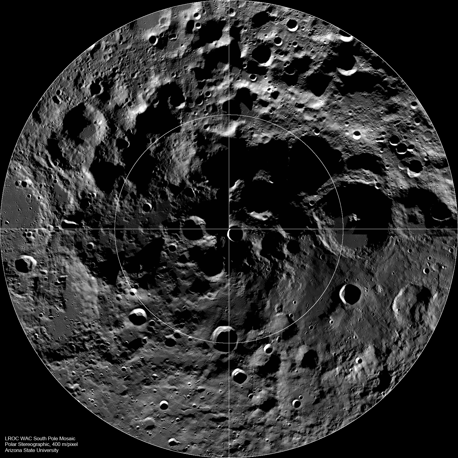
LROC Wide Angle Camera (WAC) mosaic of the lunar South Pole region, width ~600 km [NASA/GSFC/Arizona State University].

Mark Robinson
Principal Investigator
Lunar Reconnaissance Orbiter Camera
Arizona State University


The lunar South Pole is one of the most compelling places in the entire Solar System. This region of the Moon is important for both lunar scientists and engineers planning future human exploration. The towering massifs of the South Pole-Aitken Basin can be accessed, and these massifs contain impact melt that will allow scientists to unambiguously determine the age of this huge basin. Furthermore, permanently shadowed craters may harbor reservoirs of ices and other volatile compounds that could serve as a tremendously valuable resource for future explorers. Additionally, these volatile deposits could contain a priceless record of water composition dating back to the beginning of our Solar System, an incomparable dataset for astrobiology investigations. Finally, a few mountain peaks near the pole (just west and east of the rim Shackleton crater) are illuminated for extended periods of time, providing the near-constant solar power that would be required for the economical operation of a permanent lunar outpost.


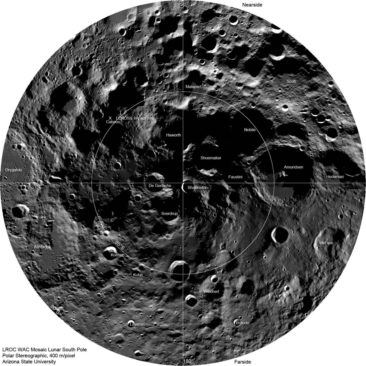
LROC Wide Angle Camera South Pole mosaic showing locations of major craters. The impact site of the LCROSS spacecraft is marked with an "X". Full Mosaic width is ~600 km [NASA/GSFC/Arizona State University].

As LRO passes over the pole every two hours, the LROC WAC snaps an image, and over a month, images covering the entire polar region are captured (80°S to 90°S). This mosaic contains 288 images taken in one month; you can see where the month began and ended at about 90°E longitude (note how the lighting changed). The rim of Shackleton crater seems to be disjointed. However, if you look closely, you can see that the Sun came from opposite sides for portions of the mosaic, resulting in opposite sides of the crater's wall being illuminated in some images. As the mission progresses, the WAC captures the pole across the full range of seasons. More mosaics of the poles will be posted in the future.

Wednesday, July 14, 2010

The Moon's largest (known) impact basin


The Four billion year old South Pole-Aitken (SPA) basin, the oldest and largest yet identified on the Moon, was readily visible just as soon as the Soviets obtained humanity's first, hazy telephoto view of the Far Side, barely more than fifty years ago. Above its tortured interior, stretching from near the equator, overlapping the South Pole, to the Near Side is equally unmistakable in a preliminary rendition of LRO (LOLA) laser altimetry. (Reproduced from "Ten Cool Things Seen in the First Year of LRO," NASA, June 23, 2010) [NASA/GSFC/Arizona State University].


A narrow view through the LRO Narrow Angle Camera (LROC NAC) northeast of Ballingauzen, showing the largely unexplored surface of one of the vast number of basalt plains encircled by SPA's outer wall of mountains. "A crater within a crater within a basin, the interior of the South Pole-Aitken basin is one of the most compelling destinations on the Moon. (LROC NAC image M103196768LE, LRO orbit 377, alt. 46.69km, July 27, 2009; Resolution 0.51cm - field of view is 520 meters [NASA/GSFC/Arizona State University].

Brett Denevi

LROC News System

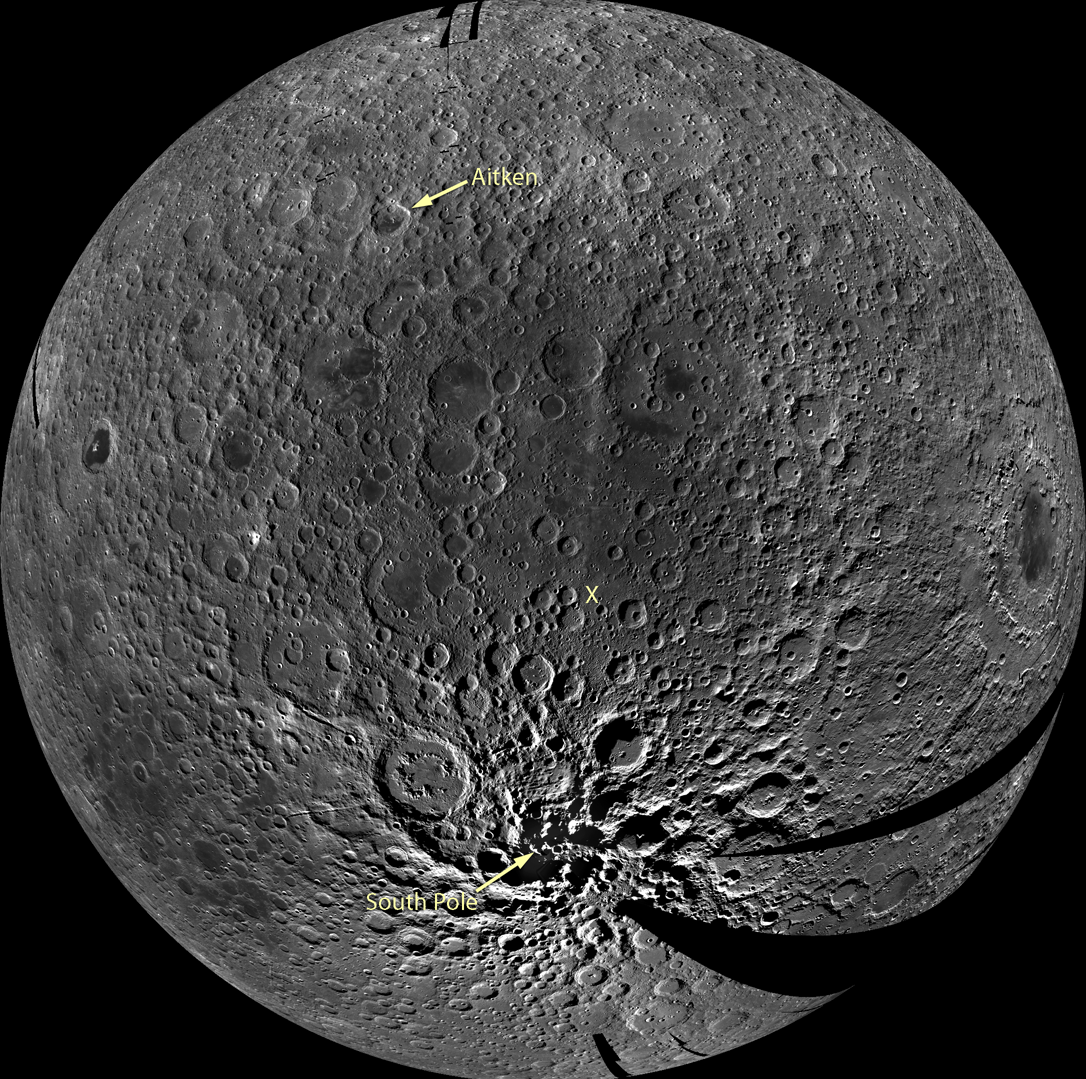
South Pole-Aitken (SPA) basin is the largest and oldest recognized impact basin on the Moon. It's diameter is roughly 2,500 km or 1,550 miles. The Moon's circumference is just under 11,000 km, meaning the basin stretches across nearly a quarter of the Moon. In the LROC WAC mosaic below, which is centered on the middle of the basin, you can see SPA as an area of relatively low reflectance extending from the crater Aitken in the north and all the way down to the South Pole. Topographic data from LOLA can also help to give a sense of the enormous effect the SPA impact had on the Moon - the basin is more than 8 km (5 miles) deep.


A preliminary monochrome mosaic of the Moon from the LROC Wide Angle Camera (WAC), centered in the middle of the South Pole-Aitken basin. Arrow points to the South Pole and an X marks the Constellation region of interest within the basin and the location of the NAC detail above [NASA/GSFC/Arizona State University].

Stratigraphic relationships show that SPA is the oldest impact basin on the Moon, but scientists are intensely interested in just how old it is. Lunar samples suggest that most of the major basins on the Moon formed around 3.9 billion years ago in a period called the late heavy bombardment. By this time most of the large debris within the solar system should have already accreted to form the planets, so such a large number of big impacts occurring at nearly the same time may have been due to unusual gravitational dynamics in the early Solar System. Was the impact that caused the SPA basin also a part of some cataclysmic event that occurred 3.9 billion years ago? If so, that impact is strong evidence for an extreme event that would have affected all of the terrestrial planets, including Earth at a time when life was just beginning. If the basin is much older, that may suggest that instead of a spike in the impact rate at 3.9 billion years, the number of impacts simply trailed off from a peak earlier on.

How can we find out just how old the SPA impact basin is?

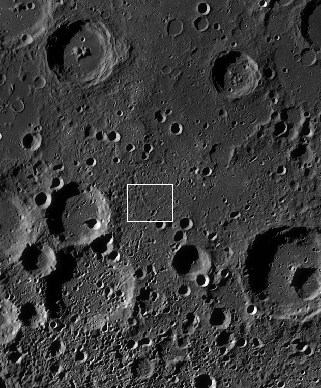
The best way would be to sample materials from the interior of the basin and use radiometric age-dating techniques to determine when they were last molten, as heat from the impact would have melted a large volume of material, resetting radiometric clocks. But the basin is so old that its surface has been cratered many times over, meaning that some of the rocks would have had their radiometric ages reset by these subsequent impacts. So it may be difficult to find rocks with ages that truly reflect the SPA event without careful consideration of the local geology. The Constellation region of interest, highlighted in the NAC detail above and outlined in the WAC mosaic below, was selected because it is in a deep portion of the basin, where a large volume of melt would be expected. Some of this melt would remain as a significant component of the soil, and an analysis of a carefully selected suite of samples from this region would reveal the age of the oldest lunar impact basin.


WAC monochrome mosaic of the interior of SPA, zoomed in to show the 40x40 km Constellation region of interest (white box) and surroundings [NASA/GSFC/Arizona State University].

One final note - imagine the view of the Moon from the Earth when the SPA impact occurred. What would it have looked like? How much ejecta would have landed on the Earth? How long would it take for ejecta to reach the Earth? Surely this impact profoundly affected the young Earth.

Where would the best sample site be? Browse the full-resolution NAC image and WAC mosaic and decide for yourself!

Wednesday, January 13, 2010

Magnificent Aitken


North of the equator on the Moon's Far Side, Aitken stands out as a landmark, the furthest border of 4 billion year old South Pole-Aitken (SPA) Basin, 2500 kilometers from its nearest rim spilling 200 kilometers over onto the Near Side past the Moon's south pole [NASA/Apollo 17/ASU-Apollo Image Archive].


A lobate scarp in the mare basalts of Aitken crater on the lunar farside (arrows). Aitken crater is one of the fifty regions of interest in NASA’s Constellation Program. The smooth mare basalts that flooded the floor of Aitken crater are relatively few on the lunar farside. Mare basalts often have wrinkle ridges and lobate scarps, tectonic landforms that express contraction of the volcanic flows. Future astronauts who might visit Aitken crater will explore this landform in search of clues to how this and other lobate scarps form. Image width is 4.5 km, NAC frame M103374879RE [NASA/GSFC/Arizona State University].

Tom Watters
LROC News System

Aitken Crater Constellation Program
Region of Interest

Mare basalt-filled craters (basins) are few in number and small in size on the farside. Aitken crater is about 135 km-in-diameter and is located on the northern rim of the South Pole-Aitken basin, the largest preserved basin on the Moon. The crater has a central peak and much of its original floor has been buried by younger mare basalt. Enigmatic albedo features called swirls are found on the floor of Aitken. Scientists are not sure how these features formed, but think they may be related to weak variations in lunar magnetism. Hummocky floored craters, impact craters formed in Aitken's mare basalt infill, have strange, bulbous hills. Their origin is also not well understood. These are some of the reasons why a Constellation Program region of interest is located within Aitken crater. The wealth of unusual features in Aitken make it an exciting location for exploration by astronauts.


Basalts, swirls, and hummocky floored craters all populate the floor of Aitken crater. Mare basalts lapped up against the south half of the central peak (center of image), burying much of the original floor. The swirls can be seen just west of the central peak as bright and dark mottling, their origin remains a mystery. Arrow indicates location of today's featured image; LROC WAC mosaic, image width ~36 km [NASA/GSFC/Arizona State University].

The Moon, like Earth and the other terrestrial planets and many of the other solid bodies in the Solar System, exhibits tectonic landforms. Tectonic landforms result from forces that have either contracted and pushed crustal material together, or extended and pulled crustal material apart. Most of the tectonic landforms on the Moon are found in and around the nearside mare basins. Two contractional tectonic features, wrinkle ridges and lobate scarps, are found in mare basalts, volcanic rock that flooded the floors of the nearside impact basins after their formation. The forces that created these landforms in the mare basins are thought to be from the weight of the dense basalts that caused them to subside and contract.

Like the mare basalts in nearside basins, those in Aitken have been deformed resulting in wrinkle ridges similar in form to those on the nearside, although much smaller in scale. Near the southeastern rim of Aitken, close to the contact between the mare basalts and hummocky crater rim material, is a linear, low-relief scarp. This scarp, about 3 km in length, is very similar in size and morphology to lobate scarps found elsewhere on the Moon. Lobate scarps are relatively young landforms thought to be the surface expression of thrust faults, formed when an upper fault block is pushed up and over a lower fault block.

Outside of a mare basin, what is the origin of the tectonic forces that formed this lobate scarp? The thickness of the mare basalts in Aitken crater is small compared to the thickness in the much larger nearside basins. Is there enough mare basalt to cause subsidence and contraction? The contraction that formed the lobate scarp in Aitken crater may be from a much broader and deeper source. Lobate scarps are the most common tectonic landforms in the lunar farside highlands. The forces that formed these thrust fault scarps may come from slow cooling of the lunar interior that led to global contraction. Thus, the lobate scarp in the mare basalts of Aitken is likely due to thermal contraction of the Moon.

Astronauts exploring and sampling the farside mare basalts in Aitken crater would surely plan a trip to this lobate scarp. Examination of the base of the scarp might reveal a subtle break and offset of the basalt regolith or soil that could be evidence of the underlying thrust fault, providing important insight into when the lobate scarp formed.

Explore the Aitken crater Constellation region of interest for yourself and look at previously released images showing another lobate scarp and several wrinkle ridges.

Friday, January 8, 2010

MoonRise SPA sample-return mission and Washington University

Scientists on Earth know least of the oldest-known, largest-known and deepest impact basin on the Moon, South Pole-Aitken (SPA) Basin, stretching from it's mountainous rim between Earth and the lunar south pole on the Near Side nearly to the equator on the southern Far Side. Among the three New Horizon missions making the final cut in an announcement by NASA before the New Year is MoonRise, the first U.S. robotic lunar sample return scenario, under the direction of Washington University in St. Louis.

Nearly 40 years after the Apollo astronauts first brought samples of the Moon to Earth for study, researchers from Washington University in St. Louis are leading an effort to return to the Moon for samples that could unlock secrets of the early Solar System.

Known as MoonRise, the proposed Moon mission is one of three finalists now bidding to become NASA's next big space science venture, a $650 million mission that would launch before 2019.

The MoonRise lander, unmanned and robotically controlled, would scoop up about two pounds of pea-sized lunar rocks and return them to Earth for further analysis.

"The samples would provide new insight into the early history of the Earth-Moon system," said Bradley Jolliff, Ph.D., principal investigator for the proposed mission and research professor of Earth and Planetary Sciences in Arts & Sciences at Washington University.

The MoonRise mission targets the giant South Pole-Aitken (SPA) Basin, which spans from edge to edge nearly 2500 km, so named because it lies between the Moon's South Pole and Aitken Crater, just south of the Moon's equator. The SPA Basin ranks among the largest recognized impact structures in the Solar System.

Samples from the crater could answer questions about the bombardment history of the Earth-Moon system during the first 600 million years of Solar System history, at a time when life was first gaining a foothold on Earth.

"Determining the age of rocks formed during the impact event will allow scientists to test hypotheses for the cause and source of such giant impactors during the planets' formative years," Jolliff said. "The samples would also illuminate processes by which the crusts of planets form and by which giant impacts alter them.

NASA announced Dec. 29 that MoonRise would be one of three space exploration proposals considered for selection as the third venture in its ongoing New Frontiers space science program. New Horizons, the program's first mission, is expected to reach the Pluto-Charon system by 2014. The Juno mission, slated for launch in 2011, will explore Jupiter from pole to pole.

WUSTL's MoonRise mission is competing with a proposal from the University of Arizona at Tucson that would retrieve a sample from a near-Earth asteroid and another proposal led by the University of Colorado at Boulder to probe the atmosphere and crust of Venus.

"These are projects that inspire and excite young scientists, engineers and the public," said Ed Weiler, associate administrator for the Science Mission Directorate at NASA Headquarters in Washington. "These three proposals provide the best science value among eight submitted to NASA this year."

Each of the three proposal teams will receive about $3.3 million from NASA in 2010 to conduct comprehensive, 12-month studies documenting details of concept implementation underlying their proposed missions.

In 2011, after detailed mission implementation, feasibility, cost, management and technical plans are completed and reviewed, NASA will select one proposal for full development and launch. Mission cost, excluding the launch vehicle, is limited to $650 million.

Washington University's Department of Earth and Planetary Sciences has a rich history of involvement in NASA space missions and in the study of lunar samples — Apollo and lunar meteorites .

Department colleagues joining Jolliff as key members of the Moon mission are research professor Randy L. Korotev, Ph.D., and research scientist Ryan Zeigler, Ph.D.

Scientists are eager to explore the South Pole-Aitken region because it is thought to harbor rocks and melted material from deep in the Moon's crust, which are poorly represented in lunar samples retrieved by the Apollo missions. The last batch of Apollo Moon rocks arrived on Earth in 1972.

The MoonRise mission's scientific value is greatly magnified, said Jolliff, by the opportunity it poses to determine the ages of key impact events in Solar System history, a line of study now limited mostly to analysis of the Apollo lunar samples and meteorites found on Earth.

"What we have is a set of very testable hypotheses about the causes and effects of the pummeling by giant impactors that took place at a time when Earth's rock record holds very little information," Jolliff said. "This information is perhaps uniquely recorded in the ancient Moon rocks."

MoonRise also would make use of information gleaned from orbital spacecraft, including recent missions by European Space Agency's (SMART-1), the Chinese (Chang'e-1), the Indians (Chandrayaan-1), the Japanese (Kaguya), and the currently active US Lunar Reconnaissance Orbiter (LRO), to provide all of the information needed to select the best landing site.

MoonRise will be the first NASA mission to robotically return samples from another planetary body to Earth. Such a capability would be a precursor and a feed-forward demonstration for future sample return missions from Mars or other planetary bodies, according to Dr. Leon Alkalai, Manager of JPL's Lunar Robotics Exploration Program Office, and Capture Lead for the MoonRise proposal,

Jolliff is a co-investigator on the Lunar Reconnaissance Orbiter Camera system (LROC) that is currently imaging and investigating the Moon in ways that will enable the next generation of landers — human and robotic — to land safely anywhere on the Moon and to select the best sites for science.

The South Pole-Aitken Basin targeted by MoonRise is especially ripe for scientific exploration, according to lunar sample expert Korotev.

"This is the largest and oldest impact basin known on the moon," said Korotev. "The main goal of the mission is to determine how old it is."


Small rock fragments from an Apollo soil (left) and analysis of one such rock fragment in Korotev's gamma-ray detector lab in the WUSTL Department of Earth & Planetary Sciences.


Washington University is partnered with the Jet Propulsion Laboratory in Pasadena, CA, for project management, systems engineering, mission design, and navigation and operations. For the implementation of the flight system, WUSTL and JPL have teamed up with Lockheed Martin Space Systems Co. of Littleton, CO. Other partners include the Deutsches Zentrum für Luft und Raumfahrt (DLR) in Berlin, Mullard Space Science Laboratory, University College, London, and Malin Space Science Systems, San Diego, to develop camera systems for the spacecraft. Science partners for site selection, sample handling and analysis, and geophysics include the Australian National University; Brown University; College of Charleston; Harvard University; Institut de Physique du Globe de Paris; Johnson Space Center; Lawrence Livermore National Laboratory; the Lunar Geotechnical Institute; Marshall Spaceflight Center; Purdue University; US Geological Survey, Flagstaff; University of Arizona, Tucson; University of California, Los Angeles; University of Hawaii, Honolulu; University of Muenster, Germany; University of New Mexico; and the University of Western Ontario.

NASA's New Frontiers program seeks to enhance understanding of the Solar System by sending frequent space exploration missions to celestial bodies deemed most likely to hold clues about such issues as the formation of the Planets and the origins of life.

For more information about the New Frontiers Program, visit: http://newfrontiers.nasa.gov

Friday, January 1, 2010

Scratching the Surface of our Moon


Pictured above rather fancifully (and on-the-fly) is one of a hoped-for three future nodes of the International Lunar Network (ILN) now in the planning stages. This one is situated on the rim of Shackleton crater, near the location of the Moon's South Pole and also within the immense South Pole-Aitken (SPA) impact basin. At an estimated 4 billion years of age, SPA is the largest and oldest known impact basin on the Moon.

Beyond the on-going and highly-anticipated mission of the Lunar Reconnaissance Orbiter (LRO) are two other "precursor" robotic orbiters considered vital before extended human activity on the Moon can begin. The Lunar Atmosphere and Dust Environment Explorer (LADEE) remains in NASA's budget and is scheduled for launch in May 2012.

Before LADEE the Massachusetts Institute of Technology hopes to use increasing finesse at low-energy lunar transfer trajectories to fly the Gravity Recovery and Interior Laboratory (GRAIL) mission in September 2011. This pair of small orbiters designed to fly in tandem are being developed to improve detail of the Moon's still elusive centers of mass.

Because seismometers left on the Moon during Apollo were clustered around landing sites near the Moon's equatorial latitudes, all on the Near Side, their operation until 1977 left a lot of uncertainty about the precision of their measurements. The differences between the near and far sides of the Moon turned out to be dramatic, especially in elevation and crustal thickness. Scientists now want to co-locate at least two or three seismometers further apart at carefully chosen landing sites to better identify the sources of recorded events. There are some who even believe the source of some moonquake events could be collisions with very high energy cosmic rays. And seismometers are not the only reason for locating ILN nodes at strategic locations on the Moon.

The only experiment left on the Moon during the Apollo era still in use are the laser reflector arrays at the landing sites of Apollo 11, Apollo 14, Apollo 15 and Luna 21. As the original laser reflector telescope at MacDonald Observatory in Texas was winding down operations last year a new set of instruments continued gearing up at Apache Point in New Mexico. Using laser pulses measurement of the distance to the Moon has gradually improved in precision from 150 cm to slightly above 3 cm. Cosmologists are anxious to improve on what is already an incredibly precise measurement in hope of solving many great questions. Among these is whether or not physical laws as they are known here in the Milky Way are change over great distances.

And that introduction fails even to scratch the surface of why Earth is so fortunate to have a naked Moon located at the same distance from the Sun as itself. And we have not even begun to scratch the surface of the Moon.

In 1959, almost immediately after the Soviet Union returned the first images of the Moon's far side a very large basin could be seen located almost entirely in the far southern hemisphere. It is now understood that the massive massifs on the south side of the Moon's near side are the rim of the Moon's largest known basin. In latitude, SPA stretches from 200 kilometers this side of the Moon's south pole to 20 degrees south of the equator on the Far Side. It's the largest and oldest known impact basin, at 4 billion years old it predates the more familiar Near Side basins by 200 million years. Beyond it's northern rim are the Moon's highest elevations and, as the Japanese confirmed with Kaguya's laser altimeter the basin holds the Moon's lowest elevations as well.

South Pole Aitken Basin holds the oldest rocks on the Moon and certain unusual traces of elements like Thorium that present question without adequate answers. From the six landing sites of Apollo come traces of nearly all the better-known events that shaped the face of the Moon, except SPA.

At the end of December it was announced that a robotic sample-return mission to "the Moon's South Pole" had become one of three finalists to become a Discovery mission later in the coming decade. But the mission to the Moon presented in the news is not some frivolous, random rock tourist happening. The mission proposed is to land and return samples from the Moon's largest feature, on the Moon's far side and out of direct contact with the ground. Fulfilling such a mission would not just solve mysteries for planetologists, it would be an engineering achievement in robotics, as well.

This is not to say the other missions making the final cut are without merit. Far from it. It's just a fairer representation of the needed science and the programs that are finally already underway to get a firm lasting foothold on the Moon.