Showing posts with label Aitken. Show all posts

Friday, November 4, 2011

LROC: Boulder rich crater on floor of Aitken


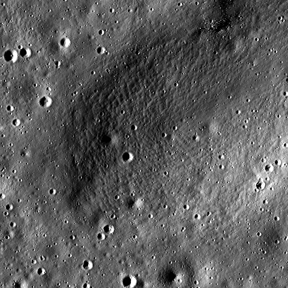
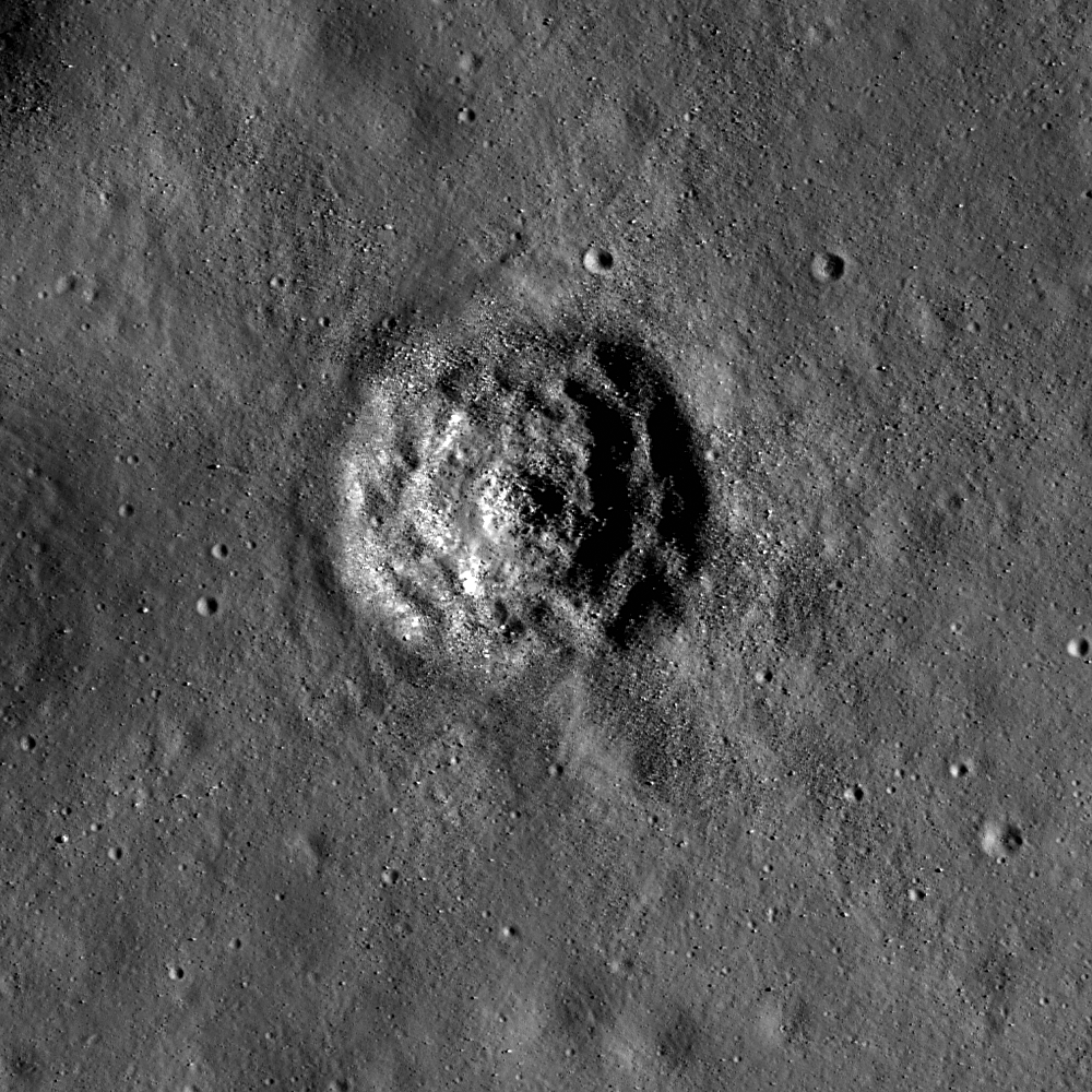
Full resolution (65 centimeter per pixel) view of the boulder-rich central zone in an unusually shaped small crater north of Aitken N, on the wide floor of farside landmark crater Aitken. LROC Narrow Angle Camera (NAC) M141132981R, LRO Orbit 5932, October 7, 2010. Field of view is 378 meters wide, incidence angle 17.79° from 63.6 km. From LROC Featured Image released November 2, 2011 [NASA/GSFC/Arizona State University].
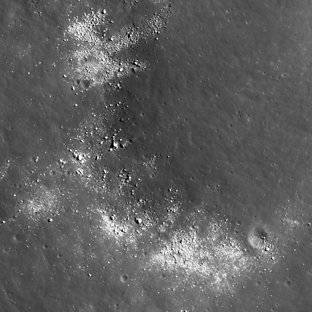
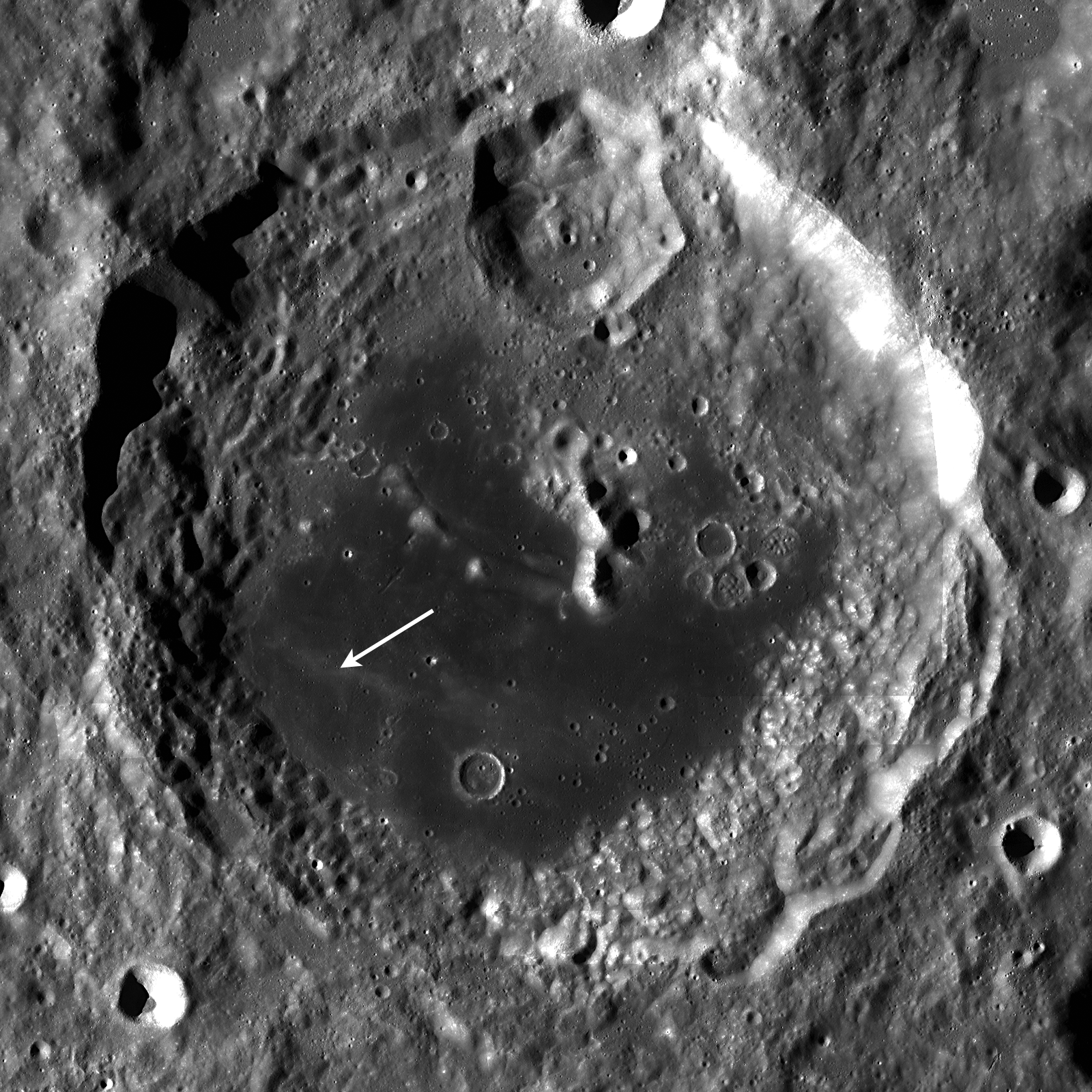
Wider angle view of the unnamed diamond-shaped and boulder-rich crater on the floor of Aitken. See the full size LROC Featured Image HERE [NASA/GSFC/Arizona State University].
Hiroyuki Sato
LROC News System

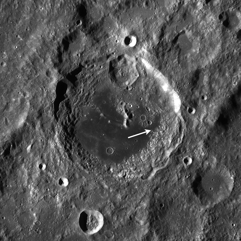
This extremely boulder-rich, unnamed crater is located on the floor of Aitken crater (at the north rim of South Pole Aitken Basin); the diameter is about 480 meters. The floor of Aitken crater is thought to be resurfaced by post-impact lava flows, which corresponds to the low-reflectance smooth surface. The unnamed crater impacted with and excavated these putative lava flows long after the lava solidified.

The high-reflectance boulders of this crater are mostly distributed within the crater cavity, and very few are visible in its ejecta. The extent of this ejecta, traced by the dark/bright contrast, is quite small compared to the crater diameter. Another crater with a similar diameter at 3.4 km to the northeast also has similar characteristics, which are different from typical craters with smooth bowl-shaped cavities and long, bright rays.

The physical properties of target materials, in this case the lava flow layers, and projectile itself, can change the final crater shape and boulder distribution. Why are so many boulders found only on the interior? That is a darned good question, and we don't know the answer! Perhaps the basalt is very thin here, and the lower portions of the crater expose underlying unconsolidated (loose) debris supplied as the ejecta from Aitken N crater. The strength difference between a basalt cap and the regolith may play a role in boulder distribution as well. This type of crater occurs in other mare, and their origins are often mysterious. Here is yet another lunar enigma awaiting future exploration!

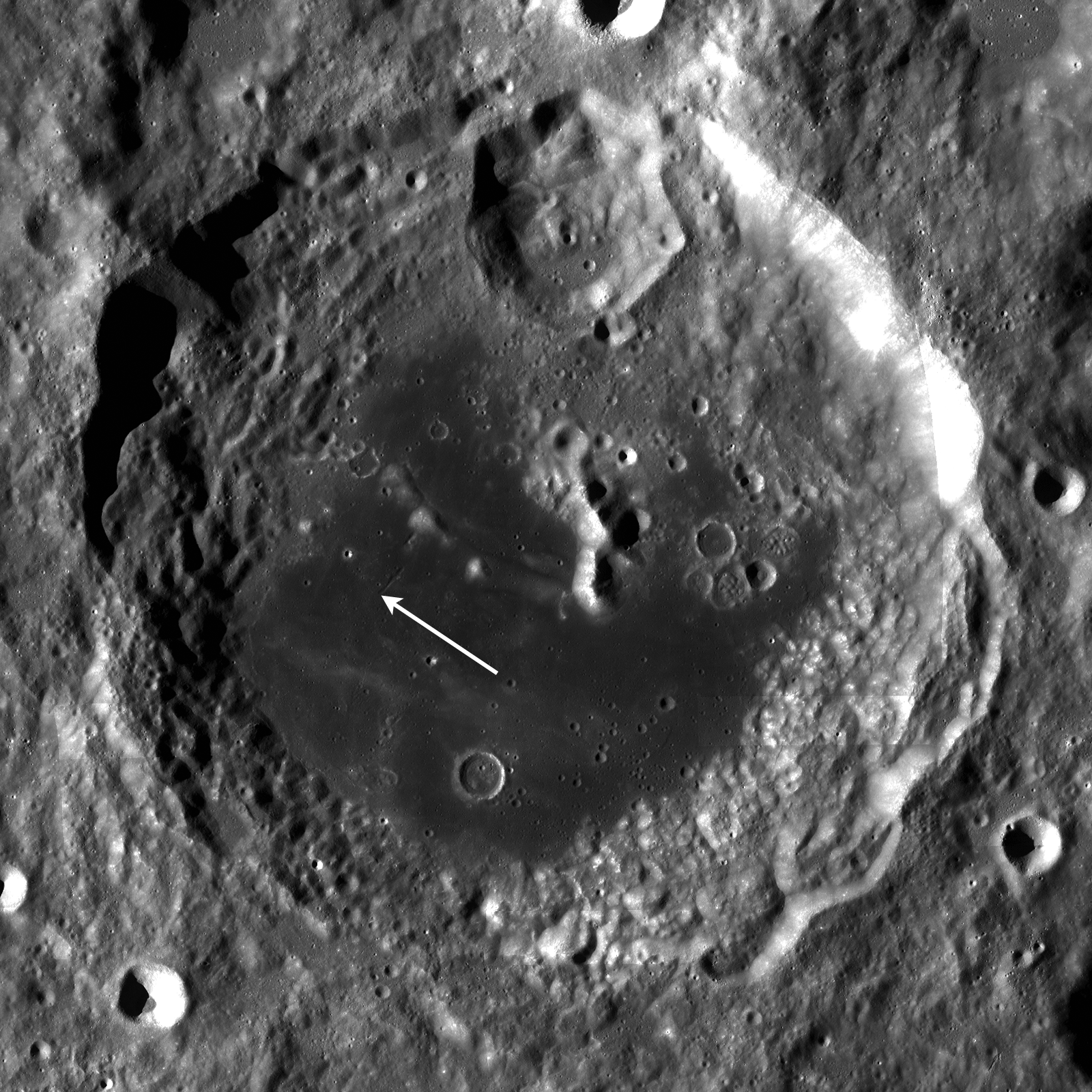
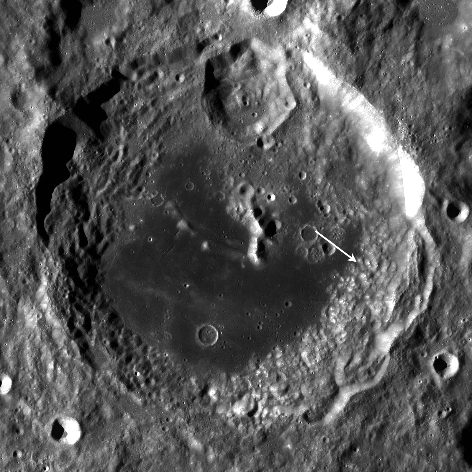
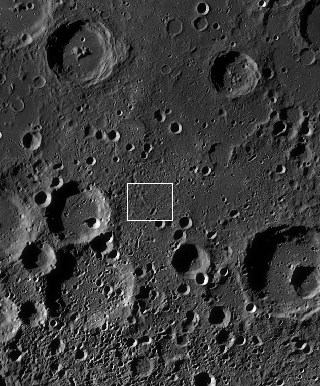
LROC Wide Angle Camera (WAC) monochrome mosaic of Aitken crater, not far from the central meridian of the Moon's farside. Image center view is located near 16.46°S, 173°E. The star and rectangle indicate the location of the LROC Featured Image and NAC footprint. View the full size LROC WAC context image HERE [NASA/GSFC/Arizona State University].

Explorer this boulder rich crater and its environs on the floor of Aitken in the full NAC frame HERE.

Related posts:
Farside impact!
Ray of boulders
Recent Impact in Oceanus Procellarum
Rubble Pile on Fresh Crater Floor
Crater in Mare Humorum

Wednesday, November 2, 2011

LROC: Fissures and Pit Chains

Fissures and associated pit-chains on the east floor of farside landmark crater Aitken (16.4°S, 173.4°E). LROC Narrow Angle Camera (NAC) M128148929L, LRO Orbit 4018, May 10, 2010 from 55.5 km; incidence angle 44.72° (resolution 58 cm, image field of view width ~336 meters. View the full size LROC Featured Image HERE [NASA/GSFC/Arizona State University].

Hiroyuki Sato
LROC News System

Aitken crater (16.4°S, 173.4°E) is a 135 km diameter crater located very near the center of the farside. Its floor is covered by low-reflectance materials, most likely post-impact lava flows. The eastern edge of the floor is disrupted by an irregular shaped wrinkle ridge that extends in a north-south direction.

Today's Featured Image is about 3.5 km west of the ridges. Here there are parallel linear fissures aligned in NW to SE direction. Pit-chains are located along the fissures, which are likely caused by mass wasting into the subsurface void space.

The largest pit is in the center of the image and shows a relatively rough bottom compared to the surrounding smooth surface. One might expect a small pit like this to be quickly filled by debris from impacts and moonquakes. But this hole seems fresh, which implies a relatively young age.

A virtual oblique view of the western interior of Aitken demonstrating the relative size of the western crater wall, towering over the region of interest. LROC Wide Angle Camera (WAC) 604 nm mosaic, from May 27, 2011, is seen projected on the lunar digital elevation model available to users of the Google Earth application. The rectangle represents the roughly 2900 meter-wide field of view of LROC NAC observation M128148929L [NASA/GSFC/Arizona State University/USGS/Google].

Explore these fissures and pits in the full detail NAC frame yourself!

Related posts:
Extensional Fractures
Tectonics in Mare Frigoris
Stress and pull
Relative age relationships

Friday, January 28, 2011

Rille in Aitken Crater


The beginning (or end) of a short rille within Aitken crater. The rille is 5 kilometers long and 600 meters wide. LROC Narrow Angle Camera observation M149391207, LRO orbit 7148, January 11, 2011; resolution 90 cm per pixel [NASA/GSFC/Arizona State University].

Drew Enns
LROC News System

Rilles can be formed by two basic processes: tectonism producing a graben due to faults running beneath the surface or volcanism carving long channels out of the surrounding terrain. Which process formed this rather short rille? The answer is likely volcanism. Two observations support this hypothesis. First the rille is located on a mare surface, itself created from volcanism, and second the rille is not straight, which can be seen in the WAC context image below. However, this does not rule out tectonism. Faulting can, and does, occur in volcanic plains, and faults are never perfectly linear. It's also possible that both forces helped shape the rille. We really don't know right now. The best way to find out would be to place astronauts in the area to conduct field studies. In the mean time scientists can use LROC and LOLA data to compare rilles across the Moon and better our understanding of rille formation.


Location of the linear rille, subject of LROC Featured Image January 27, 2011, within Aitken crater, LROC Wide Angle Camera monochrome mosaic [NASA/GSFC/Arizona State University].

Search for more interesting features in the NAC frame.

Related Posts
Terraced Craters in Aitken Crater
Exposed Boulders in the Aitken Mare

Exposed Boulders in the Aitken Mare


Boulders eroding out of the hillslope and concentrated between two hills. LROC Narrow Angle Camera observation M143480262, LRO orbit 6278, November 4, 2010. Featured Image width = 700 meters, resolution 70 cm per pixel [NASA/GSFC/Arizona State University].

Drew Enns
LROC News System

Boulder fields on the Moon are a fairly common feature. In general, large boulder fields are usually part of an ejecta deposit surrounding their parent crater or a product of gravity-driven mass wasting, where blocks on a slope are dislodged from the regolith or rock outcrops by various geologic processes (including meteorite impacts or moonquakes) and roll downhill. Since this boulder field is located at the base of a slope, it is likely a product of gravity-driven mass wasting. This field has boulders as large as 10 meters in size. Astronauts exploring Aitken crater could use boulder fields like this one, where materials from higher up have fallen to lower, more accessible elevations, to collect samples that otherwise would be very time-consuming to collect.


Location of the boulder field within Aitken crater. LROC Wide Angle Camera monochrome mosaic [NASA/GSFC/Arizona State University].

Can you find more boulders in the NAC image?

Related Posts:
Wrinkle Ridges in Aitken Crater
Terraced Craters in Aitken Crater
Gassendi's Fractures
Bouncing, Bounding Boulders

Tuesday, January 25, 2011

Terraced Craters in Aitken Crater


Small crater within Aitken has a terraced and hummocky floor with boulders strewn about and no bright rays (though when seen in context, below, is situated within a larger debris ray or area of anomalously optically immature regolith. LROC Narrow Angle Camera observation M145855135, LRO orbit 6628, December 1, 2010. Crater is roughly two kilometers wide [NASA/GSFC/Arizona State University].

Drew Enns
LROC News System

This crater has an unusual floor for its size. An impact crater of this size typically has a simple bowl shape, yet this example displays terraces and hummocks. The terraces give us insight into the impact material. A bolide that impacts a solid surface covered by loose material, for example mare covered by regolith, will use less of its energy to break up the loose material than solid material. The "excess" energy goes into excavating more material thus making for a larger diameter. Thus we see terrace at the boundary between the regolith and underlying more coherent material. The fact that the crater has no bright rays indicates that it is old - its rays have weathered into the background.


Location of the terraced crater (LROC Featured Image. January 25, 2011) within the landmark farside crater Aitken (16.8° S 173.4° E) [NASA/GSFC/Arizona State University].

Find more craters in the full NAC frame!

Related Posts:
Wrinkle Ridges in Aitken Crater
Aitken Central Peak, Seen Obliquely
Approaching Aitken Crater - Vertregt J

Saturday, January 22, 2011

Wrinkle Ridges in Aitken Crater


Mare basalts and hummocky ejecta both displaying wrinkle ridges in Aitken crater. LROC Narrow Angle Camera observation M105730242, LRO orbit 731, August 24, 2009; image field of view, ~1.6 kilometers, Sun is from east by northeast (upper left) [NASA/GSFC/Arizona State University].

Drew Enns
LROC News System

Aitken crater, located at 16.8° S 173.4° E, is a 135 km Upper Imbrian-aged crater. It is notable in that its floor is filled by a mare deposit, and that it, along with the Moon’s South Pole, is the namesake for the biggest and most ancient lunar basin, South Pole-Aitken Basin (SPA). Within its flooded floor are many scientifically interesting features, one of which are wrinkle ridges.


Location of wrinkle ridges within Aitken crater. LROC Wide Angle Camera mosaic displays an area 163 kilometers wide [NASA/GSFC/Arizona State University].

The dark mare basalts in the left half of the image were deformed by contractional forces into narrow, very sinuous (winding) landforms called wrinkle ridges. This pattern of deformation is not uncommon in mare basalts, and the small size of the ridges may indicate that the thickness of the volcanic fill in this area of Aitken crater is thin. The light (high albedo) material in the right half of the image is hummocky (hilly) impact ejecta. The same contractional forces that deformed the mare basalts into wrinkle ridges likely thrust up this ejecta forming analogous ridges. Wrinkle ridges are not often found outside of mare, something unusual is at work in Aitken crater! Note that the wrinkle ridge in the ejecta is more uniform in width and less sinuous than the wrinkle ridge in the mare basalt. This contrast in the two tectonic landforms may be an expression of a difference in the strength and other mechanical properties between the mare basalts and ejecta. The ejecta is most likely loose and unconsolidated, while the mare is more coherent. Thus when they are compressed they respond differently.

Search for more wrinkle ridges in the mare and highlands in the whole NAC mosaic.


A wider view of LROC NAC M105730242 and a closer view of the slow shedding of boulders on top of a wrinkle ridge, part of the diverse morphology of Aitken's interior [NASA/GSFC/Arizona State University].

Related Posts:
Aitken's Central Peak, Seen Obliquely.

Thursday, January 20, 2011

Vertregt J: Approaching Aitken


During orbit 7152, January 11, 2011, as LRO slewed to obliquely view Aitken crater (Featured Image, January 17), the northern edge of Vertregt J was serendipitously captured by the Narrow Angle Camera. North is to the left and the image field of view is about 6 kilometers [NASA/GSFC/Arizona State University].

Mark Robinson
Principal Investigator
Lunar Reconnaissance Orbiter Camera
Arizona State University


Extreme oblique views are a luxury with the LRO mission, since most instruments (including LROC) need to be pointed nadir (straight down) most of the time. Also, thermal concerns limit when LRO can look off to the side. The LROC targeting team closely monitors when opportunities arise to target extreme slews and acquire spectacular views (Bhabha crater).


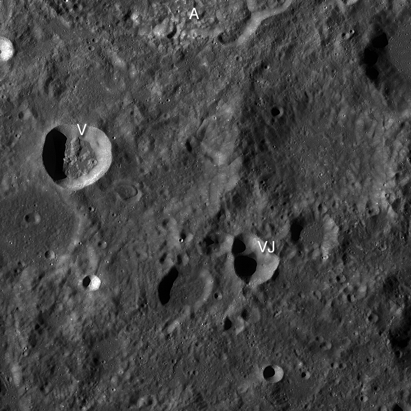
LROC Wide Angle Camera mosaic, centered on the Vertreg J (21.5°S, 174.3°E) oblique NAC featured image, January 19, 2011. Image field of view is 80 kilometers; A = bottom of Aitken crater, V = Vertregt K & VJ = Vertregt J [NASA/GSFC/Arizona State University].

Sometimes LROC obtains images while the spacecraft is slewing to a steady off-nadir position, which takes about ten minutes, in order to acquire oblique views. When possible the LROC targeting team will squeeze in a short NAC image just as the spacecraft is nearing the slew position - when this type of targeting works we sometimes obtain spectacular views such as today's featured image.


The full Narrow Angle Camera oblique view, with the double crater Vertregt J partially seen in the southeast background (right). The full scene is about 30 kilometers wide, LROC NAC M149411489 [NASA/GSFC/Arizona State University].

The region around Vertregt J (21.46°S, 174.32°E) is typical of the highlands - hilly and rugged. About seventy percent of the Moon is mapped as highlands, yet this most common terrain type is only poorly sampled. Only one Apollo mission explored a true highland target: Apollo 16.

As it turns out, results from the Clementine and Lunar Prospector missions showed lunar scientists that the chemistry of Apollo 16 rocks differs significantly from most the highlands. Murphy's law at work!

Lunar scientists need samples from other highland targets, especially inside the South Pole Aitken Basin (SPA) basin, to get a better handle on the origin of the lunar crust and the history of asteroid bombardment early in our solar system's history.

Explore at full resolution the Vertregt J oblique view.

Also visit the oblique view taken a few minutes later across the center of Aitken crater.

Explanation of "lettered craters" on the Moon.

Tuesday, January 18, 2011

Oblique view of Aitken's central peak


Southern end of Aitken crater central peak complex. The upper left is about 1000 meters above the crater floor, which is just seen at lower right. Bright material (high albedo) may be a landslide of local soil, or a secondary impact from a small nearby impact crater. Distance along ridge line is ~4 km [NASA/GSFC/Arizona State University].

Mark Robinson
Principal Investigator
Lunar Reconaissance Orbiter Camera
Arizona State University


Occasionally LRO is commanded to look off to the side at extreme angles to snap spectacular views. On 11 January, 2011 (hot off the press!) LROC shuttered this spectacular of Aitken crater. Here LROC was looking over the southwest ridge of its central peak. In the distance the lower portion of the northeastern walls of Aitken crater itself is just visible. In the center of the image is the Aitken crater Constellation Region of Interest.


LROC NAC oblique view of Aitken crater, including the central peak, northern walls, and the Constellation Region of Interest. Scene is about 30 km wide [NASA/GSFC/Arizona State University].

The Lunar Reconnaissance Orbiter has collected an extremely limited number of these oblique views of the lunar surface, which are useful for engineering purposes and visualizing key geologic features on the lunar surface -- like Aitken. Aitken (~135 km in diameter) is one of the most geologically diverse settings on the farside. The crater is mapped as an Imbrian-aged feature, and its floor is covered in a small puddle of mare basalt; mare deposits are quite rare on the lunar farside, and lunar scientists are still trying to figure out why. Aitken is also on the northern rim of the great South Pole-Aitken basin, the oldest and largest impact basin on the Moon and one of the oldest and largest impact basins in the whole Solar System! Further exploration of the South Pole-Aitken basin is one of the highest priorities for planetary science in the next decade.


LROC WAC mosaic of the central portion of Aitken crater. The arrow indicates a high albedo patch seen in the opening image [NASA/GSFC/Arizona State University].

This latest LROC oblique view gives you a sense of what astronauts will see on their terminal descent into Aitken. Check out the stunning full-resolution image and think about where you would go inside this spectacular geologic feature!

Read some of our previous postings about Aitken crater here, here, and here! And visit the central peak of Bhabha crater.

Wednesday, July 14, 2010

The Moon's largest (known) impact basin


The Four billion year old South Pole-Aitken (SPA) basin, the oldest and largest yet identified on the Moon, was readily visible just as soon as the Soviets obtained humanity's first, hazy telephoto view of the Far Side, barely more than fifty years ago. Above its tortured interior, stretching from near the equator, overlapping the South Pole, to the Near Side is equally unmistakable in a preliminary rendition of LRO (LOLA) laser altimetry. (Reproduced from "Ten Cool Things Seen in the First Year of LRO," NASA, June 23, 2010) [NASA/GSFC/Arizona State University].


A narrow view through the LRO Narrow Angle Camera (LROC NAC) northeast of Ballingauzen, showing the largely unexplored surface of one of the vast number of basalt plains encircled by SPA's outer wall of mountains. "A crater within a crater within a basin, the interior of the South Pole-Aitken basin is one of the most compelling destinations on the Moon. (LROC NAC image M103196768LE, LRO orbit 377, alt. 46.69km, July 27, 2009; Resolution 0.51cm - field of view is 520 meters [NASA/GSFC/Arizona State University].

Brett Denevi

LROC News System

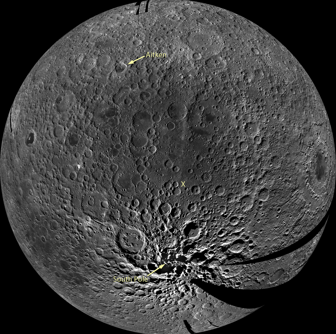
South Pole-Aitken (SPA) basin is the largest and oldest recognized impact basin on the Moon. It's diameter is roughly 2,500 km or 1,550 miles. The Moon's circumference is just under 11,000 km, meaning the basin stretches across nearly a quarter of the Moon. In the LROC WAC mosaic below, which is centered on the middle of the basin, you can see SPA as an area of relatively low reflectance extending from the crater Aitken in the north and all the way down to the South Pole. Topographic data from LOLA can also help to give a sense of the enormous effect the SPA impact had on the Moon - the basin is more than 8 km (5 miles) deep.


A preliminary monochrome mosaic of the Moon from the LROC Wide Angle Camera (WAC), centered in the middle of the South Pole-Aitken basin. Arrow points to the South Pole and an X marks the Constellation region of interest within the basin and the location of the NAC detail above [NASA/GSFC/Arizona State University].

Stratigraphic relationships show that SPA is the oldest impact basin on the Moon, but scientists are intensely interested in just how old it is. Lunar samples suggest that most of the major basins on the Moon formed around 3.9 billion years ago in a period called the late heavy bombardment. By this time most of the large debris within the solar system should have already accreted to form the planets, so such a large number of big impacts occurring at nearly the same time may have been due to unusual gravitational dynamics in the early Solar System. Was the impact that caused the SPA basin also a part of some cataclysmic event that occurred 3.9 billion years ago? If so, that impact is strong evidence for an extreme event that would have affected all of the terrestrial planets, including Earth at a time when life was just beginning. If the basin is much older, that may suggest that instead of a spike in the impact rate at 3.9 billion years, the number of impacts simply trailed off from a peak earlier on.

How can we find out just how old the SPA impact basin is?

The best way would be to sample materials from the interior of the basin and use radiometric age-dating techniques to determine when they were last molten, as heat from the impact would have melted a large volume of material, resetting radiometric clocks. But the basin is so old that its surface has been cratered many times over, meaning that some of the rocks would have had their radiometric ages reset by these subsequent impacts. So it may be difficult to find rocks with ages that truly reflect the SPA event without careful consideration of the local geology. The Constellation region of interest, highlighted in the NAC detail above and outlined in the WAC mosaic below, was selected because it is in a deep portion of the basin, where a large volume of melt would be expected. Some of this melt would remain as a significant component of the soil, and an analysis of a carefully selected suite of samples from this region would reveal the age of the oldest lunar impact basin.


WAC monochrome mosaic of the interior of SPA, zoomed in to show the 40x40 km Constellation region of interest (white box) and surroundings [NASA/GSFC/Arizona State University].

One final note - imagine the view of the Moon from the Earth when the SPA impact occurred. What would it have looked like? How much ejecta would have landed on the Earth? How long would it take for ejecta to reach the Earth? Surely this impact profoundly affected the young Earth.

Where would the best sample site be? Browse the full-resolution NAC image and WAC mosaic and decide for yourself!

Wednesday, January 13, 2010

Magnificent Aitken


North of the equator on the Moon's Far Side, Aitken stands out as a landmark, the furthest border of 4 billion year old South Pole-Aitken (SPA) Basin, 2500 kilometers from its nearest rim spilling 200 kilometers over onto the Near Side past the Moon's south pole [NASA/Apollo 17/ASU-Apollo Image Archive].


A lobate scarp in the mare basalts of Aitken crater on the lunar farside (arrows). Aitken crater is one of the fifty regions of interest in NASA’s Constellation Program. The smooth mare basalts that flooded the floor of Aitken crater are relatively few on the lunar farside. Mare basalts often have wrinkle ridges and lobate scarps, tectonic landforms that express contraction of the volcanic flows. Future astronauts who might visit Aitken crater will explore this landform in search of clues to how this and other lobate scarps form. Image width is 4.5 km, NAC frame M103374879RE [NASA/GSFC/Arizona State University].

Tom Watters
LROC News System

Aitken Crater Constellation Program
Region of Interest

Mare basalt-filled craters (basins) are few in number and small in size on the farside. Aitken crater is about 135 km-in-diameter and is located on the northern rim of the South Pole-Aitken basin, the largest preserved basin on the Moon. The crater has a central peak and much of its original floor has been buried by younger mare basalt. Enigmatic albedo features called swirls are found on the floor of Aitken. Scientists are not sure how these features formed, but think they may be related to weak variations in lunar magnetism. Hummocky floored craters, impact craters formed in Aitken's mare basalt infill, have strange, bulbous hills. Their origin is also not well understood. These are some of the reasons why a Constellation Program region of interest is located within Aitken crater. The wealth of unusual features in Aitken make it an exciting location for exploration by astronauts.


Basalts, swirls, and hummocky floored craters all populate the floor of Aitken crater. Mare basalts lapped up against the south half of the central peak (center of image), burying much of the original floor. The swirls can be seen just west of the central peak as bright and dark mottling, their origin remains a mystery. Arrow indicates location of today's featured image; LROC WAC mosaic, image width ~36 km [NASA/GSFC/Arizona State University].

The Moon, like Earth and the other terrestrial planets and many of the other solid bodies in the Solar System, exhibits tectonic landforms. Tectonic landforms result from forces that have either contracted and pushed crustal material together, or extended and pulled crustal material apart. Most of the tectonic landforms on the Moon are found in and around the nearside mare basins. Two contractional tectonic features, wrinkle ridges and lobate scarps, are found in mare basalts, volcanic rock that flooded the floors of the nearside impact basins after their formation. The forces that created these landforms in the mare basins are thought to be from the weight of the dense basalts that caused them to subside and contract.

Like the mare basalts in nearside basins, those in Aitken have been deformed resulting in wrinkle ridges similar in form to those on the nearside, although much smaller in scale. Near the southeastern rim of Aitken, close to the contact between the mare basalts and hummocky crater rim material, is a linear, low-relief scarp. This scarp, about 3 km in length, is very similar in size and morphology to lobate scarps found elsewhere on the Moon. Lobate scarps are relatively young landforms thought to be the surface expression of thrust faults, formed when an upper fault block is pushed up and over a lower fault block.

Outside of a mare basin, what is the origin of the tectonic forces that formed this lobate scarp? The thickness of the mare basalts in Aitken crater is small compared to the thickness in the much larger nearside basins. Is there enough mare basalt to cause subsidence and contraction? The contraction that formed the lobate scarp in Aitken crater may be from a much broader and deeper source. Lobate scarps are the most common tectonic landforms in the lunar farside highlands. The forces that formed these thrust fault scarps may come from slow cooling of the lunar interior that led to global contraction. Thus, the lobate scarp in the mare basalts of Aitken is likely due to thermal contraction of the Moon.

Astronauts exploring and sampling the farside mare basalts in Aitken crater would surely plan a trip to this lobate scarp. Examination of the base of the scarp might reveal a subtle break and offset of the basalt regolith or soil that could be evidence of the underlying thrust fault, providing important insight into when the lobate scarp formed.

Explore the Aitken crater Constellation region of interest for yourself and look at previously released images showing another lobate scarp and several wrinkle ridges.