Monday, June 14, 2010

Ancient moon has 100x more water

Denise Chow
Space.com

The moon's interior may harbor 100 times more water than previous estimates, according to a new study that took a fresh look at samples of moon rocks collected by Apollo astronauts nearly 40 years ago.

The researchers determined that the lunar water likely originated early in the moon's formation history, suggesting that it is, in fact, native to the moon.

Scientists at the Carnegie Institution's Geophysical Laboratory, and other colleagues, said it's likely that the water was preserved from the hot magma that was present when the moon began to form – some 4.5 billion years ago.

They also think that the water, which is locked up in lunar rocks and material, is likely more widespread in the moon's interior than previous studies estimated. These findings now suggest that the lower limit for total water on the moon could be 100 times greater.

Read the full article HERE.

Orion budget embargoed, 600 jobs cut

The first Lunar Test capsule for people since Project Apollo has just been welded into shape. This work finishes the structural framework of the pioneer Orion crew cabin – known as the Ground Test Article – or GTA, by a Lockheed Martin contractor team toiling away at the historic NASA-owned Michoud Assembly Facility (MAF) in New Orleans [NLSI/Ken Kremer].

Ken Kremer

Lockheed Martin and other contractors working on NASA's endangered Constellation program now have no choice but to delay or halt forward progress on major aspects of the 'Return to the Moon' program and that will quickly cause numerous jobs cuts rippling across the US.

These actions are a direct result of new budget and contract guidance from NASA Administrator Charles Bolden with regard to contract termination liabilities for Project Constellation if the project is cancelled. This could effectively kill the moon program as desired by the Obama Administration, despite a Congressional legislative ban on changing or cancelling Constellation without the agreement of Congress.

"The impact of termination liability on the contract has necessitated a 20 percent reduction across the program within Lockheed Martin as well as our subcontractors and suppliers", says Cleon Lacefield, Lockheed Martin vice president and Orion program manager. Lacefield told me that "Orion procurements are being reduced to allow work to continue within the budget limitations and about 600 positions among the Lockheed Martin and subcontractor workforce are being moved off of the program to adjust staffing needs."

These cutbacks come directly on the heels of Lockheed Martin just completing the structural framework of the first Lunar Orion test capsule at NASA's Michoud Assembly Facility in New Orleans as reported in my illustrated Orion feature story on June 7 here.

Bolden outlined the job and budget issues in stark terms in a June 9 memo to the chairs of the key Congressional committees that have NASA oversight.

The issue is who is liable to pay for the costs of terminating NASA contracts; NASA or the contractors. Bolden states that according to the "Anti-Deficiency Act" the contractors must now set aside funds to cover the termination liability costs in case the contract is cancelled.

NASA estimates the termination liability costs this year to be almost $1 Billion and must be accounted for before the end of the fiscal year in September 2010.

Read the full article, HERE.

Moon's 'apatite' for water


Figure 1. (McCubbin, et.al.) Back-scattered electron images of Apollo high-Aluminum basalt sample 14053, 16. Phase abbreviations are as follows, apatite; Met, Fe-metal; b Si, intergrown Fe-metal and silica; Kfs b Si, intergrown K-rich feldspar and silica; Pyx, pyroxene; Ox, Fe-Ti oxide; Pl, plagioclase; Si, silica; Ol, olivine. (A) BSE image showing one of the apatite granes analyzed by SIMS. The black circle with the white number indicates the analysis spot and its corresponding analysis number. The reduction texture of fayalite breaking down to Fe-metal b silica is also captured in this image. (B) BSE image showing the apatite analyzed by SIMS. The black circle with the white numbers indicate analysis spots and their corresponding analysis numbers.

Carnegie Institution of Washington/Geophysical Laboratory - For years it was believed that the Moon is 'bone dry'. A new paper reports a higher water content of the Moon compared to previous work based on direct measurements upon lunar samples of the phosphate mineral apatite. Video press release.

Francis McCubbin, Andrew Steele, Erik Hauri and Russell Hemley, from Carnegie along with Hanna Nekvasil from Stony Brook University and Shigeru Yamashita from Okayama University find 100’s to 1000’s parts per million (ppm) water in the apatite using a technique known as secondary ion mass spectrometry. The results indicate a minimum water content of the source of the Moon’s magmas that is more than two orders of magnitude greater than the previous estimates of less than 1 parts per billion (ppb) for the lunar interior.

Water is an important component in igneous systems, and its presence in planets affects the nature of these bodies as a whole. The lower limit of water inferred for the Moon in this study is still low in comparison to the interior water contents of the Earth and Mars. The work shows, however, that the 40 year old notion that the Moon now appears to contain significantly more water than previously thought not only needs to be reassessed, it can also be quantified. For additional information see: Moon Whets Appetite for Water.

The article can be found at: F. McCubbin et al. Proc. Nat. Acad. Sci. 10.1073, 1006677107 (2010).

The thumbnail image is a crystal structure of apatite Ca5(PO4)3(F,OH,Cl).

Saturday, June 12, 2010

NASA's time to wait on Congress


Senator Bill Nelson (D-FL), an early supporter of President Obama, has to decide if this Congress will have a voice in national space policy.

Joel Raupe

The White House and NASA's new administrators are apparently in a mad rush to absolutely purge the Constellation program, and they are short-circuiting Congress right out of that process.

Whatever the motives, after making the country wait for more than a year, throughout proceedings of a second Augustine commission, and afterward for the President to announce a recommendation, the White House is muscling past this Congress.

There is nothing improper or unusual in the White House pushing forward implementation of the President’s new proposal past this Congress. This kind of tug of war back and forth between the Legislative and Executive Branch has been almost continuous since the inauguration of George Washington. The system is designed that way.

Instead, Congress is definitely failing to defend its constitutional role by actually approving and perhaps even improving on the administration's proposals. The present Congress shoulders blame for not defending its prerogatives.

On Wednesday, May 26, Constellation program manager Jeff Hanley was simply ousted, moved to a deputy position at Johnson Space Center hours before a House committee sat down with NASA chief Charlie Bolden to resume hearings on the White House plan.

Days later NASA was trying to halt work on Ares citing federal contract irregularities and now the agency is citing budget shortfalls through the remaining four months of fiscal year 2010 as their excuse for stopping work on their unwanted Constellation program.

We can safely guess this White House dislikes anything at NASA even remotely reminding history about George W. Bush. The White House wants out of congressional mandates to continue implementation of space policy surviving from the time “Before Obama,” unswayed that the tired old law was expressly written forbidding any changes without congressional approval.

If Congress allows itself to be sandbagged one or two hairy problems with the administration’s space plan won’t properly be deliberated in the only commission that counts: the one elected by the people.

Friday, June 11, 2010

LROC: The Dewar Geochemical Anomaly


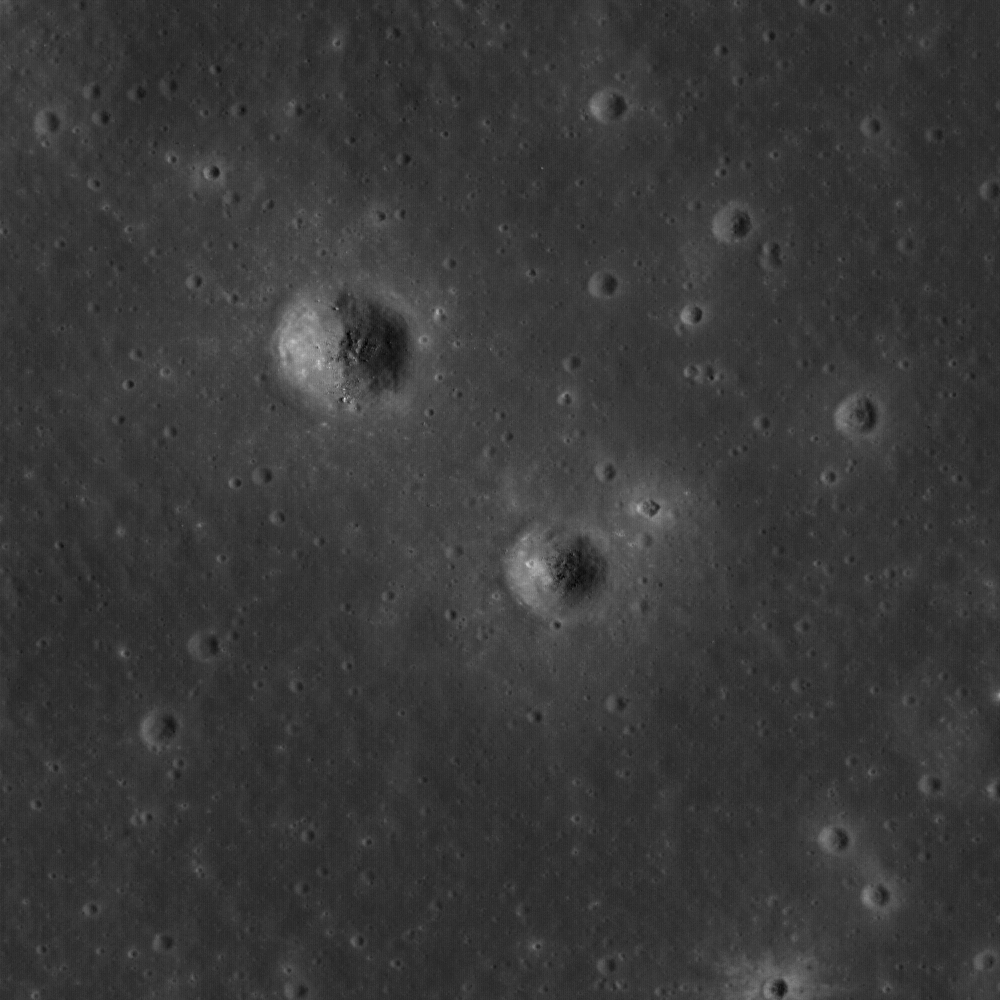
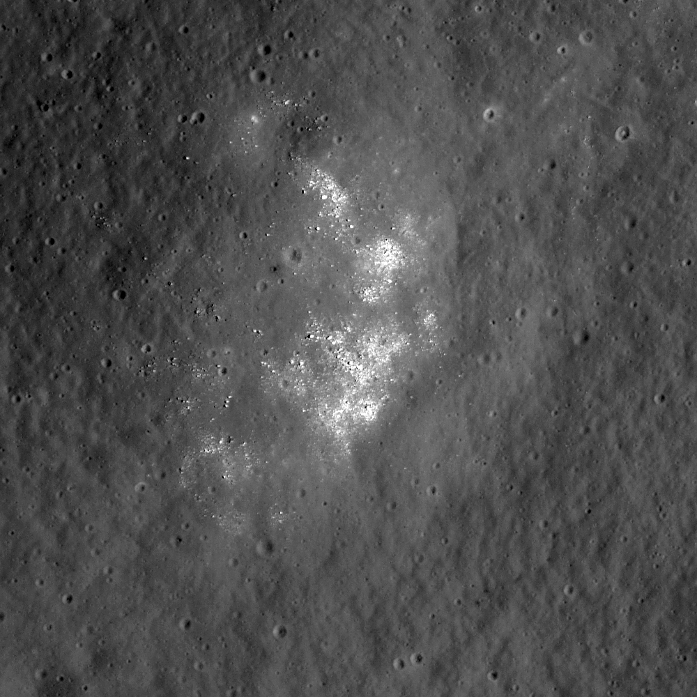
Ejecta from small craters reveal ancient buried mare to the northeast of Dewar crater, near the center of a Constellation region of interest. Image Field of View is 570 meters (Full-sized image, HERE) [NASA/GSFC/Arizona State University].

Samuel Lawrence
LROC News System

This area is the heart of the Dewar geochemical anomaly, one of only a handful of mare deposits on the far side of the Moon. Unlike many mare basalts, such as those that fill Mare Moscoviense, the Dewar deposit is not associated with a giant impact basin, but is instead an ancient and mostly buried mare deposit known as a "cryptomare." Apollo-era imaging of this location was extremely limited; although this region was visible as low-reflectance material in Lunar Orbiter images, the mare deposit was not definitively identified as such until 2008. This discovery came from detailed analysis of multi-spectral images from Clementine (1994) and geochemical information returned by the Lunar Prospector (1998-1999).

Results from these two missions revealed that the low-reflectance materials are spectrally similar to nearside mare basalts, have elevated levels of iron and titanium, and are enriched in the element thorium. So although the Dewar materials are geochemically anomalous in the context of the lunar far side highlands, they are surprisingly similar to nearside basalts.

The small craters that you see in today's Featured Image have excavated material from within the mare deposit. Astronauts visiting craters such as these would be able to unravel clues to the stratigraphy and age of the Dewar basalts.


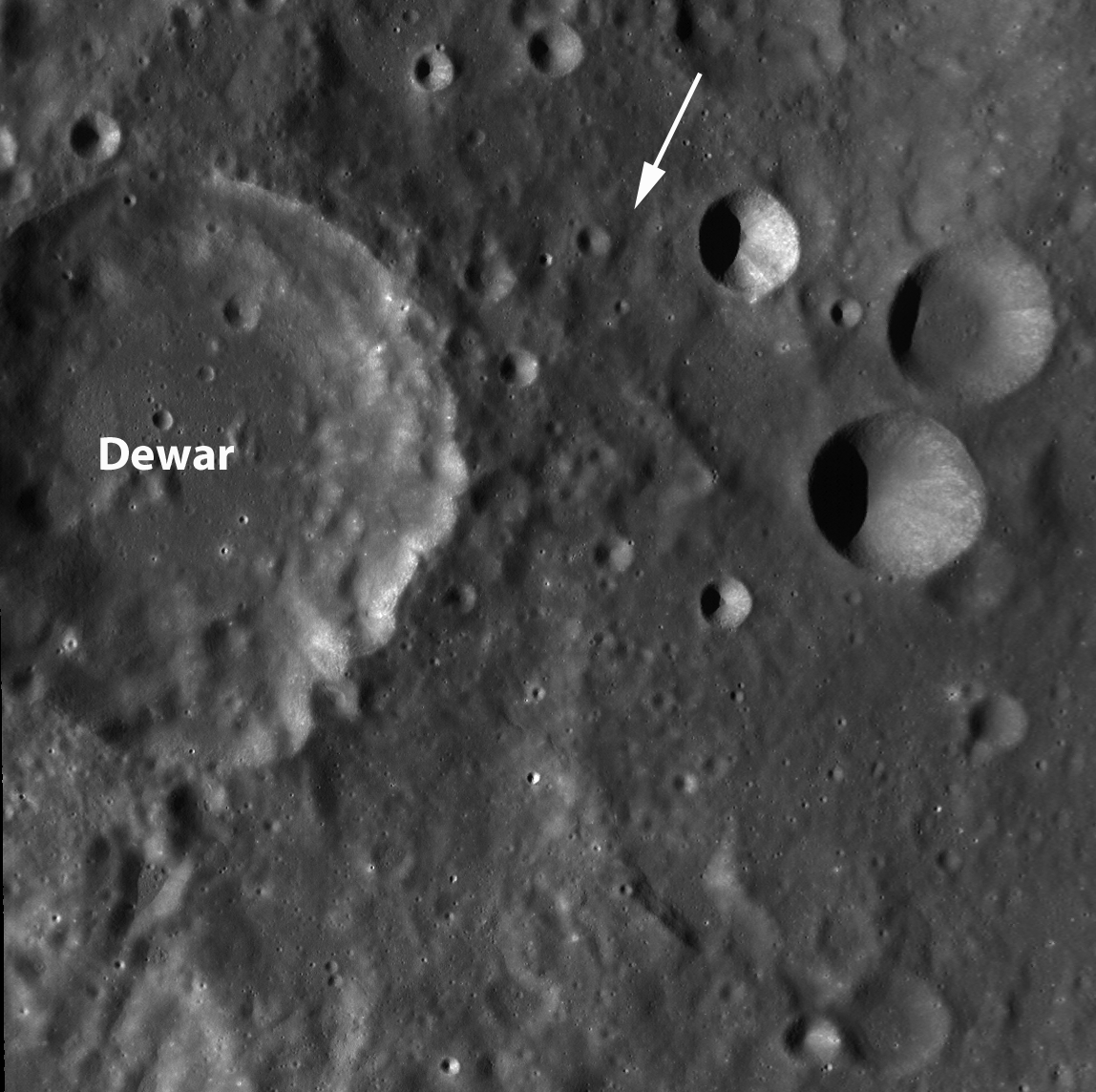
LROC Wide Angle Camera context image (above-lower) of the Constellation Region of Interest northeast of Dewar. Note the low-reflectance deposit visible to the northeast of Dewar crater (apparent also in the close-up of the far lower resolution Clementine albedo image, above-upper. The dotted square on the Clementine image is roughly equivalent to the 90 km-wide field of view in LROC WAC image. The location of the Featured Image is highlighted with a tiny yellow square inside the LROC WAC field of view and the range of the LROC Narrow-Angle Camera image (M128196707L) from which it was taken is designated with the white arrow. [NASA/GSFC/Arizona State University].

Of particular interest is the fact that the Dewar deposits are enriched in thorium. Thorium is an incompatible element, which means that typically it does not get incorporated into magmas until the source is almost completely depleted (or, to put it another way, until there is nothing else left to erupt). Thorium is relatively easy to detect with remote sensing methods because it is radioactive, and when thorium is detected on the surface it is usually safe to assume that other incompatible elements, like the famous lunar KREEP component, are present along with it.


Distribution and abundance of surficial lunar thorium [LPI/Paul D. Spudis, Ph.D.].

These incompatible components are key to understanding the history and mechanics of lunar volcanism and the evolution of the lunar crust. On the near side, many of the mare basalts have high thorium concentrations compared to the typically low concentrations on the far side.

Surprisingly, the thorium abundances in the Dewar region (as well as Mare Moscoviense, which lies to the northwest) are even higher than near side basalts, which has some important implications for lunar geology. Instead of the thorium being concentrated only on the near side, the portions of the far side interior (including the mantle and the lower crust) that produced the magmas emplaced in Dewar and Moscoviense were also rich in thorium. Why are incompatibles concentrated on the near side? What do these small, high-thorium regions on the far side mean? How did the lunar interior evolve to produce this asymmetric distribution of incompatible elements on the Moon? Many important questions remain unanswered.

The geology of this region is complicated and intriguing, and until it is directly explored by astronauts, interpretations based solely on remote sensing data will be challenging. For this reason, this area is a Constellation Region of Interest. The presence of mare basalts also makes this area an in situ resource utilization candidate, since mare materials are so rare on the far side.


Side trips, in the 'Spaceship of the Imagination.' From a point-of-view 3 km over the Dewar ROI, looking toward the south-southwest in the direction indicated by the white arrow in the LROC WAC image further above, the LROC WAC, NAC & Featured Image thumbnail are placed on the Google Earth lunar globe, but perspective and scale are just as difficult to gauge as near the real Moon. On the horizon is the southeastern rim of 50 km-wide Dewar, a point 53 km away from the area within the Featured Image. The elevation there is 2.7 km above global average, towering 3.7 km over Dewar's interior, beyond view. The closest part of Dewar's rim is around 30 km away, with an elevation of 1.4 km; all well over the horizon for anyone standing in the area of the Featured Image, where the elevation at 1.79°S, 166.85°E is about 480 meters [NASA/GSFC/Arizona State University - Google/JAXA].

For more information about the Dewar cryptomare, be sure to check out Planetary Science Research Discoveries.

Plan your own adventure to Dewar crater here!


A second fanciful "side-trip" to that high elevation on the Dewar's rim, 53 km away from the area within the Featured Image. allows an opportunity to see the LROC WAC image super-imposed upon the Google Moon digital elevation model and how closely that image matches an improving but lower-resolution terrain model. The full-sized image made a surprisingly interesting desktop wallpaper [NASA/USGS/JAXA/SELENE/GSFC/Arizona State University].

Thursday, June 10, 2010

LROC/LOLA: Hunting for Ancient Impact Basins


Figure 1: The lesser-known impact basin Freundlich-Sharonov (centered ~ 18.5°N, 175°E) is revealed in this Digital Terrain Model (DTM) created using data from LROC Wide-Angle Camera stereo images. Darker shades represent lower elevations and higher elevations by increasingly brighter shades. The diameter of the orange-colored ring is 595 km. DTM images like these allow scientists to inventory and study the morphologies of lunar basins. (Most of the mare-intrusion in this area is not readily apparent to the naked eye, presumably from orbit. The basin is north of the equator near the far side's central meridian. Mare material has largely become obscured by an overfill of ejecta from later impacts in the area.) [NASA/GSFC/Arizona State University/DLR].


Freundlich-Sharonov basin is all but invisible in this sampling of roughly the same region within the LROC Featured Image taken from the Clementine (1994) far side albedo mosaic [NASA/DOD].

Juergen Oberst
LROC News System

Large impact structures represent important time markers and clues to the early history of the Moon. Unfortunately, older basins may be highly degraded and are sometimes difficult to identify in images. Digital Terrain Models (DTMs) allow us to make more confident identifications of lunar basins and to study their morphologies. Large numbers of tentatively identified lunar impact basins, thoroughly listed in catalogs [1], are awaiting verification and detailed investigation of their ages.

Previous lunar topographic data sets used for studies of basins include the stereo model derived from Clementine images (5 km resolution). Currently, LRO's Lunar Orbiter Laser Altimeter (LOLA) is collecting a global topographic dataset. Due to LRO's polar orbit, the LOLA topographic products have high resolution (better than 40 meters) at the poles and suffer from orbit gaps of about a kilometer in equatorial areas.


Early LRO/LOLA laser altimetry of the Freundlich-Sharonov basin for comparison with LROC photographic elevation studies and the Clementine visible light albedo image of the region further above [NASA/GSFC].

The DTM of the Nubium basin (below) was made from overlapping LROC Wide-Angle Camera (WAC) images obtained in adjacent orbits. The topography has a uniform global spatial resolution of 500 meters, except at the poles where deep shadow results in areas of no coverage. Using these new WAC topographic data, several degraded impact structures were positively confirmed (opening image and Fig. 2).


Ancient Mare Nubium basin, as represented from data collected from the Lunar Reconnaissance Orbiter. Above the LROC Digital Terrain Model of the near side landmark is set atop a mosaic of multiple LROC Wide-Angle Camera images gathered in adjacent orbital passes.

Figure 2: The geographic location of the ancient Nubium basin (20°S, 344°E) is difficult to determine in images. The color-coded DTM (above-top) and the hill-shaded model (above-bottom) help show Nubium due to a slight topographic depression easily seen in the topographic map. Parts of a rim structure can be identified in the southeast, suggesting a basin diameter of about 675 km (black dashed), which is consistent with previous estimates of 690 km (gray dashed, [1]).

The mean rim height (the height difference between rim and basin floor) is ~1.8 km according to the DTM. The hill-shaded model accentuates Nubium's smooth floor [NASA/GSFC/Arizona State University/DLR].


Though Nubium is a near side landmark it's basin-like features are highly degraded, and it can hardly be recognized as a basin at all in the Clementine albedo mosaic. The LROC WAC elevation study validates a confirmation of Nubium as an authentic basin from laser altimetry gathered by Japan's first lunar orbiter Kaguya (SELENE-1) in 2009.


Finally, for even further context and comparison, here is a bonus look at Mare Nubium in a representation of LRO/LOLA laser data points from the initial release of LOLA data to the Planetary Data System, March 15, 2010 [NASA/GSFC].

Landmark features like Rupes Recta, the Straight Wall, hardly show at all in the early LOLA elevation study, at least not as one has come to expect. Instead, in both LROC and LOLA small-scale representations of data, the marked differences in grade on either side of this famous telescopic target stand out better than the fault itself.

Charles Wood at Lunar Picture of the Day (LPOD) takes up a learned comment on these newly released images of Mare Nubium, HERE.

Other basins, such as Mare Marginis, (Figure 3, below) are not yet positively confirmed.


Mare Marginis is more easily recognized as a telescopic landmark to viewers of an early evening's crescent Moon, straddling the eastern limb and the boundary between the near and far sides of the Moon, further east of Mare Crisium. Above top are the results of elevation analysis from stereoscopic LROC WAC photography of the region, near the equator. Above-bottom is roughly the same area as determined from initial LOLA laser altimetry data [NASA/GSFC/Arizona State University/DLR].

Figure 3: Confirming the location of Marginis basin (20°N, 84°E), with a proposed rim diameter of ~580 km (black dashed, [1]), is difficult. A chain of mountain peaks in the western area may represent remnants of a basin rim. However, this chain could also be part of the neighboring prominent Crisium basin, located to the west. With time the WAC and LOLA topographic maps will have higher resolution and more accuracy to help scientists better decipher the location, size, and relative ages of ancient lunar basins.


Mare Marginis was so-named because it's mare-infill was distinct in the highly-foreshortened and necessarily steep angled views from Earth prior to the Space Age. This mare inundation, whether it is truly distinct to Marginis or coincident with a nearby cataclysm, is still visible from lunar orbit. But it's most striking feature in the Clementine mosaic above, something completely invisible in any elevation study made so far, are countless swirl albedo markings -- perhaps the richest such field on the Moon. These features appear to coincide with a wide-spread, close-cropped crustal magnetic anomaly here, on the face of the Moon directly opposite, or "antipodal," to Mare Orientale. The latter needs little analysis to be confirmed as a basin.

[1] Wood C.A. (2004): Impact Basin Database.

Wednesday, June 9, 2010

LROC: Gruithuisen Domes Constellation ROI


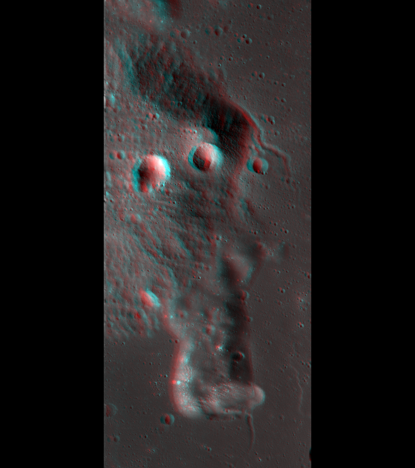
Full width context of LROC NAC frame M104776541RE, showing the location of the Featured Image on the eastern slope of Mons Gruithuisen Gamma, a nonmare volcanic dome that is a Constellation program Tier One Region of Interest. Lower inset field width = 8.1 km [NASA/GSFC/Arizona State University].

Sarah Braden
LROC News System

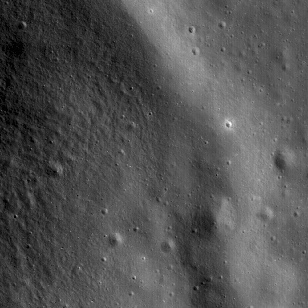
A small rille hugging the contours at the base of Gruithuisen Gamma, at the contact between the dome and the surrounding mare. The Featured Image is 1.6 km wide, illumination is from the left, NAC frame M104776541R [NASA/GSFC/Arizona State University].

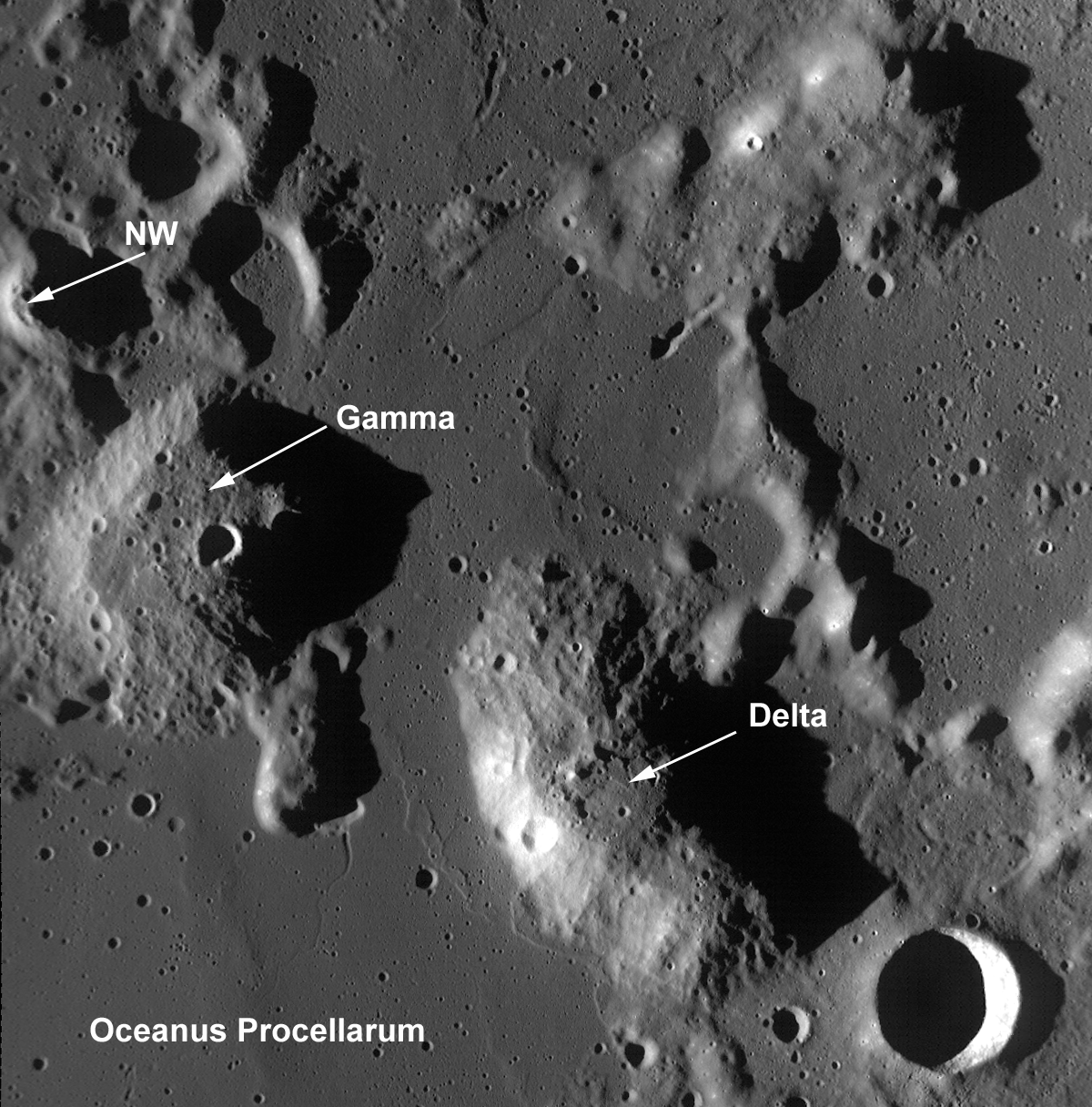
The Gruithuisen Domes, a Constellation program region of interest, are located on the northeast border of Oceanus Procellarum at the highlands-mare boundary. The three Gruithuisen domes are named for nearby Gruithuisen crater. The two largest domes have been unofficially referred to for many years as Gruithuisen Gamma and Gruithuisen Delta, with the smallest dome called NW (for "northwest").


Three of the Gruithuisen domes and surrounding terrain in LROC Wide-Angle Camera frame M117752970. Field of view width is 64 km and illumination is from the west-southwest (left). (The approximate location of the Featured Image is within the small white square enshrouded in the late afternoon shadow of Gruithuisen Gamma) [NASA/GSFC/Arizona State University].

The Gruithuisen domes are classified by lunar scientists as "nonmare" volcanic domes. This is because we know from Earth based telescopes, Lunar Prospector (1998-1999) gamma-ray spectroscopy data, and Clementine (1994) multispectral data that the domes are composed of materials different from either the mare or highlands.

The Gruithuisen Domes are characterized by a relatively high albedo and strong absorptions in the visible and ultraviolet, and the domes are low in iron and titanium compared to the volcanic deposits of the lunar mare. Previous studies of this region showed that Gruithuisen may represent a lunar analog to terrestrial rhyolites, dacites, or basaltic andesites, which are characterized by viscous lava and low extrusion rates. In comparison, mare volcanic domes (like the Marius Hills and Hortensius, also Constellation Regions of Interest) are similar to mare basalts in composition and are generally flatter, smaller, as well as more common on the lunar surface.


Take out your 3D glasses and view this amazing anaglyph of Gruithuisen Gamma created using NAC stereo pairs! Image features NAC frames M104776541 and M104783697 (Orbits 598 & 599, August 13, 2009). The rille on the northeast edge of Gruithuisen Gamma is featured in the opening image [NASA/GSFC/Arizona State University].

Due to the unique nature of the Gruithuisen Domes, they are a high-priority target for future human lunar exploration.

What geologic process created these domes here -- and when? How did the magmas that formed the Gruithuisen domes differ from the magmas that formed the highlands and the mare? Since significant scientific questions remain about the mechanics of lunar mare formation, understanding how the Gruithuisen Domes differ from typical mare basalts will enable us to answer these and other important questions about the formation and evolution of terrestrial planets.

Data from LROC and the other instruments aboard LRO, as well as data from other recent lunar missions, are helping us address these questions, although a true understanding of the region will only come when astronauts can explore it directly.

Plan your own adventure to the Gruithuisen Domes!

For more information on LROC's observation campaign for the Constellation program regions of interest read this Lunar and Planetary Science Conference abstract, and visit the LRO Science Targeting Meeting website (look for the baseball card summary sheets for each site: part 1, part 2).

Some additional context for the Constellation Region of Interest at Gruithuisen, the full length and width of LROC Narrow-Angle Camera frame M104776541RE is set within Wide-Angle Camera frame M104783713CE, imaged during the same opportunity in LRO orbit 598, August 13, 2009, encompassing a field of view roughly 100 km in width. Both are, in turn, set together withing the lunar digital elevation model (DEM) available in Google Earth (v.5). The red placemark is the proposed center to the Constellation ROI (36.03°N, 319.86°E). On distant horizon is Sinus Iridum, on the northwestern edge of Mare Imbrium. The full image, available here, shows the ROI is a border land on small scales and large, located at the "confluences" of Mare Imbrium and Oceanus Procellarum. The distance between 17 km-wide Gruithuisen crater, at bottom right, and Sinus Irudum is approximately 300 km.

Friday, June 4, 2010

Humboldtianum two for one from LRO


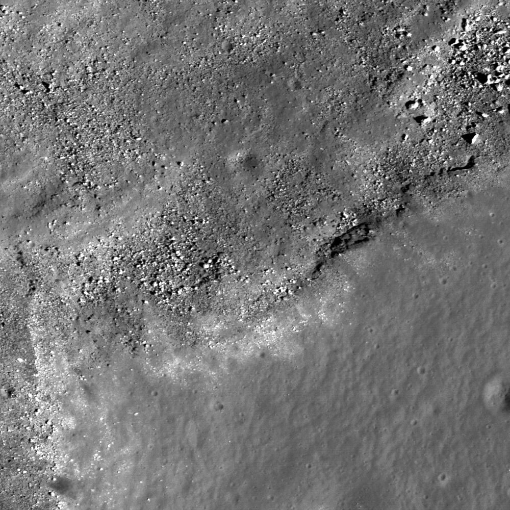
Rectangular sampling of LRO Narrow-Angle Camera frame M119354856R, including the area at upper left center brought forward as LROC News System's Featured Image, June 4, 2010. "Small crater and associated boulders near the center of the Constellation Region of Interest in Mare Humboldtianum," straddling the boundary between the mare of the inner basin and the lunar highlands. "Note the different textures of the highlands (bottom) and mare basalts (top). Explorers at this location will obtain key information about the lunar geologic timescale. Area shown in the image above is approximately 1 km wide; LRO orbit 2723, January 28, 2010, resolution = 0.52 m/pixel [NASA/GSFC/Arizona State University].

Bashar Rizk
LROC News System

Mare Humboldtianum is an ancient impact basin on the northeast limb of the Moon whose inner ring was flooded by basalt billions of years ago to form the mare. The Constellation region of interest in Humboldtianum is located in the southwest portion of the mare, straddling the mare highlands boundary.

In LROC's Featured Image, June 4, 2010, we see the center of the Constellation Region of Interest, where the mare basalts meet the highlands. The highlands are characterized by their high reflectance and the distinctive, so-called "elephant skin" texture, while the mare basalts are characterized by their low-reflectance, relatively smoother surfaces.


LROC Wide Angle Camera context image showing the approximate location of LROC's Featured Image in Mare Humboldtianum. The image at the top of this post is approximately within the smaller (yellow) rectangle, nested, in turn, inside the full-swath of NAC frame M119354856R NAC frame, superimposed on the WAC mosaic above. The 57 km-wide WAC image is represented by a white rectangle drawn upon the LOLA false-color elevation model of Humboldtianum, below [NASA/GSFC/Arizona State University].

Since (Humboldtianum ROI) is at the edge of a large impact basin, based on the Apollo experience it is likely that you can find samples of the basin melt sheet here. During large, basin-forming impact events, the shock of the impact disaggregates rocks in the impact zone, and these smaller fragments are swept up in the sheet of impact melt that sweeps outward from the point of impact. Consequently, the solidified impact melts contain fragments of the rocks and minerals that were present in the crust at the point of impact. Lunar scientists can therefore study these impact melts, billions of years after the impact, to unravel fundamental geochemical information about the composition and heterogeneity of the lunar crust.

For example, how would the basin impact melts we collect in Humboldtianum differ from those collected at the landing sites of Apollo 15, 16, and 17?

We can't answer that important question until human explorers do the necessary fieldwork at this site. Also importantly, the highlands and mare samples collected from this location would be radiometrically age-dated, providing key information about when the basin formed and when it filled with the erupting mare basalts--important questions for helping to clarify the lunar geologic time scale.

The Humboldtianum site offers several operational benefits. As a near-side location it would give astronaut explorers the chance to survey a unique, high-latitude location while remaining in Earth's line of sight, which is important for communications. The mare regolith at this site would also provide easy access to feedstock for in-situ resource utilization (ISRU), while still enabling access to the lunar highlands.


For more information on LROC's observation campaign for the Constellation program regions of interest read this Lunar and Planetary Science Conference abstract, and visit the LRO Science Targeting Meeting website (look for the baseball card summary sheets for each site: part 1, part 2).


Like a box within a box, or a Russian nested doll, a portion of the LRO Lunar Orbiter Laser Altimeter (LOLA) "Image of the Week," also focused on Mare Humboldtianum on June 4, lending further context to the LROC WAC frame above, represented by the 57 km-wide area within the white rectangle [NASA/GSFC].

GSFC/LOLA - Located along the northeastern limb of the Moon (centered at approximately 56.8°N, 81.5°E), Humboldtianum Basin is a (Second Tier) Constellation program Region of Interest. LOLA data show the 650 km diameter basin is more than 4.5 km deep. The impact that formed Humboldtianum is estimated to have happened during the Moon's Nectarian Period, approximately 3.92-3.85 billion years ago.

Many other multi-ring impact basins are also believed to have formed during this time period, including Crisium.

In the inner ring of Humboldtianum Basin is Mare Humboldtianum (Humboldt's Sea). LOLA data reveal the relatively smooth, flat floor of the mare. The younger mare is believed to have formed during the Late Imbrian, approximately 3.8-3.6 billion years ago.

Also visible in the basin are smaller craters that were partially filled in by the mare lava. Humboldtianum was named after explorer Alexander von Humboldt (1769-1859) and is one of only two lunar seas named after people, the other being Smythii named for British astronomer William Henry Smyth (1788-1865).

* The LRO team at Goddard Space Flight Center shines as we approach the unbelievable 1st Anniversary of the launch of LRO, together with LCROSS, June 18, 2009, - by presenting an outstanding "two-for-one." The result speaks for itself.

LOLA Image of the Week, simultaneous with the most recent LROC Featured Image from Arizona State University, was released Friday, June 4, 2010.

LOLA's Tranquility


Not really happy with the quality of the presentation the LOLA Image of the Week, May 28 - highlighting LRO laser altimetry from within the Sea of Tranquility - it was the height of presumption to take a stab at it ourselves. Nevertheless, weak as it may be, Tranquility is contrasted with a more 'typical' near side impact basin father east (above) within the multi-ringed Mare Crisium, for example, and Tranquillitatis hardly stands out in this false-color image, based on elevation alone. Tranquillitatis is a very old basin, inundated repeatedly and home today of some of the Moon's most optically mature mare regoliths. Some of the Moon's most iron and titanium-oxide (and Helium-3) "rich" surfaces are found under the landing site of Apollo 11 [NASA/GSFC/LOLA/CELESTIA].

LOLA/GSFC - May 28, 2010: The Sea of Tranquility has long captivated astronomers. Once thought to be an ocean on the Moon, its relatively smooth fields of basaltic lavas and equatorial position made it an ideal location for the first manned lunar landing. On July 20, 1969 Neil Armstrong and Buzz Aldrin left the first human footprints on the Moon near the southwestern shores of Mare Tranquillitatis.

Mare Tranquillitatis (approximately 873 km in diameter) lies in the Tranquillitatis basin (centered on 0.68 N, 23.43 E; extending, roughly, from 20.4 N-4.4 S, 15.0-45.9 E). This basin is thought to have been formed as a result of a very large impact in the Moon's early history, likely more than 3.9 million years ago. The crater was then flooded with mare basalts, making it appear dark when viewed from Earth, and making it smooth and relatively flat, as seen in LOLA data. There is only a little over a 500 meter elevation difference between the highest and lowest points within the mare, excluding overprinted craters. The mare has an irregular margin because several basins, including Serenitatis and Nectaris, intersect in this region. See if you can find other features surrounding Mare Tranquillitatis on a map of the Moon.

See the original LOLA presentation, HERE.

Thursday, June 3, 2010

The LOIRP time machine looks back 43 years


LUNAR ORBITER II-128-H2 - The Lunar Orbiter Image Restoration Project (LOIRP) has released a never before seen look at a series of frames originally taken in November 1966, showing the floor of Sinus Medii where the Moon's equator crosses the central meridian, or if you prefer, the direct center of the near side [NASA/JPL/USGS/LPI/LOIRP].

Contrast in quality between the best available view of the area for more than forty years, a site of puzzling surface morphology, in high-resolution frame 2 is particularly valuable.

While no comparable Narrrow-Angle Camera image from the new LRO (LROC) mission has yet been released to the Planetary Data System, investigators hope to make a rigorous examination images now being gathered now with those in the Lunar Orbiter (1966-1968) archive to more precisely measure surface changes over time.

LOIRP has been compared to a time machine, breathing new life into the ingeniously processed photography, originally shot, developed, scanned and then televised back to Earth in the months leading up to the first Apollo landings. Tapes of the original telemetry were meticulously stored and later later discovered. Before modern digital processing could be applied to the recordings it was necessary to reconstruct long obsolete tape decks and othe requipment.

Lunar Orbiter II set 128, High Resolution frame 2 was particularly problematic, as seen in the accompanying images.


This high resolution image, subframe 2128_H2, was taken by Lunar Orbiter 2 on 22 November 1966 at 20:18:27 UT


Because the LOIRP images are original images stacked from the archived telemetry, they can't properly be called restorations. Above is the more accurate digital rendering of the forty-three year old data digitized by LOIRP in 2010 [NASA/LOIRP].

A look at the full-resolution images is necessary to do justice to this remarkable work. See the release details HERE.

Wednesday, June 2, 2010

LROC: Marius Hills ROI


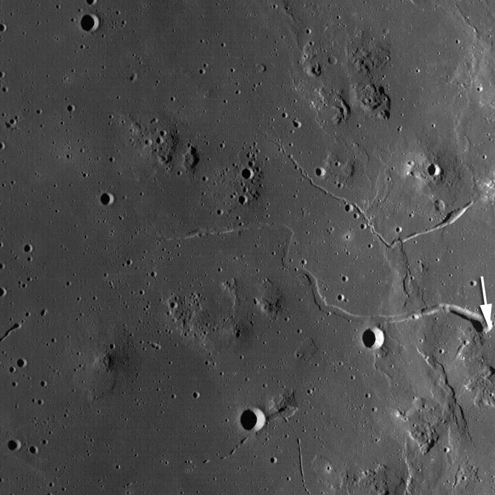
Close-up on the rim of unofficially named "Sinuous Rille A," on the western edge of the Marius Hills Constellation Region of Interest, showing materials slumped into the bottom of the rille bed towards the northwest, and (possibly) an outcrop; prime location for fieldwork and sample collection. One of the several hundred volcanic features located in the Marius region. Exploration of this site will yield important insights into planetary volcanism. Full-sized portion of M111965782RE, HERE. Area of field highlighted above is 550 meters [NASA/GSFC/Arizona State University].

Backed off a bit from the field within the LROC Featured Image, the 'snake's head' feature of the unnamed feature unofficially designated "Sinuous Rille A" comes into better view [NASA/GSFC/Arizona State University].

Samuel Lawrence
LROC News System

This is the heart of the Constellation Region of Interest in the Marius Hills. You can see the rim and interior wall of the head of a large, unnamed sinuous rille directly adjacent to the ROI (13.58°N, 304.2°E).

Astronauts exploring this location will be able to learn about the geologic processes that form sinuous rilles and develop new insights about lunar and planetary volcanic processes.

One of the longest sinuous rilles on the Moon, the rille is one of 20 in the Marius Hills region. The incredible geologic diversity of the Marius region - where mare deposits, volcanic domes, sinuous rilles, and small localized pyroclastic deposits (including the Harayuma Skylight, the "Marius Hills Hole," identified from data returned by Japan's lunar orbiter Kaguya in 2009) are all in roving distance from one another - making the Marius Constellation site a geologist's paradise, a prime candidate for a human lunar sorties.

Viewable through terrestrial telescopes, the Marius Hills region of the Moon has been a high-priority target for human lunar exploration for almost 50 years. In fact, the Marius Hills region was one of the top candidates for an Apollo landing site (and, as memorably recounted by Don Wilhelms in To a Rocky Moon, was very nearly the choice for the Apollo 15 landing site).

Had the Apollo landings not come to a premature end, it is likely that Americans would have explored the region during the early 1970s.

The geology of the Marius Hills region is very complicated. Located in southwest Oceanus Procellarum west of Marius crater (lending the region its name) and northeast of the famous Reiner Gamma formation, the Marius Hills complex represents the largest concentration of volcanic features on the Moon.

Over 250 volcanic domes are found here, along with sinuous rilles, as well as some steeper-sided, roughly cone-shaped positive relief features that previous scientific investigations of the region have suggested are composed of pyroclastic materials. Unlike the domes created by non-mare volcanic processes (such as the Gruithuisen Domes, also a Constellation Region of Interest) which occur in the lunar highlands near mare-highlands boundaries, the Marius Hills complex is located on a plateau completely surrounded by Oceanus Procellarum.

Multispectral data from the Clementine mission (1994) indicates the composition of the Marius Hills domes and cones are very similar to the surrounding mare basalts.


LROC Wide Angle Camera regional context image for the LROC Featured Image of the Marius Hills region (M117867923M). The approximate position the 550 meter-wide area within the image is highlighted by the small white arrow. Numerous volcanic features are visible within the confines of this image. The full-sized image is HERE. Field width within the image above is 58.5 km [NASA/GSFC/Arizona State University].

So, what geologic process concentrated all of these volcanic features in this region? We simply don't (yet) know the answer to that question, although based on the available data we can make a reasonable hypothesis: that the Marius Hills domes were produced billions of years ago by episodic eruptions of low effusion rate, low-temperature, viscous, high crystal content mare lavas contemporaneously with emplacement of the surrounding mare basalts. That model would require some sort of long-lived, shallow, and occasionally replenished source reservoir for the dome-forming lavas, with the sinuous rilles being formed later by subsequent eruptions of higher-effusion rate, less viscous mare materials that didn't form domes.

We need further exploration to ascertain whether this model is accurate. Important contributions to understanding the geology of the Marius Hills will be made with long-lived teleoperated surface mobility systems that can survey and explore the many geologic features in the area, but we won't know for certain until human explorers reach the site to do the fieldwork, collecting samples needed to answer key scientific questions.

Check out the full-resolution Narrow-Angle Camera frame, and plan your own adventure in the Marius Hills!

From Lunar Pioneer
Album 3
For more information, see: D. J. Heather, S. K. Dunkin, and L. Wilson (2003) Volcanism on the Marius Hills plateau: Observational analyses using Clementine multispectral data, Journal of Geophysical Research, Vol. 108, NO. E3, 5017.

Monday, May 31, 2010

Lunar Outpost Life Support Architecture Study Based on a High-Mobility Exploration Scenario


Figure 1. Scenario 12.0.1 Lunar Outpost schematic. Lunar Electric Rovers (LER) are shown without a Portable Utility Pallet (PUP) Larger view available in source and through the image above.

Kevin E. Lange
Jabobs Technology, Inc.

Molly S. Anderson
NASA JSC

International Conference on Environmental Systems
Barcelona, July 11-15, 2010

An American Institute of Aeronautics and Astronautics paper presenting results of a life support architecture study based on a 2009 NASA lunar surface exploration scenario known as Scenario 12.

The study focuses on the assembly complete outpost configuration and includes pressurized rovers as part of a distributed outpost architecture in both stand-alone and integrated configurations. A range of life support architectures are examined reflecting different levels of closure and distributed functionality. Monte Carlo simulations are used to assess the sensitivity of results to volatile high-impact mission variables, including the quantity of residual Lander oxygen and hydrogen propellants available for scavenging, the fraction of crew time away from the outpost on excursions, total extravehicular activity hours, and habitat leakage. Surpluses or deficits of water and oxygen are reported for each architecture, along with fixed and 10-year total equivalent system mass estimates relative to a reference case. System robustness is discussed in terms of the probability of no water or oxygen resupply as determined from the Monte Carlo simulations.

New to the NTRS database, HERE.

MO lunar samples not 'lost,' just forgotten


Fragments of Missouri’s moon rocks are mounted in a case above a Missouri flag that flew on Apollo 11. The case is in storage in the basement of the state Capitol Chris Fritsche/Missouri State Museum/Columbia (MO) Daily Tribune].

Janese Heavin
Columbia Daily Tribune

Fragments of a moon rock collected during the Apollo 17 mission and given to Missouri are safe and sound in the basement of the state Capitol — not lost, as was indicated in a news report last weekend.

The article in Sunday’s Tribune, taken from The Record of Hackensack, N.J., reported that 19 states, including Missouri, could not account for the “goodwill moon rocks” given to states to commemorate NASA’s last manned mission to the moon. After reading the story, staff at the Missouri State Museum went looking for it, said Linda Endersby, interim museum director.

“We knew we had it in our collection; we just didn’t know exactly where it was,” she said. “From the description in the newspaper article, our curator said she saw it and knew where it was.”

Although Missouri’s moon rocks weren’t accounted for, they were never lost, said Judd Slivka, a spokesman for the Department of Natural Resources, which oversees the museum. It’s more accurate to say they simply weren’t found, he said, because no one was looking for them.

Read the article HERE.

Saturday, May 29, 2010

Hearts of Marius, Shadows of Yutu

Updated 1059-1 June 2010 UT


Near the center of the many Marius Hills, recently surmised to be many vents of a single source volcano that China's Chang'e-1 investigators have unofficially named Yutu, the scene above is at the heart of the complex of many small domes, each with a very low profile. These domes are familiar landmarks to earthbound observers, easily visible in modest telescopes only when the sunrise (or sunset) terminator sweeps over Oceanus Procellarum three days before a Full Moon. Within hours these hills, only slightly darker than the surrounding terrain, disappear in the glare. The Sun was less than 2° above the eastern horizon when LRO flew 45 km overhead, during orbit 2329, December 28, 2009, and Arizona State University's LROC Wide-Angle Camera swept up this exposure (M116683214ME) [NASA/GSFC/Arizona State University].

By way of comparison, here (yet again) is a portion of Lunar Orbiter V-152 that shows much the same area seen at the crack of dawn in the LROC WAC frame up above, but in a middle to late morning sun four decades ago. The two tallest of the squat domes or their many neighbors are hardly distinguishable. The twin rilles between them were, however, well out of the shadows. The southern and longer of these channels hosts the "Marius Hole" (or Haruyama Skylight), identified by Japan's Kaguya (SELENE-1) investigators in 2008, near the elbow of it's upper-most bend [NASA/JPL/USGS/LPI]..

We've written and reported a lot about the Marius Hills Volcanic Complex, If there been an Apollo 18 Marius Hills might have been the landing site. Alas, those missions were scrubbed and their architectures were cannibalized for the Skylab and Apollo-Soyuz missions (and the Smithsonian).

Since we're on the subject, even though it's been posted here before in the context of Lunar studies published in connection with the Lunar and Planetary Science Conference in March (seem like only yesterday), a whole "slew" of professional investigators published LROC OBSERVATIONS OF THE MARIUS HILLS in connection with that event.

Clearly, were not paying as close attention as necessary. Originally, in this post, we speculated briefly on why Marius did not appear among the fifty Constellation Regions of Interest, when we knew better. Checking back with our sources, as we thought had, the area around Sinuous Rille A (below, 13.58°N, 304.2°) is definitely listed among those Tier 2 Constellation ROI's.

Coincidentally, you have to get up pretty early in the morning to keep up with the professionals shepherding the Lunar Reconnaissance Orbiter Camera. LROC's Samuel Lawrence posted a very interesting (and timely!) discussion of the Marius ROI date June 1.

From 41st Lunar & Planetary Science Conference (2010)
Figure 3 from "LROC OBSERVATIONS OF THE MARIUS HILLS," 41st Lunar and Planetary Science Conference (2010): LROC Digital Terrain Model (DTM), Sinuous Rille A in the Marius Hills.

Cernan joins Stafford at home in OK to celebrate Gemini, Apollo & Apollo-Soyuz


Lt. Gen. Thomas P. Stafford, (USAF, Ret.) (left) joins Captain Eugene A, Cernan (USN, Ret.) participate in a panel discussion at B.C. Clarks Jewelry store at Penn Square Mall in Oklahoma City, Thursday. Stafford and Cernan flew together on two missions, Gemini 9 and to within 9 kilometers of the lunar surface on Apollo 10. Cernan was the last person to walk on the Moon, in command of Apollo 17 and Stafford flew in command of the first U.S. Soviet rendezvous in space, Apollo-Soyuz, in 1975. The veteran astronauts talked about their missions and answered some questions from the public [The Oklahoman/Paul Hellstern].

David Izzo
NewsOK/The Oklahoman

Just before Tom Stafford and Gene Cernan lifted off for their Gemini 9 space mission in 1966, the flight crew director called Stafford aside. "We can't afford to have a dead astronaut floating around in a space suit,” he told Stafford.

"I wasn't in on that conversation,” Cernan said.

Stafford recalled that director Deke Slayton told him that if Cernan died while on a risky spacewalk that was part of Gemini 9, Stafford should haul the body back into the capsule.

Stafford, the mission commander, listed the many perils of that strategy.

Read more HERE.

Mastin & XCOR to develop unmanned landers

Mastin's Xombie performs during second leg of last October's Northrop Grumman Lunar Lander Challenge.

CSM/Space.com

Two California companies, one a rocket engine builder and the other a mock moon lander champion, have teamed up to develop new private unmanned vehicles that NASA could send to the moon, Mars and asteroids.

The companies are XCOR Aerospace, specializing in rocket engines, and Masten Space Systems — which won a $1 million NASA contest to build and fly robotic vehicles on simulated hops on the moon. The two companies hope to combine their areas of expertise in anticipation of NASA-sponsored unmanned lander projects, according a joint announcement this week.

"It seems like NASA may actually be interested in a commercial approach to landers," Michael Mealling, of Masten Space Systems, told SPACE.com Tuesday.

Read the article HERE.

Friday, May 28, 2010

LROC: Constellation ROI at Hertzsprung Basin


Portion of LROC NAC image M112421089RE showing fresh boulders on the inner ring of lunar far side Hertzsprung Basin, thought to be nearly pure anorthosite. Image is approximately 690 meters across and the Sun is from the right of the frame (east) [NASA/GSFC/Arizona State University].

Ross Beyer
LROC News System

Lunar Reconnaissance Orbiter (LROC) narrow angle camera (NAC) Featured Image focuses in on the Hertzsprung Constellation Tier One Region of Interest, detailing an area of the 270 kilometer diameter Inner Ring of the Hertzsprung Basin (570 km diameter) on the lunar far side. This basin is of the early Moon's Nectarian period (> 3.8 billion years) and is intermediate in size between two-ring basins (e.g., Schrodinger) and larger, multi-ring basins (e.g., Orientale). As such, it excavates material from an intermediate depth that helps us better understand the composition and structure of different zones of the lunar crust.


WAC context view of the inner ring of Hertzsprung basin and the 40x40 km Constellation region of interest. Arrow indicates the approximate location of NAC detail above. Image M118315549ME [NASA/GSFC/Arizona State University].


This site is a great exploration target because it provides access to the inner portion of the basin and the inner ring, which is thought to be nearly pure anorthosite. Explorers based in Hertzprung can investigate basin formation, highlands regolith, and these unique deep crustal rocks from far below the surface. The fresh boulders make perfect samples, and are just waiting for someone to come and pick them up! Nature has provided a natural drill hole to the lower portions of the crust - just the place to determine how the crust formed in the first place.

Browse the entire NAC frame of the Hertzsprung site !

JAXA plans for robotic moonbase by 2020

Japanese Space Agency concept drawing of robotic lunar base [JAXA].

Nancy Atkinson
Universe Today

The Japanese space agency, JAXA, has plans to build a base on the Moon by 2020. Not for humans, but for robots, and built by robots, too. A panel authorized by Japan's prime minister has drawn up preliminary plans of how humanoid and rover robots will begin surveying the moon by 2015, and then begin construction of a base near the south pole of the moon. The robots and the base will run on solar power, with total costs about $2.2 billion USD, according to the panel chaired by Waseda University President Katsuhiko Shirai.

Read the article HERE.