Showing posts with label complex craters. Show all posts

Tuesday, September 24, 2013

On the edge of Lichtenberg

M1108660598RL-NSJ-0108-58b-9383x12942
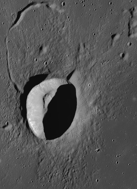
An oblique view of Lichtenberg crater (31.854°N, 292.284°E). LROC Narrow Angle Camera (NAC) M1108660598RL, a 9526x15400 mosaic, captures a side-glance view (spacecraft and camera slewed -53.22° off nadir) of the geologically anomalous Lichtenberg crater, on the northwestern side of Oceanus Procellarum. LRO orbit 15660, November 27, 2012; overall resolution above 3 meters per pixel, early morning angle of incidence 81.38° from 142.54 km over 32.1°N, 300.76°E [NASA/GSFC/Arizona State University].
H. Meyer
LROC News System

Lichtenberg crater (19 kilometers in diameter) is located in western Oceanus Procellarum (31.85°N, 292.28°E). Originally thought to be Copernican in age due to its visible ray system,

Lichtenberg is now thought to be Eratosthenian in age. It turns out that Lichtenberg rays are highly reflective due to their composition and not their relative youth (compositional ray vs maturity ray). Today's Featured Image is an oblique view of Lichtenberg crater and the surrounding terrain. Oblique images are similar to what an astronaut in orbit around the Moon would see looking out a window towards the horizon, and these views are different than most of the LROC NAC images that are taken at nadir (looking straight down).

Lichtenberg crater, super-positioned on the vast basalt flooded nearside plains of Oceanus Procellarum that are, in turn, superimposed nearly over a more ancient, larger "ghost crater" to the northeast. Lichtenberg was originally selected as a Constellation Region of Interest (ROI) for, among other reasons, a distinct younger flow of melt superimposed on the crater's southeastern frontier, demonstrating this part of Procellarum was inundated both before and after Lichtenberg's formation. LROC Wide Angle Camera (WAC) monochrome (604 nm) mosaic from observations collected in sequential orbits July 27, 2011, from approximately 43 km overhead. View a wider field of view in the original mosaic HERE [NASA/GSFC/Arizona State University].
Because oblique images are taken by looking at an angle, these images can enhance or reveal features that may not be evident when looking straight down. For example, Lichtenberg's raised rim is prominent in this image, as is the topographic high within the ghost crater beside it. The diameter of the ghost crater (29 kilometers) suggests that it is a complex crater with a central peak that was subsequently buried by mare basalts. Perhaps a now deeply buried central peak is reflected in the surface as a distinct topographic high in the center of the ghost crater? It is the presence of this flooded crater that caused Lichtenberg to form in an asymmetrical fashion. This viewing geometry also enhances Lichtenberg's textured ejecta blanket, revealing a partial embayment of the ejecta on the eastern side. By applying our understanding of the principles of stratigraphy, the history of this area can be unraveled. A complex crater formed on the surface and was buried by mare basalt. Then, Lichtenberg formed on part of the partially buried rim of the ghost crater. Finally, a new flow of mare basalt partially flooded the ejecta of Lichtenberg.

Explore the full NAC mosaic HERE.

Related Posts:
Ghost Crater in Southern Mare Crisium (June 21, 2011)

Tuesday, August 13, 2013

Follow up on concentricity in Apollo basin

M1097537923LR-NSJ-0567-4199x5676
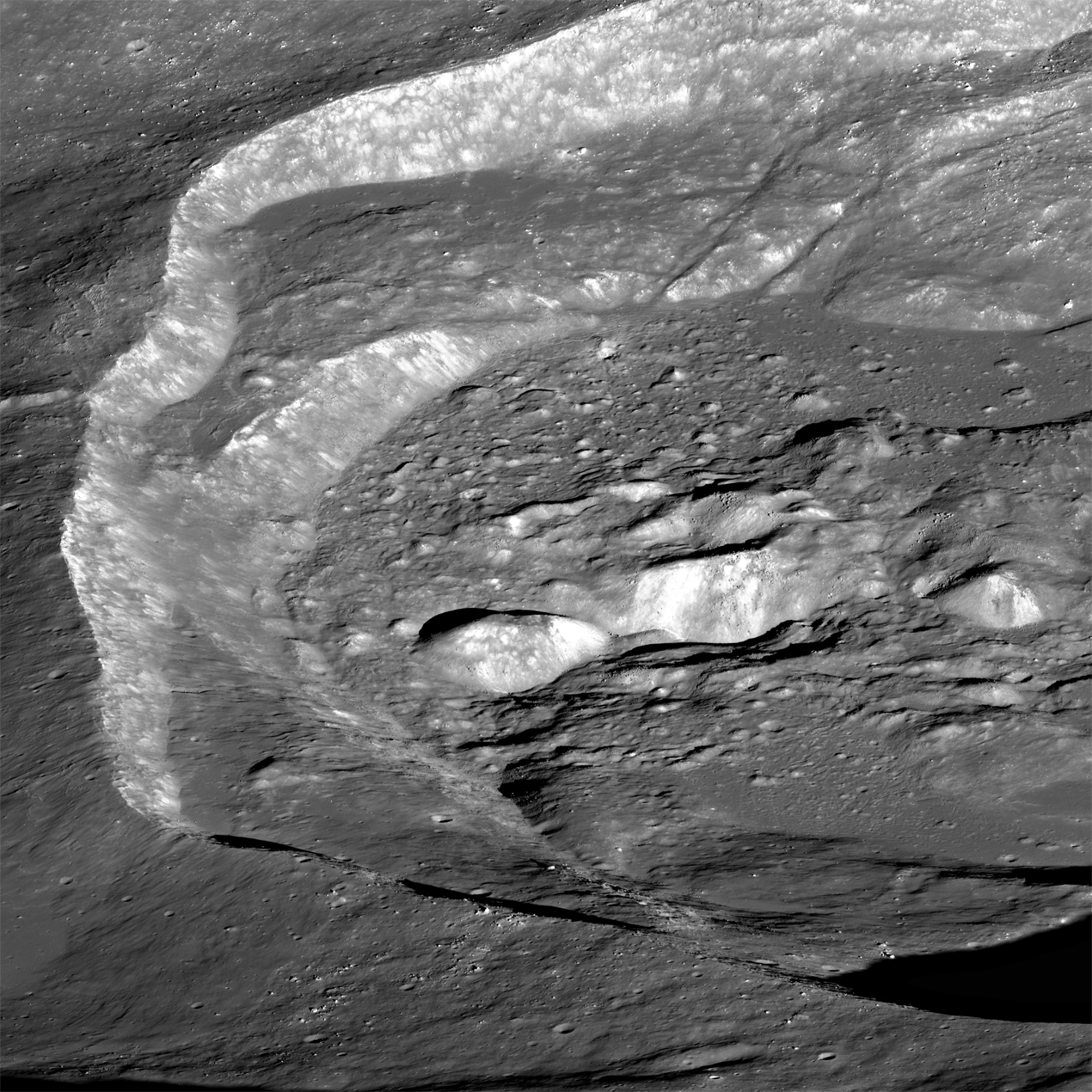
Oblique view of an unnamed but prominent 12 km-wide concentric crater in the Apollo Basin, centered on 30.757°S, 205.931°E. Spacecraft and camera were slewed eastward off nadir 57.74° from 76.2 km over 31°S, 200.62°E, LROC NAC mosaic M1097537923LR, spacecraft orbit 14102, July 21, 2012; resolution roughly 2 km in the original [NASA/GSFC/Arizona State University].
Raquel Nuno
LROC News System

The May 22, 2013 Featured Image showed a portion of an unnamed concentric crater located in the Apollo Basin. Today’s Featured Image is a spectacular oblique (58° from vertical) view of that same crater.

Lunar geologists find craters useful in investigations because they tell so much about the geological history of the Moon. Craters reveal structural properties below their surface and the relative ages of the surfaces where they formed. How can looking at a hole in the ground be so insightful?

Combining imaging with numerical modeling and laboratory experiments, we can test how different structural properties beneath craters affect their shape and size, and even derive information about the direction of the impactor that formed the crater. Crater counting lets us estimate how long a surface has been exposed; more craters indicate an older surface. While insightful, these techniques do not conclusively describe the formation mechanism for all observed crater shapes. That is the case for concentric craters such as the one in today’s post, an unnamed 11.5 km concentric crater located in the Apollo Basin, centered at 30.757°S, 205.923°E. Concentric craters have an inner rim whose formation mechanism is not yet entirely understood, but the concentric mounds may indicate that there is a discontinuity, such as layers with different strengths, in the subsurface excavated by the impact.

LROC WMS (Quick Map) Wide Angle Camera (WAC) mosaic of the 11.5 km concentric crater (center), in context with north and northwestern Apollo basin. [NASA/GSFC/Arizona State University].
Craters are beautiful landscapes depicting the violent impact history of the moon, but are also a reminder of how human ingenuity can unravel the formation mechanisms of geological features on other worlds. As is the case for concentric craters, some of nature’s mysteries require on-site human and robotic investigations to fully understand them.

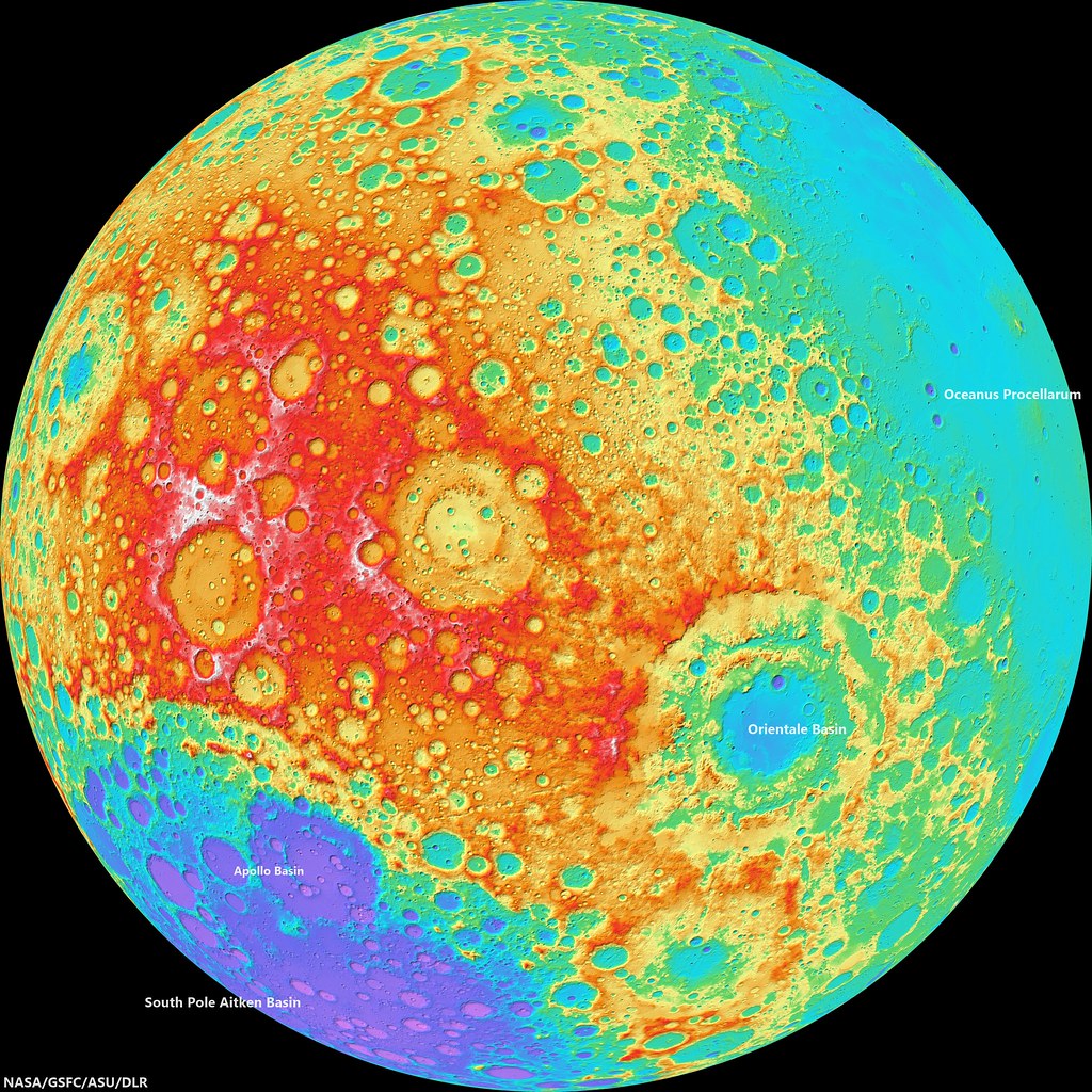
WAC_CSHADE_O000N2400_064P-2943
LROC Wide Angle Camera (WAC)-derived global elevation model, hemisphere centered on the equator and 240° east meridian. The Apollo basin, in context inside the rim of 4.26 billion year old South Pole Aitken basin, is at bottom left, site of deep craters - many named in honor of Americans famed for their contributions to lunar exploration - may have excavated samples of the Moon's primeval crust. The Orientale basin, southeast of this view's center, marks the western limb of the Moon's nearside [NASA/GSFC/ASU/DLR],

Investigate and zoom into the full resolution LROC-processed NAC frame, HERE.

Related Posts:
Concentricity in Apollo Basin (May 22, 2013)
Concentric crater (Gruithuisen K - August 4, 2010)
LOLA's Apollo Basin (April 24, 2010)
Apollo Basin: Mare in a Sea of Highlands (March 30, 2010)
"Biggest, deepest crater," an excavation of the hidden, ancient Moon (March 6, 2010)

Tuesday, July 23, 2013

The View Inside a Tilted Crater

Oblique view of the chaotic interior of 30-km Wiener F crater. LROC Narrow Angle Camera (NAC) mosaic M1113262343LR; LRO orbit 16307, January 19, 2013, spacecraft and camera slewed 52° west from 160.39 km over 41.84°N, 140.28°E, subsampled from a scaled 2.78 meter per pixel resolution. Scene width approximately 13 kilometers from left to right, centered at 41.1°N, 150.0°E. [NASA/GSFC/Arizona State University].
Brett Denevi
LROC News System

Impact melt is commonly found in and around fresh lunar craters and can be spotted as ponds, flows, and ejecta.

This oblique view of the farside crater Wiener F highlights one of the more spectacular examples of what happens to the melt when a crater forms on a slope.

In the image above, you have a great perspective view of the chaotic crater interior, where material slumping into the crater interacted with the fluid melt, creating rough, hummocky mixtures in some regions and smoother pools of melt in others. But what is really interesting about this crater becomes clear when you zoom out to the full width of the image, below.

Thumbnail view of LROC NAC mosaic M1113262343LR, looking from west to east into Wiener F crater. For the full-resolution, zoomable view click HERE [NASA/GSFC/Arizona State University].
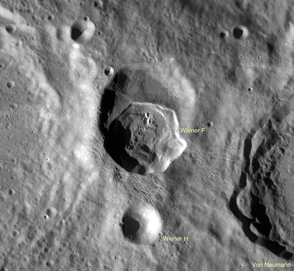
Wiener F formed atop a larger, older crater, so its northern rim, on the left in the picture above, ended up substantially lower than the southern rim. A profile across the crater, taken from the GLD100, shows the northern rim of the crater is over 2 km lower in elevation than the southern rim!

A profile from south to north across crater Wiener F, taken from LROC WAC-derived topography data [NASA/GSFC/Arizona State University].
So tilting the crater like this is like tilting a glass of water - it spills. In this case, the hot impact melt that would normally stay within the crater poured out, spilling over the northern rim and pooling outside the crater. Click on the image below to see this spectacular flood. You can find individual flows and places where the melt was still moving even as a crust of hard rock formed on top, resulting in cracks and wrinkles in the top layer.

View of the impact melt that escaped Wiener F, pooling outside the northern crater rim. Image subsampled from the original resolution [NASA/GSFC/Arizona State University].
Impact melt is a favorite target for LROC imaging because of its often complicated and bizarre features, and because of what it tells us about the impact process. The volume of melt can give clues as to how fast an impactor hit the surface (higher velocities mean higher shock pressures and more heat to melt rock), at what angle it impacted (melt is often thrown downrange of an impact), and how long ago the impact occurred (by observing how well preserved the melt morphology is, or by age-dating a sample of melt). Impact melt can also give insights into how portions of the crater moved and settled as the crater formed (for example, how did melt get up HERE?).

LROC Wide Angle Camera (WAC) contextual view of Wiener F crater, nested in the Farside Highlands [NASA/GSFC/Arizona State University].
Wiener F is another piece of that puzzle, showing what a dynamic environment an impact crater is shortly after formation. Click HERE for the full-resolution view of Wiener F.

Other Spectacular
Impact Melt Favorites:
Rumker E Impact Melt
Dynamics of Molten Rock
La Pérouse A Impact Melt
Rippled Pond
Breached Levee
Secondary Melt on the rim of Wiener F
Getting cracked in Wiener F
Giordano Bruno Whorl

Wednesday, May 22, 2013

Concentricity in Apollo Basin

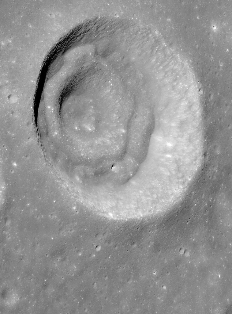
Portion of an unnamed concentric crater in Apollo Basin. Sun is incident from the right to the left. LROC Narrow Angle Camera (NAC) mosaic M1122245918LR, orbit 17571, May 3, 2013; image field of view is 6.3 km [NASA/GSFC/Arizona State University].
Sarah Braden
LROC News System

The double-arch shape in the Featured Image is a portion of an unnamed concentric crater located in the northwestern extent of Apollo Basin (basin center at 35.687°S, 208.232°E).

The concentric crater has an inner ring, centered on 30.757°S, 205.931°E, a middle ring, and then the crater rim.

The crater formed within the mare basalt that fills Apollo Basin. The formation mechanism for concentric craters like this one is not entirely clear. One theory is that the target material is made of multiple stratigraphic layers with different strengths. If the difference between the strengths of the layers is great enough, the impact may form concentric rings.

Bench craters also form when target layer strengths are different.

Oblique NAC view of the unusual crater morphology in Apollo basin. LROC NAC mosaic M109753923LR, orbit 14102, July 21, 2012; camera and spacecraft slew off nadir 57.74° resolution roughly 2 meters per pixel from 76.2 km over 31°S, 200.62°E [NASA/GSFC/Arizona State University].
In the late 1960s laboratory experiments replicated the concentric shape of craters using targets with loose, granular material over stronger, more cohesive layers. The laboratory experiments use different materials and are at smaller scales than their lunar counterparts. Still, experiments like these are important for comparing what we see on the lunar surface to basic physical principles. What if an impact occurs in an area with highland material as one layer and then mare basalt as a second layer? What crater shape is produced if you introduce a regolith layer? These are the questions that lunar geologists use to design their experiments.

LROC WMS Wide Angle Camera mosaic of the concentric crater in context with north and northwestern Apollo basin, The crater of interest is 11.5 km across [NASA/GSFC/Arizona State University].
Explore the entire LROC NAC mosaic, HERE

Related Images:
Concentric Crater (Gruithuisen K)
Apollo Basin: Mare in a Sea of Highlands
Small Pond
LOLA's Apollo Basin
Biggest, deepest crater - an excavation of the hidden, ancient Moon

Thursday, February 7, 2013

Archimedes Rock Garden

A group of rocks, a small shallow crater, and rays of ejecta occur together up on one of the fault terraces of the crater nearside landmark crater Archimedes. Cropped from LROC Featured Image released February 7. 2012 - LRO Narrow Angle Camera (NAC) M109256375R, spacecraft orbit 1235, October 4, 2009; resolution 52 cm per pixel, 31.95° angle of incidence, from 52.35 km [NASA/GSFC/Arizona State University].
Jeffrey Plescia
LROC News System

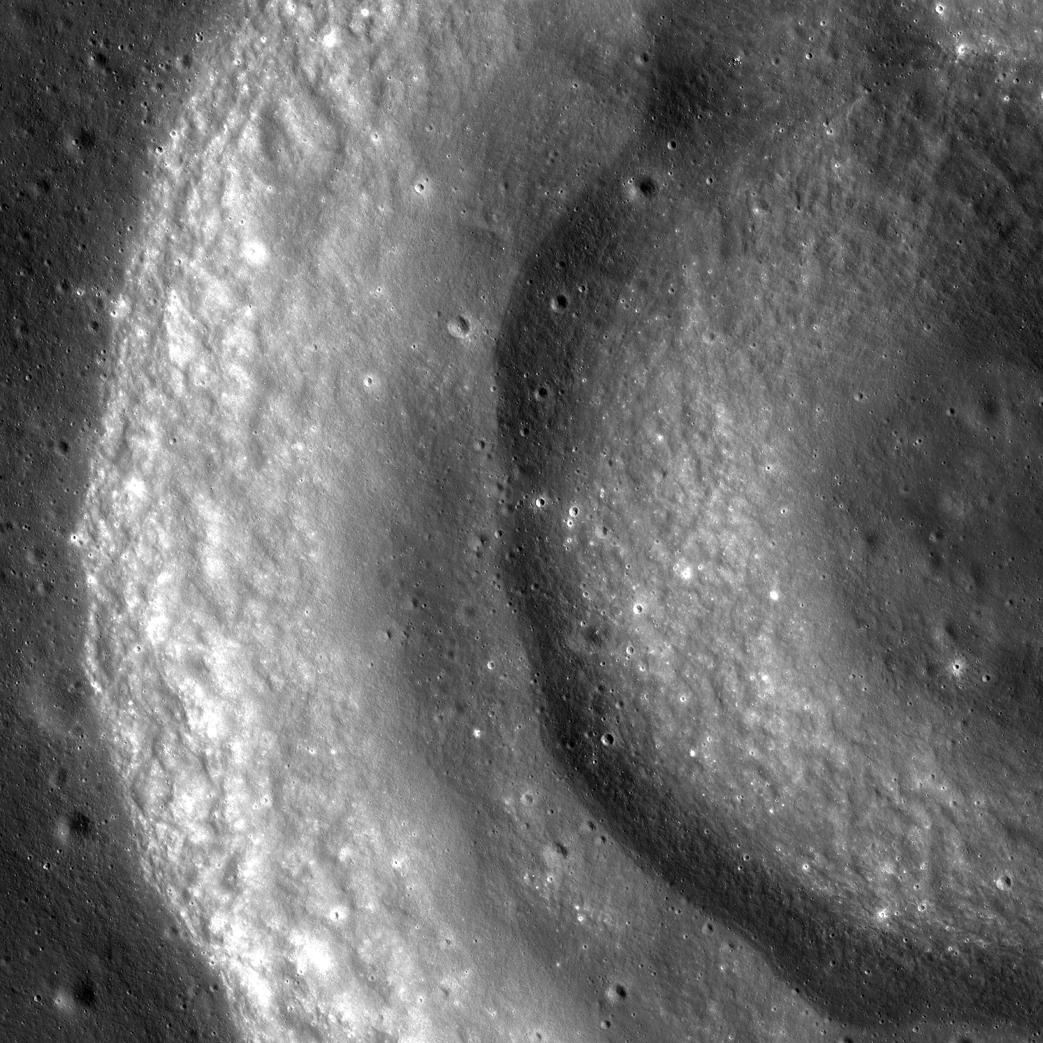
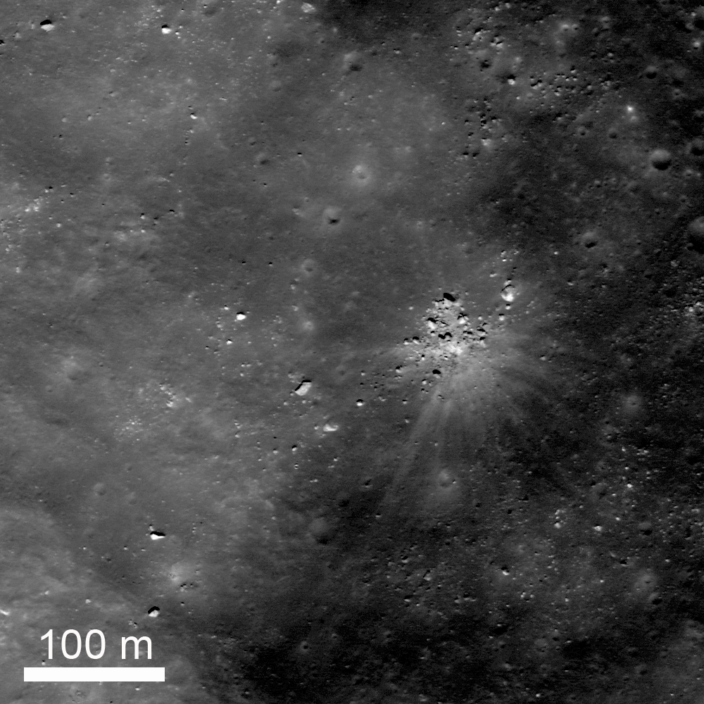
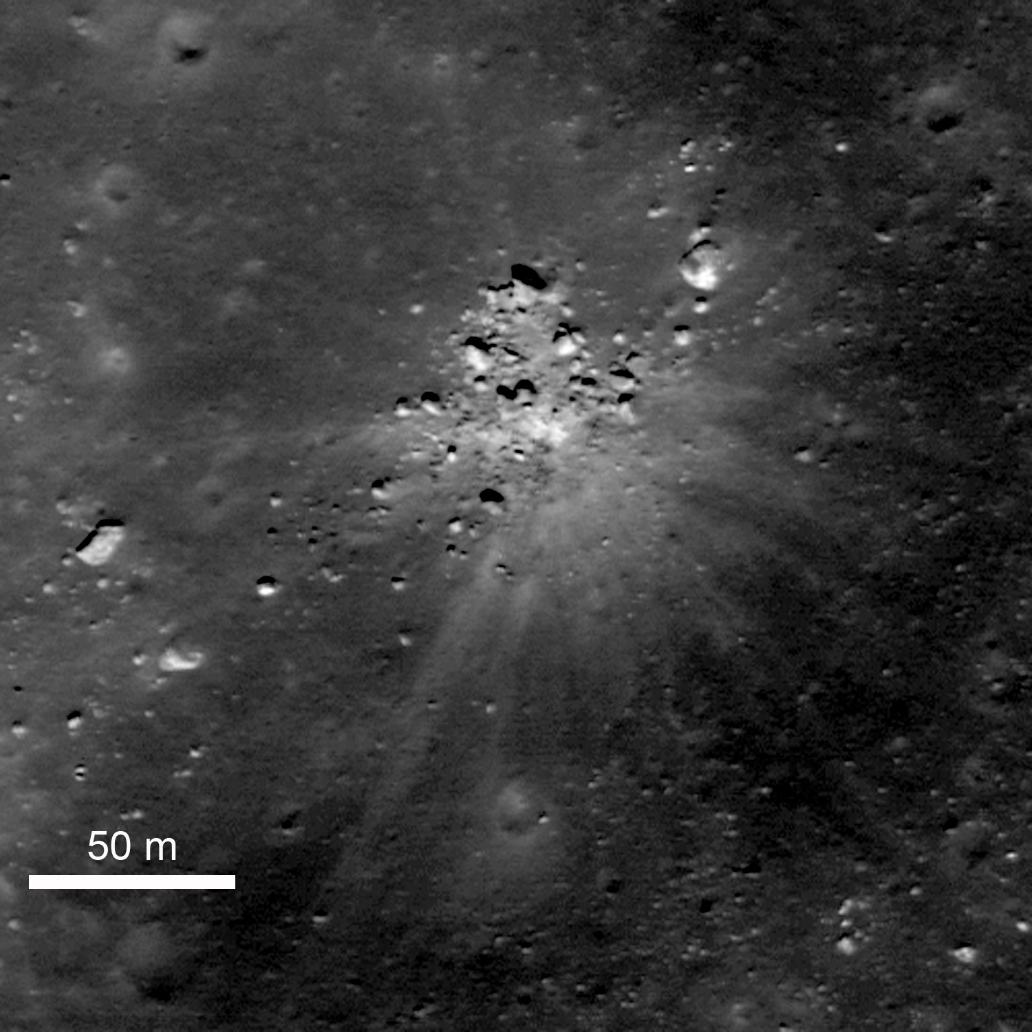
A collection of rocks up to about 8 m across surround a small shallow crater, also about 8 m in diameter. A series of bright ejecta rays surround the area. The site lies on the edge of one of the northeast faulted terraces of Archimedes crater (83 km) at 30.154°N, 357.141°E.

Understanding the origin of this distinctive scene is not necessarily straight forward. At the center is a shallow crater about 8 m in diameter, and a series of bright rays extend away from the crater out to distances of about 150 m. Note that some of the blocks seem to block the rays. On the southwest side there is a large rock about 6 m across, bright lanes of ejecta extend past it on both sides but not behind the rock. To the north, a collection of rocks forms a semicircle; within that semicircle is bright ejecta, but not much beyond.

Zoomed in view of the area shown in the Featured Image. The rocks immediately around the impact site are on the surface. The large bright rock to the northeast and several of those to the southwest are buried by older regolith. LRO NAC M109256375R [NASA/GSFC/Arizona State University].
Not all of the rocks in the scene are related to this event. To the northeast there is a bright, partly buried rock about 12 m across, and the west-southwest an elongate rock 7 x 14 m rests of the surface.

The question is, what happened?

One possibility is that there was already a collection of rocks on the surface and a small meteor happened to hit in a small open area among them; then as the ejecta spread out, it was blocked by the rocks.

Another possibility is that there was a giant boulder at this location that just happened to get hit by a small meteor, shattering the boulder into the pieces that now surround the crater.

The third possibility is that a large boulder ejected during the impact of Archimedes (or from some other nearby impact) landed here and shattered upon impact making a small crater. If the boulder was from the Archimedes impact, it must have been launched into a high trajectory such that it hit the surface only after most the impact activity had ended.

An earlier LROC NAC survey of the terraces and northeast floor of Archimedes. The 'rock garden' is designated with the yellow arrow. A 1.29 meter resolution frame considerably resampled to view the full-width of a 6.46 km-wide field of view. LROC NAC M106898464R, orbit 894, September 6, 2009; 39.9° angle of incidence, from 160 km [NASA/GSFC/Arizona State University].
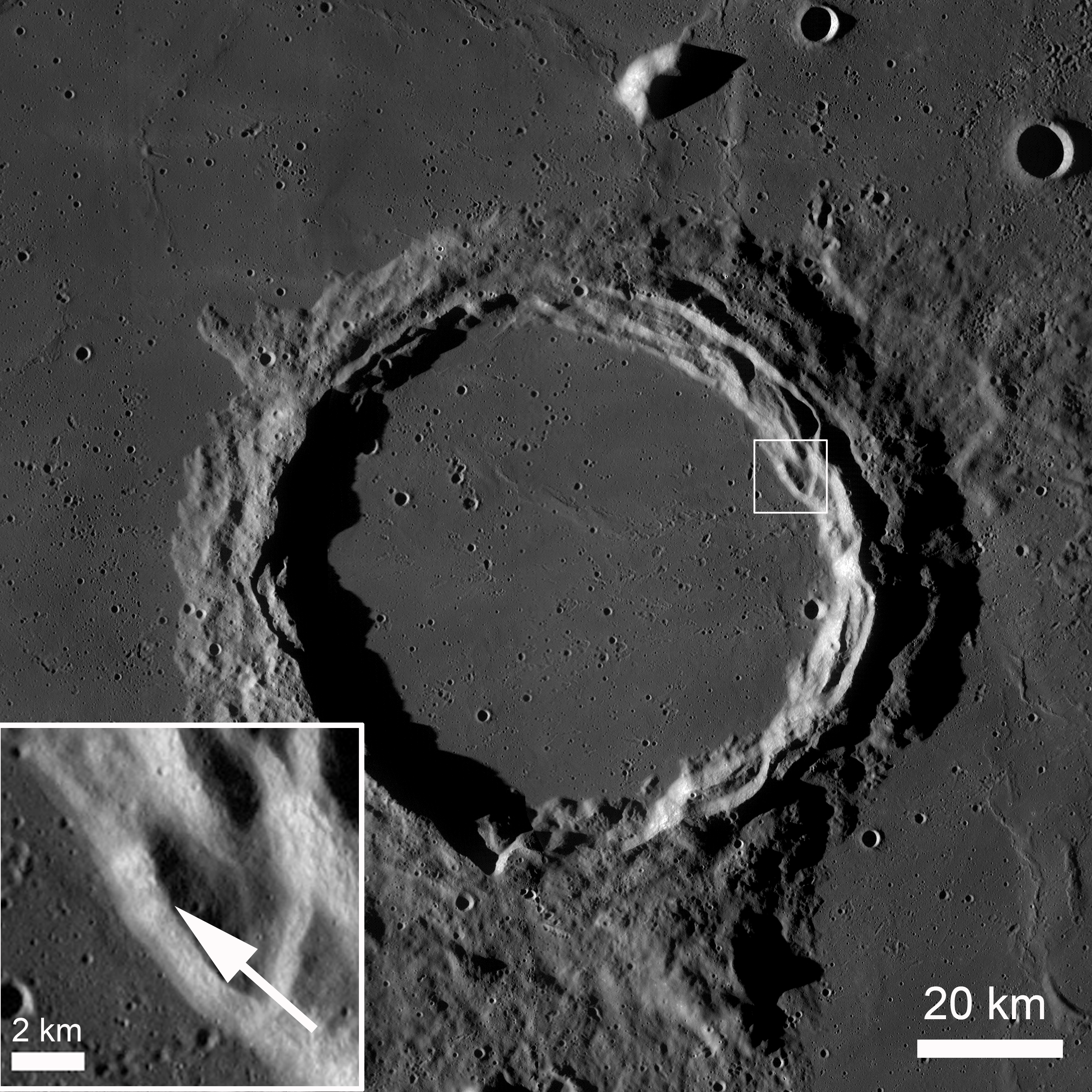
Archimedes under afternoon illumination. The small box on the northeast edge of the terraces in shown as an enlarged inset in the lower left, denoting the location of the rock garden and adding some context also to the image immediately preceding this one. LRO Wide Angle Camera (WAC) mosaic. [NASA/GSFC/Arizona State University].
The area of the rock garden lies on the edge of the Archimedes terraces.  Archimedes is 83 km diameter and lies on the eastern edge of Mare Imbrium.  It is filled with and surrounded by mare basalts on most sides. The crater floor lies a couple hundred meters below the surrounding mare.

Explore more of Archimedes in the full LROC NAC, HERE.

Related Posts:
Archimedes - Mare Flooded Crater!
Sunset Over Giordano Bruno
Necho's Terraces

Archimedes as viewed from the northest, high over Mare Imbrium through the HDTV camera of Japan's SELENE-1 (Kaguya). Further south are the Montes Archimedes and on the left, at the foot of the Appenines (arcing south beyond the horizon), is Palus Putredinus and Hadley Rille, landing site of Apollo 15 in 1971 [JAXA/NHK/SELENE].

Wednesday, December 26, 2012

New oblique view of Tsiolkovskiy central peak

The prominent, very distinctive central peaks of farside Tsiolkovskiy crater, from a new, scaled mosaic of the left and right frames of LROC Narrow Angle Camera (NAC) observation M1098059280, spacecraft orbit 14176, July 27, 2012; resolution between 4.6 and 5.3 (top) meters per pixel, captured 87.66 km over 20.44°S, 121.42°E, a point over 200 km west of the highest promontory. Larger versions available HERE  [NASA/GSFC/Arizona State University].
Joel Raupe
Lunar Pioneer

Each quarterly release of LROC data to the Planetary Data System (the twelfth, on December 15, covers the three months between mid-June and September), is not really complete until the KML index emerges, for viewing through Google Earth's lunar simulation.

Fortunately, the Lunar Reconnaissance Orbiter Camera (LROC) team made available to the public an incredibly useful set of improvements to their Web Map Server (WMS) Image Search tool, something that was already a real complimentary companion to the newer LROC QuickMap tool. Playing with the layers and search capabilities of the new tool, while studying the LUNAR landing site study, was enough to keep us busy.

The KML data are a fast and intuitive way yet to search directly for LROC NAC images, especially those with exceptionally high slew angles, the few oblique images. And the latest KML files appeared on the Massachusetts Institute of Technology servers December 21.

Since the very first grainy, misunderstood images of the Moon's far side were returned to Earth by the Soviet Union in 1959, Tsiolkovskiy immediately stood out, strongly underscoring the remarkable differences between the tidally locked hemispheres. LROC Wide Angle Camera (WAC) context view of the most conspicuous mare-flooded surface on the lunar farside, 185 km Tsiolkovskiy crater [NASA/GSFC/Arizona State University].
The oblique views are rare. Off nadir NAC observations are of a lower scientific value, perhaps, than the job of completing the high-resolution photography of the entire Moon, a goal the LROC team is closing in on. My favorite targets for these oblique views are never in the new batches, but there's always one or two that are breathtaking and unexpected.

Last September LROC's 11th release included an oblique look into the interior of Antoniadi, for example, that was then included in our post highlighting oblique views of Engel'gardt heights. Antoniadi, as it turns out, figures prominently in the aforementioned landing site study. Follow-up posts on that Eratosthenian crater, well inside the very ancient South Pole-Aitken basin, are in preparation.

Among the new, few oblique views that really stand out in the twelfth release is an off-nadir view of the central peaks of Tsiolkovskiy, shown up above. The complete field of view here is a highly re-sampled (less than 8 percent) version of what was originally a 6204 by 8955 mosaic (of LROC NAC M1098059280LR, swept up last July). It's reduced down to 580 x 800, or the maximum size allowable in a blogger post.

Because we derive vast amounts of valued-added imagery, in an image-intense subject of study, this last limitation has become a nagging problem we would like to solve.

Quarter resolution view of the LROC NAC mosaic shows some of the glory of the wider view, the eastern range and summit, as well as some of the considerable slumping of the degraded northern section of Tsiolkovskiy central peak [NASA/GSFC/Arizona State University].
We would welcome recommendations and/or reviews of image hosting sites, most especially those that do not presume to arbitrarily substitute photography with lossy resampling. Meanwhile, a planned migration to a new host for this website has been delayed yet again.

A virtually full resolution view of a high promontory of the Tsiolkovskiy central peak, suffering from a foreshortening affect, partly the result of simple distance and the high lateral motion of the LRO spacecraft, more 200 kilometers away. Like a more dramatic LROC NAC view of the high place on the central peaks of Tycho, this view seems to show a large boulder sitting near its top, likely a rock that emerged from the upthrust after considerable mass wasting [NASA/GSFC/Arizona State University].
Perhaps the best off-nadir view of the central peak of Tsiolkovskiy crater, prior to this latest oblique LROC NAC observation, from among the HDTV stills of the crater captured by Japan's SELENE-1 (Kaguya) orbiter in 2008. The view is from well to the north [JAXA/NHK].
Like the oblique LROC NAC mosaic of the Moon's highest elevation at Engel'gardt, discussed here in early October, this latest view of Tsiolkovskiy took place while the area of interest was under a high Sun, and from a great distance. Thus the raw result is of low contrast, the details of relief given over to raw albedo. That, and the apparent lateral motion through a field of view made small by distance, results in a less than perfect aesthetically pleasing result. We will take what we can get before continuing with the work of putting together raw illustrations needed to offer posts about the LUNAR landing site study.

Another 'full-resolution' first look at the new Tsiolkovskiy central peak NAC mosaic, this section near the southern base, a good illustration of the affects of foreshortening, and lateral speed through a narrow window, and over a bright Sun-Subject-Spacecraft phase angle. Though their trails are not individually seen, the subject and scene shown above are near to the area shown at much higher resolution (from overhead) discussed in the LROC Featured Image post "Weaving boulder trails on the Moon," last July 11 [NASA/GSFC/Arizona State University].
Sample Posts regarding Tsiolkovskiy crater:

The Old and the Young at Tsiolkovskiy (October 31, 2012)
Weaving boulder trails on the Moon (July 11, 2012)
Bulging wrinkles at Tsiolkovskiy (January 11, 2010)
Regolith on Basalt (January 10, 2012)
Highland-Mare boundary of Tsiolkovskiy (September 29, 2011)
The Hummocks of Tsiolkovskiy (August 26, 2010)
More of Tsiolkovskiy's boulders and boundaries (August 26, 2010)
Small fractures in the mare floor of Tsiolkovskiy (August 25, 2010)
Tsiolkovskiy - Constellation Region of Interest (May 1, 2010)
Uplift, Boulders of Tsiolkovskiy (September 1, 2009)

Aristarchus follow-up

Aristarchus in one sweep, an orbital swath ultimately stitched into a four-orbit mosaic, shows one of the most photographed of the complex lunar craters in unusually muted tones. Because Aristarchus is unusually bright, the reason it is most often cited as the reported location of Transitory Lunar Phenomena, fast LROC low-orbit photography allows an unwashed-out appreciation of its topographic detail. Full-width strip of LROC Wide Angle Camera (WAC) observation M162622850CE, (604nm), LRO orbit 9099, June 13, 2011; resolution 56.85 meters at a morning angle of incidence of 79° from 40.77 km [NASA/GSFC/Arizona State University].
Strip from the four sequential LROC WAC orbital observations mosaic shows young Aristarchus nested on the southeastern heights of Aristarchus plateau, together with the Cobra Head and much older, mare-flooded companion Herodotus to the west. The youngest mare surface on the Moon yet identified, estimated to be a mere 1.1 billion years old, is situated at the southern end of this field of view. Despite it's relative youth, that surface is older than Copernican-age Aristarchus, so the crater cannot be its source [NASA/GSFC/Arizona State University].
A full-resolution crop from a full-disk 33 image mosaic of the Moon, September 25, 2008, shows Aristarchus and its plateau at local late afternoon [Astronominsk].
Southside, Aristarchus crater (December 25, 2012)
Oblique Narrow Angle on Aristarchus Cobra Head (October 9, 2012)
Debris Channels (August 8, 2012)

Tuesday, December 11, 2012

Impact melt in Picard crater

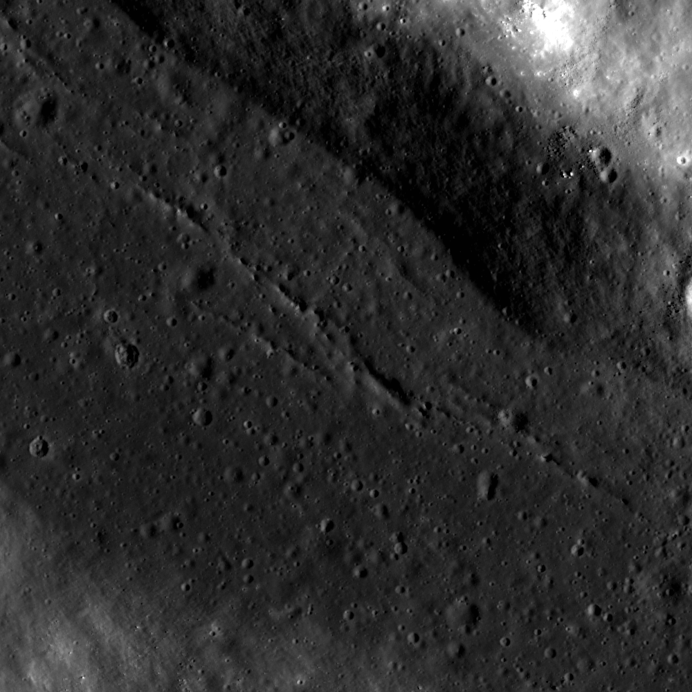
Cracks in ancient impact melt, pooled on a terrace on the wall of Picard, a landmark crater on the basin floor of Mare Crisium. The cracks probably formed during cooling, as the impact melt solidified. LROC Narrow Angle Camera (NAC) M1107917713RE, LRO orbit 15556, November 18, 2012; field of view approximately 1300 meters [NASA/GSFC/Arizona State University].
Drew Enns
LROC News System

Craters inform lunar scientists about many aspects of the Moon's surface and subsurface. Impact craters act as drill holes into the lunar subsurface, excavating deep material and scattering this previously buried material into their ejecta blankets. Impact melt within craters preserves a mix of the material that was excavated as well. Picard crater, at 14.55° N, 54.74° E, exposes a chemically distinct underlying basalt layer in Mare Crisium. In this way, Picard crater contributed to our understanding of the volcanic stratigraphy within the depths of the Mare Crisium basaltic fill. Does Picard crater penetrate through the basalts to expose the underlying highlands material, and can the impact melt help us understand more about the stratigraphy of the Mare Crisium?

Wide contextual view of the interior wall of Picard, from LROC NAC M1107917713R [NASA/GSFC/Arizona State University].
LROC Wide Angle Camera (WAC) context image of 22.34 km-wide Picard. Monochrome (643nm) mosaic of LROC WAC M150158282C and M150165076C (orbit 7264 and 7265, January 20, 2011; resolution 57.3 meters [NASA/GSFC/Arizona State University].

The floor of Picard crater is relatively bright compared to the surrounding basalts (Head et al., 1978) making it likely the deepest material brought up was from benath the mare fill. Thus we can estimate the thickness of the basalt deposit at this location. Spectroscopic studies in the 90's found evidence of both a basaltic and highland rock signature within Picard crater (Blewett et al., 1995). The impact melt that fills a significant portion of Picard crater (like the terrace above) is likely a mix of both rock types, giving Picard crater this mixed signature. Using the LROC WAC Digital Elevation Model (DEM) for the area tells us that Picard crater's floor is about 2300 m below the surface, as is the thickness of the Mare Crisium basalt!

Explore more of Picard crater in the full LROC NAC, HERE.