Showing posts with label Astonominsk. Show all posts

Saturday, August 13, 2011

Recent impact near Reiner Gamma


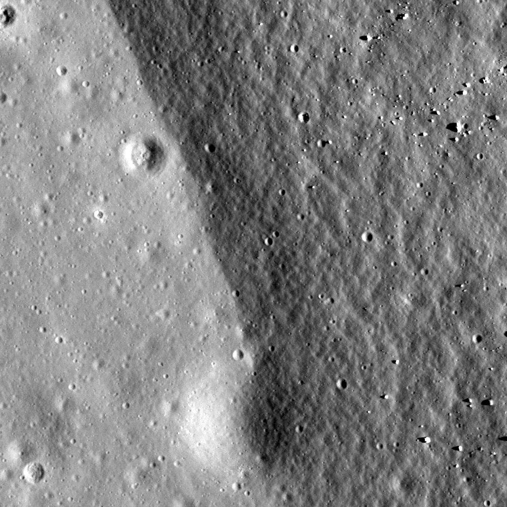
An exaggerated close-up of an apparently unmarked pool of impact melt marking the bulls-eye floor of what must be a very fresh crater at a geologic crossroads in Oceanus Procellarum. Sampling in and around this "dig" would add to our knowledge of the Reiner Gamma albedo swirl and magnetic anomaly, the Marius Hills to the north, nearby Reiner crater and the vast Procellarum basin itself [NASA/GSFC/Arizona State University].


The small amount of impact melt pooled and froze becoming the 90 x 70 meter floor of this Copernican Age crater. What process creates impact melt pools? LROC Narrow Angle Camera (NAC) observation M111972680LE, LRO orbit 1635, November 4, 2009; image field of view is 750 meters. View the full 1500 pixel-wide LROC Featured Image HERE [NASA/GSFC/Arizona State University].

Drew Enns
LROC News System
Link
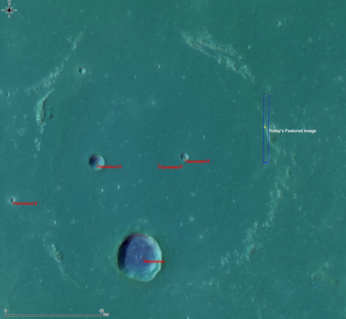
This unnamed crater is near the Reiner Gamma Swirl in Oceanus Procellarum. The crater’s relative youth makes it a great example to investigate how impact craters form. The cratering process occurs in three stages: contact and compression, excavation, and modification. The impact melt and boulders were created during contact and compression as the bolide transferred its kinetic energy to the target.


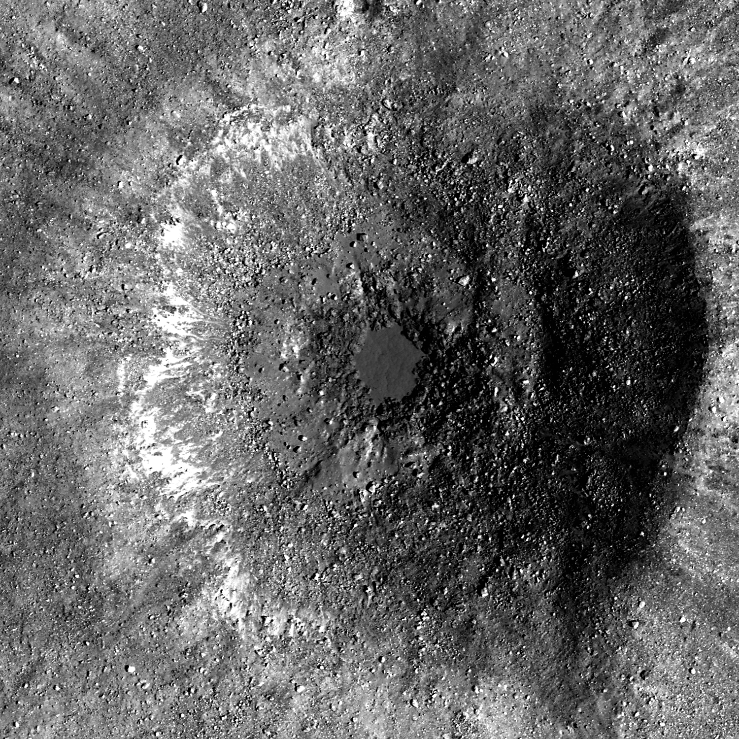
The ejecta blanket of the unnamed crater. Image is a mosaic of NAC pair M111972680, image width is 3.0 km [NASA/GSFC/Arizona State University].

The ejecta blanket was deposited during the excavation stage, covering the surrounding mare surface with high reflectance, immature material. The modification stage brought about the final shape of the crater. As the forces involved in the impact subsided, the impact melt pooled at the bottom of the crater along with the boulders. The modification stage is still ongoing as gravity has since caused small landslides on the crater wall, and more boulders have probably eroded out of the crater wall.

Can you find similar craters in the full NAC frame?


The arrow notes the location of the relatively recent crater enfolded by the wispy anomalous albedo of Reiner Gamma, the Moon's most extensive such "swirl," in this 125 km-wide monochrome (643 nm) LROC WAC mosaic. The small crater is also situated near the end of a secondary crater chain radiant of the Reiner crater impact zone, just peaking into view at lower right. A wider field of view can be viewed HERE [NASA/GSFC/Arizona State University].

Related Posts:
Rubble Pile on Fresh Crater Floor
Action Shot
Melt and more melt


It's not inconceivable that the small but bright (optically immature) impact crater northeast of the "eye" of Reiner Gamma could be imaged from Earth. For a variety of reasons it is invisible in this spectacular mosaic captured by the Astonominsk partnership on September 25, 2008. Neither are many other lower profiled features characteristic of the Procellarum basin anatomy [Astronominsk].

Thursday, April 7, 2011

Interior Rim of Flamsteed P


Boundary of buried crater rim and mare basalt at Flamsteed P, Illumination is from west at an angle of 60°, field of view is 500 meters; from LROC Narrow Angle Camera (NAC) observation M114233793R, LRO orbit 1968, November 30, 2009. View the full-size Featured Image, HERE. [NASA/GSFC/Arizona State University].

Hiroyuki Sato
LROC News System

Today's Featured Image displays a portion of eastern rim of Flamsteed P crater, located in southern Oceanus Procellarum. The rough and darker right side corresponds to the rim slope, and the brighter and smoother area to the left is the younger mare basalt. Flamsteed P's interior was mostly filled by mare basalts and all that remains are portions of its rim showing as discontinuous ridges (see WAC context image below).

In terms of local timeline of events (geochronology), following the formation of Flamsteed P, mare basalt flooded its interior and exterior. Later a small crater (110 m diameter) formed just at the boundary between the mare and crater rim (bottom of today's Featured Image). This small crater is half covered by the older rim unit. Does this make sense? Even though the small crater is much younger than the Flamsteed P rim it is buried by rim materials that slid downhill after the crater formed. What cause the regolith to move? Perhaps moonquakes generated by internal stresses or nearby impact events. Or perhaps a slower process of downhil creep caused by thermal cycling of the regolith (soil). We have much to learn about the Moon - the next frontier!


Whole of Flamsteed P, yellow cross and blue rectangle indicate the locations of the April 6, 2011 LROC Featured Image and the NAC frame from which is was taken. False color image from the Digital Terrain Model (DTM) centered at 3.15°S, 315.96°E. A LROC Wide Angle Camera (WAC) mosaic at 100 meters per pixel resolution is overlaid by LROC WAC DTM at 500 meters per pixel. View the full-size context image HERE [NASA/GSFC/Arizona State University/DLR].

The topographic color was produced as a by-product of stereo analysis of the WAC global dataset. Producing the global Digital Elevation Model (DEM) is a big job being led by LROC team members at the German Aerospace Center (DLR; English version) in Berlin.


Flamsteed P also hosts the first United States spacecraft to soft-land on another world, on June 2, 1966. The sentinel Surveyor 1, visible in this illusion of a 500 meters high "flyover" of LROC NAC images of the spacecraft's shadow on the ancient mare-inundated crater's interior. The northern rim of Flamsteed P is just apparent on the horizon [Google Earth/NASA/USGS/GSFC/Arizona State University].

Explore the boundary of mare basalts by viewing the full NAC frame!

Related posts:
Archimedes - Mare Flooded Crater
Wrinkle Ridges in Aitken Crater
Volcanoes in Lacus Mortis
Relative Timing of Geologic Events in Mare Frigoris
Surveyor 1 - America's first soft lunar landing


This 15 percent reproduction of a 6100 x 8200 mosaic from 43 individual images from Astronominsk hardly does it justice. You own it to yourself to see the original, captured in August 2010, just to see if you can locate Flamsteed P, a familiar target for even modestly-equipped amateurs [Goryachko, Abgarian & Morozov, Minsk, Belarus].


And here's the line-of-sight view of Flamsteed P as seen from Earth, not close-up but at full-resolution from the Astronominsk. The contact zone between the eastern rim of the nearly buried 100 kilometer-wide crater, discussed in the LROC Featured Image, can be spotted with little effort [Goryachko, Abgarian & Morozov, Minsk, Belarus].