Showing posts with label Rima Bradley. Show all posts

Friday, November 18, 2011

LROC: Shiny Mound

Northeastern edge of a high-reflectance mound within "driving distance" of the Apollo 15 landing site on the southeastern frontier of Mare Imbrium. Downslope is to the upper-right. (Field of view 1512 meters across). LROC Narrow Angle Camera (NAC) observation M106869873R, LRO orbit 890, September 6, 2009; resolution 1.26 meters per pixel, incidence angle 36.72° from an altitude of 153.64 kilometers. View the much larger, full size LROC Featured Image HERE [NASA/GSFC/Arizona State University].
Hiroyuki Sato
LROC News System

At the southeastern edge of Mare Imbrium, about 25 km west of Rima Hadley, there is a small shiny mound on a dark and flat mare basalt plain which looks like a white sand island in the middle of a black ocean. This mound is about 2.7 by 2.2 km across. 

Normally fresh slopes and fresh ejecta have high reflectance due to less space weathering but this mound is brightest at its highest elevations and not down the slopes, brighter than nearby ejecta implying the mound is composed of higher-reflectance materials than mare basalts. Then how was this shiny island was formed?

Whole view of high-reflectance mound centered at 25.482°N, 1.684°E (Field of view about 5.3 kilometers. See the original LROC context image HERE, also from LROC NAC frame M106869873R [NASA/GSFC/Arizona State University].
Most likely, the mound is a remnant of highlands sticking through the mare, a hummock of plagioclase-rich highlands materials was embayed by mare basalt volcanism, burying all except its summit. If so, mare basalt is overlapping the mound's skirt. 

Can you see the an overlap contact in today's Featured Image?

An oblique view from a simulated low altitude looking northeast over the LROC WAC 100 m monochrome Global Mosaic affixed to LOLA topography, using NASA's ILIADS program. The bright mound is near the center of the view, with the Hadley Rille Valley and the landing site of Apollo 15 in the background. Does the angle of this view seem familiar? [NASA/GSFC/Arizona State University].
Unfortunately, the contact is not clear or sharp. Over time such sharp contacts are blurred by micrometeorite bombardment. If we are lucky, in the future, a small impact may occur right at the contact once again revealing the sharp contact. Or perhaps a future explorer might take a shovel to this spot and settle the question!

Explore this shiny mound in the full NAC image!

Related posts:
Farside Highlands Volcanism!
Up from the depths
Hortensius Domes - Constellation ROI

Friday, February 11, 2011

LROC: Rima Bradley


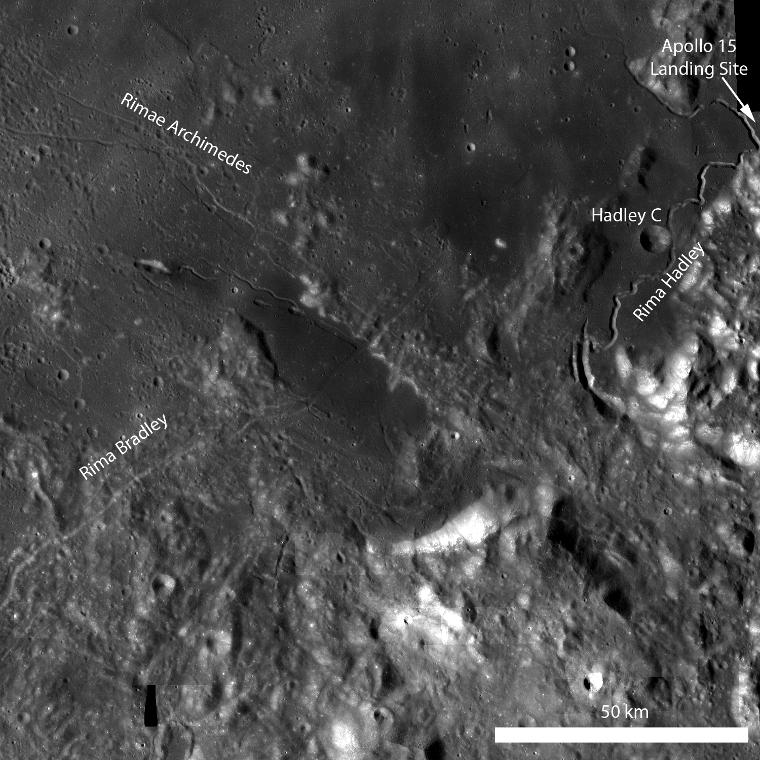
Rima Bradley is a 134 km northeast/southwest-trending linear rille at the foot of Montes Apenninus, between Mare Imbrium and Palus Putredinis, very close to the Hadley Rille Valley landing site of Apollo 15. Rima Bradley probably formed as a result of tectonic stresses in the Imbrium basin. Click here to view the full-sized annotated LROC WAC monochrome mosaic [NASA/GSFC/Arizona State University].


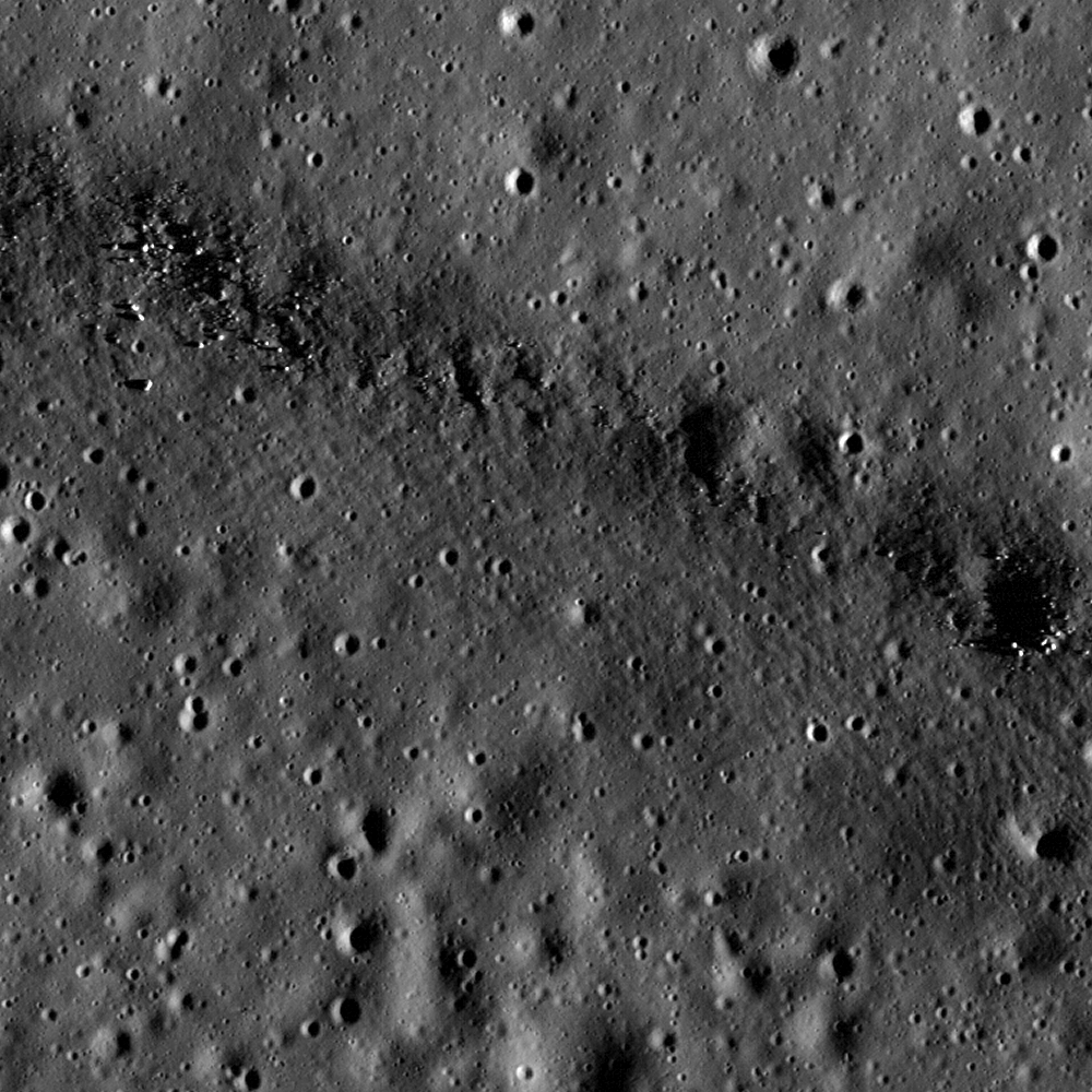
Rima Bradley primarily divides highland terrain, but in the portion captured by the LROC Narrow Angle Camera observation M146980324L, last December 14 the rille bisects a 15 km by 35 km mare pool (center of the first image above). The field of view from M146980324L is 700 meters wide with a resolution of 0.70 meters per pixel; illumination is from the east. Click here for the full-sized LROC Featured Image release [NASA/GSFC/Arizona State University].


The full 1800 width of a 36.5 kilometer-long field of view within LROC NAC M146980324L allows some context to the area of detail further above. This spur of Rima Bradley is a surface component of a inundated rift, a spur departing from the rille system's general run arcuate with nearby hills and jagged peaks pushed up around the rim of the Imbrium impact zone [NASA/GSFC/Arizona State University].

Lillian Ostrach
LROC News System

This region is geologically complex, featuring sinuous rilles, mare volcanism, highland mountain ranges, and of course impact craters.

Certainly future human missions are needed to explore this area in detail, but for now, explore the full-resolution LROC WAC monochrome mosaic and the full LROC NAC image!


A simulated perspective near LRO low-lunar orbital altitude, looking southeast over the central meridian. The LROC Wide Angle Camera mosaic is fixed to the lunar digital elevation model available in Google Earth (>v.5), with added detail from the Apollo Corridor, an area of the Moon photographed in detail during the Apollo 15 & 17 science missions, thus allowing for the highest quality lunar topographic models through the first decade of the 21st century. View the full-sized image here.

Related posts:
Linear Graben
Features of the Rimae Fresnel Area
Hadley-Apennine: Apollo 15
Rupes Recta


The same southeasterly view closer in, from 2.5 km over the 35 km length of the melt pool bisected by the main arc of Rima Bradley (across upper center). An addition of several 1.4 meter per pixel resolution frames from LROC NAC M104519138 show boulder-sized granularity around a sinuous rille and twin sinks that seem related to the featured "spur" joined perpendicular to the Bradley system at the north shore at upper left. The general run of the spur, and the melt pool itself, appears to be radial to the Imbrium impact. View the full-sized image here.


The shallow 1200 meter long sinks "Ann" (left, near 25.1°N, 0.07°W) and "Patricia" (r), seemingly related to both the Rima Vladimir and Rima Bradley systems, in the long inundated valley radial to Mare Imbrium. center. Mosaic of the left and right frames of LROC Narrow Angle Camera observation M104519138 from the Commissioning Phase of the LRO mission, orbit 562, August 10, 2009 [NASA/GSFC/Arizona State University].


North-south slice of the breathtaking LROC Wide Angle Camera monochrome mosaic, "stretched" in contrast and pushed to pull detail out of the melt pool, darker than the glare from Mons Bradley. [NASA/GSFC/Arizona State University].