Showing posts sorted by relevance for query Sinus Iridum. Sort by date Show all posts

Saturday, October 16, 2010

Sinus Iridum - Next Destination?


LROC Wide Angle Camera (WAC) topography of Sinus Iridum. Blue shows the lowest areas and red the highest. From Promontorium Heraclides to Promontorium Laplace is 235 kilometers across [NASA/GSFC/Arizona State University].

Mark Robinson
Principal Investigator
Lunar Reconnaissance Orbiter Camera
Arizona State University


Wow - five spacecraft launched to the Moon in three years! The latest is China's second lunar orbiter, Chang'e 2, which was launched 1 October 2010 and arrived at the Moon on 6 October. Chang'e 2 carries a higher resolution camera than Chang'e 1 that may help Chinese scientists scout out the proposed landing site for their upcoming lander/rover, Chang'e 3. Currently the Chinese lander is slated to land in Sinus Iridum (Bay of Rainbows) sometime before 2013. Why Sinus Iridum? The WAC topographic map shows the area to be very flat and nearly featureless. However as the LROC Narrow Angle Camera (NAC) keeps showing us, there are no featureless spots on the Moon - everywhere on the Moon is fascinating!


Boulders resting on the top of a wrinkle ridge in the middle of Sinus Iridum. Where did they come from? (LROC Narrow Angle Camera observation M124749832R) [NASA/GSFC/Arizona State University].

Sinus Iridum is a mare-filled impact crater that superposes the Imbrium basin. It is far from any Apollo landing sites, with the closest (Apollo 15) being more than 1000 km distant. Scientists would love to have a look at the chemistry of these basalts - how much do they differ from the Apollo 15 basalts which are from the other side of Imbrium? Wrinkle ridges cross the mare, and in places families of boulders are perched on the ridges. Are the boulders weathering out of the ridge? Many small irregular shaped craters dots Sinus Iridum, how were they formed? The LROC team will post selected NACs over the coming weeks, you can join the effort to explore this future landing site now!

Explore the whole of Sinus Iridum with a WAC BW mosaic!

The topographic color was produced as a by-product of stereo analysis of the WAC global dataset. Producing the global Digital Elevation Model (DEM) is a big job being led by LROC team members at the German Aerospace Center (DLR; English version) in Berlin. This winter a global 100 meter DEM will be released.

Thursday, February 9, 2012

LROC: Outcrops in Laplace A

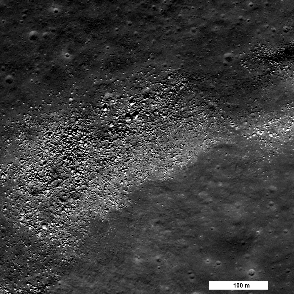
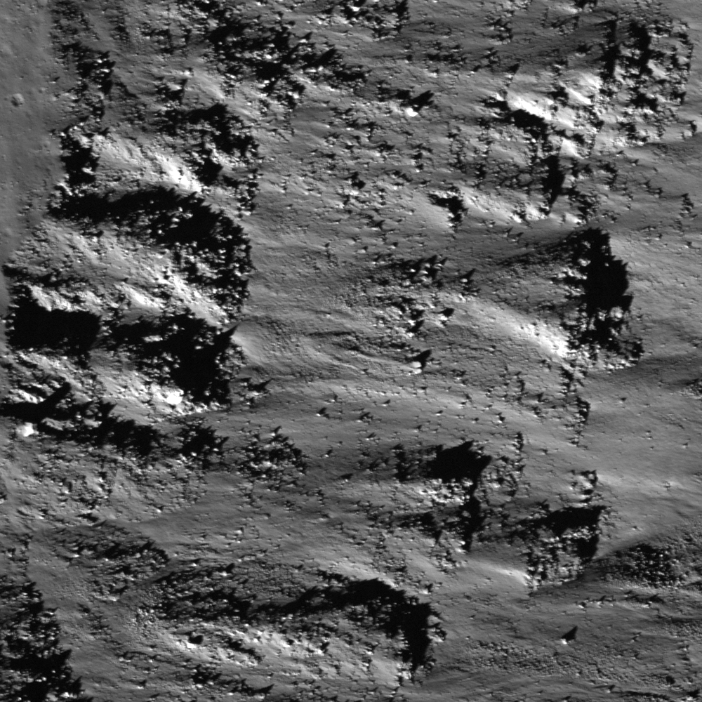
Debris flows and outcrops exposed in the walls of Laplace A crater, offset from Sinus Iridum. Illumination from southwest over a field of view (FOV) approximately 525 meters across, down-slope to the right. LROC Narrow Angle Camera (NAC) M137725771R, orbit 5430, August 29, 2010; incidence angle 52.91° with a resolution 0.52 meters per pixel from 49.72 kilometers. View the original LROC Featured Image HERE [NASA/GSFC/Arizona State University].
James Ashley
LROC News System

As with many mare deposit exposures when viewed at the Narrow Angle Camera imaging scale of 0.5 m/pixel, the bedrock outcrops in the walls of Laplace A appear as layered ledges. The layers are most noticeable in the north-northeast to south-southwest trending rocks visible in the northeast quadrant of the frame. Additional indications of layering can be found in the full NAC image

The prominent V-shaped outlines to some of the outcrops are suggestive of constructional deposition. Granular debris flows cascading down the crater walls following excavation appear to have encountered the obstructing ledges and "dammed up" behind them. Resistance to flow in such situations takes on a tapered shape in the direction of flow as the material becomes compacted. Minor occurrences of impact melt may be contributing to the smooth appearance of the flow deposits between the outcrops.

Featured Image FOV in context of the full 2.5 kilometers wide LROC NAC frame M137735771R [NASA/GSFC/Arizona State University].
The north wall of Laplace A is similarly characterized by the outcrops visible in very high resolution in the LROC NAC frame. The crater and surrounding Sinus Iridum were closely examined as a likely landing site for the Chang'e 3 mission by 2014 by China's lunar orbiter Chang'e 2. Nine kilometer-wide Laplace A (43.64° N, 333.33°E) is a familiar nearside feature because of its place in the largely "featureless" landscape along the frontier of the northwest Mare Imbrium and Sinus Iridum. The crater excavated Imbrium mare over the inundated "missing" southeastern outer ring of the Iridum impact zone. A rewarding 7000 pixel-wide, very detailed version of the image is available from tantaonews.com [CNSA/CLEP].
Nine-kilometer Laplace A is a familiar nearside feature in the mare where Sinus Iridum meets Mare Imbrium. If you have access to a small telescope, it is a challenging target for the eyepiece best viewed two days after First Quarter or a day after Last Quarter. Context information for the LROC NAC Featured Image and the Chang'e 2 study from LROC Wide Angle Camera (WAC) observations gathered during last August's low periapsis period (from an average 33.06 kilometers, at a resolution of 47.6 meters per pixel), orbits 9946 through 9949, August 19, 2011 [NASA/GSFC/Arizona State University].
A 95 km-wide FOV from the WAC monochrome (566 nm) mosaic collected over 4 orbital passes, August 29, 2011 [NASA/GSFC/Arizona State University].
Additional examples of both layering and debris flow in crater wall exposures can be found in the following Featured Image posts: Dawes, Pytheas, and Layering in Messier A.

The apparent isolation of Laplace A (center right) is misleading in this HDTV still of Sinus Iridum, embayed by the vast northwest floor of Mare Imbrium, though there is an authentic paucity of similarly-sized craters in the vicinity, unlike the lunar Highlands. HD video captured by Japan's lunar orbiter SELENE-1 (Kaguya) in 2009. A larger version of this frame can be viewed HERE [JAXA/NHK/SELENE].

Tuesday, August 16, 2011

LROC: A Strategic Overhang


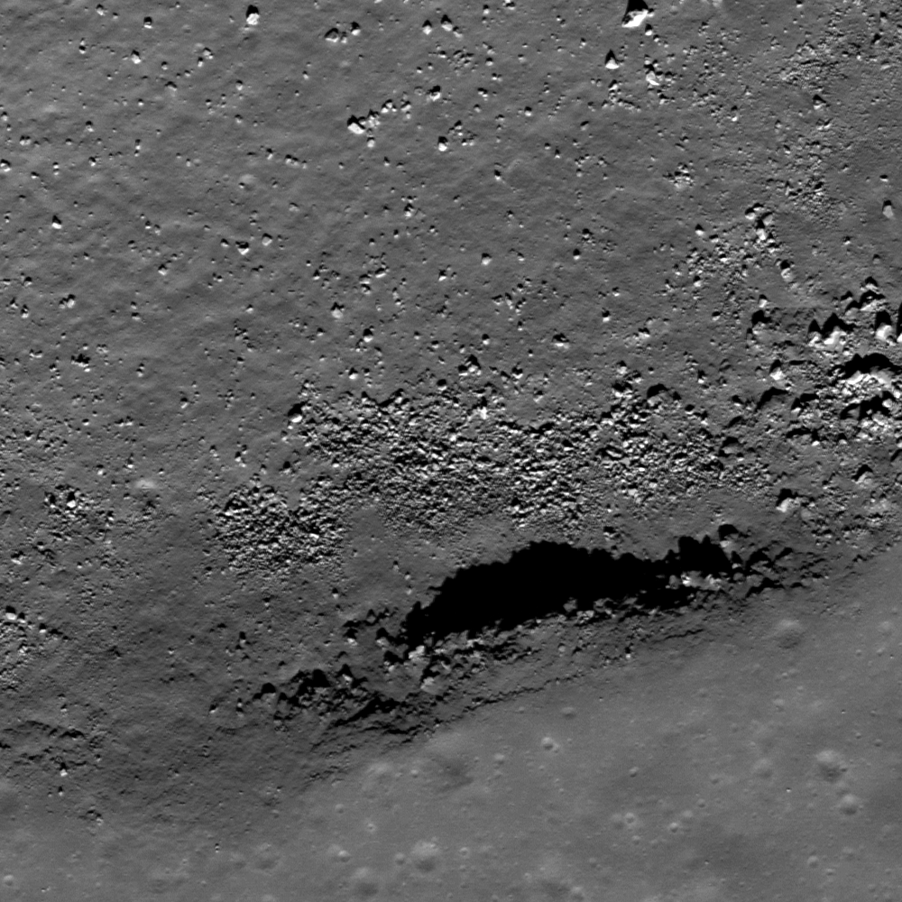
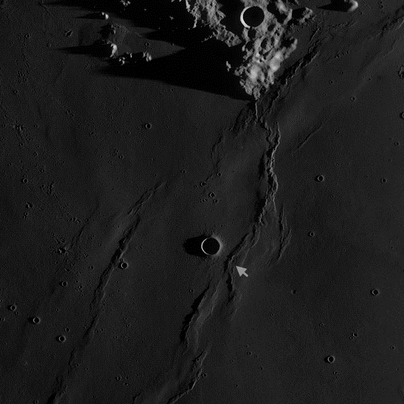
An outcrop in the south wall of an unnamed rille on the edge of Sinus Iridum, immediately north of the Promontorium Heraclides, may form an overhang. Image field of view 400 meters, LROC Narrow Angle Camera (NAC) Observation M124790534R, LRO orbit 3524; from 38.22 km altitude, April 1, 2010. See the full-size LROC Featured Image release HERE [NASA/GSFC/Arizona State University].

Lillian Ostrach
LROC News System

Sinuous rilles are frequent in the mare-filled basins on the Moon and reflect erosion caused by turbulent, very hot lava extruding from a vent. Oftentimes, sinuous rilles meander in tight twists and turns. However, there are exceptions to the "general rule" of sinuous rilles and today's Featured Image of an unnamed rille near Promontorium Heraclides (41.07°N, 326.49°E) may be one such example. Less than 10 km long, the rille is linear with one gentle twist. The opening image highlights a portion of the southern wall of this rille, where rocks outcrop from the rille walls. The rocks jut out from the wall, forming a jagged shadow with illumination from the lower right, and there is abundant debris on the floor that likely represents eroded wall material. It may be that this outcrop is the ceiling of a slight overhang into the rille. If this is the case, obtaining rock samples from beneath the overhang would be useful in order to ascertain exposure ages of rocks in the outcrop compared to those beneath.


For context, a full-width view of the LROC NAC frame M124790534R shows a center slice of the unnamed rille featuring a possible overhang at a stratigraphic crossroads on the southern edge of Sinus Iridum and Mare Imbrium.


Promontorium Heraclides and the unnamed rille as viewed through a LROC Wide Angle Camera (WAC) monochrome (643 nm) mosaic swept up over orbits 6477-6480, November 19, 2010. Field of view is roughly 30 km-wide [NASA/GSFC/Arizona State University].

In addition, measurements of the ancient solar wind could be made from rock samples as solar wind particles are implanted onto the lunar surface.


Promontorium Heraclides in long shadow and higher relief of LROC WAC monochrome (689 nm) mosaic gathered over the course of orbits 2480-2483, January 9, 2010. The long shadows of the promontory and the southern curve of the semicircle of mountains surrounding Sinus Iridum, bring an early late afternoon sunset to the unnamed rille. Mare Imbrium stretches east-southeastward. A larger view of the image cane be seen HERE [NASA/GSFC/Arizona State University].

However, let's not be too hasty! The interpretation of an overhang created by the outcrop is based largely on the presence of the distinct shadow on the rille floor. This image has an incidence angle of ~40°, so the Sun is just a little more than halfway to noon in the lunar sky. Illumination often plays tricks on scientific interpretation, so just because there is a prominent shadow cast by the outcrop does not mean that an overhang truly exists. The best way to determine whether the overhang is real or an illusion is to observe the location under different illumination conditions. Unfortunately for us, the current LROC coverage contains images with incidence angles of ~40° to ~45°, so we are stuck wondering whether this outcrop overhangs the rille walls for the time being.

Can you find any evidence for other outcrops or potential overhangs in the full LROC NAC image?


The mountainous 411 kilometer-wide semi-circumference and interior of Sinus Iridum, on the northeast edge of Mare Imbrium. At lower left is Promontorium Heraclides, marking the border with the Imbrium impact zone. The rest of the original Sinus Iridum crater was presumably destroyed and carried under by the weight of the basalt-flooded Imbrium basin over repeated inundations. An early LROC WAC mosaic released late in 2010 [NASA/GSFC/Arizona State University].

Related Posts:
Discontinuous rilles
Rima Calippus
Sublunarean void!

Saturday, June 11, 2011

Chang'e-2 completes lunar mission and departs


Detail from the Digital Elevation Model (DEM) of Sinus Iridum, an area of high interest to the Chinese Lunar Exploration Program surveyed by the PRC's second lunar orbiter Chang'e 2, which has now left the Moon's vicinity and departed for "Outer Space" [CNSA/CLEP].

Deng Shasha
xinhua

Beijing -- China's second moon orbiter Chang'e-2 on Thursday set off from its moon orbit for outer space about 1.5 million km away from the earth, Chinese scientists said Thursday.

The orbiter left its moon orbit at 5:10 p.m. and it will take about 85 days for the orbiter to reach outer space, according to the State Administration of Science,Technology and Industry for National Defence (SASTIND).

The orbiter had finished all its tasks within its designed life span of six months by April 1.

Scientists decided to let it carry out additional exploratory tasks as the orbiter still had fuel in reserve.

Traveling into outer space from the moon's orbit is the most important task among five additional ones, according to the SASTIND.

"It's the first time in the world for a satellite to be set off from the moon in remote outer space," said Zhou Jianliang, deputy chief engineer of the Chang'e-2 measure and control system of the Beijing Aerospace Control Center (BACC).

Moon exploration means about 400,000 km away from the earth, but outer space exploration means 1.5 million km, posing great challenges to the country's technology in measure and control, telecommunications, data transaction and orbit design, scientists said.

Before flying away, the orbiter had finished two additional tasks as of May 23.

One was to take photos of the northern and southern poles of the moon. The other was to descend again to the perilune orbit, about 15 km away from the surface, to catch high-resolution images of the Sinus Iridum, or Bay of Rainbows, the proposed landing ground for future moon missions.

Scientists hope the satellite can continue operations until the end of next year.


Nine kilometer-wide Laplace A (43.64° N, 333.33°E) is a familiar nearside feature because of its place in the largely "featureless" landscape along the frontier of the northwest Mare Imbrium and Sinus Iridum. The crater, also extensively surveyed by NASA's LRO - see links below - has "pre-excavated" Imbrium seabed over the inundated "missing" southeastern outer ring of the Iridum impact. A rewarding 7000 pixel-wide, very detailed version of the image is available from tantaonews.com [CNSA/CLEP].

"We are developing outer space measure and control stations in outer space and they will be capable to carry out tasks by the end of the second half next year," said an SASTIND scientist, who declined to be named.

At that time, the satellite can be used to test the two stations' functions, the scientist said.

Challenges exist as Chang'e-2 was not designed for the additional task and it is now in extended service without extra capacities to deal with abnormal risks, Zhou said.

Meanwhile, long-distance brings many problems like weakening signals and difficulties in measure and control, Zhou said.

The Chang'e probes are named after a legendary Chinese moon goddess who flew to the moon.

Besides the current operations, China's ambitious three-stage moon mission will include a moon landing and launch of a moon rover around 2012 in the second phase. In the third phase, another rover will land on the moon and return to earth with lunar soil and stone samples for scientific research around 2017.

The country has no plan or timetable for a manned moon landing for now.

China launched its first lunar probe, Chang'e-1, in October 2007.

It became the third country after Russia and the United States to send a person into space in 2003. Two more manned space missions followed with the more recent in 2008 involving the country's first human space walk.

Heads Up: Barbara A. Cohen, Marshall Space Flight Center

Related Posts:
Mounds in a Melt Pond
February 24, 2011
Sinus Iridum - Next Destination?
October 16, 2010
Chang'e-2 arrives in mission orbit
October 9, 2010

Friday, November 29, 2013

Chang'e-3 launch window opens 1 December 1730 UT

chang-e-3-yutu-2013-670x324
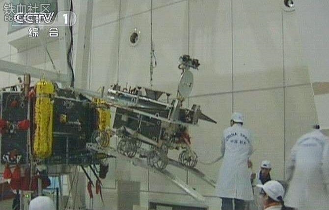
CCTV video still, released August 2013, shows final tests and loading of China's Chang'e-3, the third mission of China's Lunar Exploration Program [CCTV/CNSA].
Joel Raupe 
Lunar Pioneer
 
The China National Space Administration (CNSA) Lunar Exploration Program (CLEP) is gearing up for a nighttime launch of it's third unmanned lunar mission, Chang'e-3, Sunday, December 1 (UT), the first of a series of launch windows beginning 1730 UT, December 1; early Monday morning, December 2, at 1:30 am in Beijing.

Chang'e-3 will be launched aboard a modified Long March 3B booster from Xichang Satellite Launch Center, Suchuan Provence. The long-stated goal of the mission is to perform China's first soft-landing beyond Earth and the first such landing on the Moon in the 21st century, the first since the Soviet mission Luna 24 landed and retrieved a sample from Mare Crisium in 1976.

Presuming a successful launch, early Monday local time, Chang'e-3 will land on the Moon as early as Saturday, December 14, or about 30 hours after local sunrise at the targeted landing zone in Sinus Iridum. A landing early into the two-week-long lunar day will allow the mission to take full advantage of its designed use of solar power.

Sunrise at the intended landing zone, in the vicinity of Laplace A crater (43.74°N, 26.935°W), will begin in the early hours of December 12 (UT).

The mission is also designed to deploy the first remote-operated lunar rover on the lunar surface since the Soviet Luna 21 lander deployed Lunokhod-2 and explored Le Monnier crater in 1973. 

Following a national naming contest with 650,000 online participants, China state news sources report the Chang'e-3 lunar rover has been named Yutu, (Jade Rabbit), after the traditional ethereal attendant to the lunar goddess Chang'e.

Tasks for Yutu include "surveying the moon's geological structure and surface substances while looking for natural resources," said Ouyang Ziyuan, a chief scientist of CLEP, in an interview with Xinhua ("China's lunar probe to land on Moon next month," Mo Hong'e, November 26, ecns.cn).

A detailed summary of the planned landing zone for the Chang'e-3 mission, near Laplace A crater in east Sinus Iridum, was posted HERE, a discussion written by Lunar Reconnaissance Orbiter Camera (LROC) principal investigator Dr. Mark Robinson of Arizona State University, released November 22.

In cooperation with the International Lunar Observatory Association (ILOA) in Hawaii, an ultra-violet telescope will be operated from the Chang'e-3 lander, a first since a small UV instrument was operated on the Moon by the Apollo 16 expedition in 1972.

China's Lunar Exploration Program, initiated in 2004, consists of five planned missions. Chang'e-1 became that nation's first lunar orbiter November 5, 2007 and was deorbited to a reportedly planned impact in Mare Fecunditatis, March 1, 2009.

The highly-successful Chang'e-2 orbiter was launched from Xichang, October 1, 2009 and was inserted into lunar orbit five days later. Chang'e-2 captured orbital photography later assembled into a global, low-angle illumination mosaic of the Moon, said to be the first of its kind. 

While performing orbital maneuvers critical to the planned Chang'e-3 landing in Sinus Iridum, Chang'e-2 captured high-resolution low-perilune photography of Laplace A crater and its vicinity.

Chang'e-2 was afterward maneuvered beyond Cislunar space, leaving lunar orbit  June 9, 2011. Ground controllers moved the spacecraft to an extended stay in and around Lagrangian Point 2 (L2), one of five stable points in the Earth-Moon-Sun system where the influences of the gravity of the three bodies balance each other out. 

L2 space is beyond the Moon, more or less directly over the farside, and it presumably where communications with surface missions beyond line-of-sight of Earth could be at least partially maintained.

4179 Toutatis Chang'e-2 flyby
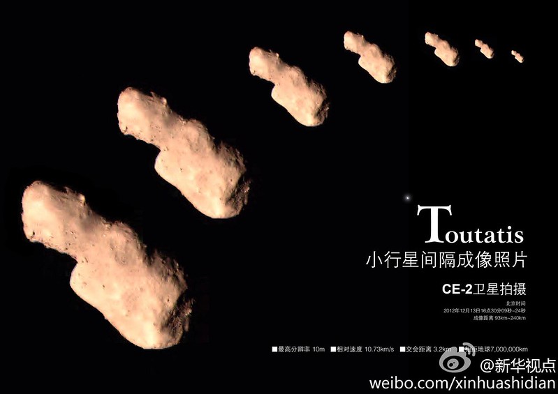
Chang'e-2 passed to within 3.2 km of the potentially hazardous asteroid 4179 Toutatis in December 2012, traveling at a relative speed of 11.72 kilometers per second [CNSA/Xinhua].
Still underway, having departed L2 for interplanetary space, Chang'e-2 recently returned photographs of its recent very close encounter with potentially hazardous asteroid 4179 Toutatis, December 13, 2012.

After Chang'e-3, China plans at least two additional unmanned lunar missions designed to retrieve samples, Chang'e 4 in 2015 and Chang'e 5 in 2018.

Related Posts:
'Government Penalty' removed from Google Lunar XPRIZE terms (November 7, 2013)
Chang'e-3 and LADEE: The Role of Serendipity (October 31, 2013)
Outstanding animation celebrates China's Chang'e-3 (October 29, 2013)
LROC updates image tally of human artifacts on the Moon (September 25, 2013)
Chang'e-3 officially enters launch phase (August 31, 2013)
Chang'e-3 undergoing thermal vacuum testing (May 9, 2013)
Chang'e-3: China's rover mission (May 4, 2013)
Chang'e-3 lander and rover expected in 2013 (January 10, 2013)
China's grand plan for lunar exploration (October 11, 2012)
ILOA to study deep space from Chang'e-3 (September 11, 2012)
Will China deploys first lunar rover since 1976? (April 29, 2012)
China's Long March to the Moon (January 14, 2012)
China plans lunar research base (May 11, 2011)
PRC continues methodical program (March 8, 2011)
Chang'e-2 arrives in mission orbit (October 9, 2010)
Dispatch from Chang'e-2: Sinus Iridum (October 4, 2010)
Chang'e-2 takes direct approach (October 1, 2010)
Chang'e-2 sets stage for future lunar missions (September 3, 2010)
Chang'e-1 research reported published (July 22, 2010)

Thursday, September 22, 2011

On the shore of the Bay of Rainbows


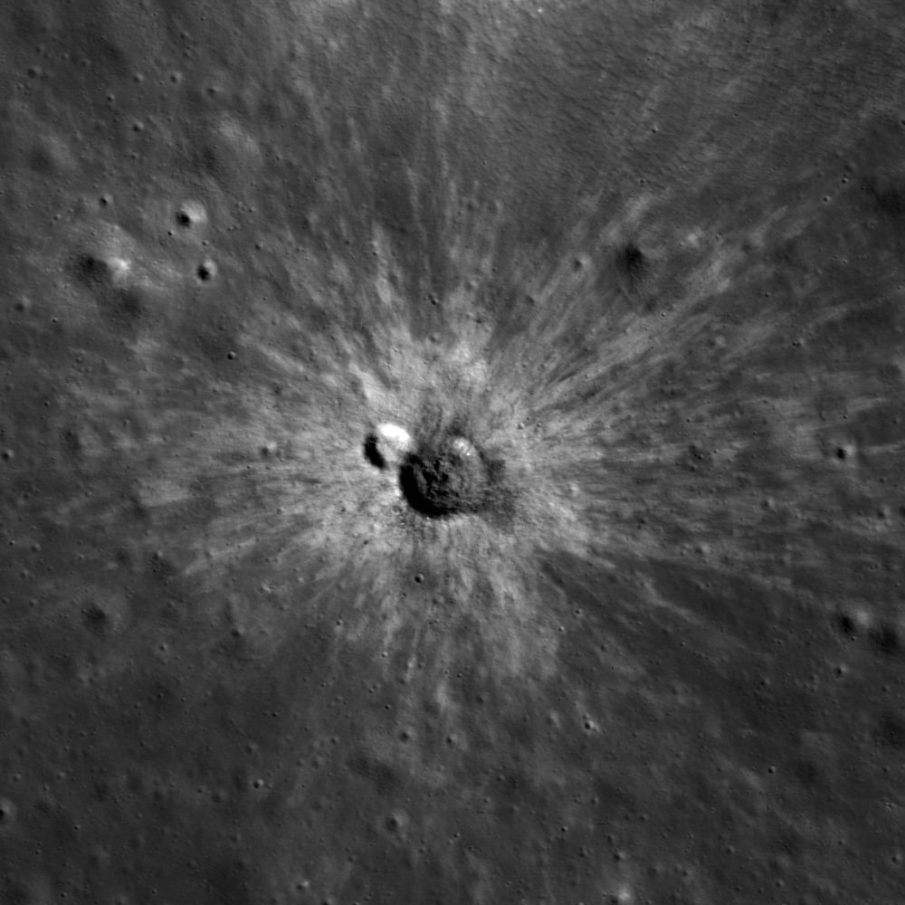
A pair of small craters show different albedos within a spectacular ejecta display along the shore of Sinus Iridum (47.9°N, 31.7°W). LROC Narrow Angle Camera (NAC) observation M104726204L, LRO orbit 591, August 12, 2009; incidence angle 65°, Sun is from the southwest, resolution 1.71 meters per pixel (Field of view < 1 km). View the full size LROC Featured Image HERE [NASA/GSFC/Arizona State University].

James Ashley
LROC News System

In addition to being a spectacular example of a recent impact feature, this pair of small craters was chosen with the small backyard telescope in mind. You won't be able to see this impact feature in your eyepiece, but you should be able to locate the region fairly easily. By the 11th day following a new Moon (during the waxing gibbous phase), Sinus Iridum (the Bay of Rainbows) is ideally illuminated and visible through even a modest-sized instrument, or even a large pair of binoculars! Look for the large, crescent-shaped arc of mountains on the northwest "shore" (44.1°N, 328.5°E) of Mare Imbrium. You will find the partial remains of an ancient crater (236 km diameter), flooded long ago by Mare Imbrium basalts. The range of peaks is known as the Jura Mountains. With a good eye, you might even see the crater Bianchini, nestled within the range along its northwestern edge. You can use Bianchini with the images below to pinpoint the Featured Image location.


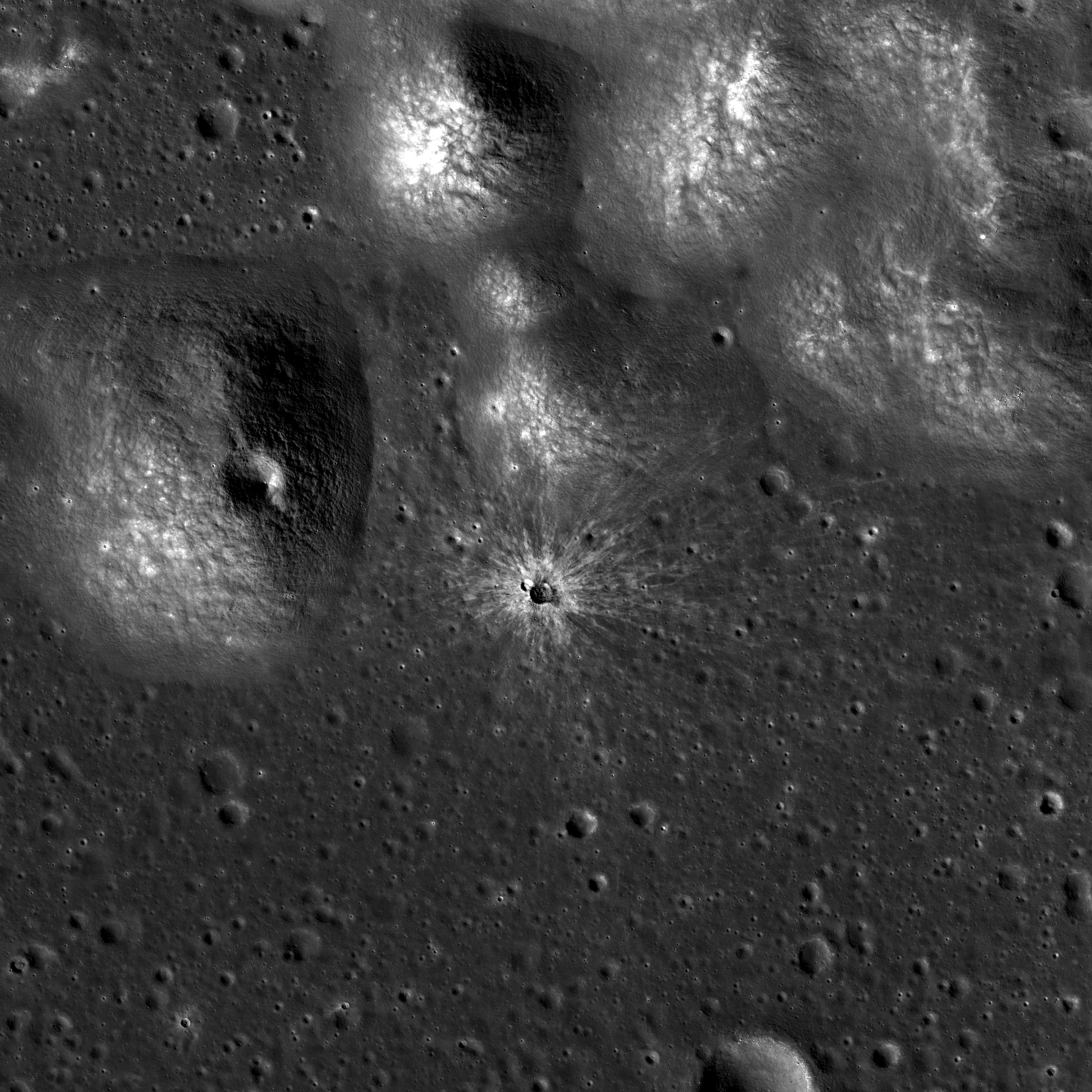
This wider view from M104726204L shows foothills high, mountainous rim of Sinus Iridum, immediately to the north, more than 2 km higher in elevation than the wide bay floor to the south. Note how the ejecta rays were forced to curve as the flying debris encountered the topography just northeast of the larger and more recent impact (field of view ~8.3 km across, downsampled to 2.8 meter/per pixel). See the spectacular full size LROC context image HERE [NASA/GSFC/Arizona State University].

Notice how one of the featured craters has a low-reflectance interior while the other appears more reflective. The low-reflectance crater is roughly twice the size of the light-floored crater, and therefore excavated to a greater depth. Could this have resulted in the exposure of darker, buried materials that were missed by the less-energetic impact? There are many questions that we could ask about this interesting pair: Which impact happened first? Is there ejecta from one crater on the floor of the other? Why or why not? 

What other clues would you look for in the full NAC frame?


The 39 km-wide crater to the upper left of the Featured Image location (yellow arrow) is Bianchini in this LROC Wide Angle Camera (WAC) mosaic showing a roughly 300 km field of view. See the richer, original LROC WAC context image HERE [NASA/GSFC/Arizona State University].

Related posts include:
Dark-haloed crater in Mare Humorum
Dark-haloed crater near Censorinus A
Sinus Iridum - Next Destination?

Friday, November 22, 2013

A Great Place to Rove: Sinus Iridum and Chang'e 3

China will launch it's third unmanned lunar probe very early in December. Plans for Chang'e 3 include the first soft landing on the Moon since 1976 and the first rover since 1973. The China National Space Agency (CNSA) has long reported the target for this historic mission is Sinus Iridum, "the Bay of Rainbows," on the northwestern frontier of Mare Imbrium.

Meanwhile, following five years of planning, the NASA orbiter
LADEE has begun a 100 day examination of the Moon's tenuous exosphere, its formal science mission, in low equatorial orbit. It's all but certain both missions will be underway at the same time, leading some to jump to conclusions in reporting the two missions will interfere with one another. But, as Dr. Paul Spudis of the Lunar and Planetary Institute reports, nothing could be further from truth. Read his assessment, HERE.

-
Sinus Iridum
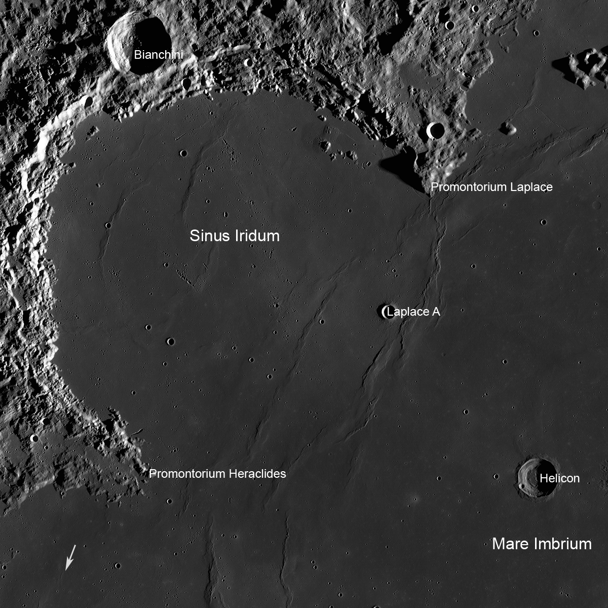
Sinus Iridum - it is likely China will land a rover near Laplace A before the end of 2013. (Arrow shows location of the Soviet Lunokhod 1), LROC Wide Angle Camera mosaic field of view 360 km [NASA/GSFC/Arizona State University].
Mark Robinson
Principal Investigator
Lunar Reconnaissance Orbiter Camera (LROC)
Arizona State University

In the near future China will attempt a robotic landing on the Moon, and will deploy a rover. The launch date and landing dates have not been officially announced. The exact landing spot is also not yet publicly designated, but it seems likely the landing will take place in Sinus Iridum, possibly near the fresh crater Laplace A (8 km diameter).

Why this particular spot on the Moon? Likely there are critical engineering constraints in terms of landing site selection as well as important science goals. And there is the dramatic grandeur of the lunar landscape!

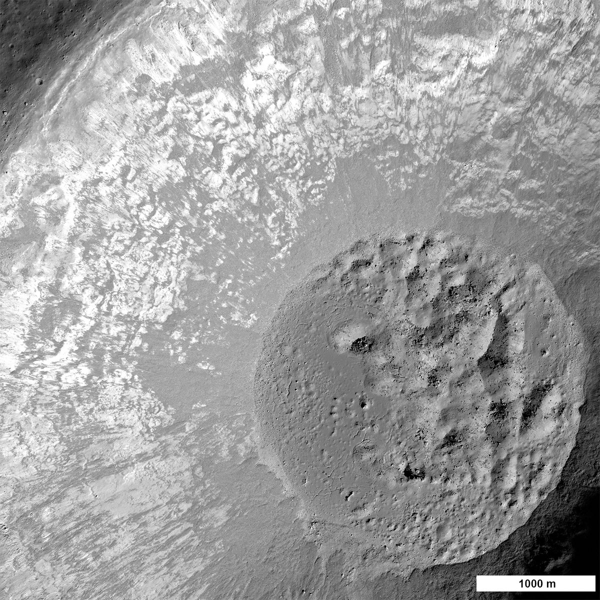
Imagine the first rover-eye view from the crater rim - a sheer drop of 1600 meters at your wheels, and an 8 km view across to the far wall! From LROC NAC images we know rock is exposed in the upper walls and dramatic landslides streamed material down to the crater floor. Speaking of the crater floor - it hosts a now frozen lake of impact melt 2500 meters (1.5 miles) in diameter. Imagine the moments after the crater formed, the floor was a cauldron of molten rock with debris sliding down into the melt, and the crater itself was deforming as the floor uplifted after the initial pressure of the impact was relieved.

Laplace A and wrinkle ridge
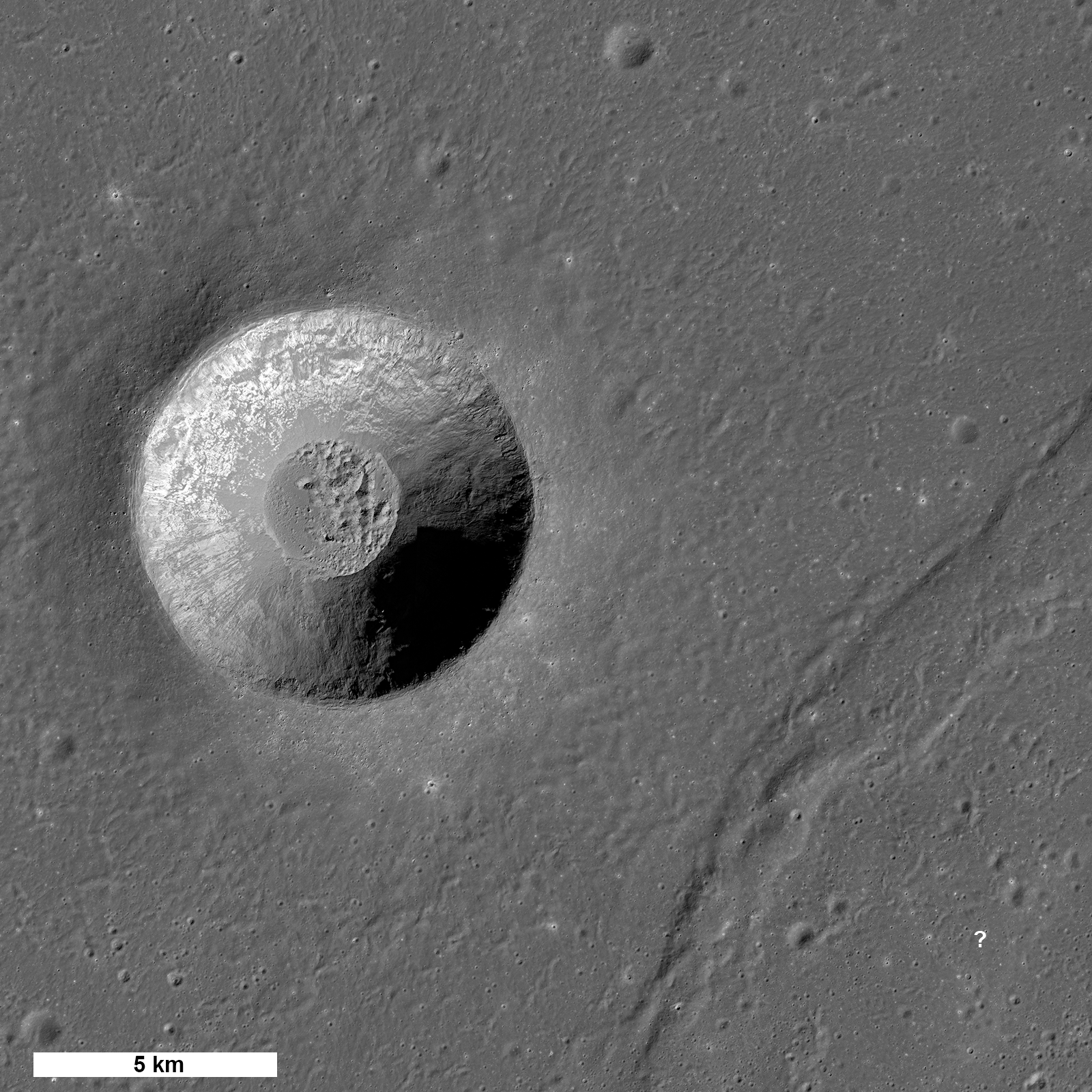
Laplace A crater and nearby wrinkle ridge (diagonally across at lower right). The question mark shows a potential landing site from which the rover could traverse northwest across the ridge to the edge of the crater [NASA/GSFC/Arizona State University].
Laplace A is a fascinating scientific target for a rover. It is a great example of a very young crater formed in mare basalt. A rover traversing the crater's ejecta blanket is in essence similar to driving down into the crater (in a geologic sense). We know from studies of terrestrial impact craters (such as Meteor crater) that material ejected from deep in a crater ends up near the rim, and rocks from the pre-impact surface are thrown far from the crater (a crater radius or more). So as a rover drives closer and closer to the rim it can characterize rocks from deeper and deeper below the surface.

Some of the many outstanding questions regarding the nature of the mare basalts include: how thick are individual flows, does the composition of the erupted magma change with time and location, and are pyroclastic (explosive) eruptions intermingled with effusive eruptions? These questions can be directly addressed with the Chang'e 3 rover! No humans or robots have ever visited a fresh crater anywhere near this size on the Moon (or Mars for that matter) so the return from this mission has great potential for advancing our knowledge of the Moon.

Laplace A
LROC NAC view of the interior of Laplace A crater [NASA/GSFC/Arizona State University].
But wait, there's more!

Another key question can be addressed: what is the 3D nature of large contractional ridges on the Moon? The rover is thought to have a ground penetrating radar (GPR) and it just so happens that a large wrinkle ridge (a contractional landform) lies about 10 km east of Laplace A. Although the exact mission plan is not publicly available, one potential scenario is that the lander sets down just east of the wrinkle ridge and deploys the rover. After initial testing of the lander and rover, and geologic characterization of the landing site, the rover could set off to the west towards the crater. As the rover drives up and over the wrinkle ridge the GPR would continuously probe the subsurface, slowly building up a 3D profile down to 100 meters or more (?) beneath the surface. Wrinkle ridges are complex landforms created when mare basalts are compressed, causing them to buckle and break along faults. However, wrinkle ridges have not been fully explored, and the  geometry and number of faults associated with each wrinkle ridge is not known. A subsurface profile of a wrinkle ridge could tell us the number of faults, where the faults are located, and how steeply the faults dip: is it 15°, 30° or 45°?

Chang-E-2-Laplace-A-900
Laplace A as plotted using photography and digital terrain model gathered from the CNSA orbiter Chang'e 2 [CNSA/CLEP].
From LROC images we have mapped the location of all the mare wrinkle ridges, and measured their surface topography, but all we have for the subsurface are models! Soon we may have actual measurements providing a good first step towards interpreting these poorly understood features. Wrinkle ridges are also found on Mercury and Mars, so better understanding a lunar example will help scientists unravel the tectonic story across the inner Solar System. Since only a handful of human and robotic missions have ever landed on the Moon, the results from the Chang'e 3 mission will provide important new scientific insights into our Moon.

Chang-e-2-CCD-LaPlace-full
Full resolution segment of the west wall and rim of Laplace A by Chang'e 2 [CNSA/CLEP].
Once Chang'e 3 has landed, LROC should be able to spot the lander and the rover; LRO will be above Laplace A on 25 December, 22 January, and 18 February.  The LROC team looks forward to posting images of the two vehicles!

Coincidentally, Lunokhod 1 landed only 250 km to the southwest of Laplace A over forty years ago (17 November 1970). This intrepid Soviet rover explored for almost a year and traveled a total distance of 10.5 km. Both the lander vehicle (Luna 17) and the rover can be seen on the surface today.

Perhaps the Chang'e 3 lander and rover will look something like this. Lunokhod 1 rover in its final parking place (38.315°N, 324.992°E) on the surface of Mare Imbrium, 250 km southwest of Laplace A. The Soviet rover, and its French-built laser range reflector array, were lost for four decades until relocated by LRO. The addition of the LLR to astrophysicists on Earth critically improved the accuracy of measurements of the distance to the Moon, bringing the uncertainty to within 3 millimeters. LROC NAC observation M175502049RE, spacecraft orbit 10998, resolution 33 cm per pixel. Original LROC Featured Image, HERE [NASA/GSFC/Arizona State University].
Explore the LROC Featured Mosaic of the Laplace region of interest, HERE.

Related Posts:
Lunar Laser Ranging: The Millimeter Range (November 19, 2013)
'Government landing penalty' removed from Google Lunar Xprize terms (November 7, 2013)
Chang'e 3 and LADEE: The Role of Serendipity, Paul Spudis (October 31, 2013)

Saturday, October 9, 2010

Chang'E-2 arrives alive in mission orbit

Following a third orbital trim, Chang'E-2 has been successfully inserted into it's targeted mission orbit.

Dr. Yong-Chun Zheng of the Chinese Academy of Sciences reported early Saturday (UT) that the third braking of Chang'E-2 was successfully completed at 03:17, October 9 (UT).

"The braking action lasted for about 15 minutes," Zheng said "Chang'E-2 has entered its initial target orbit of 100 x 100km with a period of about 117 minutes."

There was no word yet on when perilune for China's second lunar orbiter will be brought down to as low as 15 km to enable very high resolution surveys of potential landing sites for Chang'E-3 and 4.


'Target Rainbow,' Sinus Iridum, the "Bay of Rainbows," high resolution survey target for Chang'E-2, the second lunar orbiter that entered orbit October 6 after a nominal direct transit after only 112 hours from launch. (As impressive as such navigation still is, contrary to press account, this was not the "fastest" such transit in history.) 411 km-wide Iridum is an announced landing target for the Chang'E-3 stationary lander and rover under development for 2013. From LROC WAC mosaic of 40 observations (see below) during LRO orbits 2469 through 2491, January 9-10, 2010 [NASA/GSFC/Arizona State University].

"In the target orbit, Chang'E-2 will work and explore the lunar surface for about half a year. The topography and material composition of the lunar surface will be measured in the future. During that time, the space environment and microwave thermal emission of the moon will be measured by Chang'E-2."

Instruments on board Chang'E-2 began checking in beginning soon after launch, October 1. Following a 17 second orbital trim Friday, October 8 Chang'E-2 was brought down to an 3.5 hour elliptical orbit.

"The two ground stations in Beijing and Yunnan have recieved the first data sets, amounting to 1.6 Gb," Zheng said. "There are seven scientific instruments on board Chang'E-2," Zheng said. An improved stereo CCD camera, laser altimeter, gamma ray spectrometer (GRS), X ray spectrometer (XRS), Microwave radiometer (MRM), solar wind ion dector (SWID) and high-energy particle dector (HPD).

"The GRS, SWID, HDP were powered up and began work duirng the 112 hour trans-lunar coast. The CCD and MRM will be powered up after Chang'E-2 enters its mission orbit and will begin mapping the topography of the lunar surface.

"Topography data and technology testing," Zheng said, "will be helpful for the soft landing of Chang'E-3.

Chang'E-3, a stationary lander and lunar rover, are under development for launch in 2013. Further along, planning is also under way for Chang'E-4, an unmanned sample return mission in 2017.


Promonitorium Laplace (46.0°N, 314°E), 24.8 x 49.6 km (east at top) full resolution detail from LROC Wide Angle Camera mosaic, January 9-10, 2010. At it's highest point, the cliffs rise 2600 meters over the basin's interior rim [NASA/GSFC/Arizona State University].


Very small thumbnail of the 9184 x 6312 pixel LROC mosaic study of Pre-Imbrium Sinus Iridum from which these smaller-scale higher resolution images were sampled. Iridum is centered near 45.0°N, 32.0°W and has an outer ring and full interior submerged by the northwestern Mare Imbrium basin melt. 39 km Bianchini crater straddles the Jura mountains on Iridum's rim, and Promonitorium Laplace stand out sharply in the long shadows three days following a Full Moon. A small part of Mare Frigoris stretches through the northwest. The landing site of Luna 17 (Lunokhod 1) is well outside the field of view. The entire scene exceeds 1000 km west to east, at an average 62 meters per pixel in full resolution (see below) [NASA/GSFC/Arizona State University].

Friday, December 6, 2013

Chang'e-3 safely inserted into lunar orbit

Chang'e-3 in lunar orbit
Chang'e-3 was slowed into an 100 x 100 km retrograde orbit around the Moon by 0953 UT, Friday, December 6, 2013. Engine cut-off ended a well-planned and executed 361 second firing sequence that brought to conclusion an approximately 112 hour trans-lunar coast. China's third unmanned lunar mission since 2007 was launched directly into trans-lunar trajectory from Xichang Satellite Center at 1730 UT, Sunday December 1 (1:30 am Beijing time, Monday morning, December 2).

Looking forward, orbital maneuvers are planned that will eventually reduce the lowest altitude of the Chang'e-3's orbit to within 16 km over Sinus Iridum at local sunrise, December 14. Chang'e-3 is expected to perform the first soft-landing on the lunar surface in the 21st century; the first of the millennium and first since the Soviet Union's Luna 24 sampling mission of 1976. Chang'e-3 is designed also to deploy the remotely-controlled lunar rover Yutu, the first since the Soviet Lunokhod 2 of 1973, on or after Saturday, December 14 (in China).

Terminal velocity and landing, with engine cut-off 4 meters over the pulverized surface of Sinus Iridum, is expected after local sunrise immediately southeast of Laplace A crater
[Lunar Pioneer].
Xinhua - China's Chang'e-3 probe entered lunar orbit at 0953 UT (5:53 pm in Beijing), Friday, December 6, following approximately 112 hours in Earth-Moon transfer orbit. This report has been confirmed by the Beijing Aerospace Control Center (BACC).

The probe was slowed into lunar orbit by a 361 second precise burn of the vehicle's variable thrust engines, following commands uploaded by ground controllers at BACC, as it flew over the Moon's farside .

The center later verified Chang'e-3 had entered a 100 km-high, nearly circular orbit around the Moon.

Launched at 1730, Sunday (UT) from southwest China's Xichang Satellite Center, Chang'e-3 is set to be soft-landed on the Moon near the contact zone between Mare Imbrium and Sinus Iridum, near Laplace A crater, soon after the sunrise terminator sweeps over the selected landing zone, after December 14..

Friday, December 13, 2013

Chang'e-3 successfully lands on the Moon

chasing-rainbow-rabbit-626
China's Chang'e-3 lunar lander successfully touched down on the surface of the Moon, Saturday, while returning live images. The landing occurred more than a half-hour prior to the time of 1340 UT announced earlier, at 1318:11 UT instead, and an estimated 160 km east of the original target in the frontier region shared between Mare Imbrium and Sinus Iridum, the "Bay of Rainbows." The preliminary official landing coordinates are 44.12°N, 19.51°W (340.49°E).
China's first  lunar lander, Chang'e-3, has landed on the Moon, not at 1340 UT, as announced Friday, but at 1311 UT, a half hour earlier. China state television televised sequential still video, 59 frames, showing the approaching surface. Eight minutes afterward, the lander deployed stowed solar panels, angled toward the low, two-week long southern solar track at the high latitude.

Chang'e-3, along with the semi-autonomous lunar rover "Yutu," have landed in northwestern Mare Imbrium, perhaps intentionally near a border between distinct basalt types.

Chang'e-3 Jade Rabbit Sunrise Detailed
The view of the originally targeted landing area, from LRO and at local sunrise, in a view cropped from an LROC WAC mosaic prepared by Maurice Collins, featured as Lunar Picture of the Day (LPOD), August 15, 2012.
The View from Earth of an informally announced target zone near Laplace A - Closing in on Sinus Iridum, familiar embayment on the northwestern edge of Mare Imbrium, from an excellent color photography of the Moon taken April 6, 2009. (See the full-sized color mosaic, showing the area of interest under lighting conditions similar to those at the anticipated time of the Chang'e-3 landing attempt, HERE.) [Astronominsk].
More to Come...

Saturday, August 31, 2013

Chang'e-3 officially enters launch phase

Chang'e-2 soft lander deploys first lunar rover in nearly 40 years in this simulation shown on China national television [CNSA].
Zhu Ningzhu
From Xinhua   

"Chang'e-3 has officially entered its launch stage, following its research and manufacture period," said a statement released by the administration after Wednesday's meeting on the mission.

The mission will see a Chinese space probe land on a celestial body for the first time.

"The Chang'e-3 mission makes best use of a plethora of innovative technology. It is an extremely difficult mission, that carries great risk," said Ma Xingrui, head of China's space exploration body and chief commander of the lunar program.

LROC WAC Sinus Iridum Mosaic [NASA/GSFC/Arizona State University]
Sinus Iridum, the "Bay of Rainbows" embayment on the northwestern frontier of Mare Imbrium and likely target for the first soft landing on the Moon since 1976, by China's third unmanned lunar probe Chang'e-3 before the end of 2013. LROC Wide Angle Camera (WAC) mosaic [NASA/GSFC/Arizona State University].
The Chang'e-3 mission is the second phase of China's lunar program which includes orbiting, landing and returning to Earth, following the successes of the Chang'e-2 missions, which include plotting a high-resolution, full-coverage lunar map.

Chang'e-3's carrier rocket has successfully gone through its first test while the launch pad, control and ground application systems are ready for the mission.

Chang'e-3 will be launched from the Xichang Satellite Launch Center in southwest China.

From the Register:

The Chang’e-3 probe, first revealed last year, is a 100kg, six-wheeled rover that will spend three months traversing the lunar landscape under human control. The spacecraft will use the Moon’s gravity to slow down, orbit the satellite, and then soft-land using rocket propulsion.

This will be the first time the Chinese have landed a spacecraft on a non-terrestrial surface and the Chang’e-3 will be a crucial test of both Chinese aeronautics and rocketry control systems. The rover will pave the way for a future manned mission to the Moon, and a possible space colony on the surface.

“The Chang’e-3 mission makes best use of a plethora of innovative technology. It is an extremely difficult mission, that carries great risk,” said Ma Xingrui, head of China’s space exploration body and chief commander of the lunar program.

The first Chang’e probe was launched 2007 and completed a 3D map of the Moon’s surface before being intentionally crashed into the planetoid. Chang’e 2, launched in 2010, carried out further mapping 100km off the Moon’s surface before being directed out to fly by the asteroid Toutatis and is now heading out into the Solar System.

Like NASA’s early rovers on Mars, the Chang’e-3 will be primarily solar powered and will carry a ground-facing radar on its belly capable of penetrating up to 30 meters into the lunar regolith, as well as a alpha particle X-ray spectrometer and an infrared spectrometer.

China plans a manned mission to the lunar surface possibly as soon as 2017 – although he authorities aren’t setting themselves a Kennedyesque deadline and say they’ll go when they are ready. Once there, however, the Chinese government has said it plans to build the first manned lunar outpost, an objective NASA has already abandoned.

Related Posts:

Monday, October 4, 2010

Dispatch from Chang'E-2: Sinus Iridum


Clementine (1994) Near-Infrared Multi-Spectral Mosaic (USGS Map-A-Planet] view of Sinus Iridum (44.4°N, 330.0°E), the 414 km-wide "Bay of Rainbows" on the northwestern tier of Mare Imbrium (with the lofty Jura Mountains on its west). Xinhua news agency reports the relatively high-latitude feature is the intended target of a low a planned low-perigee, high-resolution survey by Chang'E-2 as the intended target for a planned landing by Chang'E-3 in 2013.

Dr. Yong-Chun Zheng, associate professor at the National Astronomical Observatories, Chinese Academy of Sciences (NAOC) reports from Beijing, "the high energy particle detector (HPD) on board Chang'E-2 was switched a day after Trans-Lunar Injection, "suggesting the scientific instrument has begun working"

"Data transmitted from Chang'E-2, such as the temperature, voltage and power of the HDP, are all within range, indicating the instrument works well."

Chang'E-2 carries seven scientific instruments. "The HPD is responsible for surveying the space environment in the journey from the earth to the moon and space environment near the moon," Zheng said. HPD is one of two instrument stages of the Chang'E'2 Space Environment Monitor System, designed to measure heavy ions, proton spectra and the composition and spatial distribution of low-energy solar wind.

Second of Three Course Corrections Unnecessary

Beijing Aerospace Command and Control Center completed an initial adjustment of Chang'E-2's course at 12:25, October 2 (Beijing time). Further adjustments are expected, but Xinhua has reported that the second of three planned TLC maneuvers had been deemed "unnecessary."

Chang'E-2 was launched at 18:59:57 pm, October 1 (Beijing time) and was directly inserted into an earth-moon transfer orbit. Direct Earth-Moon transfers generally require an initial critical course correction.

"Chang'E-2 needed to slightly change its orbit at the appropriate time," Zheng reports. "If the orbit correction is not on time, the satellite could depart from its correct orbit to the moon and might not be captured by the moon's gravity," which is overwhelmed first by Earth and then, about half the distance to the Moon, by the Sun. "So, for Chang'E-2," Zheng said, "the orbit correction was very important."

Telemetry indicates the Long March 3C booster successfully sent Chang'E-2 into its target course and, "everything is going well," Zheng said. "We give the mission perfect evaluation marks."

"Chang'E-2 needed to slightly change its orbit at the appropriate time," Zheng said. "If the orbit correction is not on time, the satellite could depart from its correct orbit to the moon and might not be captured by the moon's gravity," which is overwhelmed first by Earth and then, about half the distance to the Moon, by the Sun.

China's state news agency Xinhua reported Monday Chang'E-2 is expected to travel a total of 112 hours before lunar orbit insertion.

Xinhua also disclosed the relatively high-latitude Sinus Iridum, the familiar 411 km "half-moon" embayment "Bay of Rainbows," on the northwestern edge of Mare Imbrium is one intended target of the Chang'E-2 survey. "To acquire more detailed moon data, Chang'E-2 will enter a lower lunar orbit about 100 km above the surface (compared with the 200-km altitude of Chang'E-1) according to the control center.

"The satellite will eventually be maneuvered into an orbit just 15 kilometers above the moon. At that point, Chang'E-2 will take pictures of moon's Bay of Rainbows area, the proposed landing site for Chang'E-3, with a resolution of 1.5 meters. The spatial resolution of Chang'E-1's CCD stereo camera was 120 meters, said Wu Weiren, chief designer of China's lunar orbiter project.

Monday, October 25, 2010

Destination: Moon

From Lunar Networks: Lunar Pioneer Online
The definitive confirmation of water (and a host of exotic resources) at Cabeus, and elsewhere on the Moon, caps off a watershed moment of historic lunar exploration, all long after the Apollo era. New frontiersmen and women are taking a belated, second look at the inevitability of the Moon. And far from having already "been there" and "done that," - beginning with the humble Lunar Prospector and renewed by the political fallout following the Columbia accident, the Moon has yet again become a destination in its own right [Lunar Pioneer].

Interesting speculation are following publication of peer-reviewed studies of the LCROSS impact continues to grow. An example follows that will probably interest to LP Partners.

Yeoman Jack Kennedy of Spaceports, in an energetic column appearing in the Charlottesville Daily Progress, writes:
"The American private sector is not sitting out the next race to the moon; it is creating it. The first privately owned and operated lunar rover will be a new benchmark for free enterprise and capitalism. In the next quarter-of-a-century, we will come know a two-world system.

"While the more narrow-minded among us may consider it all sheer lunacy, the reach for the moon by foreign governments and the American private sector is a technology-driver for those of us remaining firmly on earth. The economic benefits derived from the Apollo era are staggering when cast in measure of cost accounting benefits derived and now taken for granted in telecommunications, navigation, weather prediction, health care and a host of other science and technology endeavors.

"We shall soon see the American Internet technology leaders engaging the private space development paradigm with similar vigor, innovation and creativity as witnessed in the creation of companies like PayPal, Amazon and a multitude of computer software firms."

- Back to the Moon, October 25, 2010
Kennedy, along with others, has also raised our long-anticipated question of who has rights to the Moon's resources.

President Obama, in one of his first official acts, unilaterally ended American tourism to the forbidden continent of Antarctica. And because the Outer Space Treaty of 1967 places responsibility for space-related activities by a signatory nation's citizens squarely in the hands of their respective governments (regardless where such activities may take place) can access to the Moon be blocked even to science? The answer is yes.

What role can profit play in using the Moon's resources, for any purpose? Could a new treaty, more favorable to capitalism, even be conceived at a time when Libya and even Iran sit on the United Nations Human Rights Commission?

When President Obama and, more importantly, a Congress controlled by super-majorities of his Party began eliminating the legacy for his predecessor by ending the Constellation brand name the result has really been only to defund a single significant program under development, disregarding the kinds of boosters America might need "in the pipeline." In fact, if the Lunar Reconnaissance Orbiter and the other precursor lunar robotics become the sole legacy of the Vision for Space Exploration proponents already have reason to be proud.

Lost in the fuss over boosters and architecture was Altair, the simple ability to safely land depart from the lunar surface, regardless of what such a vehicle might eventually have looked like.

The "either/or," zero-sum idea of "Moon or Mars" is a false issue. Its only natural Lunar Pioneer has welcomed the notion of private access to orbit, but no mention has yet been officially offered about similar access to the Moon's surface.

Even when Constellation's development was still in high gear the Space Studies Board of the National Academies spelled out the case for exploring the Moon systematically by precursor robotics "prior to extended human activity," to better understand lessons to be learned while the Moon remains relatively "pristine." But the Board also anticipated events rapidly catching up with such a need (regardless of American timetables).

Another story today from China's Peoples Daily reminds us of what might seem only minimally important to many, that is until China's increasing reluctance to part with its near monopoly of certain rare earths, essential to much of the world future economy, is taken into account:
"The Chang'e II, China's second lunar probe, conducted an imaging tests of its CCD camera yesterday and it will track down and enter into an orbit around the moon of 100 kilometers by 15 kilometers on Tuesday by an enhanced thrust from the launch vehicle.

"After the third image tests, the Chang'e II will enter into and image the Rainbow Bay, the landing area for the satellite.

"The imaging tests of the CCD camera aboard the satellite started yesterday in the early morning. It ceaselessly conducted the work of interruption and restoration of power supply and flew around the moon every two hours, according to Zhang Bo, chief designer of the Beijing Institute of Tracking and Communication Technology.

"The three imaging tests are just preparations for the imaging of the Rainbow Bay, said Zhang.

"Yesterday's imaging tests show the camera works well and Chang'e II is still running around an orbit of 100 kilometers by 100 kilometers."

Liang Jun, People's Daily Online
Lost in translation, of course, is that "the satellite" China intends to land is not Chang'e-2,but Chang'e-3, and then not before 2013.

Why has the Chinese Lunar Exploration Program (CLEP) decided upon Sinus Iridum, their "Rainbow Bay" as a future landing target candidate?

Officials say the half crescent bay on the northwest edge of the Iridium basin is only one possible target. China space-watchers might want to trace out other areas where Chang'e-2 will swing closer to the Moon at perilune, along this same middle latitude before and after the Moon's rotation brings "Rainbow Bay" within range of its improved optics.

It seems to be an exceptionally flat place, known for low reflectivity in Earth-based radar. It is surrounded by, but not really a significant part of, the Procellarum KREEP terrain, recognized for an unusual combination of potassium, rare earths and phosphorus, nor is Rainbow Bay really part of the broader area on the Moon's Near side known for high relative abundance of nearly every kind of metallic oxide and thorium.


Courtesy of the venerable Astrogeology section of the United States Geological Survey (USGS), three context views of the Sinus Iridum venue (small Red dot), all Mercator projections (1/2 degree per pixel). At top, the Moon in "natural color" from the Ultraviolet-Visible Light (UVVIS) survey from Clementine (1994), and at middle and bottom the relative elemental abundance of thorium and, at bottom, oxygen from surveys by Lunar Prospector (1998-1999). Iron oxide (mapped elsewhere) is thought to be a good marker for the highest probable presence of helium-3. Though Sinus Iridum is clearly of morphological interest, it is not particularly rich in thorium and less rich in oxygen (and oxides) than most Near side basalt-filled areas on the Moon [USGS].

Perhaps, along with areas in Africa and the Americas, the always forward-thinking Chinese are looking to secure resources on the Moon. Then again, perhaps the methodical Chinese Lunar Exploration Program (CLEP) is simply learning the delicate skill of orbital targeting in their stated ambition of shortly landing Chang'e-3 on a wide and flat target.

Nevertheless, premature speculation about the PRC's lunar intentions, based on their present and more obvious strategic priorities, is just starting to run high:
ONE SMALL STEP FOR MAN, ONE GIANT LEAP FOR CHINA
Rare metals on the Moon have yet to spark modern Moon race

Minyanville Daily Feed
Cory Bortnicker October 25, 2010

China’s abundance of rare earth metals has been the talk of the town, as of late. And for good reason. They’ve got about 90% of the Earth’s supply of compounds like Neodymium, Dysprosium, Cerium and thus, can dole them out as they wish while the rest of the world squirms, begs, and barters.

But thanks to a little known science called “astronomy,” there could be an alternative locale for mining rare Earth metals…the moon.

The AFP reports that researchers at Brown University have analyzed particles of lunar dust and found a “surprisingly rich mixture that, in addition to the silver, included water and compounds like hydroxyl, carbon monoxide, carbon dioxide, ammonia, and free sodium.”

Brown geologist Peter Schultz said “This place looks like it's a treasure chest of elements, of compounds that have been released all over the Moon.”

Score!

And the best news? The US has serious plans to launch extensive missions to the moon! Er…actually, scratch that. Not the US. We mean China.

On October 11th, President Obama signed the NASA Authorization Act 2010, effectively ending the Constellation program, which aimed to return humans to the Moon.

Meanwhile, on October 1st, the Chinese Lunar Exploration Program (CLEP) launched its Chang E 2 lunar probe, the second lunar orbiter launched in three years. In 2004, the Chinese government authorized a three-stage robotic lunar exploration that will:

Stage 1: Orbiters will circle the moon and collect data.

Stage 2: Robotic probes will land on the lunar surface to collect and analyze lunar samples and transmit the data back to Earth.

Stage 3: After landing on the moon, the robotic probe will return to Earth with a set of moon rocks and soil sample.

NASA’s behind-the-times approach isn’t lost on NASA Administrator Charles Bolden, who recently traveled to China for talks about cooperative spaceflight.

As you can imagine, lawmakers are less than thrilled.

Rep. Frank R. Wolf (R-Va.), who is on the subcommittee that oversees NASA’s budget, wrote “It should go without saying that NASA has no business cooperating with the Chinese regime on human spaceflight. China is taking an increasingly aggressive posture globally, and their interests rarely intersect with ours."

POSITION: No positions in stocks mentioned."
These seem like wild speculations now, based in part on outdated science, yet thinking in this manner about the Moon, as a destination rather than as mere stepping stone, has begun once again, some writing driven by agendas based upon thinking pretty far afield from the expansion of a human permanent presence beyond the confines of our single planet, the one the dinosaurs too late discovered a sitting target.

A very recent study has also appeared speculating that "soot" from an eventual 1,000 suborbital tours by the Virgin Galactic SpaceShipTwo (supposedly using only one particular rocket design during that entire extended period) would result in more so-called "global warming" than would result from all of the world's civil aviation.

With the confirmation of a tally of elements uncovered at Cabeus comes chatter about a need to understand the "pristine" lunar exosphere, as well as the Moon's long record of the Solar System's history, before any extended human activity on the Moon.


The landing site of Apollo 16, for a variety of reasons, is among the Fifty priority Constellation program Regions of Interest. At one time believed to have proved out as a mistaken choicethe Cayley Plain between North and South Ray craters, in the shadow of the Descartes formation has become a standard for calibrating remote sensors, on board Japan's Kaguya, for example. Artifacts of the Young & Duke expedition are invaluable as a long-duration exposure facility (LDEF). Based on studies of the similar, though secondary purposes for landing Apollo 12 near Surveyor 3 in 1969, the authors in 2008 recommended any future approach here "low and from a distance" - quite different than the notion pictured above. For a wallpaper-sized view (1920 x 1100), click HERE [Lunar Pioneer].

Thankfully, no tie into the world's ecosystem and food chain, no fauna or flora, has yet been discovered on the Moon or the "temporary" status of Antarctica set up more than fifty years ago might eventually set the economic salvation available from the Moon in a tragic and unnecessary limbo. Those who favor ignoring the Moon in hope of moving on to Mars - a place far more likely to harbor life - should pay close attention.

Love of humanity, among humans, is not universal.

Even setting aside the possible future harvesting of helium-3 for a clean fusion power, we are facing a simple harsh reality. For the human race to continue its present technological and economic growth - for the world at large to enjoy even the most basic kind of lifestyle now enjoyed in the United States, for example, beyond 2050 we will very likely need what the Moon has to offer.

There is no reason why both the learning of the lessons that the Moon has to offer while enriching our species in the process cannot go hand in hand - unless, of course, some are simply unwilling to simply step out of the way. If that should eventually prove impossible, there is another and more traditional kind of extended human activity to settle the issue, though such methods might also serve to unnecessarily delay the fulfillment of both these noble purposes.