Saturday, February 21, 2015

CRaTER: Lunar Proton Albedo Anomalies

Figure 1. Top: Lunar albedo proton yield map (cylindrical projection) with anomalous yield regions labeled “A” through “E”. Regions A (Mare Serenitatis) and B (Oceanus Procellarum) are both centered near the boundaries of mare regions. Regions C, D and E are all in the highlands on the far side of the Moon. Bottom: Visible global composite image from the Lunar Reconnaissance Orbiter Camera (LROC).

LUNAR PROTON ALBEDO ANOMALIES:
SOIL, SURVEYORS, AND STATISTICS

J.K. Wilson, N. Schwadron and H. E. Spence, et al.
Space Science Center
University of New Hampshire, Durham

Introduction: Since the launch of the Lunar Reconnaissance Orbiter (LRO) in 2009, the Cosmic Ray Telescope for the Effects of Radiation (CRaTER) has been mapping albedo protons (~100 MeV) coming from the Moon [1,2].

These protons are produced by nuclear spallation, a consequence of galactic cosmic ray (GCR) bombardment of the lunar regolith. Just as spalled neutrons and gamma rays reveal elemental abundances in the lunar regolith [3-6], albedo protons may be a complimentary method for mapping compositional variations across the Moon’s surface.

Albedo Proton Yield: The CRaTER instrument simultaneously detects albedo protons from the Moon and GCRs arriving from the zenith direction. We divide the number of albedo protons observed over each point on the Moon by the number of GCRs detected over the same location to produce a map of the yield of albedo protons.

We presently find that the lunar maria have an average proton yield which is 0.9% ± 0.3% higher than the average yield in the highlands; this is consistent with some neutron data that shows a similar yield dichotomy due to differences in the average atomic weight between mare regolith and highland regolith [7].

Map Features: There are cases where two or more adjacent pixels (15° × 15°) in the map have significantly anomalous yields above or below the mean.

These include two high-yielding regions in the maria, and three low-yielding regions in the far-side highlands. Some of the regions could be artifacts of Poisson noise, but for completeness we consider possible effects from compositional anomalies in the lunar regolith, including pyroclastic flows, antipodes of fresh craters, and so-called "red spots" which are associated with volcanic domes. We also consider man-made landers and crash sites that may have brought elements not normally found in the lunar regolith.

References: [1] Wilson, J. K. et al. (2012) JGR, 117, E00H23. [2] Spence, H. E. et al. (2012) Space Weather, 11, 643-650. [3] Feldman W. C. et al. (1998) Science, 281, 1496-1500. [4] Gasnault, O. et al. (2001) GRL, 28, 3797-3800. [5] Maurice, S. et al. (2004) JGR, 109, E07S04. [6] Mitrofanov, I. G. et al. (2010) Science, 330, 483-486. [7] Litvak, M. L. et al. (2012) JGR, 117, E00H22.

Wednesday, February 18, 2015

Hell Q

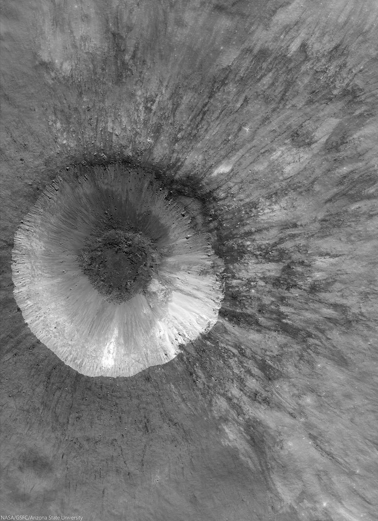
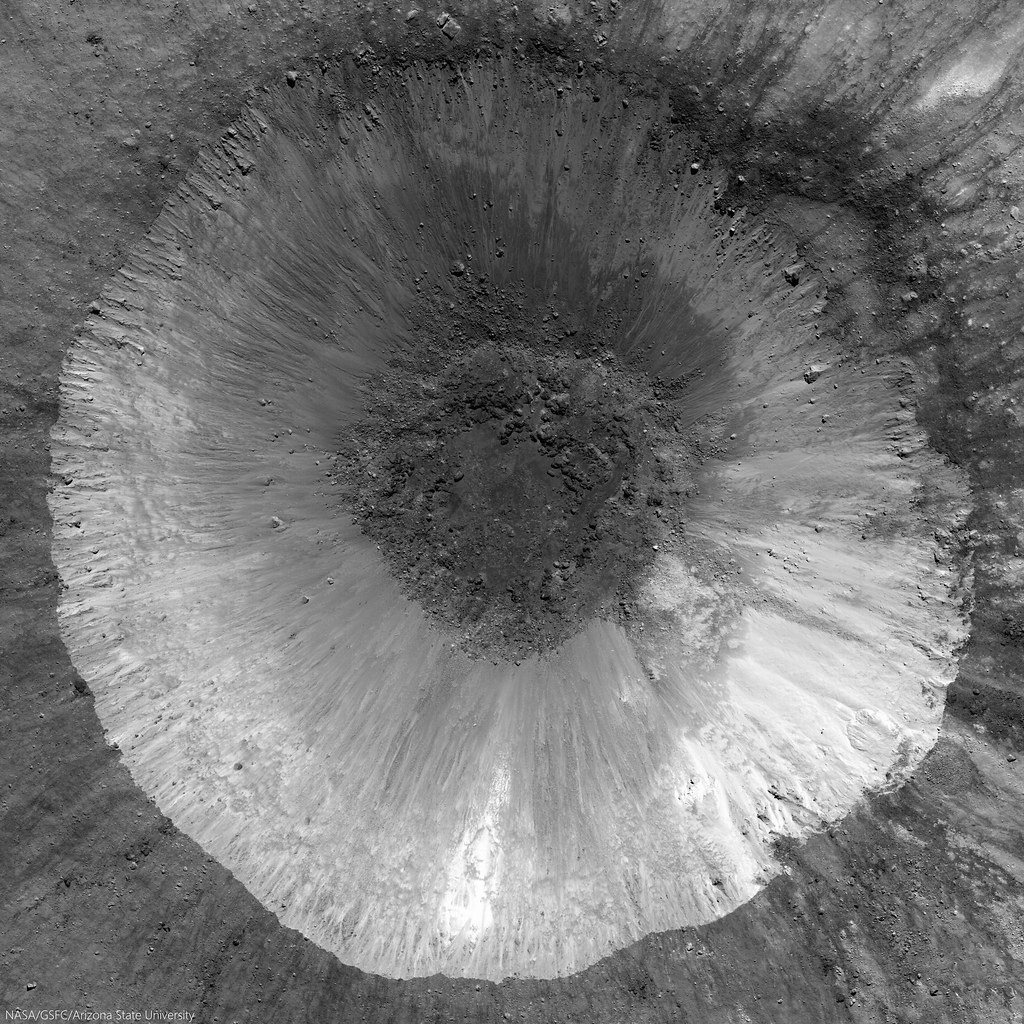
LROC NAC mosaic M1164853645RL, LRO orbit 23561, September 8, 2014; spacecraft and cameras slewed 3° from nadir, 33.17° angle of incidence, 71 cm resolution from 68.29 km over 33.07°S, 355.72°E [NASA/GSFC/Arizona State University].
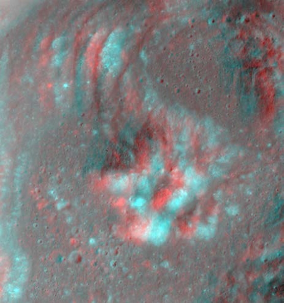
Hell Q (3.75 km; 33°S, 355.53°E) seems younger than Tycho, standing out as it does in the nearside Southern Highlands northeast of the more famous astrobleme. 

There seems little doubt the effect of the larger, far more widespread blast zone from Tycho changed the face of this contemporary but pre-existing smaller crater. The chevron effect left grooves untouched down stream and tore away a chunk of the northeast rim, morphologies apparently perpendicular to a straight line drawn southwest to the more spectacular, 109 million year-old Tycho.

View full resolution views, of a variety of sizes, HERE.

Friday, February 13, 2015

Apollo 17 samples further refine bombardment timeline

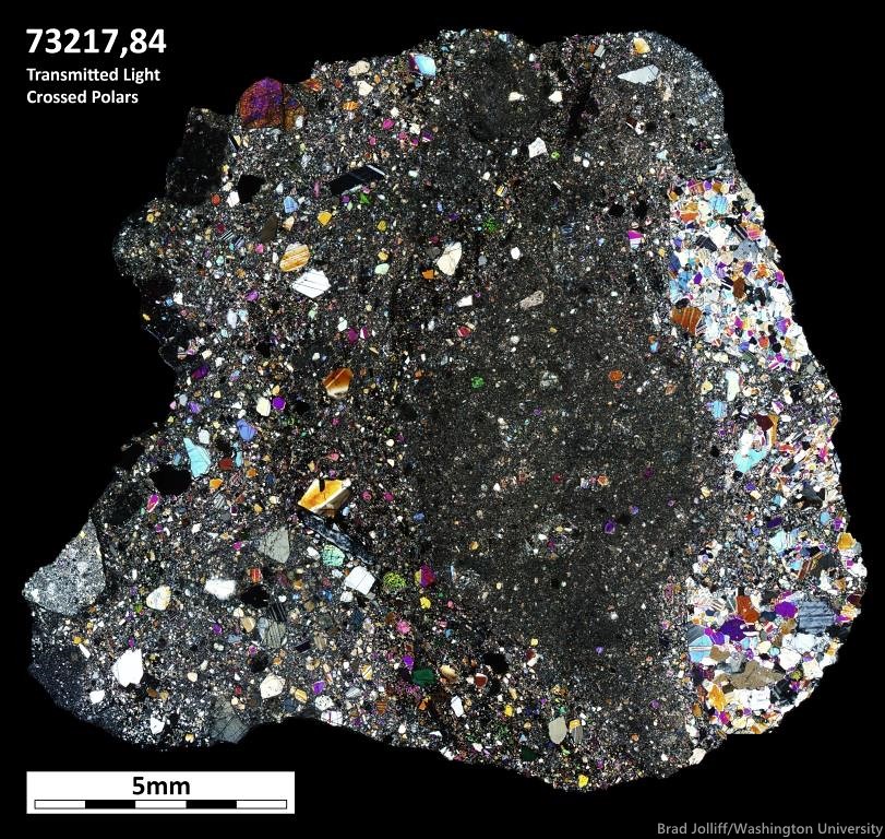
Photomicrograph of a petrographic thin section of a piece of a coherent, crystalline impact melt breccia collected from landslide material at the base of the South Massif, Apollo 17 (sample 73217, 84). In their article published in the Feb. 12 issue of Science Advances, ASU researchers used a laser microprobe technique to investigate age relationships of three of the distinct generations of impact melt shown in this image.
Nikki Cassis
School of Earth and Space Exploration
Arizona State University

It’s been more than 40 years since astronauts returned the last Apollo samples from the moon, and since then those samples have undergone some of the most extensive and comprehensive analysis of any geological collection.

A team led by Arizona State University researchers has now refined the timeline of meteorite impacts on the moon through a pioneering application of laser microprobe technology to Apollo 17 samples.

Impact cratering is the most ubiquitous geologic process affecting the solid surfaces of planetary bodies in the solar system. The moon’s scarred surface serves as a record of meteorite bombardment that spans much of solar system history.

Developing an absolute chronology of lunar impact events is of particular interest because the moon is an important proxy for understanding the early bombardment history of Earth, which has been largely erased by plate tectonics and erosion, and because we can use the lunar impact record to infer the ages of other cratered surfaces in the inner solar system.

Researchers in ASU’s Group 18 Laboratories, headed by professor Kip Hodges, used an ultraviolet laser microprobe, attached to a high-sensitivity mass spectrometer, to analyze argon isotopes in samples returned by Apollo 17. While the technique has been applied to a large number of problems in Earth’s geochronology, this is the first time it has been applied to samples from the Apollo archive.

The samples analyzed by the ASU team are known as lunar impact melt breccias – mash-ups of glass, rock and crystal fragments that were created by impact events on the moon’s surface.

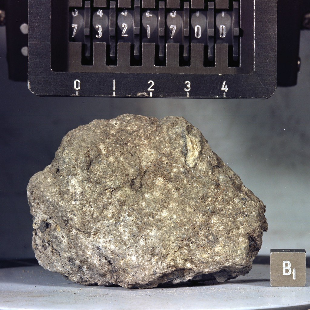
Apollo 17 sample 73217, before processing a 138.8 gm "tough impact melt" breccia rake sample from Science Station 3. The sample was half-buried near Lara crater and close to the Lee-Lincoln lobate scarp contact, and also well inside the Tycho debris chevron called Tortilla Flat. The rock contained a prominent white anorthosite clast, partially analyzed before the remainder was set aside for "posterity." Full processing has waited patiently for the 21st century. S73-16784 [NASA/JSC].
When a meteor strikes another planetary body, the impact produces very large amounts of energy – some of which goes into shock, heating and melting the target rocks. These extreme conditions can "restart the clock" for material melted during impact. As a result, the absolute ages of lunar craters are primarily determined through isotope geochronology of components of the target rocks that were shocked and heated to the point of melting, and which have since solidified.

However, lunar rocks may have experienced multiple impact events over the course of billions of years of bombardment, potentially complicating attempts to date samples and relate the results to the ages of particular impact structures.

Conventional wisdom holds that the largest impact basins on the moon were responsible for generating the vast majority of impact melts, and therefore nearly all of the samples dated must be related to the formation of those basins.

Annotated reproduction of an LROC oblique NAC mosaic showing the landing site (arrow) of the Cernan-Schmitt expedition in December 1972, a roughly 18 km-wide field of view used to illustrate "Approach to Taurus Littrow Valley," December 12, 2012 [NASA/GSFC/Arizona State University].
While it is true that enormous quantities of impact melt are generated by basin-scale impact events, recent images taken by the Lunar Reconnaissance Orbiter Camera confirm that even small craters with diameters on the order of 100 meters can generate impact melts. The team’s findings have important implications for this particular observation. The results are published in the inaugural issue of the American Association for the Advancement of Science’s newest journal, Science Advances, on Feb. 12.

“One of the samples we analyzed, 77115, records evidence for only one impact event, which may or may not be related to a basin-forming impact event. In contrast, we found that the other sample, 73217, preserves evidence for at least three impact events occurring over several hundred million years, not all of which can be related to basin-scale impacts,” says Cameron Mercer, lead author of the paper and a graduate student in ASU’s School of Earth and Space Exploration.

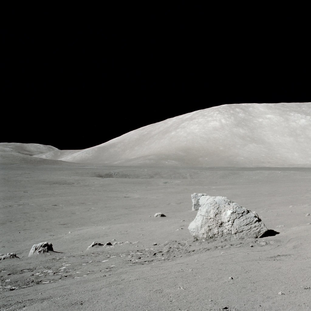
Apollo 17 sample 77115 was taken from the side visible above of the Science Station 7 boulder at lower left in this processed mosaic. From this vantage on the lower slopes of North Massif Gene Cernan and Harrison Schmitt had perhaps their best view across Taurus Littrow valley over to South Massif. The lunar module is easily visible at higher resolutions [NASA/JSC].
Sample 77115, collected by astronauts Gene Cernan and Harrison Schmitt at Station 7 during their third and final moonwalk, records a single melt-forming event about 3.83 billion years ago. Sample 73217, retrieved at Station 3 during the astronauts’ second moonwalk, preserves evidence for at least three distinct impact melt-forming events occurring between 3.81 billion years ago and 3.27 billion years ago. The findings suggest that a single small sample can preserve multiple generations of melt products created by impact events over the course of billions of years.

“Our results emphasize the need for care in how we analyze samples in the context of impact dating, particularly for those samples that appear to have complex, polygenetic origins. This applies to both the samples that we currently have in our lunar and meteoritic collections, as well as samples that we recover during future human and robotic space exploration missions in the inner solar system,” says Mercer.

Thursday, February 12, 2015

Postdoctoral Researcher positions, SwRI

Far-UV albedos show some agreement with epithermal neutron suppression regions [NASA/GSFC/SwRI].
Erin Rogers, PHR
Sr. Specialist
Employment Operations
Southwest Research Institute

The UV imaging spectrograph group at Southwest Research Institute (SwRI) is seeking postdoctoral planetary scientists to join our team's investigations of a variety of science questions using far-UV observations. 

Topics of study include:
  1. Characterization of volatiles within permanently shaded regions (PSRs) at the lunar poles with the Lyman Alpha Mapping Project (LAMP) imaging spectrograph on the Lunar Reconnaissance Orbiter (LRO); 
  2. Imaging Jupiter's powerful auroral emissions with the Juno UV Spectrograph (UVS)
  3. Studying the atmosphere of Pluto with the New Horizons Alice instrument
  4. Analysis of Hubble campaign observations in search of water vapor plumes on Europa
  5. Instrument development work related to the Jupiter Icy Moons Explorer (JUICE) UVS investigation and other future UV/optical projects in Astrophysics, Planetary Science, Heliophysics, and Earth Sciences.
  • Candidates are encouraged to develop their own additional research projects.

Candidates must have experience with imaging and/or spectroscopy from space-based or ground-based observatories; strong programming skills with Interactive Data Language (IDL) is preferred. A background in scientific analysis and publications related to one or more of the topics listed above is highly desirable. Specific tasks include: analyzing UV spectral imaging datasets; assist with planning future observations; publishing results in peer-reviewed journals and presentations at professional meetings; development of concepts and new technologies for UV/VIS/IR instrumentation and assist ing with flight instrument integration, test and calibration tasks, and leading and/or assisting proposal writing for new business.

All candidates must use the swri.jobs website to prepare and submit applications.  They may reference job number 15-01143 or utilize the following job link:

Tuesday, February 10, 2015

Can "chain of title" ever be established on the Moon?

The European Space Agency continues logistical planning for lunar habitat, a vision illustrated in a recently released online agency video presentation. Plans call for utilizing a half-buried inflatable framework eventually covered by 3D-printed and sintered regolith for improved shielding [ESA].
Douglas Jones
New York Times

Who can own Earth's Moon? Or an asteroid? Or a homestead on Mars?

According to the Outer Space Treaty of 1967, no nation can claim sovereignty over any part of any celestial rock. But the treaty is less clear on what a company or an individual can do in space — possibly because in the 1960s, the drafters of the treaty might have thought it hard to imagine a space race led by entrepreneurs rather than governments.

For companies today hoping to set up a Moon colony or to mine asteroids for platinum, the ambiguity is one more hurdle in attracting investors.

“There has been a chicken-egg conundrum to create a lunar legal framework,” said John Thornton, the chief executive of Astrobotic Technology, a Pittsburgh company that hopes to become the first private company to land a robotic spacecraft on Earth's Moon and win the Google Lunar X Prize. “How do you get businesses to invest in Earth's Moon if there is no legal framework versus how do you get a legal framework if there are no business operations?”

The Federal Aviation Administration, which licenses private space launchings in the United States, has now provided some clarity.

Read the full article, HERE.

Related Posts:
China and the Moon (June 19, 2012)

Sunday, February 8, 2015

Chang'e-5 T1 service module completes orbital tests

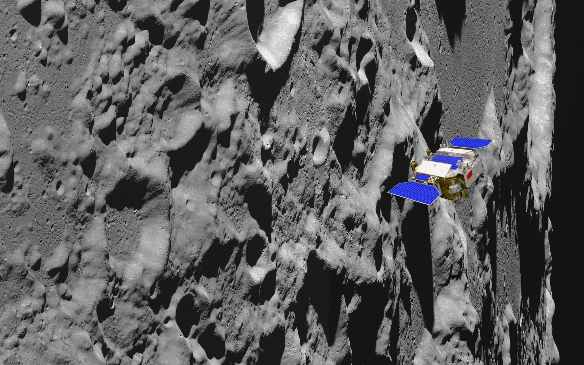
Weeks following the successful test of China's re-entry vehicle Xiaofei, anticipating the scheduled 2017 Chang'e-5 sample-return mission, the "T1" service module, in lunar orbit, has been put through its paces rehearsing next year's landing.
Updated, 1840 UT, 9 February

China's state news agency Xinhua reports the Chang'e-5 T1 service module in lunar orbit "has finished tests of orbiting technologies" ahead of the scheduled 2017 sample return mission.

Launched October 24, the Chang'e-5 T1 service module released its smaller passenger, the Xiaofei high-speed reentry test article, and was later steered into lunar orbit following three Lissajous circuits around L2, the semi-stable Sun-Earth-Moon second Lagrange point (L2), roughly 1.5 million km from Earth, in the direction opposite the Sun.

The interval was China's second visit to L2. After its 2011 primary mission in lunar orbit, Chang'e-2 vehicle was orbited L2 from August until the following April. The probe moved on for a very close encounter with the asteroid 4179 Toutatis, December 13, 2012.

The most celebrated part of the Chang'e-5 T1 mission was completed November 1 when, following a free-return trajectory behind the Moon the Xiaofei test article successfully returned to Earth.

Meanwhile, Xinhua reported by mid-January the T1 service module had been maneuvered to the Moon's vicinity and inserted into lunar orbit, later circularized to an altitude roughly 200 km every 127 minutes. 

"The orbiter conducted three tests between Friday and Saturday," Xinhua reported, "to modulate the speed, height and orbit, rehearing next year's Chang'e-5 sampling mission," this "according to a statement of the State Administration of Science, Technology and Industry for National Defense."

Some Related Posts:
The Chang'e-3 mission to the Moon - a special issue (January 27, 2015)
Chang'e-5 T1 service module tightens lunar orbit (January 15, 2015)
It's not bragging if you do it (December 9, 2013)

Bigelow, FAA not talking lunar property rights

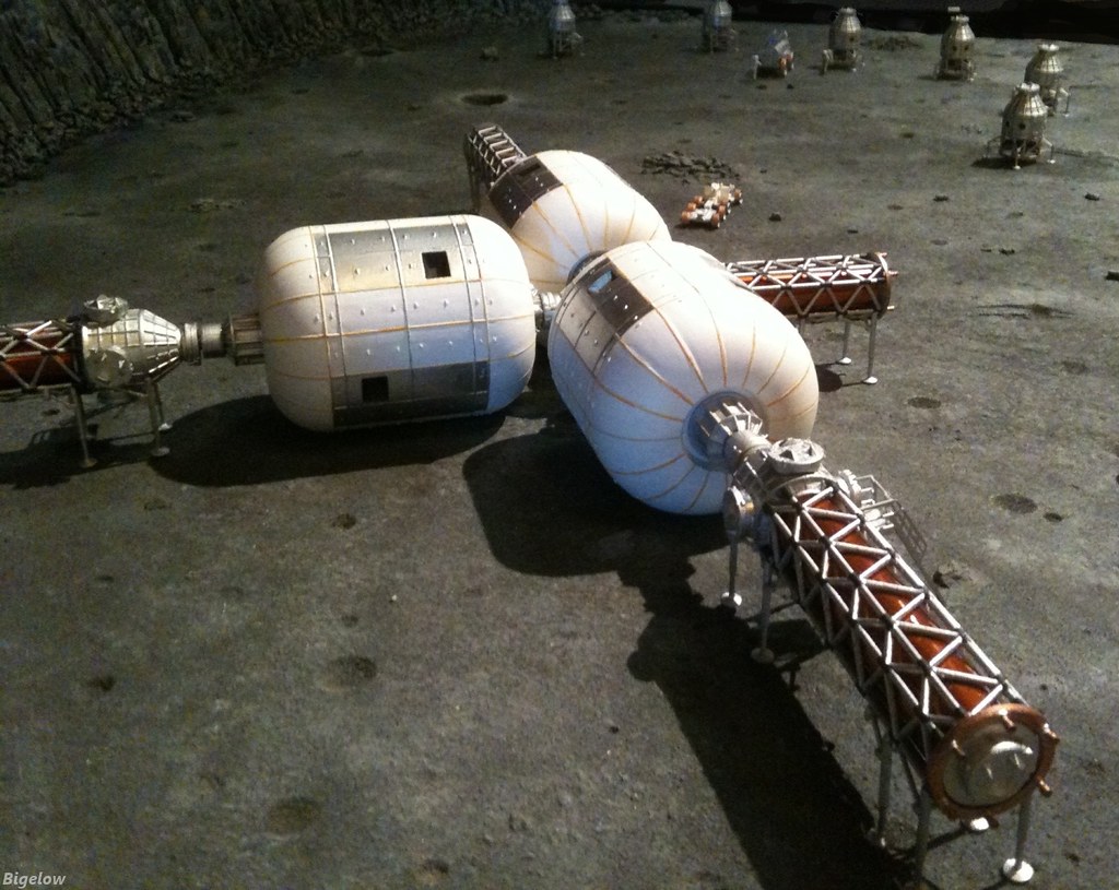
Notional Bigelow inflatable lunar habitat - Detail of scale model of a possible lunar habitat, based on Bigelow Aerospace inflatable modules. Recent exchanges of reports with the FAA, U.S. authority for American compliance with the 1967 Outer Space Treaty, have been misinterpreted as clearing the path for land claims on the Moon [Bigelow].
Jeff Foust
SpaceNews

A positive review by the Federal Aviation Administration of a proposed Bigelow Aerospace lunar habitat is seen as a first step towards supporting commercial activities on the moon, but contrary to some reports, that review does not represent a government endorsement of property rights claims there.

In a December 22 letter to Bigelow Aerospace, the FAA’s Office of Commercial Space Transportation (AST) said it had completed a payload review of a proposed lunar habitat requested by the company in late 2013. The office, working with several other government agencies, said it was willing to use its authority to ensure Bigelow could carry out its activities there without interference from other companies licensed by the FAA.

“AST was able to assure Bigelow Aerospace that it in fact would use its launch licensing authority, as best it can, to protect private sector assets on the Moon and to provide a safe environment for companies to conduct peaceful commercial activities without fear of harmful interference from other AST licensees,” Mike Gold, director of Washington operations and business growth for Bigelow Aerospace, said in a Feb. 3 statement to SpaceNews.
First reported by Reuters February 3, news was interpreted by many as an endorsement by the U.S. government of lunar property rights for private companies. Nield said that was not the intent of the FAA’s review.
Although Bigelow has no immediate plans for a lunar base, the company requested the payload review — one part of the FAA’s overall launch licensing process — to identify any issues that could hinder private development of the moon. Bigelow decided to pursue the review after completing a report for NASA in 2013 that identified an uncertain regulatory environment as a major obstacle to commercial activities there.

“We think that, first of all, this is not an overnight process, and that is probably the main reason why we are starting on this,” Bigelow Aerospace founder and president Robert Bigelow said at a November 2013 press conference, discussing the company’s intent to request the payload review.

“They wanted to know, before they go through a lot of engineering design, analysis, and investment, whether there were going to be any showstoppers,” said George Nield, FAA associate administrator for commercial space transportation, at the FAA Commercial Space Transportation Conference here February 4.

“In this particular case, it looked like a really good idea that the government as a whole is supportive of,” Nield added.

“We’re not talking about property rights at this point,” he said. “What we’re talking about is having the U.S. government have a regulatory framework that provides some certainty so they will be free to proceed with their plans and raising of funds.”

Read the full article at SpaceNews, HERE.

Some Related Posts:
"The Flight of the Dragon" Paul Spudis (May 16, 2012)
Boeing, Bigelow commercial crew concept Rob Coppinger (February 2, 2010)
Boeing throws hat in with Bigelow (September 23, 2009)

Armstrong's treasure of Apollo 11 artifacts found

Neil Armstrong's "McDivitt Bag," filled with priceless souvenirs of the July 1969 first manned expedition to the lunar surface, has been disclosed to the Smithsonian Institute by his widow. Among them, the 16mm DAC camera that captured the landing from the starboard window.
Jesus Diaz
Sploid/gizmodo

These are the contents of a mysterious white bag found hidden in Neil Armstrong's closet: Weird looking lamps, wrenches, utility brackets, sights, and a film camera that later was identified as the one that captured the famous Apollo 11's descent on the Moon's surface. Nobody knew about it, including his widow.

According to NASA, Carol Armstrong sent photos to Allan Needell, curator of the Apollo collection at the Smithsonian's National Air and Space Museum, who immediately knew what was inside: It was a McDivitt Purse full of parts from the Eagle, Apollo 11's Lunar Module:

After Neil Armstrong's death, his widow, Carol, discovered a white cloth bag in a closet, containing what were obviously either flight or space related artifacts. She contacted Allan Needell, curator of the Apollo collection at the Smithsonian's National Air and Space Museum, and provided photographs of the items. Needell, who immediately realized that the bag—known to the astronauts as the Purse - and its contents could be hardware from the Apollo 11 mission, asked the authors for support in identifying and documenting the flight history and purpose of these artifacts. After some research it became apparent that the purse and its contents were lunar surface equipment carried in the Lunar Module Eagle during the epic journey of Apollo 11.

These artifacts are among the very few Apollo 11 flown items brought back from Tranquility Base and, thus, are of priceless historical value. Of utmost importance is the 16mm movie camera with its 10mm lens.

The on-board 16 mm film camera, with which the landing, first steps, and take off of the lunar module Eagle from Mare Tranquillitatis were filmed, has been unearthed in a bag of similarly priceless small artifacts of the epic mission found in Neil Armstrong's closet in Ohio.
The camera was mounted behind the right forward window of the lunar module and was used to film the final phase of the descent to the lunar surface, the landing, as well as Neil Armstrong's and Buzz Aldrin's activities on the lunar surface including taking the first samples of lunar soil and planting the US flag.

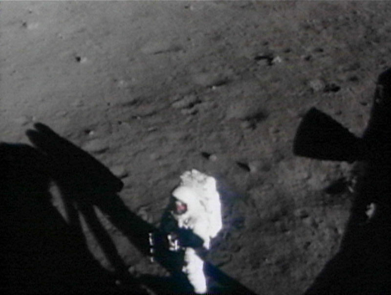
Still from the Apollo 11 16mm DAC film camera shows Armstrong (with visor up) taking his initial, halting steps out onto Mare Tranquillitatis, still tethered to the spacecraft.
Thanks to the Neil Armstrong family, the Apollo 11 purse and its contents are now on loan at the National Air and Space Museum for preservation, research and eventual public display.

Here's a list of everything inside and how it looked inside and outside the Eagle:

Read the full article at sploid.gizmodo, HERE.

Wednesday, February 4, 2015

Hydrogen retention on pole-facing slopes

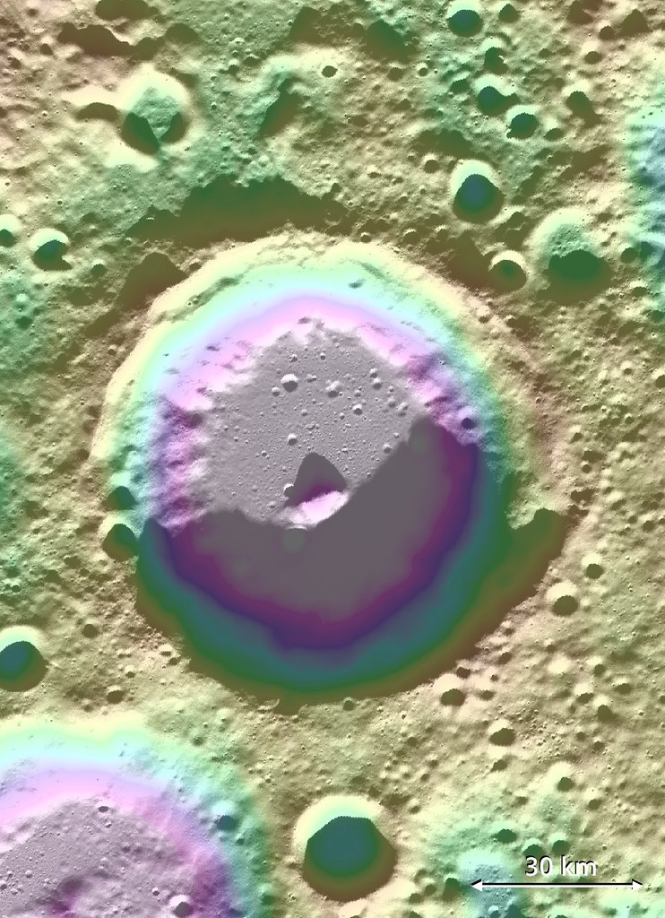
Lovelace (57.06 km; 82.08°N, 250.49°E) crater, of the Moon's far north, hosts a signature of volatiles within permanently shadowed regions (PSR) on the inside slope of its south wall. Long-term studies of the Moon's reserves of hydrogen and other volatiles, made possible by the extended science missions of the Lunar Reconnaissance Orbiter (LRO), show a diurnal cycle of hydrogen retention on pole-facing slopes, perhaps a result of neutral hydrogen from the Sun. [NASA/GSFC/ASU/LOLA/PDS].
Bill Steigerwald
Goddard Space Flight Center

Space travel is difficult and expensive – it would cost thousands of dollars to launch a bottle of water to the moon. The recent discovery of hydrogen-bearing molecules, possibly including water, on the Moon has explorers excited because these deposits could be mined if they are sufficiently abundant, sparing the considerable expense of bringing water from Earth.

Karnik
Lunar water could be used for drinking or its components – hydrogen and oxygen – could be used to manufacture important products on the surface that future visitors to the moon will need, like rocket fuel and breathable air.

Recent observations by NASA's Lunar Reconnaissance Orbiter (LRO) spacecraft indicate these deposits may be slightly more abundant on crater slopes in the southern hemisphere that face the lunar South Pole.

"There’s an average of about 23 parts-per-million-by-weight (ppmw) more hydrogen on Pole-Facing Slopes (PFS) than on Equator-Facing Slopes (EFS)," said Timothy McClanahan of NASA's Goddard Space Flight Center.

This is the first time a widespread geochemical difference in hydrogen abundance between PFS and EFS on the moon has been detected. It is equal to a one-percent difference in the neutron signal detected by LRO's Lunar Exploration Neutron Detector (LEND) instrument. McClanahan is lead author of a paper about this research published online October 19 in the journal Icarus.

The hydrogen-bearing material is volatile (easily vaporized), and may be in the form of water molecules (two hydrogen atoms bound to an oxygen atom) or hydroxyl molecules (an oxygen bound to a hydrogen) that are loosely bound to the lunar surface. The cause of the discrepancy between PFS and EFS may be similar to how the Sun mobilizes or redistributes frozen water from warmer to colder places on the surface of the Earth, according to McClanahan.

"Here in the northern hemisphere, if you go outside on a sunny day after a snowfall, you'll notice that there's more snow on north-facing slopes because they lose water at slower rates than the more sunlit south-facing slopes" said McClanahan. "We think a similar phenomenon is happening with the volatiles on the moon – PFS don't get as much sunlight as EFS, so this easily vaporized material stays longer and possibly accumulates to a greater extent on PFS."

The team observed the greater hydrogen abundance on PFS in the topography of the moon's southern hemisphere, beginning at between 50 and 60 degrees south latitude.

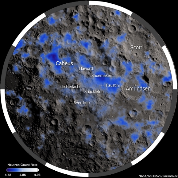
The Moon's polar south and its neutron suppression zpmes, indicative of the presence of hydrogen (inside and outside permanent shadow) mapped from data collected from the LRO LEND instrument over two and a half years [NASA/GSFC/SVS/Pockocmoc].
Slopes closer to the South Pole show a larger hydrogen concentration difference. Also, hydrogen was detected in greater concentrations on the larger PFS, about 45 ppmw near the poles. Spatially broader slopes provide more detectable signals than smaller slopes. The result indicates that PFS have greater hydrogen concentrations than their surrounding regions. Also, the LEND measurements over the larger EFS don't contrast with their surrounding regions, which indicates EFS have hydrogen concentrations that are equal to their surroundings, according to McClanahan. The team thinks more hydrogen may be found on PFS in northern hemisphere craters as well, but they are still gathering and analyzing LEND data for this region.

There are different possible sources for the hydrogen on the moon. Comets and some asteroids contain large amounts of water, and impacts by these objects may bring hydrogen to the moon. Hydrogen-bearing molecules could also be created on the lunar surface by interaction with the solar wind. The solar wind is a thin stream of gas that's constantly blown off the Sun. Most of it is hydrogen, and this hydrogen may interact with oxygen in silicate rock and dust on the moon to form hydroxyl and possibly water molecules. After these molecules arrive at the moon, it is thought they get energized by sunlight and then bounce across the lunar surface; and they get stuck, at least temporarily, in colder and more shadowy areas.

Since the 1960's scientists thought that only in permanently shadowed areas in craters near the lunar poles was it cold enough to accumulate this volatile material, but recent observations by a number of spacecraft, including LRO, suggest that hydrogen on the moon is more widespread.

It's uncertain if the hydrogen is abundant enough to economically mine. "The amounts we are detecting are still drier than the driest desert on Earth," said McClanahan. However, the resolution of the LEND instrument is greater than the size of most PFS, so smaller PFS slopes, perhaps approaching yards in size, may have significantly higher abundances, and indications are that the greatest hydrogen concentrations are within the permanently shaded regions, according to McClanahan.

The team made the observations using LRO's LEND instrument, which detects hydrogen by counting the number of subatomic particles called neutrons flying off the lunar surface. The neutrons are produced when the lunar surface gets bombarded by cosmic rays. Space is permeated by cosmic rays, which are high-speed particles produced by powerful events like flares on the Sun or exploding stars in deep space. Cosmic rays shatter atoms in material near the lunar surface, generating neutrons that bounce from atom to atom like a billiard ball. Some neutrons happen to bounce back into space where they can be counted by neutron detectors.

Neutrons from cosmic ray collisions have a wide range of speeds, and hydrogen atoms are most efficient at stopping neutrons in their medium speed range, called epithermal neutrons. Collisions with hydrogen atoms in the lunar regolith reduce the numbers of epithermal neutrons that fly into space. The more hydrogen present, the fewer epithermal neutrons the LEND detector will count.

Neutron suppression information in the Moon's polar north is, as yet, less granular than data mapped in greater detail over the far South. Here neutron suppression is overlaid on a LROC WAC mosaic with permanently shadowed regions (PSRs) outlined in black. Again, the occurrence of hydrogen is related to sunlight but not necessarily tied to its total absence.
The team interpreted a widespread decrease in the number of epithermal neutrons detected by LEND as a signal that hydrogen is present on PFS. They combined data from LEND with lunar topography and illumination maps derived from LRO's LOLA instrument (Lunar Orbiter Laser Altimeter), and temperature maps from LRO's Diviner instrument (Diviner Lunar Radiometer Experiment) to discover the greater hydrogen abundance and associated surface conditions on PFS.

In addition to seeing if the same pattern exists in the moon's northern hemisphere, the team wants to see if the hydrogen abundance changes with the transition from day to night. If so, it would substantiate existing evidence of a very active production and cycling of hydrogen on the lunar surface, according to McClanahan.

The research was funded by NASA's LRO mission. LEND was supplied by the Russian Federal Space Agency Roscosmos. Launched on June 18, 2009, LRO has collected a treasure trove of data with its seven powerful instruments, making an invaluable contribution to our knowledge about the moon. LRO is managed by NASA's Goddard Space Flight Center in Greenbelt, Maryland, for the Science Mission Directorate at NASA Headquarters in Washington.

Monday, February 2, 2015

LRO could remain in present orbit 7 or more years

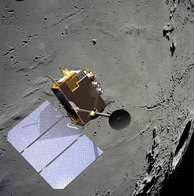
Because the Moon is lumpy and uneven, it's possible nothing has ever been in close-orbit around our companion planet as long as the Lunar Reconnaissance Orbiter. Certainly nothing built by humans. Few deep space missions have delivered as much return on their investment. The sheer volume of data returned by LRO exceeds all deep space missions ever launched combined, several times over [NASA/GSFC/SVS].


THE SECOND EXTENDED SCIENCE MISSION
FOR THE LUNAR RECONNAISSANCE ORBITER:
STATUS, SCIENCE GOALS, AND DATA DELIVERIES

Noah E. Petro and John W. Keller
NASA Goddard Space Flight Center
Solar System Exploration Division

The Lunar Reconnaissance Orbiter (LRO) has been orbiting the Moon for over five years. In that time, data from the seven instruments onboard the spacecraft have made significant advances in our understanding of the Moon and its environment. In September 2014 LRO completed its first Extended Science Mission (ESM) and began a second ESM (ESM2). 

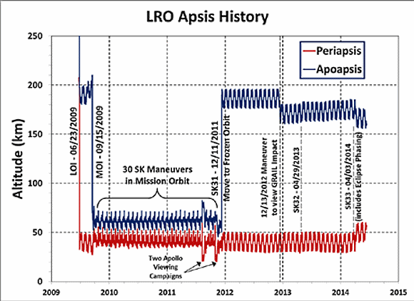
During the both ESM and ESM2, LRO has been in a quasi-stable, eccentric orbit of ~40 x 180 km with a periapse near the South Pole (Figure 1). This orbit enables high resolution measurements around the South Pole. 

The LRO Project is considering a maneuver in early 2015 to lower the periapse in order to further improve measurements over the South Pole, particularly by the LOLA instrument. Based on the current annual consumption of fuel, the spacecraft could remain in its current orbit for at least 7 more years.

FIGURE 1. Orbital history of LRO since arriving at the Moon in 2009. LRO now employs yearly station keeping (SK) maneuvers in order to maintain its orbit. There are also periodic momentum unload burns that use small quantities of fuel.
LRO Operations: As part of the approval for continued operations, LRO was directed by NASA HQ to terminate operations of the Mini-RF instrument. All of LRO’s remaining six instruments are operating nominally, and have experienced no significant degradation since beginning the ESM over two years ago.

During extended operations the LRO spacecraft has performed exceptionally well, with 98.4% uptime during the life of the mission. LRO retains sufficient fuel quantities so that its current orbit could be maintained for at least 8 years, if not longer.

LRO Science In ESM2: An overarching theme of ESM2 for LRO is that of change. A number of measurements have shown changes to the lunar surface and to its environment. LRO will focus on the five following themes that each build on prior observations from LRO, LADEE, GRAIL, and the Moon Mineralogy Mapper. Each theme has numerous questions that are address, an example few are given here.
  1. Transport of Volatiles. How are volatile elements and compounds distributed, transported, and sequestered?
  2. Contemporary Surface Change. What causes changes in the flux and intensities of meteoroid impacts onto terrestrial planets.
  3. Regolith Evolution. Characterize planetary surfaces to understand how they are modified by geologic processes.
  4. Probing the Interior from Observations of the Surface. Characterize planetary interiors to understand how they differentiate and evolve from their initial state
  5. Interactions with the Space Environment.  How is surface material modified exogenically? How do exospheres form, evolve, and interact with the space environment?
LRO Data: The LRO instrument teams will continue to deliver data to the PDS every three months. As of the beginning of 2015 over 575 Tb of data have been placed into the PDS [1]. This data volume contains a range of products, including higher level maps, mosaics, and derived products. The PDS has made available the Lunar Orbital Data Explorer [2], a mapbased tool to search for finding and downloading PDS science data of LRO as well as other recent lunar missions.

In addition to the PDS holdings, several of the LRO instrument teams have additional products and tools available on their websites (Table 1).

Several global map products have recently been added to the PDS, here we highlight a few that are new in the last year. The Mini-RF team has assembled a global mosaic of their monostatic measurements [3].

For the first time we have global radar data for the Moon, data that clearly shows variations in rock abundance and surface texture over both the near and farside (Figure 2).

FIGURE 2. Mini-RF global mosaic of the Circular Polarization Ratio (CPR), one of the number of Mini-RF mosaic products now available online.
The LROC team regularly adds new products to the PDS via the team webpage (Table 1), including shapefiles, global mosaics, NAC-derived DEM’s, and NAC mosaics of selected targets. Recently the LROC team has made available a number of anaglyphs (Figure 3) showcasing the ability of the LRO spacecraft and the LROC team to precisely target the NACs.

FIGURE 3. Red-Blue anaglyph of the central peak of Euler crater.  The LROC team has made a number of anaglyphs available on their website (Table 1).
The LAMP team has a number of polar products available, including FUV ratio maps of both poles (Figure 4). These following maps are available at a resolution of 240 meters per pixel; Lyman-α (119.57–125.57 nm), Long (130–190 nm), On-band (130–155 nm), Off-band (155–190 nm), H2O Absorption Feature Depth Maps made by a Ratio map of on/off band.

FIGURE 4. LAMP Lyman-α map of the South Pole. LRO has focused on volatiles at the South Pole since arriving at the Moon 5+ years ago.
Table 1. LRO teams and their websites

LRO Project

Outreach

CRaTER

Diviner

LAMP

LEND

LOLA

LROC

Mini-RF

Use LRO Data!

The LRO Project has begun holding a series of data users workshops with the goal of helping the community work with the large volume of LRO data. Presentations given at the workshops are archived at the LRO website [4]. Questions regarding the access and use of LRO data can be directed to the authors of this abstract.

References:  [1] LRO PDS Archive, (http://pdsgeosciences.wustl.edu/missions/lro/).
[2] Lunar Orbital Data Explorer, (http://ode.rsl.wustl.edu/moon/).
[3] Cahill, J. T. S., et al., (2014) Icarus, 243, 173-190.
[4] LRO Data Resources, (http://lunar.gsfc.nasa.gov/resources.html).

Sunday, February 1, 2015

LROC detects 26000 changes to lunar surface since '09

Close look at south wall of the Copernican age crater Fetchner T (14.33 km; 58.74°S, 122.82°E), a 2.3 km-wide field of view from LROC NAC observation M113148900R, LRO orbit 1808, November 18, 2009; incidence 67.98° at 64 cm resolution, from 61.71 km above 58.84°S, 122.02°E. Polar orbital tracks converge nearer together, allowing more frequent re-imaging  and opportunities to detect changes to the landscape [NASA/GSFC/Arizona State University]. 
DYNAMIC MOON REVEALED WITH HIGH RESOLUTION TEMPORAL IMAGING

46th Lunar and Planetary Science Conference, #2325
Speyerer and Robinson, Povilaitis and Wagner
School of Earth and Space Exploration
Arizona State University

Introduction: The Lunar Reconnaissance Orbiter Camera (LROC) began systematically mapping the Moon in the summer of 2009 with the goal of acquiring an image dataset to facilitate future exploration [1]. With the aid of the extended science mission, we have discovered hundreds of new impact craters, thousands of smaller probable secondaries, and evidence of recent crater modification using repeat observations with the high resolution Narrow Angle Camera (NAC) and a custom change detection program.

Temporal Dataset: As of 1 January 2015, LROC has acquired nearly a million NAC images of illuminated terrain. From this total, nearly 10,000 are images acquired of regions of the Moon where previous NAC observations with similar lighting and observational geometry exist (i.e. incidence angle difference more than 3°, incidence angle greater than 50°, and nadir pointing).

These before and after image pairs, called temporal pairs, enable the search for a range of surface changes, including new impact craters, formed between the time the first and second image were acquired; individual temporal pairs currently span between 176 to 1241 Earth days.

Change Detection: Since a single NAC temporal pair can contain up to 1.09 billion pixels, manual scanning of thousands of temporal pairs is impractical. However, 131 images were manually scanned and 657 surface changes were identified [2] providing a baseline for the automated change detection algorithm.

We developed an automated change detection program that identifies and crops out suspected changes from each temporal pair. Thumbnails of these candidate areas are extracted and manually classified using a custom web interface. Of the 46,057 automatically identified surface changes recorded to date, manual inspection confirmed that over half (56%) are indeed changes to the surface.

This semi-automated procedure reduces the human time required to inspect a temporal pair by over a factor of 200.

New Impact Craters and Secondaries: From the temporal pairs scanned to date (1 January 2015), we identified 225 new resolved impact craters (e.g. Fig. 1). These craters range in diameter from 1.5 meters to 43 meters and are distributed across the surface over a variety of terrain types (Fig. 2; red dots). In addition, targeted NAC observations imaged 18 and 34 meter diameter craters where impact flashes were observed on 17 March 2013 and 11 September 2013 respectively (Fig. 2; blue dots).

Fig. 1: Before (left) and after (right) images of a new 18 meter impact crater discovered by automatically scanning NAC temporal pairs.
We also identified nearly 26,000 other surface changes that do not exhibit visible crater rims but only a change in surface reflectance. These include high reflectance changes (i.e. increase in surface reflectance), low reflectance changes, as well as mixed reflectance changes (Fig. 3).

Fig. 2: Location of new impact craters overlaid on a LROC Wide Angle Camera basemap (Latitude Range: 55°N to 55°S, Longitude Range 180°E to 180°E). The red dots indicate the location of the 225 new impact craters discovered to date with NAC temporal pairs and the blue dots show the location of the two craters located with the help of Earthbased impact flash observations [3,4].
These changes are thought to be the result of small primary events in which the resulting impact crater is smaller than the resolution limit of the temporal pair or by a secondary disturbance caused by a nearby primary event. In several cases, these surface changes show clear directional indicators pointing back to a larger primary crater [3] confirming their origin as secondary craters.

Fig. 3: Example of low (left column) and high (right column) reflectance changes identified with NAC temporal pairs. The top row consists of a pair of before images, the middle row is a pair of after images, and the bottom row is a ratio of the after/before observation. Each image field of view is 250 meters across.
Crater Modification: Temporal pairs also revealed seven new landslide events inside Copernican age impact craters (Fig. 4). Several of these landslides are the result of small impact events occurring on steep (slopes over 30°) crater walls.

These landslides typically show boulder trails extending from the new impact crater and tracing a path toward the crater floor and occasionally growing in width as a result of the falling block dislodging material along the steep surface. One such event caused material to travel over 4 km to the floor of the larger parent crater.

In addition, we discovered new landslides that lack any indicator of emanating from a new impact crater. These landslides exhibit a much broader surface change (greater than 100 meters wide flows instead of narrow boulder tracks witnessed with the previously described landslides). We speculate that these may be the result of a seismic event such as a Moonquake or a large distant meteor impact disrupting regolith poised near the angle of repose and causing the loosened regolith to cascade down to the crater floor.

Fig. 4: Example of two temporal ratio images (after/before) showing recent landslide events. The image on the left shows a 250 meter-wide field of view, boulder trails extending down slope from a new impact crater. At right is 600 meter-wide view showing a larger landslide with no indication it results from an impact on the wall of the parent crater. In each example, the elevation depicted decreases from the top to the bottom.
Summary: As of 1 January 2015, we have scanned and classified changes in 8300 NAC temporal pairs using our automated change detection tool leading to the discovery of 225 impact craters ranging in size from 1.5 to 43 m. In addition, we also identified thousands of other surface changes, including:

- 23,458 low reflectance changes
- 1,911 high reflectance changes
- 468 mixed reflectance changes
- 1 Chinese lander/rover

Throughout the second extended science mission, the LROC team will continue to acquire and scan high resolution temporal pairs. From this new dataset we plan to refine estimates on the flux of small (less than 0.5 meter) bolides in the inner solar system as well as quantify secondary impact-related hazards on the Moon, which is not only an important scientific finding but a key engineering design concern for future long duration surface assets.

References: [1] Robinson M.S. et al. Space Science Reviews, 150, 1-4, 81-124 (2010); [2] Thompson S.D. et al., Recent impacts on the Moon, 45th Lunar and Planetary Science Conference (2014), #2769; [3] New crater on the Moon and a field of secondaries, Robinson M.S. et al. 45th LPSC, (2014) #2164; [4] http://lroc.sese.asu.edu/posts/810.

Thursday, January 29, 2015

B. Ray Hawke, lunar geologist

Dr. B. Ray Hawke on the rim of Kilauea Caldera, Hawai'i Volcanoes National Park, 1984 [Paul Spudis].
Paul D. Spudis
Daily Planet
Smithsonian Air & Space


I was saddened this weekend by the not totally unexpected news that lunar scientist and good friend B. Ray Hawke of the University of Hawaii has passed away.  Colleague and collaborator, I knew B. Ray as long as almost anyone in the business.  We were graduate students together, early co-workers and good friends.

Bernard Ray Hawke hailed from Upton, Kentucky, about 60 miles north of my birthplace, Bowling Green, Kentucky. We first met in 1976 as graduate students at Brown University. A returning Vietnam veteran who’d served as an Airborne Ranger, B. Ray was a kindred spirit who helped me deal with the cultural shock as an Arizona State University student who’d exchanged the grand vistas of my adopted Arizona for the claustrophobic confines of Ivy League New England.  We became good friends, spending hours at his preferred office – the local coffee shop (the IHOP, which advertised a “bottomless” coffee pot, a descriptor that B. Ray took literally).

During our graduate years, we took to using ironically the honorific “Doctor” when speaking to each other (we were all pre-doctoral candidates), not only between ourselves but also when in the presence of others, a private joke that we continued throughout the years.  This led to some amusing situations later, as our students expressed confusion when I would refer to B. Ray – a colleague but also a long-time personal friend – with the formal title of “Dr. Hawke” and he would address me as “Dr. Spudis.”

B. Ray’s scientific work focused very specifically on the Moon.  As a Masters student at the University of Kentucky, he analyzed lunar regolith chemistry and used something called a “mixing model” to determine its geological affinities.  In this technique, the composition of a soil is determined and that composition is modeled as a mixture of known components.  Although seemingly an academic exercise, this approach could be a very powerful technique to decipher the geological history of the Apollo landing sites.  Later, B. Ray and I would apply this same technique to chemical data returned by the orbiting Apollo spacecraft, giving us our first look at regional and global compositions.  Combined with information about the geological setting of regions covered from orbit (such as the basin ejecta), such study would help us reconstruct the composition and makeup of the crust of the Moon.

B. Ray’s early work dealt with integrating lunar sample information with images and geological mapping, my own field of specialization.  He and I spent many hours discussing some of the problems of this effort, and also the issue of overcoming considerable community skepticism about the approach.  We worked to convince our colleagues that the future of lunar science lay in the melding of the broad disciplines of sample science and remote sensing – taking results from the study of samples, using it to inform the interpretation of remote sensing data, and then concocting a geological model that explains and encompasses all known facts.  Although this approach is now a recognized way to conduct lunar science, careful reading of the early literature will show that most early post-Apollo work was highly sequestered by discipline, with little cross-fertilization of results and insights.

Because B. Ray and I found ourselves working on many of the same scientific problems after graduate school, we formed a partnership that lasted 40 years.  One of our earliest efforts was an attempt to use impact basins as large-scale probes of the lunar crust.  An early paper (1984) on the Orientale basin was the first to discover that massive blocks of pure anorthosite, an indigenous rock composed almost completely of plagioclase feldspar, make up the inner ring of that basin.  In addition, we measured the composition of material thrown out from Orientale using chemical maps based on data from the orbiting Apollo spacecraft.  These results indicated that the Orientale basin excavated only the upper portions of the lunar crust; new data from subsequent missions have confirmed these early results.

The study of telescopic spectra, involving very precise measurements of color at high resolution of very small spots on the Moon, became B. Ray’s specialty.  These spectra would be taken of many carefully selected geological targets, a great improvement over the previous approach of targeting mostly by geographic region.  He spent many hours at Hawaii’s Mauna Kea Observatory, diligently working to make certain that data for the correct spot on the Moon was being acquired.  His spectra were collected to address many scientific problems, including basin rings, dark halo craters, lunar “red spots” (spectrally anomalous regions), impact melt deposits and the ejecta of large craters and basins.  B. Ray brought to these studies his extensive background in image analysis and interpretation.  He had made geological maps of portions of the Moon, which for the first time could be interpreted in terms of mineral and chemical content.  These studies are critical to our understanding of the complex and protracted geological evolution of the lunar crust.

During his 35 year association with the University of Hawaii, B. Ray mentored and befriended many students and visiting scientists. I made an extended stay at UH early in 1980, and worked closely with B. Ray on using spectral interpretation to map the Apollo 16 landing site. B. Ray’s work habits were unorthodox to say the least, almost 180 degrees out of phase with normal working hours (I had to adjust to starting work at 9:00 pm and working until after breakfast). But for all that, I never saw anyone work so long and so hard when there was a problem to be solved. B. Ray was a great collaborator who very carefully reviewed each word in a paper, assuring that many errors and mistakes were corrected long before submittal. I could always count on a detailed and insightful review from him, even for papers for which he was not an author.

As he passes into the annals of history, the world of lunar science is a bit poorer without B. Ray Hawke. He was a productive scientist, a hard worker, a tireless advocate for lunar activities and a good and faithful friend. His legacy leaves us with a new way of looking at the Moon – an integrated approach involving studies of samples, remote sensing data, and images. His contributions to lunar science include work on impact melts, Apollo 14 site geology, dark halo craters and the extent of ancient volcanism, lunar non-mare volcanism (KREEP and red spots), and geochemical anomalies of the lunar crust – an extensive and impressive amount of work.

Thank you and rest easy, Dr. Hawke.

Published a short time ago at Smithsonian Air & Space, Daily Planet - Dr. Spudis is a senior staff scientist at the Lunar and Planetary Institute. The opinions expressed are those of the author but are better informed than average.

India wants Chandrayaan-2 first at the lunar south pole

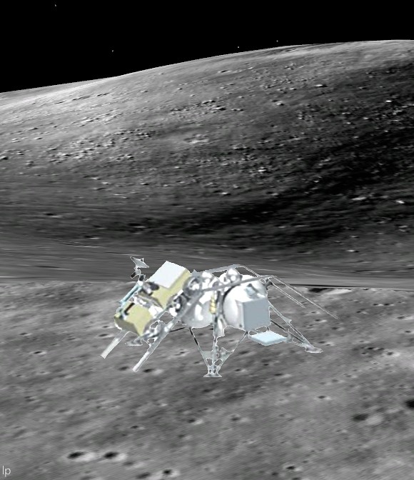
Early-hashed out configuration of ISRO lander and rover components of India's long-in-development Chandrayaan-2 mission. Having parted ways with Roscosmos what will India come up with for its own lunar lander design? [LP].
The Indian Space Research Organisation (ISRO) is out to be first in the unofficial competition to soft-land near the Moon's south pole when Chandrayaan-2 eventually flies, according to Anil Bhardwaj, director of the space physics laboratory at Vikram Sarabhai Space Centre (VSSC) in Trivandrum.

Bhardwaj made the claim when presenting the P.R. Pisharody Memorial Lecture at the Kerala Science Congress in Alappuzha, the three day science conference adjourning Thursday. 

India's national space agency was already first to crash-land a vehicle designed for that purpose near the Moon's south pole.

On November 14, 2008 the Moon Impact Probe (MIP), after launch in tandem with Chandrayaan-1 aboard the indigenously-developed PSLV rocket and insertion into polar orbit around the Moon, was deliberately impacted into the permanently shadowed interior of Shackleton crater, while capturing photographs and directly detecting sublimating water before impacting near 89°S, 330°E.

The 18 month mission of Lunar Prospector was similarly concluded as an afterthought in 1999, within the permanently dark interior of a crater close to the Moon's south pole, a crater eventually named for the American astrophysicist who came up with the idea.

It was Gene Shoemaker (1928-1997), a director of the Surveyor lunar lander program ahead of the Apollo era who suggested using the mission-ending impact of Lunar Prospector in a long-shot attempt to toss up and remotely detect volatile compounds, including water, that were thought trapped in the permanently shadowed regions of the Moon's poles after the Clementine mission in 1994.

Finer data on neutron suppression at the lunar surface collected over the first few months of the Lunar Reconnaissance Orbiter (LRO) mission lead NASA to select Cabeus crater for the deliberately targeted dual impacts of LCROSS and it's trailing Shepherding vehicle, October 9, 2009.

Bhardwaj said success with Mangalyaan, the on-going Mars Orbiter Mission (MOM), has confirmed ISRO refinements in India's ambitious space infrastructure has made a long-planned Chandrayaan-2 mission more cost-effective.

Chandrayaan-2 has suffered a number of troubling delays, inspiring concern among ISRO fans throughout the world and push backs from an original target date in 2013.

The ultimate success of the indigenously developed GSLV-Mark III rocket booster added a 1000 kg capacity to the Chandrayaan-2; more than enough to make thoughtful redesigns worth initial delays.

Russia originally partnered with ISRO in the Chandrayaan-2 mission, to build a lander as ISRO designed and built orbiter and rover components for the project.

In August 2013, however, as a direct result of the 2011 failure of the Russian-led Fobos-Grunt sample-return mission to Phobos, Roscosmos added weight to their Chandrayaan-2 lunar lander design and effectively threw off balance plans already developed involving the GSLV and the other  mission components.

Though Roscosmos offered India contingent space on-board Soyuz launches in 2015 and 2017, ISRO determined added risk together with added restrictions on the rover's design were more problematic than building their own lander.

Related:
ISRO Chandrayaan will go without Roscosmos (August 17, 2013)
Rogozin presses Russian lunar base, Chandrayaan-2 delayed
by Proton and Phobos-Grunt investigations
(September 13, 2012)
Chandrayaan-2: ISRO Annual Report (April 26, 2012)
Chandrayaan-2 may miss 2013 launch date (February 21, 2012)
Luna-Resource and Chandrayaan-2 in 2013 (August 4, 2010)
A new lunar globe as seen by Chandrayaan M3 (April 7, 2010)