LROC News System
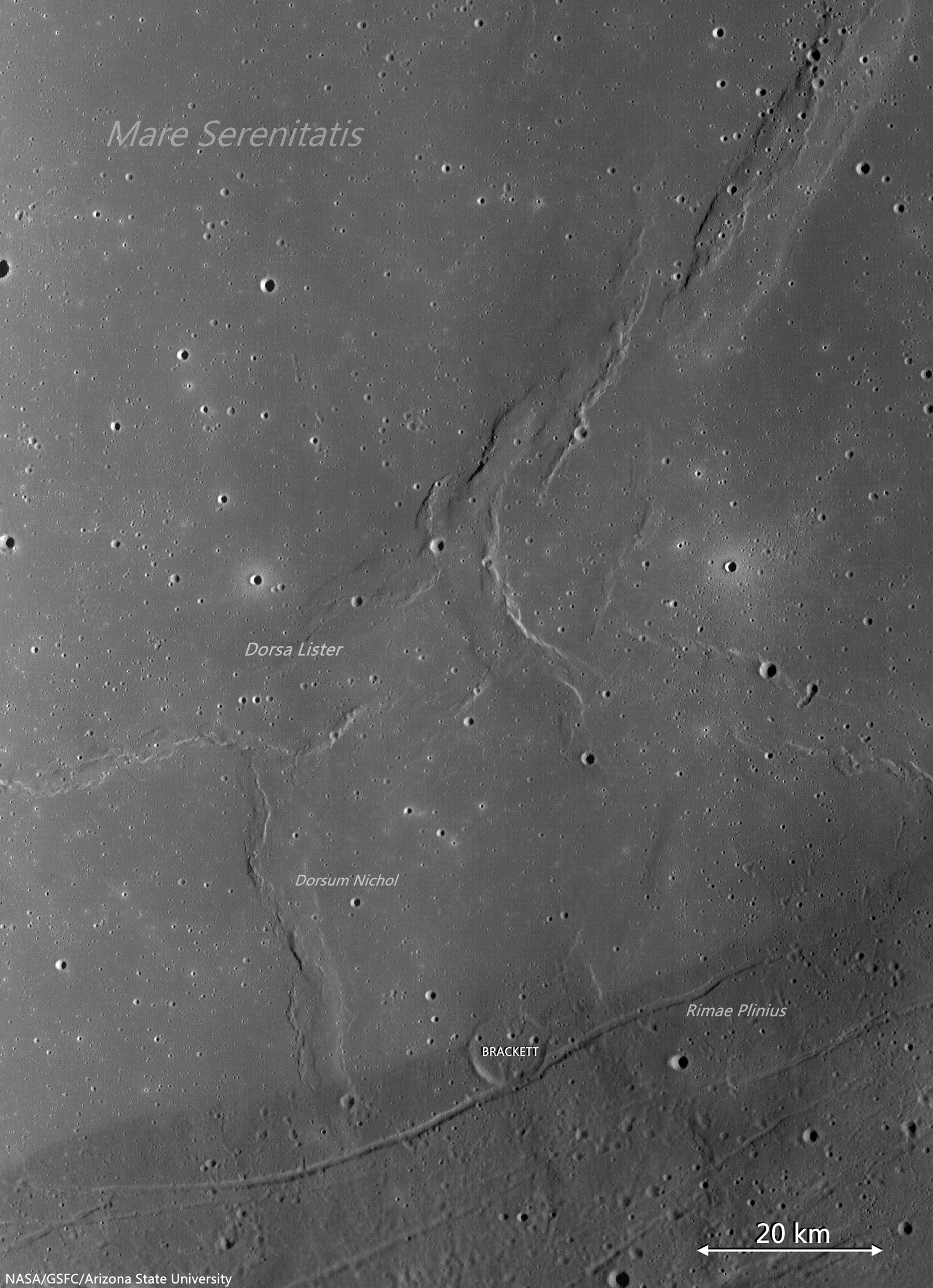
Dorsum Nicol is a wrinkle ridge found in southern Mare Serenitatis.
The opening Featured Image is a LROC NAC image, juxtaposed with a slope map, NAC-derived DTM and recent LROC NAC observation of area.
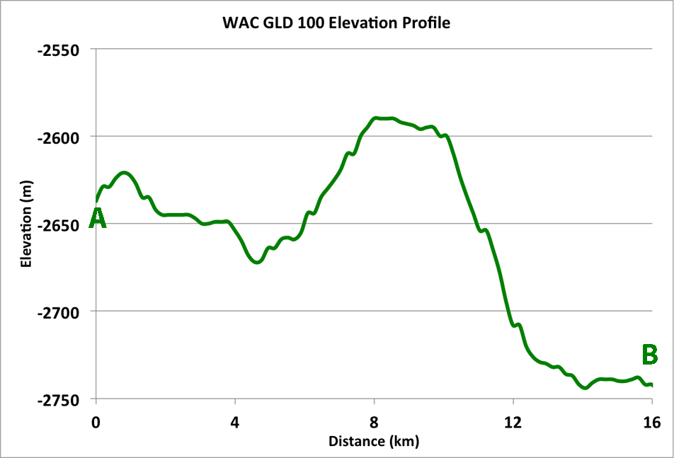
Slope maps are useful to planetary scientists because topographic features like craters and small ridges really stand out. At the location in the LROC Featured Image field of view, the mare on the west side of the ridge is about 100 meters higher in elevation than the mare on east side of the wrinkle ridge, and the peak elevation is around 50 meters above that (see profile below).
 |
| LROC WAC context image of Dorsum Nicol in Mare Serenitatis. The yellow box is the approximate location of today's Featured Image, the red box is the location of the full NAC DTM. A profile taken along the white line from A to B and is shown above. Context image spliced from LROC Wide Angle Camera (WAC) monochrome (604 nm) mosaic of three observations swept up over three sequential orbital passes (LRO orbits 9031-9033) June 8, 2011; incidence 75.86° resolution 58 meters from 42 km [NASA/GSFC/Arizona State University]. [NASA/GSFC/Arizona State University]. |
 |
| Full-sized LROC WAC mosaic, from three sequential passes June 8, 2011. See full size mosaic HERE [NASA/GSFC/Arizona State University]. |
 |
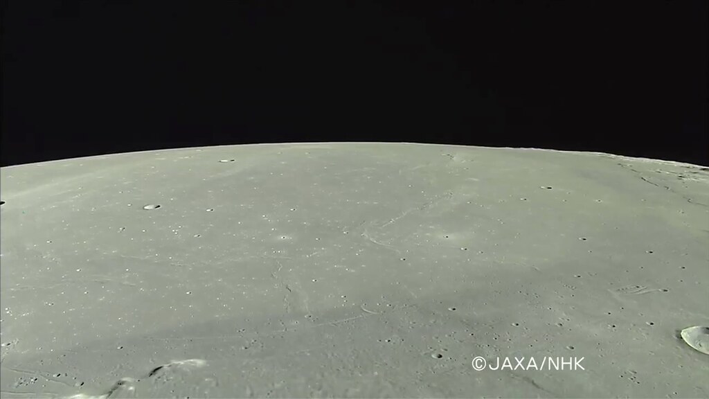
| Southwestern Mare Serenitatis in HDTV. Dorsum Nichol (next to the ghost crater Brackett, butted up against Rimae Plinius, together with Dorsa Lister, and in the foreground, the belt of darker basalts encircling the entire impact basin, Rimae Plinius and Promontorium Archerusia are at lower left, a view Harrison Schmitt describes as close to what Apollo expeditions saw in orbit. From a HDTV still, captured from Japan's lunar orbiter Kaguya (SELENE-1) in 2008. See the original release image HERE [JAXA/NHK/SELENE]. |
 |
| Locating Dorsum Nicol in southeast Mare Serenitatis is easier than actually seeing these features, through a modest telescope. The stacked photograph above, assembled by Astronominsk in Minsk, Belarus, was captured at the best illumination incidence for such a purpose, on June 28, 2009, right after local sunrise, before First Quarter (in an early evening sky, here on Earth). Locating Taurus Littrow valley, the landing site of Apollo 17, and Promontorium Archerusia, along with other features in the contact area between Mare Serenitatis and Mare Tranquillitatis are relatively easy, however, throughout the lunar day [Astronominsk]. |
Related Posts:


No comments:
Post a Comment