Showing posts sorted by relevance for query copernicus. Sort by date Show all posts

Wednesday, June 27, 2012

LROC: New oblique of Copernicus' central peaks

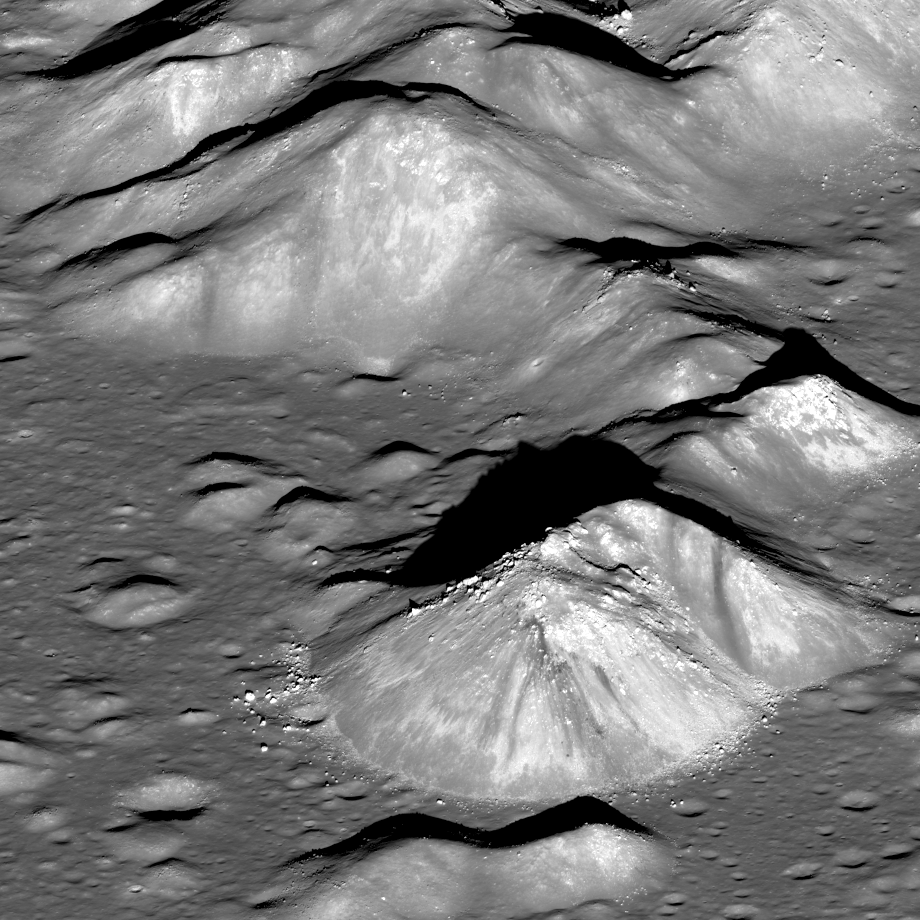
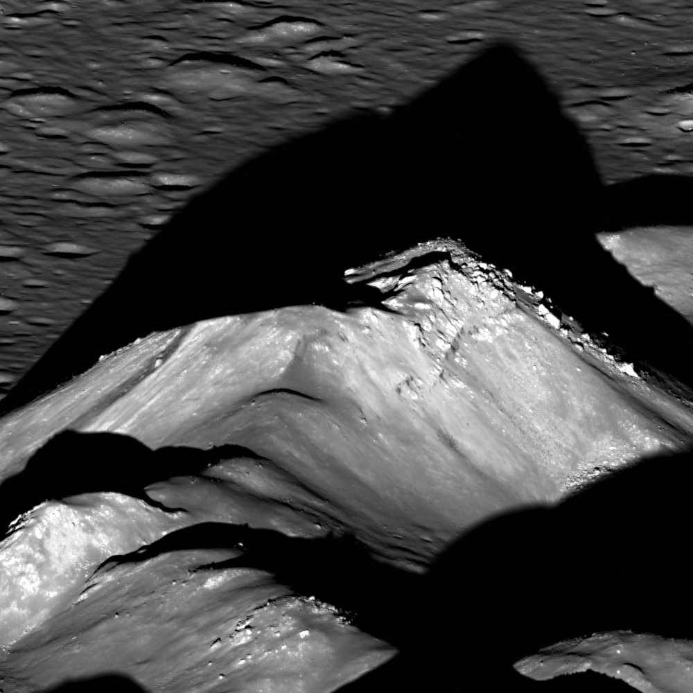
The central peaks of Copernicus crater cast a long shadows to the west over a crater floor that was flooded with impact melt that cooled and hardened to form this spectacular landscape. LROC NAC M193025138LR, image field of view is a 1350 meter section from this spectacular, new oblique mosaic showing the entire 90 km-wide interior of Copernicus, HERE [NASA/GSFC/Arizona State University]
Sarah Braden
LROC News System
 
On May 5th, 2012 LRO slewed 63° to capture this LROC image of the interior of Copernicus crater (9.62°N, 339.92°E, 93 km in diameter). The central peaks immediately capture your eye, with the tallest peak rising one kilometer above the floor of the crater. For comparison, the Grand Canyon has an average depth of 1.6 km. During the impact that formed Copernicus crater, an unimaginable amount of kinetic energy was transferred instantaneously into the surface. After the excavation stage of the impact, the initial transient crater collapsed under the force of gravity causing the crater rim to move inward, and the central region rebounded (uplifts) to form the central peaks! Central peaks only form in craters larger than 15-20 km in diameter on the Moon. The rock that forms the central peak originates from the greatest depth of all the material excavated by the crater. For that reason, scientists are very interested in the composition of central peaks, since the material tells us what lies deep beneath the surface of the lunar crust; studying central peaks of large craters is therefore one of the best ways, absent returned samples, to probe the composition of the lunar interior. Recent remote sensing studies using Moon Mineralogy Mapper spectra confirmed the presence of relatively unusual olivine-rich material in the central peaks of Copernicus. Are we sensing the upper portions of the mantle, or magma chambers that formed in the crust?

Rough vector of the view over the central peaks seen in the LROC Featured Image, released June 27, 2012. From LROC WAC observation M147109260C, orbit 6813, December 16, 2010; resolution 60.3 meters per pixel at an incidence angle of 78° from 43.13 kilometers [NASA/GSFC/Arizona State University].
Context image of Copernicus crater. The Featured Image is approximately bounded by the red box. Copernicus crater is 93 km in diameter, and the image width is 120 km [NASA/GSFC/Arizona State University].
Copernicus crater also plays an important role in our understanding of the lunar geologic timescale. Scientists use the basic principles of stratigraphy and superposition to define relative ages for geologic terrains and features. Rays are young lunar features, and any geologic unit covered by a ray of Copernicus must be relatively older than the crater itself. In fact Copernicus crater is defined as the beginning of the youngest period of lunar geologic history, the Copernican period. But how young are Copernican materials? It wasn't until the first samples were brought back from the Moon, from the Apollo and Luna missions, that scientists were able to tie relative ages to absolute time within the lunar timescale. It is likely that Apollo 12 astronauts sampled material ejected from the impact that formed Copernicus crater. These samples were radiometrically age dated to be close to 800 million years old! So all materials mapped stratigraphically as Copernican are younger than 800 million years. Of course the sample collected at the Apollo 12 site is thought to be from Copernicus crater, not known to be. Many craters are much younger, so you can think of Copernicus as the oldest young crater on the Moon (see yesterday's LROC Featured Image on Giordano Bruno crater).

Copernicus crater was a candidate landing site for the Apollo 18 lunar landing mission, which was unfortunately cancelled. The Constellation Program also designated Copernicus crater as a region of interest. So perhaps in the future astronauts will visit Copernicus crater, but when? In the meantime scientists are using LRO data to understand the complex geology of this important crater and plan future exploration.

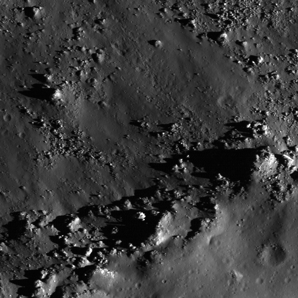
The floor of Copernicus crater is covered with rock formed as a sea of impact melt froze. There are many cracks and pits that tell a story of how the once molten rock moved around in the crater floor, a topic for a future Featured Image. (See "Failed Skylights of Copernicus," January 24, 2012) Image width is 1350 m [NASA/GSFC/Arizona State University].
LROC took another oblique view of a much younger Copernican crater, Tycho (43.37°S, 348.68°E, 85 km in diameter), which is only about 110 million years old. Even though Tycho is smaller in diameter than Copernicus, the summit of Tycho's central peak is 2 km above the crater floor! That is twice as tall as Copernicus crater's central peak. The final form of a crater transitions with the size and speed of the impactor. Craters even larger than Copernicus do not have central peaks at all, but rather peak rings. You can compare the full resolution Tycho oblique view with the Copernicus oblique view.

Explore the entire amazing interior of Copernicus crater, HERE.

Related Images:
Second new oblique of Copernicus central peaks, from the west (July 18, 2012)
Copernicus - Looking Straight Down (June 28, 2012)
Absolute Time
Central Peak of Copernicus Crater
Copernicus Crater and the Lunar Timescale
A Path Not Taken

Failed Skylights of Copernicus (January 24, 2012)
The smooth anomaly in Copernicus (September 29, 2010)
Copernicus (September 23, 2010)
New views of the Copernicus interior (May 5, 2010)
LOLA's Copernicus (April 23, 2010)

Thursday, June 28, 2012

LROC: Copernicus looking straight down

Fractures and a collapse crater within impact melt rock on the floor of Copernicus crater. LROC Narrow Angle Camera (NAC) medium resolution montage from greater than 100 kilometers, field of view width is roughly 1800 meters [NASA/GSFC/Arizona State University].
Sarah Braden
LROC News System
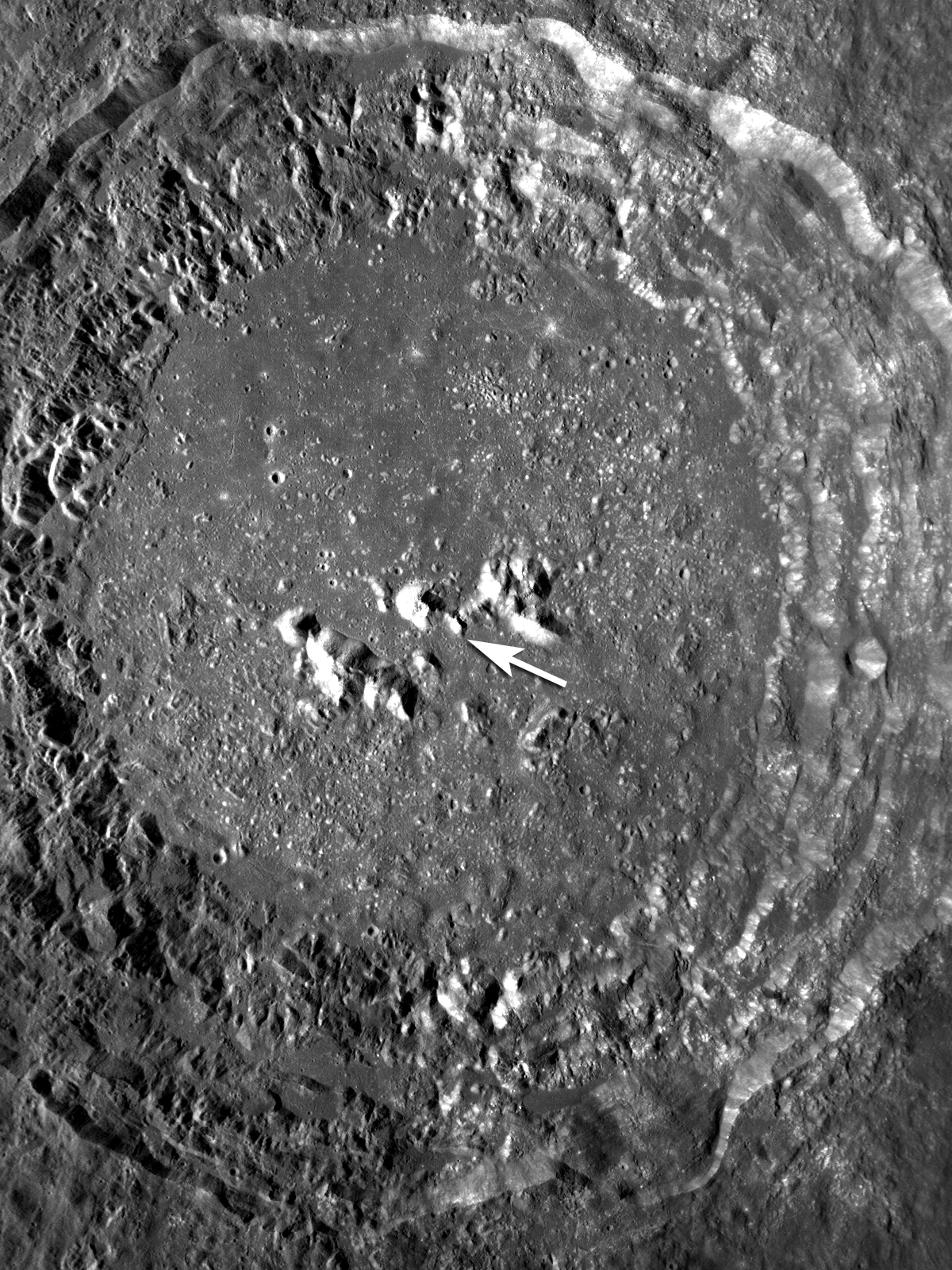
(The LROC) Featured Image (released June 28, 2012), a 1.8 meter per pixel mosaic of Copernicus (9.62°N, 339.92°E, 93 km in diameter), compliments (the) fantastic oblique view of Copernicus Crater (released June 27).(This) view, looking straight down, highlights the central peaks as well as terraces, impact melt pools, and melt fractures.

The opening image features a linear fracture with aligned pits within the impact melt deposit on the floor, and a crater which may have formed by collapse of impact melt (collapse pit rather than an impact crater). The fracture may have formed as a tube collapsed. Lava tubes commonly form within basaltic volcanoes on Earth, as part of an underground plumbing system that moves magma away from a vent. The same type of tubes and pits probably formed in lunar mare (also basalt). Should we expect lava tubes in impact melt deposits? There is much evidence for such in the NAC images collected over the past few years. 

The NAC revealed collapse pits, often aligned in rows, in many impact melt deposits. These pits are similar to collapse pits found in lava tubes on the Earth (often called skylights). In one case two collapse pits side-by-side resulted in a natural bridge! But how did they form? What caused the melt to flow after it ponded in the crater floor? Perhaps slumps of wall material into the melt caused large-scale displacements of still molten subsurface melt to flow. Or perhaps over months and years the crater floor rebounded while melt was still cooling beneath a crust. Both likely happened, so it is not a big surprise that melt moved in subsurface tubes for quite a while after the impact event.

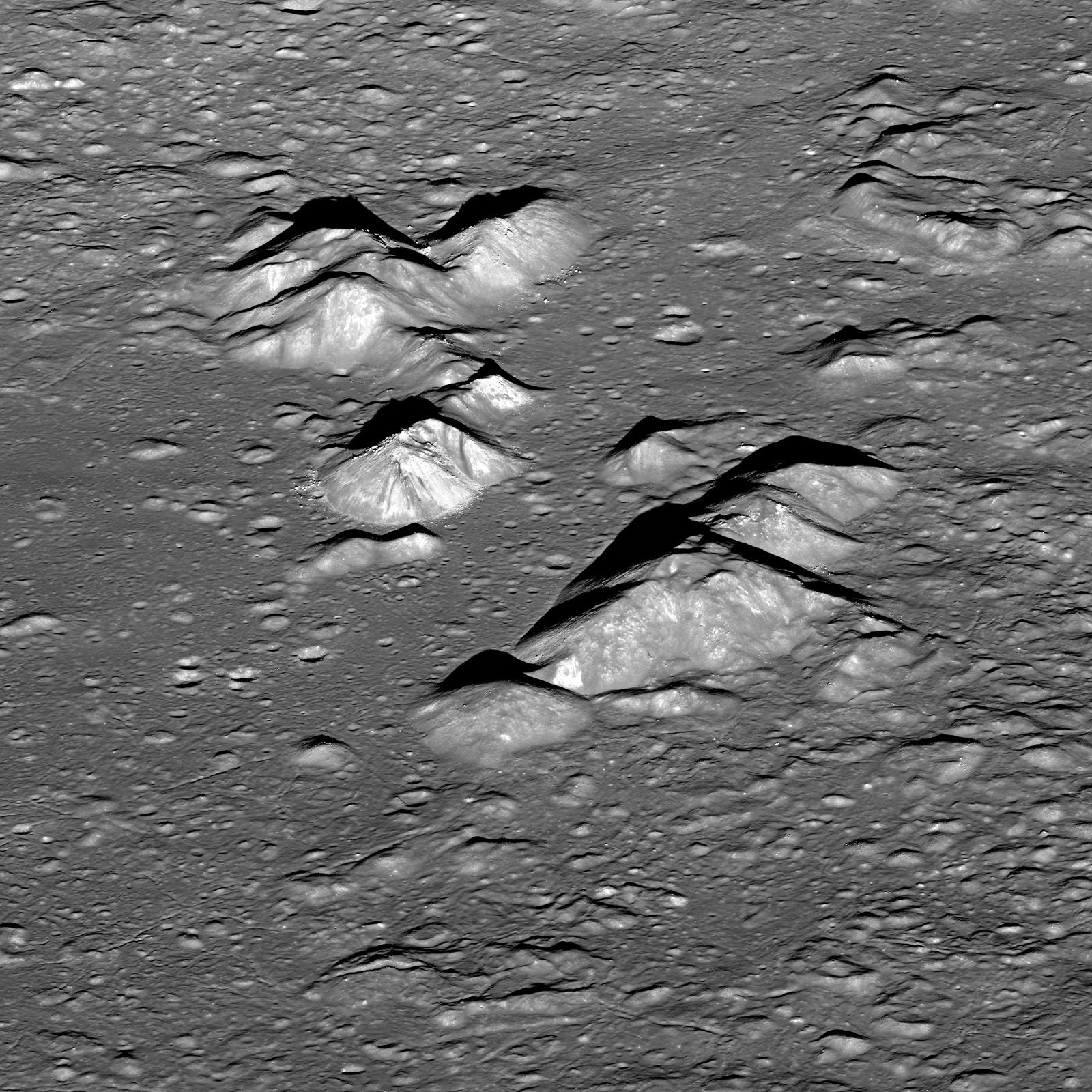
Comparison of today's mosaic with the oblique image of the central peaks. Top of the images is west. Images are 34 km across [NASA/GSFC/Arizona State University].
The interior of Copernicus contains dramatic impact melt features. The image below (a subsampled portion of the full mosaic) shows a section of the northern wall of Copernicus. The top of the image shows the edge of an impact melt pool emplaced on a small terrace. At some point, a portion of melt escaped the terrace and the liquid rock carved curved, sinuous channels as it flowed down the wall. Towards the bottom of the image you can see where one of the flows stopped, spread out, and deposited some of the impact melt. 

Impact melt flowed from terraces down the north wall of Copernicus, leaving behind curved channels. Field of view is 6480 meters [NASA/GSFC/Arizona State University].
The subsampled mosaic shows a dramatic view of the impact melt in Copernicus crater's floor. The melt in the eastern portion of the image shows several mounds, while the melt on the western half of the mosaic is noticeably smoother. Several terraces at different elevations along the northern wall also have melt ponds. How does Copernicus crater's impact melt compare to other large craters? Tycho crater has a similarly large sheet with a mix of chaotic and smooth melt. As does King crater, Necho crater, Giordano Bruno crater, and almost every other Copernican aged crater larger than 1 km in diameter!

Subsampled version of the Copernicus mosaic. Image field of view 36.5 km across [NASA/GSFC/Arizona State University].
Explore the entire Copernicus mosaic! And compare with the Copernicus peak oblique from yesterday's Featured Image. The mosaic images were taken only 8-10 orbits after the oblique image of Copernicus to maintain similar viewing geometry, making visual comparisons even easier!

Related Posts:

Failed Skylights of Copernicus (January 24, 2012)
The smooth anomaly in Copernicus (September 29, 2010)
Copernicus (September 23, 2010)
LOLA's Copernicus (April 23, 2010)

Wednesday, July 18, 2012

LROC: Second new oblique of Copernicus central peaks, from the west...

West-to-east view of the Copernicus crater central peak complex. Detail from LROC Narrow Angle Camera (NAC) mosaic of M19666538lL & R, LRO orbit 13,981, July 11, 2012; general resolution is 4 meters.  [NASA/GSFC/Arizona State University].
Mark Robinson
Principal Investigator

Lunar Reconnaissance Orbiter Camera
Arizona State University

LROC captured this spectacular view of the heart of Copernicus crater just before (local) sunset, July, 11 2012. Compare it to the reverse view point snapped from the East near local sunrise, May 5.

LROC can only be slewed large angles while looking away from the Sun, otherwise its radiators are exposed to the hot Moon and the LROC Wide Angle Camera (WAC) optics are exposed to the Sun. So back-to-back obliques are not possible on the same day.

Full 920 pixel-wide LROC Featured Image, released July 18, 2012. The sharp boundary at the base of the 700 meter high peak in the foreground is a now frozen sea of impact melt that flooded the floor of the crater in its final stages of formation. Image field of view is approximately 8 km across [NASA/GSFC/Arizona State University].
Between May and July LRO passed over the terminator (boundary between night and day) and thus the direction to the Sun reversed, in terms of LRO. On that orbit the daylight side switched from one side of the Moon to the other, at least from the perspective of the spacecraft. For example if LROC had just completed mapping the nearside, as it crossed the terminator we skip the farside and start remapping the nearside!


Central peak with bouldery outcrops and streak seen from the east (top), and the west (bottom) [NASA/GSFC/Arizona State University].
Back to Copernicus, what are those dark streaks we see on the peak? In the comparison image above, and if you skip back to the earlier post that shows the other side, that dark streak is seen on both sides of the central peak, showing that it is three dimensional within the peak. Might it be a dark rock intruded as a dike into the light colored crystalline bedrock that was brought up from beneath the deepest part of the transient cavity in the Copernicus target? Or is it simply a dark rock that is eroding and slumping down the sides of the peak?

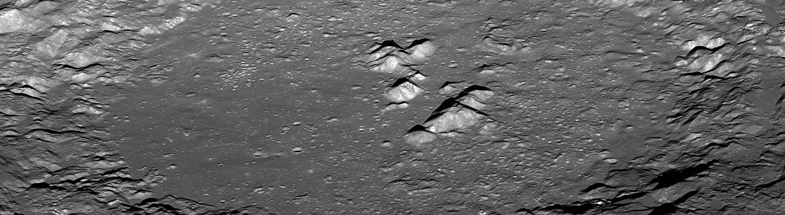
Reduced resolution view of the entire NAC view of Copernicus crater. View 1600 pixel-wide rendition, HERE [NASA/GSFC/Arizona State University].

Because of their state of preservation (despite being nearly a billion years old) and the identification of scientifically interesting mineralogy from remote sensing spectroscopy, the central peaks of Copernicus have long been coveted by lunar explorers as a prime location for a mission, including sample return. In fact, Copernicus was considered as an Apollo landing site, and was recently proposed as a target for a robotic rover within the Discovery program. To sample the peak you wouldn't need to scale the slopes - in the top image you can see many rocks and boulders that have rolled down from the summit, lying on the relatively flat floor waiting to be picked up.

Subsampled synoptic view of the central peak complex, field of view approximately 18 km across, the tallest peak rises more than 1300 meters above the floor. View the larger 1600 pixel-wide rendition, HERE  [NASA/GSFC/Arizona State University].

When and how will we first visit this fascinating, geologically rich area? Imagine the view astronauts will have as they descend to the floor and then step out at the base of this peak. Explore the full LROC NAC oblique mosaic release, HERE.

Previous LROC Featured Images highlighting Copernicus:

Copernicus - Looking Straight Down (June 28, 2012)

Tuesday, September 4, 2012

LROC: Dark Ejecta

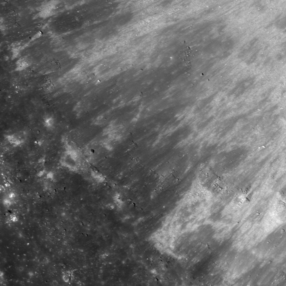
Southwestern rim of crater Copernicus H (6.88°N, 341.68°E). A 930 meter-wide field of view from LROC Narrow Angle Camera observation NAC M186005514L, spacecraft orbit 12940, March 10, 2010; incidence angle is 10° at 0.93 meters per pixel resolution. View the 1000 px original LROC Featured Image HERE [NASA/GSFC/Arizona State University].
Hiroyuki Sato
LROC News System

Copernicus H (about 4.4 km in diameter, latitude 6.88°N, longitude 341.71°E) , a satellite crater of Copernicus crater, is located 56 km southeast of Copernicus (93 km diameter crater located in eastern Oceanus Procellarum). The opening image highlights a part of the Copernicus H crater rim (see blue square in the next image). The upper right portion of the image with bright/dark streaks corresponds to the crater wall, and the bottom left low reflectance part is the surrounding flat area. The low reflectance materials extend from the rim down the slope into the crater. What is the origin of these dark materials? Is the material mature soil? Impact melts? Pyroclastic deposits?

Zoomed out view of NAC M186005514L. Field of view about 5.7 km. Blue box indicates the location of today's Featured Image [NASA/GSFC/Arizona State University].
As seen in the subsampled NAC image (above) and WAC context image (below), the ejecta blanket of Copernicus H shows relatively lower reflectance than the surrounding area. Normally crater ejecta has a higher reflectance because the newly-exposed material is "immature" in a space-weathered sense. Notice that the crater floor is largely filled by lower reflectance impact melt, and the high reflectance materials extend radially from the floor to the crater rim. These brighter materials are the debris on the slope of the crater wall that are mass-wasting gravitationally toward the crater center.

Looking at the WAC context image below, it is likely that Copernicus H excavated some low reflectance materials underlying the ejecta of Copernicus. Several craters located at least 45 km away from the Copernicus rim also show similar dark ejecta. Therefore, the underlying dark material must be widely distributed. What might these materials be? Pyroclastic deposits at Southern Sinus Aestuum are located at about 90 km southeast of Copernicus H, and are underlying the Copernicus ejecta. If this layer is extensively distributed under the Copernicus ejecta, subsequent impacts with sufficient energy could have excavated the dark materials.

To unravel these complicated stratigraphic relations from orbit, accurate spectral data and an understanding of the effects of space weathering are necessary. New measurements from LRO, SELENE-1 (Kaguya), and Chandrayaan-1 are providing lunar scientists with the needed information!

Copernicus H and surrounding area in WAC monochrome mosaic (100 m/pix). Image center is 6.88°N, 341.73°E. The blue box indicates the footprint of full NAC frame [NASA/GSFC/Arizona State University].

Explore this dark ejecta in full LROC NAC image yourself, HERE.

Related Posts:
Dark Craters on a Bright Ejecta Blanket
Dark halo crater
Just Another Crater?
Dark Impact Melt Sheet
A Beautiful Impact
Pyroclastic Excavation

NASA ILIADS (LMMP) simulated mid-day point of view 40 km over the lunar surface southeast of Copernicus. Copernicus H and it's floor are at upper center in this compilation from LROC Global 100 meter resolution WAC mosaic with LOLA altimetry at 128 meters per pixel. The darker surface further southeast from Copernicus past Copernicus H is identified as a radioactive hotspot, with signatures of thorium and uranium in Lunar Prospector, SELENE and other surveys [NASA/GSFC/LMMP/Arizona State University].

Tuesday, January 24, 2012

Failed skylights of Copernicus

More than mere melt fracture, a narrow skylight among myriad melt fractures in the chaotic interior of the familiar nearside landmark Copernicus, at a resolution of 40 centimeters per pixel from 25.4 kilometers, August 18, 2011. LROC Narrow Angle Camera observation M168333206L; illumination from the southwest (bottom left) of directly overhead, angle of incidence 38.23° [NASA/GSFC/Arizona State University].
Joel Raupe
Lunar Pioneer

The LROC targeting team had already extensively mapped the interior of Copernicus before the brief period last August when the low point in the LRO polar orbit was reduced by half, sometimes below 25 kilometers. Copernicus might be the most photographed lunar crater after Tycho. Both of these relatively young impact craters are difficult to miss in any view of a waxing Moon seen from Earth. Both craters center on extensive and bright ray systems, and Tycho's being the youngest of the two can be picked out with the naked eye.

Copernicus, though larger than Tycho, seems less intense, almost smudged, and, indeed, it is more faded a more along in years, nearly old enough for the inevitable effects of space weathering to have gardened its face with optical maturity.

The interior, slumped terraced walls, rim and some of the ejecta blanket of Copernicus as seen in one of the very first LROC Wide Angle Camera (WAC) mosaics released by Arizona State University in early 2010. At its roughly 800 million year age Copernicus, namesake of the "revolutionary" polish astronomer Nicolas Copernic (1473-1543), has lent its name to the Copernican Age on the lunar timescale, that relatively recent and relatively sparse period of bombardment. Its interior is flatter in the north than at the south and features three central peaks. A bifurcated pattern to its rays system and topography has led some to speculate at least two progenitors of nearly equal size were involved in this impact event [NASA/GSFC/Arizona State University].
As LROC team member James Ashley was spotlighting the melt fractures of Jackson crater earlier this month we were already performing a survey of the same features on the floor of Copernicus, particularly within the crater's north-central and "more featureless" interior. The melt fractures within Copernicus seem more extensively gardened, and may have formed in a somewhat different way than those at Jackson. At Copernicus there seems to have been, or still may be, voids under the impact melt, and some evidence of what may be bubbling, places that seem to be half-submerged solid rubble on the floor of Tycho, for example, may be place where gases were trapped for a time, escaping after the impact melt had rapidly cooled and solidified.

The north central floor of Copernicus only seems less distinctive than the jumbled topography of its surroundings. Barely visible in this LROC WAC monochrome (643 nm) image is a web of fractures and channels throughout the most level terrain above. A 35 km-wide field of view from LROC WAC observation M147109260C, orbit 6813, December 16, 2010; resolution 60.3 meters per pixel at an incidence angle of 78° from 43.13 kilometers [NASA/GSFC/Arizona State University].
Both the north and south ends of this 42 meter-wide exposed fracture on the floor of Copernicus are nearly buried or are not quite as wide as this section. While its tempting to see the western side as an overhang, and despite the apparent differences in the opposing edges, the exposed rift is likely only slightly deeper and more shadowed. There is evidence enough for voids under the floor of Copernicus but the more obvious clues have been pulverized by space weathering and moon quakes since the crater's formation. LROC NAC observation M157730473L, orbit 8379, April 18, 2011; angle of incidence 24.32° on a field of view 270 meters wide at a resolution of 0.47 meters from 37.85 kilometers [NASA/GSFC/Arizona State University].
Is this 300 meter-wide feature on the floor of Copernicus a crater, a void shaken to collapse or a little of both? Apparent layering in rapidly cooling impact melt may be a result of differing arrival times of the melt. LROC NAC M168333260L [NASA/GSFC/Arizona State University]. 
The area of interest on the floor of Copernicus is distinguished by its melt fractures, many obvious and others mysterious. The traces of these fractures are often marked with pits, their openings too shadowed or narrow to measure - even discovering whether any are really open at all and what may lay below awaiting future exploration. Between the two "pits" appears to be a spot long collapsed - but what if anything actually collapsed? Also from LROC NAC M168333206L [NASA/GSFC/Arizona State University].
Zoom in, out and around this area of interest in Copernicus using the LROC QuickMap, HERE, in views like the one below.


Thursday, September 30, 2010

Extensive Copernicus ejecta

Extensive Copernicus ejecta
One of the geologic features that makes Copernicus crater special is its extensive, high-reflectance ejecta rays that extend across nearby mare and superpose (overlap) ejecta from other craters - Copernican ejecta extends more than 500 km from the impact site. In this high-Sun image, albedo differences are enhanced and the arrows indicate several "fingers" of ejecta and the direction of ejecta emplacement (away from Copernicus, which is to the southwest). 470 meter-wide field of view from LROC NAC observation M127050121L, LRO orbit 3857, April 27, 2010, spacecraft and camera slew 11.6° west from nadir, angle of incidence 30.4° at 47 centimeters per pixel resolution from 37.69 km [NASA/GSFC/Arizona State University].
Lillian Ostrach
LROC News System

Check out Wilhelms' Geologic History of the Moon for more information about Copernicus crater and the lunar geologic timescale.

Copernicus context for LROC NAC M127050121LE
LROC Wide Angle Camera (WAC) mosaic of monochrome (689 nm) observations of high illumination incidence angles captured over several sequential orbits in early January 2010. Familiar Copernicus (93 km diameter) is the result, overlaid on the lunar digital elevation model available through the Google Moon (v5) application. The arrow indicates the approximate position of the area shown at high resolution in the LROC Featured Image released September 30, 2010 and the blue boundary outlines the area captured in the LROC NAC observation seen in the corrected format below [NASA/GSFC/Arizona State University].
Copernicus (early LROC WAC color)
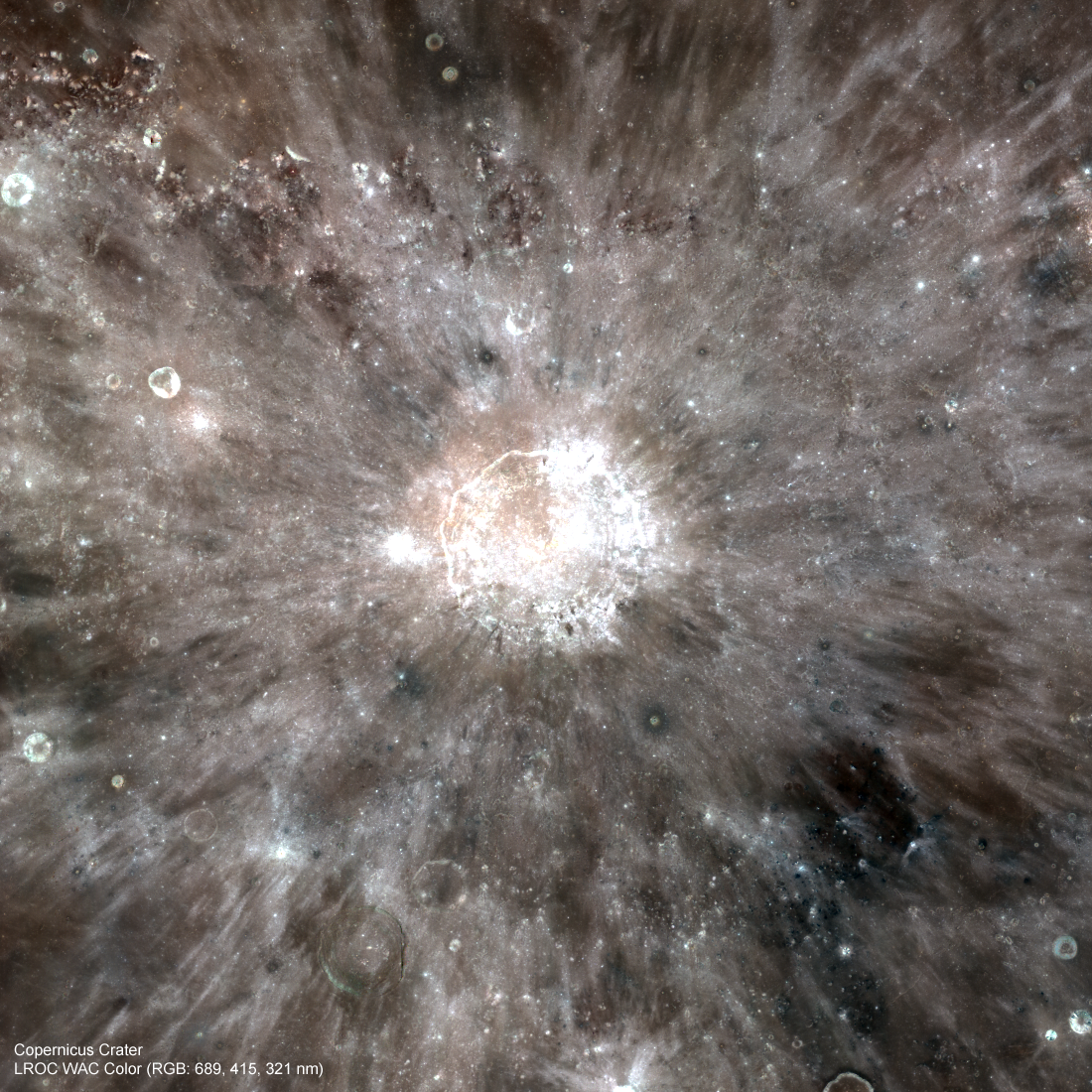
LROC Wide Angle Camera (WAC) visible to ultra-violet portrait of Copernicus in a 458 km-wide field of view, showing some degree of the extensive ejecta of the familiar Copernicus impact, a benchmark for dating lunar stratigraphy. LROC Featured Image, illustrating the post on that very subject written by principal investigator Mark Robinson, March 20, 2012 [NASA/GSFC/Arizona State University].
Discover the Copernicus ejecta deposits for yourself in the full LROC (corrected) Narrow Angle Camera frame, HERE.

Related Posts:
Central Peak of Copernicus Crater

Tuesday, March 5, 2013

Copernicus collapse pit

Collapse feature in the impact melt on the floor of Copernicus, field of view 430 meters, from LROC Narrow Angle Camera (NAC) observation M168333206L, LRO orbit 9941, August 18, 2011; resolution 40 cm per pixel from 25.4 kilometers. Originally posted to illustrate "Failed Skylights of Copernicus," January 24, 2012 [NASA/GSFC/Arizona State University].
Sarah Braden
LROC News System

A fresh collapse feature within the impact melt floor of Copernicus crater is 330 meters across (that's about 3 American football fields wide!). At one point the impact melt in this area was flat, but then the area collapsed forming the feature here (located at 10.204°N, 339.998°E). The rim of the depression is still very fresh with outcrops and boulders.

An estimate of the feature's depth is approximately 50 meters, based on shadows from another NAC image of the same area. There are a few possible causes for the collapse.

A subsurface void may have formed as the impact melt flowed and cooled. Subsurface voids occur when melt emplaced shortly after the impact drains away deeper into the impact cavity. Perhaps a small bolide impacted the surface and instigated the collapse of the structurally weak void. Alternatively, the collapse might be due to seismic shaking from moonquakes disturbing the weak section of the melt deposit.

Oblique view of the featured collapse pit, from well to the east of Copernicus; a montage of the left and right frames of LROC NAC observation M193025138 (thumbnail at bottom), orbit 13472, May 30, 2012. Spacecraft slewed from 63.11° from nadir [NASA/GSFC/Arizona State University].
This collapse feature is much larger in diameter than the mare pits: the Mare Ingenii pit is about 130 meters in diameter, the Marius Hills pit is about 65 meters and the Mare Tranquillitatis pit is around 100 meter across.

Pits in mare basalt may have formed when a portion of a lava tube collapsed. The subsequent pit is a skylight that leads into the intact lava tube. Impact melt pits are common within impact melt deposits like the one here in Copernicus, however the depression in the Feature Image is larger in diameter than average impact melt pit. Perhaps in this case the subsurface void was larger, or the surface layer of impact melt was structurally weaker, resulting in a larger collapse area.

Arrow marks location of the featured collapse pit, near an north-south contact between distinct impact melt types, easier to visualize, perhaps, in color and other images highlighting lunar surface albedo. LROC Wide Angle Camera (WAC) monochrome mosaic M147109260C, orbit 6813, December 16, 2010; resolution 60 meters from 43 km, angle of incidence 78°
A previous Featured Image, "Copernicus Seen Looking Straight Down," featured a mosaic of Copernicus's floor (9.62°N, 339.92°E, 93 km in diameter), but today's Featured Image offers much higher resolution.

Explore the entire NAC frame for more high resolution impact melt deposits, HERE. 

Related Images:
Copernicus Seen Looking Straight Down
Copernicus Central Peak
Natural Bridge on the Moon!
Impact Melt Pit
Failed Skylights of Copernicus

Tuesday, March 20, 2012

LROC: Absolute Time

LROC Wide Angle Camera (WAC) visible to ultraviolet portrait of Copernicus crater, field of view 458 km. View the full size LROC Featured Image HERE [NASA/GSFC/Arizona State University].
Mark Robinson
Principal Investigator
Lunar Reconnaissance Orbiter Camera (LROC)
Arizona State University

Understanding how scientists determine the relative age of geologic units on the Moon is straightforward, most of the time. One simply follows the law of superposition; what is on top is younger, what is below is older. In some cases superposition relations are not clear, so scientists then compare crater densities. That is the number of impact craters on a common size of ground. Since impacts occur randomly both in time and on the Moon's surface, any piece of ground has an equal chance of being hit. Over time the number craters in a given area increases. Simply stated, the older an area the more craters you will find.

How do scientists determine the absolute age of a geologic unit? Somehow the crater counts (# of craters per area) have to be "connected" to absolute age dates. The rocks brought back by the Apollo astronauts provide that connection. For example, radiometric age dates of Apollo 11 and 17 basalts are 3.6 to 3.8 billion years (by) old, while those collected at the Apollo 12 are "only" 3.2 by old. Crater counts were taken of these three areas allowing absolute ages to be estimated for other places on the Moon that have crater densities between those of Apollo 12 and Apollo 11. What about absolute age dates for the other Apollo sites and the three Soviet Luna robotic samples? Can the range of time be extended beyond the range 3.2 by and 3.8 by? Unfortunately none of the young large mare basalts were sampled by any of these other missions. Look at the absolute age plot (below).

Newly modified (red points) lunar absolute age plot, from Hiesinger et al (2012). The blowup shows how the point for Copernicus now fits the curve after improved crater counts from new images. The y-axis is the count of the cumulative number of craters larger than 1 km in diameter per a surface area of 1 square km. The x-axis is the age of the surface in billions of years.
There is a very large gap in time (x-axis on the plot) for units less than 3.2 by old! Both the Copernicus and Tycho age dates are inferred. That is, scientists hypothesized that the Apollo 12 astronauts sampled part of a ray of Copernicus and Apollo 17 astronauts collected pieces of Tycho ejecta (from a distance of >1000 km from the crater itself). For thirty years the Copernicus date did not quite fit the chronology curve defined by all of the other samples. Perhaps the absolute age curve was in error, or perhaps Copernicus ray material was not actually sampled at the Apollo 12 landing site? Or perhaps the crater density value for Copernicus was not as accurate as it could be? New crater counts acquired from LROC WAC and NAC images and Kaguya images reveal a different crater density for Copernicus!

HDTV still of Copernicus from Japan's lunar orbiter SELENE-1 (Kaguya), released in 2009. View enlarged HERE [JAXA/NHK/SELENE].
Mystery solved, well perhaps. Scientists still have to live with the sparsity of absolute age points that define the chronology curve, for now. To really nail down the connection between crater density counts and absolute ages we need samples of middle aged and young mare (3 by to 1.5 by years). And samples are needed for very young impact materials (<100 million years), such as the craters Tycho, Aristarchus, and Giordano Bruno. Such samples will not only help scientists better define absolute ages all around the Moon, but also for Mercury, Mars and asteroids.

Explore one of the LROC NAC images used to improve the crater density statistics at Copernicus. The full story on improvements to the absolute lunar chronology can be found in:

"How old are young lunar craters?" Hiesinger, H., C. H. van der Bogert, J. H. Pasckert, L. Funcke, L. Giacomini, L. R. Ostrach, and M. S. Robinson; Journal of Geophysical Research, 117, E00H10, doi:10.1029/2011JE003935


Related LROC Featured Image Posts:
Copernicus Crater and the Lunar Timescale
Eratosthenes Crater and the Lunar Timescale

Wednesday, May 5, 2010

LROC: New views of the Copernicus Interior


Lunar Reconnaissance Orbiter (LROC) Narrow-Angle Camera close-up of light-toned bedrock exposed within the central structural uplift of 93 kilometer-wide Copernicus. The full LROC NAC image strip M102293451 represents a field 1.26 km in width and the outcrop is ~800 meters wide (See Wide Angle Camera context image below and zoom-in on the high-resolution strip HERE). LROC NAC M102293451L was swept up very early in the commissioning phase of the LRO mission, during orbit 251, July 15, 2009, and from an altitude of 120 km [NASA/GSFC/Arizona State University].

Livio Leonardo Tornabene
LROC News System

Although large boulders are not rare on the Moon, in-place bedrock is a rarity. The Moon is so impact-battered that most bedrock surfaces (unless exposed on very high slopes) are covered with regolith, and thus bedrock rarely crops out. Bedrock exposures are scientifically important.

Any given point on the lunar surface has been subjected to hundreds of millions of years of meteorite impacts; these impacts tend to redistribute rocks around the lunar surface. Rocks that you just pick up from the lunar surface therefore may not have originated from the point where you found it. Now, you might think from this fact that just sampling loose rocks might not be geologically informative, but loose rocks must have been transported or disrupted by a geologic or planetary process. These processes will overprint or alter a loose rock in some way, which will also provide incredibly useful information to the geoscientist. However, bedrock formed in the location in which it is found and therefore informs scientists about the local history. Craters are one of the places on the Moon that expose bedrock, often on the very high slopes.


Copernicus, perhaps as never-before seen, showing a balance of features usually visible only in the relief of long shadows and other features obscured by their bright and complex albedo features when the sun is almost overhead, around a Full Moon as seen from Earth, courtesy of Arizona State's LROC team and the Wide-Angle Camera (WAC) on-board the Lunar Reconnaissance Orbiter. The arrow highlights the approximate location of the LROC Featured Image above. (LROC WAC image M119985095ME; 75 m/pixel; image width ~90 km) [NASA/GSFC/Arizona State University].

Today's LROC NAC image (M102293451) is a close up of the 93-km (58 miles) diameter Copernicus crater showing light-toned fractured bedrock exposed on the higher slopes on the central structural uplift. The bedrock observed in this NAC frame appears to be somewhat intact, and not a breccia (i.e., a rock consisting of a jumble of randomly oriented rock fragments).

It is only slightly brecciated (or fragmented), which is consistent with the manner in which crater central peak rocks are uplifted and exposed. This location gives us a glimpse of bedrock that was protected beneath the surface until exposed by the Copernicus impact event and later landslides. Dark materials appear to fill fractures in this outcrop that may be highly shocked materials (e.g., impact melt or breccias) that were injected into the rock during the formation of Copernicus.


For the Lunar Picture of the Day, May 2, archivist and historian/scientist Charles Wood juxtaposed a full-sized version of the image immediately above by Stefan Lemmel with the LRO laser altimeter (LOLA) topography image released by Goddard Space Flight Center last Friday. Though none were used, to show how familiar and well-studied Copernicus is to Earth-bound photographers, we had several demonstration artwork prepared to accompany the LOLA Image of the Week this past weekend. With the release of the LROC close-ups of the Copernicus interior, it's hard to improve on Wood's choice of Lemmel's image from April 23 [LPOD/Stefan Lemmel].

Spectral data from previous lunar orbital spacecraft suggested that the bulk of these light-toned rocks are consistent with troctolite (different from basalt and anorthosite that commonly occur on the lunar surface).

A troctolite is a relatively uncommon igneous rock on Earth. Troctolites consist of almost equal parts of the minerals olivine and Ca-rich plagioclase and are found in some of the most ancient large subsurface igneous bodies on Earth. Such igneous bodies are thought to have formed so slowly over time that the crystals separated from the cooling liquid magma (somewhat like oil and water separating) and accumulated (either sinking to the bottom or floating to the surface) in the magma body. These magma bodies may be quite abundant beneath the lunar crust as suggested by spectral studies of crater central peaks and cosmochemical investigations of Apollo lunar samples (especially the regolith samples) as well as lunar meteorites.

Because bedrock outcrops on the central peaks of large impact craters can bring these deep subsurface materials to the surface, large crater central peaks (like Copernicus) are high-priority scientific targets for future human and robotic exploration. Future astronaut explorers inside Copernicus will be exploring one of the most beautiful and dramatic places in the Solar System - and making tremendous scientific advances in the process!

Plan your own visit to the central peak of Copernicus.

For more information on LROC's observation campaign for the Constellation program regions of interest read this Lunar and Planetary Science Conference abstract, and visit the LRO Science Targeting Meeting website (look for the baseball card summary sheets for each site: part 1, part 2).


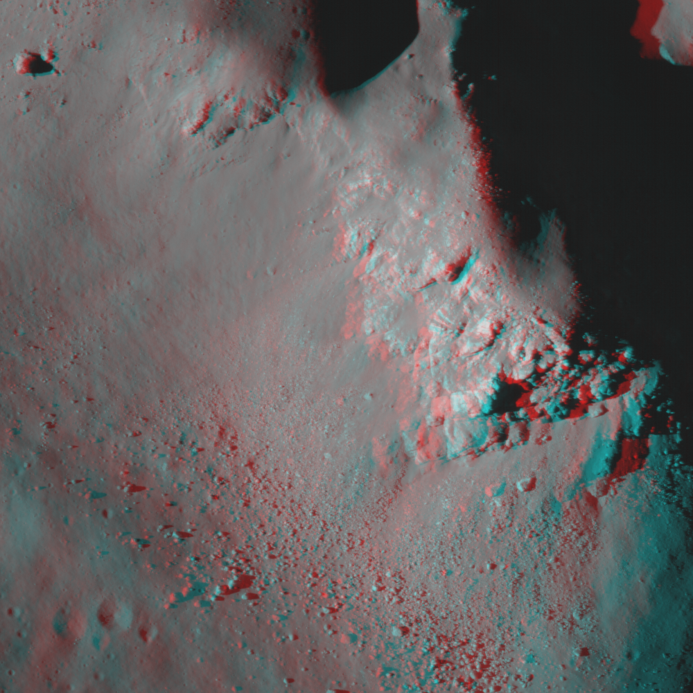
Anaglyph of the Featured Image, showing one of the central peaks of Copernicus. Viewing requires anaglyph "3D glasses," with a red lens on the left and blue on the right) [NASA/GSFC/Arizona State University].

Wednesday, September 29, 2010

Copernicus and the lunar timescale

Updated Wednesday September 29, 2010 1039 UT

LROC Narrow Angle Camera view of the southern rim of Copernicus, down-slope to upper left. (Original-size view, HERE.) The fragmented material demarcates the rough edge of the crater rim. The surface texture is still sharp and crisp, indicating a relatively young age (note the boulder tracks) 470 meter width from LROC NAC observation M129418341L, LRO orbit 4206, May 25, 2010; alt. 39.41 km, res. 47.2 cm/pixel, phase angle = 57.53 [NASA/GSFC/Arizona State University].

Mark Robinson
Principal Investigator
Lunar Reconnaissance Orbiter Camera
Arizona State University


Copernicus crater played a key role as pioneering lunar geologists Gene Shoemaker and Robert Hackman unraveled the basic stratigraphy of the Moon fifty years ago. Stratigraphy is the science of determining relative ages of geologic materials by observing overlapping relationships between different geologic units. What is a unit? In the case of the Moon, the most basic geologic units include crater ejecta, mare basalt, volcanic ash, and the ancient highlands crust. Dr. Shoemaker and his colleagues noted that rays from different craters exhibited a range of albedos, from the very bright (Aristarchus crater) to the barely visible (Copernicus crater).


Copernicus (9.7°N, 340.0°E) in late afternoon. (Larger view) LROC Wide Angle Camera mosaic (LROC WAC Previewer (v.1.16), Microsoft ICE) from six LRO orbital passes (orbits 2466-2471) January 8, 2010 [NASA/GSFC/Arizona State University].

They correctly inferred rays fade with time, as they are sand blasted by micrometeorite impacts and exposed to the relentless effects of solar wind, cosmic rays: processes often referred to as “space weathering.” By tracing the path of rays, relative ages of many units can be easily determined.


LROC Wide Angle Camera mosaic showing Copernicus crater (L), Eratosthenes (R) along the southern rim of the vast Mare Imbrium impact basin. Ejecta of Copernicus cross over Eratosthenes, showing Copernicus is younger. Image field of view is ~400 km, north is up [NASA/GSFC/Arizona State University].

Just to the east of Copernicus crater is another key crater that in the lunar stratigraphic story revealed by Shoemaker and colleagues, Eratosthenes (58 km diameter). The two neighboring craters look very similar in terms of the freshness of morphological features (rim, walls, central peak), however Eratosthenes has no rays – they have completely faded into the background. The fact that Eratosthenes has no rays shows it is older than Copernicus, but the fact that its form is still sharp indicates that it is not so old that smaller impacts have worn it down. So Eratosthenes is "middle aged" in the lunar timescale. When the lunar timescale was unraveled, scientists had no samples from the Moon so they could not accurately determine the absolute ages of the geologic units they identified.


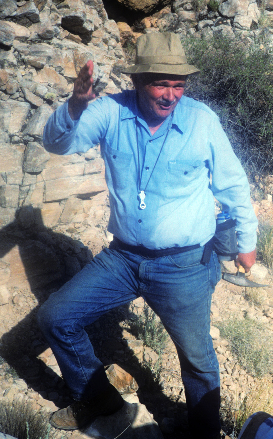
Gene Shoemaker (1928-1997) made many major contributions to planetary science. One of his most significant was deducing and proving that Meteor Crater in Arizona was formed as the result of an asteroid slamming into the Earth. Here he is seen enthusiastically telling the story of Meteor Crater to a new generation of planetary scientists while perched on the steep interior walls of the crater [Photo by Mark Robinson].

Later, material believed to be Copernicus ejecta was sampled by Apollo 12 astronauts, and these samples were radiometrically dated to be close to 800 million years old. 800 million years old is certainly an ancient age by terrestrial standards but is a relatively young age for the Moon. We have no samples from Eratosthenes and thus its absolute age is inferred from counts of smaller craters that have formed on its ejecta and interior. To this day, our knowledge of the ages of the Copernican and Eratosthenian units are poorly constrained. Obtaining samples of key areas within these two periods is a high priority amongst lunar scientists.


Farther down the terraced walls toward the crater floor, boulders of variable sizes are eroding out of the steep slopes. Many boulders are precipitously sticking out of the crater walls, such as the ~50 m boulder in the lower right. Erosion has completely freed some boulders, as evidenced by the boulder trail in the upper right. Downslope direction is toward the upper left, image field is 470 m [NASA/GSFC/Arizona State University].

As scientists learned more about the Moon from Lunar Orbiter and Apollo missions, the lunar timescale was refined. However, the Shoemaker and Hackman work still stands as our basic understanding of lunar stratigraphy. To learn more on lunar stratigraphy and other aspects of lunar geology, you can consult Don Wilhelm’s tome “The Geologic History of the Moon”. It is a serious read, but summarizes much of what we know about the Moon from a historical geology point of view. Certainly, the exciting results from LRO and three recent international missions (SELENE/Kaguya, Chang’E-1, and Chandrayaan-1) will provide many opportunities to revise past ideas! Perhaps Dr. Wilhelms will revise his masterpiece in the near future?

Explore the well-preserved impact landforms of Copernicus crater in the full NAC image and the WAC mosaic.


As an appropriate segue, a look at Shoemaker crater, once part of the stubbornly elusive, nearly completely shadowed terra incognitia near the Moon's South Pole. The South Pole LROC WAC mosaic below shows Shoemaker in visible light, while this 2009 image show the area, really for the first time, in star light, data collected by the Diviner instrument, also on-board LRO. Shoemaker became an even more fitting tribute to Dr. Shoemaker as final resting place for at least a portion of his remains which were deorbited here with Lunar Prospector, July 31, 1999. [NASA/GSFC/UCLA].