Showing posts with label central peak. Show all posts

Thursday, December 12, 2013

Bowl of Boulders in Steno Q

NAC_ROI_STENO_Q_LOA_thumb-580x820
Boulders collect in a small depression right in the middle of the central peak cluster of Steno Q crater (20.063°N, 157.728°E) . Some of these boulders are as big as houses. Field of view 870 meters, portion of NAC controlled mosaic, illumination from the southeast [NASA/GSFC/Arizona State University].
J. Stopar
LROC News System

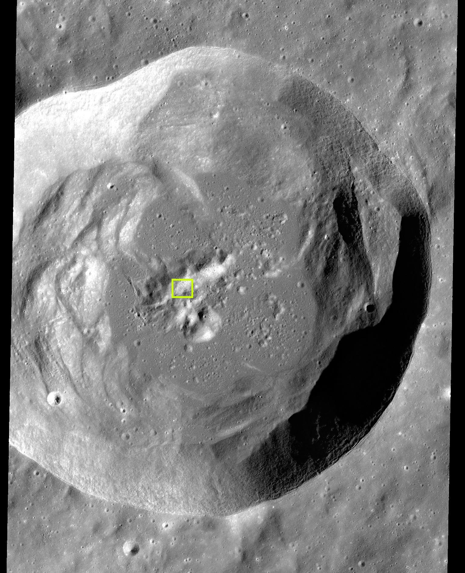
Steno Q is a 32 km diameter crater located in the highland terrain east of Mare Moscoviense. Impact craters, including Steno Q, are formed through a three-stage process consisting of: 1) contact and compression, 2) excavation, and 3) modification.

The initial crater cavity is formed during the excavation stage; during this stage, the excavated material is ejected from the crater, leaving a roughly bowl-shaped void. During modification, the last stage, the shape of the crater cavity adjusts as a function of planetary gravity and scale of impact. For larger impacts, a complex crater shape is formed as a result of a large degree of crater modification: the walls of complex craters slump through gravitational instability, a central peak forms through rebound, and impact melt and debris collect in the crater floor. Typical of other similarly sized Copernican age craters (those younger than 1 billion years), Steno Q preserves a central peak, steep walls with large slump blocks, and a sizeable pond of solidified impact melt rocks covering the lowest parts of the crater cavity.

Explore more complex craters around the Moon at the following LROC Featured Image posts: "Terraces in Eratosthenes Crater," "Not your average complex crater," "Impact melt features in Tycho craters floor," "Aitken Central Peak, Seen Obliquely," "Icarus," "Copernicus Central Peak From The West."

stenoQ_centralpeak-1086x1000
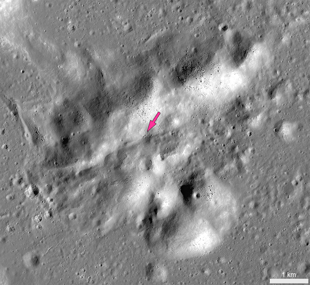
Central peak of Steno Q crater, with the location of the "Bowl of Boulders" shown at high-resolution in the LROC Featured Image indicated by the arrow [NASA/GSFC/Arizona State University].
Today's Featured Image closely examines part of the central peak of Steno Q, roughly 10 kilometers wide and consisting of mountains more than 2000 meters high.

The crests of several of these mountains are blocky and composed of highly stressed and fractured materials from the deepest part of the crater. Over time, boulders perched on these steep slopes can roll downhill as a result of seismic tremors and the shaking caused by nearby impacts. A small depression near the middle of the central peak preserves a collection of boulders accumulated from upslope.

Some of these boulders are more than 20m wide -- as big as a house. To get an idea of just how big that is, watch this video, HERE, of Apollo 16 astronauts Charles Duke and John Young approaching similarly-sized "House Rock," on the rim of North Ray crater.

Charlie Duke samples a shatter cone formation in "Outhouse Rock," a large fragment shed off the southern end of "House Rock," during the third and final EVA of Apollo 16 in 1972. Note the accumulation of lunar dust after totaling 20 hours on the lunar surface. (AS16-116-18649) [John Young/NASA/JSC/ALSJ].
At Steno Q, trails of the most recent boulder falls indicate the source of the material upslope. Boulder accumulations like this provide a unique opportunity for future explorers to collect a variety of materials derived from potentially inaccessible areas, like steep mountain peaks or the deepest components of the original surface excavated by the crater-forming impact.

stenoQ_context1-1535x1892
Complex crater Steno Q, (32 km, 29.063°N, 157.728°E). Typical of lunar craters of this size, Steno Q underwent extensive crater modification during the impact process, including wall slumping, central peak uplift and impact melt ponding. The box encompasses the field of view in the LROC Featured Image released December 12, 2013 [NASA/GSFC/Arizona State University].
The images in this post were derived from a 1.5 meter per pixel-scale LROC NAC controlled mosaic -- allowing users to explore the entire Steno Q crater, HERE.

Related LROC Posts:
Bouncing, Bounding Boulders!
Boulder trails in Menelaus crater
Rolling Rolling Rolling
Boulder Tales
Bounce, Roll, and Stop
Lazy Boulders in Scaliger Crater
A Recent Journey

Tuesday, November 19, 2013

Tsiolkovskiy's Central Peak

Oblique Close-Up Tsiolskovskiy's Central Peaks
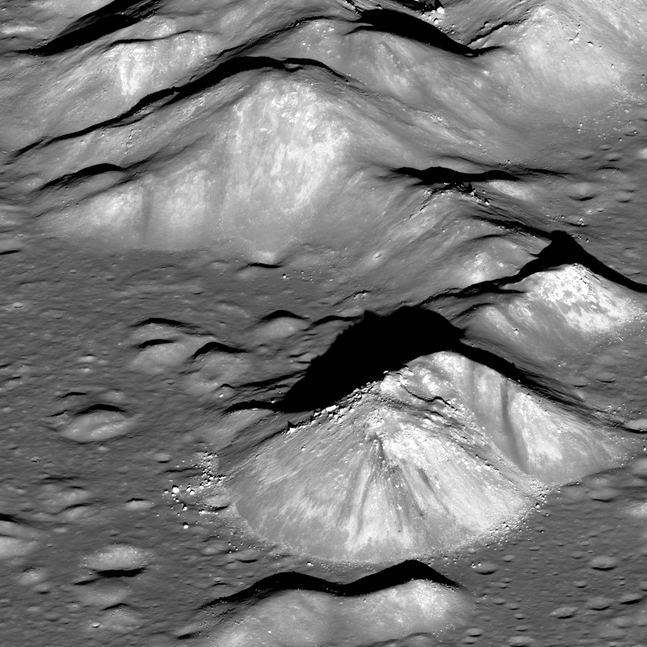
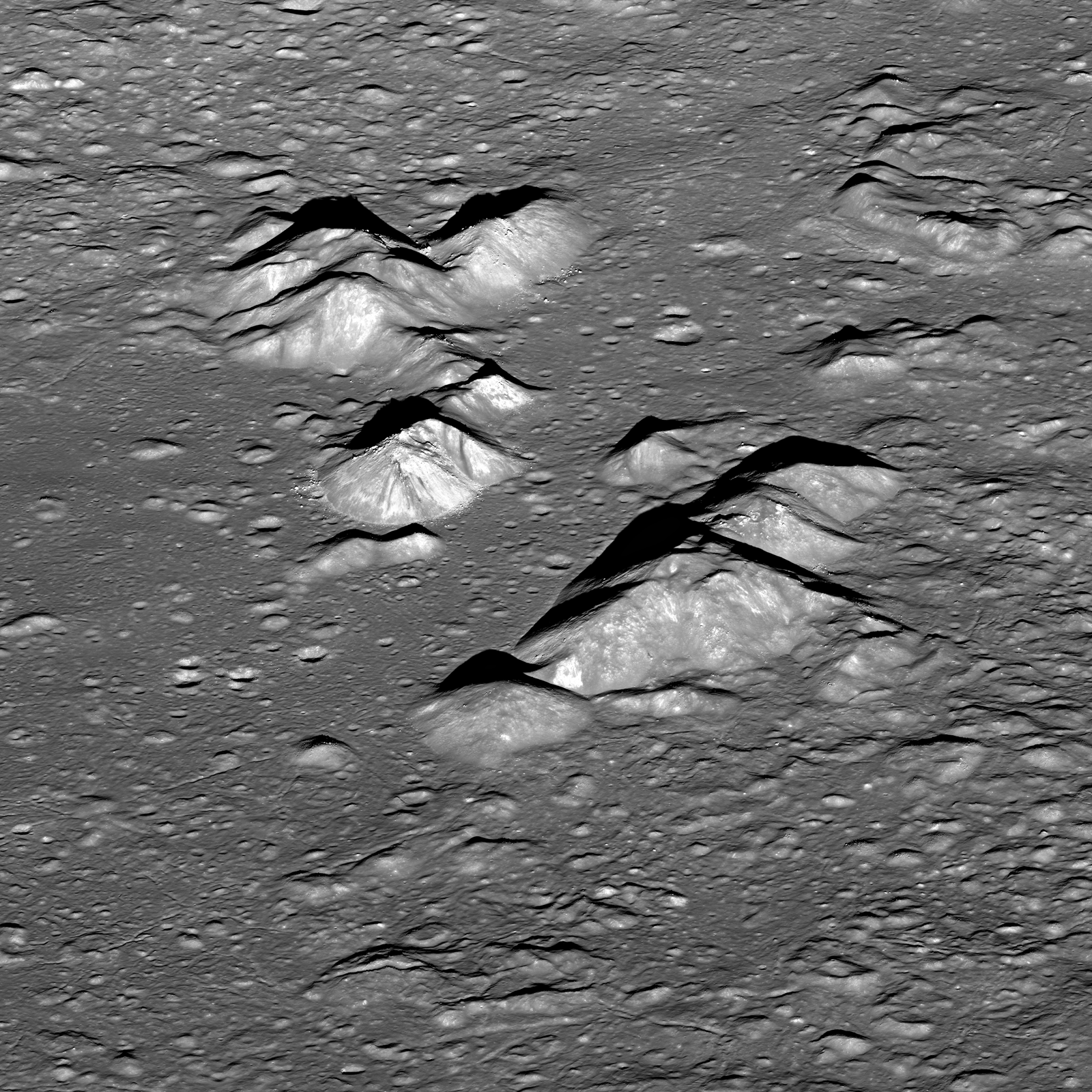
LROC Narrow Angle Camera (NAC) oblique mosaic M1098059280LR (orbit 14176, July 27, 2012; angle of incidence 60.08°), the central peak of farside landmark Tsiolkovskiy crater. The image field of view is approximately 25 km across, the central peak rises 3.4 km above the mare-inundated crater floor.  Spacecraft and camera slewed 64° far east of nadir, capturing the dramatic scene from 87.66 km over 20.44°S, 121.42°E [NASA/GSFC/Arizona State University].
Raquel Nuno
LROC News System

Today's Featured Image is a spectacular LROC NAC oblique view looking East at the central peak of Tsiolkovskiy crater. This large impact crater, with a diameter of 185 km, is located on the farside at 20.38°S latitude and 128.97°E longitude.

It is classified as a complex crater because of its terraced walls, scalloped rim, and central peak, which rises over 3400 m (11,150 ft) from the crater floor.

Central peaks of craters form in a matter of seconds from very energetic impact events. The tremendous pressure imparted from the impactor on to the target rock causes it to behave like a plastic for a few brief seconds. An imperfect analogy is a water droplet splashing into water, at first which produces a central jet, the fluid-like behavior of rock after the impact causes it to rebound upwards. Another factor assisting in the uplift of a central peak is the gravitational collapse of the crater walls which pushes material in the center upwards.

LROC interferometry and LOLA (laser altimeter) data, a brief tour of an advanced lunar Digital Elevation Model (DEM), in the vicinity of Tsiolkovskiy crater. "Tour of the Moon, Additional Footage," Science Visualization Studio [NASA/GSFC/SVS/ASU].

The floor of Tsiolkovskiy crater is partially flooded by mare basalt, which is the low reflectance smooth material seen in both the Featured Image above and the WAC context image below. The mare basalt on the floor of Tsiolkovskiy crater formed from basaltic lava that erupted after the crater formed and pooled. Mare basalts are predominantly seen on the lunar nearside; they make up the dark plains we are familiar with when we look at the Moon. This uneven distribution of mare basalts is thought to be due to the difference between the crustal thickness on the nearside and farside. The nearside crust is thinner, allowing easier access for basalt to flow up to the surface, whereas the thicker crust on the farside makes it so that only large impacts, like the one that formed Tsiolkovskiy crater, have enough energy to excavate deep enough into the crust to allow the release of basaltic lava.

Tsiolkovskiy Crater
Nearly every feature visible in the NAC oblique mosaic above is visible in this 50 km wide field of view captured from almost directly overhead. LROC Wide Angle Camera (WAC) monochrome (643 nm) observation M49675737CE, spacecraft orbit 7191, January 14, 2011; angle of incidence 74° at 78.4 meters per pixel resolution, from 57.15 km [NASA/GSFC/Arizona State University].
Tsiolkovskiy Crater
Deeper context from a mosaic of orbital passes, as the Moon rotated under the polar orbit of LRO shows the peaks emerging from it's distinctive (for the farside) mare-flooded floor. Terraced walls, slump and hummock of the complex crater come into view in this 145 km-wide field of view [NASA/GSFC/Arizona State University].
It's difficult to step back far enough to grasp the area affected by this super-positioned impact in the farside southern highlands. This context image originally helped illustrate "Tsiolkovskiy central peaks at sunset," July 3, 2013 [NASA/GSFC/Arizona State University].
Tsiolkovskiy Crater
On the left, LROC WAC monochrome mosaic centered at 120 degrees East longitude. On the right, LROC WAC context image of Tsiolkovskiy crater [NASA/GSFC/Arizona State University].

Tsiolkovskiy Crater
Tsiolkovskiy easily stood out, a rare dark spot highlighting the surprising differences between the Moon's near and its farside when it was first photographed by the Soviet Union's Luna 3 in 1959. This LROC WAC mosaic, centered on 180° and the equator, was among the first LROC Wide Angle Camera images released. Tsiolkovskiy is marked by the arrow [NASA/GSFC/Arizona State University].
The Tsiolkovskiy Crater was a Constellation Program region of interest because of the possibility to study the central peak, where astronauts could sample rocks that came from deep beneath the lunar surface.

Explore Tsiolkovskiy's central peak from an orbiting astronaut's perspective, HERE.

Related Posts:

Wednesday, May 29, 2013

Alien materials found in lunar crater! (Film at Eleven)

Central peaks of Copernicus - covered by fairy dust? -- From oblique LROC Narrow Angle Camera (NAC) mosaic M193025138LR, LRO orbit 13472, May 30, 2012; field of view is a 1350 pixel section from a spectacular LROC mosaic revealing the 90 km-wide interior of the landmark lunar crater, HERE [NASA/GSFC/Arizona State University].
Paul D. Spudis
The Once and Future Moon
Smithsonian Air & Space


Accuracy in scientific reporting (and thus the education of the public) is wholly dependent on a reporter’s understanding of the material they’re covering.  Making a reporter’s job even more challenging is the fact that some research results themselves can be misleading.  
A variant of my post title above appeared recently over a story reporting the results of a paper published in the journal Nature Geoscience.  That study used computer modeling to simulate the effects of a low velocity impact on the Moon.  Computer models of natural phenomena are made in an attempt to understand complex processes that we could otherwise not be able to address.

To briefly set the stage on this new work, we believe that the vast majority of craters on the Moon and planets are formed by the collision of solid objects with these bodies.  These impacts occur at very high speeds; on the Moon, the average velocity of impact is about 20,000 meters per second.  At such speeds, geological materials will vaporize and the mechanics of the formation of a crater are complex.  These results have been painstakingly described through laboratory and field studies of both natural and artificial impact craters of a wide range of sizes.

Because we needed to fully understand the mechanics of impact cratering to understand the record in the Apollo lunar samples, much work was conducted toward characterizing the physical and chemical effects of impact on typical rocks.  Because impact velocities are typically high, there is little preservation of the projectile in impact craters.  Most of the impactor is vaporized and this super-hot silicate vapor is partly lost to space and partly incorporated into the shock melted rocks of the crater interior.
"For every problem there is a solution that is simple, elegant and wrong." - Mencken

The soils returned from the Apollo missions contained a recognizable fraction of material that must have been added by the impacting objects that created its craters.  In most soils, this fraction is on the order of a few weight percent.  Interestingly, this “meteoritic component” tends to be defined chemically and actual fragments of meteorite in the lunar soil are extremely rare.  This observation would seem to support the notion that most of the impacting debris is vaporized at impact and does not occur as fragments on the surface.

However, the speed of impacting projectiles cited above is an average speed, meaning that while some impacts occur at higher velocities, others must occur at lower speeds.  As the encounter velocity decreases, there is an increasing likelihood that some portions of the impacting fragments might be preserved on the surface.  It is this last possibility that the new paper considers.  The authors modeled the effects of the impact of a relatively slow-moving body with the Moon and found that more fragments of the object are preserved than in high velocity impacts.  Moreover, by tracing the paths of impactor particles during cratering flow, they find that much of this preserved material ends up on or near the central peak of the resulting crater.

That last finding is interesting because in remote sensing studies of the lunar surface, it is in the central peaks where we find “unusual” compositions, in the sense that those compositions are different from the average upper lunar surface.  The traditional explanation for this relation is that because central peaks are derived from well below the impact target, they are exposing deep-seated compositions (lower levels of the crust of the Moon contain different rock types than occur on the surface).  The study’s new interpretation suggests instead that the central peaks are covered in debris from the impacting projectile.

One problem with this interpretation is that the “debris covering” of central peaks should occur in a distinct minority of craters (i.e., those created by low velocity impacts).  But the exposure of unusual compositions within central peaks of lunar craters is quite common and occurs globally.  Moreover, there are as many impacts at higher velocity as at lower velocity.  Yet slow impacts would produce less total volume of impact melt and most of the central peak craters on the Moon have abundant melt deposits.

M1098059280LR-NSJ-58ax-33p-2450x3380
Central peaks of the farside landmark crater Tsiolkovskiy, from over 200 km to the west of the highest promontory. The large, mare-inundated impact crater was very unlikely to have been formed by a "low-velocity" collision.  A highly reduced in scale crop from a LROC NAC mosaic, M1098059280, orbit 14176, July 27, 2012; resolution between 4.6 and 5.3 (background) meters, from 87.66 km over 20.44°S, 121.42°E. Enlargement, HERE [NASA/GSFC/Arizona State University].

The most serious flaw in the new study is the assumption that the “unusual minerals,” olivine and spinel (found in many central peaks), are rare on the Moon. They are not rare; although spinel is somewhat sparse on the lunar surface (requiring high pressure for its formation), it has been described as present in lunar rocks from the first sample return and more recently has been found in remote sensing data of impact basin deposits. 

Olivine is a very abundant mineral on the Moon and typically makes up a significant fraction of the dark mare basalts (including some lavas that consist only of olivine and glass.)  Olivine is also not uncommon in highland rocks, usually occurring within the rock type troctolite, a 50-50 mixture of olivine and plagioclase.  The presence of olivine does not indicate either “deep” origins or “lunar mantle” provenance; virtually all olivine in lunar samples has high calcium content, indicating a relatively shallow origin (probably in magmas that crystallized within a few kilometers of the surface). 

In short, there is no compelling reason to believe that the central peaks of many lunar craters are dusted with exotic minerals from asteroids, although such a possibility is certainly not excluded.  The minerals that we see in central peaks are all indigenous to the Moon and in some cases, abundant in the lunar crust.

Computer modeling in science has both value and pitfalls.  An impact event is extremely messy and complicated.  Simultaneously, gigantic shock pressures and temperatures occur, putting billions of particles in motion.  Computers are good at keeping track of these particles and the codes developed to model complex, multi-variable phenomena have been shown to at least partly describe the behavior of crater formation on Earth.  However, the results of computer models must be interpreted cautiously; small changes in input variables or the conditions of the simulation sometimes result in drastic changes in the output of the model.  In addition, there is a tendency in science to believe in numbers, regardless of their provenance.  Because a model holds together does not mean that it describes reality.

In science, it is dangerous to embrace a model because it “works” (i.e., comes to closure).  Much of the current fracas over human-induced climate change comes from those who contend that the results of computer models constitute “settled science” (whatever that is).  Because the computer models say that it may happen, people assume (and some journalists report) that it is happening.  In actual fact, we have no direct observational evidence that human-caused emissions of carbon dioxide are causing the climate to change.  That conclusion comes from computer models that “show” (project) that humanity’s introduction of “excess” carbon dioxide into the atmosphere by industrialization will increase the magnitude of the greenhouse effect and raise the mean global temperature.  But climate (like impact) is a complex, chaotic phenomenon and we still do not fully understand how the Earth’s atmosphere interacts with itself and the cosmos.

In questions of complex natural processes, beware of accepting the results of computer modeling too easily.  Computer models are useful tools, but the old software adage of “garbage in, garbage out” still applies.  Be familiar with whom and from where the information comes, understand how it is processed and then carefully consider the likelihood of reported accounts.

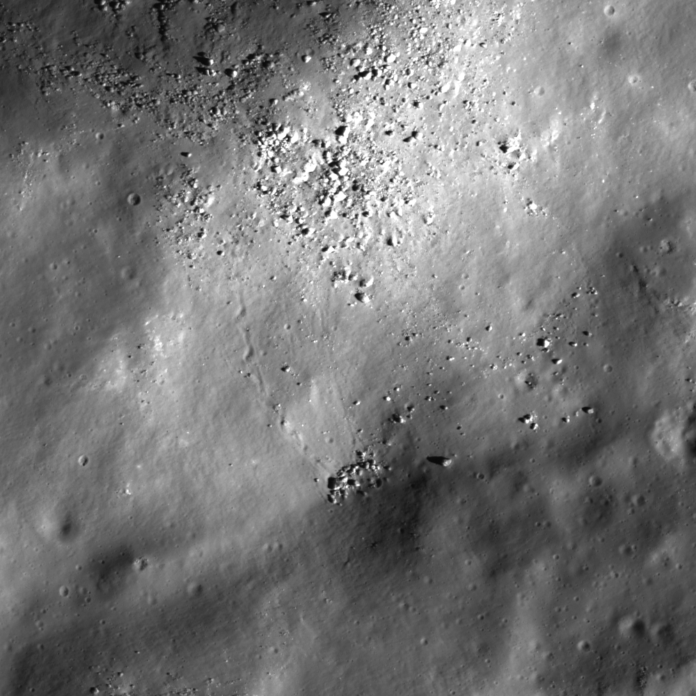
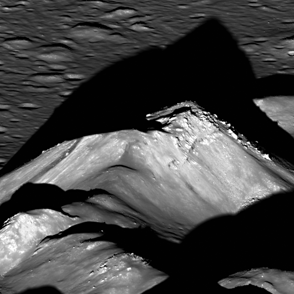
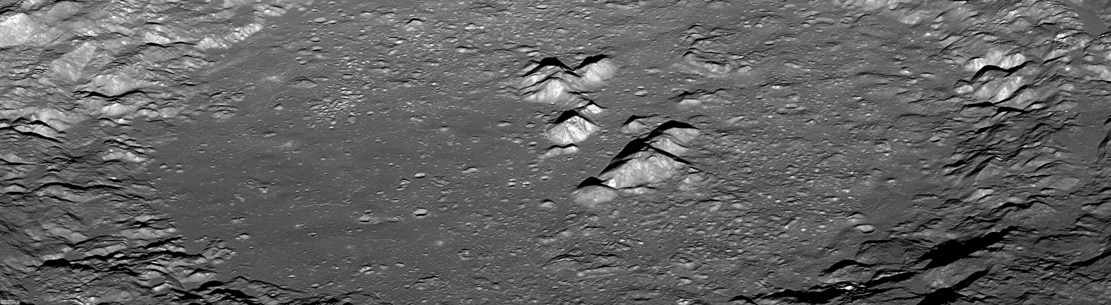
Originally published May 29, 2013 at his Smithsonian Air & Space blog The Once and Future Moon, Dr. Spudis is a senior staff scientist at the Lunar and Planetary Institute. The opinions expressed are those of the author but are better informed than average.

Wednesday, December 26, 2012

New oblique view of Tsiolkovskiy central peak

The prominent, very distinctive central peaks of farside Tsiolkovskiy crater, from a new, scaled mosaic of the left and right frames of LROC Narrow Angle Camera (NAC) observation M1098059280, spacecraft orbit 14176, July 27, 2012; resolution between 4.6 and 5.3 (top) meters per pixel, captured 87.66 km over 20.44°S, 121.42°E, a point over 200 km west of the highest promontory. Larger versions available HERE  [NASA/GSFC/Arizona State University].
Joel Raupe
Lunar Pioneer

Each quarterly release of LROC data to the Planetary Data System (the twelfth, on December 15, covers the three months between mid-June and September), is not really complete until the KML index emerges, for viewing through Google Earth's lunar simulation.

Fortunately, the Lunar Reconnaissance Orbiter Camera (LROC) team made available to the public an incredibly useful set of improvements to their Web Map Server (WMS) Image Search tool, something that was already a real complimentary companion to the newer LROC QuickMap tool. Playing with the layers and search capabilities of the new tool, while studying the LUNAR landing site study, was enough to keep us busy.

The KML data are a fast and intuitive way yet to search directly for LROC NAC images, especially those with exceptionally high slew angles, the few oblique images. And the latest KML files appeared on the Massachusetts Institute of Technology servers December 21.

Since the very first grainy, misunderstood images of the Moon's far side were returned to Earth by the Soviet Union in 1959, Tsiolkovskiy immediately stood out, strongly underscoring the remarkable differences between the tidally locked hemispheres. LROC Wide Angle Camera (WAC) context view of the most conspicuous mare-flooded surface on the lunar farside, 185 km Tsiolkovskiy crater [NASA/GSFC/Arizona State University].
The oblique views are rare. Off nadir NAC observations are of a lower scientific value, perhaps, than the job of completing the high-resolution photography of the entire Moon, a goal the LROC team is closing in on. My favorite targets for these oblique views are never in the new batches, but there's always one or two that are breathtaking and unexpected.

Last September LROC's 11th release included an oblique look into the interior of Antoniadi, for example, that was then included in our post highlighting oblique views of Engel'gardt heights. Antoniadi, as it turns out, figures prominently in the aforementioned landing site study. Follow-up posts on that Eratosthenian crater, well inside the very ancient South Pole-Aitken basin, are in preparation.

Among the new, few oblique views that really stand out in the twelfth release is an off-nadir view of the central peaks of Tsiolkovskiy, shown up above. The complete field of view here is a highly re-sampled (less than 8 percent) version of what was originally a 6204 by 8955 mosaic (of LROC NAC M1098059280LR, swept up last July). It's reduced down to 580 x 800, or the maximum size allowable in a blogger post.

Because we derive vast amounts of valued-added imagery, in an image-intense subject of study, this last limitation has become a nagging problem we would like to solve.

Quarter resolution view of the LROC NAC mosaic shows some of the glory of the wider view, the eastern range and summit, as well as some of the considerable slumping of the degraded northern section of Tsiolkovskiy central peak [NASA/GSFC/Arizona State University].
We would welcome recommendations and/or reviews of image hosting sites, most especially those that do not presume to arbitrarily substitute photography with lossy resampling. Meanwhile, a planned migration to a new host for this website has been delayed yet again.

A virtually full resolution view of a high promontory of the Tsiolkovskiy central peak, suffering from a foreshortening affect, partly the result of simple distance and the high lateral motion of the LRO spacecraft, more 200 kilometers away. Like a more dramatic LROC NAC view of the high place on the central peaks of Tycho, this view seems to show a large boulder sitting near its top, likely a rock that emerged from the upthrust after considerable mass wasting [NASA/GSFC/Arizona State University].
Perhaps the best off-nadir view of the central peak of Tsiolkovskiy crater, prior to this latest oblique LROC NAC observation, from among the HDTV stills of the crater captured by Japan's SELENE-1 (Kaguya) orbiter in 2008. The view is from well to the north [JAXA/NHK].
Like the oblique LROC NAC mosaic of the Moon's highest elevation at Engel'gardt, discussed here in early October, this latest view of Tsiolkovskiy took place while the area of interest was under a high Sun, and from a great distance. Thus the raw result is of low contrast, the details of relief given over to raw albedo. That, and the apparent lateral motion through a field of view made small by distance, results in a less than perfect aesthetically pleasing result. We will take what we can get before continuing with the work of putting together raw illustrations needed to offer posts about the LUNAR landing site study.

Another 'full-resolution' first look at the new Tsiolkovskiy central peak NAC mosaic, this section near the southern base, a good illustration of the affects of foreshortening, and lateral speed through a narrow window, and over a bright Sun-Subject-Spacecraft phase angle. Though their trails are not individually seen, the subject and scene shown above are near to the area shown at much higher resolution (from overhead) discussed in the LROC Featured Image post "Weaving boulder trails on the Moon," last July 11 [NASA/GSFC/Arizona State University].
Sample Posts regarding Tsiolkovskiy crater:

The Old and the Young at Tsiolkovskiy (October 31, 2012)
Weaving boulder trails on the Moon (July 11, 2012)
Bulging wrinkles at Tsiolkovskiy (January 11, 2010)
Regolith on Basalt (January 10, 2012)
Highland-Mare boundary of Tsiolkovskiy (September 29, 2011)
The Hummocks of Tsiolkovskiy (August 26, 2010)
More of Tsiolkovskiy's boulders and boundaries (August 26, 2010)
Small fractures in the mare floor of Tsiolkovskiy (August 25, 2010)
Tsiolkovskiy - Constellation Region of Interest (May 1, 2010)
Uplift, Boulders of Tsiolkovskiy (September 1, 2009)

Wednesday, July 18, 2012

LROC: Second new oblique of Copernicus central peaks, from the west...

West-to-east view of the Copernicus crater central peak complex. Detail from LROC Narrow Angle Camera (NAC) mosaic of M19666538lL & R, LRO orbit 13,981, July 11, 2012; general resolution is 4 meters.  [NASA/GSFC/Arizona State University].
Mark Robinson
Principal Investigator

Lunar Reconnaissance Orbiter Camera
Arizona State University

LROC captured this spectacular view of the heart of Copernicus crater just before (local) sunset, July, 11 2012. Compare it to the reverse view point snapped from the East near local sunrise, May 5.

LROC can only be slewed large angles while looking away from the Sun, otherwise its radiators are exposed to the hot Moon and the LROC Wide Angle Camera (WAC) optics are exposed to the Sun. So back-to-back obliques are not possible on the same day.

Full 920 pixel-wide LROC Featured Image, released July 18, 2012. The sharp boundary at the base of the 700 meter high peak in the foreground is a now frozen sea of impact melt that flooded the floor of the crater in its final stages of formation. Image field of view is approximately 8 km across [NASA/GSFC/Arizona State University].
Between May and July LRO passed over the terminator (boundary between night and day) and thus the direction to the Sun reversed, in terms of LRO. On that orbit the daylight side switched from one side of the Moon to the other, at least from the perspective of the spacecraft. For example if LROC had just completed mapping the nearside, as it crossed the terminator we skip the farside and start remapping the nearside!


Central peak with bouldery outcrops and streak seen from the east (top), and the west (bottom) [NASA/GSFC/Arizona State University].
Back to Copernicus, what are those dark streaks we see on the peak? In the comparison image above, and if you skip back to the earlier post that shows the other side, that dark streak is seen on both sides of the central peak, showing that it is three dimensional within the peak. Might it be a dark rock intruded as a dike into the light colored crystalline bedrock that was brought up from beneath the deepest part of the transient cavity in the Copernicus target? Or is it simply a dark rock that is eroding and slumping down the sides of the peak?

Reduced resolution view of the entire NAC view of Copernicus crater. View 1600 pixel-wide rendition, HERE [NASA/GSFC/Arizona State University].

Because of their state of preservation (despite being nearly a billion years old) and the identification of scientifically interesting mineralogy from remote sensing spectroscopy, the central peaks of Copernicus have long been coveted by lunar explorers as a prime location for a mission, including sample return. In fact, Copernicus was considered as an Apollo landing site, and was recently proposed as a target for a robotic rover within the Discovery program. To sample the peak you wouldn't need to scale the slopes - in the top image you can see many rocks and boulders that have rolled down from the summit, lying on the relatively flat floor waiting to be picked up.

Subsampled synoptic view of the central peak complex, field of view approximately 18 km across, the tallest peak rises more than 1300 meters above the floor. View the larger 1600 pixel-wide rendition, HERE  [NASA/GSFC/Arizona State University].

When and how will we first visit this fascinating, geologically rich area? Imagine the view astronauts will have as they descend to the floor and then step out at the base of this peak. Explore the full LROC NAC oblique mosaic release, HERE.

Previous LROC Featured Images highlighting Copernicus:

Copernicus - Looking Straight Down (June 28, 2012)

Thursday, June 28, 2012

LROC: Copernicus looking straight down

Fractures and a collapse crater within impact melt rock on the floor of Copernicus crater. LROC Narrow Angle Camera (NAC) medium resolution montage from greater than 100 kilometers, field of view width is roughly 1800 meters [NASA/GSFC/Arizona State University].
Sarah Braden
LROC News System
(The LROC) Featured Image (released June 28, 2012), a 1.8 meter per pixel mosaic of Copernicus (9.62°N, 339.92°E, 93 km in diameter), compliments (the) fantastic oblique view of Copernicus Crater (released June 27).(This) view, looking straight down, highlights the central peaks as well as terraces, impact melt pools, and melt fractures.

The opening image features a linear fracture with aligned pits within the impact melt deposit on the floor, and a crater which may have formed by collapse of impact melt (collapse pit rather than an impact crater). The fracture may have formed as a tube collapsed. Lava tubes commonly form within basaltic volcanoes on Earth, as part of an underground plumbing system that moves magma away from a vent. The same type of tubes and pits probably formed in lunar mare (also basalt). Should we expect lava tubes in impact melt deposits? There is much evidence for such in the NAC images collected over the past few years. 

The NAC revealed collapse pits, often aligned in rows, in many impact melt deposits. These pits are similar to collapse pits found in lava tubes on the Earth (often called skylights). In one case two collapse pits side-by-side resulted in a natural bridge! But how did they form? What caused the melt to flow after it ponded in the crater floor? Perhaps slumps of wall material into the melt caused large-scale displacements of still molten subsurface melt to flow. Or perhaps over months and years the crater floor rebounded while melt was still cooling beneath a crust. Both likely happened, so it is not a big surprise that melt moved in subsurface tubes for quite a while after the impact event.

Comparison of today's mosaic with the oblique image of the central peaks. Top of the images is west. Images are 34 km across [NASA/GSFC/Arizona State University].
The interior of Copernicus contains dramatic impact melt features. The image below (a subsampled portion of the full mosaic) shows a section of the northern wall of Copernicus. The top of the image shows the edge of an impact melt pool emplaced on a small terrace. At some point, a portion of melt escaped the terrace and the liquid rock carved curved, sinuous channels as it flowed down the wall. Towards the bottom of the image you can see where one of the flows stopped, spread out, and deposited some of the impact melt. 

Impact melt flowed from terraces down the north wall of Copernicus, leaving behind curved channels. Field of view is 6480 meters [NASA/GSFC/Arizona State University].
The subsampled mosaic shows a dramatic view of the impact melt in Copernicus crater's floor. The melt in the eastern portion of the image shows several mounds, while the melt on the western half of the mosaic is noticeably smoother. Several terraces at different elevations along the northern wall also have melt ponds. How does Copernicus crater's impact melt compare to other large craters? Tycho crater has a similarly large sheet with a mix of chaotic and smooth melt. As does King crater, Necho crater, Giordano Bruno crater, and almost every other Copernican aged crater larger than 1 km in diameter!

Subsampled version of the Copernicus mosaic. Image field of view 36.5 km across [NASA/GSFC/Arizona State University].
Explore the entire Copernicus mosaic! And compare with the Copernicus peak oblique from yesterday's Featured Image. The mosaic images were taken only 8-10 orbits after the oblique image of Copernicus to maintain similar viewing geometry, making visual comparisons even easier!

Related Posts:

Failed Skylights of Copernicus (January 24, 2012)
The smooth anomaly in Copernicus (September 29, 2010)
Copernicus (September 23, 2010)
LOLA's Copernicus (April 23, 2010)

Wednesday, June 27, 2012

LROC: New oblique of Copernicus' central peaks

The central peaks of Copernicus crater cast a long shadows to the west over a crater floor that was flooded with impact melt that cooled and hardened to form this spectacular landscape. LROC NAC M193025138LR, image field of view is a 1350 meter section from this spectacular, new oblique mosaic showing the entire 90 km-wide interior of Copernicus, HERE [NASA/GSFC/Arizona State University]
Sarah Braden
LROC News System
 
On May 5th, 2012 LRO slewed 63° to capture this LROC image of the interior of Copernicus crater (9.62°N, 339.92°E, 93 km in diameter). The central peaks immediately capture your eye, with the tallest peak rising one kilometer above the floor of the crater. For comparison, the Grand Canyon has an average depth of 1.6 km. During the impact that formed Copernicus crater, an unimaginable amount of kinetic energy was transferred instantaneously into the surface. After the excavation stage of the impact, the initial transient crater collapsed under the force of gravity causing the crater rim to move inward, and the central region rebounded (uplifts) to form the central peaks! Central peaks only form in craters larger than 15-20 km in diameter on the Moon. The rock that forms the central peak originates from the greatest depth of all the material excavated by the crater. For that reason, scientists are very interested in the composition of central peaks, since the material tells us what lies deep beneath the surface of the lunar crust; studying central peaks of large craters is therefore one of the best ways, absent returned samples, to probe the composition of the lunar interior. Recent remote sensing studies using Moon Mineralogy Mapper spectra confirmed the presence of relatively unusual olivine-rich material in the central peaks of Copernicus. Are we sensing the upper portions of the mantle, or magma chambers that formed in the crust?

Rough vector of the view over the central peaks seen in the LROC Featured Image, released June 27, 2012. From LROC WAC observation M147109260C, orbit 6813, December 16, 2010; resolution 60.3 meters per pixel at an incidence angle of 78° from 43.13 kilometers [NASA/GSFC/Arizona State University].
Context image of Copernicus crater. The Featured Image is approximately bounded by the red box. Copernicus crater is 93 km in diameter, and the image width is 120 km [NASA/GSFC/Arizona State University].
Copernicus crater also plays an important role in our understanding of the lunar geologic timescale. Scientists use the basic principles of stratigraphy and superposition to define relative ages for geologic terrains and features. Rays are young lunar features, and any geologic unit covered by a ray of Copernicus must be relatively older than the crater itself. In fact Copernicus crater is defined as the beginning of the youngest period of lunar geologic history, the Copernican period. But how young are Copernican materials? It wasn't until the first samples were brought back from the Moon, from the Apollo and Luna missions, that scientists were able to tie relative ages to absolute time within the lunar timescale. It is likely that Apollo 12 astronauts sampled material ejected from the impact that formed Copernicus crater. These samples were radiometrically age dated to be close to 800 million years old! So all materials mapped stratigraphically as Copernican are younger than 800 million years. Of course the sample collected at the Apollo 12 site is thought to be from Copernicus crater, not known to be. Many craters are much younger, so you can think of Copernicus as the oldest young crater on the Moon (see yesterday's LROC Featured Image on Giordano Bruno crater).

Copernicus crater was a candidate landing site for the Apollo 18 lunar landing mission, which was unfortunately cancelled. The Constellation Program also designated Copernicus crater as a region of interest. So perhaps in the future astronauts will visit Copernicus crater, but when? In the meantime scientists are using LRO data to understand the complex geology of this important crater and plan future exploration.

The floor of Copernicus crater is covered with rock formed as a sea of impact melt froze. There are many cracks and pits that tell a story of how the once molten rock moved around in the crater floor, a topic for a future Featured Image. (See "Failed Skylights of Copernicus," January 24, 2012) Image width is 1350 m [NASA/GSFC/Arizona State University].
LROC took another oblique view of a much younger Copernican crater, Tycho (43.37°S, 348.68°E, 85 km in diameter), which is only about 110 million years old. Even though Tycho is smaller in diameter than Copernicus, the summit of Tycho's central peak is 2 km above the crater floor! That is twice as tall as Copernicus crater's central peak. The final form of a crater transitions with the size and speed of the impactor. Craters even larger than Copernicus do not have central peaks at all, but rather peak rings. You can compare the full resolution Tycho oblique view with the Copernicus oblique view.

Explore the entire amazing interior of Copernicus crater, HERE.

Related Images:
Second new oblique of Copernicus central peaks, from the west (July 18, 2012)
Copernicus - Looking Straight Down (June 28, 2012)
Absolute Time
Central Peak of Copernicus Crater
Copernicus Crater and the Lunar Timescale
A Path Not Taken

Failed Skylights of Copernicus (January 24, 2012)
The smooth anomaly in Copernicus (September 29, 2010)
Copernicus (September 23, 2010)
New views of the Copernicus interior (May 5, 2010)
LOLA's Copernicus (April 23, 2010)