Showing posts with label Carle Pieters. Show all posts

Tuesday, December 10, 2013

Strong hints of mixing seen in South Pole-Aitken M3 data

LROCNAC-bhabha_cpeak-1200
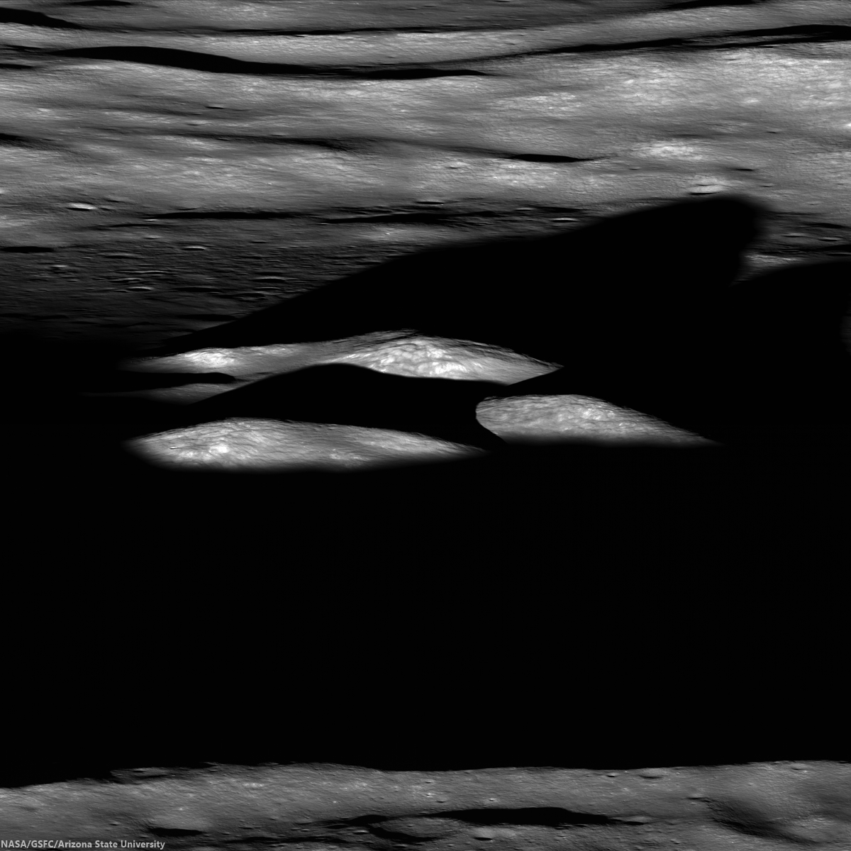
Last rays striking the central peaks of Bhabha crater, near the center of South Pole-Aitken basin, an oblique view from the west. LROC Featured Image, "Bhabha sinks into the shadows," July 21, 2010 [NASA/GSFC/Arizona State University].
PROVIDENCE, R.I. [Brown University] — Researchers from Brown University and the University of Hawaii have found some mineralogical surprises in the Moon’s largest impact crater.

Data from the Moon Mineralogy Mapper (M3) that flew aboard India’s Chandrayaan-1 lunar orbiter shows a diverse mineralogy in the subsurface of the giant South Pole Aitken basin. The differing mineral signatures could be reflective of the minerals dredged up at the time of the giant impact 4 billion years ago, the researchers say. If that’s true, then the South Pole Aitken (SPA) basin could hold important information about the Moon’s interior and the evolution of its crust and mantle.

The study, led by Brown graduate student Dan Moriarty, is published in online early view in the Journal of Geophysical Research: Planets.

At 2,500 kilometers across, the SPA is the largest impact basin on the Moon and perhaps the largest in the solar system. Impacts of this size turn tons of solid rock into molten slush. It has been assumed generally that the melting process would obliterate any distinct signatures of pre-existing mineralogical diversity through extensive mixing, but this latest research suggests that might not be the case.

LROCWACDTM-SPA-tour
South Pole-Aitken basin, with Bhabha and Leeuwenhoek craters noted, and more easily seen in the full resolution view, HERE [NASA/GSFC/SVS].
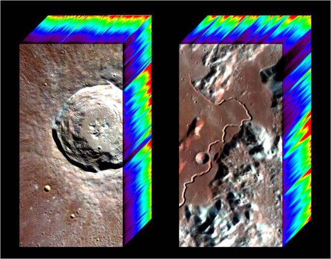
The study looked at smaller craters within the larger SPA basin made by impacts that happened millions of years after the giant impact that formed the basin. Those impacts uncovered material from deep within the basin, offering important clues about what lies beneath the surface. Specifically, the researchers looked at the central peaks of four craters within the basin. Central peaks form when material under the impact zone rebounds, forming an upraised rock formation in the middle of the crater. The tops of those peaks represent pristine material from below the impact zone.

Using Moon Mineralogy Mapper data, the researchers looked at the light reflected from each of the four central peaks. The spectra of reflected light give scientists clues about the makeup of the rocks. The spectra showed substantial differences in composition from peak to peak. Some crater peaks were richer in magnesium than others. One of the four craters, located toward the outer edge of the basin, contained several distinct mineral deposits within its own peak, possibly due to sampling a mixture of both upper and lower crust or mantle materials.

The varying mineralogy in these central peaks suggests that the SPA subsurface is much more diverse than previously thought.

“Previous studies have suggested that all the central peaks look very similar, and that was taken as evidence that everything’s the same across the basin,” Moriarty said. “We looked in a little more detail and found significant compositional differences between these central peaks. The Moon Mineralogy Mapper has very high spatial and spectral resolution. We haven’t really been able to look at the Moon in this kind of detail before.”

The next step is figuring out where that diversity comes from.

M1124763264LR-NSJ-0603-580x1200-61p-2800x5793
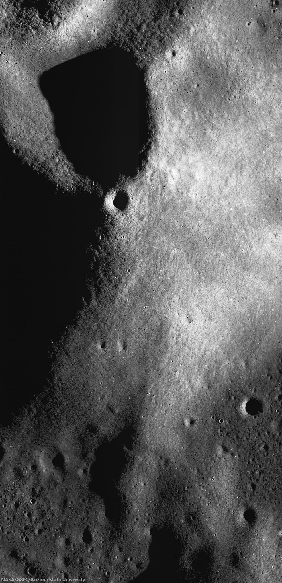
High-resolution view of small crater superpositioned on the south central peaks of Leeuwenhoek crater. Chandrayaan-1 Moon Mineralogical Mapper (3M) data studied by researchers at Brown University demonstrates evidence that lunar mantel was upthrust and exposed when Leeuwenhoek formed, perhaps close to the original transitory crater rim of 4.2 billion year old South Pole-Aitken basin. LROC NAC mosaic M1124763264RL, LRO orbit 17925, June 1, 2013; sunrise angle of incidence 83° resolution roughly 1.6 meters per pixel from 77.84 km [NASA/GSFC/Arizona State University].
It’s possible that the distinct minerals formed as the molten rock from the SPA impact cooled. Recent research from Brown and elsewhere suggests that such mineral formation in impact melt is possible. However, it’s also possible that the mineral differences reflect differences in rock types that were there before the giant SPA impact. Moriarty is currently undertaking a much larger survey of SPA craters in the hope of identifying the source of the diversity. If indeed the diversity reflects pre-existing material, the SPA could hold important clues about the composition of the Moon’s lower crust and mantle.

“If you do the impact scaling from models, [the SPA impact] should have excavated into the mantle,” Moriarty said. “We think the upper mantle is rich in a mineral called olivine, but we don’t see much olivine in the basin. That’s one of the big mysteries about the South Pole Aitken basin. So one of the things we’re trying to figure out is how deep did the impact really excavate. If it melted and excavated any material from the mantle, why aren’t we seeing it?”

If the impact did excavate mantle material, and it doesn’t contain olivine, that would have substantial implications for models of how the Moon was formed, Moriarty said.

8-SPA-meltpool-787
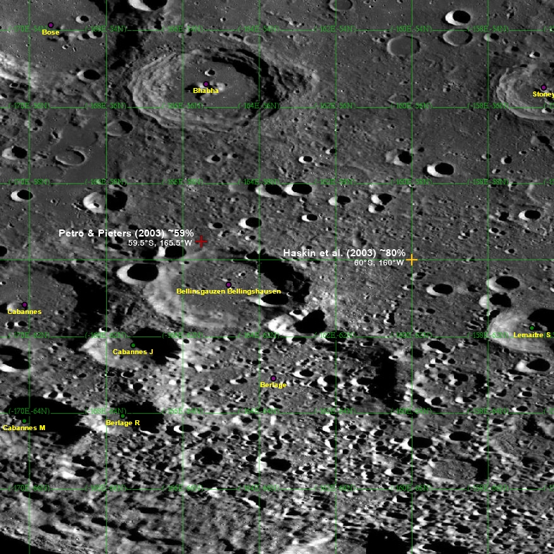
Two centers? The center of South Pole-Aitken basin is not yet agreed on, partly because it's oval shape is evidence of an oblique impact and also because of its immense age, with much of its original surface now erased. Subsequent impacts, however, has exposed deeper, perhaps the deepest and oldest materials, from the Moon's original formation [NASA/GSFC/Arizona State University].
Much more research is needed to begin to answer those larger questions. But this initial study helps raise the possibility that some of the original mantle mineralogy, if excavated, may be preserved in the Moon’s largest impact basin.

Carle Pieters, professor of geological sciences at Brown, and Peter Isaacson from the University of Hawaii were also authors on the paper. The work was supported by NASA’s Lunar Advanced Science and Exploration Research (LASER) program and the NASA Lunar Science Institute (NLSI).

Saturday, April 6, 2013

Do large impacts always erase surface mineralogy?

Our present all-encompassing view of the nearside landmark lunar crater Copernicus seems only a little different than the best photography from Earth. Only 20 degrees west and less than 10 degrees north of the 'center' of the Moon's tidally-locked hemisphere, the round rim appears only slightly oblong from angle seen from our backyards. Its general brightness, both inside and out, wash out much of the detail seen in this LROC Wide Angle Camera (WAC) monochrome (649 nm) montage made up of observations in six orbital passes in January 2010. Long recognized differences can easily be confirmed between the northwest quadrant and the remaining three-quarters of the crater floor may be more extraordinary than previously believed possible [NASA/GSFC/Arizona State University].
EDITORIAL NOTE: One of a handful of features on the Moon's nearside detectible to the naked eye, it's amazing what there is still to be learned about the majestic crater Copernicus. Not as young and bright as Tycho, with rays streaming over an entire hemisphere, it's rays are impressive enough and the larger Copernicus is distinctive enough be the namesake for an entire lunar Age, the "Copernican," the Moon's most modern period, encompassing features less than about 1.1 billion years old.

This has made the Copernican family of excavations very valuable to planetary scientists who utilize Earth's Moon as the Rosetta Stone of the Solar System (and, increasingly, our Earth - the planet with which it has shared precisely the same space in the universe for approximately 4.575 billion years.

Most likely mapped first by Galileo, the 93 kilometer impact crater has since his time been drawn and redrawn with with increasing precision and appreciation. Since the 19th century, and definitely since the latter half of the 20th century, Copernicus may be the lunar crater most individually photographed from Earth. A highly oblique orbital image captured from Lunar Orbiter 2, November 24, 1966, is one of only a handful of images popularly celebrated as a "Photograph of the Century." 

Detail (highly resampled) from Lunar Orbiter 2-162, oblique view from 26 km over the lunar surface south of Copernicus crater, November 24, 1966 [Moonviews].
That delicate telemetry was recovered and reprocessed by the phenomenal Lunar Orbiter Image Recovery Project (LOIRP) in 2009. Without question, we have learned a great deal about the Moon since 1957, but, until recently, not very much more about Copernicus crater than might have been inferred using a decent telescope here on Earth. It's complexity and subtle albedo has defied definitive understanding.

We have known for some, for example, it has at least two (or three) central peaks, and mulled over tantalizing indications of a twin set of widespread rays - hinting at a near simultaneous double impact. High-resolution analysis of its wide interior achieved greatest progress in study of the continued arrival of unambiguously remote sensing from India's Chandrayaan-1 and the U.S. Lunar Reconnaissance Orbiter (LRO) after beginning its on-going mission in close polar orbit in 2009. 

Hints that the northwest quadrant of its interior floor is very distinct from the remaining three-fourths slowly have finally come into focus, hopefully to stay.

The demarcation between the character of the western and eastern north floor of Copernicus has just become more obvious as images from LRO continued to improve. Those differences are particularly striking in spectral analysis, by the Clementine orbiter in 1994, for example. LROC WAC observation M147109260CE (643 nm), spacecraft orbit 6813, December 16, 2010; angle of incidence 77.97° at 60 meters per pixel resolution, from 43.13 km [NASA/GSFC/Arizona State University].
Now the distinguished lunar and planetary scientist Carle Pieters and a team at Brown University have added another set of clues to sharp lines from remote sensing of the northwest quarter of the floor of Copernicus that might have everyone refining or completely revising set theories about what happens in those fantastic and brief hours immediately following a highly energetic crater-forming impact.

Pre-existing mineral deposits on the Moon (sinuous melt, above) have survived impacts powerful enough to melt rock. Not detectable in the crater image (inset), deposits are visible only in light at certain wavelengths [NASA/Deepak Dhingra].
Brown University — April 2 — Despite the unimaginable energy produced during large impacts on the Moon, those impacts may not wipe the mineralogical slate clean, according to new research led by Brown University geoscientists.

The researchers have discovered a rock body with a distinct mineralogy snaking for (28.9 km) across the floor of Copernicus crater, a 60-mile-wide hole on the Moon’s near side. The sinuous feature appears to bear the mineralogical signature of rocks that were present before the impact that made the crater.

The deposit is interesting because it is part of a sheet of impact melt, the cooled remains of rocks melted during an impact. Geologists had long assumed that melt deposits would retain little pre-impact mineralogical diversity.

Large impacts produce giant cauldrons of impact melt that eventually cool and reform into solid rock. The assumption was that the impact energy would stir that cauldron thoroughly during the liquid phase, mixing all the rock types together into an indistinguishable mass. Identifying any pre-impact mineral variation would be a bit like dumping four-course meal into a blender and then trying to pick out the potatoes.

But this distinct feature found at Copernicus suggests that pre-existing mineralogy isn’t always blended away by the impact process.

“The takeaway here is that impact melt deposits aren’t bland,” said Deepak Dhingra, a Brown graduate student who led the research. “The implication is that we don’t understand the impact cratering process quite as well as we thought.”

Close up view of the feature marked with light green, designated "Surrounding Melt (Fe-Ca rich Pyroxene)" in the study illustration immediately above. LROC Narrow Angle Camera (NAC) observation M175408129R, spacecraft orbit 10984, November 8, 2011; resolution 41 cm per pixel from 26.06 kilometers [NASA/GSFC/Arizona State University].
The findings are published in online early view in the journal Geophysical Research Letters .

Copernicus is one of the best-studied craters on the Moon, yet this deposit went unnoticed for decades. It was imaging in 83 wavelengths of light in the visible and near-infrared region by the Moon Mineralogy Mapper — M3 — that made the deposit stand out like a sore thumb.

M3 orbited the Moon for 10 months during 2008-09 aboard India’s Chandrayaan-1 spacecraft and mapped nearly the whole lunar surface. Different minerals reflect light in different wavelengths at variable intensities. So by looking at the variation at those wavelengths, it’s possible to identify minerals.

In the M3 imaging of Copernicus, the new feature appeared as an area that reflects less light at wavelengths around 900 and 2,000 nanometers, an indicator of minerals rich in magnesium pyroxenes. In the rest of the crater floor, there was a dominant dip beyond 950 nm and 2400 nm, indicating minerals rich in iron and calcium pyroxenes. “That means there are at least two different mineral compositions within the impact melt, something previously not known for impact melt on the Moon,” Dhingra said.

It is not clear exactly how or why this feature formed the way it did, the researchers say. That’s an area for future study. But the fact that impact melt isn’t always homogenous changes the way geologists look at lunar impact craters.

“These features have preserved signatures of the original target material, providing ‘pointers’ that lead back to the source region inside the crater,” said James W. Head III, the Scherck Distinguished Professor of Geological Sciences and one of the authors of the study. “Deepak’s findings have provided new insight into the fundamentals of how the cratering process works. These results will now permit a more rigorous reconstruction of the cratering process to be undertaken.”

Carle Pieters, a professor of geological sciences at Brown and the principal investigator of the M3 experiment, was one of the co-authors on the paper, with Peter Isaacson of the University of Hawaii.

Thursday, January 24, 2013

Carle Pieters and David Kring present NLSI seminar Tuesday, January 29 - also available online

NASA Lunar Science Institute Seminar
NASA Ames Research Center
Moffett Field, California
1800 UT (1:00 pm EST) 29 January 2013
Available Online


The Moon: Brimstone to Keystone, Touchstone, and Cornerstone
Carle M. Pieters of Brown University.

The Earth and the Moon share a common early origin, but subsequent geologic evolution has led to quite different planetary bodies that reside in the same part of the solar system. A remarkable array of new lunar data acquired by an international armada of spacecraft over the last decade has stimulated a renaissance of inquiries about the character of the Moon and how its properties can be used to truly understand fundamental processes active on and in a planetary body. "The Moon as Cornerstone to the Terrestrial Planets" team of the NASA Lunar Science Institute is jointly hosted by Brown University and MIT faculty who share a long history of science interactions. The NLSI structure has enabled widespread science interactions and spawned active involvement by the next generation of researchers and scientific leaders. Activities range from probing the deep internal dynamo of the ancient Moon to characterizing space weathering processes active on the present surface - all leading to new strategies for human and robotic exploration.

Discoveries along a path to a new age of science and exploration
David A. Kring of the Lunar and Planetary Institute.

Our NLSI team was designed to develop a core, multi-institutional lunar science program that addresses the highest science priorities; provide scientific and technical expertise to NASA that will infuse its lunar research programs, including developing investigations that influence current and future space missions; support the development of a lunar science community that both captures the surviving Apollo experience and trains the next generation of lunar science researchers; and use that core lunar science to develop education and public outreach programs that will energize and capture the imagination of K-14 audiences and the general public. We have succeeded beyond our proposed expectations. We dramatically sharpened our understanding of impact bombardment, from the accretional growth of planets to the terminal cataclysm that reshaped the entire solar system c. 3.9 Ga. The team helped NASA develop mission scenarios (e.g., to Malapert Massif and to the Earth-Moon L2 position), conduct a global survey of lunar landing sites, and identify the most attractive sites for both robotic and human exploration (e.g., Schroedinger basin, SPA basin, and Amundsen crater). We have also helped field tests of mission scenarios, to both the Moon and NEA, with astronauts and the LER-SEV in the DRATS analog program.

Dr. Carle Pieters is a professor of Geological Sciences at Brown University and is PI of the Brown/MIT NLSI team, involving 22 Co-Investigators, 9 Collaborators, and a large and continually evolving group of students and post-docs. The Brown/MIT NLSI team links the talents of investigators at 9 US and 6 foreign institutions. Dr. Pieters obtained a master's then PhD degree at MIT in 1977 and has been pursuing the mysteries of the Moon ever since as research evolved with significant improvement in laboratory and remote sensing capabilities. Her research focuses on compositional evolution of the crust and properties of the regolith and uses an increasingly sophisticated array of spectroscopic tools, including the Moon Mineralogy Mapper, which she recently led as PI. She is committed to collaborative research and Co-chaired the 2007 NRC report "Scientific Context for Exploration of the Moon". She is a Fellow of AGU, AAAS, and GSA and has been awarded the Kuiper Prize (AAS/DPS) and G. K. Gilbert Award (GSA).

Dr. David A. Kring represents a 40-member science and exploration team, including international partners in 4 countries, and a 20-member higher education consortium, that collectively have trained 14 postdoctoral researchers and approximately 100 graduate students. PI Kring received his Ph.D. in earth and planetary sciences from Harvard University. He specializes in impact cratering processes produced when asteroids and comets collide with planetary surfaces. Kring is perhaps best known for his work with the discovery of the Chicxulub impact crater, which he linked to the K-T boundary mass extinction of dinosaurs and over half of the plants and animals that existed on Earth 65 million years ago. He has explored how impact cratering may have affected the early evolution of the Earth-Moon system. That work includes a decade-long campaign to test the lunar cataclysm hypothesis and the realization that the process affected the entire inner solar system. Kring developed an impact-origin of life hypothesis that suggests the intense period of impact bombardment created vast subsurface hydrothermal systems on Earth that were crucibles for pre-biotic chemistry and provided habitats for the early evolution of life. Dr. Kring also led a joint academic-industry-NASA design team for a robotic lunar lander and rover system that can be deployed anywhere on the lunar surface. He is particularly interested in the interfaces between science, exploration, and operations, to ensure our nation's exploration beyond LEO maximizes productivity while enhancing safety and efficiencies during robotic and crew operations. He trains astronauts how to work on planetary surfaces, whether that be on the Moon, NEA, or Mars. Participation instructions if you cannot attend in person:

TO JOIN USING A WEB BROWSER: The slides and audio/video for this meeting will be presented using Adobe Connect. To join the meeting, connect HERE. (http://connect.arc.nasa.gov/nlsi_directors_seminar/)

TO JOIN USING A VIDEOCONFERENCING SYSTEM: Please RSVP to Ricky Guest (Ricky.Guest@nasa.gov) if you will be joining by Polycom or other standards based Video Teleconferencing System.

Friday, September 10, 2010

Chandrayaan-1 M3 lunar data released to Planetary Data System

Updated September 14, 2010 1336 UT

The M3 release of Optical Period 1, Level 1B data products, is now accessible via the online data volumes. Corresponding Level 0 data products are forthcoming as they are being updated by the team to ensure ease of use and compliance with PDS standards. More info can be found at the Chandrayaan-1 M3 mission page.

Note: The national treasure Charles A. Wood, curator of LUNAR PICTURE of the DAY (LPOD) posted what many will discover to be a more understandable summary of this important development HERE. - Ed.

Carle Pieters
Principal Investigator
Moon Mineralogy Mapper (M3)
Brown University

It is with great pleasure to announce that the first installment of Moon Mineralogy Mapper (M3) data has been released and is now available through PDS: http://img.pds.nasa.gov/ http://pds-imaging.jpl.nasa.gov/volumes/m3.html

M3 is an orbital imaging spectrometer that operated from 450 to 3000 nm. It was built at JPL and flown on India’s Chandrayaan-1 lunar spacecraft. Almost all data were taken in the lower resolution “Global” mode that includes 85 simultaneous co-registered spectral channels. More information about M3 can be found at the M3 website (being updated): https://m3.jpl.nasa.gov/NEWS/

This first release is Level 1B (L1B) spectral image cubes calibrated through radiance at sensor for Optical Period 1 (OP1) of Chandrayaan-1 operations, along with all their selenolocation and observation geometry back planes. No data re-sampling has been performed. L1B data for Optical Period 2 (OP2) are being processed and are expected to be released in December.

Higher-level calibrations continue, and Level 2 data (~reflectance) for both OP1 and OP2 are scheduled to be released in June 2011.

The M3 science team is planning a tutorial session to be held early in the week at Fall AGU for those who would like to learn more about how to work efficiently with M3 data. We will also schedule short presentations at the PDS exhibit during the week. The timing for both of these will be set after the AGU program is determined.

Best wishes from the M3 Team

Saturday, July 24, 2010

Special G. K. Gilbert Award Session for Carle Pieters at Geological Society of America

Each year the Planetary Geology Division of the Geological Society of America, responding to peer nominations, presents the G.K. Gilbert Award to a planetary scientist in recognition of outstanding contributions to the solution of fundamental problems in planetary geology through the use of geochemistry, mineralogy, petrology, geophysics, geologic mapping, and/or remote sensing. The Gilbert Award is the highest honor the Division can bestow.

This year's Gilbert Award will be presented to Dr. Carle M. Pieters for her pioneering work in remote sensing of planetary surfaces and crusts.

The award is named for G. K. Gilbert, who 100 years ago clearly recognized the importance of a planetary perspective in solving terrestrial geologic problems. The G. K. Gilbert Award is presented annually for outstanding contributions to the solution of fundamental problems in planetary geology in the broadest sense, which includes geochemistry, mineralogy, petrology, geophysics, geologic mapping, and remote sensing. Such contributions may consist either of a single outstanding publication or a series of publications that have had great influence in the field.

Presentation of the G. K. Gilbert Award is made during the annual business meeting of the Division held in association with the Annual Meeting of the Society.

Head's Up to Dr. Clive Neal

Monday, April 12, 2010

The new spinel-rich lunar rock type discovered using the M3 on India's Chandrayaan-1


Figure 1. Inner ring of the Moscoviense Basin and the western mare basalt fill. The first three images are M3 data (40 km across track). The 750 nm image is albedo, IBD 1000 is continuum-removed integrated band depth for the ferrous 1 μm band, and 2936 nm is the long-wavelength image that enhances topography. The purple arrows point to the 5 anomalous regions. The two vertical lines in the third image indicate the coverage of TMC. On the right is a DEM derived from TMC data spanning ~ 4 km from top of the ridge crest to the mare basalt floor.

Carle Pieters, et.al.
Brown University, AIG, NASA JPL, USGS, ISRO, ACT, NASA GSFC, College of Charleston & University of Tennessee

Introduction. The canonical characterization of the lunar crust is based principally on available Apollo, Luna, and meteorite samples. The crust is described as an anorthosite-rich cumulate produced by the lunar magma ocean that has been infused with a mix of Mgsuite components. These have been mixed and redistributed during the late heavy bombardment and basin forming events. We report a new rock-type detected on the farside of the Moon by the Moon Mineralogy Mapper (M3) on Chandrayaan-1 that does not easily fit with current crustal evolution models. The rock-type is dominated by Mg-spinel with no detectable pyroxene or olivine present (<5%). It occurs along the western inner ring of Moscoviense Basin as one of several discrete areas that exhibit unusual compositions relative to their surroundings but without morphological evidence for separate processes leading to exposure.


With illumination from a late afternoon sun on Mare Moscoviense on the Moon's far side (time corresponds with the waning phase, between First Quarter and Full Moon, as seen from Earth), the area of interest to Dr. Pieter and her colleagues is nearly in shadow (arrow) [Kaguya Terrain Camera/JAXA/SELENE].

New Compositional Data. Lower-resolution M3 image strips have been collected for >95% of the lunar surface [1] and are being processed and validated [2]. Spectroscopic data discussed here were acquired 1/25/2009 from a 100 km orbit of the first optical period. Field of view is 40 km, spatial resolution is 140 m/pixel, and spectral resolution is 20-40 nm including 85 channels between 460 and 3000 nm.

M3 data across the western edge of Mare Moscoviense is shown in Fig. 1. A digital elevation model (DEM) derived from the Terrain Mapping Camera (TMC) on board Chandrayaan-1 [3] is shown for comparison. Lunar Prospector and Clementine data show the crustal material of this region to be highly feldspathic [4] and the mare fill represents diverse basalts [5]. Geology is discussed in [6]. M3 compositional data are consistent with the earlier data: the pervasive low integrated band depth (IBD) along the basin ring indicates very low abundance (<5%)> of mafic minerals and the high IBD for the mare (and especially craters) reflects their high pyroxene abundance. Five anomalous areas along the lower elevations of the ring are indicated with arrows.


Figure 2. [Top] M3 Spectra of Moscoviense Basin basin ring, craters, and highland soils indicate a highly feldspathic basin. Spectra of mare craters and soil indicate basaltic fill. [Below] Anomalous OOS areas (1-5) along the inner ring indicate the presence of Olivine (green), Orthopyroxene (red; offset 0.1 down for clarity), and Mg-Spinel (purple).

Spectra for representative regions across Moscoviense are compared with those of the anomalous regions in Fig. 2. Data were calibrated (K level), transformed to apparent reflectance, corrected for some systematic errors, and truncated at 2.4 μm to minimize the effects of a long wavelength thermal component. The feldspathic soil of the region (FS), possible impact melt (IMP), and rim crater (R Cr) all exhibit featureless spectra devoid of mafic minerals. Spectra for the mare soils and craters exhibit the expected features of high-Ca pyroxene. In M3 image data, no fresh craters can be seen to be associated with any of the five spectrally anomalous areas. High-resolution TMC data (5 m/pixel) are available for areas 3, 4, & 5. For each area, no unusual features are observed that might indicate the surface has been disturbed. Orthopyroxene is prominent throughout region 2 and observed at parts of regions 3 and 4. Olivine is observed across area 5 and for parts of area 4. The spatial extent of these mafic minerals is mapped by high values in the IBD image.

The entire region 1 and a small part of region 3 has an exceptionally low value (dark) in the IBD image. This is because the spectra are actually concave near 1 μm and no pyroxene or olivine can be detected (<5%). On the other hand, these spectra exhibit a prominent 2μm absorption, the character of which is better seen in spectra relative to a FS region matched to remove the continuum shown in Fig 3. The clear interpretation of these spectra are that the surfaces represent a rock type dominated by Mg-rich spinel with no detectible other mafic minerals (but probably feldspathic in character). (See [8] for a different form of spinel detected by M3.) We have considered both exogenic and endogenic origins for the OOS. Since the only other spinel-rich surfaces detected with remote sensors are a few primitive main-belt asteroids [9], one hypothesis is that these exposures represent the breakup of a multi-component (rubblepile) asteroid as it passed through the Earth-Moon system. Although the OOS exposures are relatively linearly aligned, special circumstances would be required to allow the impactor to survive. More likely, the OOS suite represents a new and fundamental crustal component of the Moon, uplifted from depth during the basin-forming event. Separation of relatively dense spinel within a mafic magma pluton experiencing fractional crystallization and crystal settling could provide the concentration mechanism to account for the formation of a new rock type, a “pink-spinel” anorthosite. Additional processes are required to embed the OOS products within the LMO feldspathic crust. These processes all had to have occurred prior to the basin-forming event.


Figure 4. Reflectance spectrum of spinel-rich area OOS3a relative to featureless FS soil compared with a laboratory spectrum of Mg-rich spinel [7].

References: 1] Boardman et al., 2010 LPSC41 these abstracts 2] Green et al., 2010 LPSC41 these abstracts 3] K. Kumar et al., 2009 Current Science, 96, 492. 4] Jolliff et al. (2000) JGR 105, 4197 5] Kramer et al.,2008 JGR.113, E01002 6] Thaisen et al 2010 LPSC41 these volumes. 7] Cloutis et al., 2004, MaPS, 39, 545.8] Sunshine et al. 2010 LPSC41 these volumes 9] Sunshine et al., 2008 Science, 320, 514.

From Kaguya HDTV
Orbiting southward over the far side's northern hemisphere, Japan's lunar orbiter "Kaguya" (2007-2009) catches the expanse of Mare Moscoviense (Sea of Moscow) in this HDTV clip, now available on YouTube. Looking south, the area of interest is center, extreme right. (The LRO Constellation candidate for a possible future manned landing sight is just inside the southern rim of basin at the center) [JAXA/NHK/SELENE].

KAGUYA/Chandrayaan-1 Cross-Calibration Meeting Ahmedabad 8-9 Feb. 2010

Sunday, February 21, 2010

2000th Posting - Dust transport and its importance in the origin of lunar swirls


In a photograph credited to the orbiting crew of Apollo 10, inside 310 kilometer-wide Mare Ingenii (33.7S°, 163.5°E), mostly southwest of mare-flooded Thompson crater, the Moon's far side hosts perhaps the most dramatic (but by no means the only) wide-spread field of easily resolved lunar swirls. Beyond the upper left are the antipodes, the precise opposite side of the Moon from the center of near side Mare Imbrium, suggesting complex magnetic field lines is the wider vicinity here were shock-fossilized by the 3.8 billion-year-old impact. Now, the mystery here has been in gaining a better understanding of the persistence of the bright surface markings, regolith that has escaped the darkening of "optical maturity" within those magnetic field lines. This maturing should have gained a foothold within an estimated 900 million years. The field lines may remain sufficient to shield the surface like an umbrella from solar particle events but not from a continuous in-fall of micrometeorites or higher-energy cosmic rays. Those influences regularly "garden" the whole of the Moon's outermost surface every 2 million years. Garrick-Bethell, Head and Pieters suggest a mechanism, part of a net cycle of lunar dust migration. A diurnal polarity shift of electro-statically charged sub-micron dust grains are first repelled from the surface, as elsewhere on the Moon, but a net volume of charged dust is repelled during fallout.

Joel Raupe
Lunar Pioneer

Congratulations to Dr. Ian Garrick-Bethell, and colleagues James W. Head III and Carle M. Pieters of Brown University for having spelled out a likely connection between the Moon’s dynamic and dusty exosphere and the enigmatic swirls on the lunar surface that accompany crustal magnetic fields. Their presentation was delivered a few weeks ago at the Lunar Dust, Plasma and Atmosphere: The Next Step workshop at the University of Colorado at Boulder. Lunar magnetic anomalies and the wide array of swirls that accompany them on the surface of the Moon have been a particular area of science interest for us for many years.

We thought so much of this paper we dedicated this 2000th posting at Lunar Networks to “spotlight” it, as we begin discussion of the papers and presentations regarding the Moon submitted to the 41st Lunar and Planetary Science Conference, March 1-5, The Woodlands, Texas.

In 2008 Larry F. Scott and I broadly hinted at their same solution, without spelling out their elegantly proposed mechanics, in the guise of a proposed hybrid robotic exploration to determine the ground truth of the Descartes Formation, home of one of the Moon’s more intense crustal magnetic anomalies, attended by its 60 km x 100 km patch of relatively high albedo. Though it is unlikely to put an end to the debate over the origins of swirls and regolith with “persistent low optical maturity, we suggest in “Dust transport and its importance in the origin of lunar swirls,” however, that Drs. Garrick-Bethell, Head and Pieters have nailed a keystone piece of the puzzle.

Dust transport and its importance in the origin of lunar swirls

Ian Garrick-Bethell, James W. Head III, and Carle M. Pieters
Department of Geological Sciences
Brown University
Box 1846, 324 Brook Street
Providence, RI 02912
Ian_Garrick-Bethell@brown.edu

Abstract. Lunar swirls are sinuous or patchy albedo anomalies associated with strong crustal magnetic fields. Spectral properties across swirls are consistent with lower space weathering but also suggest an enrichment of feldspathic material within the swirls (1).

Both of these properties are plausibly explained by fine-grained dust sorting. The sorting may result from two processes that are well established, but have not been previously considered together. The first process is the vertical electrostatic lofting of charged fine dust. Lofting of dust has been inferred from numerous lunar surface experiments (e.g. refs. 2 & 3). The second process is the formation of electric potential anomalies formed at magnetic anomalies as solar wind protons penetrate more deeply into the magnetic field than electrons. The generation of these electric potentials has been inferred from Apollo 12 and 14 surface measurements (4,5), and has been experimentally simulated (6). The electric potential can attract or repel charged fine-grained dust that has been lofted. Since the finest fraction of the lunar soil is bright, enriched in feldspar, contains the most nanophase iron, and contributes significantly to the lunar regolith spectral properties, the horizontal accumulation or removal of fine dust can change a soil’s spectral properties.

We calculate that grains can be transported on the order of typical swirl length scales on timescales comparable to the most rapid estimates of space weathering. For example, a 5 μm radius grain with a charge of 5.5 X 10(-15) C will be transported 5 km after 100,000 years, assuming 6-second-long loftings every terminator crossing, and electric fields comparable to those inferred at the Apollo 12 and 14 sites. This mechanism can explain some of the spectral properties of swirls, accommodates their association with magnetic fields, and permits weathering by micrometeoroids and the solar wind.


(1) Garrick-Bethell, I. et al., in proceedings of the 50th Vernadsky-Brown microsymposium (2009), (2) Berg, O. E. et al., in Interplanetary dust and zodiacal light, 31st (1976). (3) Criswell, D. R., LPSC 3rd, 2671 (1972). (4) Burke, W. J. et al. LPSC 6th, 2985 (1975). (5) Neugebauer, M. et al., Planet. Space Sci. 20, 1577 (1972). (6) Takahashi, K. et al., Physics of Plasmas 15, 072108 (2008).

Thursday, February 11, 2010

Chandrayaan-1 M3 mapper study reveals new lunar rock family

Carle Pieters
Professor of Geological Sciences
Brown University


R. Ramachandran
The Hindu

The Moon Minerology Mapper (M3) on Chandrayaan-1, which famously discovered the presence of water and hydroxyl molecules on the lunar surface material last year, has now identified a new lunar rock type on the far side of the moon. The M3 is a NASA instrument. This was reported here on Monday by Carle Pieters of Brown University, lead author of the present study, at the Sixth Chandrayaan-1 Science Meeting being held at the Physical Research Laboratory (PRL), a unit of the Indian Space Research Organisation (ISRO).

The rock-type is dominated by a mineral termed as ‘magnesium spinel.’ Spinel is a generic name given to a class of minerals having the chemical formula AB{-2}O{-4} and the usual spinel formations found in lunar rocks is an iron-magnesium admixture of the form (Mg, Fe)(Al, Cr){-2}O{-4}. These rocks are usually found along with magnesium-iron silicate (olivine) and calcium-rich aluminium silicate (pyroxene).

Unique feature

According to Professor Pieters, the interesting feature of the new rock type is that it is exclusively composed of magnesium-rich spinel “with no detectable pyroxene or olivine present.” This, she said, does not easily fit with current lunar crustal evolution models.

Rich in anorthosites

The generally accepted characterisation of the lunar crust is based principally on retrieved lunar material by the Apollo-Luna missions and meteorite samples. The crust is described as a rocky accumulation, basically rich in calcium-aluminium silicates (anorthosites) infused with a mix of compounds containing magnesium and iron (‘mafic’ minerals).

However, the western ring of the Moscoviense Basin of the moon appears to be one of the several discrete areas that exhibit unusual compositions relative to their surroundings, but without morphological evidence for separate geological processes leading to their exposure.

The findings are based on data acquired by M3 in January 2009 during the first observation period of Chandrayaan-1 from its initial 100 km altitude orbit over a 40 km wide strip field of view, with a spatial resolution of 140 m/pixel. The mapping was done using the emission spectrum of the surface over the wavelength region 460-3000 nanometres with a spectral resolution of 20-40 nm.

Five anomalous areas

The general composition of the area observed had a low abundance of mafic minerals and a high abundance of feldspathic minerals such as pyroxene. While this was consistent with earlier observations, five anomalous areas that are widely separated were seen along the lower elevations of the ring (see pic.). Interestingly, no unusual feature or any compositional boundary was seen for any of these areas.

Calcium-rich pyroxene is prominent in areas 2 and some parts of 3 and 4. Olivine is prominent across 5 and parts of 4. In contrast, the whole of region 1 and part of region 3 were exceptionally dark in the images. This, according to Professor Pieters, is because of the high absorption that the areas seem to have in the 2000 nm region, together with the near complete absence of pyroxene or olivine (less than 5 per cent) as indicated by the lack of any absorption around 1000 nm.

While regions rich in olivine or pyroxenes have been seen in other basins, this is the first time a magnesium-rich spinel region has been identified. “The clear interpretation of these spectra is that the surfaces represent a new rock type dominated by magnesium-rich spinel with no other detectable mafic minerals,” Professor Pieters said.

No easy explanation

There does not seem to be any easy explanation for the occurrence of these spinel formations. Since magnesium-spinels have been seen in some asteroids, one possible explanation is that the source is exogenous asteroid or comet impacts. However, there is no evidence of any impact or dispersion of rubble pile and the like from the impact’s aftermath.

An interesting feature of the Moscoviense Basin is that the crust in the region is much thinner, compared to other basins. This is indicative of a magma upturning over much recent time scales as compared to other regions. Also this offers one possible explanation for the occurrence of magnesium-rich minerals because these are very dense and would have been deposited right at the bottom during the cooling and crystallization of the crust. The recent upturning may have brought it up from the lunar deep crust during the basin formation, Professor Pieters pointed out.

Lunar crust origin

But that still does not explain the localised nature of the anomalous regions that extend only about a few kilometres across, she said. “Creating foreign deposits without a trace of their origin is hard to do. We, therefore, favour a lunar crust origin,” she said. “But even that interpretation is not entirely satisfactory. We need to fully characterise the morphology of the anomalous regions with high resolution data from TMC [ISRO’s Terrain Mapping Camera] images,” she added.

- Heads Up to Pradeep

Friday, December 4, 2009

LRO DIVINER LPSC Symposium, February 2010


It's beginning to look like the 41st Annual Lunar and Planetary Science Conference at The Woodlands in Texas, March 1-5, 2010, will be among the very best places to get any advance view of the long-on-promise data from the Lunar Reconnaissance Orbiter and its seven experiments now in lunar orbit.

The Lunar Reconnaissance Orbiter (LRO) Diviner instrument team will host a symposium on the Sunday afternoon before the LPSC to acquaint the Planetary Science community with the Diviner experiment, its dataset and scientific findings to date.

The meeting will be held in the Montgomery Ballroom of the the Woodlands Waterway Marriott Hotel and Conference Center in Houston, TX - the same hotel hosting the LPSC 2010 meeting, and the Brown-Vernadsky Microsymposium entitled “Compositional Structure of the Lunar Crust: The New View from the Moon” (http://www.planetary.brown.edu/html_pages/micro51.htm).

The Diviner symposium will directly follow the Brown-Vernadsky Microsymposium, scheduled for all day Saturday, February 27 and again on Sunday morning, February 28.

A detailed agenda for the Diviner Symposium will be posted in advance of the meeting on the LRO Diviner instrument site.

Thursday, October 15, 2009

Pieters-led team made historic lunar scan

Monique Vernon
The Brown Daily Herald

Water molecules have been found on the moon by a research team headed by Professor of Geology Carle Pieters (pictured, Left). But like many momentous scientific advances, the discovery was made almost by accident.

“You don’t expect any water on the moon,” Pieters said, and neither did her research team, which was studying lunar mineralogy. But when the team happened upon indications of water that at first confused them, they investigated further and discovered they were genuine.

“When our team saw a clear signature of water on the surface, we thought it was wrong,” Pieters said.

After months of probing and testing to try to resolve the disparity, the team later concluded that there are molecules of water and hydroxyl — a functional group consisting of hydrogen and oxygen — on the moon’s surface.

The team’s conclusion appeared in an issue of the journal Science alongside two other articles that concurred with Pieters’s findings. One research group’s instrument was on its way to Saturn and found similar readings using their spectrometer, while the other’s was on its way to a comet.

When the Indian Space Research Organization offered to carry foreign instruments on their Chandrayaan-1 spacecraft, Pieters and her team went to work on forming a detailed proposal to NASA to acquire funding to construct the instrument, known as the Moon Mineralogy Mapper, or M3. The project was accepted by NASA and the ISRO, and the Indian spacecraft containing the M3 launched successfully in October 2008.

With 10 months of data from the craft, the team was able to observe the water and hydroxyl molecules with a “unique detection using spectroscopy,” Pieters said.

“It is such a fantastic look at the way science works in the real world,” said Postdoctoral Research Associate in Geological Sciences Jeff Nettles. As a co-author of the Science paper, his role during the mission was to use software that processes and analyzes geospatial imagery to help analyze the surface.

Read the full article, HERE.

Saturday, September 26, 2009

YouTube Video of the NASA Press Conference, "A New Moon"

In the hours immediately after the press conference at NASA HQ in Washington, Thursday, Sept. 24, announcing confirmation by three missions of a new and more widespread lunar hydrology, Lunar Pioneer posted the tale tell slides presented, with contextual commentary below. Nevertheless, it's likely readers may have missed the event itself, which was worth the viewing.

Google-Partner Blog Discovery Enterprise was kind enough to post the YouTube clips of the event, in three parts, which can now been watched, HERE.

Thursday, September 24, 2009

Confirming a damp Moon

The lunar surface as swept up by Cassini during its accelerating fly-by returning through the Earth-Moon system on the way to Saturn in 1999 showed regions of trace surface water (blue) and hydroxyl (orange and green) in daylight and at equatorial latitudes. [Science] On Aug. 19, 1999 the observations show water and hydroxyl at all latitudes on the surface, even areas exposed to direct sunlight. The Visual and Infrared Mapping Spectrometer (VIMS) view was slightly south of the lunar equator. The yellow cross indicates a latitude and longitude of zero. The picture at top left shows infrared light reflected off the moon as seen by VIMS. The top right picture shows the moon as seen by Cassini's Imaging Science Sub-system (ISS) during the flyby. The image at bottom left shows temperatures of the moon derived from VIMS data. Temperatures near the equator are hotter than boiling water on Earth. The bottom center picture shows a VIMS map of water associated with minerals. At bottom right is a VIMS map of hydroxyl-bearing minerals, created by chemical reactions with minerals and glasses in the lunar soil. [NASA/JPL-Caltech/USGS]

Kenneth Chang
New York Times

There appears to be, to the surprise of planetary scientists, water, water everywhere on the Moon, although how many drops future astronauts might be able to drink is not clear.

Data from three spacecraft indicate the widespread presence of water or hydroxyl, a molecule consisting of one hydrogen atom and one oxygen atom as opposed to the two hydrogen and one oxygen atoms that make up a water molecule. The discoveries are being published Thursday on the Web site of the journal Science.

“It’s so startling because it’s so pervasive,” said Lawrence A. Taylor of the University of Tennessee, Knoxville, a co-author of one of the papers that analyzed data from a National Aeronautics and Space Administration instrument aboard India’s Chandrayyan-1 satellite. “It’s like somebody painted the globe.”

For decades, the Moon has been regarded as a completely dry place. The dark side is more than ice cold, but when it passes into sunlight, any ice should have long ago been baked away. The possible exceptions are permanently shadowed craters near the Moon’s poles, and data announced this month by NASA verified the presence of hydrogen in those areas, which would most likely be in the form of water.

If water is somehow more widespread, that could make future settlement of the Moon easier, especially if significant water could be extracted just by heating the soil. Oxygen would also be a key component for breathable air for astronauts, and hydrogen and oxygen can also be used for rocket fuel or power generation.

Samples of lunar soil brought back from NASA’s Apollo missions about four decades ago actually did show signs of water, but most scientists working with the samples, including Dr. Taylor, dismissed the readings as contamination from humid Houston air that seeped in before the rocks were analyzed at NASA’s Johnson Space Center.

“I was one of the ones back in the Apollo days that was firmly against lunar water,” Dr. Taylor said.

Now he is convinced he was wrong. “I’ve eaten my shorts,” he said.

The Chandrayyan-1 data looked at sunlight reflected off the Moon’s surface and found a dip at a wavelength where water and hydroxyl absorb infrared light. Dr. Taylor estimated the concentration at about one quart of water per cubic yard of lunar soil and rock.

Meanwhile, Roger N. Clark of the United States Geological Survey analyzed decade-old data from NASA’s Cassini spacecraft when it passed the Moon en route to Saturn. He, too, found signs of water or hydroxyl, mostly at the poles, but also at lower latitudes.

Scientists working with the Deep Impact spacecraft, which later studied the Comet Tempel 1, also found infrared absorption at the water and hydroxyl wavelengths. More interesting, the amount of absorption — and thus the quantity of water — varied over time.

That suggests the water is being created when protons from the solar wind slam into the lunar surface. The collisions may free oxygen atoms in the minerals and allow them to recombine with protons and electrons to form water.

Lori M. Feaga, a research scientist at the University of Maryland who is a member of the team that analyzed the Deep Impact data, said this process would work only to about one millimeter into the lunar surface. If correct, that would not give future astronauts much to drink.

“You would have to scrape the area of a baseball field or a football field to get one quart of water,” she said.

Data from three spacecraft indicate that a thin film of water coats the surface of the soil in at least some spots, a discovery that raises the possibility of colonization.

John Johnson, Jr.
Los Angeles Times

Space scientists have found the strongest evidence yet that water exists on the moon, a discovery that helps complete a picture of a water-rich solar system and that could make colonizing our nearest neighbor in space much easier than previously thought.

Using data from three spacecraft that have made close flybys of the moon in recent years, research teams in the United States have found proof that a thin film of water coats the surface of the soil in at least some places on the moon.

"Within the context of lunar science, this is a major discovery," said Paul G. Lucey, a planetary scientist with the University of Hawaii, who was not involved in the current research. "There was zero accepted evidence that there was any water at the lunar surface, [but] now it is shown to be easily detectable, though by extremely sensitive methods. As a lunar scientist, when I read about this I was completely blown away."

The discovery "will forever change how we look at the moon," added Roger Clark, a scientist with the U.S. Geological Survey in Denver and the author of one of three papers -- each dealing with data from a different spacecraft -- appearing in this week's edition of Science magazine.

For decades, the moon had been considered a dead and uninteresting world by scientists. The Apollo missions of the 1960s and '70s brought back some rocks that contained tiny amounts of trapped water, but scientists at the time decided they had been contaminated by water from Earth.

Proponents of human space travel hope this new discovery could put pressure on the White House to follow through with the Bush administration's plans to return to the moon by 2020 and to construct Earth's first off-world colony there.

At the very least, the discovery lends weight to a new view of a friendlier solar system, where water, the lifeblood of biology on Earth, suddenly seems to be everywhere. Last year's Phoenix mission to Mars' polar region found ice just beneath its struts. Ice has been found on Saturn's moon Titan and it covers Jupiter's moon Europa.

Research teams from Brown University, the University of Maryland and the U.S. Geological Survey used spectroscopic measurements taken of the lunar surface by NASA's Cassini and Deep Impact spacecraft, as well as India's Chandrayaan 1 satellite. The instruments on all three spacecraft detected the signature of the OH chemical bond (oxygen and hydrogen) at many places on the lunar surface, including areas subject to daytime temperatures that reach the boiling point of water. The greatest concentrations were found in the coldest regions, however, near the two poles.

Detecting the OH bond is not a sure indicator of water. The instruments could be picking up hydroxyl, which is composed of one oxygen and one hydrogen atom. Water has two hydrogen atoms and one oxygen.

But one of the papers, by research scientists Lori Feaga and Jessica Sunshine of the University of Maryland, found clear evidence for both hydroxyl and water in measurements taken by the Deep Impact spectrometer on June 2 and June 9. "We saw both species," Feaga said.

The amount of water in any one place is tiny. Clark estimated it at about a quart per ton of soil.

The moon "is almost as wet as a bone," Lucey said in an e-mail interview with The Times. "It is in the form of an imperceptible film on soil grains, perhaps several molecules thick."

Unless science makes some technological breakthrough, it would be extremely difficult for future moon colonists to harvest such tiny amounts of water. The research indicates, however, that the water migrates toward the poles -- by literally lifting off the soil particles and drifting north and south -- when the temperature rises during the lunar day. When the water molecules land in a colder area near the poles, they are trapped there in higher concentrations, "perhaps high enough to use," Lucey said.

The question of how much water might have accumulated at the poles could be answered on Oct. 9, when NASA's Lunar Crater Observation and Sensing Satellite, known as LCROSS, is set to steer a rocket into a south pole crater called Cabeus A. The resulting collision, which will send up a dust cloud two miles above the surface of the moon, will be observed and sampled by satellites and observatories on Earth for evidence of water. Cabeus A was chosen because it is in a perpetual shadow, so any water stored there in the form of ice would not melt.

"The results of the present studies lend credence to the lunar polar water hypothesis by providing a proven source of water on the surface of the moon," Lucey said.

If there is water on the moon, where did it come from? One possibility, according to the research teams, is that the water was deposited by one or more comets colliding with the moon. Another is that meteorites colliding with the moon might have unearthed underground sources of water.

Finally, the solar wind, a stream of charged particles flowing outward from the sun, which is mostly made up of hydrogen and helium, could play a role. The solar wind could supply hydrogen to bind with oxygen in lunar soils.

Perhaps ironically, given how many spacecraft have orbited and landed on the moon in the last five decades, two of the spacecraft that made this discovery had other missions besides observing the moon. Cassini's primary mission was to observe Saturn and its major moons, including the bizarre smog-choked Titan. The measurements of the moon were taken in 1999 as Cassini was on its way to Saturn.

Deep Impact shot a rocket into the comet Tempel 1 in 2005 to find out what a comet is made of, but has since been given other jobs, including rendezvousing with another comet. Chandrayaan 1, India's first moon-orbiting satellite, was launched in October 2008.

All three spacecraft carried spectrometers, which operate by breaking down the light reflected off the surface of the moon. Because every chemical molecule has a different light wavelength signature, scientists analyzing the spectrograph can tell what the surface is made of. The reason the Deep Impact instrument was able to see both water and hydroxyl, Feaga said, was because it has a larger bandwidth than the instruments carried by Cassini and Chandrayaan.

"It is astounding to find water at all latitudes on the moon and in places where the temperature is hotter than boiling water on Earth," Clark said.

The discovery comes at a pivotal time for America's space program. Former President George W. Bush set NASA on an ambitious course to return to the moon by 2020 and then travel on to Mars. But a presidential commission recently found that without a significant increase in its budget, NASA won't be able to reach either goal.

It's unclear how this new discovery will affect the debate in Washington over NASA's future, but the presence of water on the moon would presumably make colonization much easier. Water would not only be valuable for drinking, but it could also be used to make oxygen for breathing and to make rocket fuel for trips to and from Earth.

"Perhaps the most valuable result of these new observations is that they prompt a critical reexamination of the notion that the moon is dry," Lucey said. "It is not."

Wednesday, September 23, 2009

Chandrayaan-1 3M team: Abundant lunar H2O

NASA will hold a media briefing at 2 p.m. EDT on Thursday, Sept. 24, to discuss data from the moon collected by the twin to the Mini-RF radar mapper on board India's Chandrayaan-1.

NASA Television will provide live coverage of the briefing from NASA Headquarters, in Washington. Participants include:

* Jim Green, director, Planetary Science Division, Science Mission Directorate at NASA Headquarters in Washington
* Carle Pieters (pictured), principal investigator, Moon Mineralogy Mapper, Brown University
* Rob Green, project instrument scientist, Moon Mineralogy Mapper, NASA’s Jet Propulsion Laboratory in Pasadena.
* Roger Clark, team member, Cassini spacecraft Visual and Infrared Mapping Spectrometer and co-investigator, Moon Mineralogy Mapper, U.S. Geological Survey in Denver
* Jessica Sunshine, deputy principal investigator for NASA’s Deep Impact extended mission and co-investigator for Moon Mineralogy Mapper, Department of Astronomy, University of Maryland.
NASA

Tuesday, September 1, 2009

Doomed Chandrayaan-1 yielding useful data on Moon’s mineralogy

24/7 Breaking News

The Indian Space Research Organization (ISRO) might have been compelled toprematurely terminate India’s first moon exploration mission, after it lost radio contact with Chandrayaan-1 over the weekend, but the probe is already said to have yielded a treasure trove of useful data.

Dr. Carle Pieters, planetary geologist at Brown University and principal investigator of the Moon Mineralogy Mapper (M3), built by NASA instrument on Chandrayaan-1, said, "Part of the M3 mission was to determine the distribution of elements and minerals on the moon’s surface, data that NASA had hoped would be useful for future manned missions to the moon or other planets."

Pieters says that before the probe prematurely ended, the M3 instrument had successfully completed a cursory global survey of mineralogy on the moon.

This first step set the stage for higher-resolution mapping of the lunar surface.

“(But) even with the low-resolution data we have from the first phase, we have several new and completely unexpected discoveries,” National Geographic News quoted her as saying.

She did not give any information as to what those discoveries might be. Other scientists are still reviewing the data.

Expressing “enormous disappointment” at the early loss of Chandrayaan-1, she revealed she and her colleagues were looking into a future flight of a duplicate M3 instrument.

“When you see fantastic results and taste success, it’s almost criminal not to plan for the future,” she said. (ANI)

Monday, August 3, 2009

Magma Ocean theory advances, 'First Results' from Chandrayaan-1's 3M

Extent of M3 “warm” data-take across the Orientale Basin. The basemap is Clementine UVVIS 750 nm data and LAC chart locations. Basin rings are labeled in blue.

Minerology of the Lunar Crust in Spacial Context: First Results from the Moon Minerology Mapper (M3) - Pieters, et.al. (Dept. Geological Sciences, Brown University, AIG, NASA JPL, USGS (Denver), Bear Fight Center, WA, ISRO-PRL, ISRO-NRSA, ACT, NASA Goddard, College of Charleston, PSI, U. of MD, U. of TN. & DARPA.)

Introduction: India’s Chandrayaan-1 successfully launched October 22, 2008 and went into lunar orbit a few weeks later. Commissioning of instruments began in late November and was near complete by the end of the year. Initial data for NASA’s Moon Mineralogy Mapper (M3) were acquired across the Orientale Basin and the science results are discussed here. M 3 image-cube data provide mineralogy of the surface in geologic context. A major new result is that the existence and distribution of massive amounts of anorthosite as a continuous stratigraphic crustal layer is now irrefutable.

Read the published report HERE,
Chandrayaan-1 Science Team Meeting, Bangalore 9-11 Mar. 2009