 |
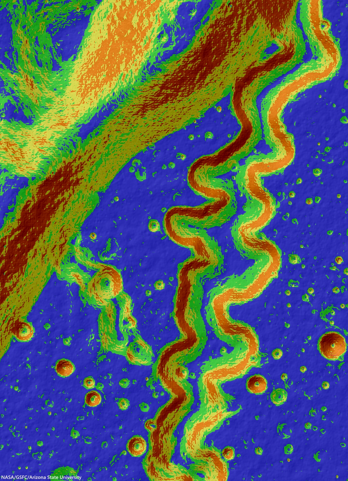
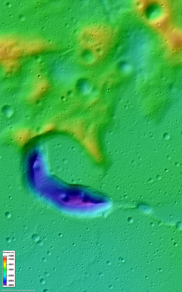
| An irregularly shaped depression, resembling a tadpole, first and largest in a sinuous chain of pits. A 14.4 km field of view from LROC Narrow Angle Camera-derived Digital Terrain Model (NAC-DTM) of the tadpole-shaped start of the informally named "Gruithuisen K Sinuous Rille chain" complex in north central Oceanus Procellarum. Color shaded-relief depicts elevation derived from photo-interferometry based on four LROC Narrow Angle Camera observations and resulting in an array of highly granular practical data, packaged into LROC NAC DTM PITVENT; higher elevations are red and white, lower elevations are blue and purple [NASA/GSFC/Arizona State University]. |

LROC News System
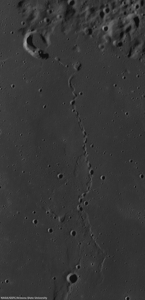
Today's feature is an irregularly shaped, steep-walled mare depression that looks a bit like a tadpole; it is about 8 km long and located at the northwest end of a 60-km long, sinuous chain of pits (35.284°N, 315.901°E) northwest of Gruithuisen crater.
The pit chain was one of the first and most spectacular candidates proposed for an intact lunar lava tube (i.e., one with uncollapsed segments).
This depression may be the source vent for the lava flows that host the pit chain (see image below).
The pit chain was one of the first and most spectacular candidates proposed for an intact lunar lava tube (i.e., one with uncollapsed segments).
This depression may be the source vent for the lava flows that host the pit chain (see image below).
 |
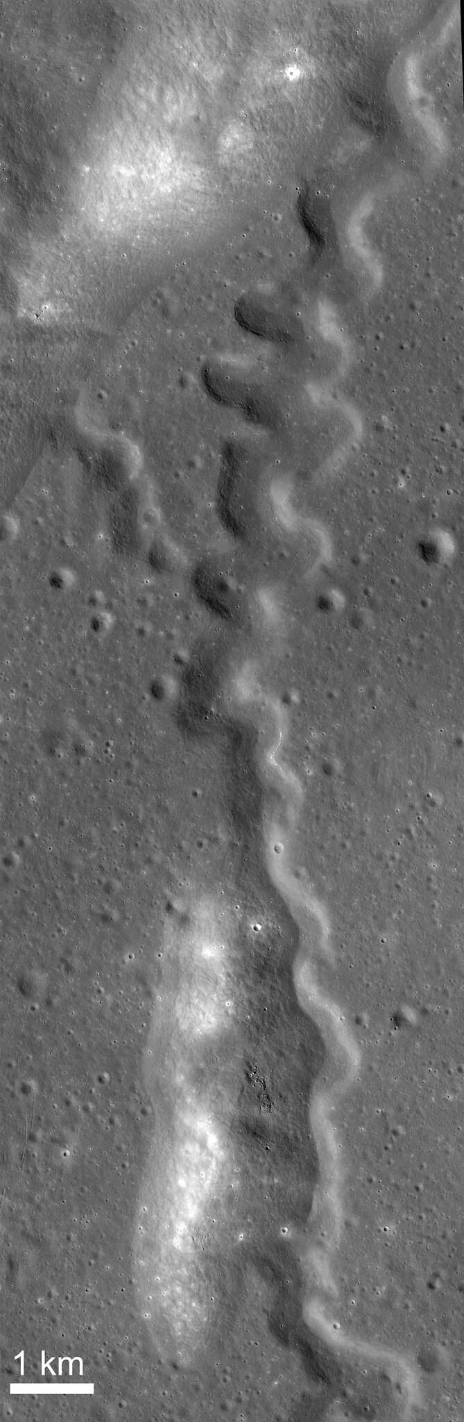
| The unnamed first among many candidate features surveyed for hints of underground voids, lava tubes, etc., west of Gruithuisen K crater in north central Oceanus Procellarum. LROC WAC mosaic swept up over three sequential orbits July 12, 2011; 77.2° incidence, resolution 57.9 meters from 42.5 km [NASA/GSFC/Arizona State University]. |
Collapse pits, with sharp and nearly vertical walls, like the one in the Marius Hills (shown in a previous post) suggest fairly recent collapse of ancient lava tubes. The chain of pits near Gruithuisen, however, has more subdued topography, and likely formed earlier in the history of the Moon (perhaps more than 1 or 2 billion years ago).
 |
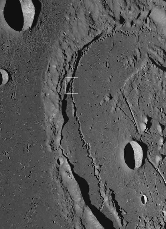
| An early mission Commissioning LROC NAC observation, covering a cross-section of the sinuous depression chain. LROC NAC M102443238LR, LRO orbit 272, July 17, 2009; incidence angle 77.85° at 1.54 meters resolution, from 155.56 km over 35.47°N, 316.56°E [NASA/GSFC/Arizona State University]. |
Many hope that uncollapsed lava tubes will be located near volcanic materials that can be used in construction or energy-generation processes. However, we still have not explored inside any lava tubes on another planet, though many engineers and scientists are currently working to enable such activities. In the meantime, LROC images combined with other data sets, can be used to search for additional lava tube candidates.
Explore today's tadpole-shaped vent in more detail: LROC NAC M1103837710.
Continue Reading about this fascinating lava tube candidate and the sinuous pit chain, or explore the Sulpicius Gallus vent and Orientale Basin vent in more detail.
Even more to explore:
Pyroclastics and an unnamed Procellarum vent
Source vent for Rima Prinz I
Craters on the Schrödinger pyroclastic cone
Morphology and distribution of volcanic vents in the Orientale basin from Chandrayaan-1
Unassuming volcanic vent north of Aristarchus Plateau
New pyroclastic structures identified using LROC data
A dark cascade at Sulpicius Gallus
Hyginus and pyroclastics
Layer of pyroclastics in Sinus Aestuum
Lavoisier Pyroclastics
Pyroclastic Excavation
Pyroclastic Trails
Pyroclastic Vent at Orientale DTM