Showing posts with label Frigoris. Show all posts

Tuesday, January 21, 2014

Wrinkled? Yes, but how old?

Wrinkle Ridge, Eastern Mare Frigoris
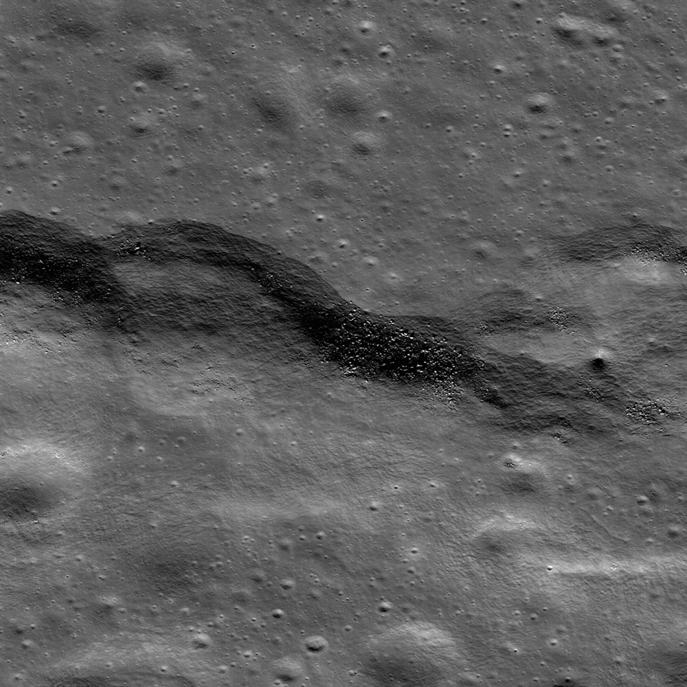
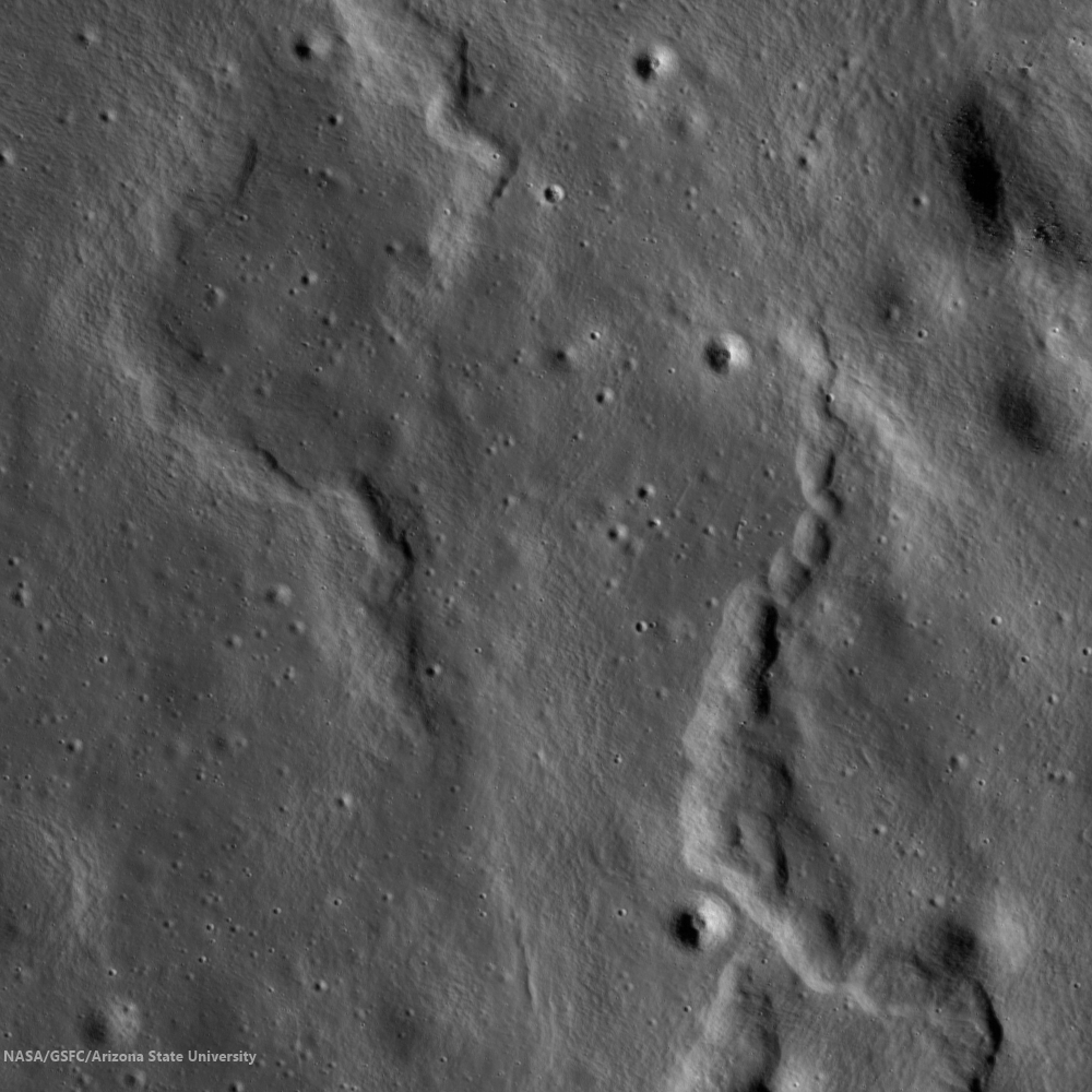
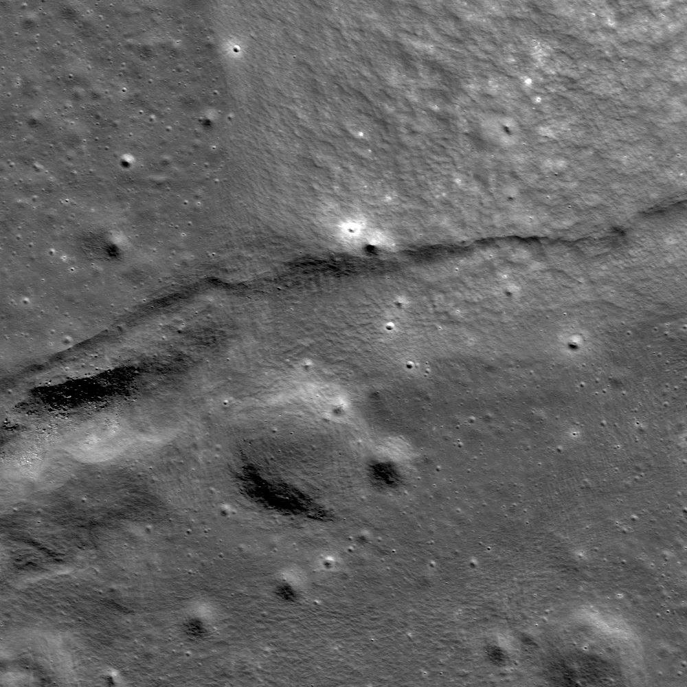
A wrinkle ridge formation in eastern Mare Frigoris (54.430°N, 35.670°E), from a 2 km -wide field of view from LROC Narrow Angle Camera (NAC) observation M139672711R, spacecraft orbit 5717, September 21, 2010; 56.22° incidence angle, resolution 47 cm per pixel from 38.87 km. LROC Featured Image, "Wrinkled, yes, but how old? - Released January 21, 2014 [NASA/GSFC/Arizona State University].
H. Meyer
LROC News System

Wrinkle ridges are not only some of the most striking features that wind their way across the lunar mare, but they are also extremely informative. Wrinkle ridges are the surface expression of tectonic stresses, and from observing the morphology of the ridges, we can interpret the tectonic history of the regions in which they are found.

Mare Frigoris hosts intricate systems of intertwining wrinkle ridges, suggesting a complex history. It is thought that this area was a topographic low that was later filled in with dense mare, causing the less dense anorthosite crust to sag as it underwent isostatic adjustment. The sagging resulted in compression at the surface, and the development of wrinkle ridges. As the crust was compressed it fractured, and long linear stretches of crust were pushed on top of itself thus forming these fascinating ridges.

Wrinkle Ridge, Eastern Mare Frigoris
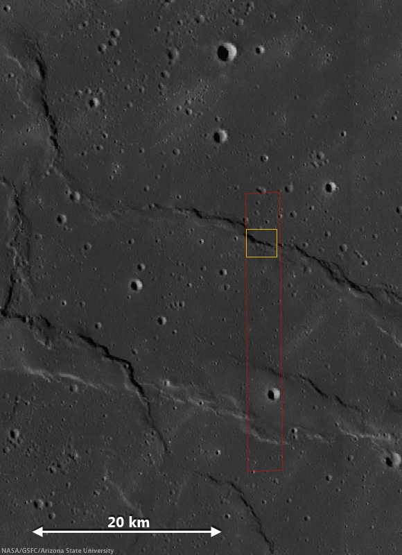
LROC WAC context image of eastern Mare Frigoris. The full NAC field of view is outlined in red and that of the LROC Featured Image released January 21, 2014 is boxed in yellow [NASA/GSFC/Arizona State University].
The ropy appearance of the ridges in the WAC context image above are a testament to the complex motion that took place within the rock, indicating multiple directions of stress. Though most of the tectonic activity that produced wrinkle ridges in Mare Frigoris is thought to have occurred ~2.6-3.8 billion years ago, recent work suggests that wrinkle ridges may have formed in this region only 1.2 billion years ago. Believe it or not, that is young (for the Moon at least)!

Who knew wrinkles could be useful? Explore the Moon's wrinkles for yourself, HERE

Related Posts:
Bulging Wrinkle
Wrinkle Ridge in Mare Crisium
Wrinkles in Mare Frigoris
Really Wrinkled
Wrinkled Reiner Gamma
Wrinkle Ridge v Impact Crater

Thursday, October 10, 2013

Wrinkles in Mare Frigoris

M181102837R LROC Featured Image, October 10, 2013
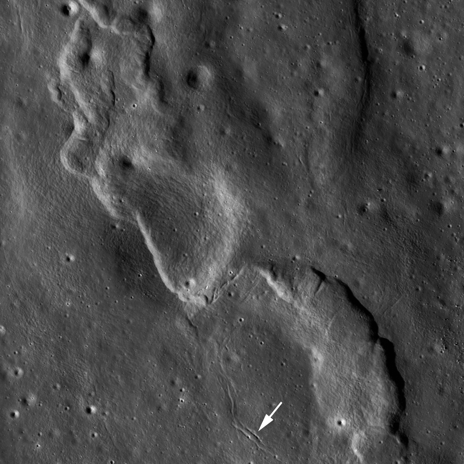
A complex wrinkle ridge deforms Mare Frigoris (52.935°N; 11.131°E) Two kilometer-wide field of view from LROC NAC observation M181102837R, LRO orbit 11804, January 13, 2013; 76.04°evening illumination angle of incidence from the west (left), resolution 1.65 meters per pixel from 168.24 km [NASA/GSFC/Arizona State University].
James Ashley
LROC News System

Lunar mare present many excellent examples of wrinkle ridges, where tectonic activity caused the foreshortening of near-surface rocks. The loading of large basins by dense mare basalts is thought to have resulted in isostatic adjustment of the underlying anorthositic crust, leading to buckling and overriding of surface rock units one atop another as compression occurred. The same stresses may also produce extensional (rather than compressional) deformation in adjacent areas. A variety of complex landforms can thus result.

M146911901CN_604nm-580x800
Area shown at high resolution in the LROC Featured Image is designated with a small arrow in this 34.4 km-wide field of view from LROC Wide Angle Camera (WAC) monochrome (604 nm)observation M146911901CE, LRO orbit 6784, December 13, 2010; early morning 78.67° angle of incidence, resolution 59.3 meters per pixel from 43 km. The area of interest is in south central Mare Frigoris. [NASA/GSFC/Arizona State University].
Most of the ridges we see in today's Featured Image are produced by thrust faulting in Mare Frigoris. Just below center in the Featured Image frame, however, is a left-lateral strike-slip fault (also called a sinistral fault). Wrinkle ridges can be lumpy and ropey-looking, not exactly what comes to mind when one thinks of a textbook compressional fault. But in cross section the faulting would be readily apparent (refer again to the links above). Just south of the strike-slip fault are zones of extension where tension cracks have formed (small white arrow in Featured Image).

M146898354CN_604nm_stitch-58b-1782x2458
Further context for the wrinkle ridge in this field of view 107 km wide south central Mare Frigoris, scared by secondary crater streams from Aristoteles crater to the southeast. LROC WAC monochrome mosaic (604 nm) from five sequential orbits captured under local sunrise (emphasizing topography over albedo), LRO orbits 6782-6786, December 14, 2010 averaging a 77° angle of incidence from 43 km [NASA/GSFC/Arizona State University].
Morphologic nuances can be explored elsewhere in the NAC frame. Note the ropey appearance of some of these ridges, again showing that motions within the rock were complex indeed. Other examples of strike-slip faults have been found in association with lobate scarps on the Moon. Recent evidence suggests that shrinkage of the Moon from deeply seated internal cooling may have contributed to the occurrence of some lobate scarps and wrinkle ridges.

M181102837R
More examples of wrinkle ridges from NAC frame M181102837R [NASA/GSFC/Arizona State University].
Explore the full NAC frame HERE.

Additional examples of wrinkle ridges can be found in LROC Featured Image posts, "Really Wrinkled," "Wrinkle Ridge in Mare Crisium," and "Bulging Wrinkle."

Wednesday, January 30, 2013

Boulder Fields

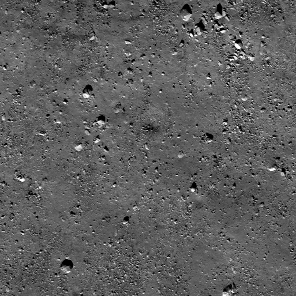
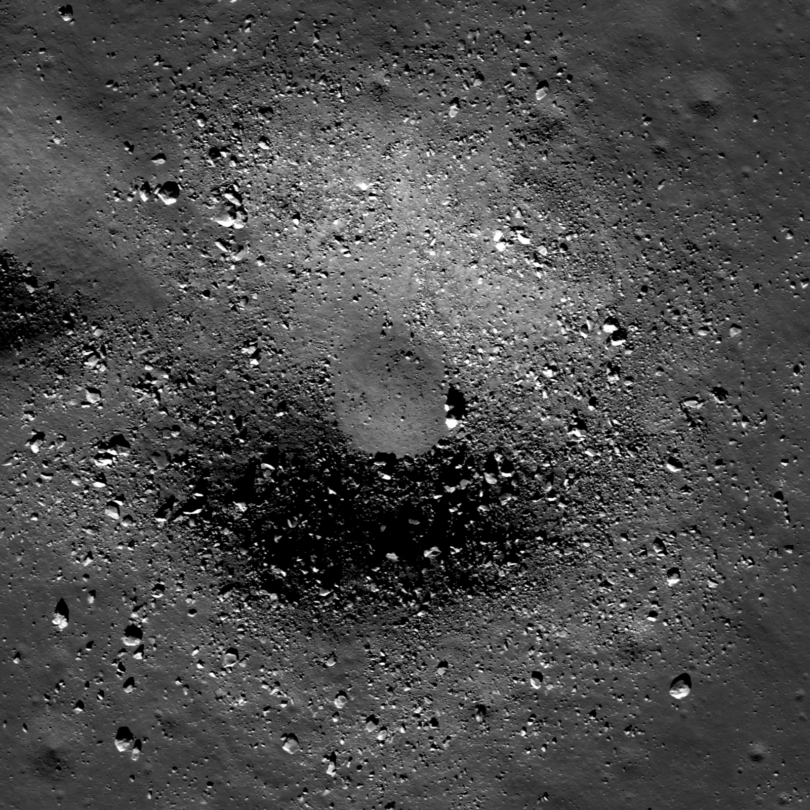
Boulders of various sizes (a few meters up to around 20 meters) scattered across the lunar surface. Where do these boulders originate? LROC Narrow Angle Camera (NAC) observation M170605553LR, LRO orbit 10276, September 14, 2011; resolution 51 cm per pixel over a field of view 510 meters across, viewed from 47 km [NASA/GSFC/Arizona State University].
Lillian Ostrach
LROC News System

Featured Images occasionally highlight lunar boulders larger than a few meters. Observed on crater floors, near crater rims, and clustered atop wrinkle ridge crests, boulders provide excellent sampling opportunities for exploration (think: Station 6 Boulder samples from Apollo 17 helped scientists understand local and regional geology). However, like any terrestrial field location, context is crucial to developing a plan for fieldwork and sampling, and even though planetary scientists frequently rely on remotely sensed data, these scientists cannot test hypotheses unless they know where and what they are observing! So, looking at the image above, where is this boulder field located (crater floor? crater rim? wrinkle ridge? elsewhere?) and from where did these boulders originate?


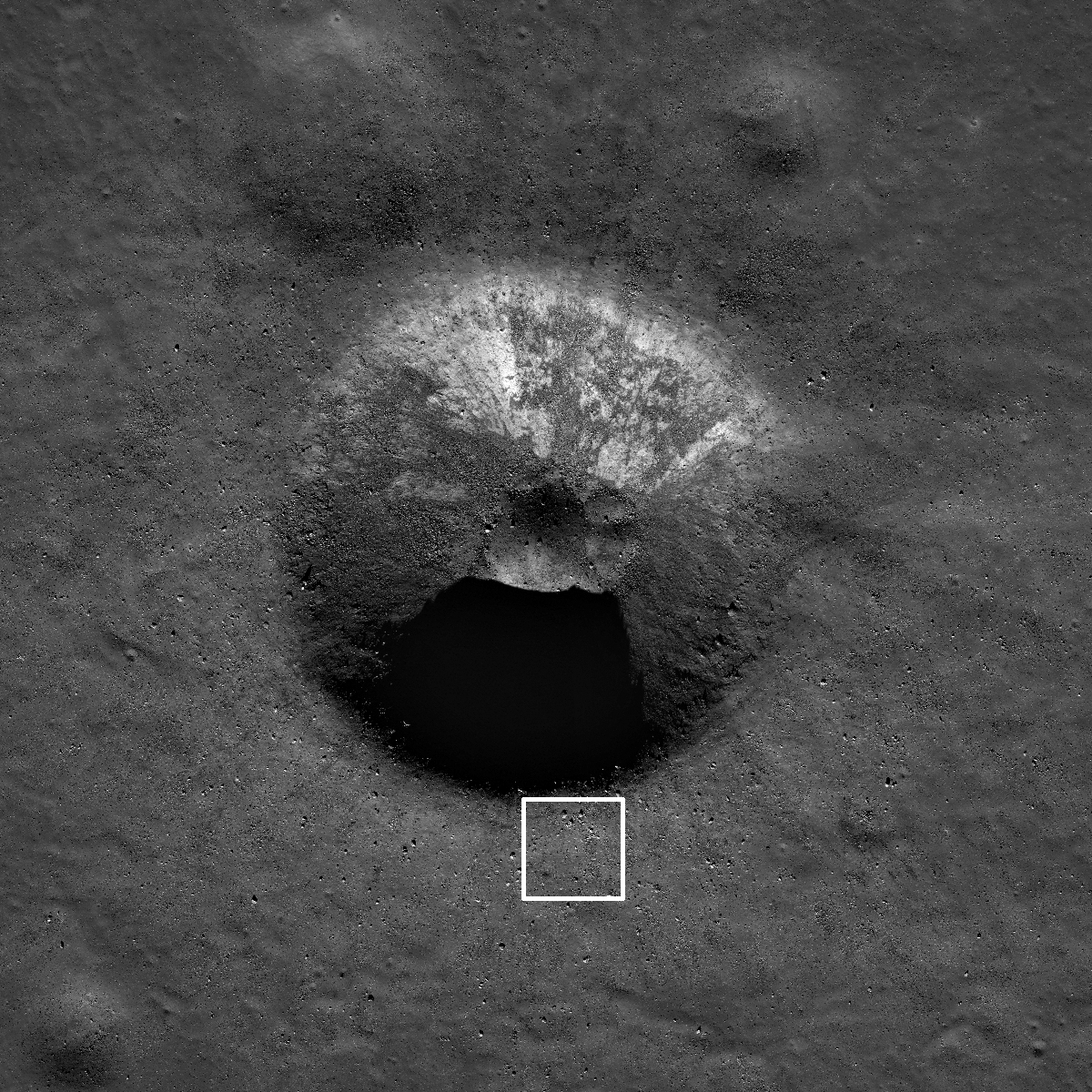
Reduced resolution view of the crater in the opening image. White box is approximate location of opening image field of view, LROC NAC M170605553LR, image width 2.5 km [NASA/GSFC/Arizona State University].
Taking a look at the zoomed out view in a reduced resolution NAC image, it becomes apparent that the opening image is located immediately exterior to the southern crater rim of an unnamed, 1.8 km diameter crater (located at 58.408°N, 351.859°E in Mare Frigoris). With this context, the location of the boulder field is revealed to be outside a mare crater. Furthermore, the origin of the boulder field is ejected material from the impact crater formation. Going back to the exploration thought - why would these boulders be advantageous to sample?

LROC WAC monochrome mosaic centered on the unnamed crater in Mare Frigoris, north-northeast of the Plato crater group; arrow notes the location shown at high resolution in the LROC Featured Image released January 30, 2013. Buried deep under this region is the antipodes, the opposing side of the Moon, of the primeval impact that formed South Pole-Aitken basin [NASA/GSFC/Arizona State University].
Sampling boulders close to the crater rim provides explorers the opportunity to collect rocks in a "radial traverse". The material right on the rim is mostly from deep within the crater and material further from the rim is from shallower within the crater. So as you approach a crater rim, the ejecta is progressively from deeper within the crater. This technique was employed by the Apollo 14 astronauts at Cone crater.

In the case of today's crater, the rocks sitting on the rim are from about 150 m below the surface even though the crater depth is about 360 m. During impact, part of the crater formation results from compression of the target and excavation flow (sideways movement of material), and for simple craters (less than 15 km diameter) an estimate of excavation depth is Hexc=0.1Dt, where Hexc is depth of excavation and Dt is transient crater diameter (diameter of the crater cavity at the conclusion of the excavation stage, before post-impact modification begins). The transient crater diameter can be estimated from the observed rim-to-rim diameter (what we measure today) using the relationship Dt=0.84D, where D is observed crater diameter. These relationships are explained in detail in Impact Cratering: A Geologic Process, by H. J. Melosh (1989).

Explore this 1.8 km impact crater in a virtual traverse using the full LROC NAC image, HERE.

Related Posts:
Sampling Schrödinger
Boulder trails in Menelaus crater
Physics is Fun!

Wednesday, November 14, 2012

Craters, Old and New

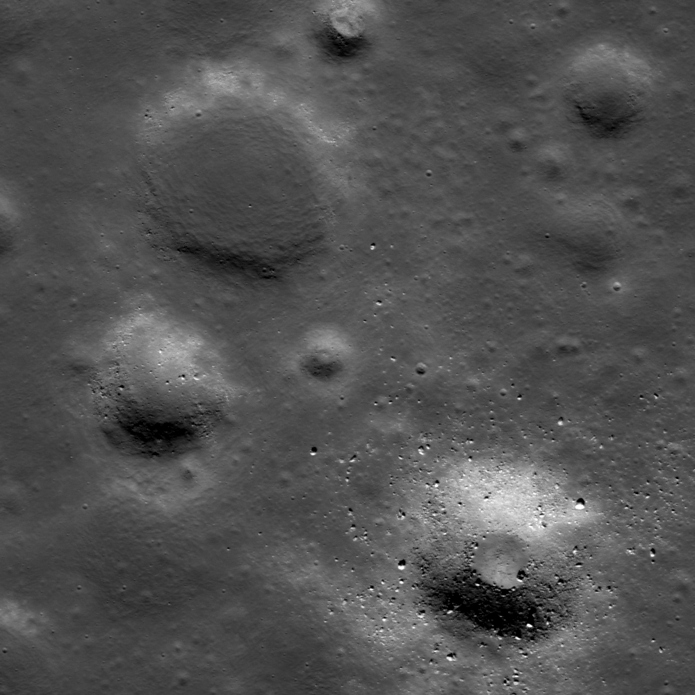
Unnamed craters on the western edge of Mare Frigoris. 1.65 kilometer-wide field of view from LROC Narrow Angle Camera (NAC) frame M186056576L, centered on 56.579°N, 334.890°E. Captured during LRO orbit 12497, March 10, 2012, resolution 1.66 meters per pixel from 168.15 kilometers [NASA/GSFC/Arizona State University].
Hiroyuki Sato
LROC News System

Today's (Tuesday, November 13, 2012 - LROC) Featured Image highlights contrasting features of a young (lower right) and old (upper left) crater with nearly the same diameters (about 450 meters). These two craters are found in the western portion of Mare Frigoris, 23 kilometers south of La Condamine S.

The walls of of the younger crater are steeper with a small, nearly flat floor, probably from pooled impact melt. The older crater appears much shallower and flatter due to an extensive amount of infilling. This type of degraded flat-floored crater is common on the maria.

Many of the craters in this area appear to have roughly the same amount of infilling. Why? Perhaps a local resurfacing event occurred, meaning the infill could either be a product of volcanic activity or impact ejecta. If we visit one of these infilled craters and dig a trench or two we could determine whether this infilling material is volcanic or impact ejecta.

Surrounding areas of La Condamine S crater in LROC WAC 100 meter/pixel mosaic on LOLA laser altimetry using NASA Lunar Modeling and Mapping Project (LMMP) application ILIADS. The long footprint of the entire LROC NAC observation from March 2012 is shown along with the much smaller field of view at high-resolution at the beginning of this post [NASA/GSFC/Arizona State University].

Explore the contrasting young/old craters and surrounding area in the full NAC frame HERE.

Related Posts:
Where Moscoviense meets the Highlands
Wrinkle Ridge Near Montes Teneriffe
Aitken Crater Constellation Program Region of Interest
Montes Pyrenaeus meets Mare Nectaris
Ghost crater in Mare Imbrium

Tuesday, August 7, 2012

LROC: Mounded Floor

Blocky crater (~500 m diameter) with a central mound, located in Mare Frigoris. LROC Narrow Angle Camera (NAC) observation M170605553R, LRO orbit 10276, September 14, 2011; angle of incidence 60.61° from 47.08 kilometers, resolution 0.51 meters - field of view width 800 meters. See the spectacular full-size LROC Featured Image (1600 px) HERE [NASA/GSFC/Arizona State University].
Lillian Ostrach
LROC News System

Blocky craters in the mare are frequently imaged by the LROC NACs. Today's Featured Image is a ~500 m diameter crater in Mare Frigoris with blocks and a central floor mound. The typical depth of excavation for simple craters is about one tenth of the crater diameter, so the crater above excavated mare material from up to 50 meters below the surface. 

The excavated material is probably a combination of regolith breccias formed during the impact and ejected fragments of bedrock. Additionally, the ejecta closest to a crater's rim is usually from the deepest part of the crater, so the blocks near the rim are probably recently exposed mare basalt rocks excavated during impact.

LROC monochrome (566nm) Wide Angle Camera image of the Mare Frigoris basalts, centered on the crater with a mounded floor (58.96°N, 8.1°W). Asterisk notes location of opening image [NASA/GSFC/Arizona State University].
The interior morphology of craters, whether they are bowl-shaped, have a central mound, or have benches, is dependent on impact mechanics and target properties. In the 1960s, laboratory cratering experiments successfully created crater landforms similar to those observed in Lunar Orbiter images. In several key papers1, Drs. Quaide and Oberbeck studied the effects of impacting conditions such as gravity, impact velocity, and the target surface with respect to final crater shape.

These scientific studies determined that the type of target material was a substantial factor in controlling interior crater morphology, and that different crater morphologies are formed based on the thicknesses of surface regolith atop stronger rock layers. The central mound observed in today's Featured Image can thus be explained as a result of an impact into a cohesive rock substrate overlain by a relatively thin layer of regolith. What do you think would happen to the interior morphology if the crater was bigger, or smaller?

Can you find additional craters with central mounds in the full LROC NAC frame?

1In the 1960s, impact mechanics experiments greatly furthered scientists' understanding of the impact process. Many publications detail these studies, but three references are particularly noteworthy: Gault, D. E., W. L. Quaide, and V. R. Oberbeck, Impact cratering mechanics and structures, Shock Metamorphism of Natural Materials, 87-99, 1968. Oberbeck, V. R., and W. L. Quaide, Estimated thickness of a fragmental surface layer of Oceanus Procellarum, J. Geophys. Res., 72, 4697-4704, 1967. Quaide, V. R., and V. R. Oberbeck, Thickness determinations of the lunar surface layer from lunar impact craters, J. Geophys. Res., 73, 5247-5270, 1968.

Related Posts:
Another, relatively fresh crater with a mounded floor, with twin pools of melt, (43.16°S, 68.98°W) near Vallis Inghirami, in the southwest near side, has been subject to more than one LROC NAC observation. This one, above, and below, at full resolution, is scaled from LROC NAC frame M175739695, orbit 11033, November 12, 2011. The incidence angle is 59.61° at 43 centimeters per pixel resolution, from 31.26 km [NASA/GSFC/Arizona State University].

Friday, January 20, 2012

LROC: Shadows in Egede A

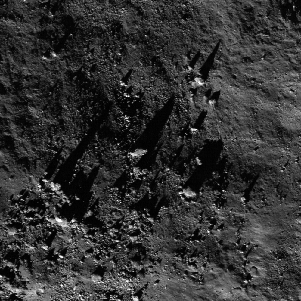
A field of boulders casts long shadows on the south wall of northern mid-latitude crater Egede A. Illumination from south-southwest at a 54.94° angle of incidence. Field of view is roughly 400 meters across. LROC Narrow Angle Camera (NAC) observation M122137079L, LRO orbit 3135, March 2, 2010; resolution 0.49 meters from 42.45 kilometers. View the full size LROC Featured Image HERE [NASA/GSFC/Arizona State University].
James Ashley
LROC News System

As on Earth, that 'golden time' just before the sun dips below the western horizon produces spectacular shadow effects on the Moon, dramatically accentuating perceived surface roughness. Because the Moon has no atmosphere, its shadows are very sharply defined and the contrast between illuminated and shadowed areas is high. The Apollo astronauts often reported difficulty in judging distances to objects because without a hazy or dust-filled atmosphere to 'soften' the view, distant objects looked very similar to objects that were close up. Shadows are useful to planetary scientists doing remote sensing investigations because their length can help us determine the size of the object casting the shadow.

For example, here we see a family of boulders resting on the inner slope of Egede A crater (51.56°N, 10.45°E). Were this a horizontal surface, the shadow length of the largest boulder in the featured image would indicate its height to be approximately 61 m. The calculation is made by knowing the solar incidence angle and using a bit of high school trigonometry. Actually, however, the surface is not horizontal -- an 'early sunset' is produced for these boulders by the sloping crater wall, effectively exaggerating the boulder's height. Therefore the true height of this boulder is something less than 61 m. That means our sun angle is wrong for producing an accurate boulder size estimate. This also means that we would have to know the angle of the sloping crater wall in combination with the sun angle and shadow length to make our calculation. Planetary sciences teaches us to be cautious in our interpretations of what we think we see. Can you think of a way to determine the slope of the crater wall?

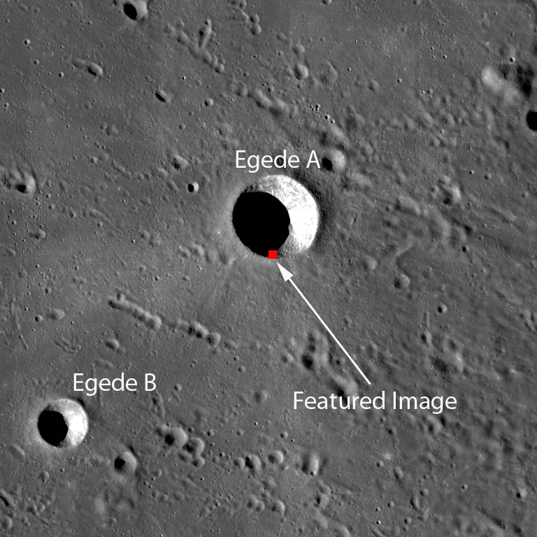
Yellow square shows the field of view of the Featured Image, near the rim of Egede A in the context of the full NAC M159080552L frame, a field of view approximately 2.5 kilometers wide [NASA/GSFC/Arizona State University].
Imagine that you're standing on the rim of this crater. The sun would still be relatively high above the horizon. Note how the surface beyond the crater in the context image below is in full sunlight. High overhead is the Earth, looking four times the diameter that the Moon does in our Earth sky. If you then held your hand up to block the sun, the rest of the heavens would be raven black and filled with stars. All your favorite constellations would be recognizable, just as if you were back on Earth, with no visible change in their positions relative to each other -- the distance between the Earth and the Moon simply isn't great enough to register a visible shift among star patterns. You had better find some shelter soon, because it will get very cold here when the sun finally sets!

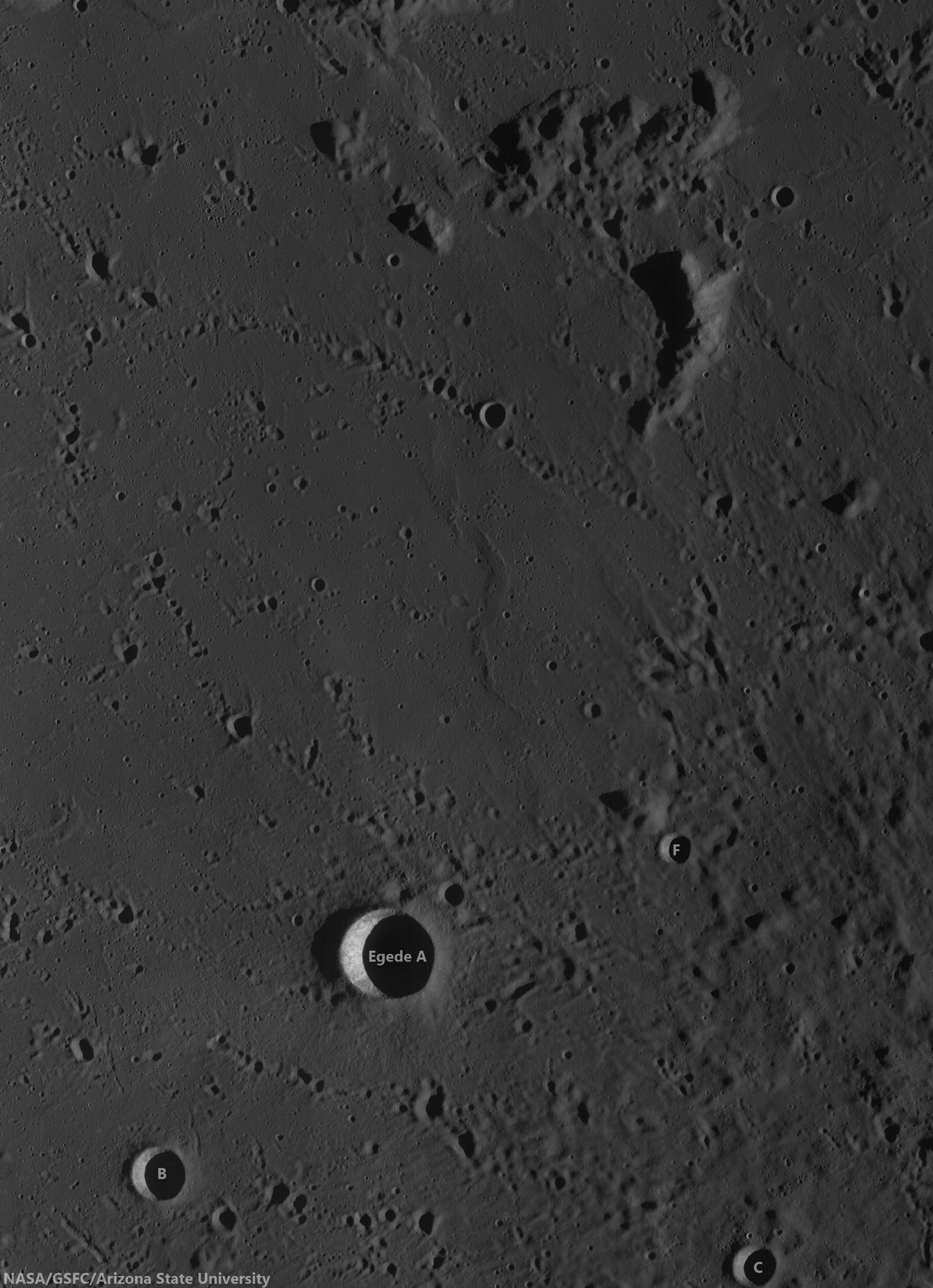
Egede A in temporal context, seen here through the LROC Wide Angle Camera (WAC) in a monochrome (604 nm) mosaic stitched from observations swept up in orbits 3132 and 3134, orbital passes immediately before and after the the Featured Image (yellow box) was captured, March 2, 2010. LROC WAC observations M122130239C and M122143802C, with an average resolution of 59.9 meters per pixel from 42.03 kilometers altitude [NASA/GSFC/Arizona State University].
Note the faintly visible, light-colored ejecta pattern surrounding Egede A in the image below. This shows it to be a relatively young impact feature. The WNW-ESE trending crater chains to the north and south of Egede A are secondary impacts produced by ejecta from a much larger impact beyond the frame.

LROC WAC mosaic context image, showing greater relief in long shadows nearer to a true sunset. Note the trails of secondary craters and the outer edge of the ejecta blanket of the far older Aristoteles crater whose center is more than 120 kilometers away. Field of view is about 78 kilometers. View the larger LROC context image HERE [NASA/GSFC/Arizona State University].
The full NAC image shows many additional features worthy of long study. Look carefully among the boulders for tracks that indicate movement as one or another rolled down the sloping crater wall. Additional interesting shadow effects can be seen in Central Peak Bedrock, Slumping Rim of Darwin C, and Necho's Jumbled Floor.

Using a modest telescope (or Google Earth, or NASA's ILIADS application), if you find the Alpine Valley (Vallis Alps), the well-known spectacular fracture fault radiant northeast from Mare Imbrium, you can find Egede A. The crater is directly on the opposite end of a line running through the valley from the huge basin [NASA/ILIADS/ASU].

Thursday, October 13, 2011

LROC: Tectonics at the edge of Procellarum

A mare wrinkle ridge transitions to a highland lobate scarp at the edge of Oceanus Procellarum. Illumination is from the lower-left in this 2.9 km wide mosaic of LROC Narrow Angle Camera (NAC) frames M107069913LE and M107069913RE, LRO orbit 918, September 8, 2009. View the full size LROC Featured Image HERE [NASA/GSFC/Arizona State University].

Nathan Williams
LROC News System

A mare wrinkle ridge transitions to a highland lobate scarp at the edge of Oceanus Procellarum. Illumination is from the lower-left in this 2.9 km wide mosaic of LROC NAC images M107069913LE and M107069913RE [NASA/GSFC/Arizona State University].

Two types of compressional tectonic landforms are commonly observed on the Moon: wrinkle ridges and lobate scarps. Wrinkle ridges are long, often sinuous hills in mare basalts and are thought to be folded rock layers overlying deeper faults. Lobate scarps usually occur in the highlands and are interpreted as rocks lifted up by faults very near to or even breaking the surface. There are a few locations where a wrinkle ridge transitions into a lobate scarp or vice-versa, such as here at the northern edge of Oceanus Procellarum (60.5°N, 331.4°E). In this LROC NAC mosaic, the lobate scarp in the highlands massif to the northeast meets a wrinkle ridge to the southwest when it reaches the otherwise flat-lying Procellarum basalts. You can also see lots of boulders eroding out of the wrinkle ridge.

Reduced resolution NAC mosaic of images M107069913L and M107069913R showing the wrinkle ridge - lobate scarp transition. Illumination is from the bottom-left in this 16 km wide mosaic. [NASA/GSFC/Arizona State University].
Wrinkle ridges are thought to have formed after the basaltic lavas erupted, filling in the basins on the nearside, and weighing down the crust. All that extra weight probably made the ground sag and bend, causing the basalt to buckle and fold in some areas. On the other hand, lobate scarps are thought to form from radial contraction or shrinking of the entire Moon. The global radial contraction built up compressional stresses in the crust until the stress was great enough to fracture all the way to the surface. The transition from wrinkle ridge to lobate scarp may be due to the contrast in materials, especially if the basaltic lavas are layered and the highland massif lacks layering. However, the relationships between wrinkle ridges and lobate scarps at transitions like this are still being studied.

LROC Wide Angle Camera mosaic (604 nm band) showing the Featured Image (yellow box) in context around 7 kilometers west of craterlet Fontenelle X, and the system of wrinkle ridges and scarps, admittedly easier to see at higher resolutions. From a larger LROC WAC mosaic swept up through 14 orbital observations from an average 36 kilometers altitude, January 26 and 27, 2011; Field of view roughly 62 kilometers (phase angle averaged 70° - see image following) NASA/GSFC/Arizona State University].
Highly reduced original LROC WAC mosaic (January 26, and 27, 2011) showing the location of the Featured Image and its environs within Mare Frigoris, north of Sinus Iridum and Mare Imbrium, possibly superimposed on the older (even with younger volcanic fill) and irregularly-shaped basin known as Oceanus Procellarum. Some investigators propose most of the nearside may be an ancient basin, responsible, perhaps at least in part, for the near and far side elevation discontinuity, and a basin that is perhaps larger than the nearside hemisphere itself, originally centered northwest of Mare Tranquillitatis. This so-called "Gargantuan" impact basin is far from without it's detractors, however. Without definitive proof, the South Pole-Aitken basin remains the largest and oldest recognized impact basin.
Then there is the laser altimetry building up from the LOLA instrument on-board LRO, from hemisphere-views released earlier this year, here showing the location of the Featured Image (blue arrow) from over far north, and the farside highlands beyond 90° west. Without the nearside's familiar albedo features, the near and farside dichotomy is easier to sense [NASA/GSFC/LOLA/SVS].
Take a look at the full NAC mosaic - can you find any other scarps or ridges?

Related Posts:
Scarps in Schrödinger
Lunar Lobate Scarp
Slipher Crater Fractured Moon in 3-D
Forked Wrinkle Ridge
Stress and Pull