
 |
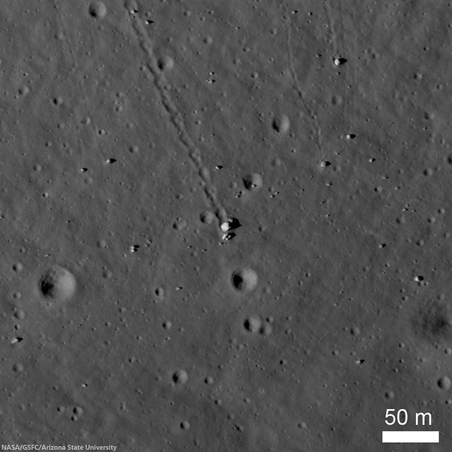
| Station 6 allowed Apollo 17 astronauts Eugene Cernan and Jack Schmitt to explore a collection of boulders and regolith that represent rocks from the mighty North Massif. Five large boulder fragments lie at the base of a long boulder trail, all from a single boulder that rolled down the hill and broke apart. LROC Narrow Angle Camera (NAC) observation M134991988R, spacecraft orbit 5027, July 28, 2010; angle of incidence 64.66° at 0.5 meters resolution from 43.83 km over 19.19°N, 30.8°E [NASA/GSFC/Arizona State University]. |

LROC News System
The North Massif lies along the northern side of the Taurus-Littrow Valley, the landing site of Apollo 17. Station 6 was visited during the third and final surface EVA of the expedition and of the Apollo program, December 13, 1972, and was intended as a location to collect ancient highland material from the North Massif as well as a dark mantle that locally covers the region.
The sampling station is about 100 meters above the general valley floor elevation of 2560 meters below global mean average. The North Massif rises some 1400 meters above Station 6 and likely formed in a few seconds as the result of the massive impact that created the Serenitatis Basin.
One of the key science goals at Station 6 was to collect impact melt caused by that event. When rock is melted its radiometric clock is reset to time zero, so a sample of impact melt can be age-dated to determine when the basin formed.
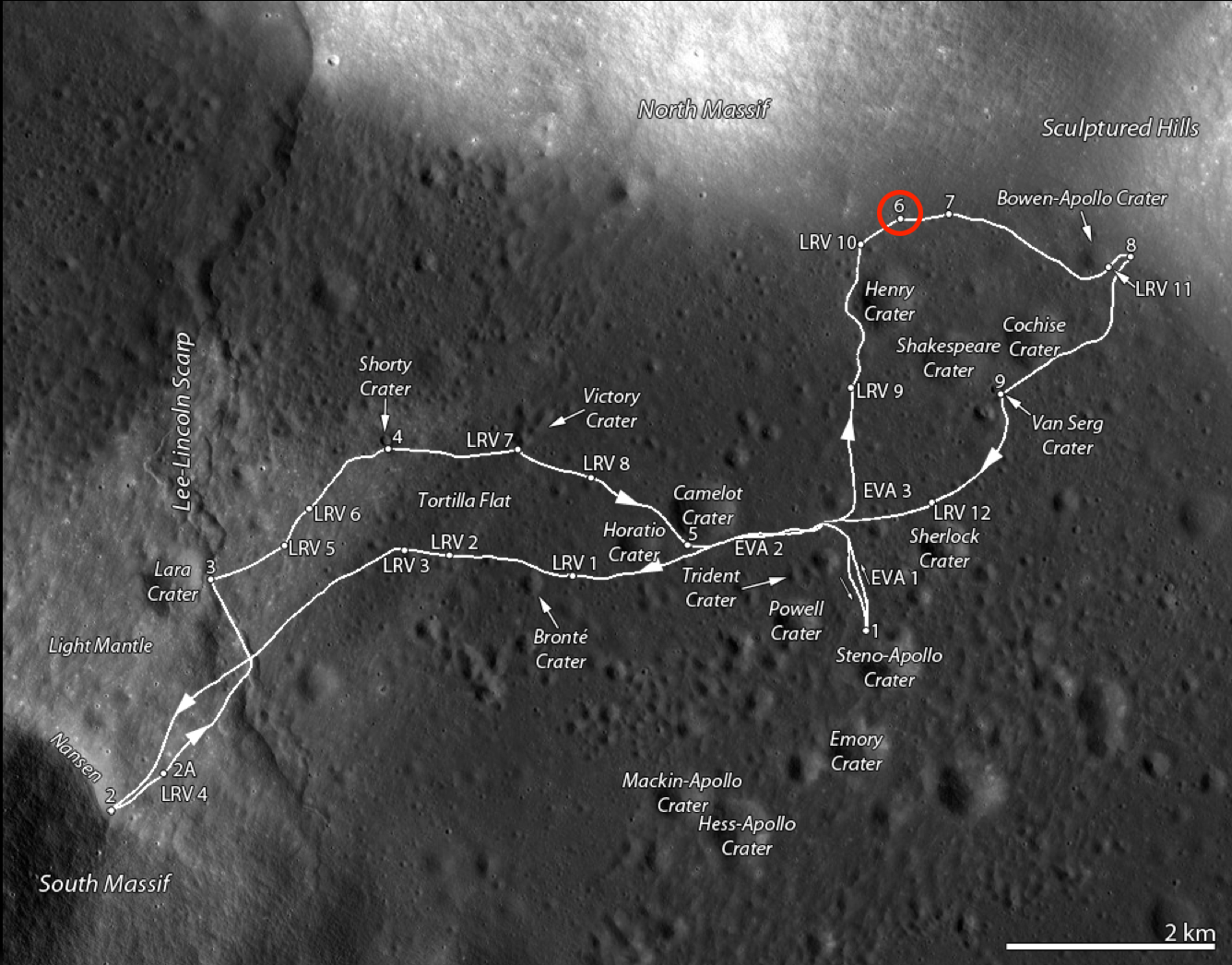 |
| Traverse map of the Apollo 17 site. Station 6 is along the base of the North Massif on the north side of the valley and is circled in red [NASA/GSFC/Arizona State University]. |
It appears that the rolling ceased when the boulder broke apart and came to the rest in its present location. As the boulder rolled down the hill slope, it pushed up material along the edge of the track forming a berm. A small berm is also visible in front of the largest fragment. An expanded view of the boulders from an LROC image is shown below. Subtle brightness differences are apparent in the largest boulder in the center, and correspond to different rock types (the boulder is a breccia).
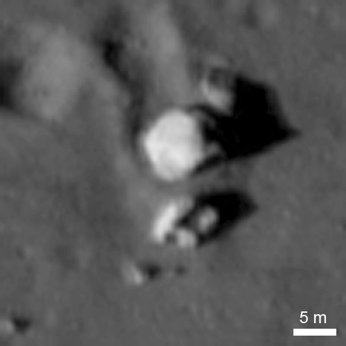 |
| The five major blocks at Station 6, and an additional one farther down slope, are clearly visible in LROC NAC M134991788RE, as is the boulder trail above the blocks. Afternoon illumination, sun from the west [NASA/GSFC/Arizona State University]. |
 |
| Jack Schmitt picking up the gnomon after collecting samples. This view is to the southwest, and the Apollo 17 lunar module stands sentinel in the upper right deep background (AS17-140-21496) [Eugene Cernan/NASA/JSC]. |
 |
| Jack Schmitt put the Apollo 17 lunar module "Challenger" in some perspective, capturing this monochrome shot, through a 500 mm lens, and from over 3 km) from Station 6. From another panorama of EVA images, AS17-139-21203-5 [Harrison Schmitt/NASA/JSC]. |
 |
| LROC image of the boulder complex (top); map of the boulder segments and the sample locations (below). North and South Panoramas designate locations where the hand-held panoramic image sequences were captured. The numbers refer to specific Apollo samples [NASA/GSFC/Arizona State University]. |
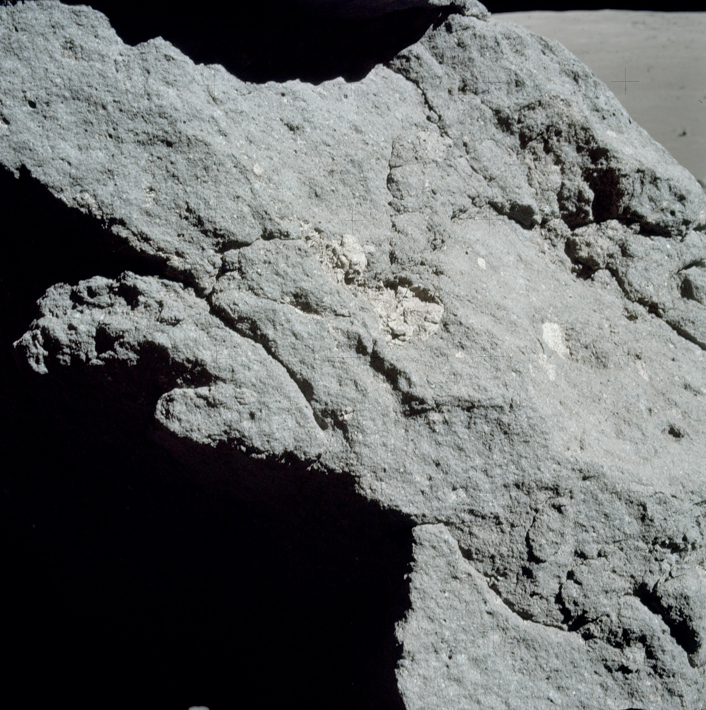 |
| Light-colored inclusions in the matrix of one of the boulders (Block 1) (AS17-140-21442) [NASA/JSC]. |
Explore the Taurus-Littrow Valley yourself, HERE.
Previous LROC Featured Images RE: Apollo 17:
Oblique view of Taurus Littrow, from the West (December 19, 2012)
Approach To Taurus Littrow Valley (December 11, 2012)
Taurus Littrow Oblique (September 29, 2012)
Question Answered! (July 17, 2012)
Just Another Crater? (December 13, 2011)
Skimming the Moon (September 6, 2011)
Exploring the Apollo 17 Site (October 28, 2009)
No comments:
Post a Comment