Wednesday, November 24, 2010

Erosional troughs on crater wall


An erosional trough (400 meters long x 100 to 200 meters wide) represents a significant chunk of material slipped down the steep upper inside east wall of the notably bright farside crater Moore F. Morphologically it resembles a martian sapping feature, suggested as the result of erosion by water flowing and undermining the subsurface. LROC Narrow Angle Camera observation M128075293R, LRO orbit 4008, May 9, 2010, Field of view is 500 meters, with the Sun from the southwest at lower right [NASA/GSFC/Arizona State University].

Jeff Plescia
LROC News System

A number of erosional troughs are observed on the inner wall of Moore F on the lunar far side (37.21°N, 185.48°E). The crater is 23.7 km in diameter and is relatively fresh, as evidenced by bright ejecta and its pristine morphology. Numerous troughs are observed extending down the inner crater wall. The feature shown here is the freshest with a smooth floor composed of bright material.

The trough is about 810 meters long and around 140 meters wide near its head, narrowing slightly to about 105 m in the middle before widening to some 200 meters.


Several other older troughs occur along the crater wall to the north and south of this feature. They all appear to begin at about the same level of the crater wall, an area marked by what appears to be discontinuous outcrops of bedrock. The older features are darker, with an albedo similar to the surrounding terrain, as opposed to this feature, which has a considerably higher albedo.

These features resemble so-called sapping features observed on Mars. The martian features are suggested to be formed by the release of ground-water along a cliff face causing headward erosion of the trough. In these lunar examples, it is highly unlikely that ground water occurs. Presumably the features are the result of dry debris flows of fine-grained, unstable material. Once mobilized, the dry granular flow broadened into a fan-shaped deposit. Here the material extends more than a kilometer downslope from the mouth of the trough.

Explore the full NAC image.

Check out a related post!

Monday, November 22, 2010

Delicate patterns in Giordano Bruno ejecta


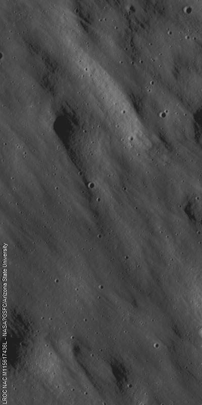
Pan of the LROC Featured Image released November 22, 2010 - Narrow Angle Camera (NAC) view of the "Far edge of the Giordano Bruno crater ejecta blanket." LROC NAC observation M115617436L, LRO orbit 2172, December 16, 2009; resolution 0.9 m/pixel, image field of view is 1.08 kilometer, the Sun's illumination is from the right. See the full-size original LROC Featured Image HERE. The famous young crater Giordano Bruno is to the northwest [NASA/GSFC/Arizona State University].

Hiroyuki Sato
LROC News System

Impact cratering is a common and universal phenomena on every planet and satellite. However, we still do not completely understand this complicated process. The Moon is one of the best libraries of impact craters in our Solar System because its surface is not modified by atmospheric weathering or water erosion. The dominant form of erosion on the Moon is indeed impact cratering.


Full resolution (86 centimeters per pixel) close-up of LROC NAC observation M115617436L showing how the Giordano Bruno ejecta blanket scoured and partially erased the terrain it channeled and buried. The pattern is reminiscent of the "elephant skin" pattern characteristic of nearly all older lunar surfaces higher than surrounding elevations [NASA/GSFC/Arizona State University].

Today's featured image shows the edge of the Giordano Bruno crater ejecta (35.94°N, 102.91°E); upper-left of the WAC image (below). Here you can easily see the delicate patterns of ejecta overlying pre-existing terrain. The ejecta pattern points back to the crater, and gives the impression of a fast moving surface flow. Combining the morphology of the ejecta, and new topographic data from NAC stereo pairs, scientists will be better equipped to unravel the physics of ejecta emplacement.


Context map around Giordano Bruno crater (centered 107°E, 34°N). LROC WAC 100 m/p monochrome mosaic overlayed by optical maturity (OMAT) parameter [Lucey et al, 2000], generated from Clementine Ultra-Violet/Visible wavelength (UVVIS) data, at 200 m/p. Blue corresponds to younger, "optically immature" material, and red is an older and more mature surface. The white dashed box corresponds to the footprint of the full LROC NAC observation from which the LROC Featured Image released November 22, 2010 was taken . See the full-resolution original of the above HERE [NASA/GSFC/Arizona State University].


Zooming in upon Giordano Bruno, using the LROC Planetary Data Base (PDS) Image Search interface now vastly improved with the new Wide Angle Camera (WAC) global mosaics, quickly unveils the brighter low OMAT influence the young crater's impact event has had on its surroundings, just beyond line-of-sight view from Earth past the Moon's eastern limb [NASA/GSFC/Arizona State University].

Explore the Giordano Bruno ejecta blanket NAC frame!

Reference: Lucey et al. (2000) JGR, v105, no. E8, p.20377-20386.

Previous post showing the floor of Giordano Bruno.

Thursday, November 18, 2010

Avalanche in Robinson crater


Northern slope inside Robinson crater, far to the northeast on the face of a Full Moon as seen from Earth (59.1°N, 314.1°E). Close-up from LROC Narrow Angle Camera observation M114259768R, LRO orbit 1972, November 30, 2009 Image resolution is 0.52 m/pixel, field og view 620 meters, sun light is from right, and the slope runs from top to bottom. View the full-width Featured Image, HERE [NASA/GSFC/Arizona State University].

Hiroyuki Sato
LROC News System

An impact crater changes its shape with time by various degradation processes, such as wall slumping, infilling with ejecta deposits from nearby impacts, and volcanic activities. Rock avalanches as shown in today's featured image also contribute to modifying crater shape little by little.


Pulling back from the NAC observation and this view inside Robinson north rim show wispy fine debris trails [NASA/GSFC/Arizona State University].

Multiple tongue shaped flow fronts in this image evoke liquid (Newtonian) flow features, especially mudflows. Similar features have been found on Mars, and are interpreted to represent recent mudflows. Water is not stable on the Moon's surface (except perhaps as ice in permanently shadowed craters), so these flows are dry (granular) rock slides. Perhaps some of the flow features on Mars thought to indicate wet mudflows are really dry granular flows?


Context map of Robinson crater, centered near 59.1°N, 314.0°E. LROC Wide Angle Camera 100 m/px monochrome global mosaic overlayed by the WAC color Digital Terrain Model (DTM) at a resolution of 500 meters/px. The blue rectangle outlines the full footprint of the LROC team's Featured NAC Image November 18, 2010. View the full field of view in the original release, HERE [NASA/GSFC/Arizona State University].


A wider view showing the location of the rockslide just inside the northern rim of Robinson, in the context of the landmark Imbrium impact event. The vicinity of Robinson, near the long and winding Mare Frigoris, appears to be on a battered outer ring of Imbrium [NASA/LROC PDS Interface].

Explore lunar landslides by viewing the full NAC frame!

Similar slides can be seen in a small crater in the center of crater Henry Frères.

Tuesday, November 16, 2010

Slope failure near Aratus


Northern flank of cone-shaped mound north of Aratus crater (23.68°N, 4.50°E) in the rough badlands west of Mare Serenitatis. LROC Narrow Angle Camera M117461002L, LRO orbit 2444, January 6, 2010. Image field of view is about 672 meters. Illumination is from west-southwest (left) at an incidence angle of 83° and downslope direction is from bottom to top. Click HERE for the full-size release. [NASA/GSFC/Arizona State University].

Hiroyuki Sato
LROC News System

The featured image above displays a mixture of smooth (denoted "S") bumpy (B) and rough textured (R) surfaces. Some of the bumpy-textured material is enclosed by the rough-textured material. The downhill-side edges of the smooth areas are scalloped and are often accompanied by parallel wrinkles.


LROC Wide Angle Camera (WAC) monochrome mosaic shows it's relation to Hadley Valley, the steep mountains bordering Palus Putredinis and the July 1971 landing site of Apollo 15 (76 kilometers away) - LROC PDS Image Search Interface [NASA/GSFC/Arizona State University].

The uphill edges of each piece of smooth-textured surface appear to have separated from the smooth material up-slope from them, leaving a gap of rough surfaced material. It is possible that these characteristics indicate slope failure (landslide) of an upper thin layer, similar to what we see on terrestrial landslides or a snow avalanche. This type of sliding occurs where the material strengths of upper and subsurface layers have large contrast, typically unconsolidated material overlaying a more rigid substrate.

Estimates of sliding layer thickness, local topography, and morphological characterization of flow features allow scientists to determine the geotechnical (soil mechanics) properties of the lunar regolith. Such studies are key to designing future rovers, space suits, and tools for exploring the Moon.


Topographic context map of the vicinity of Aratus (centered near 23.09°N, 4.43°E). LROC Wide Angle Camera 100 m/p resolution monochrome mosaic overlayed with the WAC color Digital Terrain Model (DTM, 500 m/p). (Click HERE to view the full-size original.) Blue-dashed rectangle corresponds to the footprint of the full LROC frame from which the LROC featured image of November 16, 2010 was cropped [NASA/GSFC/Arizona State University].

Explore lunar landslides by viewing the full NAC frame.

Friday, November 12, 2010

The Central Peak of Kepler


Boulders and simple craters perched on top of Kepler crater's central peak. LROC Narrow Angle Camera (NAC) observation M111843702R, LRO orbit 1616, November 2, 2009; field of view (below and HERE) is 500 meters [NASA/GSFC/Arizona State University].


Drew Enns
LROC News Service

There are two basic types of impact craters: simple and complex. Simple craters form a bowl-like rimmed depression, and complex craters (such as Kepler) display central peaks, terraces, and flat floors. Complex craters occur above a certain diameter crater, the cutoff diameter is dependent on gravity, so it varies from planet to planet (or moon to moon). On the Moon the size cutoff between simple and complex craters is between 10 and 20 km, on the Earth it is between 2 and 5 km.


A full-sized segment of an Apollo 12 orbital shot featured in previous postings from Drew Enns discussing Kepler. From this foreshortened angle (see context below) it's easier to see the minimal central peak does not exceed the crater's rim in elevation [NASA/LPI].


An LROC Wide Angle Camera mosaic of Kepler with an arrow indicating the location of featured NAC image above can be viewed HERE.

Despite the label "central peak," a central peak is not always exactly in the center of a crater, nor is it always symmetrically shaped; Kepler crater is an example. Instead of having a nice central peak, Kepler crater has an irregular off-center peak. This form is most likely due to the crater being close to the boundary diameter between a simple and complex crater. Larger craters, such as King crater, can also display oddly shaped central peaks that are likely the result of an oblique impact.
Link
Browse the whole NAC image of Kepler crater and inspect the landforms associated with its central peak. Can you find evidence of impact melt on the central peak, terraces, and floor?

Related Posts:
Concentric crater
Kepler Crater Ejecta
Kepler's Rim

Wednesday, November 10, 2010

Kepler's Rim


Steep interior wall of Kepler, the crater's northwest rim is to the upper left and interior toward the lower right. Note the exposed layering near the top and boulders collecting at the base of the crater wall. From LROC Narrow Angle Camera observation M107128381R, LRO orbit 926, September 9, 2009; field of view is ~ 800 meters [NASA/GSFC/Arizona State University].

Drew Enns
LROC News System

Landslides are primarily caused by gravity pulling loose material down a slope. Numerous factors contribute to landslides on Earth, including water and vegetation, but these can be ignored for the Moon. However, both bodies are affected by the angle of repose which is related to the cohesiveness of the material making up the slope. Once the angle of repose is exceeded the loose material on the slope slides downhill. Since the exposed bedrock layer near the top of the wall is more cohesive it stays intact while loose rocks and dust slide from underneath. As the wall material continues to slide down, more of the resistant layer will be exposed until it is undermined and is pulled down by gravity. The boulders at the base of the landslides are probably pieces of the bedrock layer.


The range of two LROC NAC observations from early November 2010, from which consecutive Featured Images were derived are seen draped over the Google Earth lunar digital elevation model of Kepler's interior, once again suggesting the vast improvements in resolution since the base albedo map from the Clementine (1994) mission was gathered [NASA/GSFC/Arizona State University].

Explore the rest of Kepler's rim in the NAC image!

Related Posts:
Linné Crater
Kepler Crater Ejecta

Tuesday, November 9, 2010

Kepler Crater Ejecta


Large boulder ejected from Kepler crater, a small depression from the boulder's impact is just visible. LROC Narrow Angle Camera (NAC) observation M140155410L, LRO orbit 5788, September 26, 2010; above field of view is 320 meters, original LROC featured image (here) 800 meters [NASA/GFSC/Arizona State University].

Drew Enns
LROC News System

Kepler is a Copernican aged crater (32 km diameter, 8.1°N, 322.0°E) named for the German Astronomer Johannes Kepler, famous for his three laws of planetary motion. The impact event that created Kepler crater was energetic enough to eject this 100 m boulder out onto its continuous ejecta blanket. Impact events excavate material from great depth (approximately 1/3 the transient crater diameter) and distribute the material around the crater as ejecta. The material at the top of the impacted surface is ejected the furthest, while the deepest material has just enough energy to land on the crater rim. This distance to depth relation creates a natural core sample for astronauts to collect as they explore.


LROC Wide Angle Camera (WAC) context image of Kepler showing the location of the boulder field north of the crater on the downward slope of its ejecta blanket [NASA/GFSC/Arizona State University].


Kepler when the Moon is full, or how the optical immaturity of it's surroundings betray its relative youth in this spectacular photograph by P. Van de Haar of the Netherlands. This is how this familiar near side crater appears through modest telescopes at local "high noon."


In November 1969 the crew of Apollo 12 had a landing transfer orbit with a perilune further west than any other of the Apollo surface expeditions, and as such apparently captured the best images of Kepler prior to LRO, forty years later. The view of Kepler, 557 km northeast of the Apollo 12/Survey 3 landing site, had to have been captured late in the mission [NASA/LPI].


A center slice of a wider wallpaper-sized view of Kepler, looking south from a virtual vantage over the featured boulders, peeking over the north rim across Kepler to the south rim 40 km beyond [NASA/GSFC/Arizona State University/Google Earth].

The lunar mare were formed as old impact basins filled by massive eruptions of very fluid basalt. Its easy to measure the area of these mare basalts, but how thick are they? Are there multiple basalt flows that form the mare? If the mare is thin enough the Kepler impact may have excavated both mare and the underlying highland material. Samples from this boulder, and others like it out to the edge of ejecta could answer these questions. An astronaut would start sampling at the far edge of the ejecta blanket and work towards the rim. During this traverse the intrepid geologist would in effect be traveling down the inside of the crater, without doing all the work of climbing in and out! The last sample on the rim would be from near the bottom of the crater. With this suite of samples the history of the emplacement of the basalts at this spot could be unraveled.

Search for other ejecta boulders in the NAC image!

Related Posts:
Ejecta from Van de Graaf Crater

Friday, November 5, 2010

Gassendi A


Impact melt material inside the south rim of Gassendi A, which in turn intrudes into the northern rim of Gassendi. LROC Narrow Angle Camera observation M107136013L, LRO orbit 927, September 9, 2009; image field of view is 840 meters [NASA/GSFC/Arizona State University].


Unfortunately reduced Google Moon nest for the 100 meter/px monochromatic Wide Angle Camera mosaic of Gassendi and the draped extent of the NAC observation from which the featured image within Gassendi A was lifted, intruding into Gassendi's northern rim. The southern rim of the crater was partially flooded with lava during the formation of surrounding Mare Humorum [NASA/GSFC/Arizona State University].

Browse the full LROC NAC frame!

Related Posts:
Gassendi's Central Peak
Gassendi's Fractures

Thursday, November 4, 2010

Gassendi's Fractures


An intersection of two fractures in the crater Gassendi forms a rough "Y," with boulders concentrated on the northern wall. LROC Narrow Angle Camera observation M104770486L, LRO orbit 597, August 13, 2009. Image field of view is 946 meters, and the solar illumination incidence angle is 51 degrees [NASA/GSFC/Arizona State University].

Sarah Braden
LROC News System

The crater Gassendi is 110 kilometers in diameter and located on the northern edge of Mare Humorum at 17.5°S, 320.1°E. Gassendi features an array of intersecting fractures on its floor, collectively known as the Rimae Gassendi.


The LROC featured image nested within the boundaries of the full Narrow Angle Camera observation and the LROC Wide Angle Camera mosaic below. What seems relatively close by is Gassendi's northern rim, more than 40 kilometers away.

Some of the largest fractures are thousands of meters wide. The origin of these fractures in the floor of Gassendi is not known for certain. After the impact the floor of Gassendi was molten and as it cooled, a crust of solid material formed at the surface. As the entire crater floor continued to cool and settle into its final shape, fractures could have formed due to the forces caused by these changes. Other craters besides Gassendi also have fractured floors, like the craters Alphonsus or Goclenius. How do you think fractures form inside craters? What are the differences between each of these craters?


Meets and Bounds of the LROC NAC observation and location of the "Y" intersection in the featured image. The full WAC mosaic can be seen here [NASA/GSFC/Arizona State University].

Examine the fractures by viewing the full NAC frame!

Related Posts:
Gassendi's Central Peak
Alphonsus crater mantled floor fracture

Wednesday, November 3, 2010

Gassendi's Central Peak


Close up of a boulder (25 meters, or two school buses, wide) on the central peak of Gassendi. 180 meter-wide segment from LROC Narrow Angle Camera observation M109495053R, LRO orbit 1270, October 6, 2009 [NASA/GSFC/Arizona State University].

Sarah Braden
LROC News System

During the Apollo era, Gassendi (17.5°S. 320.1°E) was one of two primary landing site alternatives to the Apollo 17 site at Taurus-Littrow. The candidate location was south of the westernmost of Gassendi's central peaks. The main scientific motivation for a landing at the Gassendi site was the possibility of sampling ancient highland rocks in the crater's central peak. Sampling from the region would have also supplied ages for the Humorum basin impact and the Gassendi crater impact. However, engineering constraints kept Gassendi from becoming an Apollo landing site because it was uncertain if the terrain within Gassendi was too rough and dangerous for astronauts to successfully approach the central peak and obtain a sample.


LROC WAC 100 meter/per pixel monochrome mosaic of Gassendi [NASA/GSFC/Arizona State University].


For context, the meets and bounds of the full LROC NAC observation M109495053R set within the Wide-Angle Camera mosaic and the lunar digital elevation model available to users of the Google Earth application (>v.5).

The boulder in today's featured image is exactly what astronauts would want to sample. Since the boulder came from higher up on the peak, witnessed by a trail you can follow back up the peak, astronauts can use it as an opportunity to sample material from higher elevation parts of the peak without having to actually climb the peak! However, Apollo astronauts could not have known ahead of time where boulders like this one were located. The scientists and engineers of the Apollo program used Lunar Orbiter images, Apollo metrics, and Apollo mission photography to make educated decisions between various possibilities for landing sites and to decide where astronauts would travel on the surface. Lunar Orbiter images of Gassendi are lower in resolution (~ 60 m/px) compared to the LROC NAC image (0.5 m/px). Future lunar missions will benefit from LROC images which answer questions about surface roughness and where astronauts should go. For comparison to the NAC image, you can view the Lunar Orbiter image of Gassendi from 1960 below. What a difference new technology makes! The Lunar Orbiter image is provided courtesy of the United States Geological Survey Astrogeology Research Program's Lunar Orbiter Digitization Project.


Lunar Orbiter mosaic of Gassendi crater and the surrounding area. Resolution is about 60 meters [NASA].

Take a look at the central peaks of Gassendi in the full NAC image!

Related Posts:
Eratosthenes Central Peak
Up from the depths
Central Peak/Mare Boundary
Bhabha sinks into the shadows

Tuesday, November 2, 2010

Bowditch Lava Terraces


LROC Narrow-Angle Camera (NAC) view of a part of the lava terrace within the Bowditch formation. The wall of Bowditch is on the right and the terrace is located between the two dashed white lines. LROC NAC early Commission phase observation M101478053R, LRO orbit 176, July 9, 2009; field of view 2400 meters with a solar incidence angle of 86° [NASA/GSFC/Arizona State University].

Sarah Braden
LROC News System

Bowditch (25.0°S, 103.1°E) is an irregularly-shaped depression northwest of Lacus Solitudinis. Inside Bowditch is a "ring" that resembles a dirty bathtub. Much like water in a bathtub, this ring is a marker of the highest level of liquid lava within Bowditch. The Bowditch depression filled with lava like many craters on the Moon, and as the lava cooled and solidified, it subsided into the center of the depression. The ring is the remnant from this activity. NAC images give us further evidence of lava cooling, contraction, and subsidence in the mare. We do not know if drainage or contraction during cooling causes lava terraces like Bowditch, but these new images should provide us with more clues. Check out Apollo era images of the Bowditch feature at the Apollo Image of the Week site.


In this 100 meter pixel LROC WAC mosaic Bowditch is the irregularly-shaped mare-filled depression. The lava terraces are clearly visible all the way around the rim of Bowditch. The white box marks the area in the featured NAC image above [NASA/GSFC/Arizona State University].

View the full LROC NAC frame!


Deflecting the LROC Wide-Angle Camera mosaic with some degree of tri-dimensionality, the context for the close-up of the Bowditch "bathtub ring" seen fixed on the lunar digital elevation model available in the Google Earth application (>v.5).