Showing posts with label Gassendi. Show all posts

Friday, November 5, 2010

Gassendi A


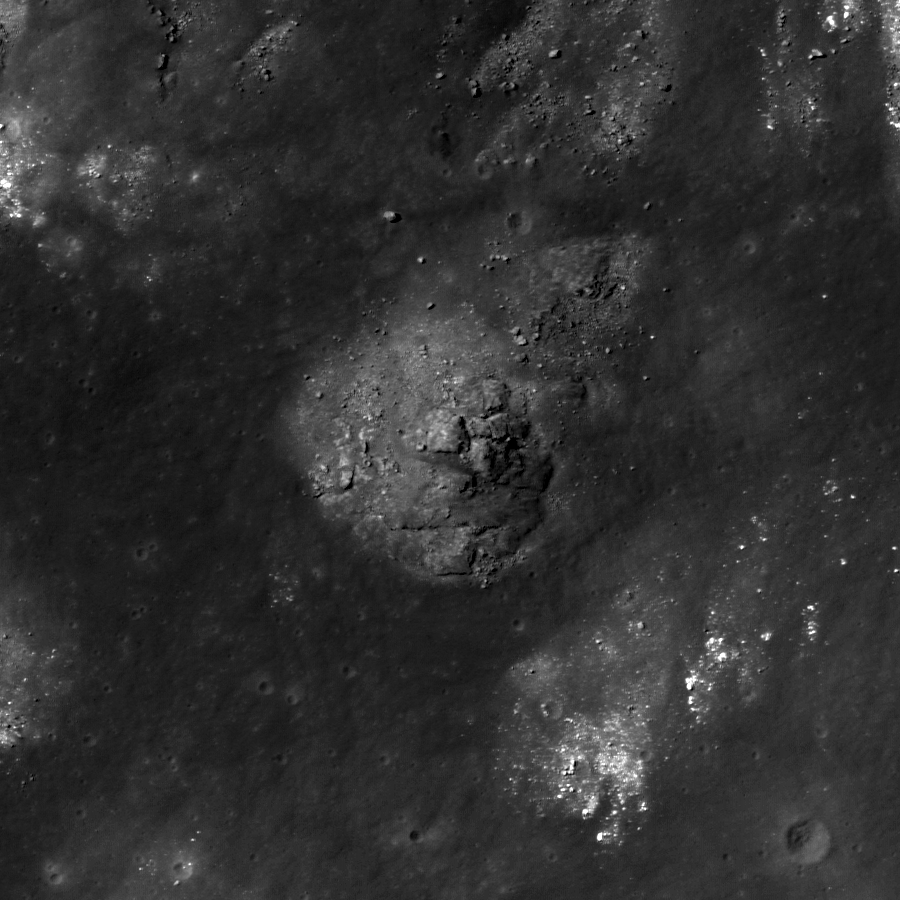
Impact melt material inside the south rim of Gassendi A, which in turn intrudes into the northern rim of Gassendi. LROC Narrow Angle Camera observation M107136013L, LRO orbit 927, September 9, 2009; image field of view is 840 meters [NASA/GSFC/Arizona State University].


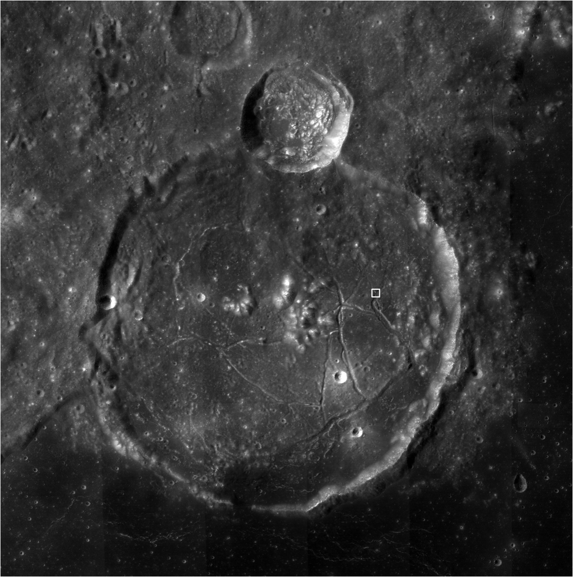
Unfortunately reduced Google Moon nest for the 100 meter/px monochromatic Wide Angle Camera mosaic of Gassendi and the draped extent of the NAC observation from which the featured image within Gassendi A was lifted, intruding into Gassendi's northern rim. The southern rim of the crater was partially flooded with lava during the formation of surrounding Mare Humorum [NASA/GSFC/Arizona State University].

Browse the full LROC NAC frame!

Related Posts:
Gassendi's Central Peak
Gassendi's Fractures

Thursday, November 4, 2010

Gassendi's Fractures


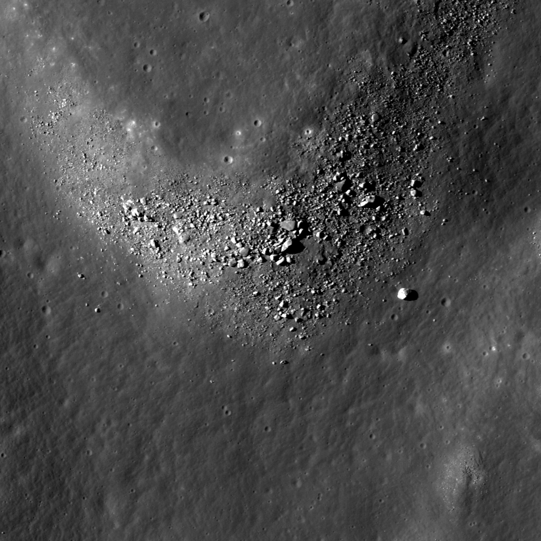
An intersection of two fractures in the crater Gassendi forms a rough "Y," with boulders concentrated on the northern wall. LROC Narrow Angle Camera observation M104770486L, LRO orbit 597, August 13, 2009. Image field of view is 946 meters, and the solar illumination incidence angle is 51 degrees [NASA/GSFC/Arizona State University].

Sarah Braden
LROC News System

The crater Gassendi is 110 kilometers in diameter and located on the northern edge of Mare Humorum at 17.5°S, 320.1°E. Gassendi features an array of intersecting fractures on its floor, collectively known as the Rimae Gassendi.


The LROC featured image nested within the boundaries of the full Narrow Angle Camera observation and the LROC Wide Angle Camera mosaic below. What seems relatively close by is Gassendi's northern rim, more than 40 kilometers away.

Some of the largest fractures are thousands of meters wide. The origin of these fractures in the floor of Gassendi is not known for certain. After the impact the floor of Gassendi was molten and as it cooled, a crust of solid material formed at the surface. As the entire crater floor continued to cool and settle into its final shape, fractures could have formed due to the forces caused by these changes. Other craters besides Gassendi also have fractured floors, like the craters Alphonsus or Goclenius. How do you think fractures form inside craters? What are the differences between each of these craters?


Meets and Bounds of the LROC NAC observation and location of the "Y" intersection in the featured image. The full WAC mosaic can be seen here [NASA/GSFC/Arizona State University].

Examine the fractures by viewing the full NAC frame!

Related Posts:
Gassendi's Central Peak
Alphonsus crater mantled floor fracture

Wednesday, November 3, 2010

Gassendi's Central Peak


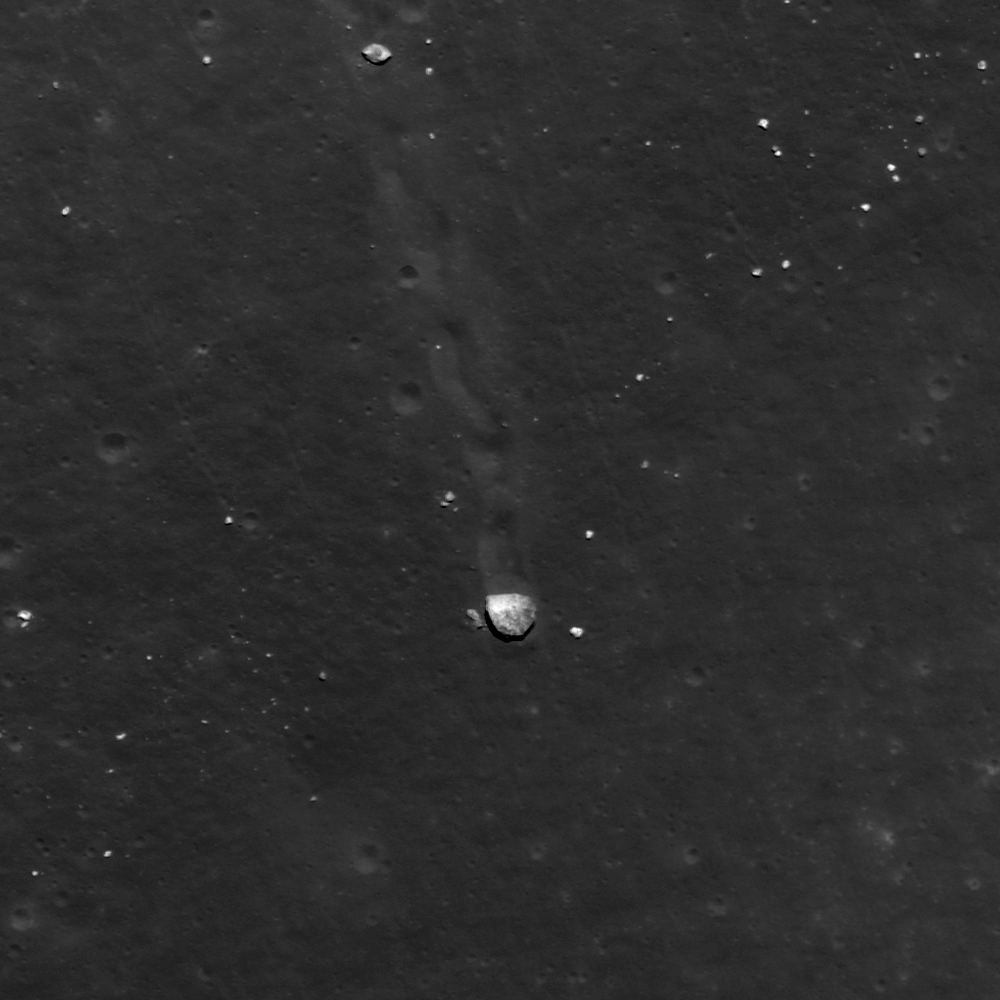
Close up of a boulder (25 meters, or two school buses, wide) on the central peak of Gassendi. 180 meter-wide segment from LROC Narrow Angle Camera observation M109495053R, LRO orbit 1270, October 6, 2009 [NASA/GSFC/Arizona State University].

Sarah Braden
LROC News System

During the Apollo era, Gassendi (17.5°S. 320.1°E) was one of two primary landing site alternatives to the Apollo 17 site at Taurus-Littrow. The candidate location was south of the westernmost of Gassendi's central peaks. The main scientific motivation for a landing at the Gassendi site was the possibility of sampling ancient highland rocks in the crater's central peak. Sampling from the region would have also supplied ages for the Humorum basin impact and the Gassendi crater impact. However, engineering constraints kept Gassendi from becoming an Apollo landing site because it was uncertain if the terrain within Gassendi was too rough and dangerous for astronauts to successfully approach the central peak and obtain a sample.


LROC WAC 100 meter/per pixel monochrome mosaic of Gassendi [NASA/GSFC/Arizona State University].


For context, the meets and bounds of the full LROC NAC observation M109495053R set within the Wide-Angle Camera mosaic and the lunar digital elevation model available to users of the Google Earth application (>v.5).

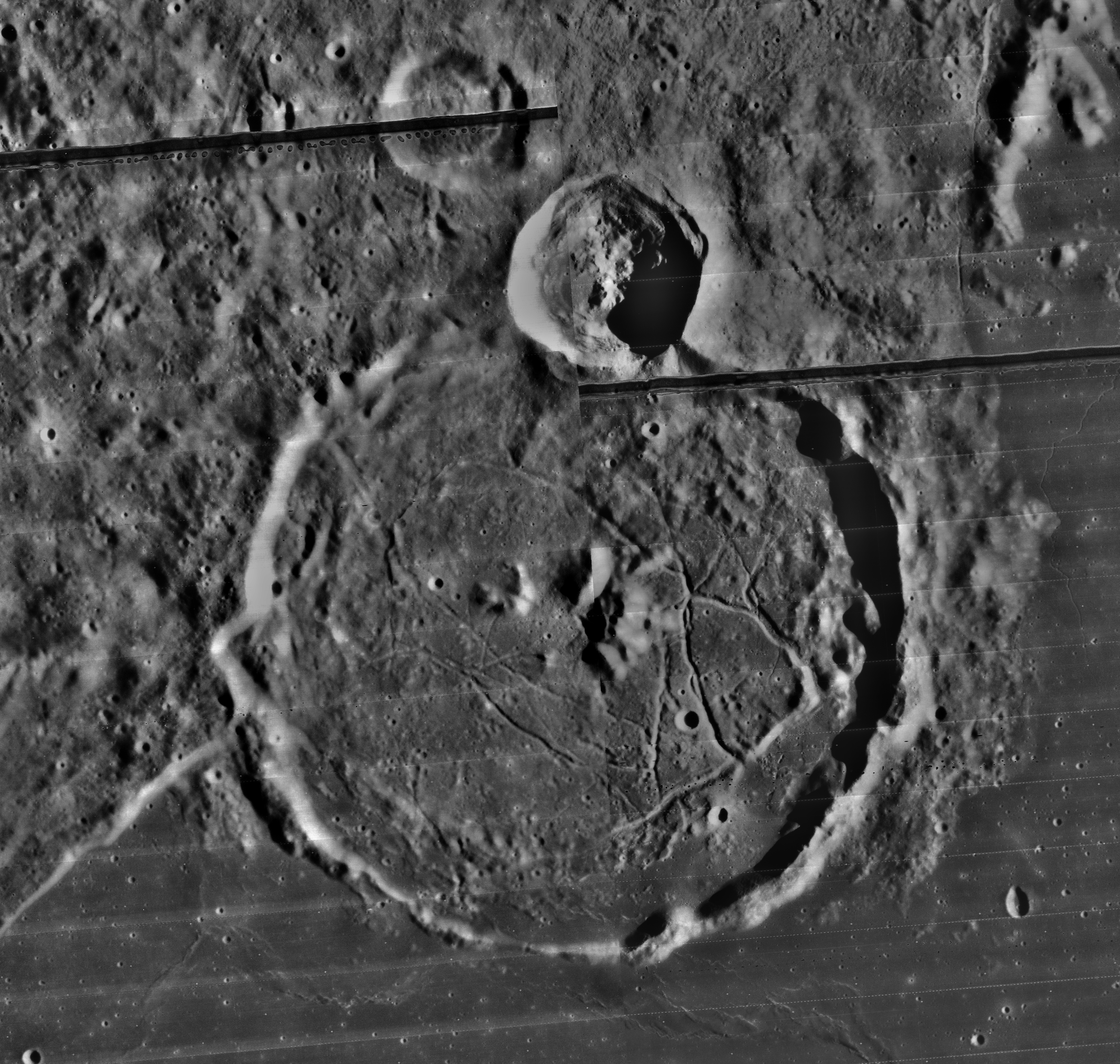
The boulder in today's featured image is exactly what astronauts would want to sample. Since the boulder came from higher up on the peak, witnessed by a trail you can follow back up the peak, astronauts can use it as an opportunity to sample material from higher elevation parts of the peak without having to actually climb the peak! However, Apollo astronauts could not have known ahead of time where boulders like this one were located. The scientists and engineers of the Apollo program used Lunar Orbiter images, Apollo metrics, and Apollo mission photography to make educated decisions between various possibilities for landing sites and to decide where astronauts would travel on the surface. Lunar Orbiter images of Gassendi are lower in resolution (~ 60 m/px) compared to the LROC NAC image (0.5 m/px). Future lunar missions will benefit from LROC images which answer questions about surface roughness and where astronauts should go. For comparison to the NAC image, you can view the Lunar Orbiter image of Gassendi from 1960 below. What a difference new technology makes! The Lunar Orbiter image is provided courtesy of the United States Geological Survey Astrogeology Research Program's Lunar Orbiter Digitization Project.


Lunar Orbiter mosaic of Gassendi crater and the surrounding area. Resolution is about 60 meters [NASA].

Take a look at the central peaks of Gassendi in the full NAC image!

Related Posts:
Eratosthenes Central Peak
Up from the depths
Central Peak/Mare Boundary
Bhabha sinks into the shadows