

Perspective view HERE. The fresh crater featured previously
is barely visible further up the slope.
is barely visible further up the slope.
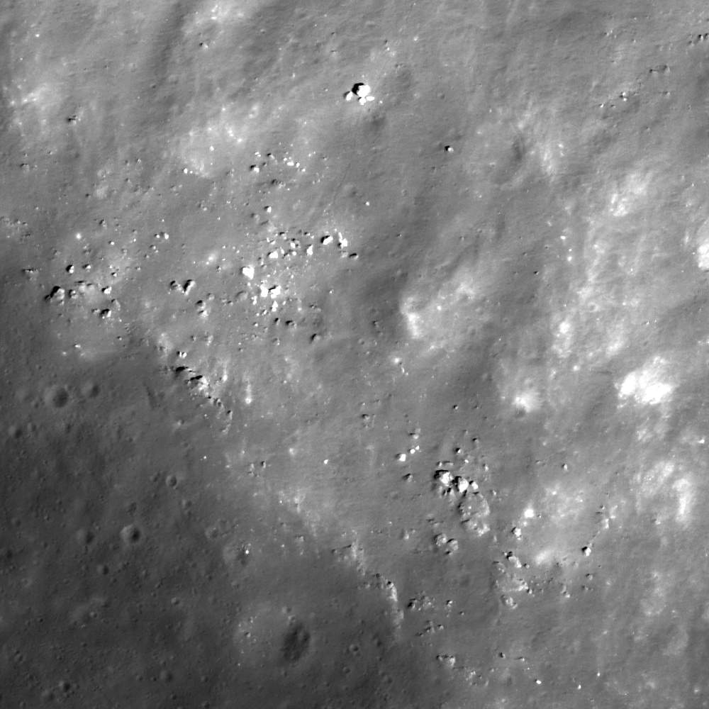
Rocks outcrop immediately within the rim of Menelaus and afterward roll downslope toward the crater floor as they erode out from the crater wall (to the upper right). (The boulder at top-middle is 8 meters across) Image (full-size available HERE) field of view is 400 meters, sampled from LROC Narrow Angle Camera observation M126826332L, LRO orbit 3824, April 25, 2010 [NASA/GSFC/Arizona State University].
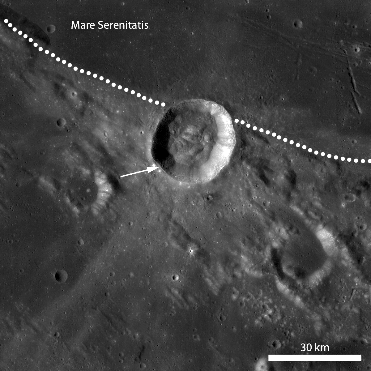
LROC Wide Angle Camera mosaic of 27 km Menelaus and associated ejecta at the boundary between Serenitatis basin and the equatorial Near side highlands, deeply etched by the Imbrium basin-forming impact event. The arrow marks the location of today's featured image, just inside the crater's southern rim [NASA/GSFC/Arizona State University].
Traverse the rim of Menelaus crater in the full LROC NAC image!
-Lillian Ostrach
No comments:
Post a Comment