Showing posts with label Braden. Show all posts

Saturday, August 13, 2011

Channelized impact melt


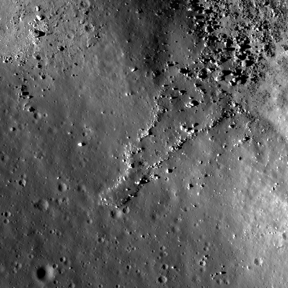
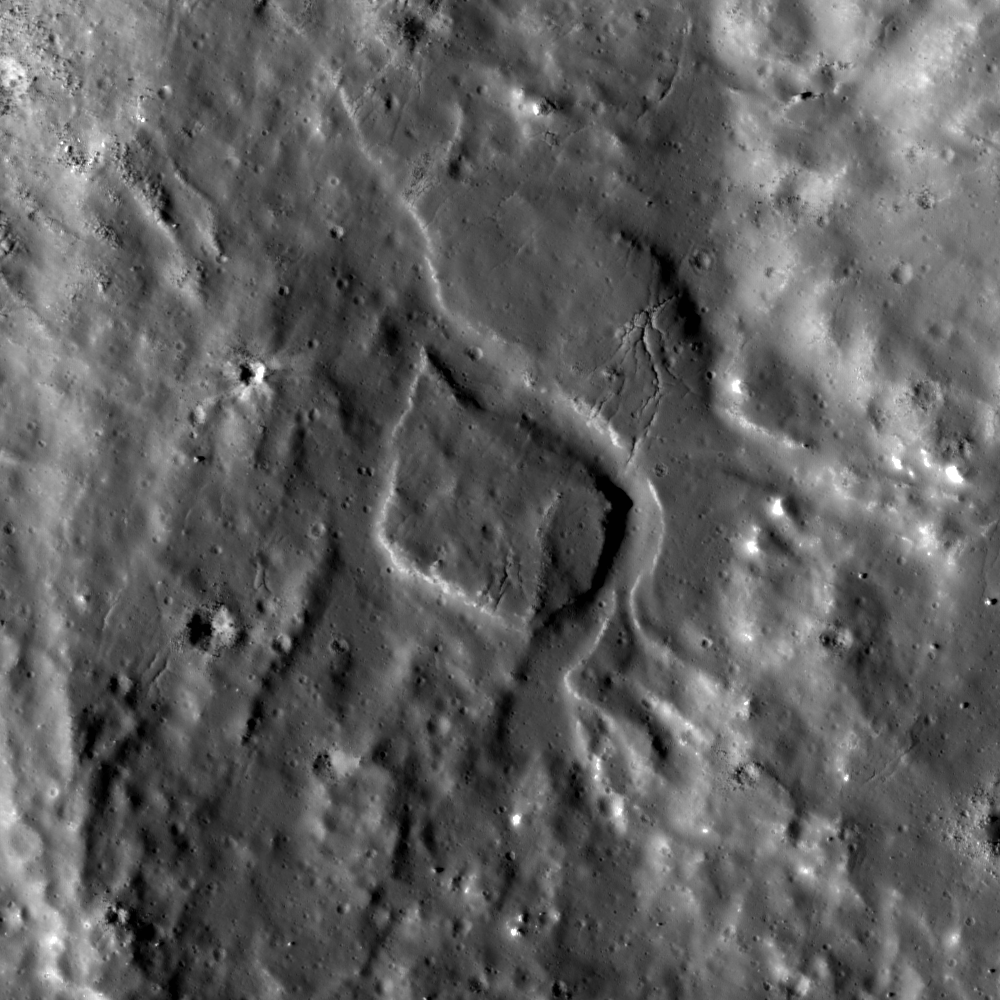
Channelized impact melt flow cut through pre-existing rock. LROC Narrow Angle Camera (NAC) observation M103216633L, LRO orbit 380, July 26, 2009, incidence angle 68°, scale 1.4 m/pixels, sunlight from the west-southwest. See the full Featured Image field of view HERE [NASA/GSFC/Arizona State University].

Sarah Braden
LROC News System

Although impact melt on the Moon was first observed in Apollo era images, the high-resolution LROC NAC images allow geologists to look at impact melt deposits in much more detail. Now we know that impact melt creates many young, spectacular features on the lunar surface: diverging flows, melt ponds, polygonal fractures, leveed flows, and fragmented blocks.
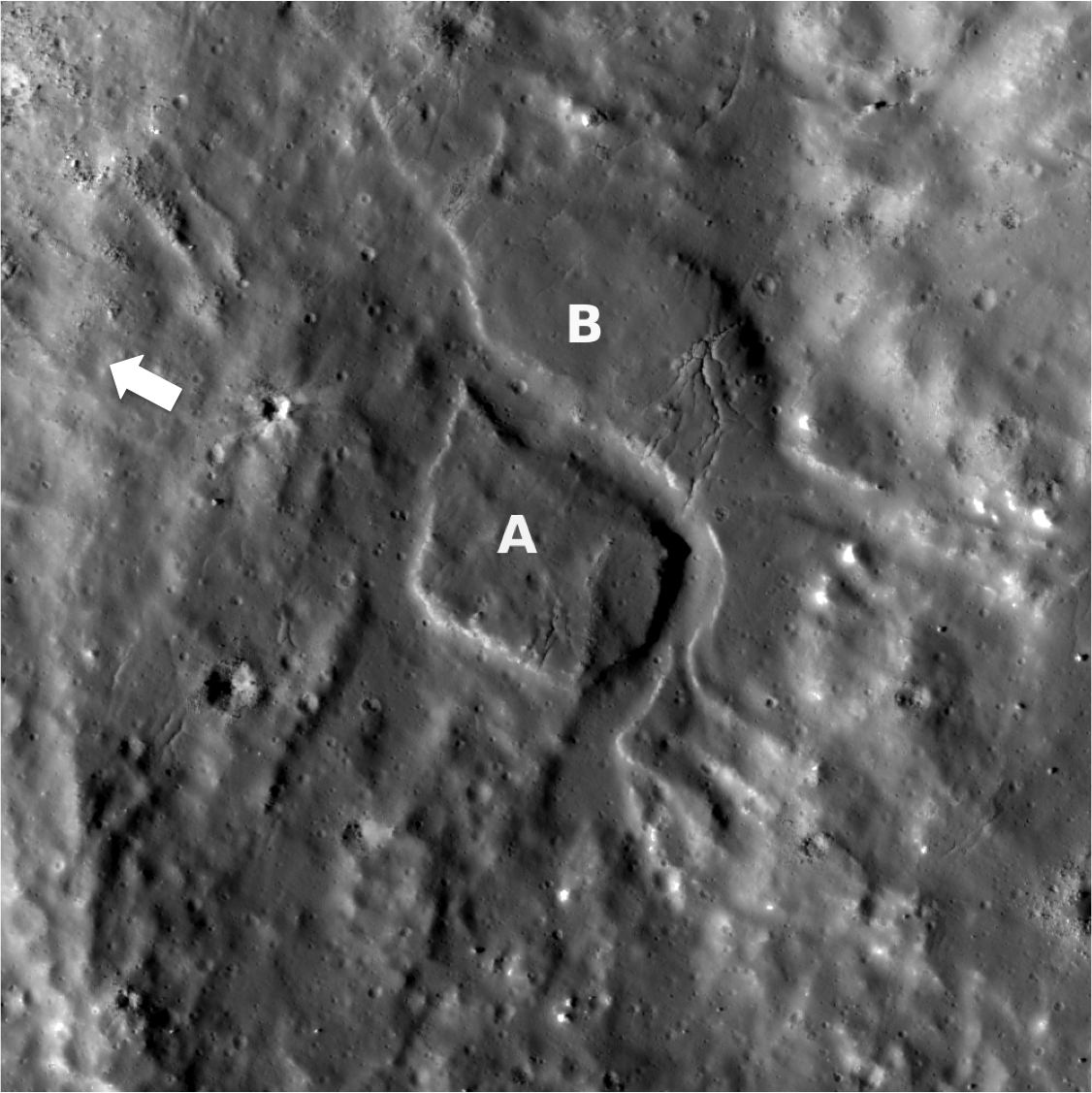

Annotated version of the Featured Image. The impact melt flow created a channel that separated rock section A from section B. The white arrow points in the downslope direction. View the full-size annotated Featured Image HERE [NASA/GSFC/Arizona State University].


Three-Dimensional oblique view, at an oblique southeasterly angle across both the left and right M103216633 frames shows the steep gradient and wider effect of the channeled impact melt flow down the eastern inner rim of Jackson. The featured channeled formation is left of center, at roughly 4500 meters elevation. The rim beyond is nearly 2 km higher up. As context, view the wider field of view in the full-sized image HERE [Google Moon - NASA/GSFC/Arizona State University].

Flowing impact melt may act erosively, removing rock from one location and depositing it in another. This Featured Image shows a section of rock on a terrace in the eastern wall of Jackson crater. The section "A" appears to be severed from the rest of the rock by a small channel. It is probable that fast-moving impact melt created this small channel (on average ~60 meters wide). As the impact melt flowed over the terraces, toward the center of the crater, it gathered enough momentum to flow turbulently and cut through the pre-existing rock. The pointed ends of the isolated section also hint at being eroded by a flow. The pre-existing rock appears to be impact melt as well (deposited by a previous flow), or is covered with a thin layer of impact melt. Usually we only see channels carved through rock in the case of sinuous rilles, which are caused by turbulent flow of basalt.


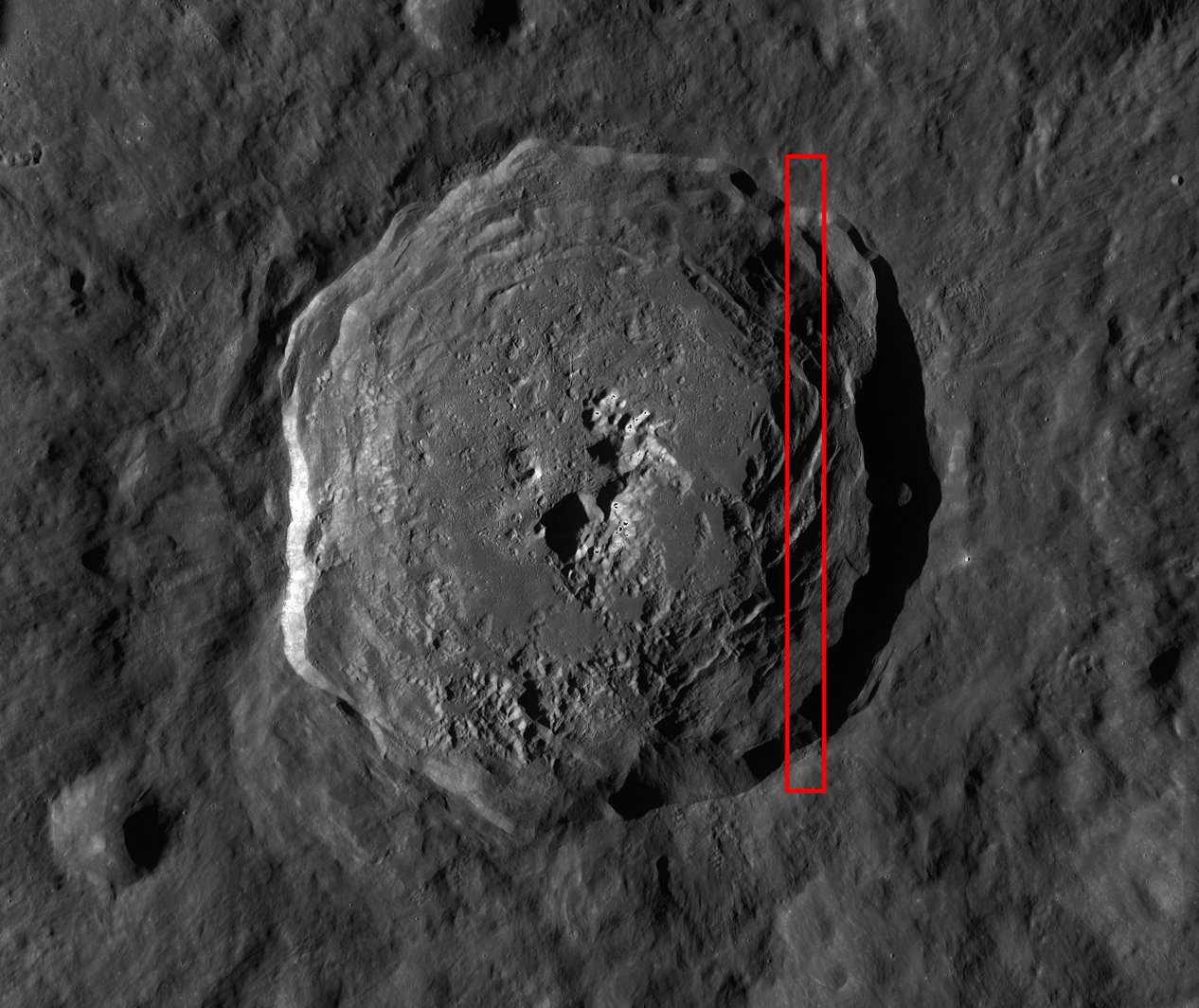
Jackson (22.4°N, 196.9°E), 71 km wide. View the full-size context image HERE The red box shows the location of the featured NAC frame [NASA/GSFC/Arizona State University].

Browse the entire NAC frame for more interesting views of Jackson crater!

Related Images:
Waves
Tendrils in Reiner Crater
Splash and Flow

Thursday, August 11, 2011

Impact melt tongue


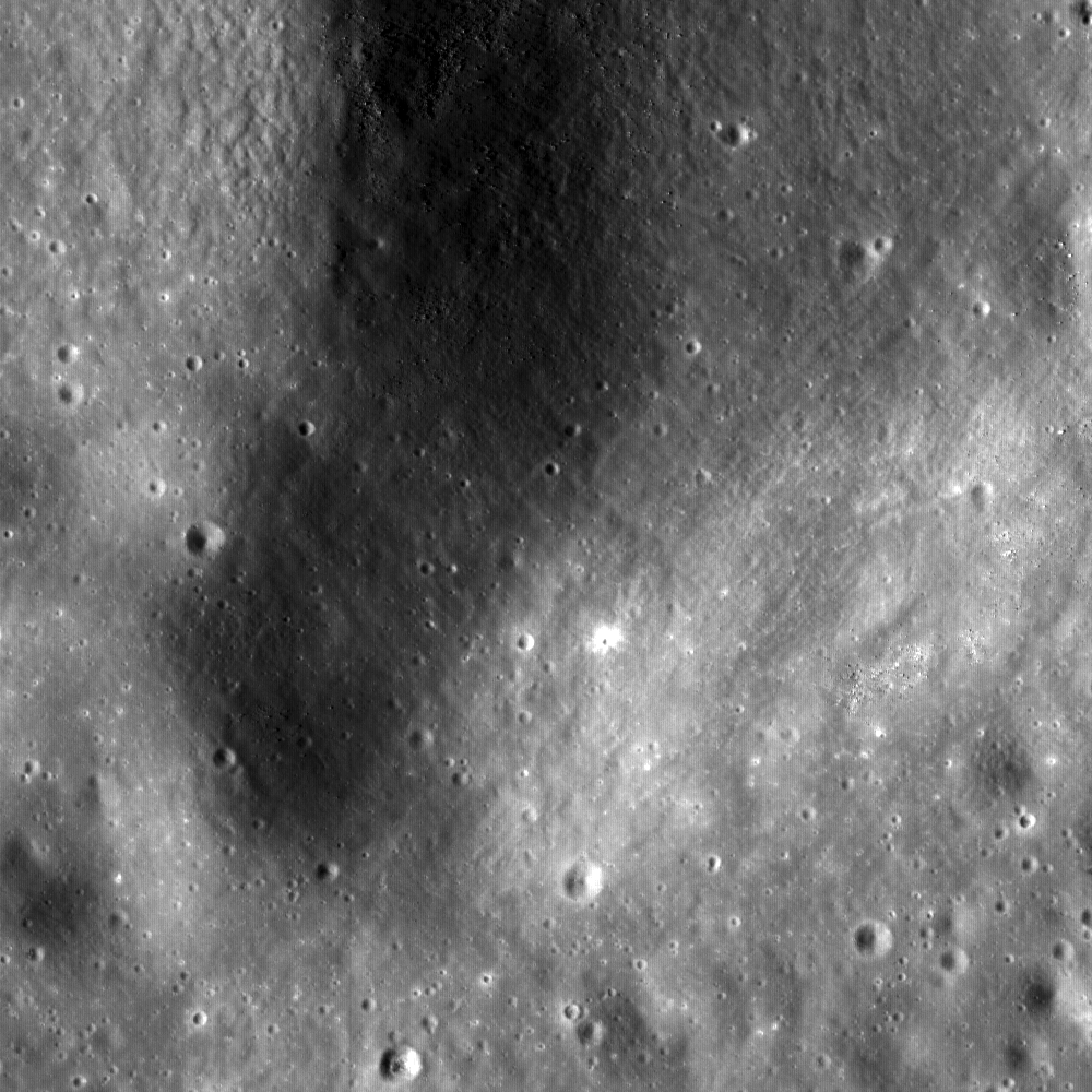
A bouldery tongue of impact melt spills over from a pool inside the ruined rim of a small crater inside Jackson, carrying along with it a debris field of house and car size boulders. LROC Narrow Angle Camera (NAC) observation M133892450L, LRO orbit 4685, July 16, 2010; incidence angle 75°, scale 83 centimeters per pixel. View the larger LROC Featured Image HERE [NASA/GSFC/Arizona State University].

Sarah Braden
LROC News System

Another beautiful impact melt feature found in Jackson crater! This thin flow of impact melt spreads across the surface of a terrace. The boulders around the edges of the flow may have eroded out of the flow, or were carried there by the impact melt. In the upper right hand corner of the image, there are many large boulders, as well as smooth areas which are impact melt. The impact melt flow seems to originate from that area. Since the large boulders are on top of the impact melt, the impact melt probably landed in the spot first, and the large boulders are a later addition, falling down from a point higher up on Jackson's wall.


Jackson crater, located at 22.4°N, 163.1°W. 71 km in diameter. The red box shows the location of the featured NAC frame; view the full-size LROC WAC context image HERE [NASA/GSFC/Arizona State University].

Look in the full NAC frame for more exciting impact melt flows!

Related Posts:
Out of the Shadows:
Impact Melt at Byrgius A Crater
Look at that flow!
Waves
Channelized Impact Melt

Friday, April 2, 2010

LROC: Constellation ROI at Hortensius Domes


Summit crater of Hortensius Dome Phi. Summit craters of all the Hortensius Domes show no raised rims and are not circular, indicating they are not impact craters, rather that they are analogous to volcanic calderas. Image width 1.22 km, LROC NAC image M104691278R [NASA/GSFC/Arizona State University].

Mike Zanetti
LROC News System

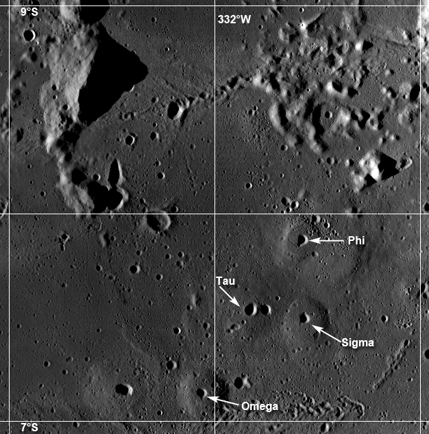
The Hortensius Domes site is a Constellation Program region of interest (ROI) located (7.48°N, -27°E) northeast of the 7 km diameter crater Hortensius in Mare Insularum. The six domes found here are typical examples of lunar mare domes. Mare domes are generally broad, convex semicircular landforms with relatively low topographic relief. They have no official individual names, but are often designated using Greek letters (Phi, Tau, Sigma, Omega, and two smaller domes that are not named).

Four main domes in the Hortensius region (Phi, Tau, Sigma, and Omega). The domes display very little relief, making them visible only at low-sun angles, LROC WAC mosaic [NASA/GSFC/Arizona State University].

The formation of mare domes is thought to be related to eruptions of more viscous and more silicic lava than normal mare basalts, intrusions of shallow laccoliths, or mantling of large blocks of older rocks with younger lavas. These domes probably formed during the later stages of volcanism on the Moon, which is characterized by a decreasing rate of lava extrusion and comparably low temperature eruptions. This eruption style contrasts the emplacement of early stage, high volume, high temperature fluid mare basin deposits. Lunar mare domes, like the Hortensius domes, are distinctly different from non-mare domes like those found in the Gruithuisen region, which have much steeper slopes and higher albedo. The Hortensius Domes are poorly understood, and visiting this region will shed more light on the development of volcanic domes on the Moon, the nature of the changes in eruption rates, as well as returning valuable mare basalt samples from an easily accessible nearside location.


Oblong summit crater (center) of Hortensius Phi. This area matches the image shown in the NAC stereo DEM in the next figure. Note how difficult it is to see the low relief of the dome above the surrounding plains. LROC Image M104691278R, width = 6.1 km [NASA/GSFC/Arizona State University].

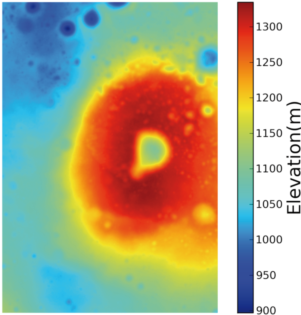
Due to the low relief of the Hortensius Domes, it is difficult to determine their exact dimensions (diameter, height) using normal photo-geologic techniques, such as shadow measurements. LROC Narrow Angle Camera (NAC) stereo images provide the means to derive high resolution topographic maps. Color shaded Digital Terrain Models (DTMs) can be created from the topographic measurements that highlight the differences in elevation between the summit crater and the surrounding plains of Mare Insularum. Using such high resolution models, comparisions of dome diameter, dome height, summit crater diameter, and crater depth can be made with other mare and non-mare domes on the Moon, as well as with terrestrial features, such as shield volcanoes. For more information regarding the use of NAC stereo DTMs and for measurements on lunar domes, see this 2010 Lunar and Planetary Science Conference abstract from S. Braden et al.


Narrow-Angle Camera (NAC) stereo DTM created from LROC NAC surveys M104691278 and M104698432 [Arizona State University].

For more information on LROC's observation campaign for the Constellation Regions of Interest refer to this Lunar and Planetary Science Conference abstract, or visit the LRO Science Targeting Meeting Website.

Explore the Hortensius Domes Constellation region of interest for yourself.