
 |
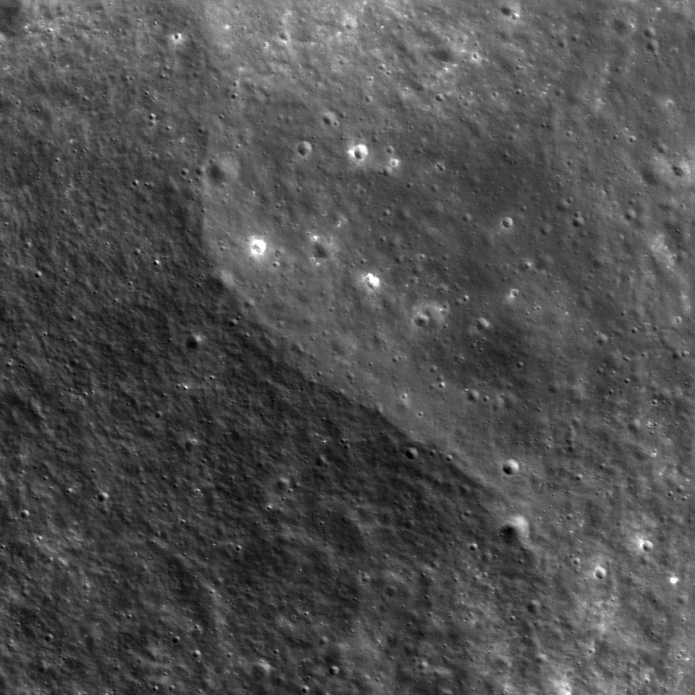
| A curvilinear valley calls attention to itself by virtue of its apparent isolation from the surrounding terrain. LROC Narrow Angle Camera (NAC) observation M153632648L, LRO orbit 7775, March 3, 2011; north is up, Sun is from the southwest, incidence angle 33° and the image field of view is roughly 302 meters. View the full size LROC Featured Image HERE [NASA/GSFC/Arizona State University]. |

LROC News System
With such an abrupt beginning and end, and no obvious connection to typical geologic flow, fault or scour processes, what could have caused this curious arcuate, negative-relief landform in the lunar highland regolith (24.3°N, 245.0°E)?
Sometimes it helps to step back for a wider look.
 |
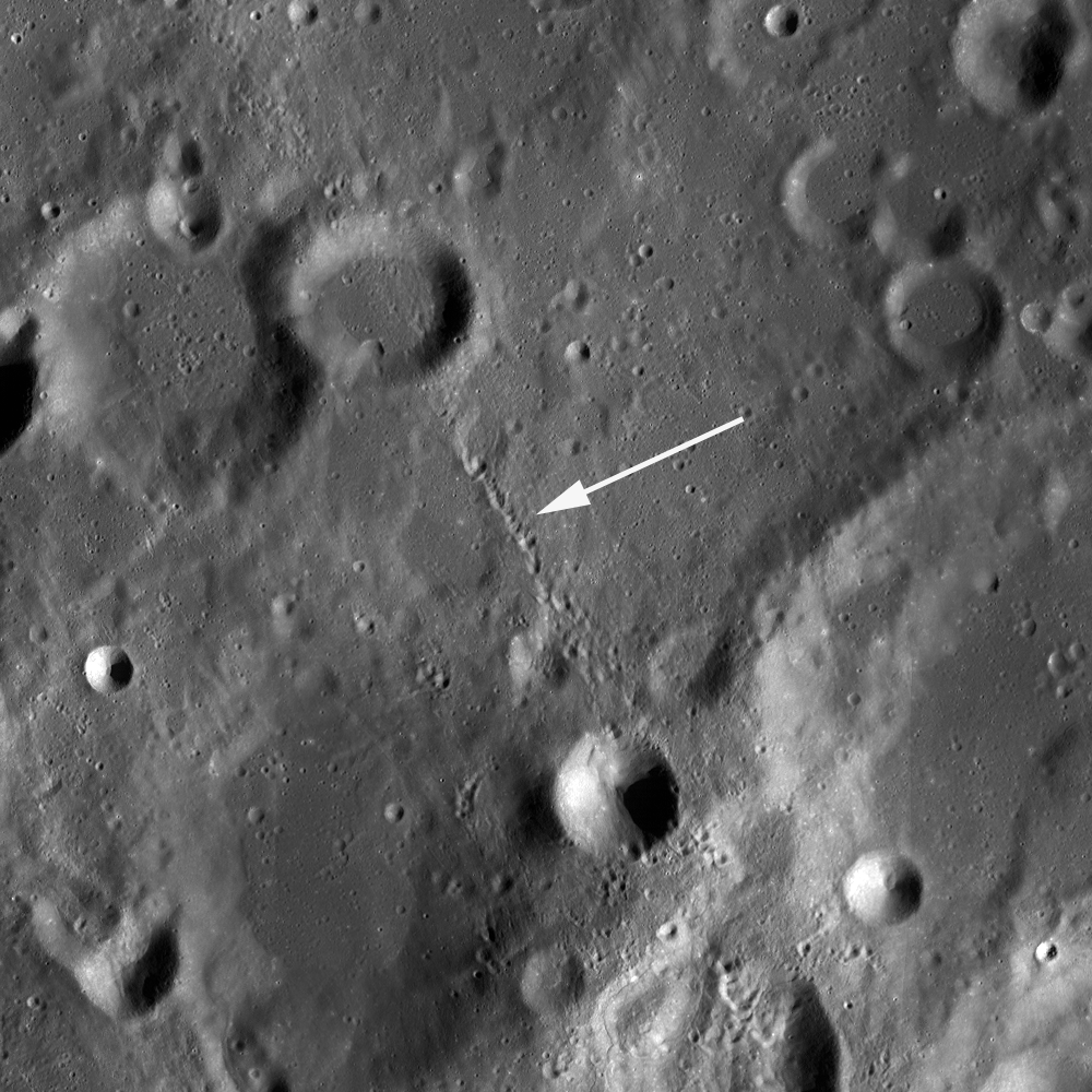
| The featured scar is to the lower right (white box) in this wider field, which shows it as only one of several similar features. LROC NAC M153632648L, image width is ~2.3 km, see the LROC 1.5 km context image HERE [NASA/GSFC/Arizona State University]. |
Compare the NAC frame above with the segment taken from a LROC Wide Angle Camera (WAC) mosaic below.
In our slow zoom out, we see that several similar features, appearing as blind valleys with abrupt endings, are aligned in a north-northwest to south-southeast direction, but are still somewhat isolated from anything that might have caused them in the nearby vicinity.
 |
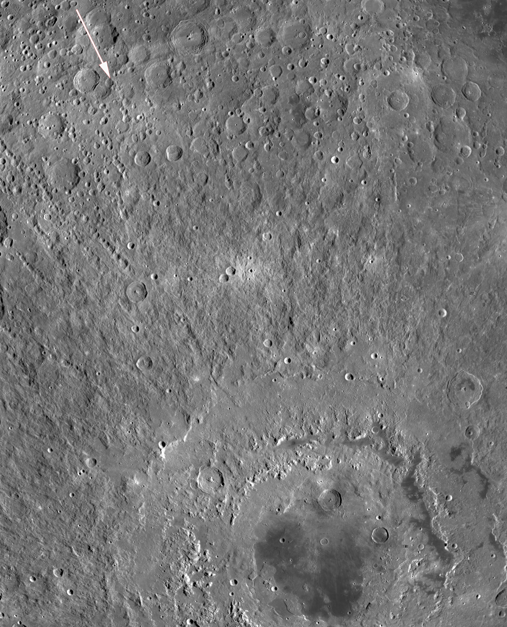
| The WAC mosaic shows the full length of the scar (white arrow); View the full size LROC 97 km-wide field of view HERE [NASA/GSFC/Arizona State University]. |
 |
| WAC mosaic showing Mare Orientale and portions of its spectacular rayed ejecta pattern. Arrow in upper left quadrant overlays scar feature in the Comrie crater group; image field of view is 1,500 km from top to bottom. See the full resolution LROC WAC context image HERE and compare the mosaic with the hemisphere-wide LOLA topography in the image below [NASA/GSFC/Arizona State University]. |
Notice the arrow in the northwest corner of this WAC mosaic, which overlays and parallels the linear trend of the featured scar. It points toward the center of Mare Orientale, a 900 km-diameter impact feature. Several crater chains are visible to the southwest of the arrow at this scale that similarly radiate from the Orientale basin. The violence of the basin-forming event was so great that it hurled prodigious volumes of target rock hundreds of kilometers across the lunar surface. The orientation and location of the featured scar pattern makes the Orientale impact a plausible cause for what we see there. In addition to rocky projectiles, ground-hugging and/or ballistically emplaced ejecta deposits are a common accompaniment to large impact features on the Moon. From their morphology and occurrence, they seem to have behaved in a very fluid-like way, and can morph and merge as they flow across the surface until losing energy and coming to rest as dunes or lobes. Today's Featured Image appears to be a place where advancing dunes merged and "healed over."
In addition to the orientation of this linear form, what other clues would help determine if this feature is indeed associated with the Orientale impact, or part of some other debris source? What other clues are visible in the full NAC frame?
Additional examples of fluidized ejecta can be found in the Lavish Lobes of Necho R, and in King Crater Ejecta Deposits. The Orientale Basin is featured in the LROC PDS Release 5 post, and the Farside! and All the Way Around post.
 |
| LOLA Altimetry adds global context to the LROC WAC image, third following from the top of the post, and shows the stark dichotomy between lunar Nearside (right) and Farside. The technical meridian need hardly be designated but begins at the lunar north through the equator (270° East). The Moon's highest regions (orange) are 13 kilometers higher than the deep and wide impact basins familiar to it's Earth-facing hemisphere. The area within the LROC Featured Image released October 4, 2011 lies roughly 1400 kms away from the center of the Mare Orientale basin at lower center [NASA/GSFC/LOLA/LMMP]. |
No comments:
Post a Comment