
 |
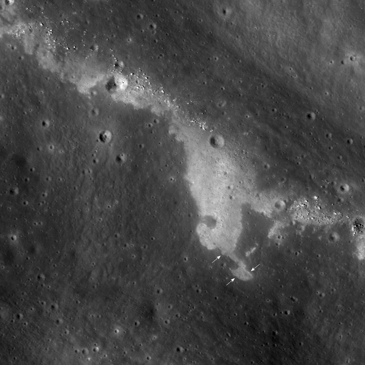
| Southern slope of unnamed fracture along the eastern mare/highland boundary of Mare Insularum. LROC Narrow Angle Camera (NAC) frame M1114199297R, LRO orbit 16439, January 30, 2013; 1147.2 meter field of view centered on 13.135°N, 355.638°E, 42.94° angle of incidence, resolution 0.96 meters per pixel from 114.18 km. (Downslope toward upper-right, north at top) [NASA/GSFC/Arizona State University]. |

LROC News System
Today's Featured Image highlights a portion of an unnamed linear fissure located along the eastern edge of Mare Insularum, near the mare/highland boundary.
The width of this fissure varies from about 1.5 to 2 km, its length is about 90 km, and it extends in the northwest-southeast direction.
The upper-right portion of the opening image, showing a shallow groove extending from up to middle right of the image, corresponds to the bottom of the fissure. Thus most of the image reveals the southern wall of the fissure.
 |
| The LROC Featured Image field of view rendered approximately in elevation data from the LROC WAC DTM. Local slopes in the vicinity of the fracture of interest can be difficult to otherwise see. LROC QuickMap [NASA/GSFC/DLR/Arizona State University]. |
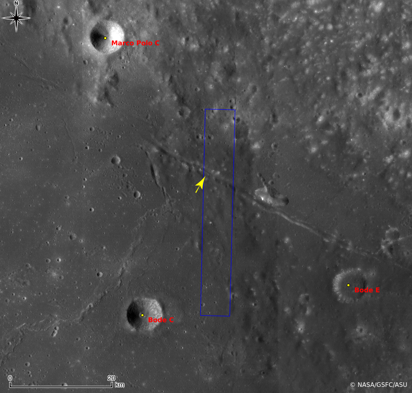 |
| Unnamed fracture running northwest to southeast on the eastern side of Mare Insularum and surrounding vicinity in LROC WAC monochrome mosaic (100 meters per pixel), centered is 13.12°N, 355.66°E. The LROC NAC footprint (blue box) and location of the field of view in the Featured Image (yellow arrow) are marked [NASA/GSFC/Arizona State University]. |
Explore this enigmatic patterned surface in full NAC frame yourself, HERE.
Related Posts:
Inside Hyginus Crater
Bright ridge near Mons Hansteen
Wrinkle Ridge vs. Impact Crater
Really Wrinkled
Boulders In The Sea Of Serenity
Ghost crater in Mare Imbrium
Zebra Stripes
Aitken Central Peak, Seen Obliquely
Constellation Region of Interest at Mare Tranquillitatis
1 comment:
I'm Impressed from your post because i wasn't have any knowledge about it which you shared over here.
west london electrician services
Post a Comment