
 |
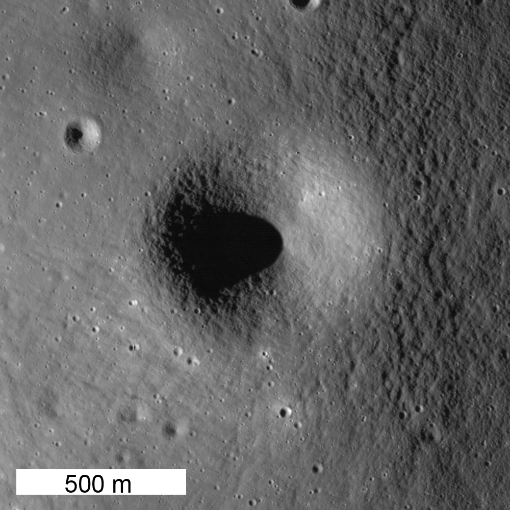
| A circular depression (700 m diameter) sits atop of a circular mound 3.7 km in diameter. It is either a perfectly placed impact crater on the hill's summit, or a volcanic vent. Mosaic of LROC Narrow Angle Camera (NAC) observations M181173832L & R, LRO orbit 11,814, June 22, 2012; native resolution 1.5 meters per pixel. View the cropped field of view (1000 px) framed and released as the LROC Featured Image, July 27, 2012, HERE [NASA/GSFC/Arizona State University]. |

Jeffrey Plescia
The origin of many features within the mare remain ambiguous.
Crater or vent? Flow or tectonic feature?
Since the mare are generally older than 3 billion years, small features are worn down and rounded from meteorite bombardment.
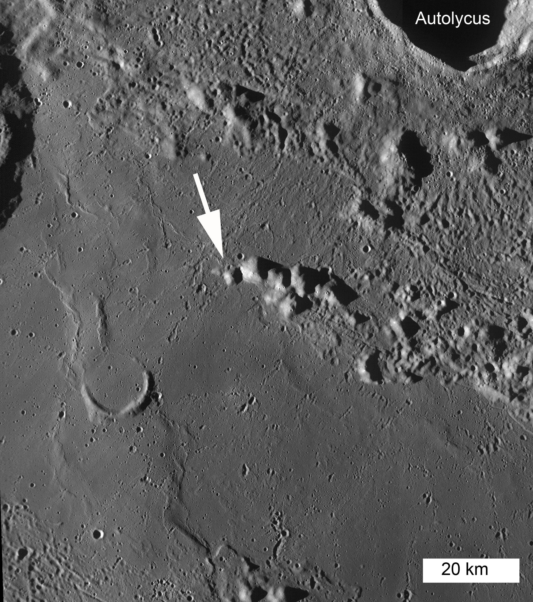
Thus their true mode of origin is not easy to discern. To the south are the mare units of Palus Putredinis, and to the north is the ejecta from the crater Autolycus.
 |
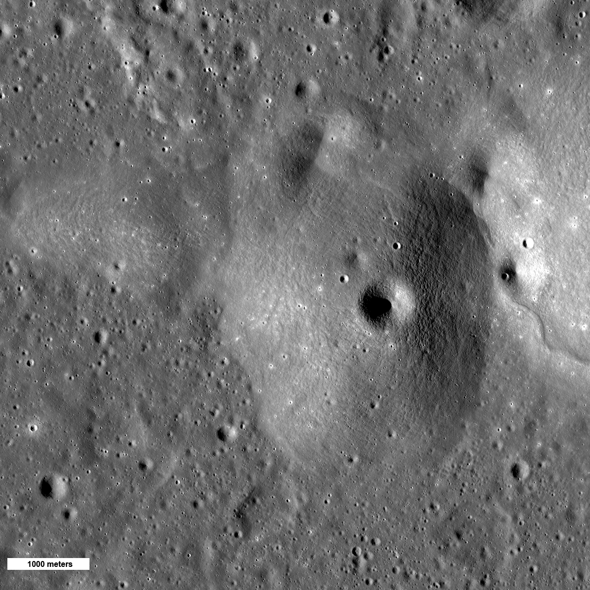
Broad view of the hill in question and the adjacent plains. Mosaic of LROC Narrow Angle Camera (NAC) observations M181173832L & R, LRO orbit 11,814, June 22, 2012; native resolution 1.5 meters per pixel. (1200 px - reduced by a factor of 4) HERE [NASA/GSFC/Arizona State University].
|
The fact that the crater is centered on the summit, the symmetry of the topography and the presence of a crater on the east side that appears to have dark ejecta suggest the feature might be a volcanic cone. The hill stands about 250 m above the surrounding plains and has a slope of about 8°. The slope is steeper than expected for a low basaltic shield, more consistent with a cinder cone.
 |
| Regional view of the hills. The arrow shows the feature in the NAC images above. Mosaic of LROC Wide Angle Camera (WAC) observations swept up in sequential orbital opportunities around M117488146ME, LRO orbit 2448, January 7, 2010; angle of incidence 82.64° averaging 56 meters resolution from 39.85 kilometers. View the 2200 px context mosaic accompanying the Featured Image HERE [NASA/GSFC/Arizona State University]. |
The grouping of hills seen in the WAC mosaic was originally mapped as Fra Mauro Formation (basin ejecta) and crater rim material by Hackmann (1966). Looking around the area south of Autolycus, there are several hills that have craters near their summit or are symmetric in shape, both attributes that might suggest a volcanic origin. Elsewhere on the Moon, there are fields of volcanic vents that look similar to these. This may be a volcanic complex that has not yet been recognized.
Map the entire NAC mosaic at full resolution HERE.
Try and decide for yourself: basin ejecta or volcanic?
Related Featured Images:
Marius Hills
 |
| An out of the ordinary view looking east by southeast over the 132 kilometers of Palus Putredinis from the subject (crater or vent) detailed in the LROC Featured Image released July 25, 2012 and the landing zone and area along Hadley Rille explored by the Apollo 15 expedition in 1971. LROC Global 100 meter mosaic over LOLA elevation model using NASA's ILIADS LMMP application [NASA/GSFC/LMMP/Arizona State University]. |
No comments:
Post a Comment