 |
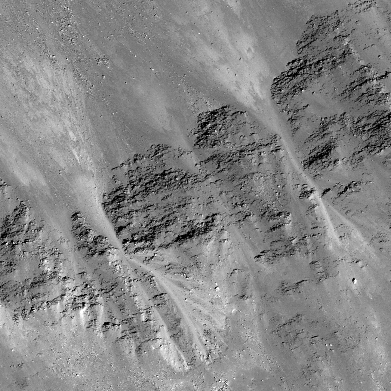
| Layers of mare basalt affected
the paths of granular material that flowed down the crater wall. The top of the image is down-slope. LROC Narrow Angle Camera (NAC) observation M157418698RE, orbit 8333, April 14, 2011; field of view 546 meters and the pixel scale is 0.4 meters/px from an altitude of 38.6 kilometers. View the full size LROC Featured Image HERE [NASA/GSFC/Arizona State University]. |
Sarah Braden
LROC News System
The wall of Dawes crater (
17.21°N, 26.32°E) contains sections of spectacular mare basalt layering. However,
mass wasting, a geologic process where material moves downhill due to gravity, has started to partially cover these beautiful outcrops.
Granular flows started above the outcrop and then flowed down the interior crater wall. As seen in the Featured Image, the topography of basalt outcrop caused the flow to deviate into narrow paths, away from a simple path flowing straight down the crater wall. As the crater Dawes ages over billions of years, the mare basalt outcrop will eventually be completely covered with granular material due to slumping of the crater's walls and more mass wasting.
 |
| The full width of LROC NAC M157418698R
with the high resolution field of view in the January 25, 2012
LROC Featured Image set off by the yellow box. The slope of the
south-southeastern wall of Dawes, from floor (upper left) to rim (bottom) rises nearly 2 kilometers in elevation [NASA/GSFC/Arizona State University]. |
 |
| Through the last release of LROC Narrow Angle imagery, all but the center swath of Dawes has been photographed at mission-optimal high resolution.
The yellow arrow marks the location of the field of view in the
LROC Featured Image released January 25, 2012 and the yellow rectangle the
area swept up in the full LROC NAC observation [NASA/GSFC/Arizona State University]. |
 |
| Dawes has an asymmetrical
ejecta to match the asymmetry of its rim elevation and floor. The fan
of its ejecta blanket, still visible on the crater's
western flank, sweeps north and crosses 'under' the color contact separating
the mare of Tranquillitatis from the Serenitatis basin. Because that change is superimposed
over the Dawes ejecta the crater is older, at least, than the last time (the last of
many times) the ancient Serenity basin was flooded with impact melt [NASA/GSFC/Arizona State University]. |
 |
| WAC/topographic context image of 17.8 km diameter Dawes [NASA/GSFC/Arizona State
University]. |
Explore the entire NAC frame,
HERE.
Related Posts:
Marius A
Detour!
Dry debris or liquid flow?
Boulder Mound


No comments:
Post a Comment