
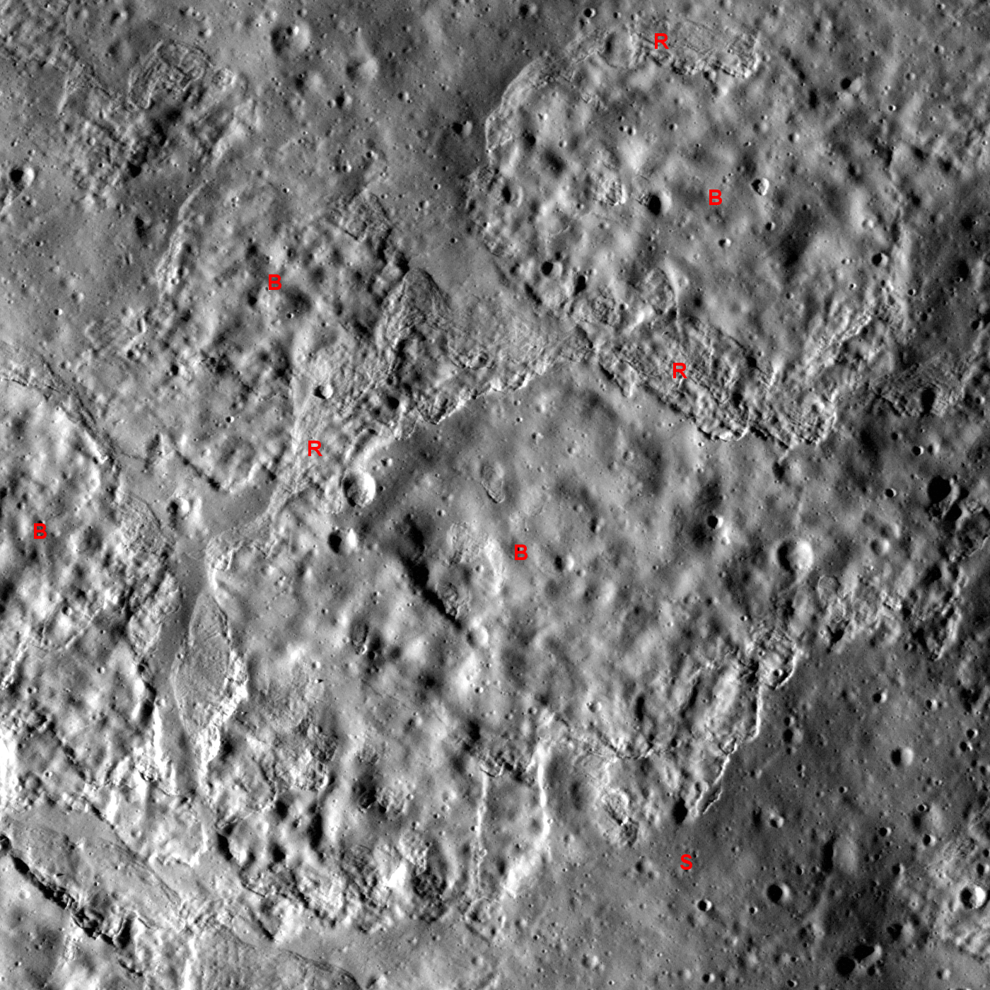
Northern flank of cone-shaped mound north of Aratus crater (23.68°N, 4.50°E) in the rough badlands west of Mare Serenitatis. LROC Narrow Angle Camera M117461002L, LRO orbit 2444, January 6, 2010. Image field of view is about 672 meters. Illumination is from west-southwest (left) at an incidence angle of 83° and downslope direction is from bottom to top. Click HERE for the full-size release. [NASA/GSFC/Arizona State University].
Hiroyuki Sato
LROC News System
The featured image above displays a mixture of smooth (denoted "S") bumpy (B) and rough textured (R) surfaces. Some of the bumpy-textured material is enclosed by the rough-textured material. The downhill-side edges of the smooth areas are scalloped and are often accompanied by parallel wrinkles.

LROC Wide Angle Camera (WAC) monochrome mosaic shows it's relation to Hadley Valley, the steep mountains bordering Palus Putredinis and the July 1971 landing site of Apollo 15 (76 kilometers away) - LROC PDS Image Search Interface [NASA/GSFC/Arizona State University].
The uphill edges of each piece of smooth-textured surface appear to have separated from the smooth material up-slope from them, leaving a gap of rough surfaced material. It is possible that these characteristics indicate slope failure (landslide) of an upper thin layer, similar to what we see on terrestrial landslides or a snow avalanche. This type of sliding occurs where the material strengths of upper and subsurface layers have large contrast, typically unconsolidated material overlaying a more rigid substrate.
Estimates of sliding layer thickness, local topography, and morphological characterization of flow features allow scientists to determine the geotechnical (soil mechanics) properties of the lunar regolith. Such studies are key to designing future rovers, space suits, and tools for exploring the Moon.
Estimates of sliding layer thickness, local topography, and morphological characterization of flow features allow scientists to determine the geotechnical (soil mechanics) properties of the lunar regolith. Such studies are key to designing future rovers, space suits, and tools for exploring the Moon.
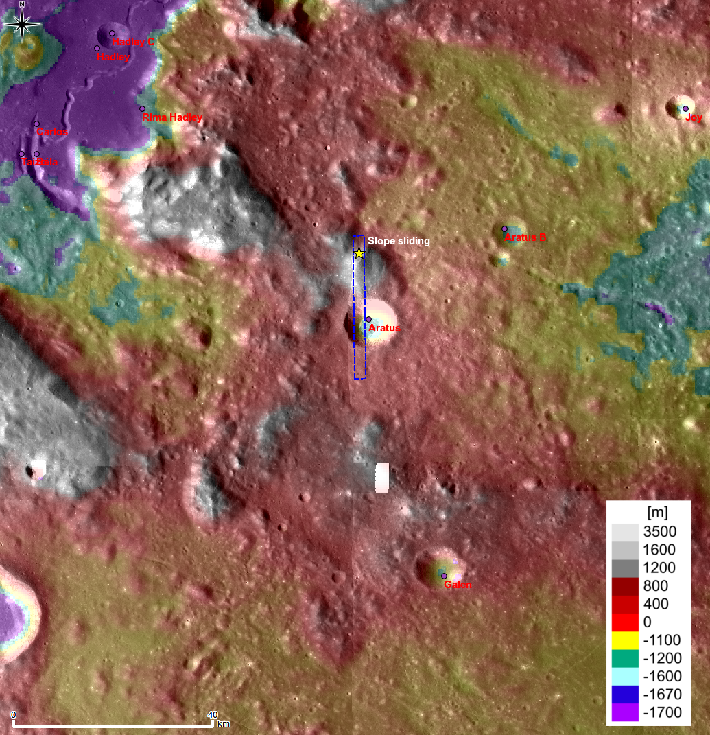
Topographic context map of the vicinity of Aratus (centered near 23.09°N, 4.43°E). LROC Wide Angle Camera 100 m/p resolution monochrome mosaic overlayed with the WAC color Digital Terrain Model (DTM, 500 m/p). (Click HERE to view the full-size original.) Blue-dashed rectangle corresponds to the footprint of the full LROC frame from which the LROC featured image of November 16, 2010 was cropped [NASA/GSFC/Arizona State University].
Explore lunar landslides by viewing the full NAC frame.