 Mark Robinson
Principal Investigator
Lunar Reconnaissance Orbiter Camera
Arizona State University
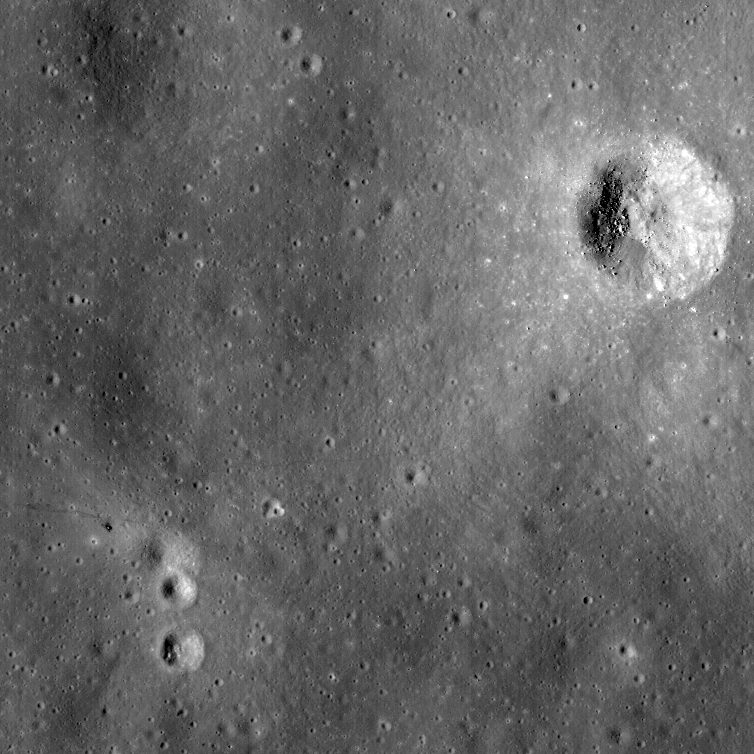
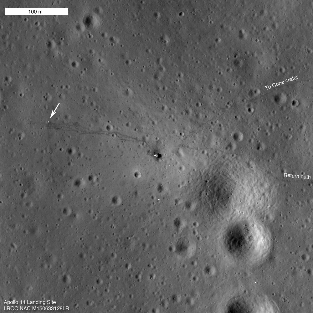
The LROC Narrow Angle Cameras continue to image the Apollo landing sites as the mission progresses. Every time LRO passes overhead the Sun is at a different position so each image gives a different perspective. Repeat imaging also serves LROC cartographic goals. Since the position of the lunar modules and other pieces of hardware are very accurately known the LROC team can check the accuracy of the mission-provided ephemeris.
Think of the Apollo sites as benchmarks put in place four decades ago for the LROC team!
Think of the Apollo sites as benchmarks put in place four decades ago for the LROC team!
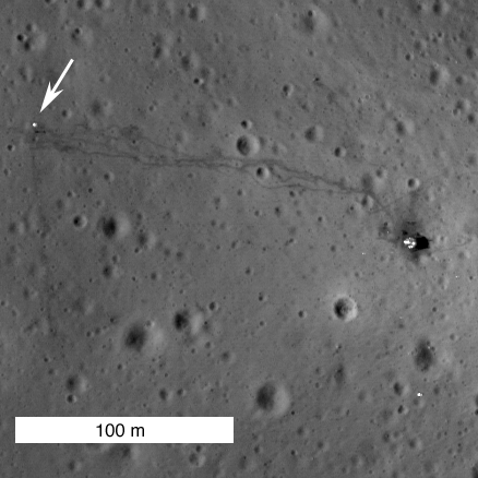
Close-up showing the Apollo 14 Lunar Module's Descent Stage (right) and Apollo Lunar Surface Experiment Package (ALSEP - arrow) with tracks between the two landmarks by Shepard & Mitchell still fresh and distinctive almost precisely 40 years later. In that interval since their departure the foot prints and Apollo 14's deployed materials endured 534 lunar days and nights of relentless exposure, adding to their immeasurable value as sentinel recorders of the lunar environment [NASA/GSFC/Arizona State University].
The Apollo 14 astronauts explored the surface of the Moon on February 5th and 6th, 1971, 40 years ago this weekend. Much was learned during the Apollo missions, yet most of the history and geology of the Moon remains a mystery.
When will we return to the Moon?
When will we return to the Moon?

Apollo 14 Post EVA view by Edgar Mitchell from inside Antares looking west toward the ALSEP station. LROC PI Mark Robinson suggests matching Edgar Mitchell & Alan Shepard's tracks in this photograph with those in the new LROC NAC view swept up from LRO orbit overhead on January 25, 2011 - forty years later. View the full-resolution high-defintion version of Mitchell's photograph HERE [AS14-66-9338 - NASA/Apollo Surface Journal].
From the Apollo Surface Journal, Apollo 14 Image Library (Magazine 66) "
Ed Mitchell took this splendid picture after he and Al Shepard jettisoned the PLSSs in preparation for launch. Of particular interest are the tracks made by the crew and the MET during the traverse to the ALSEP deployment site and during the return to the LM. Apollo 17 astronaut Jack Schmitt speculates that the descent plume sweeps away the fine particles of soil, leaving a surface dominated by small rock fragments that reflect sunlight from the down-Sun direction and make the surface look lighter in color than normal. In places where the surface is disturbed, the normal reflectivity of the surface is restored. Whatever the detailed explanation for this phenomenon, it is related to the fact that, from orbit, the area immediately surrounding a LM looks noticeably lighter in color. The ALSEP Central Station is about 180m from the LM. Note the excursions the crew made around the rimless crater in the foreground and the large depression in the middle distance that they traversed in both directions. Without the visual clues provided by the tracks, the depression is not easy to pick out in this down-Sun photo. Note that the flag is now pointing on an azimuth of about 335 and undoubtedly moved from it prior pointing of about 120 as a result of the cabin depressurization done for the jettison."

No one to ask for directions: Apollo 14 lunar module pilot Edgar Mitchell finds the "ground truth" of hiking on the Moon, that things can look very different on the surface than from Lunar Orbiter photography from orbit, and he surveys a map while looking for landmarks. Meanwhile Alan Shepard takes his picture near the end of their unsuccessful ascent up the gentle slope to Cone Crater, at Fra Mauro, February 1971. (It was the first time an Apollo expedition had journeyed beyond view of their spacecraft) [AS14-64-9089HR/NASA/ASJ].
Retrace Al Shepard and Ed Mitchell's tracks across the Moon.
Read our previous LROC Apollo 14 posting.
Read our previous LROC Apollo 14 posting.

A 'true-color' HDTV orbital view, from Japan's SELENE-1 (Kaguya), of the ancient Fra Mauro crater group and material spilled onto this area, south of Copernicus, from the epoch-marking basin-forming impact formimg Mare Imbrium to the northwest ~3.8 billion years ago. The landing site of Apollo 14 is located in the low hills north of the largest of these craters, at upper center. Click HERE for the full-sized original image release [JAXA/NHK/SELENE].