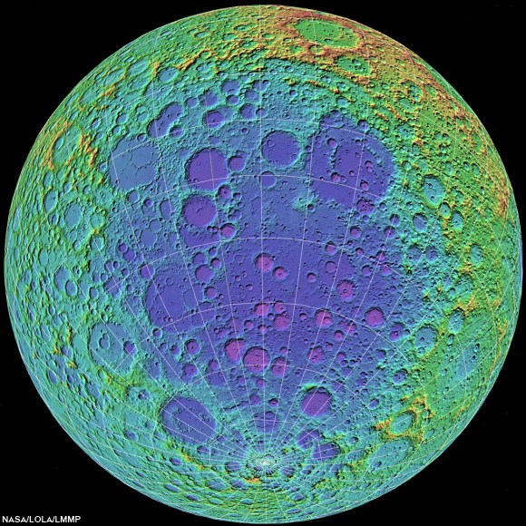
The Lunar Mapping and Modeling Portal (LMMP) is a web-based Portal and a suite of interactive visualization and analysis tools. It allows users to search, view and download mapped lunar data products from past and current lunar missions. Its visualization and analysis tools allow users to perform analysis such as lighting and local hazard assessments including slope, surface roughness and crater/boulder distribution. The data and tools available through the LMMP foster detailed lunar scientific analysis and discovery, and open the door to educational and public outreach opportunities.
This talk and demonstration given by the JPL LMMP team will deliver answers to questions such as "What can LMMP do for you?", "What are the key features?", "What data are available?", "Where to start?", "How to get help?".
Biography: LMMP project management responsibilities reside at Marshall Space Flight Center. JPL LMMP team is responsible for the Portal's development and sustaining. Team members include Emily Law, Shan Malhotra, George Chang, Richard Kim, Bach Bui, Syed Sadaqathullah and Kyle Dodge. The team has extensive experience in architecture, development, and management of complex science information systems.
Tuesday, February 26, 2013 10:00 am PST, 1:00 pm EST (18:00 UT)
TO JOIN USING A WEB BROWSER: The slides and audio/video for this meeting will be presented using Adobe Connect. To join the meeting, connect to: http://connect.arc.nasa.gov/nlsi_directors_seminar/
To view the slides, connect to http://connect.arc.nasa.gov/nlsi_directors_seminar/
 |
| Another presentation based on a much larger scale visualization using the LMMP ILIADS application, LRO laser altimetry (LOLA) based digital elevation model overlaid with LRO Wide Angle Camera mosaic. A simulated view from about 25 km over the far west Oceanus Procellarum, specifically the elusive landing site of Luna 9, the first soft-landing on the Moon. From "Boy, that sure looks like Luna 9," Saturday, December 3, 2011 [NASA/MSFC/GSFC/Arizona State University]. |


No comments:
Post a Comment