|
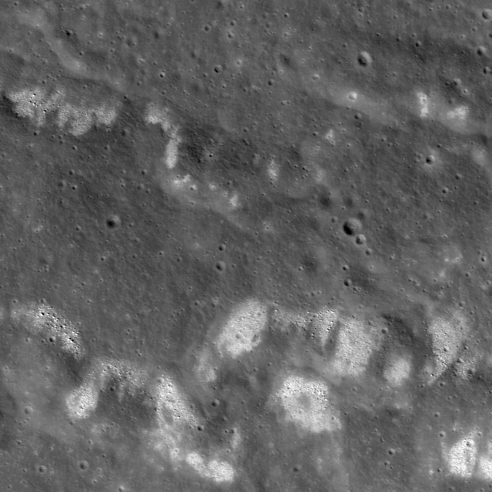
| A wrinkle ridge in southwest Mare Serenitatis is littered with boulders and areas of high-albedo, characterized by rough texture. Field of view is approximately 1500 meters across> LROC Narrow Angle Camera frame M106826896L, LRO orbit 884, September 5, 2009; angle of incidence 35.34° at 1.25 meters resolution from 150.42 kilometers [NASA/GSFC/Arizona State University]. |
Renee French
LROC News System
A
wrinkle ridge in western Mare Serenitatis (
23.448°N, 8.058°E) is one of many in the region that exhibits a high boulder density and high albedo (bright) summit areas. But it isn't the only place this relationship is seen! These bouldered ridges are also observed in
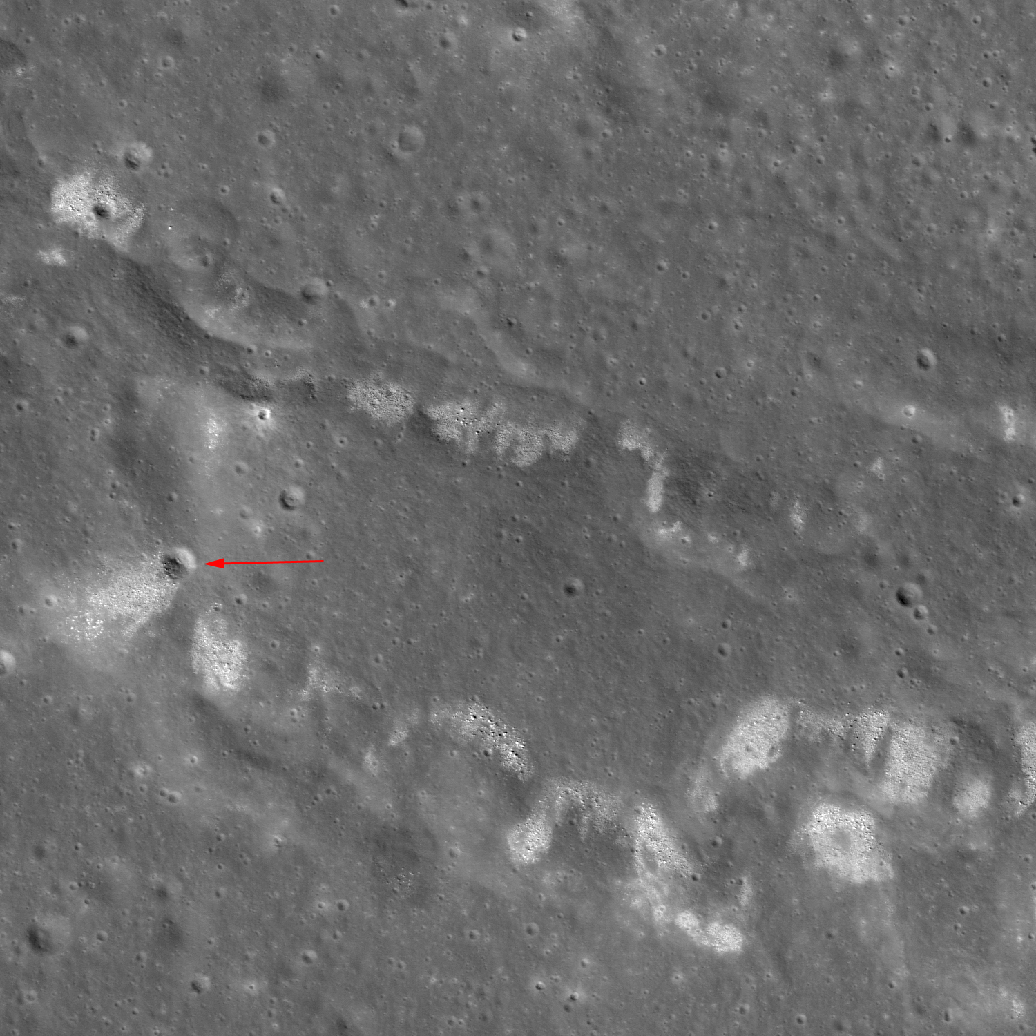
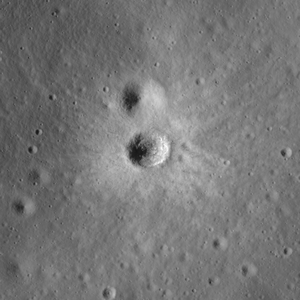
Oceanus Procellarum, Mare Humorum, Mare Cognitum, and Mare Nubium, to name a few. Scientists are still uncertain as to why some ridges have these features and others don't, and why this isn't observed along the entire ridge. This ridge seems to be eroding along its slope, rather than the crest, suggesting that the material is coming from the ridge itself. In addition, a small impact crater (red arrow in below image) has excavated boulders and high albedo material, making it more likely that the source is from the ridge and not a product of distant cratering events.
 |
| Wider view shows a crater (red arrow) that has excavated the same material eroding out of the ridge. Field of view approximately 2.3 kilometers across LROC NAC M106826896L [NASA/GSFC/Arizona State University]. |
There are two ways to describe high albedo on the Moon: either freshly exposed rock and soil, or material with different composition or properties. It is uncertain which description is best for the high albedo observed along these ridges or whether it is a combination of the two. If the boulders and high albedo material have happened because of tectonic activity, then that implies that activity along mare wrinkle ridges has occurred more recently than previously thought. These features need to be studied in more detail in order to fully understand what role they play in lunar history. This is just one of the many surprises that LROC has revealed!
 |
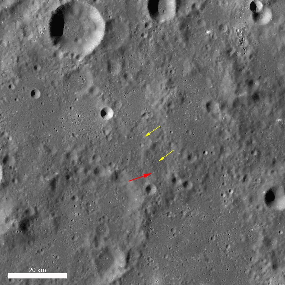
| LROC Wide Angle Camera (WAC) 100 meter-per pixel monochrome mosaic in the new and improved LROC WMS image search tool shows the the location of the wrinkle ridge in Mare Serenitatis (yellow arrow) in relation to Apollo 15 landing site near Hadley Rille [NASA/GSFC/Arizona State University]. |
To view the ridge in more detail, look at the top of the full LROC NAC frame
, HERE.
Related Posts:
Boulder clusters on a ridge crest (March 24, 2011)
Buckland Boulders (March 9, 2011)
Constellation Region of Interest in Mare Tranquillitatis (April 27, 2010)
Wrinkle Ridge Near Montes Teneriffe (December 29, 2009)
UPDATE: A Closer Look. This area of the Serenitatis basin is particularly interesting, under the influence of the extrusive volcanism of Sulpicius Gallus and the unusual elevation slope lower in elevation approaching the southwest basin rim, has been the subject of several earlier posts. As it turns out, for example, we had already, long ago, downloaded the entire 5000 sample by 52224 line NAC image from the Commissioning phase of the LRO mission about three years ago.
In a quick study, again using the continuously improving LROC image search tools, we wanted to see if any higher-resolution LROC NAC observations had been captured since September 5, 2009. Among the overlapping or nearly overlapping LROC NAC Observations we found of this same wrinkle ridge system were at least two perhaps helpful in further illustrating the area of interest.
 |
| Barely more than a year after the opening picture was taken, LROC swept
over the same region, a bit more to the west of orbit 884, during orbit
5744, and the LROC NAC caught the image above showing the ridge "lobe"
visible at lower left in the opening LROC Featured Image. Though Sun was
slightly higher in the sky, the spacecraft was 106 kilometers closer,
and the image immediately below shows that same ridge "lobe" at 49 cm
resolution. LROC NAC M139856476R, angle of incidence 26.26° from 44.33 km [NASA/GSFC/Arizona State University]. |
 |
| The wrinkle ridge "lobe" at full resolution and corrected scale in a 286 meter-wide field of view from LROC NAC M139856476R, orbit 5744, September 23, 2010 [NASA/GSFC/Arizona State University]. |
 |
| While the area in this image does not overlap the left frame of LROC NAC M10682689L, it does overlap the right frame and a part of the same wrinkle ridge system slightly to the east. The field of view is a bit more than 2 kilometers wide, with the area in the white rectangle shown at full resolution immediately below. LROC NAC M126873954R, orbit 3831, April 25, 2010; angle of incidence 34.91° at 48 cm resolution from only 40.48 kilometers [NASA/GSFC/Arizona State University]. |
 |
| Perhaps one of the better close-ups of the boulders gradually being calved from the ridge through mass wasting, another full resolution, this time at a 276 meter-wide field from LROC NAC M126873954R {NASA/GSFC/Arizona State University]. |