Showing posts with label debris flow. Show all posts

Wednesday, February 6, 2013

Debris Flows in Kepler Crater

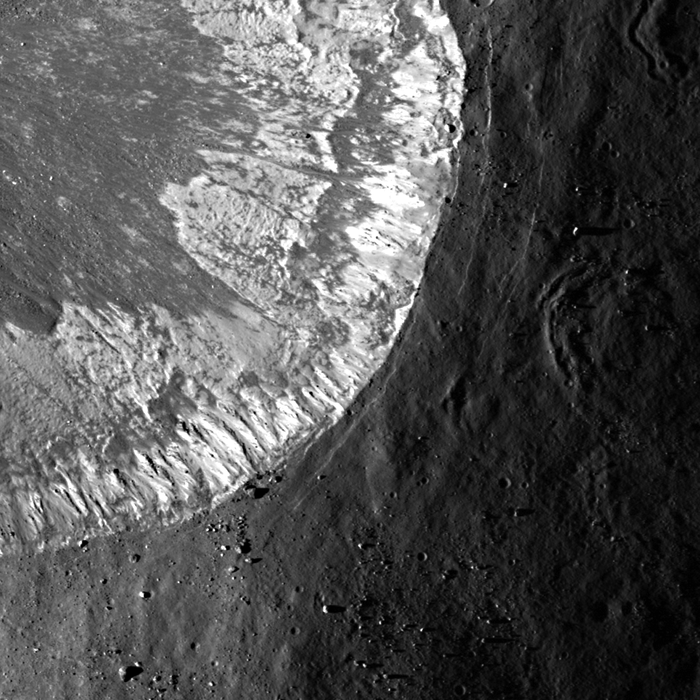
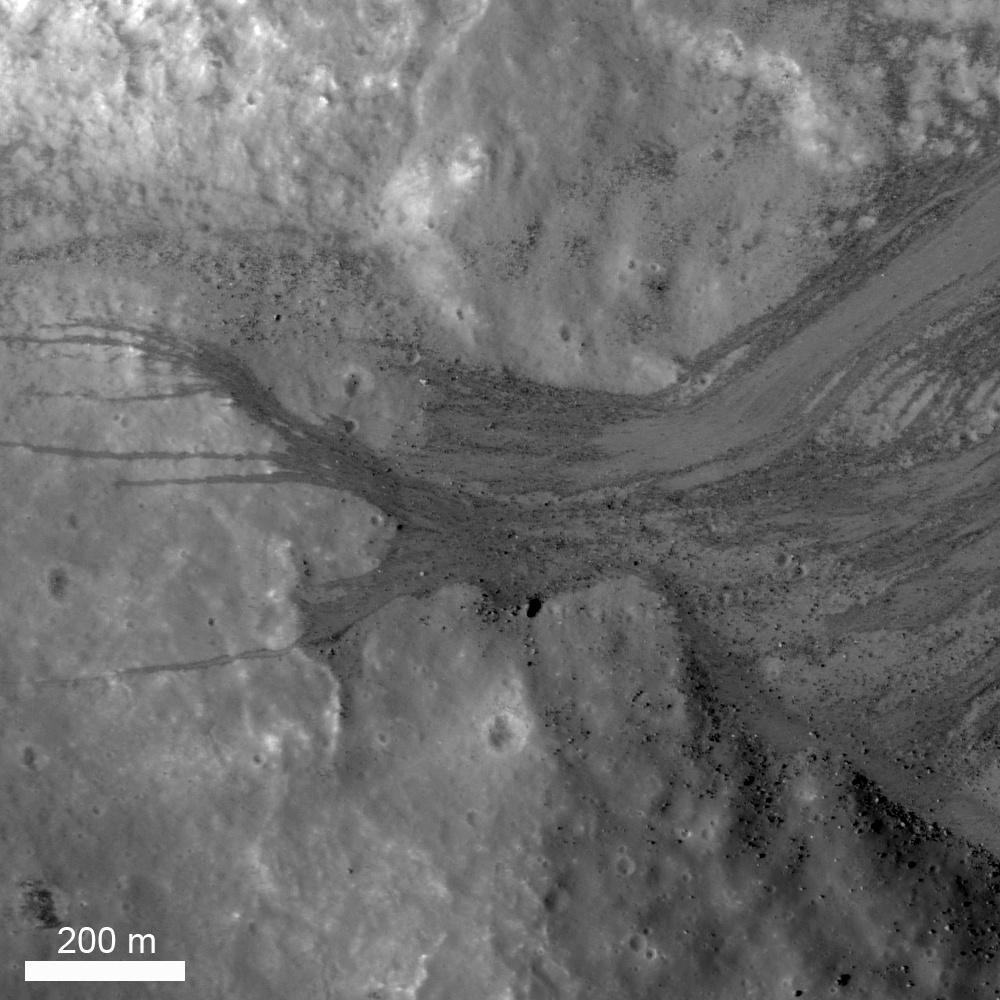
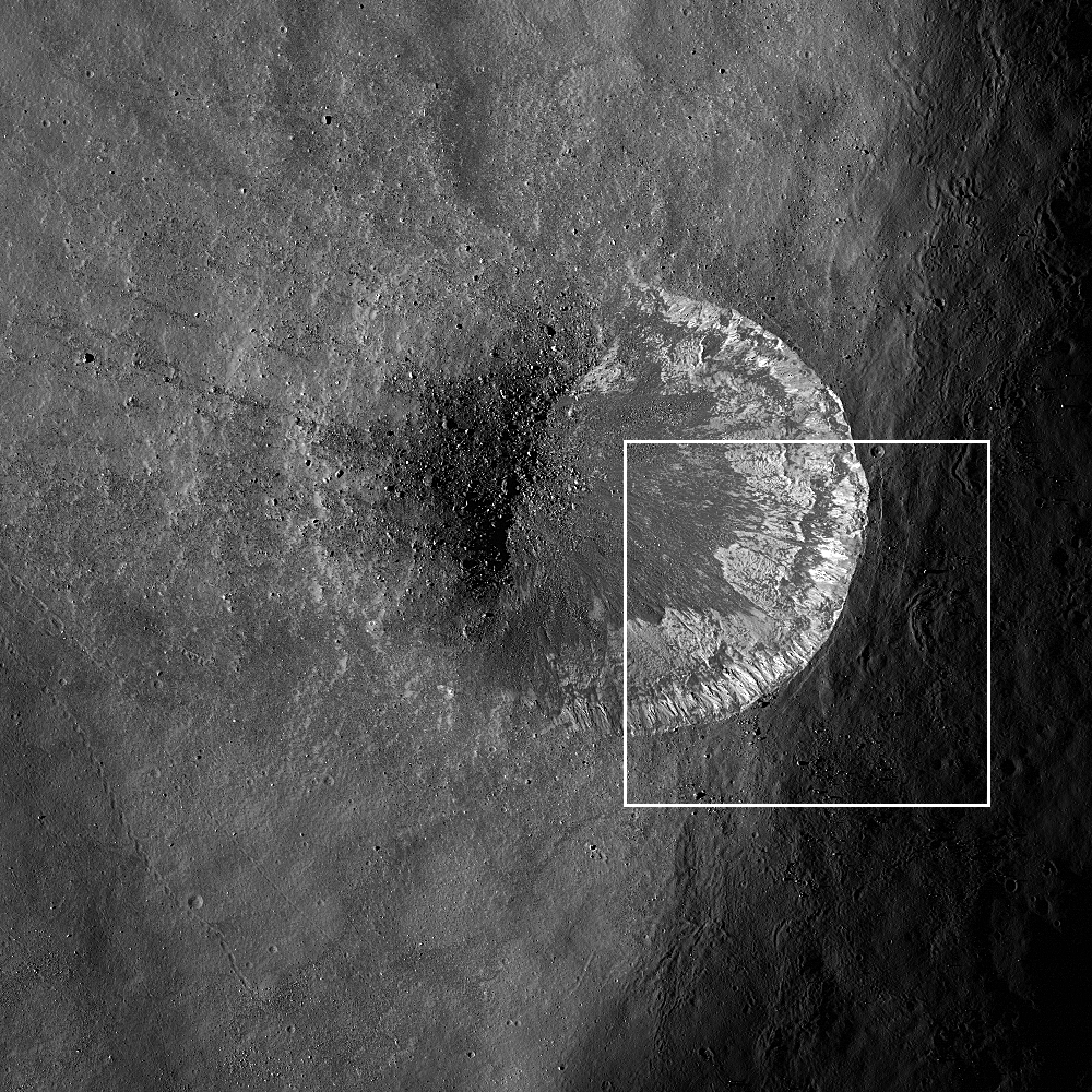
The lower part of the northeast wall of nearside landmark crater Kepler. Loose material is sliding down from near the rim crest (upper right) and ponding on a part of the crater floor. LROC Narrow Angle Camera (NAC) M104755664L, LRO orbit 595, August 12, 2009; resolution 1.27 meters from 119.86 km [NASA/GSFC/Arizona State University].
Jeffrey Plescia
LROC News System

The Featured Image shows the lower slopes of the northeast inner wall of the Kepler impact crater (8.1°N, 322.0°E, diameter 32 km). Loose material often moves down the steep slopes of impact craters, and there are many examples of lunar landslides. The observation that such landslides exist on the Moon were first made during the Apollo program using the images taken from the Command Module while it was in lunar orbit.

This landslide is composed of a range of particle sizes from well below the pixel scale (1.25 m/pixel) to boulders as large as 20 m. Debris slid down the walls and spread out across the crater floor being locally deflected by obstacles on the crater floor. The crater wall has a slope of about 33°.

Another similar pond at the bottom of a long granular debris flow, this one on the southeast wall and floor of Kepler but captured two years later, and at a high resolution opportunity afforded by spacecraft maneuvers in late summer 2011.  LROC NAC M168455361R, LRO orbit 9959, August 20, 2011; 29 cm per pixel, at 36.67° angle of incidence from 22.92 km [NASA/GSFC/Arizona State University].
In the center left of the (top) image, a coarse debris flow was diverted around local topography into several narrow (up to 12 meters wide) flows that extend an additional 400-500 m across the slope and crater floor. Boulders accumulated at the base of the debris flows after rolling all the way down the slope. Debris flows occurred numerous times in this location, as well as many other locations around the crater wall. The material acted as a fluid as it moved downslope flowing around and over obstacles and ponding behind obstructions despite the fact that there was no water present.

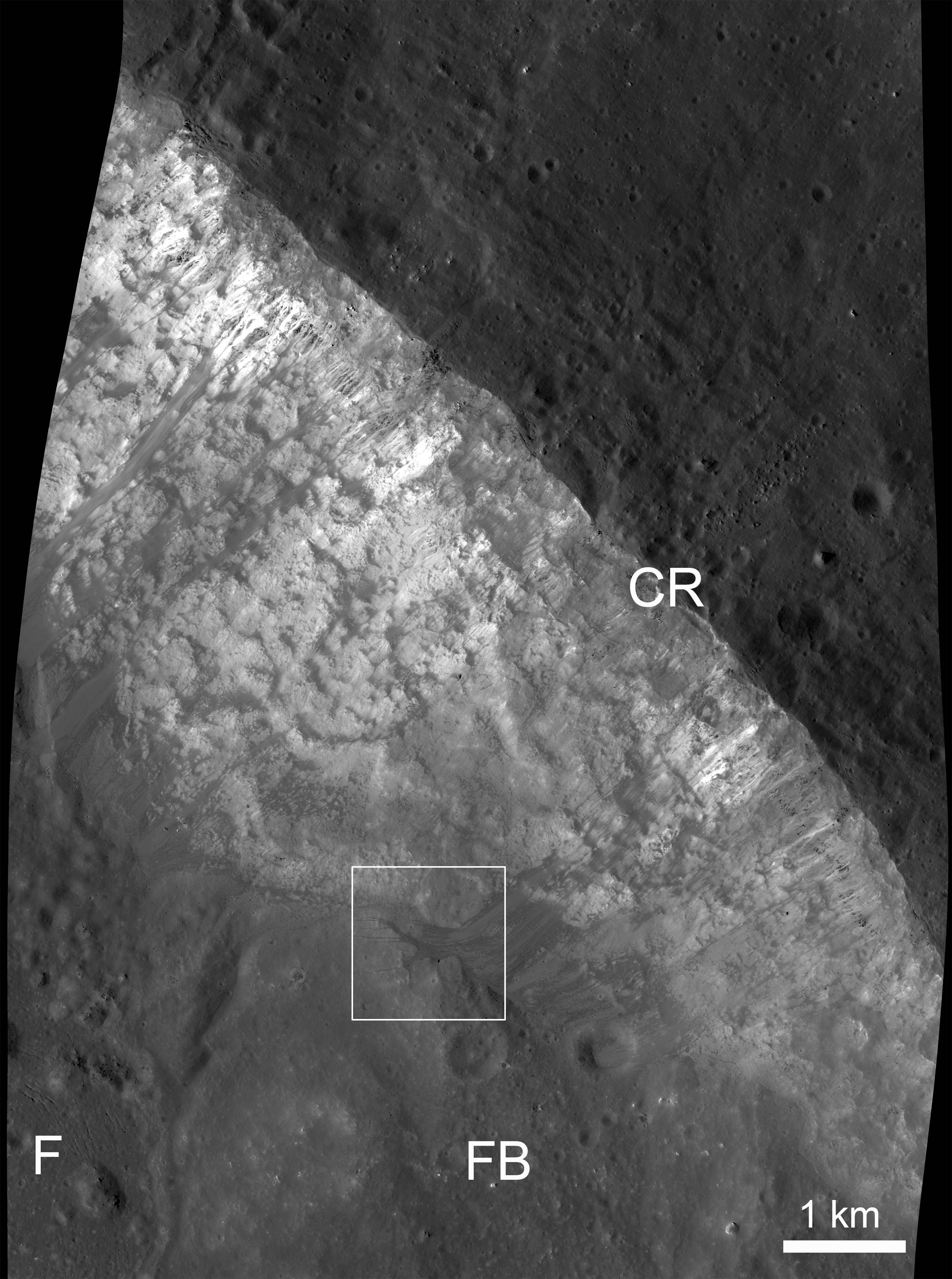
View of the northeast crater wall of Kepler, the field of view in the LROC Featured Image outlined by the white box. Legend: F: crater floor, FB: fault block which has slide down the crater wall, CR: crater rim. LROC NAC M104755664L [NASA/GSFC/Arizona State University].
Above is a reduced resolution version of a larger area around the image shown above (outlined by the white box). Several bright debris flows are observed along the inner crater wall. The area around Kepler crater is illustrated in the wide angle image below.

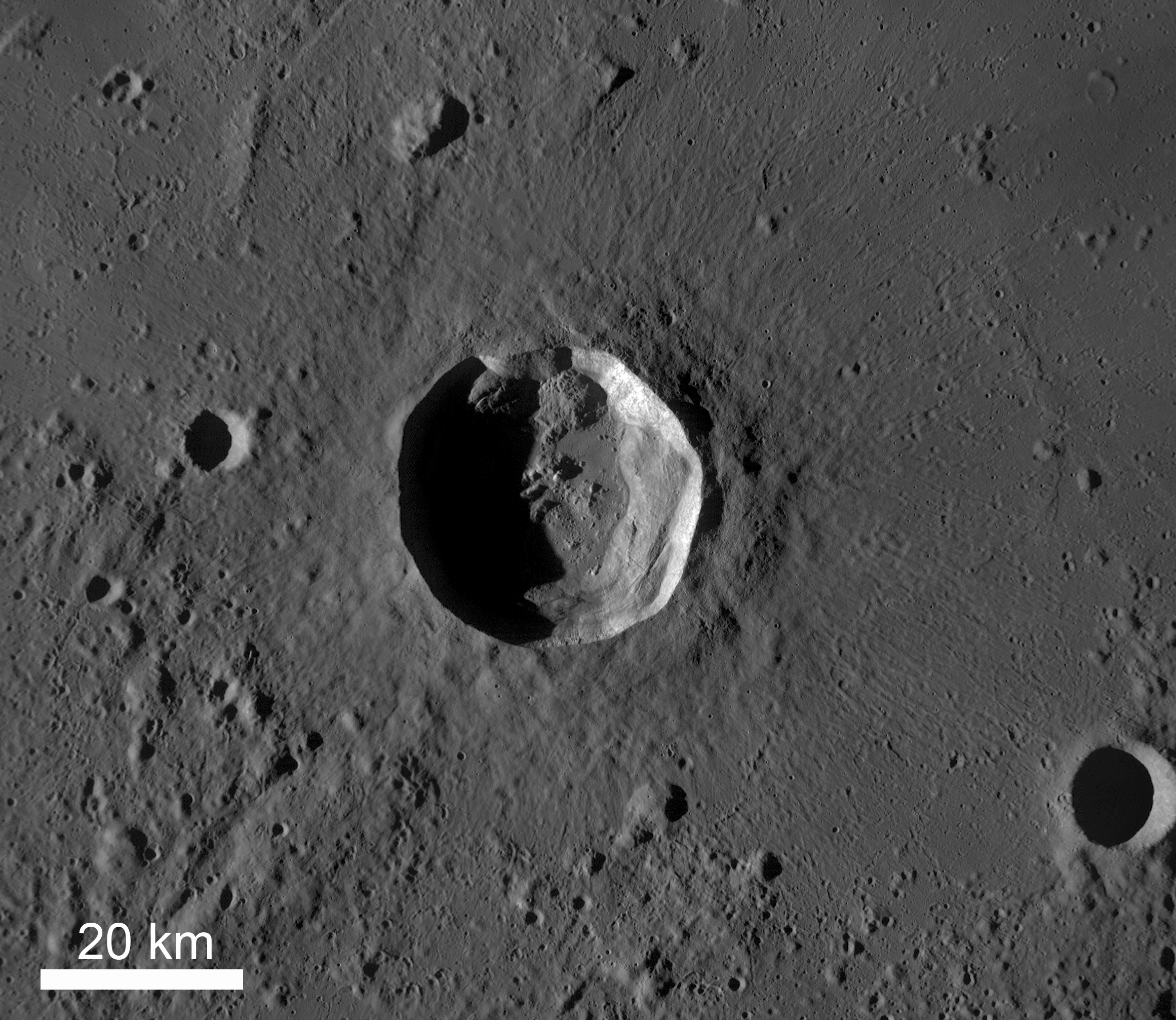
Kepler Crater (32 km diameter) and surrounding plains, afternoon lighting. LRO Wide Angle Camera (WAC) M117738837M. [NASA/GSFC/Arizona State University].
View the entire LROC NAC frame, HERE.

Oblique view of Kepler from on-board Apollo 12, November 1969; 70mm B/W, AS12-52-5547 [NASA/JSC/LPI].
In the shadow of Copernicus, Kepler's bright, widely distributed ejecta and rays would more easily stand out to the naked eye if the similarly youthful and larger crater to its east did not exist. From one of the incredible telescopic mosaics, this one of a Full Moon, by Yuri Goryachko and ASTRONOMINSK team, March 29, 2010.
 Related Posts:

How Recent?
Granular Flow
Dawes
Debris Channels
Kepler's Rim

Thursday, October 4, 2012

Geologically recent debris flow at Couder

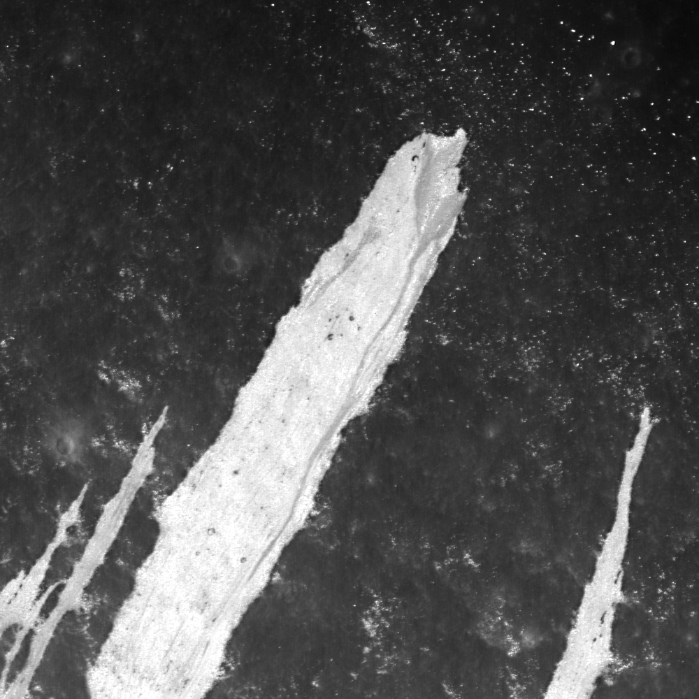
A bright debris flow down the southwest wall of Couder crater (4.89°S, 267.45°E) shows signs of geologically recent activity. Note the two distinct units within the deposit (white and grey). Downslope is to upper right, and image field of view is is 1000 meters, from LROC Narrow Angle Camera (NAC) observation M1101817103RE, LRO orbit 14702, September 9, 2012 [NASA/GSFC/Arizona State University].
Drew Enns
LROC News System

Debris flows are common on crater walls.

Why?

Because the wall slope is close to the angle of repose, it doesn't take much energy to mobilize rocks to flow downhill.

Here, one large flow is surrounded by five thinner, shorter flows. Within the largest flow is a grey portion with a channel and triangular base. Why does the grey portion of the large flow have this shape?

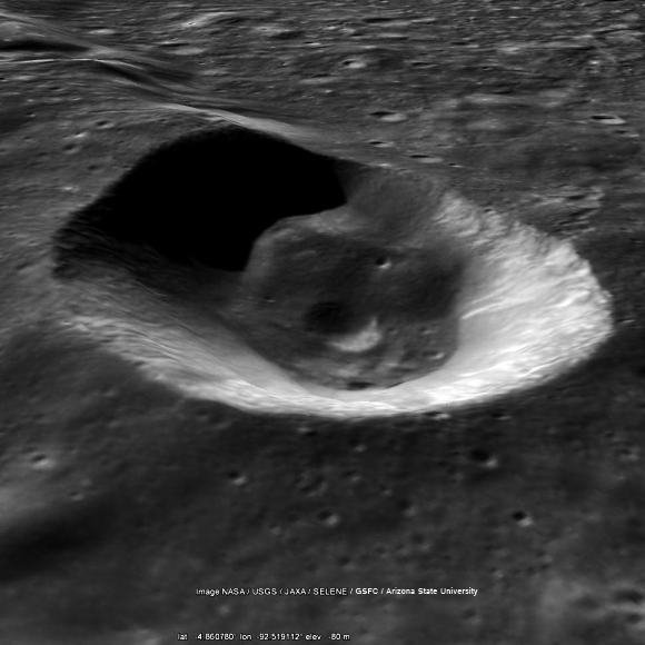
Simulated view southeast across Couder, featuring the LROC Wide Angle Camera mosaic context image immediately below, draped over the Google Earth lunar terrain model.
Context image of today's Featured Image. Couder crater is located at 4.94°S, 267.43° E. Several bright flows are along the western interior of the crater. Field of view is 100 km [NASA/GSFC/Arizona State University].
Some sedimentary systems on Earth form a similar triangular shape. Rivers that empty into a larger body of water form deltas. Deltas form due to the change in the high energy to low energy environment when a river empties. The change in energy also reflects a change in depositional environment. The high energy of the river can carry more material, but a lake or ocean is less energetic and can't carry as much. The result: the material falls out of suspension and forms a delta.

Obviously, the Moon has no liquid water and thus no river systems, but a similar change in energy environments does occur here. Material in the channel travels down the crater wall from a source. When the debris flow loses enough energy and can not sustain its downward travel, the material is spread out and deposited across the surface in this similar deltaic shape!

Explore more of the debris flows in the full LROC NAC, HERE.

Related Posts:
Debris Flows in Gardner Crater

Early (April 2010) LOLA laser altimetry small-scale comparative elevation map of Orientale basin, with the location of 21 km-wide Couder marked at upper center [NASA/GSFC/LOLA].

Thursday, September 6, 2012

LROC: Pyroclastic Trails

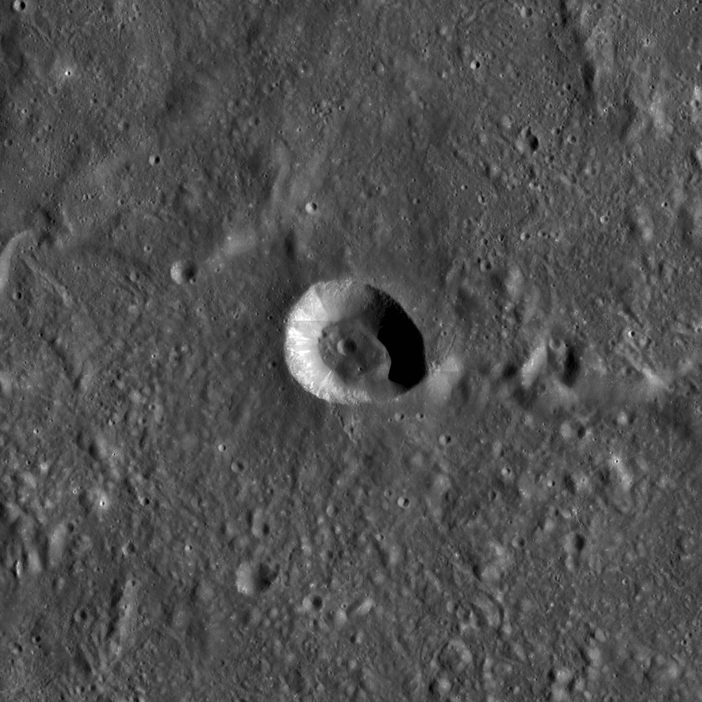
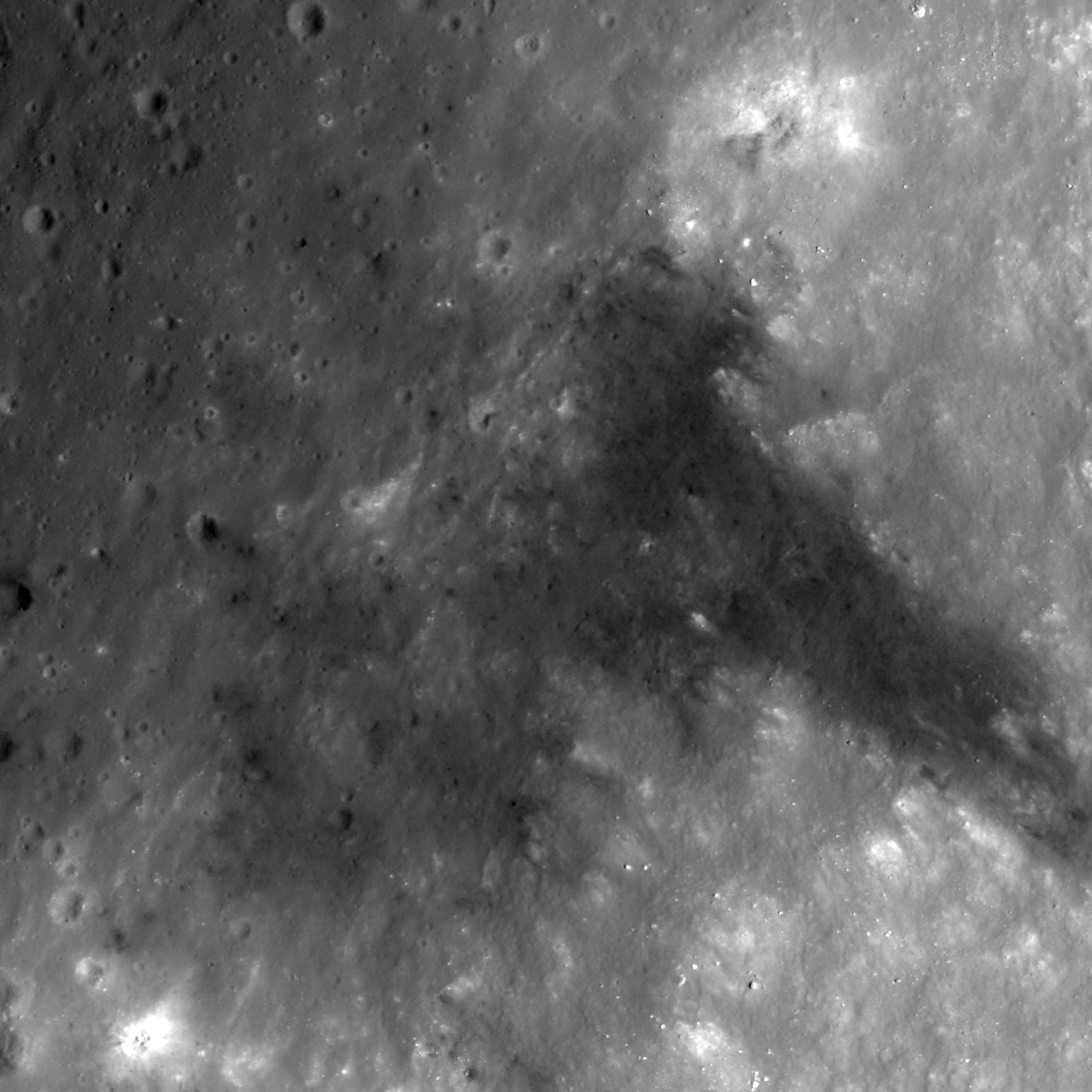
Northeastern rim of unnamed crater 340 km southeast of Copernicus, among the Schröter and Gambart crater groups in Southern Sinus Aestuum (5.65°N, 8.71°W). A 612 meter-wide field of view from LROC Narrow Angle Camera (NAC) observation M144680787R, spacecraft orbit 6455, November 18, 2010; angle of incidence 49.39° at an original 50 cm per pixel resolution from 46.42 km. Downslope is to the bottom-right, view the original 1200 x 1200 LROC Featured Image HERE [NASA/GSFC/Arizona State University]
Hiroyuki Sato
LROC News System

The pyroclastic Southern Sinus Aestuum (5.42°N, 351.36°E) is famous for extensive dark mantle deposits (DMD), materials which have the lowest albedo (or highest optical maturity, or 'OMAT') on the Moon.

The DMD were likely formed as explosive eruptions threw out a blanket of small particles (pyroclasts).

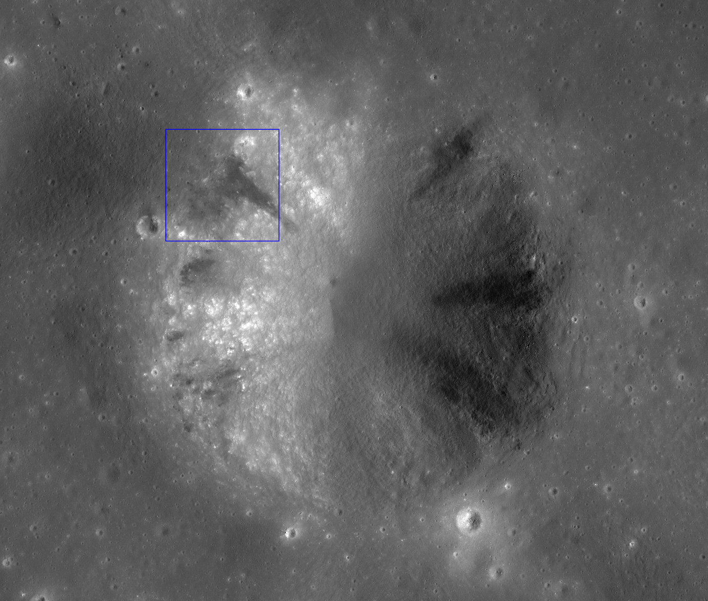
Today's Featured Image shows a portion of unnamed crater rim located inside this DMD unit, about 2.4 km in diameter, with 4 or 5 dark streaks on its slope (see the crater's full profile in the NAC mosaic below).

The opening image highlights one of the sources for a dark streak. The right half of the image is the crater wall, and the left half is the surrounding flat area. The streak originates at nearly the top portion of the crater wall and extends down the slope. Notice that the streak is darker than the surrounding flat area some buried low reflectance materials were exposed on the middle of the slope and slid downhill.

Zoom out view of a mosaic of both the right and left frames of LROC NAC observation M144680787 (M144680787R and M144680787L). About a 3.93 km-wide field of view, sunlight from the east. Blue box indicates the location of the area shown in the LROC Featured Image released September 6, 2012. View the full size context image HERE [NASA/GSFC/Arizona State University].
Actually, the albedo around this unnamed crater is not as low as the main DMD area. The contrast is very, small but you can see a slightly higher albedo halo around the crater in the WAC context image. The dark streaks inside this crater all originate from almost the same level of the crater wall. Probably this unnamed crater excavated higher reflectance bedrock under the DMD, and spread it around the crater. Then the pyroclastic materials exposed in the wall (sandwiched between the bedrock and the ejecta) slumped down the crater wall leaving the dark streaks.

Careful investigations of the craters in the DMD by NAC images are quite useful to understand the thickness, the volume, and formation process of DMD. More and more NAC observations of DMD are expected. 

Southern Sinus Aestuum in context with Copernicus, 340 km away. Note dark streaks from rim to floor are also a feature of nearby Schröter D crater. LROC WAC monochrome mosaic (100 m/pix) centered on the subject unnamed crater (arrow), draped over LOLA altimetry data using the NASA LMMP ILIADS application  [NASA/LMMP/GSFC/Arizona State University].

Explore this pyroclastic slides by full NAC frame yourself, HERE.

Related Posts:
Dark streaks in Diophantus crater
Dark Craters on a Bright Ejecta Blanket
Alphonsus crater mantled floor fracture
Dark-haloed crater in Mare Humorum
Pyroclastic Excavation

Pyroclastic Southern Sinus Aestuum, including the unnamed crater of interest at center, as seen from Earth. 4100 x 5000 pixel Mosaic of the Moon captured by Astronominsk, August 8, 2012.

Wednesday, August 8, 2012

LROC: Debris Channels

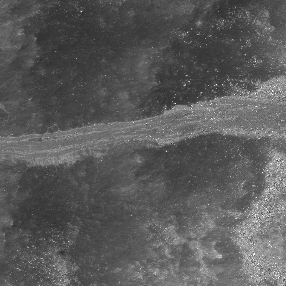
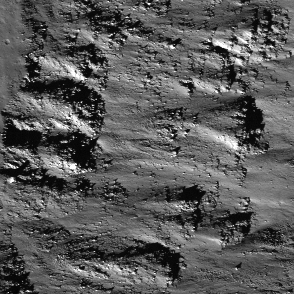
Granular materials once flowed down the crater wall of Alpetragius B and formed these striking patterns. LROC Narrow Angle Camera (NAC) observation M170606933L, LRO  orbit 10276, September 14, 2011; angle of incidence 17.54° at half-meter resolution from an altitude of 45.12 kilometers. See the full size LROC Featured Image 600 meter field of view HERE [NASA/GSFC/Arizona State University].
Lillian Ostrach
LROC News System

Crater modification is a topic of interest to lunar scientists because most of the impact craters on Earth are heavily degraded. Meteor Crater is the best-preserved and youngest impact crater studied on Earth, and fieldwork spanning as far back as the 1800s has greatly improved the understanding of crater formation and modification. By comparing geologic features on the Moon to those that are well-studied on Earth, scientists can begin to understand the complexity of geologic processes that constantly change the lunar surface.

Granular debris flows are the result of material moving downhill due to gravity. The flows often contain fine-grained material, forming a smooth, fluid-like texture, and may be mistaken for impact melt flows. Today's Featured Image highlights the complex and diverse nature of debris flows that represent erosive events that are likely occurring on the Moon today. Located on the eastern wall of Alpetragius B crater (~10 km diameter) in Mare Nubium, this debris flow (15.119°S, 353.253°E) is composed of multiple channels and different sized materials.

Elsewhere, on the north side of the first big bend past the "Cobra's Head" (25.45°N, 49.46°W), widest part of Vallis Schroteri on Aristarchus Plateau, a 1600 meter-long debris channel fans out on the valley floor after a steep 800 meter fall. (Watch your step!). LROC NAC observation M170884438R, orbit 10137, September 17, 2011; angle of incidence 27.86° at 49 centimeters per pixel resolution, from 43 kilometers [NASA/GSFC/Arizona State University].
Rubbly, higher reflectance material (opening image, to the right) appears to be surrounding and somewhat interspersed with a lower reflectance, finer-grained material composing the flow. Where the flow is composed of separate channels (opening image, to the left), the fine-grained material is bordered by the higher-reflectance material.

LROC WAC monochrome mosaic centered on Alpetragius B (15.137°S, 353.128°E) in Mare Nubium. Location of opening image noted by asterisk [NASA/GSFC/Arizona State University].
Perhaps the finer-grained debris carved through an older flow composed of the higher reflectance material. This hypothesis may be supported by observations within the image. For example, the rubbly material is visible elsewhere on the crater wall where the finer-grained material is not. The rubbly, higher reflectance material extends beyond the fine-grained, channeled flow (middle right and middle left). Additionally, the fine-grained flow channels cross-cut one another multiple times, but the higher reflectance material does not border those channels. However, additional observations should be made to make sure that the flow in the opening image is representative of the debris flow populations in Alpetragius B and not a special case.

What evidence can you find that to support the hypothesis about debris flow formation in Alpetragius B? Grab your notebooks and take a look at the full LROC NAC image, HERE.

Related Posts:

Saturday, February 25, 2012

LROC: Impact melt boundary and Moltke

Dry debris flows terminate on the cracked and bouldery melt sheet in Mare Tranquillitatis landmark crater Moltke, 43 kilometers southeast of the landing site of Apollo 11. A textural change marks the boundary between crater wall and impact melt deposits embaying the crater floor. Image field of view 1100 meters. Credited as LROC Narrow Angle Camera (NAC) observation M122591558L, orbit 3200, March 7, 2010; resolution 0.5 meters from 40.63 km. View the full size LROC Featured Image (labeled M183360570RE) HERE [NASA/GSFC/Arizona State University].
Drew Enns
LROC News System

In the absence of an absolute age date, lunar scientists have to rely on the geomorphology of a crater to determine how old it is relative to other craters. The sharpness of the deposits in today's Featured Image is a good indicator that Moltke is young, probably Copernican in age. Large cracks in the impact melt formed as the melt cooled and contracted towards the center of the crater. The uneven terrain within the melt is probably composed of smaller ejecta blocks that have been mixed in with the impact melt. These features have not been covered by regolith or debris flows from the crater wall that naturally accumulate over time, indicating that Moltke is probably young. Do these observations agree with a larger contextual view?

Context for the LROC Featured Image (FOV yellow arrow). Moltke (0.589°S, 24.180°E) is barely 6 kilometers in diameter but has a diffuse high-reflectance ejecta blanket that makes it very easy to spot in modest telescopes trained in on the south-southeastern corner of Mare Tranquillitatis, nestled between the craggy "horns" of the contact separating the relatively flat Sea of Tranquility. This makes it easy to spot, at least in the mind's eye, the spot where "man first walked upon the Moon, July 20, 1969, a very little distance to the northwest. LROC Wide Angle Camera (WAC) observation M144463675CE, orbit 6463m November 15, 2010; resolution 62 meters from 45.07 kilometers [NASA/GSFC/Arizona State University].
These observations do agree with the larger contextual view! A bright halo of ejecta surrounds Moltke, superposing older and darker mare material. The "freshness" of the impact melt and crater wall, the brightness of the ejecta blanket all argue that Moltke must be a relatively young Copernican aged crater.

Sparely labeled HDTV frame of the southwestern corner of Mare Tranquillitatis, landing site of Ranger 8, Surveyor 5 and Apollo 11, as captured by Japan's lunar orbiter SELENE-1 (Kaguya) and released November 2009. View an enlarged version HERE [JAXA/NHK/SELENE].

Explore more of the Moltke melt sheet in the full NAC frame!

The dry debris flows in the context of the western side of Moltke crater were also imaged from LRO during the brief and extraordinary low-periapsis maneuvers, on August 15, 2011, from only 24.96 kilometers altitude; with resolution of 40 centimeters. Those unique unprocessed frames are M168048451L and M168048451R.

Related Posts:
Action Shot
Linne Crater
Melt and more melt

Tuesday, February 21, 2012

LROC: Rim on a rim (Hermann B)
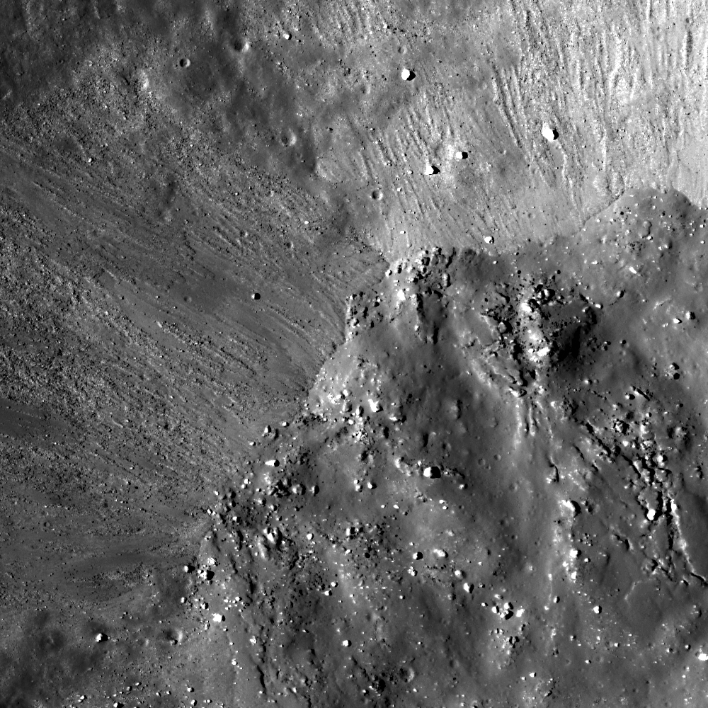
A small fresh crater positioned right on the rim of Hermann B (0.35°S, 302.832°E). Material slides down the crater wall toward the crater center, creating small headscarps along the interior's rim. Image width is 650 m, LROC Narrow Angle Camera (NAC) observation M117867678RE, orbit 2503, January 11, 2010; field of view 650 meters from an original resolution of 0.68 meters per pixel from an altitude of 42.54 kilometers. See the 1000 x 1000 full size LROC Featured Image HERE  [NASA/GSFC/Arizona State University].
Drew Enns
LROC News System

Crater rims are a boundary between the inside and outside of a crater. Thus the rim is also where the slope changes from steeply down into a crater to the shallow sloping exterior.

This change in slope results in a ridge along which dry debris flows often form and carve backwards into the rim. This fresh crater is almost on top of the rim of Hermann B, so what does the whole crater look like?

A context image might give us an idea.

Context image for the Featured Image (white box), centered on 0.353°S, 302.830°E. The rim of the young crater is almost touching the rim of Hermann B. The interior of Hermann B is to the left with the exterior is to the right in this mosaic of the left and right frame pair for LROC NAC M117867678, subsampled to 2 meter/pixel. View the full size context image accompanying the Featured Image release HERE [NASA/GSFC/Arizona State University].
Full 3.4 kilometer width of the mosaic frame from the LROC Image Browser, providing context for the context image [NASA/GSFC/Arizona State University].
Amazingly, the small perched crater is not a simple bowl shape! Instead of having a discrete rim that rings the entire crater, the crater rim exists only along the upslope portion of Hermann B's crater wall. The other half of the crater rim is a mess! Boulders cover the center of the crater, and streamers were ejected downslope. The blocks hint that the bolide might not have been traveling very fast, and maybe it was a block of ejecta from another crater. Because the bolide that created the fresh crater may have been traveling relatively slowly when it impacted into Hermann B's sloped crater wall, the crater did not form a uniform shape!

Explore more of Hermann B's crater rim in the full NAC mosaic!

Related Posts:
Debris Flows in Gardner Crater
Boulder Mound
An Ill-defined Portion of an Otherwise Circular Rim

Stepping back still further, a 35 km-wide FOV of Hermann and Hermann B and the surrounding floor of Oceanus Procellarum, from a LROC Wide Angle Camera (WAC) observation (M150897433 - 643 nm) a little over one year after the Featured Image was swept up, in LRO orbit 7371, January 28, 2011; resolution is 58.8 meters per pixel from 42.27 km, early afternoon incidence angle 57.159° [NASA/GSFC/Arizona State University].
Thursday, February 9, 2012

LROC: Outcrops in Laplace A

Debris flows and outcrops exposed in the walls of Laplace A crater, offset from Sinus Iridum. Illumination from southwest over a field of view (FOV) approximately 525 meters across, down-slope to the right. LROC Narrow Angle Camera (NAC) M137725771R, orbit 5430, August 29, 2010; incidence angle 52.91° with a resolution 0.52 meters per pixel from 49.72 kilometers. View the original LROC Featured Image HERE [NASA/GSFC/Arizona State University].
James Ashley
LROC News System

As with many mare deposit exposures when viewed at the Narrow Angle Camera imaging scale of 0.5 m/pixel, the bedrock outcrops in the walls of Laplace A appear as layered ledges. The layers are most noticeable in the north-northeast to south-southwest trending rocks visible in the northeast quadrant of the frame. Additional indications of layering can be found in the full NAC image

The prominent V-shaped outlines to some of the outcrops are suggestive of constructional deposition. Granular debris flows cascading down the crater walls following excavation appear to have encountered the obstructing ledges and "dammed up" behind them. Resistance to flow in such situations takes on a tapered shape in the direction of flow as the material becomes compacted. Minor occurrences of impact melt may be contributing to the smooth appearance of the flow deposits between the outcrops.

Featured Image FOV in context of the full 2.5 kilometers wide LROC NAC frame M137735771R [NASA/GSFC/Arizona State University].
The north wall of Laplace A is similarly characterized by the outcrops visible in very high resolution in the LROC NAC frame. The crater and surrounding Sinus Iridum were closely examined as a likely landing site for the Chang'e 3 mission by 2014 by China's lunar orbiter Chang'e 2. Nine kilometer-wide Laplace A (43.64° N, 333.33°E) is a familiar nearside feature because of its place in the largely "featureless" landscape along the frontier of the northwest Mare Imbrium and Sinus Iridum. The crater excavated Imbrium mare over the inundated "missing" southeastern outer ring of the Iridum impact zone. A rewarding 7000 pixel-wide, very detailed version of the image is available from tantaonews.com [CNSA/CLEP].
Nine-kilometer Laplace A is a familiar nearside feature in the mare where Sinus Iridum meets Mare Imbrium. If you have access to a small telescope, it is a challenging target for the eyepiece best viewed two days after First Quarter or a day after Last Quarter. Context information for the LROC NAC Featured Image and the Chang'e 2 study from LROC Wide Angle Camera (WAC) observations gathered during last August's low periapsis period (from an average 33.06 kilometers, at a resolution of 47.6 meters per pixel), orbits 9946 through 9949, August 19, 2011 [NASA/GSFC/Arizona State University].
A 95 km-wide FOV from the WAC monochrome (566 nm) mosaic collected over 4 orbital passes, August 29, 2011 [NASA/GSFC/Arizona State University].
Additional examples of both layering and debris flow in crater wall exposures can be found in the following Featured Image posts: Dawes, Pytheas, and Layering in Messier A.

The apparent isolation of Laplace A (center right) is misleading in this HDTV still of Sinus Iridum, embayed by the vast northwest floor of Mare Imbrium, though there is an authentic paucity of similarly-sized craters in the vicinity, unlike the lunar Highlands. HD video captured by Japan's lunar orbiter SELENE-1 (Kaguya) in 2009. A larger version of this frame can be viewed HERE [JAXA/NHK/SELENE].